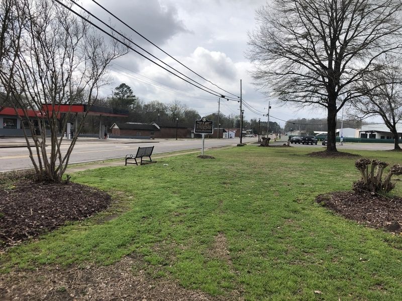
The City of Brent was founded in 1898 in the southern portion of Bibb County along the Gulf, Mobile and Ohio Rail line. The town was named after Mr. Brent H. Armstrong, a surveyor for the railroad. Brent was later incorporated in 1913. The . . . — — Map (db m217202) HM
Absalom Pratt built this house 8 miles west of here circa 1835 though a section was constructed earlier. It was moved to this site in 1994 by the Cahaba Trace Commission, restored by the Alabama Historic Ironworks Commission, 1997-98, and dedicated . . . — — Map (db m37078) HM
The Bibb County Iron Company under the direction of C. C. Huckabee of Newbern, Alabama, constructed a furnace here and poured the first iron in November 1862. Within a year, the Confederate government purchased the works and completed a second and . . . — — Map (db m37090) HM
Wilson Hayes constructed this typical farm house for his wife and six children just south of Six Mile around 1900. After he moved to Oklahoma c. 1915, his daughter Ollie and her husband Levert Rotenberry lived in the home until 1928. Between 1928 . . . — — Map (db m37136) HM
Montebrier was built in 1866–67 for John William Mallet, a renowned scientist and educator and former Superintendent of Confederate Ordnance Laboratories. He came to Brierfield to assist General Josiah Gorgas, former Confederate Ordnance Bureau . . . — — Map (db m292815) HM
Originally located off Patton Chapel Road in what is today Hoover, Alabama, the Sunshine and Dorothy Morton house was moved to the Brierfield Park in March 2005 by the Morton family and restored over the next two years by restoration specialist . . . — — Map (db m37177) HM
Centreville Cemetery is older than the town of Centreville itself. The earliest known burial is that of Willie Coleman, dated 1822, and Centreville was established in 1823. One half of the cemetery, known as Cooper Cemetery, contains mostly the . . . — — Map (db m156403) HM
Located in the community of Easttown in Centreville,
Mt. Sinai Community Cemetery was founded in 1930.
The cemetery contains the burials of several
community heroes, including 25th Infantry Buffalo
Soldier Edward Mack, Sr., Purple Heart . . . — — Map (db m307397) HM
Years before 1859, two acres of land were donated for a school by Mr. and Mrs. Good. A two-story wooden structure was built. Among its first teachers were John Alexander, W. J. Peters, R. M. Humphries, and R. H. Pratt. Under Pratt’s leadership the . . . — — Map (db m37054) HM
Incorporated in 1859 though organized earlier and operated continuously through 1897. First trustees were William P. Thomas, Leroy T. McGuire, Ezekiel C. Smith, Simpson W. Hederick and Pulaski Wallace. This noted center of learning in Bibb County . . . — — Map (db m37053) HM
One and a half miles northeast of here, the mining town of Belle Ellen was established by the Bessemer Coal, Iron and Land Company in the fall of 1895 and named for Henry F. DeBardeleben's daughter, Belle, and wife, Ellen. DeBardeleben was a noted . . . — — Map (db m37226) HM
Blocton
Centered around the coke ovens, Blocton, first called Gresham, was the Cahaba Coal Mining Company town founded by Truman H. Aldrich in 1883-84. Other company officers included W. A. Clark of Muscatine, Iowa, and Cornelius Cadle, Jr., . . . — — Map (db m37228) HM
Piper
The town of Piper was established in 1901 a half mile northeast of here by the Little Cahaba Coal Company, named for Oliver Hazzard Perry Piper, a partner of industrialist Henry F. DeBardeleben. Two coal mines were opened in 1901 and . . . — — Map (db m83225) HM
The railway system was an important part of the iron and steel industry and the operation of the Blocton coke ovens. The ovens were constructed with rails on top for the charging car, often called a larry. There were rails between each row of ovens . . . — — Map (db m215680) HM
History of coke ovens
In the park are four rows of the remains of the Cahaba Coal Company's coke ovens. These beehive block ovens were not the earliest coke producing units in the Cahaba Coal Field but may very well have been the largest . . . — — Map (db m215677) HM
West Blocton began as a business and residential community adjoining the Cahaba Coal Mining Company's town of Blocton in 1883-84. West Blocton incorporated in 1901. Eugene D. Reynolds was the first mayor, 1901-1904, followed by Dr. L.E. Peacock, . . . — — Map (db m72283) HM
Coke ovens, such as the ones you see in the park, are used to convert coal into coke, a cleaner burning fuel that produces little smoke. Construction here started in the late 1880's, with 140 ovens producing coke by 1889. The end buttresses that . . . — — Map (db m215681) HM
Woodstock was first settled in the 1820’s with a formal land grant to William Houston on Feb. 27, 1826. The settlement was established along the old Tuscaloosa to Huntsville Stage Coach Line. Woodstock got its name when Dr. J.U. Ray named it after . . . — — Map (db m63697) HM
Nathan Bedford Forrest attacked Col. Streight’s column as it crossed Locust’s swift waters, causing the Federals to make tremendous exertions to complete the movement, contributing thereby to Streight’s eventual surrender of his entire command to . . . — — Map (db m28320) HM
1820-1889 seat of Blount County, a county older than the State.
Named for Tennessee Governor W. G. Blount who sent Andrew Jackson to aid Alabama settlers in Creek Indian War, 1812-1814.
Indian Chief Bear Meat lived here at crossing of . . . — — Map (db m156445) HM
1813: Colonel John Coffee and 800 Tennessee Volunteers see Bear Meat Cabin Cherokee Settlement near Blountsville
1816: Town settles around square
1820: Newly named Blountsville becomes county seat
1827: Town incorporated with Trustee System . . . — — Map (db m49176) HM
First minister assigned to Alabama Territory by Tennessee Conference. Preached first sermon two blocks west at Bear Meat Cabin (present Blountsville) April 18, 1818. He later organized churches in Shelby, St. Clair, Jefferson, Tuscaloosa and Cotaco . . . — — Map (db m27991) HM
Three prowling Union soldiers invaded home of sister-in-law of Celia and Winnie Mae Murphree taking food, drink; killing two colts.
When soldiers fell asleep, these two young girls took rifles, marched soldiers to headquarters of General . . . — — Map (db m83226) HM
In late April 1863, Union colonel Abel D. Streight set out on a raid
from Eastpoint. Mississippi, to Rome, Georgia, charged with disrupting
crucial Confederate supply lines. Streight crossed into north Alabama
with 1,700 men. including members . . . — — Map (db m295685) HM
Gen. N.B. Forrest (CSA) captured wagon train and supplies of Col. Streight's raiders (USA).
Forrest continued his relentless pursuit eastward toward final capture of Streight. — — Map (db m295687) HM
The Dallas Community in Blount County was settled in the mid-1800s
after the Second Creek War (1836-1837). Settlers built general
merchandise stores, a blacksmith shop, a Methodist Church, and
a cemetery later known as Bethlehem Cemetery. Local . . . — — Map (db m307414) HM
Four school sites have been located in this community known as Morton’s Center, Hew Hope, and Poplar Springs now Holly Springs. The first at Morton’s Center was taught in 1882 by George W. Burttram. The first school at New Hope was taught by . . . — — Map (db m145410) HM
Member Constitutional Convention 1819
First Senator of Blount County
Brigadier General,
Alabama Militia
County road and court
systems organized
at his house 1820. — — Map (db m32484) HM
While traveling south with his troops, General Andrew Jackson camped at the fork of the river in 1813. General Jackson carved his name in a locust tree naming this area Locust Fork. In 1817, the Hanby family came from Virginia and settled in this . . . — — Map (db m50125) HM
Planter, trader, historian, geologist, surveyor. Gathered authentic data from early settlers and Indians for his history of Blount County published in 1855. Made original survey of Blount County. — — Map (db m50123) HM
Antioch (an'~te~ok') was an ancient Biblical city and a chief center of early Christianity. Today, many churches and cemeteries throughout the United States use the name. Once called Glover's Graveyard, the earliest recorded burial is 1794. Antioch . . . — — Map (db m128071) HM
William M. Bailey (born 1859 in Cherokee Co.; died 1909 in Blount Co.) settled 40 acres on what became Co. Rd 36 to the west and New Home Church Rd to the east in 1893. He brought three small sons from Cherokee Co. after the death of his first wife . . . — — Map (db m42599) HM
Created Feb. 7, 1818 by Alabama Territorial Legislature from lands ceded by the Creek Indian Nation. Named for the Tennessee Governor W. G. Blount, who sent militia under Andrew Jackson to punish the Creeks for Fort Mims massacre. Jackson fought and . . . — — Map (db m24353) HM
John Hanby came in 1817 and found a rich seam of brown iron ore. Named Champion in 1882 when Henry DeBardeleben and James Sloss bought land and brought L&N Railroad causing county seat to be moved from Blountsville to Oneonta in 1889. Most ore was . . . — — Map (db m28362) HM
Starting in 1889, the Louisville and Nashville Railroad, also known as the Birmingham Mineral Railroad, began railroad freight and passenger
service to Oneonta with the completion of the rail line from Boyles Railroad Yard near Birmingham to the . . . — — Map (db m38894) HM
Near this site once stood a school built for African American children erected in 1925 at a cost of $2,800. Funding for the two-classroom, wooden structure came from area residents, along with public funds and $700 from the philanthropic foundation . . . — — Map (db m282167) HM
The origin and development of Oneonta was due to the coming of the Birmingham Mineral Railroad, a part of the Louisville & Nashville Railroad. Because of the presence of iron ore, limestone and coal in the area, there was always a great potential . . . — — Map (db m156406) HM
In 1864, traveling in an ox cart, Dr. Robert M. Moore left his family in Walton County, Georgia, and journeyed to Blount County, Alabama. Finding fertile land, he returned to Walton County and persuaded his wife to move to Blount County with him. In . . . — — Map (db m49251) HM
Dedicated with honor to the men and women of Chilton Co. who served and died in the Republic of South Vietnam
Piper, Edward R. Army CWO • Minor, Randy M. Army Sp4
7-11-39 5-28-65 6-27-47 6-16-67
Bearden, Lee . . . — — Map (db m155150) WM
Established by the Alabama Legislature on December 30, 1868,
from land obtained from Autauga, Bibb, Perry, and Shelby counties.
Originally designated Baker County for Alfred Baker, postmaster,
justice of the peace, state legislator, and . . . — — Map (db m155116) HM
Fallen officers of Chilton County, Alabama
This is a memorial to the officers who have dedicated their lives for the citizens of Chilton County.
Clyde W. Gregg 1907-1959
Gerald L Horn 1950-1981
William O. (Bill) Wilson 1934-1984
Richard H. . . . — — Map (db m224708) HM
The Chilton County Training School (CCTS) was the only facility in the county that provided a secondary education for black boys and girls until the mid-1960s. In 1924 black landowners donated five acres for the school to the Board of Education who . . . — — Map (db m54656) HM
Dedicated to the brave men and women of Chilton County who gave their lives that freedom and justice should not perish from the earth
World War I
[List of names]
World War II
[List of names] . . . — — Map (db m155155) WM
Clanton, originally named Goose Pond, was founded in 1867 by Alfred Baker Sr. Goose Pond was renamed Clanton in honor of Confederate hero General James Holt Clanton. The city limits cover approximately 18 square miles. Clanton is located near the . . . — — Map (db m54979) HM
Constructed by the Western Pipe and Steel Company of San Francisco. the Bayfield-class attack transport ship was launched on December 29, 1942, as the SS Sea Needle. The vessel was retrofitted at the Brooklyn Naval Shipyard in New York for . . . — — Map (db m224688) HM
Arthur Love, a charter member, was first pastor. Organized as a Methodist Episcopal Church. Became Methodist Protestant, 1828. Changed to Methodist Church, 1939. Affiliated with United Methodist, 1968. In the original church built of logs, Judge . . . — — Map (db m83268) HM
This structure is an excellent example of the one-room Gothic Revival - style church buildings which once were built throughout the South. It was originally located on a three-acre site that was deeded to trustees W. A. D. Ramsey, G. W. Brand, and . . . — — Map (db m37615) HM
After the war broke out, wooden frame barracks were built by North and South at permanent installations such as forts, arsenals, coastal installations, and training camps. In winter, smaller barracks were constructed with available materials and man . . . — — Map (db m129426) HM
A number of Soldiers' Home veterans were members of this church over the years. It originally had a second floor for Sunday School classes and a cupola on the roof.
With the closing of the local lumber mill in 1910 the population of the town . . . — — Map (db m129424) HM
On this site stood "Memorial Hall," the two story, log and shingle administrative and social center of the Alabama Confederate Soldiers' Home. Construction was partially financed by individuals from across the state who purchased "Memorial Logs" for . . . — — Map (db m129410) HM
This ship's mast flagpole is an aluminum replica of the original wooden Soldiers' Home flagpole which stood in front of Memorial Hall (approximately 25 yards southwest of this spot).
High above [Memorial Hall] towered a long and graceful . . . — — Map (db m129420) HM
Two cedar trees were planted and dedicated at the Alabama Confederate Soldiers' Home on February 12, 1928 in memory of Mrs. Sarah H. Bellinger and 1st Lt. Robert C. Norris.
Mrs. Bellinger and her husband, Dr. Carnot Bellinger, established the . . . — — Map (db m129412) HM
After the death of Jefferson Manly Falkner, Soldiers' Home founder in 1907, the Soldiers'
Home Board of Control commissioned this obelisk in his honor. The monument was erected in 1908 under the northeast corner of the veranda of Memorial Hall. . . . — — Map (db m129411) HM
This late nineteenth century building, originally Gray & Speer's store, was located less than a mile south near the South & North Railroad (later L&N and present day CSX). It was converted to a post office around 1906.
Veterans from the Alabama . . . — — Map (db m129333) HM
This bell was salvaged from Frisco Railroad steam locomotive No. 734, built in 1905 and scrapped during the early 1950's.
It was donated to Confederate Park by Alf Miller Israel Thompson in memory of Pvt. L. Israel, Co E, 19th Alabama Infantry . . . — — Map (db m129335) HM
This is the site of Alabama's only Confederate veterans' home. The Alabama Confederate Soldiers' Home operated for 37 years as a haven for many of Alabama's destitute Confederate veterans and their wives or widows.
Twenty two buildings once . . . — — Map (db m129359) HM
The Alabama Confederate Soldiers' Home was a self-sufficient operation. Constructed in 1904 by the State of Alabama, the reservoir and pumping stations were part of an intricate system which replaced hand dug wells as the main source of fresh water. . . . — — Map (db m130091) HM
Completed in 1904, this is one of only three remaining sections of the original woven wire fence at the Soldiers' Home.
During the latter half of the nineteenth century woven wire and barbed wire began to replace wooden rail fences.
Woven . . . — — Map (db m129332) HM
Completed in 1904, this is one of only three remaining sections of the original woven wire fence at the Soldiers' Home.
During the latter half of the nineteenth century woven wire and barbed wire began to replace wooden rail fences.
Woven . . . — — Map (db m129425) HM
On April 1, 1865 near here the forces of Lt Gen Nathan Bedford Forrest, CSA, engaged the forces of Maj Gen James H. Wilson, USA. The 17th Indiana Infantry Regiment, led by Lt Col Frank White, made a cavalry charge with sabers, resulting in hand to . . . — — Map (db m133588) HM
On July 31, 1819, Ebenezer Baptist Church was constituted by Isaac Suttle, Lewis C. Davis (“Old Club Axe”), and William Harrod. The first house of worship was a large log house located one mile south of this site, near Bogle's Creek. After fire . . . — — Map (db m217203) HM
Cavalry engagement here among fiercest of war.
To defend arsenal at Selma Forrest (CSA) charged with 1500 into Wilson (USA) moving south with 7500.
Forrest was seeking to delay Wilson pending arrival of . . . — — Map (db m37617) HM
In 1896 Swedish settlers organized the Concordia Methodist Church and acquired this land for the Concordia Cemetery, later known as the Lutheran Cemetery. This is the former site of Strassburg School. In the 1980s it became known as the Scandinavian . . . — — Map (db m83269) HM
Founded in 1895, the Town of Thorsby was the first planned community in Chilton County. The original settlers were people of Scandinavian origin seeking a favorable climate to locate for farming, fruit growing and better health. The original . . . — — Map (db m73231) HM
Named by the Board of Directors
of
Alabama Power Company
to honor
James Mitchell
President 1912-1920
Major modifications to this project were completed in 1985. Three new generating units with a total capacity of 150,000 kilowatts . . . — — Map (db m72486) HM
This cemetery is the final resting place for thirty-seven
members of the Moore Family. John Moore, son of American
Revolutionary War Patriot and Battle of Charleston POW
Obadiah Moore, purchased this land on September 4, 1834.
The Moore family . . . — — Map (db m206684) HM
The only community in the U.S. so designated, Verbena was named for the profuse wild flowers growing in the area. Settlers arrived in the area as early as 1832. Completion of the North-South Railroad and a train depot at Verbena in 1870 enabled . . . — — Map (db m68286) HM
North side
To the memory of our World War heroes who died that civilization might not perish from the earth.
West Side
HONOR ROLL
WORLD WAR
Allbright Rufie PVT. Co. D. 167th Inf. KA
Bailey Andrew SGT. Co. D. 167th . . . — — Map (db m39928) HM
Bright Star
In 1907, Greek immigrant Tom Bonduris invested his savings and opened a small cafe with only a horseshoe shaped bar at First Avenue and 21st Street in Bessemer, Alabama. Outgrowing three locations, the Bright Star moved to this . . . — — Map (db m83797) HM
Organized September 5, 1818 in home of Isaac Brown 3 miles west of Elyton. Met in homes and schoolhouse near Old Jonesboro until 1824. First building erected on site now the 14th Street entrance to Cedar Hill cemetery. Canaan Association (now . . . — — Map (db m37218) HM
In 1840 he published his study, History of Rise and Progress of the Baptists in Alabama.
Also an evangelist and missionary.
In 1818 moved to Alabama from Carolinas, organizing five churches in vicinity.
President of Alabama Baptist . . . — — Map (db m27025) HM
A cotton plantation house
circa 1840, with about 2,000 acres.
Built by Thomas McAdory, Jr.,
the pioneer architecture was the
dog-trot style built of numbered
hand-hewn logs and wooden pegs.
Born here: Robert McAdory,
first mayor of Bessemer . . . — — Map (db m215904) HM
Thomas Hennington Owen,
grandson of Methodist
minister, David Owen and
Lucy McCraw, moved into
the 2 room rear wing with his
bride Malissa Rose Sadler in
1833. Second wife was Mary
Elizabeth Tarrant. The 2 story
addition in 1838 was . . . — — Map (db m215730) HM
This house was built in 1906 by architect William E. Benns for H. W. Sweet at a cost of $10,000. The house uniquely blended the Queen Anne and Neo-Classical architectural styles, featuring two identical pedimented entrance porticos supported by . . . — — Map (db m27024) HM
The Bessemer Site was the largest
indigenous mound site in what is now
Jefferson County, and it once dominated
a large territory in what became
north-central Alabama. Occupied from
about AD 1150 to 1250 during the early
Mississippian period, . . . — — Map (db m144908) HM
Thomas McAdory Owen, son of Dr. William Marmaduke
Owen and Nancy Lucretia McAdory Owen, was born
here on December 15, 1866, at the home of his maternal
grandparents, Thomas and Emily McAdory. A University
of Alabama graduate and lawyer, Owen . . . — — Map (db m215738) HM
Union Baptist Church was organized in 1834 by 18 or 20 members from Canaan Church. The Libscomb area was then known as East End. Members of the Rockett and Ware families donated the original two acreas of this site and a log cabin, which served as . . . — — Map (db m24352) HM
Evalina Brown Spencer founded Highlands Day School in 1958, expanding a daycare she operated in her family's backyard. In 1962, Highlands moved from rented space in St. Luke's Episcopal Church to this site, on land donated by Joseph and Virginia . . . — — Map (db m201032) HM
In honor of Julius Ellsberry of Birmingham
World War II Hero
First Jefferson County Citizen
to die for his country at Pearl Harbor while serving aboard the U.S.S. Oklahoma December 7, 1941 — — Map (db m70261) HM
From 1820 until 1878 this bell hung in the
belfry of the old Elyton courthouse, one-half mile northeast of this spot. In 1861
Jefferson County boys were mustered in
there and the bell tolled them off to war.
John Felix McLaughlin was one of . . . — — Map (db m216063) HM
(front): United Confederate Veterans Camp Hardee No. 39 Camp Hardee No. 39 was organized as a camp of the United Confederate Veterans on August 7, 1891. This cemetery plot was acquired by the camp to provide a final resting place for the men . . . — — Map (db m12487) HM
In 1818 before Alabama, Jefferson County, Elyton or Birmingham existed, The Elyton Methodist Church was established on Center Street. It was moved to 14 Second Avenue, and in 1909, to its present site. Renamed in 1910 for Corilla Porter Walker . . . — — Map (db m24348) HM
Gen. James H. Wilson, USA, having crossed the Tennessee River with a large force of well equipped cavalry, grouped them here at Elyton.
Their mission: to destroy Alabama's economic facilities for supporting the War.
From these headquarters he . . . — — Map (db m24358) HM
The Corey Land Company, a group of prominent local businessmen headed by Robert Jemison, Jr., developed Belview Heights as a neighborhood for the professional employees of U.S. Steel in the 1910's. Extending the grid system being used in Ensley over . . . — — Map (db m24351) HM
On Palm Sunday, 1963 Rev. N. H. Smith, Rev. John T. Porter and Rev. A. D. King led a sympathy march from St. Paul United Methodist Church down 6th Avenue North in support of Rev. Martin Luther King, Jr., Rev. Fred Shuttlesworth and Rev. Ralph . . . — — Map (db m73023) HM
Built 1959-60, 1517 5th Ave. N.
The A. G. Gaston Building's second floor conference room was
the location of regular meetings of “Project C's” Coordinating
Committee. Here, they planned strategies for the April - May
1963 marches, boycotts, . . . — — Map (db m187976) HM
In 1963, Birmingham underwent a major political transformation. To
force Commissioner “Bull” Connor from office, progressive Whites and
Blacks plotted to change the form of government from Commissioners
to a Mayor-Council system. Mayor Albert . . . — — Map (db m187705) HM
Southern members of the U.S. Congress in 1956 issued the "Southern Manifesto” that called the U.S. Supreme Court's Brown decision an "abuse of judicial power." By forcing public school integration contrary to social custom,
the high court had . . . — — Map (db m187661) HM
Shuttlesworth began to dedicate himself to the ministry and enrolled
in Cedar Grove Bible College, a Baptist institution in the Mobile suburb
of Pritchard. He took classes at night while he worked during the day.
The young couple added two more . . . — — Map (db m187628) HM
Child protestors overwhelmed police, who found it hard to confine
them to the Kelly Ingram Park area. Organizers used clever methods
to get them to City Hall before police could stop them. Children were
sent out in pairs. When they got closer to . . . — — Map (db m187836) HM
Built 1947-50, 710 20th St. N.
Birmingham City Hall was the administrative center for the
enforcement of local segregation codes. Thus, this building was
one of the major destination points for the “Project C" marchers
in the 1963 . . . — — Map (db m187717) HM
Freddie Lee Robinson was born March 18, 1922, in Mt. Meigs,
Montgomery County, Alabama, to Alberta Robinson and Vetter Greene.
The unmarried couple also conceived a girl, Cleola. Because Vetter
could not provide for his growing family, Alberta's . . . — — Map (db m187631) HM
The Process
The boiler was the source of power for most of Sloss. The boilers burned blast furnace gas to provide the heat necessary for converting water into steam. The steam produced here powered the blowing engines and turbo-blowers, the . . . — — Map (db m43728) HM
Built 1924 (Extended in 1957), 1930 8th Ave. N.
In 1924, Municipal Auditorium was one of the South's largest
(6,000 seats) and most modern auditoriums. In April of 1956,
Ku Klux Klansman Asa Carter led an attack on Montgomery
native and . . . — — Map (db m187715) HM
565 entries matched your criteria. The first 100 are listed above. Next 100 ⊳