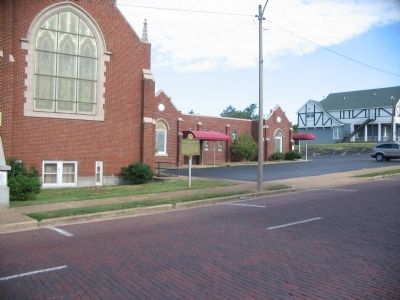
A church building occupied by First Presbyterian Church has stood at this northwest corner of Main and Oak Streets since 1884, the longest period of time one denomination has occupied one site in Poplar Bluff's history. Founded in 1879, first church . . . — — Map (db m36142) HM
In 1913 the city completed 3-⅓ miles of brick streets along Main & Vine at the cost of $86,645 following specifications established for brick streets in New York City. These historic streets have served the city for nearly a century. — — Map (db m36140) HM
This site marks northwest corner of original town platted in 1849. Poplar Bluff, named for beautiful tulip poplars on bluffs overlooking Black River, became county seat of Butler County in 1849 and was incorporated on February 9, 1870. — — Map (db m36126) HM
(Front): Butler County chose this bluff and the surrounding area as the county seat in 1849 and named it Poplar Bluff. The beautiful trees growing on the natural bluff were tulip poplars. (Reverse): According to legend, early . . . — — Map (db m36127) HM
In the Ozark perimeter, above Missouri's Southeast Lowland Region, Poplar Bluff was laid out in 1849 as seat of newly organized Butler County. The town was named for its location in a forest of yellow poplars on the bluffs above Black River. . . . — — Map (db m36128) HM
This beautiful staircase is a reconstruction of the original depot stairs built in 1910. Thousands have used the steps as a gateway to and from downtown Popular Bluff. After a century of deterioration, the depot steps could not be salvaged and were . . . — — Map (db m180373) HM
Dedicated to the memory of Pvt. Billie Gene Kanell 35th Infantry Regiment 25th Infantry Division - Company I Korean War Awarded the Congressional Medal of Honor and to all the servicemen of Butler County Missouri who made the supreme sacrifice for . . . — — Map (db m36139) HM
The Battle at Chalk BluffDown the hill from this marker is the place where four brigades of Confederates, led by Brig. Gen. John Sappington Marmaduke, crossed the St. Francis into the safety of Arkansas on May 1-2, 1863. The clash with Union troops . . . — — Map (db m18141) HM
Erected to preserve the memories and incidents of our associations in the great wars and dedicated to all the men and women of this community and surrounding area who served our country — — Map (db m207514) WM
Dedicated by the Samuel T. Adams Post No. 66 in grateful tribute to the men of Independence Township who gave their lives in defense of our country
World War II
Marshall E. Pulley • Earl L. Grogan • Vergal D. Cuff • Hermon E. Seeger • . . . — — Map (db m307490) WM
Here in the Southeast Lowland Region of Missouri on a Delaware and Shawnee Indian village site, Kennett was laid out as the seat of Dunklin County, 1846. The town was first called Chilletecaux for a Delaware Indian living here at the time. Later . . . — — Map (db m17477) HM
Joe Keene designed, built, and operated a one-story, concrete block recording studio at this location beginning in 1971. More than 350 performers and dozens of backing musicians recorded
country, gospel (Black and Southern), and rock music here and . . . — — Map (db m255366) HM
(list of names, side facing east:)
Mike Adams • Gary Glover • Jim Watson • Jim Cagle • Roy Moylan • Ray Conway • David Shaw Jr. • Jimmy Williams • Ronnie Proctor • Glen Woodham • Charles Trinkler • Rudy Michel • Gene Michel • Richard . . . — — Map (db m307408) WM
With the faith and courage of their forefathers who made
possible the freedom of these United States
The Boy Scouts of America
dedicate this replica of the
Statue of Liberty as a pledge of everlasting fidelity and
loyalty 40th . . . — — Map (db m307415) HM
In solemn gratitude, the citizens of Malden dedicate this memorial to the young men of this community who gallantly made the ultimate sacrifice fighting for the preservation of freedom against the forces of tyranny.
World War I
Thomas . . . — — Map (db m307413) WM
North and west of this location, the Battle of Belmont was fought on November 7, 1861. It was the first battle in which Ulysses S. Grant commanded an army. He had recently been promoted to Brigadier General and placed in command of the federal . . . — — Map (db m17763) HM
(Front): Comprising 411 square miles of Missouri's great alluvial plain, this county, organized in 1845, is a high producer of cotton, grain, and soybeans. The Mississippi (Algonquin Indian for Great Water), flowing along some 70 miles of the . . . — — Map (db m17721) HM
One wintry morning in January 1939, residents of Southeast Missouri woke to find two thousand black & white sharecroppers alongside two state highways. With them were their families and the few meager belongings that they owned.
The . . . — — Map (db m216652) HM
Rev. Owen Whitfield with the support of local landowner, Mr. Thad Snow, and 1500 black and white sharecroppers camped here in harsh January weather several days in 1939 to protest the plight of Boot Heel sharecroppers. The event received national . . . — — Map (db m77862) HM
United States Military Academy at West Point • 1946 University of Missouri School of Law • 1952 State Representative from Mississippi County • 1951-1961 Missouri Secretary of State • 1961-1965 Missouri Governor • 1965-1973 Sculptor Sabra . . . — — Map (db m190985) HM
Erected in Honor of those who served in the World War 1917 — 1918 Atcher, P. (Col) • Cauthorne, L. N. • Cooper, C. • Cooper, J. N. • Culp. J. • Eaton, C. M. • Edwards, C. • Favors, John • Greer, H. V. • Gruner, H. L. • Krauss, F. • Mansfield, G. • . . . — — Map (db m190995) WM
Sketched in 1871 by A. R. Waud of Harper's Weekly, this drawings is the only known full sketch of the 1854 Courthouse. Built at a cost of $2,750 under the supervision of T. J. 0. Morrison, the wooden frame building was 45 by 60 feet (2,700 sq.ft.) . . . — — Map (db m179444) HM
When established in 1789, New Madrid was one of a handful of settlements in the Spanish territory west of the Mississippi River. First as a district and later as a county, the New Madrid jurisdiction extended as far south to the northern border of . . . — — Map (db m179976) HM
In February 1862, General John Pope concentrated an army in southeast Missouri for the purpose of capturing New Madrid and Island No. 10. Federal troops cut a channel twelve miles long to bypass Island No. 10. Transports and smaller boats were . . . — — Map (db m213170) HM
More than one hundred and fifty years ago, Brigadier General John Pope faced a tactical dilemma on the Mississippi River. Confederate batteries at Island No. 10 blocked passage through a complex series of river bends. Although Pope held New Madrid, . . . — — Map (db m238834) HM
To further protect New Madrid from Union attack, a smaller fort was built on the east side of town at the mouth of St. John's Bayou. This upper fort, named Fort Bankhead (the original location was washed away by the ever-changing Mississippi River) . . . — — Map (db m82002) HM
Harry S. Truman delivered campaign speeches at the Court
House during his senate campaigns in 1934 and 1940. The
1934 campaign was open in southeast Missouri and New Madrid was one of the early campaign stops. In his 1934 speech Truman developed . . . — — Map (db m178007) HM
Commemorating Harry S. Truman President of the United States 1945-1953 Harry S. Truman spoke from these Courthouse steps in 1934 and 1940 to New Madrid County citizens during his successful US Senate Campaigns. — — Map (db m178282) HM
Established in 1930 near Higgerson Landing on land purchased from John E. "Eddie" Higgerson. Floated from its piers in 1937. Destroyed by fire in 1940 and replaced with this building. The school closed in 1967. Moved to this site June 10, 1997. . . . — — Map (db m19486) HM
From 1857 to 1861, Samuel Clemens - later to be better known as Mark Twain - navigated the Mississippi River, first as a cub pilot for steamboats, then as a pilot. Working on at least 15 different boats, Twain made 120 trips between New Orleans . . . — — Map (db m302673) HM
(Front) First American town in Missouri. Founded in 1789 by George Morgan, Princeton graduate and Indian trader, on the site of Francois and Joseph Le Sieur's trading settlement, L'Anse a laGraise (Fr. Cove of Fat). Flood and caving banks . . . — — Map (db m238835) HM
At this location, and at other locations up and down stream, the Siege of New Madrid and the Island No. Ten campaigns took place during the months of March and April of 1862. Union victories here ensured Federal control of the middle Mississippi . . . — — Map (db m12342) HM
President Theodore Roosevelt's 1907 inspection trip down the Mississippi River was a moment of celebration for communities, especially in New Madrid.
Boarding the steamboat Mississippi No. 1, operated by the Mississippi River Commission, on . . . — — Map (db m302675) HM
The Spanish and El Camino Real
The Spanish Government in St. Louis authorized the construction of a military road from St. Louis to New Madrid shortly after New Madrid was established as a fortified settlement by Col. George Morgan in the . . . — — Map (db m178960) HM
On October 1811, the steamboat New Orleans set out from Pittsburgh, marking the first attempt to navigate the Ohio and Mississippi Rivers by steam power. On board were boat captain Nicholas Roosevelt, his wife, Lydia, and their two children and a . . . — — Map (db m302677) HM
In February 1862, Union Gen. John Pope, then stationed in central Missouri, was placed in command of the 20,000-man Army of the Mississippi and ordered to advance on Island #10 and New Madrid. On February 28th, Pope and his men left Commerce, MO . . . — — Map (db m302268) HM
They Passed This Way
Home to thousands of men, women, and children, the Cherokee Nation once spread across parts of Georgia, North Carolina, Tennessee and Alabama. The 1830 Indian Removal Act required that the Cherokee surrender their land . . . — — Map (db m213156) HM
This was a remote stretch of the Mississippi River when steamboats of Cherokee passed by on their way west to Indian Territory on the water route of the Trail of Tears. River traffic in 1838 was limited to the daylight hours because of snags and . . . — — Map (db m178285) HM
In memory of
U.S.N.R. World War II
Thomas F. Hunter Jr. PHM 3/C
March 4, 1925
Gave his life for his country
May 5, 1945
Battle of Okinawa — — Map (db m302924) WM
World War I
Pemiscot County.
Barley William R. •
Brooks, Ned •
Bush, Harvey •
Davis Miles •
Dean, Auvel •
DePriest, Carroll •
Disbennett, Curtis •
Dunn, Jiles E. •
Erby, Allie D. •
Fitzpatrick, David •
Gaines, . . . — — Map (db m231954) WM
(Front): The capital of historic Pemiscot County and center for a cotton, grain, timber, and industrial area, Caruthersville was laid out, 1857, by George W. Bushey and J. Hardeman Walker (1794-1860), on the Walker plantation. "Bootheel" . . . — — Map (db m36219) HM
This memorial site was dedicated on November 11, 2000 to the honored veterans of all wars by Lieutenant General John M. Riggs, United States Army. LTG Riggs and his wife, Cathy, are natives of Caruthersville. At the time of the dedication, LTG Riggs . . . — — Map (db m36401) HM WM
Born Jan. 15, 1923 Caruthersville, Missouri Died Nov. 17, 1954 Toul, France (Left Side Inscription) Colonel England participated in 108 combat missions during World War II. He destroyed 19 German aircraft and on one mission downed four enemy . . . — — Map (db m36402) HM WM
In honor of Sterling Price Reynolds to whom this park is dedicated on his 100th birthday November 9th, 1961 Born in Callaway County, Missouri. Graduated from University of Missouri, 1883, with highest honors. Settled in Caruthersville in 1896. . . . — — Map (db m36389) HM
An Agricultural Town
Mr. Charles B. Baker was a man of great foresight and he had plans for the future of agriculture in this area. It was with true grit and determination that drove him into his involvement with Deering. He ran the farming . . . — — Map (db m295985) HM
This school building was built in 1874 at a contract price of $375 and was used until 1895. The back room, from which the interior can be viewed, was added later. This one room school is restored as a Community Betterment Project to commemorate . . . — — Map (db m296829) HM
The second county formed in Missouri's famed Southeast Lowland Region, Scott was organized 1821, and named for John Scott, the State's first Congressman. Southerners were first settlers on Spanish land grants in the late 1790's. The King's Highway . . . — — Map (db m161191) HM
Scott County Men Who Lost Their Lives in the World War
(two plaques)
Chas M. Eaton • Floyd Simmons • Chas. Raglin • John Ross • Frank Hooven • Chas. Malone • John Meneese • Clifford Moore • Harold Sage • Albert Richardson • . . . — — Map (db m163746) WM
In memory of those men of this community who made the supreme sacrifice in the World War • 1917-1918 World War II • 1941-1946 Korean War • 1950-1955 Vietnam War • 1961-1975 OPN Urgent Fury OPN Just Cause OPN Desert Storm OPN Iraqi Freedom OPN . . . — — Map (db m190974) WM
In honor of those who have served in the armed forces in war and peace. We shall never forget those who served and died for our country
WW I
Walker, James • Wallace, Henry Cpl. • White, Marshall Pvt.
WW II
Allen Claude H. . . . — — Map (db m307474) WM
Four score and seven years ago our fathers brought forth, on this continent, a new nation, conceived in liberty, and dedicated to the proposition that all men are created equal.
Now we are engaged in a great civil war, testing . . . — — Map (db m247115) HM
In June of 1863, Brigadier General John W. Davidson received orders to take command of the newly formed First Cavalry Division, Department of Missouri, (U.S.). The division consisted of 6,000 cavalrymen, thousands of horses, 16 pieces of field . . . — — Map (db m207651) HM
On August 10, 1821, the Territory of Missouri became the 24th state of the United States. In 1829, the Missouri legislature set boundaries for a new county to be named after Major Amos Stoddard, a distinguished officer of the United States Army. . . . — — Map (db m299218) HM
On Thursday morning, October 22, 1863, citizens of Bloomfield were puzzled by early morning activity around Union military headquarters. The battalion's four armed cavalry companies, with two artillery pieces, were drawn up in front of the . . . — — Map (db m207728) HM
With willing hearts and skill full hands the difficult we can do at once. The impossible takes a bit longer.
Seebees can do
We build We fight — — Map (db m245916) WM
(Front): Stoddard Countians Aboard the C.S. Arkansas
In 1861 President Abraham Lincoln requested General Winfield Scott to submit a plan to suppress the outbreak of the Civil War and reunite the Union. Scott devised "the Anaconda Plan" . . . — — Map (db m207528) HM
The largest of Missouri's six southeast lowland counties, Stoddard encompasses 837 sq. miles. Organized 1835, it is named for Maj. Amos Stoddard, first American civil governor of Upper Louisiana. In the 1808 Osage Indian land cession, the county . . . — — Map (db m207603) HM
In 1853 a group of Bloomfield citizens organized the Bloomfield Educational Society for the purpose of establishing a "First Class Literary Institution in Bloomfield." In 1854 the directors purchased land for a building site and in 1855 the Missouri . . . — — Map (db m208055) HM
The strategic location of Bloomfield on the high ground of Crowley's Ridge made it an important crossroads during the Civil War. Both Union and Confederate forces contested for control of the region. The small community changed hands more than . . . — — Map (db m208228) HM
During the Civil War, Bloomfield was a geographically commanding point in southeastern Missouri due to its location atop Crowley's Ridge, the only high ground separating two nearly impenetrable swamps. Whoever held Bloomfield controlled movements on . . . — — Map (db m207550) HM
Shortly after three o'clock on Saturday afternoon, October 29, 1864, six Confederate prisoners of war were taken from their cell in the Gratiot Street Prison in St Louis and executed by a military firing squad. This was by order of Federal Major . . . — — Map (db m131219) HM
(Front): An article in the Missouri Democrat, a Cape Girardeau newspaper, dated July 3, 1862, described the war-weary community of Bloomfield. It also told of a certain tree used for sad occasions. Two or three of us went down and . . . — — Map (db m60710) HM
On Saturday, November 2, 1861. Brigadier General Ulysses S. Grant directed Colonel Richard J. Oglesby of the 8th Illinois Infantry Regiment to move from Bird's Point, Missouri. to destroy Brigadier General Jeff Thompson's Confederate forces in . . . — — Map (db m207533) HM
Bloomfield's first organized school was established in 1842 with classes held in a small log structure, which had served as a Methodist Episcopal church since 1837. In 1853 a group of citizens organized the Bloomfield Education Society and . . . — — Map (db m208221) HM
During the War Between the States this spring served as a natural gathering place for soldiers. Located adjacent to the road that proceeded down Crowley's Ridge to the crossing of the St. Francis River at Chalk Bluffs, and situated near the . . . — — Map (db m307475) HM