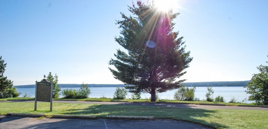
This region's history is long and rich. Father Ménard, the Jesuit missionary, wintered near what is now L'Anse in 1660-1661. Near here Father Baraga set up his mission in 1843. He and the head of the neighboring Methodist mission, the Rev. J. H. . . . — — Map (db m76282) HM
Preservation of Life and Liberty.
Aalto, Waino T. •
Aalto, Eino E. •
Aaltonen, Wilhart N. •
Ahola, Alvar A. •
Ahola, Helmer L. •
Anderson, Arne A. •
Anderson, Emil E. •
Anderson, Verner A. ·•·
Beauprey, Frederick R. •
Beauprey, . . . — — Map (db m255423) WM
Completed in 1938, this
building replaced an earlier
schoolhouse destroyed by
fire in 1934. The new school
housed kindergarten through
fourth grade. Classes, first
held during the 1938-39
academic year, continued
until 1986 when L'Anse
Area . . . — — Map (db m254004) HM
After demolishing its original
hall, Covington Township
built this hall on the same
site in 1934 with support
from the Civil Works
Administration, a program
created to alleviate the Great
Depression. The Hall became
a center for community . . . — — Map (db m254002) HM
Frederic Baraga was consecrated the first Bishop of the
diocese of Sault Ste. Marie (moved and renamed in 1866 as
the diocese of Marquette) on November 1, 1853. In his first
pastoral letter, he stressed the principal and sacred
duties to be . . . — — Map (db m255542) HM
On another occasion, Baraga, with an Indian for a guide, decided to go from LaPointe to Ontonagon. He pondered the possibility of shortening the journey considerably in time and distance. Thus, he and his companion began their walk on the ice at . . . — — Map (db m255769) HM
LaPointe was the first mission Father Baraga established in
the upper region. Located on Madeline Island on the western
end of Lake Superior, it was an Indian village in which, at
times, Canadian traders resided to traffic with the Indians.
Upon . . . — — Map (db m255485) HM
Many of Baraga’s winter journeys were taken on snowshoes. This particular trip found him struggling through fierce, howling winds, deep snow, and bitter cold to reach his destination. Having traveled a great distance in the blinding storm, he . . . — — Map (db m255775) HM
So great was Baraga’s love of the Lord, it is recorded,
that he was often moved to tears during the celebration of
the Holy Mass. It is little wonder, then that his beautiful
and holy example inspired his beloved Indian children to
make for him . . . — — Map (db m255541) HM
Father Frederic Baraga's last assignment in his native
homeland was in a parish in Metlika, caring for more than
6,000 souls. His love of the Lord and his zeal for the
people were rewarded with the love the people had for
him. They responded to . . . — — Map (db m255494) HM
Another incident in Baraga’s life recalls the time when
an Indian came to him at night requesting the Blackrobe
to accompany him to his lodge to attend spiritually to
his dying mother. After providing the Indian and his dog
with food, warmth, . . . — — Map (db m255767) HM
Another time Father Baraga decided to go from LaPointe to
Grand Portage. Instead of traveling the shorelines, he rationalized
that straight voyage across the lake from Sand Island would save
80 to 100 miles as well as a month’s travel time. So, . . . — — Map (db m255673) HM
To the native Ojibwa, this area was known as Wikwedong ("“in a bay”). The French
Jesuit priest Father René Menard renamed it L’Anse de Sainte Thérèse (St.
Theresa’s Cove) in honor of his arrival on St. Theresa’s Day in 1660. Although . . . — — Map (db m254249) HM
My recollection of Bishop Baraga is rather indistinct. I remember him as a rather small, slender man
exceedingly reserved in his demeanor, and with a very sweet low voice. He was idolized by the Indians, the half-breeds, and the old voyageurs . . . — — Map (db m255501) HM
Although so many of Baraga’s missionary journeys were filled with hardships, occasionally he could relax and smile during a pleasant trip to one mission or another. Journeys taken in late summer found him filled with joy and gratitude as he . . . — — Map (db m255771) HM
Near this spot ran the L’Anse-Lac
Vieux Desert Trail, which crossed
the interior of the Upper Peninsula
of Michigan from L’Anse on Keweenaw
Bay to Lac Vieux Desert on the
Wisconsin border. The trail was
used in prehistoric times by . . . — — Map (db m254252) HM
Early Methodist missionaries
came to Kewawenon from
Sault Sainte Marie by canoe,
often a two week trip. Among
them was John Sunday, a
Chippewa, who arrived in 1832
to educate and Christianize
his fellow Indians. John Clark
came two years . . . — — Map (db m254247) HM
One of the first municipal theaters in America, the Calumet opened on March 20, 1900, "the greatest social event ever known in copperdom's metropolis." The theater contained a magnificent stage and elegant interior decorations, including an . . . — — Map (db m76299) HM
The Calumet and Hecla Mining Company couldn't allow winter to derail its operation. In a remote region that can receive upwards of 300 inches (762 cm) of snow each year, snow removal was serious business. Clear rail lines were essential for moving . . . — — Map (db m122496) HM
a mass of native copper weighing 9,392 lbs. found in 1970, buried under three ft. of soil, (glacial till), about 4½ miles southwest of Calumet. Float copper such as this, was torn loose from fissures and lodes by glacial action and together . . . — — Map (db m76304) HM
St. Joseph Roman Catholic Church was established in 1889 by Slovenian immigrants who came to the area to work in the mines of the Copper Country. The wood frame church erected by the parish in 1890 was destroyed by fire in 1902. The following year . . . — — Map (db m76302) HM
On March 25, 1890, nine Lutheran congregations, representing 1200 Finnish immigrants, assembled at Trinity Lutheran Church in Calumet and organized the Finnish Evangelical Lutheran Church In America-Suomi Synod. Four pastors and seventeen laymen . . . — — Map (db m201425) HM
Long before Columbus reached America, Indians extracted native copper in the Lake Superior region and worked it into articles which were used by tribes throughout the continent. French explorers learned of the vast copper deposits but were not able . . . — — Map (db m201426) HM
The Italian Hall. The building that stood on this site was called the Italian Hall, and was home to the Societa Mutua Beneficenza Italiana, which aided immigrants and others in need. Built in 1908, the hall housed a saloon and an . . . — — Map (db m76300) HM
The Calumet & Hecla Mining Company extracted copper from the rich Calumet conglomerate from 1866 to 1968. As early as 1870, C & H already produced over half of Michigan's copper and Michigan accounted for 87% of copper mined in America. Between . . . — — Map (db m279370) HM
Site of the childhood home of photographer
Edward Steichen (1879-1973) and Lilian Steichen Sandburg (1883-1977), wife of writer Carl Sandburg.
At this site in the 1880s the seed was sown that later
grew into Steichen’s signature . . . — — Map (db m122590) HM
Hancock
The Quincy Mining Company platted Hancock in 1859, a decade after the company began mining Keweenaw copper. While many copper towns boomed and busted within a short period of time, Hancock remained stable, incorporating as a city in . . . — — Map (db m122367) HM
Old Main
Suomi College was founded in 1896 by the Finnish Evangelical Lutheran Church of America. The cornerstone of Old Main, the first building erected at Suomi College, was laid on May 30, 1898. Jacobsville sandstone, quarried at the . . . — — Map (db m122387) HM
Finlandia University, founded in 1896 as Suomi College, established the Finnish American National Historical Archive and Museum (FANHAM) in 1990 to honor the past contributions of Finnish Americans, to link present visitors with Finnish America and . . . — — Map (db m122599) HM
The first Finnish newspaper in America was the “Amerikan Suomalainen Lehti,” published by A. J. Muikku in Hancock on 14 April 1876. It was printed at the northwest corner of Quincy and Reservation Streets at the offices of the North . . . — — Map (db m122668) HM
Residents of Houghton found many outlets for social interaction, including membership in a wide variety of clubs and organizations. Some relied on the community of large extended families, while others sought the camaraderie of those with shared . . . — — Map (db m153995) HM
The Copper Range Company was a fully integrated industrial enterprise, operating the Champion, Baltic and Trimountain copper mines south of Houghton, a number of milling facilities, and a large smelting works along Portage Lake. It was a late . . . — — Map (db m153999) HM
Methodism had considerable success in Cornwall, an important mining area in southwest England. Cornish miners migrating to the Keweenaw Peninsula during the copper boom of the mid-nineteenth century brought their devotion to Methodism with them. . . . — — Map (db m201429) HM
Houghton has grown dramatically since 1861, when its two thousand residents, wood frame commercial district and few industrial buildings were incorporated as a village. By the time of the copper district's peak production, 1900-1920, the population . . . — — Map (db m153994) HM
Commissioned by prominent Houghton residents Mary Shelden and James R. Dee, the Shelden-Dee building is one of the key architectural landmarks of central Houghton. It was built in 1899-1900 for an estimated $75,000 and is on the National Register of . . . — — Map (db m201465) HM
It is said that there are two seasons in the Copper Country: "winter's here" and "winter's coming." The region's northern latitude and unsheltered exposure to Lake Superior combine to guarantee heavy "lake effect" snowfall. The Keweenaw Peninsula . . . — — Map (db m286289) HM
Although many families and businesses have called Houghton their permanent home, the city has also catered to a more transient population as well. Its growth as the center of the region's major transportation routes guaranteed a steady stream of . . . — — Map (db m153996) HM
Houghton County Courthouse.
The opulent High Victorian design of
the Houghton County Courthouse
testifies to the prosperity that the
copper boom brought to the area in
the late nineteenth century. The
building’s irregular form and . . . — — Map (db m254431) HM
Houghton wasn't merely a port for the pass-through of raw materials and wholesale goods. Throughout its history, the city's central waterfront location was attractive to manufacturing and industrial operations. As with the larger Keweenaw Peninsula, . . . — — Map (db m154076) HM
In 1885 the state established a mining
school here in America’s first great
metal mining region. As the Michigan
College of Mines, it achieved world-wide renown as a center of education
and research in mining, metallurgy,
and geology. In 1927 . . . — — Map (db m254477) HM
By the 1890s, Houghton had developed from a small lakeside village into a bustling regional hub for transportation and commerce. Its municipal services were designed to provide structure for the growing town, not only through ordinances and . . . — — Map (db m226704) HM
The roots of the Catholic Church in
the Portage Lake area are associated
with Bishop Frederic Baraga, the
"Snowshoe Priest," who dedicated the
original St. Ignatius Loyola Church
on July 31, 1859. Before the erection
of that building, . . . — — Map (db m254430) HM
The Amphidrome. The Amphidrome stood on this site from 1902 until 1927, when it burned. The first hockey game was played in the arena on December 29, 1902, when Portage Lake beat the University of Toronto, 13-2. The Amphidrome was the home of . . . — — Map (db m76308) HM
Many of the Cornish miners, storekeepers and mining captains who immigrated to this area during the Copper Country mining boom (1842-1860) were Anglicans. On July 17, 1860, the Reverend Samuel A. McCoskry, Episcopal Bishop of Michigan, met with nine . . . — — Map (db m76306) HM
Finnish Lutheran Church.
In 1886 a group of Finnish immigrants
banded together to organize the
Jacobsville Finnish Lutheran congregation. Early worship services were
held in various locations until 1888,
when this simple frame structure . . . — — Map (db m254476) HM
In 1911, the Weeks Act allowed for the purchase of units of land for public use.
In 1931, the Ottawa National Forest was created through the purchase of such units.
The stone monument before you was built in recognition of the forest as it . . . — — Map (db m278610) HM
This monument and park stands in honor of legendary Notre Dame athlete George Gipp, a native son of Laurium. It was dedicated on August 3, 1935, and restored in 1999.
George Gipp was born on February 18, 1895 and attended Calumet High where he . . . — — Map (db m279373) HM
”We embarked on the… schooner Swallow… [and] at the end of the seven days from the Sault sighted Copper Harbor, the most important and best known point on Lake Superior.” A Pioneer, 1846 By the mid-1840s Copper . . . — — Map (db m153811) HM
It is my painful duty to inform you of the loss of the Brig Astor… Her keel is badly broken [and] her rudder broke in two. Captain Benjamin Stannard September 27, 1844 On Friday, September 20, 1844, the John Jacob . . . — — Map (db m153600) HM
"The finest vessel afloat" In 1835, two years before the Territory of Michigan becomes a state, the American Fur Company builds a small schooner at Sault Ste. Marie and launches it on Lake Superior. The boat is called “the finest vessel . . . — — Map (db m153599) HM
A Favorite Drive Brockway Mountain Drive is one of the Copper Country's most popular driving attractions. In winter, it is also a favorite destination for snowmobilers and skiers. Built during the Great Depression, this road reflected a larger . . . — — Map (db m153989) HM
Early in 1843 the U.S. War Department built the “Government House” and established a Federal Land Agency on Porter’s Island – the small narrow island lying just off shore. Prospectors found small deposits of copper ore and native . . . — — Map (db m152893) HM
Lake Superior is famous for its wild beauty and extreme weather, but it's also a busy maritime corridor. There are many types of boats that frequent the waters around the Keweenaw Peninsula. Chances are you can see a ship right now. What's on . . . — — Map (db m153998) HM
Douglass Houghton, Michigan's first
state geologist, conducted a systematic
geological survey of Michigan and the
Upper Peninsula from 1837 to 1845. In
the area around Copper Harbor once
mined by Indigenous people, Houghton
sampled veins of . . . — — Map (db m254442) HM
The influx of miners and speculators caused concern about the lack of law and order in the region. So in March 1844, Secretary of War, William Wilkins, dispatched two companies of infantry to build and occupy a fort, that bears his name, one mile . . . — — Map (db m152892) HM
Isle Royale is an archipelago comprising more than 200 islands 45 miles north of Keweenaw County. The main island is the largest in Lake Superior, 45 miles long and 9 miles wide. There are 70 lakes on Isle Royale, the largest, Siskiwit Lake. Rock . . . — — Map (db m152894) HM
Market demand drives the cost of Lake passage. In 1844, cabin passengers aboard the Astor pay $10 to travel from Sault Ste. Marie to Copper Harbor (about $210 today). Conditions are cramped, dirty and made worse by rough seas. ”Too . . . — — Map (db m153778) HM
Near this site in September 1844, the John Jacob Astor was driven upon the rocks by gale-swept seas. Every assistance was rendered by the officers and men of Fort Wilkins. They kept up fires as nigh the Shore as they could… and watched . . . — — Map (db m153810) HM
Early Indian footpaths became the trails for explorers, missionaries and fur traders, who came to carve out homes in Michigan’s wilderness. The early settlers began to widen and improve these trails, which became the majority of Michigan’s primary . . . — — Map (db m152799) HM
An ancient vanished race mined native copper hundreds of years ago in countless pits and trenches scattered among the hills from Copper Harbor to Ontonagon and on Isle Royale. The explorer, Jacques Cartier, reported in 1536 that Indians on the St. . . . — — Map (db m154000) HM
The discovery of copper and dangers of navigation created a demand for lighthouses on Lake Superior. Built in 1848 and replaced by the present structure in the 1860s, the Copper Harbor lighthouse was among the first beacons on Lake Superior. Now . . . — — Map (db m153808) HM
When white settlers arrived in Michigan, vast stands of old growth white pine covered the land. Much of the state's initial prosperity relied on processing these trees into useful lumber. Have you ever wondered what it would be like to walk among . . . — — Map (db m153788) HM
For thousands of years, the view from here was of a densely forested landscape. American Indians hunted, fished, and collected copper for centuries. But in 1843, the Keweenaw mining rush was on, and everything changed. Sheltered by Porters . . . — — Map (db m153991) HM
Take one rift valley enriched by the largest deposit of native copper on Earth. Add a handful of 19th-century American ingenuity and industry. Watch America light up as copper wire from Keweenaw mines powers the "electrical revolution" across . . . — — Map (db m153997) HM
The Delaware mine was a failure, but it wasn't for lack of trying. Spurred on by the great success of the nearby Cliff and Central mines, the Northwest Company, the Pennsylvania Mining Company, the Delaware Mining Company, the Conglomerate Mining . . . — — Map (db m153983) HM
Horace Greeley landed on June 15, 1847. He came on the Independence, the first propeller boat on Lake Superior. It had a maximum speed of 5 miles per hour. That night, Greeley reported, the harbor was frozen over for some distance from shore. There . . . — — Map (db m76313) HM
Eagle Harbor was an important port of refuge on this North Shore of the Keweenaw Peninsula during the last half of the nineteenth century. Settlers, speculators and miners arrived at the two docks, and large boats were loaded with unprocessed . . . — — Map (db m153140) HM
Built by the Eagle Harbor Mining Company in 1845, Eagle Harbor House opened to boarders and travelers in 1846, the beginning of the Keweenaw copper rush. It is the last remaining log building of the first four in Eagle Harbor. In 1852 German . . . — — Map (db m106232) HM
In the mid-19th century, when roads to this area were almost non-existent, the infant community of Eagle Harbor saw a dramatic increase in waterborne commerce, including incoming settlers and supplies and outgoing shipments of copper and logs. . . . — — Map (db m152900) HM
A fog signal was installed in this building on November 30, 1895. Its purpose was to warn mariners of rock and reef along this treacherous Lake Superior coast. The invaluable signal was activated during periods of fog when the light in the tower was . . . — — Map (db m153149) HM
"Folding Stock Anchor of the Great Lakes"
This 3,000 pound anchor was snagged in Bete Gris by the "John G. Munson* of the U.S. Steel Company in October 1983. It was entangled in the "Munson's" anchor along with about 250 feet of . . . — — Map (db m226591) HM
Lake Superior was discovered in 1629 by the French explorer Brule. Largest expanse of fresh water in the world. The water of Lake Superior is chemically pure. Area 31,800 sq. miles; 1500 miles of coast; greatest length, 350 miles; greatest breadth, . . . — — Map (db m152798) HM
A U.S. Life Saving Service Station was established directly across the harbor entrance from this Light Station in 1912. The well trained, locally recruited crew accomplished many heroic rescues on stormy Lake Superior complementing the light and fog . . . — — Map (db m153056) HM
This old-style bell buoy, minus the original bell, is eight feet wide and thirteen feet tall. It weighs approximately 5,000 pounds. It was donated by the U.S. Coast Guard and was transported on the cutter,
"Sundew" , in August 1983. Heavy equipment . . . — — Map (db m226590) HM
The Eagle Harbor General Store was established by John, Michael and Martin Foley and Michael Smith in 1861, the year Lincoln became President. Martin Foley eventually became shopkeeper in another Foley general store in Red Jacket (Calumet) and . . . — — Map (db m152796) HM
This was the "common anchor" of the Great Lakes. It was used from the beginning of lake navigation until around 1890. The wooden stock is split to receive the shank, and then bolted closed and secured.
This particular anchor was discovered . . . — — Map (db m226589) HM
In Memory of Douglass Houghton Michigan’s first State Geologist Born Sept. 21, 1809 Drowned in Lake Superior off Eagle River, Oct. 13, 1845 Erected by the Keweenaw Historical Society the Home Fortnightly Club the Women’s Clubs and the . . . — — Map (db m181727) HM
Douglass Houghton, Michigan’s first State Geologist, was born in Troy, New York, on September 21, 1809. He studied under Amos Eaton at the Van Renssaeler Polytechnic School in Troy. In 1828 he graduated and became a professor of chemistry and . . . — — Map (db m181726) HM
First settled in the early 1840’s by prospectors looking for copper deposits. Was later the shipping port for the famous Cliff and other nearby copper mines, and was very active in the 1850’s. In 1855 there were two breweries, 32 saloons, and three . . . — — Map (db m152746) HM
In memory of Joseph Blight, Sr. founder of the Original Lake Superior Safety Fuse Co. Established in 1862 at Eagle River, Michigan Erected 1938 — — Map (db m152749) HM
Lake Shore Drive Bridge. This bridge, completed in 1915, was one of two bridges erected simultaneously by the Michigan State Highway Department across the Eagle River. The second was located in nearby Phoenix. Prior to 1915 a Pratt through . . . — — Map (db m106210) HM
This bridge, a Pratt pony truss design built in 1909, is currently under a restoration through the efforts of the citizens of this community.
The span – serving social, economic and historic values - was acquired by Houghton Township in 2007 to . . . — — Map (db m198436) HM
A Part of Local History A few workers from Hebbard Lumber and Stone Company established a small lumbering community in the early 1880s. Nestled into the protected east shore of Keweenaw Peninsula, its population remained low, and by 1898, the . . . — — Map (db m153270) HM
Gay was established in 1901, when the Mohawk and Wolverine mining companies each built a stamp mill here to process copper ore from their mines. The area, once known for quarrying, lumbering, and fishing, developed into a booming mill town named for . . . — — Map (db m153268) HM
During the winter of 1978-79 Keweenaw County established a new snowfall record by tabulating a seasonal total of 390.4 inches of snow. This could be a new record set in the U.S.A. for the entire area east of the Rockies. The monthly tabulations for . . . — — Map (db m152800) HM
From Lake Superior the main range of mountains looks like a crouching porcupine, thus their name. Machinery, rock dumps, and old adits are ghostly reminders of forty mining ventures in the years from 1846 to 1928, none of which succeeded. Some . . . — — Map (db m269015) HM
On this site Raymond Dick and P.J. Hoffmaster, two men who loved these mountains, saw in them an opportunity to save something of of our vanishing wilderness heritage. As a result, the Porcupine Mountains were acquired in 1944 that they might . . . — — Map (db m290888) HM
1846 - The Rush is on!
America's first mineral rush in the mid-1840s brought speculators, scientific men, capitalists and miners to Michigan's "Copper Country." Unlike the later "gold rush" of this country, most of these miners were not . . . — — Map (db m185730) HM
This property has been placed on the National Register of Historic Places
by the United States Department of the Interior.
Court House and Former Jail, 1889.
Florence County Courthouse and Jail
The courthouse and jail . . . — — Map (db m247054) HM
This Art Moderne Red Brick Building built by the WPA
(Works Progress Administration) served as the Town Hall
and Community Center. Max Hanisch Sr., architect with
Unit Structures, used massive arched, glued & laminated
(glulam) wood beams. Carl . . . — — Map (db m254480) HM
Jobs in the iron mines of the Penokee Range! Ample land to homestead!
News of the good life on the Penokee Iron Range brought Finnish immigrants here as early as 1887. By 1900, native born Finns were the largest ethnic group seeking a new . . . — — Map (db m46684) HM
The Gogebic Iron Range, which may be seen to the south of here, extends 80 miles from Lake Namekagon, Wisconsin to Lake Gogebic (Chippewa for “place of diving”) in Michigan. Prior to the discovery of iron ore the area was relatively uninhabited as . . . — — Map (db m210258) HM
Although iron mining in Wisconsin had its beginnings in Sauk, Dodge and Jackson counties in the southern part of the state in the 1850’s, discoveries of vast new deposits shifted the focus to northern Wisconsin in 1880. The major iron mining area . . . — — Map (db m30849) HM
Leon Lawrence Lewis
1888-1954
Lawyer, Activist, Spymaster
Leon Lewis, a Jewish Los Angeles attorney, ran an anti-Nazi spy ring from 1933 to 1941. Born in Hurley, Wisconsin, Lewis obtained his law degree in 1913 from the . . . — — Map (db m290980) HM
Ashland County was not willing to have its eastern most township, the Town of Vaughn, “secede” to form a new county in 1887.
The Town incorporated Hurley’s rich iron ore mines. The community’s wealth and population were booming. Iron . . . — — Map (db m45526) HM
129 entries matched your criteria. The first 100 are listed above. The final 29 ⊳