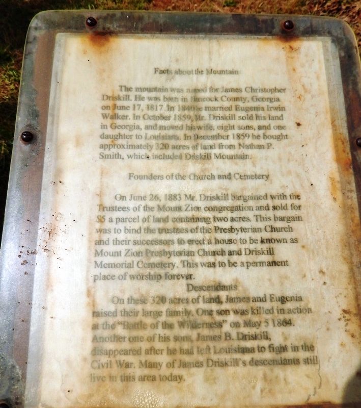
Facts about the MountainThe mountain was named for James Christopher Driskill. He was born in Hancock County, Georgia, on June 17, 1817. In 1840 he married Eugenia Irwin Walker. In October 1859, Mr. Driskill sold his land in Georgia, and moved . . . — — Map (db m166115) HM
Near this spot is the trailhead to Driskill Mountain, Louisiana's highest point and the Mt. Zion Presbyterian Church and Cemetery. James Christopher Driskill, the mountain's namesake. was born in Hancock County, Georgia, on June 27, 1817. On . . . — — Map (db m234596) HM
Founded in 1849 as first parish seat for Bienville Parish. Post office est. 1849. 1st Postmaster J. M. Denson. Incorp. 1852. 1860 pop. Of 250 composed of merchants, craftsmen and professionals. Had two churches, two Masonic Lodges, three private . . . — — Map (db m166144) HM
On This Site May 23, 1934 at 9:15 a.m.
The Infamous Outlaws Bonnie Parker and Clyde Barrow
Met Their Demise At The Hands Of These
Dedicated Law Enforcement Officials
Lest we Forget These Brave And
Vigilant Conservators of the . . . — — Map (db m128271) HM
This Is The Location Of Ma Canfield's Cafe Where Bonnie Parker And Clyde Barrow Stopped At 9am On May 23, 1934, Picked Up Sandwiches And Drove Off To Their Deaths 7 Miles Away. — — Map (db m181170) HM
Nearest point of Federal advance on Shreveport during Civil War. About four miles to southwest near confluence of streams Confederates sank steamer New Falls City which blocked passage of Federal gunboats, April 10, 1864. — — Map (db m109795) HM
The botanist, artist, author, conservator, and pioneer, Caroline Dormon, was born at Briarwood in Saline, Louisiana on July 19, 1888. Established by Dormon's grandparents, Harietta and Benjamin Sweat, in 1859. Briarwood was originally a cotton . . . — — Map (db m209848) HM
Deacon and manager T.J. Coleman executed the cash deed with H.A. Sherman, president of the Bienville Parish school board establishing the Sardis Baptist Church on April 23, 1931. Prior to this date this was known as the Jackson School. — — Map (db m305041) HM
303rd Bombardment Group (H)
Molesworth, England
12 September 1942–11 June 1945
More combat missions (364) than
any other 8AF B-17 Group
Dedicated to all who served
with this highly decorated
group from its activation
3 . . . — — Map (db m105224) HM WM
1942 - 1945
England - France
Belgium - Germany
Dedicated to the memory of the young men that trained at Barksdale and went on to serve with the 344th Bomb Group (M) in World War II.
The 344th Bomb Group led the Ninth Air Force into . . . — — Map (db m109811) WM
A tribute to all
who served in the
34th Bomb Group
April 1944 - June 1945
Mendlesham, England
4th Sqdn - 7th Sqdn
18th Sqdn 391st Sqdn — — Map (db m109807) WM
This WWII unit flew 191 combat missions over Nazi-held Europe from Station No. 174 Sudbury-Suffolk, England between May 1944 and July 1945.
The survivors of the 486th dedicate this memorial to all who served the unit in the cause of freedom . . . — — Map (db m109808) WM
General Ira C. Eaker was a farm boy from Eden, Texas who became one of history's most famous air commanders. From April 15, 1942 to December 1, 1943 General Eaker commanded VIII Bomber Command (later redesignated Eighth Air Force) from his command . . . — — Map (db m109689) HM WM
General Joseph James Nazzaro was born and raised in the shadows of the skyscrapers of New York City. Not too many years later, General Nazzaro would soar over the tops of those skyscrapers and go on to command some of this nation's mightiest air . . . — — Map (db m109691) WM
Lewis Elton Lyle, a native of Pine Bluff, Arkansas and a graduate of Ouachita College, earned his wings in the 41-I class at Brooks Field, Texas. Assigned to the 303rd Bombardment Group upon activation of the 8th Air Force, he and his crew flew his . . . — — Map (db m109687) HM WM
USAF aerial reconnaissance can trace its roots back to the American War between the states, when balloons carried aloft battlefield observers. The invention of the aircraft offered exciting new possibilities. The Wright brothers courted the air . . . — — Map (db m109802) HM WM
Official burial ground for Bellevue, formerly Bossier Parish seat. At least two judges, four Bossier parish Sheriffs, and twenty-one Confederate soldiers are buried here Bellevue was first called Freedonia, then Society Hill. — — Map (db m181378) HM
Historic site of Freedonia, where first session of Bossier Parish court was held September 25, 1843: presiding was Judge W.K. Beck. Site later named Society Hill, then Bellevue. First Police Jury meeting was held about two miles northeast on site of . . . — — Map (db m181438) HM
Cornerstone laid July 1, 1910 by members of R.J. Hancock Chapter, U.D.C. Formally unveiled on Tuesday, August 30, 1910, as a monument to the Confederate soldiers of Bossier Parish. — — Map (db m178396) HM
Built in circa 1840 by Alex B. Hughes, the house remained in the Hughes family until its donation to the Bossier Restoration Foundation in 1972. This was the boyhood home of William Clark Hughes who was the Speaker of the Louisiana House of . . . — — Map (db m109778) HM
In 1926, at this location, the first Bossier City High School football team was formed. They chose to call themselves “Bearkats” — — Map (db m282096) HM
CMSGT Richard L. Etchberger
Medal of Honor
21 SEP 10
Isaiah 6:8 “I heard the voice of the Lord, saying
Whom shall I send and who will go for us?
Then said I, here am I; send me
The introduction of the B-52 into the Vietnam War . . . — — Map (db m199163) WM
Following World War II, Great Britain realized the importance of maintaining strategic bombers possessing long-range, heavy bomb loads, high speed, high-altitude performance, and able to be based anywhere in the world. To meet this challenge, . . . — — Map (db m199175) HM
The AT-11 was the standard bombing trainer in World War II, responsible for training more than 90% of the more than 45,000 Army Air Force (AAF) bombardiers. The Kansan was one of several military versions of the Beechcraft Model 18 Commercial . . . — — Map (db m199232) HM
The C-45 was the World War II military version of the popular Beechcraft Model 18 commercial light transport. Beechcraft built a total of 4,526 of these aircraft for the Army Air Forces (AAF) between 1939 and 1945 in four versions, the AT-7 . . . — — Map (db m199234) HM
The B-29 was designed in 1940 as an eventual replacement for the B-17 and B-24. Its maiden flight was on September 24, 1942 from Boeing Field in Seattle. After taking delivery in 1943, United States military leadership decided not to employ the B-29 . . . — — Map (db m199178) HM
Since it became operational in 1955, the B-52 has been the main long-range heavy bomber of the Strategic Air Command. It first flew on Apr. 15, 1952. Nearly 750 B-52s were built when production ended in Oct. 1963, of which 170 were -Ds. The -Ds were . . . — — Map (db m199170) HM
Since it became operational in 1955, the B-52 has been the main long-range heavy bomber of the Strategic Air Command. It first flew on Apr. 15, 1952. Nearly 750 B-52s were built when production ended in Oct. 1963, of which 193 were-Gs. The B-52G was . . . — — Map (db m199162) HM
Based on the Boeing 707 airframe, the KC-135 was the first totally jet powered in-flight refueling aircraft. C-135s served as Air Force One and have been modified into electronic warfare aircraft, weather reconnaissance, airborne command post and . . . — — Map (db m199140) HM
The C-97 was the Army Air Force.cargo/transport version of the B-29. Between 1943 and 1950, 74 Stratofreighters were ordered; the first flight occurred on Nov. 15, 1944. A tanker version (KC-97) was introduced in 1950 using the “flying boom” . . . — — Map (db m199176) HM
Built by Don S. Coleman in 1960. Designed in the mid-century modern style showcasing an iconic wave roof of reinforced concrete and a free span vaulted ceiling. Originally “Holiday Bowl” with 32 lanes. — — Map (db m214288) HM
The U.S. Air Force's first operational supersonic bomber, the B-58, made its initial flight on Nov 11, 1956. In addition to the Hustler's delta wing shape, distinctive features included a sophisticated inertial guidance navigation and bombing . . . — — Map (db m199223) HM
The USAF bought 76 production FB-111As to fill a gap in the strategic bomber force between the time when the Boeing B-52C & F models and Convair B-58As were being phased out in the late 1960's into the early 1970's. The Advanced Supersonic Manned . . . — — Map (db m199186) HM
“We believe peace is at hand”
Oct. 23, 1972
Dr. Henry Kissinger, National Security Advisor to
President Richard Nixon
Beginning in early October thru mid-December of 1972, United States National Security Advisor Dr. Henry Kissinger and North . . . — — Map (db m199181) HM WM
The two-place T-33 jet was designed for training pilots already qualified to fly propeller-driven aircraft. It was developed from the single-seat F-80 fighter by lengthening the fuselage slightly more than three feet to accommodate a second cockpit. . . . — — Map (db m199179) HM
Dedicated in 1999 to
Mr. B-52
Major General William E. Eubank, Jr.
for
outstanding service to the nation
• Flew first B-52 and KC-135 aircraft accepted by the USAF from Boeing
• Commanded 93rd Dome Wing winning Mackay Trophy for first . . . — — Map (db m199143) HM WM
The Martin Titan II was developed at the beginning of the 1960s. A major improvement over the Titan I was an upgraded version of the Aerojet-General LR87 first-stage rocket engine. The engine was capable of producing 430,000 lbs of thrust and burned . . . — — Map (db m199227) HM
The MiG-21F is a short-range day fighter-interceptor and the first major production version of the popular MiG-21 series. It is but one of many versions of this aircraft that have served in the arsenals of many nations around the world. The E-5 . . . — — Map (db m199174) HM
The North American Aviation Corporation AGM-28 Hound Dog was was a supersonic, jet-powered, air-launched cruise missile. The Hound Dog was initially given the designation B-77, later re-designated GAM-77, and finally designated the AGM-28. It was to . . . — — Map (db m199146) HM
Cornerstone laid Nov. 26, 1926. Officially dedicated May 19, 1927. A fine example of the Spanish "Hacienda" style adapted for public buildings. The second floor still contains original jail cells. — — Map (db m109777) HM
Located a short distance down this road. Founded 1848 by Fillmore Methodist Church, once located on site. Buried here are Thomas D. Connell, founder of Connell's Cross Roads (now Fillmore), and W.P. Haughton. Also here is O.R. Gelette (1845-1944), . . . — — Map (db m181360) HM
Built 1883 after earlier house on site burned. Residence of Dr. Paul Lawrence. respected physician, who performed house calls for over 50 years despite the loss of a leg in the Civil War. Haughton was originally called Lawrenceville in his honor. — — Map (db m169679) HM
At this site in 1868, Isaac Williams
and thirty other African American
men were arrested and unlawfully
convicted and sentenced to one year
in the penitentiary for holding a
Loyal-League meeting. Four months
later, with the advice and consent . . . — — Map (db m144214) HM
Modified dog trot house is example of skills and creativity of early 20th century homes in Bossier Parish. It has one room on south side and three rooms on the north.
Built circa 1927 by Henry McDade for his wife, Artie Lee Patterson McDade and . . . — — Map (db m169361) HM
This house was built in stages between 1832 and 1848, and by 1850 was owned by Doctor Abel Skannal. From this house the family controlled five plantations totaling over 8000 acres. Rumors about ghosts are sustained by the fact that Doc Skannal kept . . . — — Map (db m169284) HM
Built c.1875, was residence of Elam S. Dortch, believed to be the last surviving Confederate veteran residing in Bossier Parish. Moved c.1923 to present site from original location nearer river. Listed in National Register of Historic Places, 1982. — — Map (db m109796) HM
Grades 1-11 1921-1947
Grades 1-12 1948-1955
Grades 1-8 1956-1969
Dedicated to the Principals, Faculty and Students who made this school such a special part of our lives. This was education as it should be.
Dedicated by the Friends of . . . — — Map (db m175303) HM
The property for Belcher Methodist Church was purchased in 1916 after over two years of fundraising. A white wood frame church was built that same year. In 1954 that structure was raised and a new brick church was built. Several men in the . . . — — Map (db m175189) HM
A Caddo mound and village dating between approximately 1450 & 1650 A.D. were located northeast of Belcher. The mound consisted of a series of platforms that contained houses or meeting places for the village leaders. The houses were burned . . . — — Map (db m87132) HM
Belcher Presbyterian Church was organized on July 18, 1897, as the Red River Presbyterian Church. The congregation met in a vacant store building on Rush Point Plantation where services were held until 1900, when a one room frame building was . . . — — Map (db m87130) HM
A Caddo dugout canoe from the Middle Caddo period (ca. A.D. 1200-1500) was found in the bank of the Red River on Kavanaugh family property near this location in June of 2017 by Jenna Bradley and Robert Cornett. The canoe was recovered from the river . . . — — Map (db m174857) HM
A Caddo Indian dugout canoe dating to the early Caddo period (ca. A.D. 900-1200) was found in the bank of the Red River on the North family property near this location in August of 1983. A section of the canoe was discovered protruding from the . . . — — Map (db m175579) HM
Cedar Bluff Ferry was one of the ferries on the Red River between Bossier and Caddo Parishes in the 19th and early 20th century. It operated until the early 1950s when a bridge was built to the north for Highway 2. It ran from Cedar Bluff in Bossier . . . — — Map (db m87160) HM
The First State bank of Belcher was organized in 1913. The present brick building was designed by the architect Edward F. Neild of Shreveport and built in 1924. The First State Bank later became Caddo Trust & Savings Bank the Belcher Masonic Lodge . . . — — Map (db m87128) HM
Built in 1915, the one lane bridge is one of the earliest examples in Louisiana of an all-concrete structure. Unique characteristics give it a coherent, monolithic appearance. The reinforced concrete superstructure consists of a concrete deck on two . . . — — Map (db m175070) HM
Ca. 1922 a country store was moved from Myrtis, La to this location to serve as the new commissary for the J.W. Lynn Plantation. At it's peak over 300 hundred families lived and worked on the plantation, with the commissary serving as the general . . . — — Map (db m174856) HM
During the Louisiana Maneuvers of 1941, the U.S. Army and Air Corps divided itself into two opposing armies for practice for possible war in Europe. Among the noted commanders in the maneuvers, was General George S. Patton. His mechanized armored . . . — — Map (db m87133) HM
The plantation was established in 1914 by James Wiley Lynn with the purchase of property from the Cavett family. The plantation home, the cotton gin and the blacksmith shop were built by Mr. Lynn in 1928. The renovated dogtrot style home, the barn . . . — — Map (db m87159) HM
Clyde Connell, an internationally-known artist named for Scotland's River Clyde, was born and raised in a large household in Belcher on the Dixon Plantation. These early life experiences are reflected in her art. A self-taught painter and sculptor, . . . — — Map (db m174932) HM
The original house was built in 1899 by Ruben T. Glassell, a planter, and his wife Vyvian. It faced west and had a center hall in the dogtrot style. The house was enlarged about ten years later with the addition of a new roof, interior columns, . . . — — Map (db m175072) HM
Cornerstone Missionary Baptist Church was started in a house on the back of the Corner Place in Dixie, Louisiana. The first prayer meeting and a revival was held there in late 1889. Led by Rev. Eddie Moore, Pastor. Cornerstone Church congregation . . . — — Map (db m175731) HM
Typical of the large river plantations of the mid-nineteenth century, land was owned on both the Caddo and Bossier sides of the Red River. Beginning in 1849 Woodlawn was successively owned by several large land owners of the region, the A.D. Palmer . . . — — Map (db m196110) HM
The church began in 1902 as the Presbyterian -Methodist Church of Dixie as a result of an agreement between the minister, Mr. Ziegler and Mr. Ivey, who donated the land on North Road for the church. In 1904 the Red River Presbytery organized the . . . — — Map (db m175732) HM
Killarney was built by James Stuart Douglas in 1920 and designed by Edward F. Neild, a prominent Shreveport architect in the firm C. E. Olschner Architect Assoc. This is one of the first homes designed by Mr. Neild. Mr. Douglas was a planter, civic . . . — — Map (db m175663) HM
The W.H. North Plantation dates back to 1886. The original home was moved with mules and wagons from the bank of Red River in 1903 to the present site on Cottonwood Bayou. After being destroyed by fire in 1923, the home was rebuilt on the original . . . — — Map (db m175850) HM
Just to the north of Herndon Middle Magnet School is one of the most historic regions in north Caddo Parish. During the early decades of the 19th century it was a crossroads of navigable bayous, a Caddo Indian Trail, an early road which settlers . . . — — Map (db m174348) HM
The village is named for R.L. "Bob” Gilliam who owned property from which he donated right-of-way for the T.S. & N. Railroad which ran from Texarkana to Shreveport. The understanding was that the railroad would establish a depot on the banks of Red . . . — — Map (db m174855) HM
The first worship services in Gilliam were held in a railroad box car. In 1902 Gilliam Methodist Episcopal Church, South was built across Red Bayou north of the present church. That building was destroyed in the storm of 1908, along with all but one . . . — — Map (db m174465) HM
The Justice Chapel Baptist Church was organized in 1894 under the leadership of Rev. C.J. Justice and Brother Willie Davenport and his wife. Other leaders in this early church were Rev. Eddie Moore, Brother Eddy Green, Brother Frank Cook, Mathis . . . — — Map (db m174630) HM
Organized June 6, 1919, with 12 charter members, and named in honor of Mrs. Linda Lay who had been instrumental in the development of the spiritual life in the town. Constructed in 1920, dedication of the building was held on August 14, 1921. The . . . — — Map (db m174628) HM
The home was built circa 1910 by Reuben Douglas and his wife, Lucy Parsons, after the Gilliam 1908 storm destroyed their first home. Reuben, one of the early landowners in the area, purchased 800 acres in 1900, which he named All's Well Farm. Reuben . . . — — Map (db m174463) HM
Home of the Sunflower Festival and Red River Crossroads Museum
After R.L. Gilliam donated property in 1898 for the railroad depot, the area was officially founded and named Gilliam.
An article published in the Shreveport Times on . . . — — Map (db m174227) HM
From the mid-1890's to the early 1970's the Texarkana, Shreveport & Natchez/Texas & Pacific Railroads served the economic and personal needs of northeast Caddo Parish along a roadbed at this site. While the railroad was being built during the 1890's . . . — — Map (db m174224) HM
Built circa 1840. Used as a hospital for Confederate wounded following Battle of Mansfield in April, 1864. Several soldiers who died here are buried on the grounds. — — Map (db m257541) HM
On June 23, 1912, twelve charter members organized the Hosston Methodist Church. At first they worshiped at the Baptist Church then in 1916 built a white wood frame church which faced east on this spot. In 1940 as the membership grew two porches . . . — — Map (db m173876) HM
The Hosston Post Office was established on May 27, 1901. The first Hosston Postmaster was Dee R. Allen who served from May 27, 1901 - March 16, 1908, and the last Postmaster was Charles V. Giles who served from June 3, 1966 - December 31, 2004. The . . . — — Map (db m174037) HM
The house was built around 1878 and occupied by the William Adams family. James Patrick Fuller and his wife Gertie McKinney Fuller purchased the house in 1919. Their family included daughters Pattie Mae and Audrie, who was born in the house in 1920. . . . — — Map (db m244247) HM
Settlement in the Ida area began before 1840, with increasing numbers coming from the East after the Civil War. They came by ox-drawn wagons or by steamboat. Earliest permanent settlers were Readrick Kelly, Chesley Green Williams, the Munnerlyn . . . — — Map (db m173788) HM
This building was erected in 1923 by W.C. Reynolds, an early Postmaster in Ida. It was the location for the Ida Post Office from 1923 until 1962. Following this period, the building was a carpenter shop of J.E. Richardson. In 1997 the building . . . — — Map (db m173786) HM
Built 1903-04. Constructed by Tom Hudnall. Dedicated Oct. 16, 1904. Bell came from Teer family plantation, Coushatta, Louisiana. — — Map (db m176072) HM
In 1914, as modes of transportation progressed, the Historic Caddo Lake Drawbridge at Mooringsport was built to replace the ferry. The Midland Bridge Company of Kansas City Missouri built the bridge under authority of the Caddo Parish Police Jury. . . . — — Map (db m205847) HM
Formally known as the town of Ananias, Oil City was founded as a whistle stop along the Kansas City Southern Railroad.
Early on, most settlers were fishermen, trappers, and farmers. Others took part in the timber industry, and another group . . . — — Map (db m170202) HM
Before white men came to the area, North Caddo was the rich forestland of the Kadohadacho, or Caddo, Indians. In 1904, the first oil well in North Louisiana was drilled. The resulting "Oil Rush" brought hysteria to the once peaceful and serene . . . — — Map (db m169807) HM
The world’s first over water oil well was completed in Caddo Lake in 1911. The Ferry Lake No. 1 was erected by Gulf Refining Co. The well bottomed at 2,185 feet and produced 450 barrels per day. — — Map (db m87158) HM
Blues singer from Mooringsport, La. (1888-1949). He played 12 string guitar on Shreveport’s Fannin St., sang his way out of prison, and became a folk hero with songs like “Goodnight Irene,” “Bourgeois Blues,” and “Midnight Special.” — — Map (db m139521) HM
In the early 1900's this was a small logging community known as Ananies. In 1906, the first discovery oil well in the field, the Savage No. 1, was brought in. Around 1908 the name of the town was changed to Oil City, by 1910 the population had . . . — — Map (db m87161) HM
Built 1910 at Trees, Louisiana. Moved to present site in 1983. Both Trees and Oil City are intimately associated with the oil boom of the early 1900s. Trees City was founded in 1909 by Trees Oil Company. Listed in National Register of Historic . . . — — Map (db m169898) HM
United Gas Public Service Company, discovered the Rodessa Oil Field one mile west of this historical marker on July 7, 1935. Rodessa was a “Boom Town” a few weeks later.
United’s L.L. Young No. 1, Lease 6875, Sec.21-23N-16W Rodessa Field Caddo . . . — — Map (db m128263) HM
Frog Level and Rodessa
A town meeting was called in the 1800’s by Noah Tyson Sr., store owner, police juror and post master, to name their town. The frogs were hollering in a nearby pond. A man from Alabama jumped up and said, “Let’s name . . . — — Map (db m128259) HM
Typical of the large river plantation of the mid-nineteenth century, the 1,647 acres were located on both the Caddo and Bossier sides of the Red River. Beginning in 1839, Cash Point Plantation was successively owned by several large land owners of . . . — — Map (db m175958) HM
The former Rosenwald School at Cash Point was built in 1923-24 for a cost of $2,300.00 as a two teacher frame school. The Rosenwald Fund was developed by Julius Rosenwald, CEO of Sears, Roebuck & Company, and educator, Booker T. Washington in . . . — — Map (db m175959) HM
Three historic plantations, Cash Point, Gold Point, and Buckhall Plantations, date back to 1839, when they were purchased by James Belton Pickett, Paulina de Graffenried, and James Blair Gilmer. The Buckhall portion on the north and east side was . . . — — Map (db m175957) HM
The first cotton gin on this site was built by John M. Sentell circa 1895. It was a wooden structure painted red and known as The Red Gin. It burned and was replaced by the current structure circa 1933. In 1953 Lowry and Wash Sentell modernized the . . . — — Map (db m175852) HM
The largest ceremonial center of the Caddo Indians in Louisiana, this site originally included seven mounds arranged around a large plaza. The Caddo Indians lived at this site between 900 and 1200 A.D. — — Map (db m175851) HM
One of the many properties acquired by James Belton Pickett in the period following the succession of the Caddo Indian lands to the United States, c. 1837. Pickett, of South Carolina, came to this area c. 1836. He became one of the founders of . . . — — Map (db m175853) HM
In 1899, the large landholdings of James Pickett, one of the founders of Shreveport, began a series of ownership changes. In 1912, Samuel S. Pittman and his wife, Pattie, purchased land in Section 14, formerly held by James Pickett. The house, built . . . — — Map (db m175956) HM
542 entries matched your criteria. The first 100 are listed above. Next 100 ⊳