95 entries match your criteria.
Historical Markers and War Memorials
in Border Reivers Country
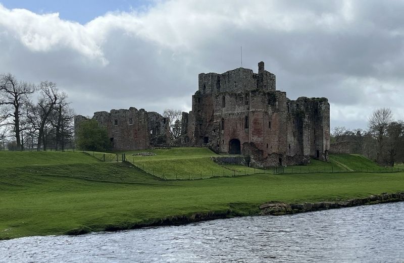
By Ray Gurganus, April 11, 2024
Brougham Castle
1 ► United Kingdom, England, Cumbria, Brougham — The Castle of Robert de Vieuxpont — Brougham Castle —  |
| Near Regional Route 71. | |||
| 2 ► United Kingdom, England, Cumbria, Brougham — The Keep in the 14th Century — Brougham Castle — |
| Near Regional Route 71. | |||
| 3 ► United Kingdom, England, Cumbria, Burgh by Sands — King Edward I Statue — |
| On Cycle Route 72. | |||
| 4 ► United Kingdom, England, Cumbria, Carlisle — Changing Scenes of Carlisle — |
| On English Street. | |||
| 5 ► United Kingdom, England, Cumbria, Carlisle — The Captain's Tower — |
| Near Church Street. | |||
| 6 ► United Kingdom, England, Cumbria, Carlisle — The Citadel or Court Houses — |
| Near English Street. | |||
| 7 ► United Kingdom, England, Cumbria, Penrith — Great Dockray — Millennium Trail — |
| On Great Dockray, on the left when traveling south. | |||
| 8 ► United Kingdom, England, Cumbria, Penrith — Home for a Future King — Penrith Castle — |
| Near Ullswater Road. | |||
| 9 ► United Kingdom, England, Cumbria, Penrith — Penrith Castle — |
| On Ullswater Road. | |||
| 10 ► United Kingdom, England, Cumbria, Penrith — St Andrew's Churchyard — Millennium Trail — |
| Near Saint Andrews Churchyard. | |||
| 11 ► United Kingdom, England, Cumbria, Penrith — Welcome to Penrith Castle — |
| Near Castle Terrace. | |||
| 12 ► United Kingdom, England, Northumberland, Alnwick — Alnwick Quarters — |
| On The Peth (England Route B6341) at Bailiffgate, on the left when traveling south on The Peth. | |||
| 13 ► United Kingdom, England, Northumberland, Alnwick — Alnwick War Memorial — |
| On Bondgate Within (Route B6346) at Route B1340, on the left when traveling east on Bondgate Within. | |||
| 14 ► United Kingdom, England, Northumberland, Alnwick — Bosnian Army Gun — |
| Near The Peth (Route B6341) at Bailiffgate, on the left when traveling south. | |||
| 15 ► United Kingdom, England, Northumberland, Alnwick — Robertson’s Pant — |
| On Market Street (England Route B6341) at Bondgate Within, on the right when traveling east on Market Street. | |||
| 16 ► United Kingdom, England, Northumberland, Alnwick — Sir Henry Percy ‘Harry Hotspur’ — |
| On Pottergate at Narrowgate, on the right when traveling east on Pottergate. | |||
| 17 ► United Kingdom, England, Northumberland, Alnwick — Sir Henry Percy Hotspur — |
| Near The Peth (England Route B6341) at Bailiffgate, on the left when traveling south. | |||
| 18 ► United Kingdom, England, Northumberland, Bamburgh — 19th Century Iron Mortar — |
| Near Links Road at Front Street, on the right when traveling north. | |||
| 19 ► United Kingdom, England, Northumberland, Bamburgh — 24 Pounder Cannons — |
| Near Links Road at Front Street, on the right when traveling north. | |||
| 20 ► United Kingdom, England, Northumberland, Bamburgh — 32 Pounder Cannon — |
| Near Links Road at Front Street, on the right when traveling north. | |||
| 21 ► United Kingdom, England, Northumberland, Bamburgh — Bamburgh Castle Bell — |
| Near Links Road at Front Street, on the right when traveling north. | |||
| 22 ► United Kingdom, England, Northumberland, Bamburgh — Bamburgh Castle Coastguard Station — |
| Near Links Road at Front Street, on the right when traveling north. | |||
| 23 ► United Kingdom, England, Northumberland, Bamburgh — Bamburgh’s Recorded History — |
| Near Links Road at Front Street, on the right when traveling north. | |||
| 24 ► United Kingdom, England, Northumberland, Bamburgh — Chapel of St. Peter — |
| Near Links Road at Front Street, on the right when traveling north. | |||
| 25 ► United Kingdom, England, Northumberland, Bamburgh — Home of Kings — Bamburgh Castle — |
| Near Links Road at Front Street, on the right when traveling north. | |||
| 26 ► United Kingdom, England, Northumberland, Bamburgh — Mid-Tower Room — |
| Near Links Road at Front Street, on the right when traveling north. | |||
| 27 ► United Kingdom, England, Northumberland, Bamburgh — Northumbria’s Royal Throne — |
| Near Links Road at Front Street, on the right when traveling north. | |||
| 28 ► United Kingdom, England, Northumberland, Bamburgh — Stocks — |
| Near Links Road at Front Street, on the right when traveling north. | |||
| 29 ► United Kingdom, England, Northumberland, Bamburgh — The Armada Gun — |
| Near Links Road at Front Street, on the right when traveling north. | |||
| 30 ► United Kingdom, England, Northumberland, Bamburgh — The Farne Islands — Bamburgh Castle — |
| Near Links Road at Front Street, on the right when traveling north. | |||
| 31 ► United Kingdom, England, Northumberland, Bardon Mill — Hadrian's Wall — Frontiers of the Roman Empire World Heritage Site — |
| Near no nearby street. | |||
| 32 ► United Kingdom, England, Northumberland, Bardon Mill — Steel Rigg — Welcome to Northumberland National Park — |
| Near 68. | |||
| 33 ► United Kingdom, England, Northumberland, Branxton — After the Battle of Flodden — Branxton Church — |
| On unnamed street. | |||
| 34 ► United Kingdom, England, Northumberland, Branxton — Flodden — 1513 — |
| On unnamed street. | |||
| 35 ► United Kingdom, England, Northumberland, Corbridge — Corbridge — |
| On Middle Street at Market Place, on the right when traveling north on Middle Street. | |||
| 36 ► United Kingdom, England, Northumberland, Corbridge — Corbridge Roman Site — |
| Near Corchester Lane 0.8 kilometers west of Stagshaw Road, on the left when traveling west. | |||
| 37 ► United Kingdom, England, Northumberland, Corbridge — First Methodist House — |
| On St Helen's Street at Watling Street, on the left when traveling east on St Helen's Street. | |||
| 38 ► United Kingdom, England, Northumberland, Corbridge — St Andrew Corbridge World War I Memorial — |
| On Middle Street at Market Place, on the right when traveling north on Middle Street. | |||
| 39 ► United Kingdom, England, Northumberland, Corbridge — The Courtyard Building — |
| Near Corchester Lane 0.8 kilometers west of Stagshaw Road, on the left when traveling west. | |||
| 40 ► United Kingdom, England, Northumberland, Corbridge — The Early Forts — |
| Near Corchester Lane 0.8 kilometers west of Stagshaw Road, on the left when traveling west. | |||
| 41 ► United Kingdom, England, Northumberland, Corbridge — The East Military Compound — |
| Near Corchester Lane 0.8 kilometers west of Stagshaw Road, on the left when traveling west. | |||
| 42 ► United Kingdom, England, Northumberland, Corbridge — The Fountain House — |
| Near Corchester Lane 0.8 kilometers west of Stagshaw Road, on the left when traveling west. | |||
| 43 ► United Kingdom, England, Northumberland, Corbridge — The Golden Lion — |
| On Hill Street at Princes Street, on the left when traveling east on Hill Street. | |||
| 44 ► United Kingdom, England, Northumberland, Corbridge — The Granaries — |
| On Corchester Lane 0.8 kilometers west of Stagshaw Road, on the left when traveling west. | |||
| 45 ► United Kingdom, England, Northumberland, Corbridge — The King’s Oven — |
| On Watling Street at Hill Street, on the left when traveling south on Watling Street. | |||
| 46 ► United Kingdom, England, Northumberland, Corbridge — The Main Street — |
| Near Corchester Lane 0.8 kilometers west of Stagshaw Road, on the left when traveling west. | |||
| 47 ► United Kingdom, England, Northumberland, Corbridge — The Old Market Cross — |
| Near Middle Street close to Market Place, on the right when traveling north. | |||
| 48 ► United Kingdom, England, Northumberland, Corbridge — The Side Street — |
| Near Corchester Lane at Stagshaw Road, on the left when traveling west. | |||
| 49 ► United Kingdom, England, Northumberland, Corbridge — The West Headquarters Building — |
| Near Corchester Lane 0.8 kilometers west of Stagshaw Road, on the left when traveling west. | |||
| 50 ► United Kingdom, England, Northumberland, Corbridge — The West Military Compound — |
| Near Corchester Lane 0.8 kilometers west of Stagshaw Road, on the left when traveling west. | |||
| 51 ► United Kingdom, England, Northumberland, Corbridge — Vicar’s Pele — |
| On Middle Street at Market Place, on the right when traveling north on Middle Street. | |||
| 52 ► United Kingdom, England, Northumberland, Elsdon — The Pinfold — |
| On roas 68 at Crawford Cres, on the right when traveling north on roas 68. | |||
| 53 ► United Kingdom, England, Northumberland, Hexham — 16th Century Bastle House — |
| Near England Route B6319 2.9 kilometers west of North Road, on the right when traveling west. | |||
| 54 ► United Kingdom, England, Northumberland, Hexham — A Changing Fort — |
| Near England Route B6319 4.7 kilometers west of North Road, on the right when traveling west. | |||
| 55 ► United Kingdom, England, Northumberland, Hexham — A military community — |
| Near road 68 4 kilometers north of Route A69, on the left when traveling north. | |||
| 56 ► United Kingdom, England, Northumberland, Hexham — Allenheads War Memorial — |
| On England Route B6295 at an unnamed road to Rockhope, on the right when traveling north on England Route B6295. | |||
| 57 ► United Kingdom, England, Northumberland, Hexham — Barracks: the Last Hundred Years at Housesteads — |
| Near Route B6319 4.7 kilometers west of North Road, on the right when traveling west. | |||
| 58 ► United Kingdom, England, Northumberland, Hexham — Beneath the soil — |
| Near road 68 4 kilometers north of Route A69, on the left when traveling north. | |||
| 59 ► United Kingdom, England, Northumberland, Hexham — Chesterholm Museum — |
| Near road 68 4 kilometers Route A69, on the left when traveling north. | |||
| 60 ► United Kingdom, England, Northumberland, Hexham — Crindledykes — |
| On Stanegate 5.2 kilometers west of North Road, on the right when traveling west. | |||
| 61 ► United Kingdom, England, Northumberland, Hexham — Dolichenum — |
| Near road 68 4 kilometers north of Route A69, on the left when traveling north. | |||
| 62 ► United Kingdom, England, Northumberland, Hexham — From Cathedral to Priory Church — |
| On Beaumont Street. | |||
| 63 ► United Kingdom, England, Northumberland, Hexham — Mediterranean Style in Northern Climes — |
| Near Route B6319 2.9 kilometers Route A69, on the right when traveling west. | |||
| 64 ► United Kingdom, England, Northumberland, Hexham — North West Quadrant Barracks — |
| Near road 68 4 kilometers north of Route A69, on the left when traveling north. | |||
| 65 ► United Kingdom, England, Northumberland, Hexham — Roman Pottery Kiln — |
| Near road 68 4 kilometers north of Route A69, on the left when traveling north. | |||
| 66 ► United Kingdom, England, Northumberland, Hexham — S.P.Q.R. — |
| Near road 68 4 kilometers north of Route A69, on the left when traveling north. | |||
| 67 ► United Kingdom, England, Northumberland, Hexham — Severan Circular Huts — |
| Near road 68 4 kilometers north of Route A69, on the left when traveling north. | |||
| 68 ► United Kingdom, England, Northumberland, Hexham — The Comanding Officer and his House — |
| Near England Route B6319 4.7 kilometers west of North Road, on the right when traveling west. | |||
| 69 ► United Kingdom, England, Northumberland, Hexham — The Fort and its Design — |
| Near England Route B6319 4.7 kilometers west of North Road, on the right when traveling west. | |||
| 70 ► United Kingdom, England, Northumberland, Hexham — The Fort Food Supply — |
| Near Route B6319 2.9 kilometers west of North Road, on the right when traveling west. | |||
| 71 ► United Kingdom, England, Northumberland, Hexham — The Heart of Hexham — |
| On Market Place. | |||
| 72 ► United Kingdom, England, Northumberland, Hexham — The heart of the fort — |
| Near road 68 2.5 kilometers north of Route A69, on the left when traveling north. | |||
| 73 ► United Kingdom, England, Northumberland, Hexham — The Heart of the Fort — |
| Near England Route B6319 2.9 kilometers west of North Road, on the right when traveling west. | |||
| 74 ► United Kingdom, England, Northumberland, Hexham — The Milestone — |
| Near road 68 4 kilometers north of Route A69, on the left when traveling north. | |||
| 75 ► United Kingdom, England, Northumberland, Hexham — The North Gate — |
| Near Route B6319 4.7 kilometers west of North Road, on the right when traveling west. | |||
| 76 ► United Kingdom, England, Northumberland, Hexham — The Severan fort — |
| Near road 68 4 kilometers north of Route A69, on the left when traveling north. | |||
| 77 ► United Kingdom, England, Northumberland, Hexham — The Vicus — |
| Near B6319 4.7 kilometers west of North Road, on the right when traveling west. | |||
| 78 ► United Kingdom, England, Northumberland, Hexham — The village and fort — |
| Near road 68 4 kilometers north of Route A69, on the left when traveling north. | |||
| 79 ► United Kingdom, England, Northumberland, Hexham — The Wall Arrives — |
| Near England Route B6319 2.9 kilometers west of North Road, on the right when traveling west. | |||
| 80 ► United Kingdom, England, Northumberland, Hexham — Vindolanda Inscriptions — |
| Near road 68 4 kilometers north of Route A69, on the left when traveling north. | |||
| 81 ► United Kingdom, England, Northumberland, Hexham — Where the Soldiers Lived — |
| Near England Route B6319 2.9 kilometers west of North Road, on the right when traveling west. | |||
| 82 ► United Kingdom, England, Northumberland, Hexham — Workshops — |
| Near road 68 4 kilometers north of Route A69, on the left when traveling north. | |||
| 83 ► United Kingdom, England, Northumberland, Morpeth — The Chapel — Warkworth Castle — |
| Near Castle Street at Wellfield, on the left when traveling north. | |||
| 84 ► United Kingdom, England, Northumberland, Morpeth — The Great Hall — Warkworth Castle — |
| Near Castle Street at Wellfield, on the left when traveling north. | |||
| 85 ► United Kingdom, England, Northumberland, Riding Mill — Welcome to the Broomhaugh and Riding Mill History Trail — |
| On Church Lane, on the right. | |||
| 86 ► United Kingdom, England, Northumberland, Rothbury — Armstrong Cross — |
| On Front Street at Church Street, on the left when traveling west on Front Street. | |||
| 87 ► United Kingdom, England, Northumberland, Rothbury — Rothbury War Memorial — |
| On Front Street at Church Street, on the right on Front Street. | |||
| 88 ► United Kingdom, England, Northumberland, Shilbottle — Shilbottle War Memorial — |
| On Grange Road at Percy Road, on the right when traveling west on Grange Road. | |||
| 89 ► United Kingdom, Scotland, Dumfries and Galloway, Dumfries — Robert Burns — Burns' Mausoleum — |
| Near St. Michaels Street. | |||
| 90 ► United Kingdom, Scotland, Dumfries and Galloway, Dumfries — Sweetheart Abbey — "The last Cistercian abbey established on Scottish soil" — |
| On Main Street. | |||
| 91 ► United Kingdom, Scotland, Dumfries and Galloway, Stranraer — Z4 — |
| On North Crescent just west of North Crescent and Welsh Place, on the right when traveling west. | |||
| 92 ► United Kingdom, Scotland, Scottish Borders, Melrose — An Eccentric Vision — William Wallace Statue — |
| Near B6356. | |||
| 93 ► United Kingdom, Scotland, Scottish Borders, Melrose — Royal Connections — Melrose Abbey — |
| Near Abbey Road at Cloisters Road. | |||
| 94 ► United Kingdom, Scotland, Scottish Borders, Melrose — Scott's View — |
| On B6356. | |||
| 95 ► United Kingdom, Scotland, Scottish Borders, Selkirk — The Fletcher Monument — Flodden Field — |
| On Scotts Place. | |||