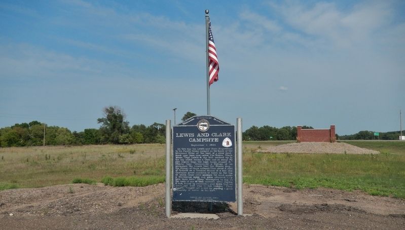
On this day the Lewis and Clark Expedition to the Pacific Ocean camped on the bank of the Missouri River at the base of a river landmark near here, now called The Tower. Clark wrote, “Capt Lewis & my Self walked up to the top which forms a Cone and . . . — — Map (db m181800) HM
On August 3, 1944, a C-47 transport carrying twenty-eight men of the U.S. Army Air Forces crashed in a ravine six miles southwest of Naper during a severe storm. There were no survivors. It was the largest single military air disaster in Nebraska . . . — — Map (db m70623) HM
Ainsworth Army Air Field, completed on November 30, 1942, was a satellite of Rapid City Army Air Field and under command of the Second Air Force. The field was one of eleven Army Air Force training bases built in Nebraska during World War II. The . . . — — Map (db m77760) HM
Lakeland High School was constructed 20 miles south of this site by ranchers from several rural school districts during the summer of 1934. School began that September with 11 students. Constructed of prairie sod, with a sod roof supported by pole . . . — — Map (db m9623) HM
Like many Nebraska communities, Long Pine's history is tied to railroad development. When the Fremont, Elkhorn, and Missouri Valley line arrived in 1881, Long Pine became a bustling railroad town. The Chicago & North Western Railroad (CNW) built a . . . — — Map (db m182061) HM
The first ranch in this area was set up on the Niobrara River about five miles south of here in 1877. E. S. Newman established his ranch to sell cattle to the government for delivery to the Indians at the Pine Ridge Agency to the north.
The . . . — — Map (db m9622) HM
This natural valley extending east and west across the Sandhills became known as Survey Valley after the Burlington and Missouri River Railroad surveyed a prospective line from O’Neill to Alliance in 1887. No rails were ever laid. On January 19, . . . — — Map (db m178711) HM
This arched cantilever truss bridge, connected in the center with a single pin, is the only one of its kind in the United States. It was built in 1932 by the Department of Public Works and named by the local citizenry in honor of Governor Charles . . . — — Map (db m70625) HM
When a Sioux Indian reservation was established north of here in Dakota Territory in 1878, early settlers in the region grew fearful of attack. They requested military protection, and in 1880 Fort Niobrara was built a few miles east of present-day . . . — — Map (db m77753) HM
At 10:45 a.m. on February 5, 1944, 1st Lt. John B. Beatty of Sandusky, OH, and 2d Lt. Earnest W. Fanslau of Mantua, NJ took to the air from the Ainsworth Army Air Field in two P-47 "Thunderbolt" fighter planes for an instrument training flight. Lt. . . . — — Map (db m77754) HM
The Early Years 1875-1881 Welcome to Atkinson — a city of 1,462 as of 2019 census and thank you for visiting Railroad Park. The Railroad played an important role in establishing our city. This picnic pavilion is on the west end of . . . — — Map (db m191594) HM
Atkinson celebrated its Diamond Anniversary in August 1940 and The Atkinson Graphic newspaper published numerous articles describing meetings of various local clubs which were organizing activities leading up to the late summer event. In the June . . . — — Map (db m191595) HM
Near here was the scene of some of Nebraska’s earliest experiments with flight in a heavier-than-air vehicle. Sometime before late 1907, Martin P. Savidge’s sons set out to construct a flying machine.
They began by studying hawks, then went . . . — — Map (db m101688) HM
One of the most colorful leaders in the early development of Nebraska was General John O'Neill, founder of O'Neill. After leading several ill-fated raids against British military posts in Canada 1866-1871, O'Neill lost his leading position in the . . . — — Map (db m9632) HM
The Irish were a major immigrant group contributing to the settlement of Nebraska. Speaking the English language, they blended into the population and were found in many communities. However, due to ancient animosities with Britain, some of them . . . — — Map (db m179200) HM
Originally the entire responsibility for highways in Nebraska rested with the counties. In 1917 the Legislature accepted the provisions of a federal law and appropriated money to match federal funds for highway construction. This act marked the . . . — — Map (db m182016) HM
In the late nineteenth century the U. S. Coast & Geodetic Survey undertook measurements to determine the nation’s physical shape with absolute accuracy. This survey initially involved two triangulation networks. One survey stretched from coast to . . . — — Map (db m181892) HM
The first Page School was a small sod building located ½ mile south of Page and was erected in 1883. It was open for seven years. In 1891, a large 2-story wooden schoolhouse was erected on the block west of the Page Park. In 1892, the students put . . . — — Map (db m181975) HM
Before you is a settlement success story resulting from the Homestead Act of 1862 and the Timber Culture Act of 1873.
David A. and Kate E. (Blakely) Clopton came to Keya Paha county from Jefferson, Iowa in 1884. They homesteaded just south of . . . — — Map (db m237138) HM
Keya Paha County, organized at a special election January 20, 1885, was created from that part of Brown County lying north of the Niobrara River. Its name comes from “Ke’-ya Pa-ha’ Wakpi” or “Turtle Hill River,” the Lakota Indian designation for . . . — — Map (db m237246) HM
Dedicated to the memory of our men from Keya Paha County who served their country in the Civil War, the Spanish War, and Great World War that Liberty shall not perish from the Earth. World War Antrim, Benj. R. • Austin, Warren . . . — — Map (db m237257) WM
Dedicated to the memory of the Men and Women from Keya Paha County who served their county, that Liberty shall not perish from the Earth World War II Adams Everett V. • Adkinson Charles L. • ☆Alexander Charles H. • . . . — — Map (db m237274) WM
The first Keya Paha County Fair was held in September 1898. Ever since, the center of the fair’s activities has been the Barn Dance. The current fairground was purchased in 1921. A new dance hall was approved in 1929 and built by Fred Taylor. The . . . — — Map (db m179183) HM
On its journey to the Pacific Ocean the Lewis and Clark Expedition camped near here on September 2, 1804. At this camp the explorers’ imagination and knowledge of military fortifications misled them into concluding that sand ridges and mounds left . . . — — Map (db m181799) HM
George Shannon was reunited with the Lewis and Clark Expedition and the group traveled onward to present-day North Dakota. Private John Newman was caught speaking in mutinous tones — an attempt to subvert the discipline and loyalty of other members . . . — — Map (db m181894) HM
Seen through Ponca eyes, the original prairie environment was a cherished sea of grasses and plants. Together, with the buffalo, we kept the prairie healthy. Buffalo herds would graze the vast landscape, and our people would collect different types . . . — — Map (db m192598) HM
In contrast to the village earthlodge, the tipi was a light and portable shelter. It was a kind of seasonal, second home. Constructed of slender wooden poles and buffalo hide, tipis were pitched in a circular arrangement during the bison hunt and . . . — — Map (db m192656) HM
George Shannon was in St. Louis in 1810 when he was authorized to travel to Pennsylvania to assist historian Nicholas Biddle in editing the Lewis and Clark journals. While working on the journals, Shannon decided he would like to study law. Shannon . . . — — Map (db m181895) HM
This building was constructed in 1936 by the Indian Emergency Conservation Work (IECW) force. Like the Civilian Conservation Corps, the IECW was part of the country's New Deal program aimed at providing economic relief during the Great Depression. . . . — — Map (db m192597) HM
Back in the day, our people lived in villages comprised of earthlodges. We called the lodges maithi, and they were set beside our gardens and crops. These dwellings were constructed by women, though men sometimes helped to cut and carry in the . . . — — Map (db m192655) HM
After a tragic history of forced relocation and land loss many tribes began coming together in the mid-20th century for intertribal gatherings. It was here that each tribe's long history of seasonal dances and sacred ceremonies culminated in a new . . . — — Map (db m192596) HM
For thousands of years our people depended upon the buffalo. We ate its meat, used its hides for our homes and clothing, its horns to make spoons, and our children even used the buffalo's ribs to make winter sleds. Every part of the animal was . . . — — Map (db m192600) HM
maN zhaN (the land) is xube' (sacred) to the Ponca People as is Ni' (water). Following forced removal of the Ponca Tribe to Oklahoma, the tribe split into two groups. The members that stayed in Oklahoma are now referred to . . . — — Map (db m192657) HM
This has been the homeland of the Ponca Indians since earliest recorded history. In 1868 the federal government signed the Treaty of Fort Laramie, which transferred the land to the Sioux without the permission of the Ponca. Treaties made with the . . . — — Map (db m179194) HM
On the night of June 2, 1969, while on maneuvers in the South China Sea off the coast of Vietnam, the Australian aircraft carrier Melbourne was in collision with the destroyer USS Frank E. Evans. The impact cut the Evans in . . . — — Map (db m181893) HM WM
Seen through Native eyes, the land and water are alive. Rocks, trees, meadows, and rivers: all of these natural elements possess their own life spirit. In our culture, Mother Earth is a powerful force in everyday life. We believe that our people, . . . — — Map (db m192653) HM
Our villages and old trails were always located near rivers or streams. Waterways were the highways of days gone by, and we used them for travel and trade. Sometimes they would also function as natural yet strategic barriers between one tribe and . . . — — Map (db m192599) HM
Welcome to Spring Valley Park. Pioneers of this
region, eastern Rock County, recognized it as a great
natural haying region extending over twenty miles
south down this valley. The nearby village of Newport.
established in 1883, became one of . . . — — Map (db m223476) HM