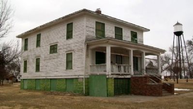
The Franklin Academy occupied this site from 1881 until 1922. It was one of six Congregational Church-affiliated academies in Nebraska. Others were located at Crete, York, Neligh, Weeping Water, and Chadron.
Over 2,500 students in college . . . — — Map (db m58998) HM
Present Franklin County was formerly a part of the buffalo hunting range of the Pawnee Indians, whose villages were at one time located further down the valley of the Republican River. Cheyenne and Sioux hunting parties also frequented the area . . . — — Map (db m59005) HM
World War I
They Died for Freedom
[Roll of Honored Dead]
World War II
The Supreme Sacrifice
[Roll of Honored Dead]
Korea
They Died for Freedom
[Roll of Honored Dead]
Vietnam
[Roll of Honored Dead] . . . — — Map (db m59000) WM
This memorial
erected on the site of
The Old Franklin
Congregational Academy
Pioneer Founders and Educators were:
E. B. James · A. E. Rice · W. S. Phipps
Rev. Amos Dresser · Rev. C. S. Harrison
Reve. W. S. Hampton · Prin. A. C. . . . — — Map (db m59003) HM
When Frontier County was organized in 1872, Stockville became the county seat. During its first decade no real town existed, it being only a trading center for the ranchers of the region. It was not until the middle-eighties, when the county filled . . . — — Map (db m223453) HM
Last of the Old West [manually inscribed on top of marker] This trail crossed the divide between Deer and Medicine Creeks. From the Republican to the Platte. — — Map (db m303474) HM
On May 23, 1919, Dr. Frank A. Brewster of Beaver City and pilot Wade Stevens took off on a flight to Herndon, Kansas. There, Brewster performed emergency surgery to save the life of an injured man. This flight attracted worldwide attention and Dr. . . . — — Map (db m264269) HM
First Homestead in Neb. By Daniel Freeman. Jan. 1, 1866
Cambridge Incorporated 1885
First Counsel W. H. Faling W.E.B. Babcock James, John J.W.
Pickle W.P. Bennett
Dist. 21. Organized 1874
Minnie Finch First Teacher 7. Pupils.
George . . . — — Map (db m252903) HM
Faced with the great influx of white settlers after the Civil War, hostile Sioux and Cheyenne Indians retreated into the Republican River Valley. Here they found a nearly ideal location since the valley remained one of the great buffalo ranges of . . . — — Map (db m176855) HM
On May 30, 1935, torrential rains fell in eastern Colorado and southwestern Nebraska; by early morning of the 31st, the usually peaceful Republican River was running bluff-to-bluff along its upper reaches. When the waters subsided two days later, . . . — — Map (db m48549) HM
Large reservoirs like Harlan County Lake provide habitat for aquatic birds. Many of these birds eat fish like small gizzard shad and carp. To avoid competing for food and territory, these fish-eating birds forage in different parts of the reservoir, . . . — — Map (db m45524)
Like most reservoirs in Nebraska, Harlan County Reservoir was created to store water for flood control and irrigation. In the fall, winter, and spring water flowing down the Republican River is stored, to be used during the summer to water . . . — — Map (db m45523) HM
Culbertson was the county seat of Hitchcock for twenty years, and this marks the site of the first court house, used 1886-1893. Founded as a trading post in July 1873 by W.Z. Taylor, it became the county seat when Hitchcock County was organized . . . — — Map (db m79363) HM
In January 1944 German prisoners of war from the Indianola camp came to a side camp here to help area farmers complete the 1943 corn harvest. Over the next two years the Palisade camp was activated and deactivated as needed to supply labor to . . . — — Map (db m176961) HM
In the spring of 1859, William H. Russell and John S. Jones established The Leavenworth and Pike’s Peak Express to carry passengers and freight from the Missouri River to the Colorado gold fields. The route crossed northern Kansas, detouring . . . — — Map (db m79359) HM
The adjacent stone monument erected in 1930 was first placed about a mile south of this area. Originally on the highway overlooking the canyon, it was moved to this location after the highway was relocated.
Massacre Canyon is the large canyon . . . — — Map (db m79361) HM
These were the four Pony Express Stations in Jefferson County. Big Sandy Station • Whiskey Run • Rock Creek Station • Otoe Station Rock Creek Station was the site where Wild Bill Hickok shot and killed David McCanles, July 12, 1861. Russell, . . . — — Map (db m177362) HM
Above is a facsimile of an inscription carved by these men on a nearby boulder while camping here June 22, 1842. ☆ ☆ ☆ Placed by Jefferson County under the auspices of Quivera Chapter, Daughters of the American Revolution, . . . — — Map (db m177379) HM
The Oregon Trail passed 250 feet west of this point. Colonies of patriotic Americans followed this route to gain possession of the Oregon country. The first colony starting from Independence, Missouri. In May 1842, the road was afterward a great . . . — — Map (db m287912) HM
The availability of suitable building material was of great importance to Nebraska’s pioneer settlers. Here in Jefferson County, native limestone was used for building and the stone was burned in kilns to produce lime for mortar and whitewash. The . . . — — Map (db m177301) HM
Pony Express riders and Oregon Trail emigrants used Virginia Station, once located near this site. Indians traded for whiskey at the station and harassed the emigrant trains. The whiskey was dumped in a near-by creek, thus dubbing the station . . . — — Map (db m177351) HM
In 1874-1875, this area was settled by a group of Mennonites led by Cornelius and Peter Jansen. Many of these settlers were descendants of Dutch emigrants who left Holland in the 16th Century and founded a colony in Russia. Coming to Jefferson . . . — — Map (db m287906) HM
Plymouth began in 1871 as a farming community 3 miles south and 1 1/2 miles west of the present town of Plymouth. D.E. Jones, a Congregational minister and land agent for the Burlington and Missouri Railroad, arrived to locate a site for a colony . . . — — Map (db m110644) HM WM
Schopp - Ewing - Nispel Post No. 243
Plymouth, Nebraska
Gratefully dedicates this memorial to all the servicemen and women who so gallantly served this great country during time of war and conflict.
Dedicated November 11, 1989
[Reverse . . . — — Map (db m110654) WM
During the Civil War many regular troops were withdrawn from Plains military posts to fight in the east. The Sioux, Cheyenne and Arapaho, seizing this opportunity, attempted to drive white settlers from their lands.
Beginning on August 7, 1864, . . . — — Map (db m76706) HM
August 9, 1864, Robert Emery, stage driver, discovering Indians in ambush on the trail just ahead, 722 ft. due south of this point, wheeled his horses, and under hot fire, raced back to a wagon train three miles east, saving lives of his nine . . . — — Map (db m287805) HM
Sixteen-year-old Laura Roper, Mrs. Lucinda Eubanks, and children, Isabelle 3, and William 3 months, were captured by Indians at "The Narrows." Little Blue River, on Aug. 7, 1864. Laura and Isabelle were released to the Army at Hackberry Creek, . . . — — Map (db m287754) HM
Monument erected on the Oregon Trail by Nuckolls County, Neb. In memory of those who were killed and those who escaped at the Oak Grove Ranch in the Indian raid Aug. 7, 1884.
Killed
J.H. Butler • M.C. Kelley
Escaped
John . . . — — Map (db m287828) HM
The original townsite of Oak grew up around a gristmill constructed here in 1882. By 1883 the village had a druggist, physician, blacksmith, and milliner. Oak was platted in April 1884. In 1888 all businesses but the mill moved two miles west to . . . — — Map (db m287761) HM
From April through October 1870 Company C of the second U.S. Cavalry garrisoned a temporary military post, Camp Bingham, located northeast of here on the Little Blue River, to protect nearby settlements from Indians.
On May 15 Sergeant Patrick J. . . . — — Map (db m85665) WM
The Pawnee City Historical Society and Museum was incorporated January 25, 1968, by citizens interested in preserving the history of this area. This home of Nebraska’s First Governor — David Butler and other historical buildings represents much . . . — — Map (db m303620) HM
Pawnee City, the county seat of Pawnee County, was platted and the first lots were sold in the spring of 1857. The county, named for the Pawnee Indians who lived in Nebraska for generations, was defined by the territorial legislature on March 3, . . . — — Map (db m223472) HM
In 1888, the building was constructed by Joseph Steinauer to house his banking business. In 1898, the bank received its charter. The ownership of the bank has remained within the Steinauer family for five generations. — — Map (db m190303) HM
Originally, this area included a number of businesses. After the structures were gone, the gazebo was built, and the playground equipment was installed. — — Map (db m190302) HM
The school and convent were constructed in 1932. They were built to replace ones destroyed by a fire. The new school building featured a beautiful attached convent, which was home to four Benedictine nuns until the school closed in 1970. It was . . . — — Map (db m190308) HM
The jail was originally located just northeast of its current location. For a number of years, a local farmer used it as a grain bin. In 1977, it was moved back to the village and placed adjacent to the Steinauer Community Heritage House. — — Map (db m190301) HM
The Knights of Columbus Hall was built in 1929 to replace the Opera House as the center of social activity. Currently, it is used by the community for meetings and events. — — Map (db m190305) HM
The house was built in 1902 by Nicholas A. Steinauer, banker, NE Congressman, and landowner. A grandson of Nicholas currently lives here, and he has preserved many of the original features of the home. Note the stained glass in the upper-floor . . . — — Map (db m190306) HM
The Opera House is located on the upper floor of the Bank of Steinauer. On July 17, 1988, it was officially listed in the National Register of Historic Places. The walls are pressed tin from ceiling to wainscoting. Playbills are drawn on the walls . . . — — Map (db m190304) HM
The first church was located on the site of the St. Anthony Cemetery. A second church was built on this site. The congregation outgrew this facility, and present brick church was dedicated in 1927. It is considered to be one of the most splendid . . . — — Map (db m190307) HM
This structure was built in 1874 by Joseph A. Steinauer, the first Postmaster of the village. It was used as a post office, a bank, and a newspaper office. The bank was moved in 1888 to its current location, and the newspaper was discontinued in . . . — — Map (db m190300) HM
We dedicate this memorial in remembrance of the veterans from the Steinauer community and the surrounding area who have served their country at home and throughout the world. We honor their heroism and their dedication. Land donated in . . . — — Map (db m190401) WM
Warnings to avoid “bloody Kansas” prompted the Steinauer brothers, Anton, Nicholas, and Joseph, to settle here in Pawnee County. They arrived in September 1856, only two years after the creation of Nebraska Territory. Famine and depression had . . . — — Map (db m177419) HM
St. John's Catholic Church, one of the oldest wood church buildings in Nebraska was built in 1877. The church originally had no steeple and was a simple square-type structure. The Steeple was later added along with the stained glass windows in the . . . — — Map (db m194900) HM
In memory of Fannie Kavalec, Mary Macen, Annie Osmera, and six children pioneer Bohemians drowned in this canyon enrout to their homesteads in Dundy County Neb. May 26, 1885 — — Map (db m251774) HM
In June, 1886, the townsite of Bartley was platted on land owned by the Reverend Allen Bartley, a minister of the Methodist Church. The previous year, Methodist Bishop Mallalieu had proposed this site as the location for a church-affiliated . . . — — Map (db m176889) HM
The fate of the Nelson Buck survey party lies
sealed forever in the dust of this meandering
valley. Theirs was a hard life with a tragic ending.
Nelson Buck was commissioned in 1869 to
survey in southwest Nebraska while encamped
about 1 . . . — — Map (db m251285) HM
Presented to McCook Red Willow High School In Honor and Recognition of your 1958-1959 Football Team being selected to this unique and honored group as the Golden Anniversary Team Dick Reiners, Don Deebe, Marvin Teel, Virgil Couse, Bill . . . — — Map (db m303505) HM
The US built prisoner of war camps across the country during World War II. One such camp opened north of Indianola. It held mostly German soldiers captured in North Africa and Italy. Prisoners began arriving by train in November 1943. The camp was . . . — — Map (db m223474) HM
The Republican Valley was the center of one of the major buffalo ranges of the Great Plains. It was a favorite hunting ground of several Indian tribes. Pawnee, Sioux, Oto and Cheyenne spent much time here as late as 1874. These tribal hunts, . . . — — Map (db m152923) HM
Boyhood home of E. Benjamin Nelson, Governor of Nebraska from 1991 to 1999. He was elected to the U.S. Senate in 2000. Moved from original location on West B St. — — Map (db m177021) HM
This copper kettle was brought from Claton, Ill., in a prairie schooner by Bert’s grandparents in 1870. Bert’s father, Clifford, followed with family in 1880, and took a homestead north of Marion Nebr., Red Willow Co. Built the first frame house . . . — — Map (db m242197) HM
Home of Frank B. Morrison, Governor of Nebraska from 1961 to 1967. Before becoming Governor, Morrison practiced law in McCook and raised a family with wife Maxine. — — Map (db m177033) HM
Norris, the “Gentle Knight of Progressive Ideals,”
Served five terms in the House of Representatives and five terms in the U.S. Senate before retiring here in 1943 — — Map (db m79365) HM
George W. Norris, whose home is on Norris Avenue, McCook, Nebraska, served forty years in the Congress of the United States. Born in Ohio, he worked his way through college, followed the footsteps of the pioneers westward, settling in Nebraska. He . . . — — Map (db m79364) HM
Harry D. Strunk dedicated his life to the development of southwest Nebraska and northwest Kansas as founder and president of the Republican Valley Conservation Association. Motivated by the Republican River Flood of 1935 that claimed more than 100 . . . — — Map (db m177000) HM
Its initial points were independence and Westport, Missouri. Trappers and traders followed its course from about 1830. General travel began in 1842.
Big Sandy Crossing
3½ miles east — — Map (db m287909) HM
West Bound
July 20, 1960
Harry Sulz • Leonard Mussman • Raymond Kerwood • Henry Korensky • Arthur Daringer • Edward Ells • Ross W. Bruning • Marvin Kerwood • Hugo Broeder • Ray M. Johnson
East Bound
July 28, 1960 . . . — — Map (db m287842) HM
During the nineteenth century the United States underwent a dramatic westward expansion, but perhaps no single event stimulated this mass migration more than the 1848 discovery of gold at Sutter’s Mill in California. Hundreds of thousands of . . . — — Map (db m206659) HM
Acree, William • Albert, John • Armstrong, William • Arnett, Willard • Blakeslide, Herbert • Boekman, George • Bohle, Robert • Brown, Jack • Brown, Richard • Burke, James • Clarkson, Donald • Hemphill, Lloyd • Hutslar, Orson • Johnson, Arthur • . . . — — Map (db m206988) HM
Bruning Army Air Field, located northeast of here, was one of eleven army airfields in Nebraska during World War II. Construction began in September 1942 on 1,480 acres of farmland, for which the government paid twelve landowners $73,400. The field . . . — — Map (db m206989) HM
On October 22, 1960, Paul E. ‘Ed’ Yost made the first free flight of a modern hot-air balloon from the former Bruning Army Air Field. The flight lasted 25 minutes and covered 3 miles. Humans first flew in 1783 in a hot-air balloon conceived and . . . — — Map (db m207000) HM
The Chester Municipal Auditorium was a 1938 WPA project intended for social and recreational uses. It was built at a cost of $29,340 with much of the labor done by hand. — — Map (db m79893) HM
Located three miles north of this corner, near the Little Blue River, the village of Friedensau ("Peaceful Meadows") was established in 1874 by Lutheran missionary pastor John J. Kern. The town was first settled by his former parishioners from . . . — — Map (db m85667) HM
This statue of our school's mascot, the Hebron Bear, is dedicated to our classmates and friends who made our time in school so memorable, to the teachers, coaches, school board volunteers and administrators who provided the invaluable guidance . . . — — Map (db m79889) HM
From Independence and Westport (Kansas City) Missouri to the Columbia River. Route of the first Oregon Colonists, the trail of trappers and traders as early as 1830. A main road to the gold fields and western military posts. The path of the Pony . . . — — Map (db m206998) HM
West Bound
July 20, 1960
Harry Sulz • Leonard Mussman • Raymond Kerwood • Henry Korensky • Arthur Daringer • Edward Ells • Ross W. Bruning • Marvin Kerwood • Hugo Broeder • Ray M. Johnson
East Bound
July 28, 1960 . . . — — Map (db m287839) HM
The boundaries of the future Thayer County were first defined in 1856, and the county was named Jefferson. In 1867 Jones County to the east was attached. The legislature in 1871 divided the single large county into two, naming the western county . . . — — Map (db m79885) HM
The Civilian Conservation Corps (CCC) was authorized by Congress in 1933 to provide employment and vocational training to young men during the Great Depression. The CCC worked on forestry and soil conservation projects across the nation. Company . . . — — Map (db m79890) HM
Tell me it ain't so, Joe. This reporter's smile crumpled to the floor as I scanned the Guinness website to find the world's largest porch swing listing. It doesn't exist. The only category I could fin[d] that even came close was the world's . . . — — Map (db m79888) HM
Here on the Divide between the Republican and the Little Blue lived some of the most courageous people of the frontier. Their fortunes and their loves live again in the writings of Willa Cather, daughter of the plains and interpreter of man’s . . . — — Map (db m287674) HM
The village of Cowles, founded in 1878 and incorporated in 1912, in 1913 approved a bond issue of $14,000 to construct a three-story brick schoolhouse on this site. It was completed in 1915. Classes were taught there to the eleventh grade level. . . . — — Map (db m287669) HM
Cowles Alumni Killed in Action
WWI
Dewey Fuller
WWII
Robert H. Beitler • William H. Harrington • David Johnson • Donald Merrill • Charles E. Riggins • Robert Taylor • Ralph Thompson
Korean
Wayne J. Fair . . . — — Map (db m287668) WM
Built in 1897, the main section of Red Cloud's Burlington Depot contained sleeping quarters on the second floor, and freight room, agent's office, and waiting room below. The building was moved here from its site near the tracks directly . . . — — Map (db m77974) HM
Built ca. 1876, this is the house in which Willa Cather lived from 1884 to 1890. She describes it in "Old Mrs. Harris," in "The Best Years," and in this quotation from Song of the Lark:
"They turned into another street and saw . . . — — Map (db m77976) HM
(front:)
To the memory of the unknown dead of the Union Army and Navy, 1861-65
(left:)
In memory of those loyal women who gave their lives to aid our country's defenders, W.R.C. No. 14
(right:)
On fame's . . . — — Map (db m287570) WM
This cottonwood was planted in front of the first business in this location, the Taylor Hotel, a log building which catered to buffalo hunters. The upper one half story was a dormitory and in the lower level their food was served. The menu featured . . . — — Map (db m85671) HM
110 entries matched your criteria. The first 100 are listed above. The final 10 ⊳