571 entries match your criteria. The first 100 are listed. ⊳
Entries Containing All of the Words «trail» AND «death»
The following noise* word you entered was ignored: of.
If this word is required for a successful search, go to the Other Ways to Search page and use the Google Search from there.
By Jason Voigt, September 7, 2021
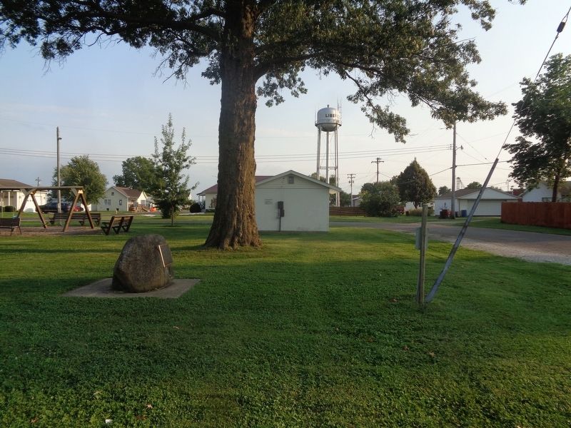
Trail of Death Marker
RANKED BY RELEVANCE, THEN GEOGRAPHICALLY
| 1 ► Illinois, Adams County, Liberty — Trail of Death — Regional Historic Trail — Indiana to Kansas — |
| On North Park Street at Hannibal Street, on the right when traveling north on North Park Street. | |||
| 2 ► Illinois, Adams County, Quincy — In Memory of the Potawatomi Indian "Trail of Death" — Indiana to Kansas, September 4 - November 4, 1838 — |
| On Maine Street west of 7th Street, on the right when traveling west. | |||
| 3 ► Illinois, Adams County, Quincy — Potawatomi Trail of Death — Mill Creek 1838 — |
| On Rock Quarry Road south of Illinois Route 104, on the left when traveling north. | |||
| 4 ► Illinois, Champaign County, Homer — Potawatomi Trail of Death — Davis' Point Encampment — September 20, 1838 — |
| On County Route 1250 N west of County Route N 300 E, on the right when traveling west. | |||
| 5 ► Illinois, Champaign County, Sadorus — Potawatomi Trail of Death — Sadorus's Grove Encampment — September 22, 1838 — |
| On North West Street at North Front Street, on the left when traveling north on North West Street. | |||
| 6 ► Illinois, Champaign County, Sidney — Potawatomi Trail of Death — Sidney Encampment — September 21, 1838 — |
| On Dunlap Woods north of East Main Street, on the right when traveling north. | |||
| 7 ► Illinois, Macon County, Decatur — Potawatomi Trail of Death — Sangamon Crossing — 24 - 26 September, 1838 — |
| On Dunbar Road at Caleb Road, on the left when traveling south on Dunbar Road. | |||
| 8 ► Illinois, Piatt County, Monticello — Potawatomi Trail of Death — |
| On West Railroad Street west of North Park Street, on the left when traveling west. | |||
| 9 ► Illinois, Piatt County, Monticello — Trail of Death — Pyatt's Point — Sept. 21, 1838 — |
| On West Center Street west of North Market Street, on the left when traveling west. | |||
| 10 ► Illinois, Pike County, Perry — Potawatomi Trail of Death — |
| On East Main Street at Federal Street on East Main Street. | |||
| 11 ► Illinois, Sangamon County, New Berlin — Potawatomi Trail of Death — McCoys Mill Encampment — Sept 4 - Nov 4, 1838 — |
| On Old Jacksonville Road (County Highway 8) at New Salem Church Road, on the left when traveling west on Old Jacksonville Road. | |||
| 12 ► Illinois, Sangamon County, New Berlin — Potawatomi Trail of Death — Island Grove Encampment — Sept 4-Nov 4, 1838 — |
| On Old Jacksonville Road (County Route 8) 0.1 miles east of Peters Road (County Route 8), on the right when traveling west. | |||
| 13 ► Illinois, Sangamon County, Springfield — Potawatomi Trail of Death — |
| Near East Adams Street west of South 6th Street. | |||
| 14 ► Illinois, Sangamon County, Springfield — Potawatomi Trail of Death — |
| On County Route 1a east of Dave Stockton Drive, on the right when traveling west. | |||
| 15 ► Illinois, Scott County, Exeter — Potawatomi Indians Trail of Death — Exeter Encampment — October 2, 1838 — |
| On Exeter Bluffs Lane at Water Street, on the right when traveling west on Exeter Bluffs Lane. | |||
| 16 ► Illinois, Vermilion County, Catlin — Potawatomi - A Trail of Death — Sandusky Point Encampment — |
| On North Paris Street, on the right when traveling south. | |||
| 17 ► Illinois, Vermilion County, Danville — Trail of Death 1838 — Ellsworth Park — |
| On West Ellsworth Street south of Oakwood Avenue, on the left when traveling south. | |||
| 18 ► Indiana, Carroll County, Delphi — Trail of Death — September 10, 1838 — "Winnemac's" Old Village — |
| On West Towpath Road west of North Meridian Road, on the left when traveling west. | |||
| 19 ► Indiana, Carroll County, Pittsburg — Trail of Death — Pleasant Run — |
| On County Road N 800 W at County Road W 550 N, on the right when traveling south on County Road N 800 W. | |||
| 20 ► Indiana, Fulton County, Rochester — Father Petit and the Potawatomi 'Trail of Death' — Indiana to Kansas, September 4 - November 4, 1838 — |
| On U.S. 31 south of County Road W 375 N, on the right when traveling south. | |||
| 21 ► Indiana, Fulton County, Rochester — Potawatomi "Trail of Death" — Indiana to Kansas, September 4 - November 4, 1838 — |
| On Main Street north of East 9th Street, on the right when traveling north. | |||
| 22 ► Indiana, Fulton County, Rochester — Trail of Death — Mud Creek — |
| On State Road 25 south of County Road E 400 S, on the right when traveling south. | |||
| 23 ► Indiana, Marshall County, Plymouth — Chief Menominee — |
| On Peach Road, on the right when traveling north. | |||
| 24 ► Indiana, Marshall County, Plymouth — 50.1949.1 — Trail of Death |
| On West 12th (State Road 17) at Hiawatha on West 12th. Reported missing. | |||
| 25 ► Indiana, Tippecanoe County, Battle Ground — Potawatomi ‘Trail of Death’ Route — |
| On Battleground Avenue. | |||
| 26 ► Indiana, Tippecanoe County, Lafayette — Trail of Death — September 13, 1838 — Lagrange on Wabash River — |
| On County Road S 950 W south of County Road W 75 S, on the right when traveling south. | |||
| 27 ► Indiana, Tippecanoe County, Lafayette — Trail of Death — September 12, 1838 — LaGrange - Logansport State Road — |
| On County Road W 500 N west of Road N 225 W, on the right when traveling west. | |||
| 28 ► Indiana, Warren County, State Line City — Trail of Death — Gopher Hill Cemetery — |
| On County Road S 900 W north of County Road W 950 S, on the right when traveling north. | |||
| 29 ► Indiana, Warren County, Williamsport — The Trail of Death — |
| On East Independence Road near North 800 East, on the right when traveling east. | |||
| 30 ► Indiana, Warren County, Williamsport — Trail of Death — Old Town Park - - Williamsport — |
| On Main Street at South 2nd Street, on the right when traveling east on Main Street. | |||
| 31 ► Kansas, Linn County, Centerville — [Potawatomi] Trail of Death — Indiana to Kansas — |
| 32 ► Kansas, Linn County, Centerville — [Potawatomi] Trail of Death — |
| 33 ► Kansas, Linn County, Centerville — Father Petit and the Potawatomi 'Trail of Death' — (Indiana to Kansas, September 4 - November 4, 1838) — |
| 34 ► Kansas, Linn County, Centerville — Father Petit and the Trail of Death — |
| 35 ► Kansas, Linn County, Centerville — Potawatomi "Trail of Death" march & death of Fr. Petit — |
| 36 ► Kansas, Miami County, Osawatomie — The Potawatomi Trail of Death — Indiana to Kansas — September 3, 1838 to November 4, 1838 — |
| On 6th Street at Lincoln Avenue, on the left when traveling north on 6th Street. | |||
| 37 ► Missouri, Carroll County, Carrollton — Trail of Death — |
| On North Mason Street south of U.S. 65, on the right when traveling north. | |||
| 38 ► Missouri, Carroll County, De Witt — Trail of Death — |
| On Jefferson Street east of 7th Street. | |||
| 39 ► Missouri, Chariton County, Brunswick — Trail of Death — |
| Near South Polk Street near East Mulberry Street, on the right. | |||
| 40 ► Missouri, Jackson County, Independence — Trail of Death — |
| On North Dodgion Street at East Truman Road, on the right when traveling south on North Dodgion Street. | |||
| 41 ► Missouri, Jackson County, Independence — Trail of Death — |
| Near East Park Highway (State Highway 78) at South Fisher Road. | |||
| 42 ► Missouri, Lafayette County, Lexington — Trail of Death — Historical Marker — |
| On Broadway (Missouri Route 224) at Highland Avenue, on the right when traveling west on Broadway. | |||
| 43 ► Missouri, Lafayette County, Napoleon — Potawatomi Trail of Death March — 1838 — |
| On East 2nd Street west of State Highway 224, on the left when traveling east. | |||
| 44 ► Missouri, Lafayette County, Wellington — Potawatomi "Trail of Death" March — Sept. - Nov. 1838 — |
| On West 5th Street (State Highway 224) at Walnut Street (State Highway 131) on West 5th Street. | |||
| 45 ► Missouri, Marion County, Monroe City — Trail of Death — |
| On County Route 240 east of County Route 238, on the right when traveling west. | |||
| 46 ► Missouri, Marion County, Palmyra — Trail of Death — |
| On County Route 320 at County Route 361, on the left when traveling west on County Route 320. | |||
| 47 ► Missouri, Marion County, West Quincy — Trail of Death — |
| On U.S. 24 west of County Highway 357, on the right when traveling west. | |||
| 48 ► Missouri, Monroe County, Shelbina — Trail of Death — |
| On Route FF (County Route FF) at Farm to Market Road 327, on the left when traveling west on Route FF. | |||
| 49 ► Missouri, Randolph County, Huntsville — 55 — Trail of Death — |
| On North Main Street at East Library Street, on the right when traveling north on North Main Street. | |||
| 50 ► Missouri, Ray County, Richmond — Potawatomi "Trail of Death" March — September - November 1838 — |
| On East South Street west of South Spartan Drive (State Highway 13), on the right when traveling east. | |||
| 51 ► Oklahoma, Pushmataha County, Tuskahoma — Chahta Nishkinokchi Micha Aiilli Hinushi / The Choctaw Trail of Tears and Death — |
| Near North 4355 Road, 1.2 miles north of U.S. 271. | |||
| 52 ► South Dakota, Meade County, Vale — 32 — "Death of the Bismarck Trail" — |
| On 130th Avenue (South Dakota Route 79) 0.2 miles north of 199th Street, on the right when traveling north. | |||
| 53 ► Tennessee, Davidson County, Nashville, North Capitol — Cherokee deaths on Trail of Tears — |
| On 7th Avenue North, on the left when traveling south. | |||
| 54 ► Wyoming, Sweetwater County, Farson — Death on the Trail — |
| Near State Highway 28, 11.5 miles west of U.S. 191, on the left when traveling west. | |||
| 55 ► California, Inyo County, Trona — Ballarat — 3 1/2 Miles — |
| On Trona Wildrose Road at Ballarat Road, on the right when traveling north on Trona Wildrose Road. | |||
| 56 ► California, Inyo County, Trona — Fish Canyon — |
| On Slate Range Road, on the left when traveling north. | |||
| 57 ► Missouri, Marion County, Palmyra — Potawatomi Emigration — Trail of Death — |
| On East Main Cross, 0.1 miles west of US 61 and US 24 (U.S. 61/24), on the right when traveling west. | |||
| 58 ► Indiana, Cass County, Logansport — Potawatomi Encampment — Trail of Death — |
| On Michigan Avenue (a.k.a. - St Rd 25) at Fulton Street, on the right when traveling south on Michigan Avenue (a.k.a. - St Rd 25). | |||
| 59 ► Indiana, Fulton County, Rochester — Site of Indian Village Chippewa-Nung — Potawatomi - Trail of Death — |
| On North Old US Highway 31 north of County Road E 350 N, on the right when traveling north. | |||
| 60 ► Indiana, Marshall County, Plymouth — Menominee Chapel — Potawatomi - Trail of Death |
| On 12th Road west of South Pear Road (a.k.a. - South Peach Road), on the left when traveling west. Reported missing. | |||
| 61 ► Illinois, Adams County, Quincy — Indian Removals - A Memorial — |
| On Quinsippi Island Road, on the right when traveling east. | |||
| 62 ► Wyoming, Natrona County, Alcova — A Tribute to Hardship — |
| On State Highway 220 near Martin Cove Road, on the right when traveling west. | |||
| 63 ► California, Inyo County, Death Valley National Park — Golden Canyon Trail — |
| On Badwater Road, 2 miles south of California Route 190, on the left when traveling south. | |||
| 64 ► Idaho, Caribou County, Soda Springs — William Henry Harrison — |
| On Soda Point Power Plant Road near Reservoir Road, on the right when traveling south. | |||
| 65 ► Illinois, Morgan County, Jacksonville — Potawatami Indians — |
| On South Central Park at Mauvaisterre Street on South Central Park. | |||
| 66 ► Oklahoma, Haskell County, Stigler — In Memory of the Early Choctaw Settlers — and to Our Ancestors Who Perished on the "Trail of Tears" — |
| On East Main Street (Oklahoma Route 9) east of SE 2nd Street, on the right when traveling east. | |||
| 67 ► Oregon, Umatilla County, Pendleton — Pendleton Oregon Trail Kiosk — |
| On Southwest Frazer Avenue near Southwest 1st Street, on the left when traveling west. | |||
| 68 ► Alabama, Lauderdale County, Waterloo — Trail of Tears — |
| On Main Street. | |||
| 69 ► Arkansas, Sebastian County, Fort Smith — Cherokee Nation — |
| Near Parker Avenue at South 3rd Street. | |||
| 70 ► California, San Joaquin County, Woodbridge — William Lewis Manly — 1803-1903 — |
| On North Lower Sacramento Road. | |||
| 71 ► California, Inyo County, Death Valley National Park — 826 — Old Stovepipe Wells — |
| On Stovepipe Wells Road, 0.8 miles west of Scotty's Castle Road, on the right when traveling west. | |||
| 72 ► California, Inyo County, Death Valley National Park, Stovepipe Wells — Road To Adventure — |
| Near California Route 190 east of Cottonwood Canyon Road, on the right when traveling east. | |||
| 73 ► California, Kern County, Cantil — 476 — Desert Spring — |
| Near Pappas Road. | |||
| 74 ► California, Kern County, Inyokern — 766 — Freeman Junction |
| On Isabella Walker Pass Road (State Highway 178 at milepost 88), on the right when traveling west. Reported missing. | |||
| 75 ► California, Kern County, Rosamond — 130 — Willow Springs — California Historical Landmark — |
| On Manly Road, 0.4 miles north of Truman Road, on the right when traveling north. | |||
| 76 ► Connecticut, New Haven County, New Haven, West Rock — Judges Cave — |
| Near Wintergreen Avenue, 0.2 miles north of Brookside Avenue, on the left when traveling north. | |||
| 77 ► Georgia, Peach County, Fort Valley — 49 D-6 — James A. Everett — Founder of Fort Valley — |
| On West Church Street, 0 miles west of Anderson Avenue, on the left when traveling east. | |||
| 78 ► Pennsylvania, Butler County, Evans City — George Washington — |
| On Evans City Road (Pennsylvania Route 68) at Ash Stop Road, on the right when traveling east on Evans City Road. | |||
| 79 ► Texas, Williamson County, Cedar Park — 9041 — Cedar Park Cemetery — |
| On West Park Street. | |||
| 80 ► Utah, Wayne County, Lyman — 393 — Fremont Park — |
| On West Center Street east of South 300 West Street, on the right when traveling east. | |||
| 81 ► West Virginia, Jefferson County, Charles Town — John Brown Hanging Site — Creation of a Martyr — Prelude to War — |
| On South Samuel Street at East Hunter Street on South Samuel Street. | |||
| 82 ► West Virginia, Kanawha County, Charleston — Mary Price Ratrie Greenspace / Illustrated History of the Midland Trail — |
| On Washington Street East (U.S. 60) just west of Sentz Street, on the right when traveling west. | |||
| 83 ► Florida, St. Lucie County, Fort Pierce — 3 — Zora Neale Hurston House — Zora Neale Hurston Dust Tracks Heritage Trail — |
| On Avenue L east of North 19th Street, on the right when traveling east. | |||
| 84 ► Indiana, Fulton County, Rochester — Ga bgojwébnegéjuk Mural — |
| On Main Street south of West 8th Street, on the right when traveling south. | |||
| 85 ► New York, Nassau County, Oyster Bay — Sagamore Hill National Historic Site — National Park Service — |
| Near Sagamore Hill Road, on the right when traveling north. | |||
| 86 ► Tennessee, Williamson County, Franklin — Welcome to Winstead Hill Park — Park History — |
| On Columbia Avenue (U.S. 31) 0.2 miles south of Mack C Hatcher Memorial Parkway (Tennessee Route 397), on the right when traveling south. | |||
| 87 ► Utah, Garfield County, Escalante — 501 — Old Boulder Mail Trail — |
| On Utah Route 12, on the left when traveling east. | |||
| 88 ► Missouri, St. Charles County, St. Peters — Centennial Greenway - Heritage Crossing — |
| On Heritage Landing south of South St. Peters Parkway, on the right when traveling north. | |||
| 89 ► Oregon, Josephine County, Grants Pass — The 1846 Applegate Trail — Southern Route to Oregon — |
| Near Interstate 5 at milepost 62 near Merlin Road, on the right when traveling north. | |||
| 90 ► California, Kern County, Mojave — 652 — Mojave 20-Mule Team Borax Terminus — |
| On California Route 14 north of Nadeau Street, on the right when traveling north. | |||
| 91 ► California, Riverside County, La Quinta — The Bradshaw Trail / Point Happy — |
| On Washington Street at Point Happy Way, on the right when traveling south on Washington Street. | |||
| 92 ► Delaware, Kent County, Smyrna — KC-84 — Site of Green Pottery — |
| Near N. Main Street close to Mt. Vernon Street. | |||
| 93 ► Georgia, Gordon County, Calhoun — 064-33 — Trail of Tears — |
| Near Chatsworth Highway/Joseph Vann Highway (Georgia Route 225). | |||
| 94 ► Kansas, Gray County, Cimarron — The Santa Fe Trail — |
| Near South Main Street (State Highway 23) 0.1 miles south of West Avenue E, on the right when traveling south. | |||
| 95 ► Michigan, Barry County, Hastings — L215 — Indian Landing - Charlton Park — |
| Near South Charlton Park Road. | |||
| 96 ► Michigan, Berrien County, New Buffalo — Avoiding Removal - The Pokagon Band of Potawatomi — |
| On Oselka Road at North Whittaker Street, on the right when traveling east on Oselka Road. | |||
| 97 ► Michigan, Wayne County, Dearborn — HB17 — Fair Lane — |
| On Fair Lane Drive, on the right when traveling south. | |||
| 98 ► Mississippi, Claiborne County, Port Gibson — Sunken Trace — |
| On Natchez Trace Parkway (at milepost 41.5), 0.4 miles north of Mississippi Route 18, on the left when traveling north. | |||
| 99 ► Missouri, Jackson County, Kansas City, South Kansas City — Kit Carson — Frontiersman — |
| On East Red Bridge Road, on the right when traveling west. | |||
| 100 ► Missouri, St. Louis County, Maryland Heights — Dripping Springs — |
| Near Marine Avenue, 0.1 miles north of Maryland Heights Expressway (State Highway 141), on the right when traveling south. | |||
571 entries matched your criteria. The first 100 are listed above. Next 100 ⊳
* Inflectional forms of words are their plurals, singulars, and possessives as well as gramatical tenses and similar variations.
* A noise word is a word that Microsoft has deemed too common to index. “The,” “to,” and ‘’then” are examples of noise words. You will find a full list on the Other Ways to Search page, in the Rules and Options link of the Keyword Search.
* A noise word is a word that Microsoft has deemed too common to index. “The,” “to,” and ‘’then” are examples of noise words. You will find a full list on the Other Ways to Search page, in the Rules and Options link of the Keyword Search.