On Bay Street South at Main Street West, on the right when traveling north on Bay Street South.
1887 1987 2087
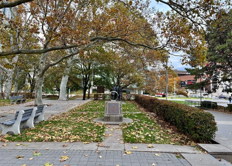
Engineering Centennial Commemorative Plaque and Time Capsule
This monument has been erected by the Hamilton Section of
the Canadian Society for Civil Engineering on behalf of all individuals and organizations . . . — — Map (db m235468) HM
On Silver Street just north of Bunker Lane, on the right when traveling north.
A time capsule was placed in this spot on August 06, 2006 to commemorate 100 years of incorporation for the Township of Coleman and the Town of Cobalt. To be opened August 6, 2056. — — Map (db m245396) HM
On Epigmenio González just west of Prolongación Ezequiel Montes, on the right when traveling west.
Cápsula del tiempo 2010-2060
"Confiamos en tí nuestra visión de México, para seguir construyendo este
país, juntos.”
Aquí yace la Cápsula del Tiempo 2010. Este receptáculo cuenta con un acervo de documentos de reflexión y . . . — — Map (db m188651) HM
On Monroe Street Northwest at Washington Street Northwest, on the left when traveling east on Monroe Street Northwest.
Interred on November 17, 2012 to commemorate Madison County's military history and to preserve items reminiscent of our Veterans' proud service to this great nation.
To be opened November 11, 2062 — — Map (db m85613) WM
Near North Alameda Street at Los Angeles Street, on the right when traveling south.
On May 5, 1979, the President of the United States, Jimmy Carter, participated in the dedication of this Placita de Dolores. The following is a memorable excerpt from his remarks:
“... Freedom is never permanently ours, despite the . . . — — Map (db m162117) HM
On Vine Street at Sunset Boulevard, on the right when traveling north on Vine Street.
On February 13, 2004, the Entertainment Industry's Time Capsule, buried on this world-famous corner since 1954, was opened to commemorate another 50 years of Hollywood
history. It was on this block that Cecil B. DeMille directed Hollywood's . . . — — Map (db m231871) HM
Memorial Stone commemorating the 100th Anniversary of the laying of the cornerstone of the Colorado State Capitol. The time capsule beneath this stone contains messages and memorabilia from the people of Colorado in 1990 to its people in 2090. . . . — — Map (db m46059) HM
On Rye Street at Old Ellington Drive, on the left when traveling south on Rye Street.
Spirit of Unity
Time Capsule
To be Opened June 10, 2092
Dedicated June 10, 1992
To the People
of
East Windsor, South Windsor and Ellington
Who united in purpose on June 10, 1991 to oppose
the siting of a radioactive dump in order to . . . — — Map (db m113960) HM
Buried 8-18-1984 by
Union Historical Society
Uncover 8-19-2034
This was the stepping stone
to The Center School C. 1844
Plaque gift of Gertrude and Maurice Chappell — — Map (db m123874) HM
On South Church Avenue (State Road 37) at SE 1st Street, on the right when traveling north on South Church Avenue.
This marker commemorates the dedication of the Mulberry Time Capsule. The capsule was placed here on June 12, 1977 by the Greater Mulberry Chamber of Commerce. The capsule will be opened in the year 2076 to view the mementoes of the 1976 . . . — — Map (db m4984) HM
Near George W. Engram Boulevard, 0.1 miles east of Walker Avenue.
(Top)
Time Capsule
In honor of
Dr. Martin Luther King, Jr.
1929 - 1968
Planted this January 19, 1987
To be opened on January 19, 2087
The City of Daytona Beach
Lawrence J. Kelly, Mayor
Commissioners . . . — — Map (db m214839) HM
Near Luckie Street east of South Perry Street (Georgia Route 20), on the right when traveling east.
[Time capsule]
In honor of the
Gwinnett Bicentennial
December 15, 2018
To be opened December 15, 2118
[Sign, left panel]
Gwinnett County: A vibrantly connected community
Gwinnett County anchors the . . . — — Map (db m197716) HM
Near West Jefferson Street (U.S. 30) east of U.S. 6, on the right when traveling east.
Behind this plaque is a 16 x 12 x 13 inch copper box which was filled by the Will County Committee of the Illinois Sesquicentennial Celebration (1968). This is to be opened in one hundred years.
Beside the plaque is the cornerstone of Will . . . — — Map (db m158522) HM
On East Main Street near South Barr Street, on the right when traveling west.
A capsule was buried on this site on May 11, 2002 when citizens of Takaoka and Fort Wayne met to re-affirm an alliance established in 1977. The capsule, containing articles related to the 25th anniversary, will be opened on the occasion of the . . . — — Map (db m239279) HM
On South Main Street (U.S. 50) at East Cross Street, on the right when traveling north on South Main Street.
In Memory of Col. John Ketcham
1782 - 1865
Fearless pioneer, Ranger, surveyor, public servant who dedicated this public square for seat of government of Jackson County, Ind. when Brownstown was founded April 8, 1816.
Time Capsule . . . — — Map (db m46756) HM
On North 3rd Street just north of East Graham Street, on the right when traveling north.
Located 5 feet north To be opened July 4, 2076 Dedicated November 15, 1976 Newton County Bicentennial Committee County Board of Commissioners “Pun’kin Vine” Fair Board — — Map (db m237798) HM
On East Gale Street at South Martha Street, on the right when traveling west on East Gale Street.
Each date in history has a significant
memory that takes us back to a special
time in history. None more than the start
of the new millennium - the Year 2000 - in Steuben County.
Representatives from many walks of life
came together to . . . — — Map (db m196522) HM
A collection of materials and important papers representative of the period were buried in a time capsule in front of this marker during the 1972 Osceola County Centennial Celebration.
Those involved in this, did so with the hope that it . . . — — Map (db m119050) HM
On Main Street at 1st Street, on the left when traveling south on Main Street.
Be it hereby known that on June 23, 1977 a time capsule was herein placed to commemorate 100 years of progress for Odebolt, Iowa. It is our wish that this time capsule be reopened in the year of 2077. Odebolt, Iowa The star in the crown of Iowa . . . — — Map (db m162249) HM
In commemoration of Hays Centennial - 1967
Plastic capsule buried May, 1967 - to be exhumed 2067
Buried 10' 0" below this marker.
The Time Capsule is to provide historical reference on the progress of Kansas family farmers working with the . . . — — Map (db m59719) HM
On Kansas Avenue north of Park Avenue, on the right when traveling north.
Beneath this stone is buried a capsule containing papers and items used in celebrating the American Revolution Bicentennial in Johnson County, Kansas. Placed on this Thanksgiving Eve November 24, 1976 A.D. by the Johnson County Bicentennial . . . — — Map (db m69376) HM
Near Front Street at Commercial Street, on the left when traveling west.
In honor of the courageous men and women of Worcester who served our country in the spirit of securing freedom, democracy, and peace for our nation and the world. May the memory of their bravery endure through the annal of time.
Presented by . . . — — Map (db m151789) WM
On State Road near West Huron Street, on the right when traveling east.
Port Hope became incorporated as a
village in 1887. During the centennial
celebration in 1987, it was decided to
create a time capsule to preserve
memorabilia. On July 2, 1989 a
container filled with a variety of items
was buried at this . . . — — Map (db m225984) HM
On Black River Street at Dyckman Avenue, on the right when traveling south on Black River Street.
South Haven became a village by Michigan Legislature in 1869. At that time, South Haven contained establishments such as a post office, schoolhouse, and hotel. Judge Jay R. Monroe is credited as the first white settler of the South Haven area, . . . — — Map (db m204686) HM
On Bush Avenue west of Forest Street North, on the right when traveling west.
Setting the Cornerstone, Building 21
President William L. McKnight, accompanied by chief engineer E. M. Johnson, supervised the installation of the cornerstone in October 1939.
The mason worked for the William Murphy and Son Construction . . . — — Map (db m151373) HM
On Court Square (Washington Avenue) at West Main Street, on the left when traveling south on Court Square (Washington Avenue).
Beneath this marker is a Time Capsule buried December 17, 1976, at 2:00 P.M. by the West Plains Bicentennial 1976 Steering Committee to be disinterred July 4th, 2076 by the Howell County Court Time capsule donated by . . . — — Map (db m186135) HM
On College Avenue at Idaho Street, on the right when traveling east on College Avenue.
Right in the Heart of the Golden West, Home means Nevada to Me. Nevada State Song
About the Sculpture The Sculpture symbolizes the past, present, and the future of Nevada. The passage of time, growth, and history of the state are . . . — — Map (db m146799) HM
On Main Street (New Jersey Route 670) near Veterans Drive.
The contents of this
Time Capsule
are presented
to the residents of Sayreville, New Jersey
in 2076 from the
residents of Sayreville, New Jersey
in 1976
Mayor John E Czernikowsky
Councilmen
Kenneth W. Buchanan, Sr. • Alvin W. . . . — — Map (db m5181) HM
On Sanger Avenue, on the left when traveling north. Reported missing.
Beneath this plaque lies a time capsule installed 16 September 1960 to commemorate the first centennial of the United States Army Signal Corps. The time capsule is to be opened in the year 2060 on 21 June, the birthday of the corps.
This time . . . — — Map (db m32158) HM
On Main Street, 0 miles east of High Street (New York State Route 94), on the right when traveling east.
In Honor of
The Men and Women
of the Town of Chester
Who Served Their Country
1917 - In The World War - 1919
[Column 1:]
Charles Babcock, Jr.; John E. Bailey; George W. Bartow; William D. Bartow; Anthony S. Becker; . . . — — Map (db m22545) HM
On Avenue of the States at Perimeter Road, on the left when traveling north on Avenue of the States.
The time capsules deposited September 23, 1938 and October 16, 1965 by the Westinghouse Electric Corporation as a record of Twentieth Century civilization to endure for 5000 years — — Map (db m108628) HM
Near White Plains Road (New York State Route 22) at Crane Road, on the left when traveling north.
Bicentennial Time Capsule
On 7 March, 1788, under enactment of the Senate and Assembly of the State of New York, that portion of the County of Westchester called the Manor of Scarsdale was erected into a town, by the name of Scarsdale.
As part . . . — — Map (db m42523) HM
On Princess Street just east of North 3rd Street, on the left when traveling east.
The Evening Star, forerunner of the StarNews newspaper, published its first edition on Sept. 23, 1867. In recognition of our 150th anniversary, a time capsule was placed here Oct. 18, 2017, with keepsakes, including a special newspaper section and . . . — — Map (db m224893) HM
Beneath this plaque is
the dedicatory time capsule
in celebration of
West Park's 100th Anniversary.
Buried September 17, 2008
To be opened September 17, 2108 — — Map (db m175001) HM
On 2nd Avenue at Beaty Street, on the right when traveling east on 2nd Avenue.
December 9, 2003. A time capsule filled with historical documents and artifacts from the era are placed here. To be opened December 9, 2103. — — Map (db m866) HM
On U.S. 522 at Bath Street, on the right when traveling south on U.S. 522.
This official West Virginia Centennial Time Capsule was dedicated October 12, 1963 as Morgan County's contribution to the State's Centennial celebration. It contains historical documents, personal messages to be distributed in 2063. — — Map (db m13026) HM
Near 3rd Avenue North near Richard Arrington Jr, Blvd North.
To Be Opened March 1, 2022
Dedicated at the construction completion March 1, 2002
Project Team
Owners - BLH Group, LLC
Brookmont Investors II, LLC
Spire Holdings, LLC
Developer - Brookmont Realty Group, LLC
General . . . — — Map (db m27010) HM
Near Figueroa Street south of Exposition Boulevard, on the right when traveling south.
Bud Greenspan's
"16 Days of Glory,"
the official film
of the games of the XXIIIrd Olympiad.
Buried on June 18, 1987
by Mayor Tom Bradley and the Disney Channel.
Time capsule to be opened on July 28, 2034.
second marker: . . . — — Map (db m239675) HM
Near Ocean Front Walk south of 18th Avenue, on the right when traveling south.
Committed December 13, 2009.
To be opened 2059.
Sponsored by: Iron Man Magazine .com
in conjunction with
Councilmember Bill Rosendahl, 11th District;
City of Los Angeles Recreation and Parks. Created and developed by
Joseph and Christine . . . — — Map (db m231062) HM
Near Pennsylvania Avenue Northwest west of 7th Street Northwest, on the right when traveling west.
The rank of chief petty officer - the senior position among naval enlisted ranks - was established by the Navy Department in 1893. A time capsule was placed within this foundation on 13 October 1993 to be opened in the chiefs’ bicentennial year . . . — — Map (db m109755) HM
On West Washington Street just west of South Iowa Avenue, on the right when traveling west.
In grateful appreciation for the heritage of our forefathers, this monument and its contents are dedicated to those generations yet to come. Time capsule to be opened July 4, 2076 — — Map (db m238399) HM
Near Georgia Avenue, on the right when traveling north.
This geodetic mark was established to commemorate 200 years of science, service, stewardship to the nation by NOAA and its predecessor agencies and to mark the location of NOAA's 200th Celebration Time Capsule. The materials reflect the essence of . . . — — Map (db m66195) HM
On Old Boonton Road at Lathrop Avenue, on the right when traveling south on Old Boonton Road.
The
Mayors Park
Dedicated On May 29, 1967
During Boonton’s Centennial Celebration
In Honor Of The Mayors
Who Have Served The Citizens
Of The
Town Of Boonton Since 1867
Time Capsule
Buried Beneath This Puddingstone Is The
Time . . . — — Map (db m88873) HM
On Peck Road (Michigan Route 90) 0.3 miles east of Brown Road, on the right when traveling west.
This handsome building was the first church erected in Buel Township. Known as the Buel United Methodist Church, it was dedicated on December 3, 1882. The founding trustees were Robert Jolley, David Chewings, Halver Hulverson, Nicholas Van Natter, . . . — — Map (db m154386) HM
On Dominion Road at Church Street, on the right when traveling west on Dominion Road.
(Front Side): History of the Railroad in Vienna * 1859 to 1968 * 1859 — Alexandria, Loudoun & Hampshire Railroad begins passenger, mail and freight service to Vienna. * 1861 — First use of a railroad in war occurs in Vienna . . . — — Map (db m151768) HM
Sequoia Union High School was founded in Redwood City in 1895, having two downtown locations before moving to the present site in 1924. With the exception of the Class of 1917, the tradition of installing graduation year plaques began with the first . . . — — Map (db m55258) HM
To summon the people of Bellwood to worship God and to strive for education
1908
St. John Lutheran Church and School
Placed here in honor of the nation's bicentennial
1976 — — Map (db m245033) HM
Settlement of this area began in the 1840s. A small community named Duck Creek was established and by 1846 a log cabin was serving as a community center, school, and Union Church. Early businesses included a general store, grist mill, and cotton . . . — — Map (db m243584) HM
Near College Hill Road south of Circle Drive West, on the left when traveling south.
Warner's idea came from Sir Issac Newton's, "I Stand on the Shoulders of Giants." He named the statue "Apollo" in appreciation for the space program.
Alderson-Broaddus chose it for the Centennial symbol-1971-because the college's aspirations . . . — — Map (db m211831) HM
On Bloor Avenue at Main Street, on the right when traveling west on Bloor Avenue.
Official opening: January 16, 1939 Reeve: Victor H. Evans Council: George Helmer, Melvin Cavanagh, Emil Heino, William Fairhurst Last council at amalgamation: December 31, 1972 Reeve: Ernie R. White Council: Dennis Pope, Maurice Londry, Luigi . . . — — Map (db m244988) HM
On McIntyre Road just north of Schumacher Drive (Provincial Highway 101), on the left when traveling north.
Erected by the Timmins-Porcupine Chamber of Commerce in June, 1966 to commemorate development of this important zinc, copper, lead, silver discovery (time capsule in base) ————— Celebrating 50 Years of World Class Mining and Metallurgy (2016) Kidd . . . — — Map (db m244446) HM
On Douglas Street, on the right when traveling east.
This memorial is dedicated to all veterans and civilians who served and supported our nation in times of military conflict. The perpetuation of our constitutional freedoms is owed to these patriotic men, women and children. World War I 1917-1918 • . . . — — Map (db m229849) WM
On Frederick Avenue (Maryland Route 144) at Font Hill Avenue, on the right when traveling west on Frederick Avenue.
The burial place of Methodist pioneers including Bishops Francis Asbury, Enoch George, John Emory and Beverly Waugh, also Robert Strawbridge, first preacher in Maryland and Jesse Lee, founder in New England. Site of 1966 Methodist Bicentennial time . . . — — Map (db m33697) HM
On South Main Street, on the right when traveling north.
Chelsea celebrated the 200th birthday of the United States of America. On this site July 4th, 1976, a time capsule was buried below this marker, not to be opened until July 4, 2026. — — Map (db m228205) HM
On South Main Street, on the right when traveling north.
The Village of Chelsea celebrated its 150th birthday. On this site July 4th, 1984, a time capsule was buried below this marker, not to be opened until July 4th, 2034. — — Map (db m228204) HM
On Pine Street just north of 1st Street, on the left when traveling north.
This marker is dedicated to the group of Irish families from Lindsay, Ontario Canada, who settled here in the 1870’s. The petition to incorporate as a village was granted by the Board of Supervisors of Platte County on March 7, 1888. The Centennial . . . — — Map (db m181359) HM
On Northeast 21st Street west of North Lincoln Boulevard, on the right when traveling west.
Below this bench lies a time capsule presented to the State of Oklahoma by the Reynolds Metals Company containing historic records and memorabilia of the bicentennial era of the United States of America to be opened July 4, 2075 so its contents may . . . — — Map (db m165713) HM
Near East Elk Avenue east of South Sycamore Street, on the right when traveling east.
On this location the citizens of Elizabethton, Tennessee have dedicated a Time Capsule as the finale of their year long celebration of Elizabethton’s 200 Years. The capsule buried here is to be opened in the year 2099 AD. With this . . . — — Map (db m192864) HM
On North Velasco Street, on the right when traveling north.
This stone is an original column from the 1895 Brazoria County Courthouse located in Brazoria, Texas. Column donated by Mr. A. T. "Tom" Covert in memory of his beloved wife Georgia City of Angleton Centennial Time Capsule 1892 - 1992 Placed May . . . — — Map (db m173354) HM
Erected 1968, commemorating the 100th Anniversary of discovery of helium in the gaseous atmosphere surrounding the sun. (The discovery of traces of helium on earth was first announced in 1895.)
The four time columns are filled with books, . . . — — Map (db m91715) HM
In memory of the gallant men who gave their lives on December 7, 1941 on the Battleship U.S.S.
Arizona during the attack on Pearl Harbor
Dedicated December 7, 1976
The Honorable Raul H. Castro, Governor of Arizona
The contributions . . . — — Map (db m26425) HM
Near Grandview Avenue near West Beale Street (Business Interstate 40).
Dedicated in Memory of
Charles Metcalfe
1855-1943
He deeded in perpetuity this land as a park for the use of Kingman youth. Recognized as a civic leader and land developer, He proposed development of Hualapai Mountain Park. He held . . . — — Map (db m29362) HM
Near W. Main Street, 0.1 miles west of Front Street, on the right when traveling west.
(South Face of Memorial)
You a veteran of this
Old town or pilgrim
From far away looking
For some tranquility...
Here you may become
Silent in honor of those
Who have served...
No one is a stranger at
This revered place . . . — — Map (db m68541) WM
Near Anchor Road east of Highway 288, on the left when traveling east.
The First Baptist Church of Angleton was established in 1896 with Joseph Matthew Kailin as pastor. A hurricane in 1900 destroyed the sanctuary. Members met in borrowed facilities until 1911 when a new church building was erected. The congregation . . . — — Map (db m173320) HM
On West King Street east of Winchester Avenue (Business U.S. 11), on the left when traveling west.
“Big Apple Time Capsule”
Dedicated: Oct 19, 1990 – Re-open in year of 2040
Sponsor: Martinsburg Jaycees
This “community pride project” is an attempt to preserve the Apple Capital city and surrounding areas of . . . — — Map (db m1212) HM
On Foothill Boulevard (U.S. 238) at City Center Drive, on the right when traveling north on Foothill Boulevard.
Lt. Colonel Juan Bautista de Anza by decree of Carlos III of Spain led an expedition to this site – The mission being to colonize the San Francisco Bay Area
In the center of the marker is a circular motif, designed by Doris Birkland . . . — — Map (db m28815) HM
On Lincoln Circle Northeast north of Tapscott Street Northeast, on the right when traveling south.
Panel 1
“Ole Jim” Fondly known by Gallaudet alumni as “Ole Jim,” this building was the first Gallaudet College gymnasium. Designed by Frederick Withers and built in 1881, it was the nation’s second gymnasium . . . — — Map (db m40440) HM
Near Huron-Seneca County Line Road (Ohio Route 269) south of County Road 46, on the right when traveling south.
This monument is erected in thanksgiving to the mother of God. It is dedicated to all that generously gave donations for the restoration and renovation of the Shrine Chapel, the heart and oldest section of the Sorrowful Mother Shrine, through: A . . . — — Map (db m221378) HM
On Canal Walk at Washington Place, on the right when traveling south on Canal Walk. Reported damaged.
The World War I monument stood at a spot 127 feet north of this plaque until 1987, when it was dismantled to make way for the relocated river. In 1995 it was reerected in Memorial Park to the south of here.
Consideration was given in the . . . — — Map (db m151711) HM
On Fresno Street near L Street, on the right when traveling east.
La Ville d'Etamps
a l'Amerique
This monument from General Patton's Route of Liberation is a gift of the people [of] Cannes, France to the people of California, sent via La Train de la Reconnaisance Francaise (Merci Train) and dedicated . . . — — Map (db m131236) HM
On Proton Avenue (Provincial Highway 37) just south of Main Street (Provincial Highway 37), on the left when traveling south.
Arriving in Gull Lake in 1917-18, Wong Guy came to a town in turmoil. The Spanish Flu was raging, and despite being a brand new resident to the town, he took it upon himself to cook for the patients at the old brick school, which doubled as an . . . — — Map (db m201268) HM
Near Cape Florida Park Boulevard when traveling south.
Archaeologists began work on Key Biscayne in 1985 and have uncovered hundreds of artifacts providing clues of human habitation beginning with the Tequesta Indians and continuing through the mid-nineteenth century. Ten archaeological sites are . . . — — Map (db m134806) HM
On East Main Street at Mascoutah Avenue, on the right when traveling east on East Main Street.
The park is on the site of Hanover House, built in 1862, and later named Hotel Tiemann. The three-story hotel was demolished in 1998. Ever and Anon Park was developed by the Belleville Heritage Society.
Old Belleville Historic District, one . . . — — Map (db m143389) HM
On South Main Street (U.S. 27), on the right when traveling south.
North United States 200th anniversary time capsule buried in 1976 contains histories of families, places and businesses of Harrison County to be opened in 50 years on July 4, 2026.
South Harrison County's 175th anniversary history capsule . . . — — Map (db m218104) HM
On East Pine Street (State Highway 22) near Southeast Railroad Avenue, on the left when traveling west.
This memorial is dedicated to all the officers and men who served aboard the USS Ponchatoula (AO-148) from its commissioning in January 1956 until its retirement from naval service in August 1992. The Ponchatoula was a Neosha Class Fleet Oiler . . . — — Map (db m115387) HM WM
On Cass Street south of State Street, on the right when traveling south. Reported missing.
On July 28, 1869, eight Traverse City women organized the Ladies Library Association. In 1878 the association purchased its first building, at 205 East Front Street. In 1909 the association sold that building and retained Fred E. Moore as architect . . . — — Map (db m98228) HM
Near Jeff Davis Boulevard north of South Temple Road, on the right when traveling north.
The Abandoned Mound (designated “Mound A”) remains a mystery. Numerous French colonial narratives describe the other two mounds at the Grand Village but fail to mention this mound. The Natchez Indians apparently stopped using this mound . . . — — Map (db m114672) HM
On Barrett Road, 0.8 miles east of Route 94 (New Jersey Route 94), on the left when traveling east.
This property is listed on the New Jersey and National Registers of Historic Places.
High Breeze was the last farm on Wawayanda Mountain. The main house dates back to 1828. From 1860 to 1986, the 160 acre farm was home to four generations of the . . . — — Map (db m81865) HM
On 10th Mountain Division Drive north of South Riva Ridge Loop, on the left when traveling north.
The Citizens of Jefferson, Lewis and St. Lawrence Counties extend heartfelt welcome to the United States Army and to the men and women of Fort Drum. This standard, which flies our nation's flag, and the time capsule beneath this marker are . . . — — Map (db m110392) WM
On West Main Street (Pennsylvania Route 274) west of South Carlisle Street (Pennsylvania Route 34/274), on the left when traveling west.
In 1898, a generation after the Civil War (1861-1865), Perry County citizens dedicated in New Bloomfield a monument to those soldiers and sailors who participated in that conflict to secure the Union and advance the freedom of all Americans. . . . — — Map (db m242029) HM
On Main Street at Court Avenue, on the left when traveling west on Main Street.
In the spring of 2018, Somerset Trust Company rededicated the former H.F. Schell House to become the G. Henry Cook Enrichment Center. As the fifth generation of the Scull family to lead the bank, Henry has always championed lifelong learning and . . . — — Map (db m199577) HM
The stone before you honor the 5,731 Tennesseans who made the ultimate sacrifice during the global war. The Gold Star Mothers of Tennessee received this symbol upon the death of their loved one.
Open time capsule below on 11 November 2045 — — Map (db m206482) WM
On Houston Street at Navarro Street, on the right when traveling west on Houston Street.
Records for this site date back to February 25, 1793, when the Spanish government granted the land to settler Matias del Rio. He planted six pecks of corn. The land was good, and his harvests are reported to have been excellent. In 1919, this . . . — — Map (db m225228) HM
On Fowler Avenue (U.S. 160) at Main Street, on the left when traveling east on Fowler Avenue.
[Barber County Veteran Tiles]
Twin Towers Beam
This steel beam is from the Twin Towers that were destroyed by foreign terrorists on 9-11-01. New York City has donated it to the Barber County Veterans Memorial in remembrance of the lives . . . — — Map (db m65211) WM
On Center Street at Union Street, on the left when traveling east on Center Street.
Dutcher Lodge No. 193
Masons from Douglas, Fennville, and Saugatauk chartered Dutcher Lodge No. 193 on January 19, 1867. From 1867 to 1870 they held meetings in a building owned by Worshipful Master Thomas Dutcher. In 1875, the western . . . — — Map (db m45393) HM
On Christopher Street near 7th Avenue South, on the left when traveling west.
This expressive bronze portrait of General Philip Henry Sheridan (1831-1888), created by Joseph Pollia (1893-1954), was unveiled in Christopher Park in 1936. The sculpture honors the distinguished Civil War cavalry commander for whom the surrounding . . . — — Map (db m98720) HM WM
On County Route 236 at Carey Road (Ohio Route 568), on the left when traveling north on County Route 236.
The 1960s in Findlay celebrated the old as it welcomed the new!
In 1962, a weeklong Sesquicentennial celebration in July included four parades, a historical pageant, a beard growing competition, fireworks, burying a time capsule, and . . . — — Map (db m245370) HM
In 1951, when Irvin G. Bieser, Sr. was president of the hospital Board of Trustees, this
cornerstone was placed during construction of the Main Building. A construction addition
in the 1970’s relocated the entry way and the cornerstone became . . . — — Map (db m85991) HM
On 28th Street at L Street, on the left when traveling south on 28th Street. Reported permanently removed.
Swiss Immigrant
Founder of New Helvetia
The beginning of Sacramento
Builder of Sutter’s Fort
A man of vision and compassion
who deserves the respect
and gratitude
of Americans and Swiss — — Map (db m167066) HM
On Parkedale Avenue just east of Stewart Boulevard (County Highway 29), on the left when traveling east.
This sculpture symbolizes the strength and confidence of our students entering the new millennium. With cooperation, creativity, and communication, accomplishments may only be bound by the limits of our own imagination. In this case the . . . — — Map (db m193795) HM
On 4th Avenue SE, on the left when traveling west.
Side A Red Bay is nestled in the northwest corner of the state in Franklin County. The oak trees, planted by the Garden Club in 1937, issue a Main Street welcome through the “tunnel of trees.” Originally inhabited by Chickasaw . . . — — Map (db m41133) HM
On Hollywood Boulevard at Highland Avenue, on the right when traveling west on Hollywood Boulevard.
At this location on August 15, 1958 the first eight stars on the Hollywood Walk of Fame were dedicated to Olive Borden, Ronald Colman, Louise Fazenda, Preston Foster, Burt Lancaster, Edward Sedgwick, Ernest Torrence and Joanne Woodward.
The Walk . . . — — Map (db m204738) HM
On Carlsbad Boulevard at Grand Avenue on Carlsbad Boulevard.
In 1881, Captain John A. Frazier, a homesteader, purchased 127 acres of oceanfront land for $1200. While drilling for drinking water in 1884, Frazier tapped into an underground mineral spring. He built a 510 foot well tower and began promoting the . . . — — Map (db m100673) HM
239 entries matched your criteria. The first 100 are listed above. Next 100 ⊳
* Inflectional forms of words are their plurals, singulars, and possessives as well as gramatical tenses and similar variations.