By Steve Gustafson, October 10, 2010
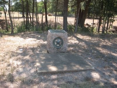
Pilgrim Predestinarian Regular Baptist Church Marker
GEOGRAPHIC SORT Title Sort Marker Number Sort Marker Number Sort N Marker Number Sort T Publication Order Sort Publication Order Sort A Erected Year Sort Most Viewed Sort Most Recent-Interest Sort Most Recently Changed Sort SEE FAQ #33 FOR DESCRIPTIONS
On State Highway 294 at Farm to Market Road 319, on the right when traveling east on State Highway 294.
On Farm to Market Road 19 at Road 320, on the right when traveling south on Road 19.
On North Mallard Street (State Highway 19) at East Poplar Street, on the right when traveling south on North Mallard Street.
On West Reagan Street at Knox Street, on the right when traveling east on West Reagan Street.
On Eunice Highway (State Highway 176) 0.3 miles east of County Road 7001, on the right when traveling west.
On U.S. 69, on the left when traveling south.
On Charlton St. east of Third Street, on the right when traveling east.
On Farm to Market Road 326, on the left when traveling west.
Near Henderson Street at Fulton Beach Road, on the left when traveling east.
On State Highway 35 at Farm to Market Road 1781, on the left when traveling north on State Highway 35.
On Bois D’Arc Street at Main Street, on the right when traveling north on Bois D’Arc Street.
On Broadway Street (State Highway 35) at East Orleans Street, in the median on Broadway Street.
On State Highway 79, 0.3 miles north of Sam Cowan Road, on the right when traveling south.
Near County Road 25, 0.2 miles south of U.S. 287, on the right when traveling south.
On Farm to Market Road 294, 0.2 miles north of U.S. 287, on the left when traveling north.
Paid Advertisement
On Campbell Avenue at Circle Drive, on the left when traveling north on Campbell Avenue.
On West Main Street (State Highway 36) at Nelsonville Road (State Highway 159), in the median on West Main Street.
Near Amthor Street, 0.1 miles south of East Main Street (Farm to Market Road 529).
Near Hall Road at Farm to Market Road 1094.
On Schroeder Road, 0.2 miles west of Ernst Parkway (Farm to Market Road 109), on the left when traveling west.
On Ernst Parkway (Farm to Market Road 109) at Missouri Street, on the right when traveling south on Ernst Parkway.
Near Farm to Market 1458, 0.2 miles 2nd Street, on the left when traveling north.
On South 1st Street (State Highway 214) south of West Avenue C, on the right when traveling south.
On State Highway 16 at Old San Antonio Road, on the right when traveling south on State Highway 16.
On Hwy 173, 10.6 miles north of SR 16, on the left when traveling north.
On State Highway 21 at Loop State Highway 150, on the right when traveling east on State Highway 21.
On Pecan Street north of Walnut Street, on the right when traveling south.
On Park Road 1-A, 0.6 miles east of Loop Texas Highway 150 when traveling east.
Near State Highway 95, 0.1 miles north of Farm Street.
On Church Street at Buttonwood Street, on the right when traveling south on Church Street.
Near State Highway 95, 0.1 miles north of Farm Street.
Paid Advertisement
On Farm to Market Road 969, 0.2 miles west of Upper Elgin River Road (County Route 127), on the right when traveling east.
Near Jeddo Road (County Highway 297) 0.2 miles north of Farm to Market Road 713.
On South Washington Street at McLain Street, on the left when traveling south on South Washington Street.
On East Avenue E east of South Penelope Street, on the left when traveling west.
Near Interstate 35 Frontage Road.
On South Main Street, on the right when traveling south.
On South Main Street at Pace Park Road, on the right when traveling north on South Main Street.
On West Nugent Avenue west of Interstate 35, on the right when traveling west.
On Alamo Plaza at Houston Street, on the right when traveling north on Alamo Plaza.
On Rigsby Avenue, 0.2 miles west of Shrader Street, on the right when traveling east.
Near Paso Hondo at North Monumental Street.
On Paso Hondo Street, on the right when traveling east.
Near East Commerence Street at North Monumental Street.
Near East Commerce Street.
Paid Advertisement
Near Paso Hondo at North Monumental Street.
Near South Colorado Street at Vera Cruz.
Near South Colorado Street at Vera Cruz.
Near South Colorado Street at Vera Cruz.
On U.S. 90 Access Road, 1 mile east of Pinn Road, on the right when traveling west.
Near South Colorado Street at Vera Cruz.
On Plaza de Armas south of West Commerce Street, on the left when traveling south.
On Holbrook Road, on the left when traveling south.
On Austin Highway (State Highway 368) at Corrine Drive, on the right when traveling south on Austin Highway.
On Martinez Losoya Road at U.S. 281, on the right when traveling east on Martinez Losoya Road. Reported damaged.
On Mission Road, 0.1 miles south of Hansford street, on the left when traveling south.
On U.S. 180 at North Elm Street, on the right when traveling east on U.S. 180.
On State Highway 22 at State Highway 6, on the right when traveling east on State Highway 22.
On James Bowie Drive, 0.1 miles east of North McCoy Boulevard (Texas Highway 8), on the right when traveling east.
On North State Line Avenue at Hazel Street, on the left when traveling north on North State Line Avenue.
On China Street south of Camp Street, on the left when traveling south.
Paid Advertisement
On N. Brooks Street (State Highway 36) at W. Smith Street, on the right when traveling south on N. Brooks Street.
On West Velasco Street at Marion Street, on the right when traveling north on West Velasco Street.
Near West Lake Jackson Road north of West Plantation Drive, on the right when traveling west.
On Plantation Drive at Dixie Drive, on the right when traveling west on Plantation Drive.
Near West Lake Jackson Road north of West Plantation Drive, on the right when traveling west.
Near County Highway 8, 0.1 miles south of Boone 6th Street.
Near County Highway 8, 0.1 miles south of Boone 6th Street.
On Skinner Street at North Avenue B, on the left when traveling north on Skinner Street.
On State Highway 36 at Gulf Prairie Road, on the right when traveling east on State Highway 36.
On Highway 272A at Cemetery Road, on the right when traveling east on Highway 272A.
On Monument Drive west of Jettyview Road, on the right when traveling west.
Near Main Street (Farm to Market Road 524) 0.2 miles east of Old Main Street.
Near Oil Field Road (County Route 467) 0.5 miles east of Texas Highway 36W, on the right when traveling east.
Near East Jackson Street east of South 16th Street, on the right when traveling east.
Near East Jackson Street east of South 16th Street, on the right when traveling east.
Near South Columbia Drive (State Highway 36) north of Reid Road, on the right when traveling north.
Paid Advertisement
Near East Jackson Street east of South 16th Street, on the right when traveling east.
Near East 26th Street at North Washington Avenue, on the right when traveling west.
On Boonville Road (Farm to Market Road 158) 0.1 miles east of Austins Colony Parkway, on the left when traveling east.
On U.S. 90 at U.S. 67, on the right when traveling west on U.S. 90.
Near Farm to Market Road 689.
On Lone Star Street east of Main Street, on the right when traveling east.
On East Commerce Street, on the right when traveling south.
On Presidential Corridor East (State Highway 21) at North Green Street (State Highway 36), on the right when traveling east on Presidential Corridor East.
On CR-210A, on the right when traveling east.
On East Washington Street at South Pierce Street, on the left when traveling west on East Washington Street.
On South Pierce Street at East Washington Street, on the left when traveling north on South Pierce Street.
Paid Advertisement
On S. Main Street at E. Market Street, on the right when traveling north on S. Main Street.
On State Highway 316, 0.6 miles south of North Ocean Drive, on the left when traveling south.
Near South Ocean Drive, 0.1 miles south of Channel Drive, on the right when traveling south.
On Texas 35 (State Highway 35) 1.2 miles west of Farm to Market Road 1593, on the right when traveling west.
Near Martin Luther King Drive at Nueces Street.
808 entries matched your criteria. The first 100 are listed above.
Next 100 ⊳