By Gregory Walker, October 18, 2012
La Salle Monument (side 2)
GEOGRAPHIC SORT Title Sort Marker Number Sort Marker Number Sort N Marker Number Sort T Publication Order Sort Publication Order Sort A Erected Year Sort Most Viewed Sort Most Recent-Interest Sort Most Recently Changed Sort SEE FAQ #33 FOR DESCRIPTIONS
On State Highway 316, 0.6 miles south of North Ocean Drive, on the left when traveling south.
Near South Ocean Drive, 0.1 miles south of Channel Drive, on the right when traveling south.
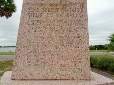
On Texas 35 (State Highway 35) 1.2 miles west of Farm to Market Road 1593, on the right when traveling west.
Near Martin Luther King Drive at Nueces Street.
On Farm to Market Road 1090, 1.8 miles west of Texas Highway 35, on the right when traveling north.
On County Road 471, 0.4 miles east of County Road 483, on the right when traveling east.
Near 4th Street (Business Interstate 20) at Market Street, on the right when traveling west.
Near U.S. 283, 0.1 miles south of County Road 328, on the left when traveling north.
On Finley Road (County Road 324) 0.6 miles east of County Road 323, on the right when traveling east.
On Frontage Road, 0.1 miles north of Fish Hatchery Road, on the right when traveling south.
On East Washington Street (Business U.S. 77) at East 13th Street, on the right when traveling north on East Washington Street.
On East Ruben M Torres Boulevard at Frontage Road, on the right when traveling west on East Ruben M Torres Boulevard.
On East 11th Street north of East Madison Street, on the right when traveling north.
On International Boulevard at West University Blvd, on the left when traveling west on International Boulevard.
Paid Advertisement
On Old Military Road (County Highway 269) 0.1 miles west of Military Road (U.S. 282), on the right when traveling west.
Near Palmitto Hill Road, 0.1 miles south of Boca Chica Boulevard (State Highway 4), on the right when traveling south.
On Boca Chica Boulevard (State Highway 4), on the right when traveling west.
On Paredes Line Road, 0.1 miles south of Palo Verde Drive.
On Military Highway (U.S. 281) 0.1 miles west of Don Felipe Trevino, on the left when traveling west.
On East Queen Isabella Blvd (State Highway 100) at North Garcia Street, on the left when traveling east on East Queen Isabella Blvd.
On Military Highway (U.S. 281), on the right when traveling west.
On Main Street north of W 4th Street, on the left when traveling north.
On US-59 South, on the right when traveling south.
On Miller Road (State Highway 61), on the right when traveling west.
Near Unnamed roads within the park.
On Washington Avenue (State Highway 61) at Cummings Street, on the right when traveling south on Washington Avenue.
On Feeder Road to Interstate 10, 0.3 miles west of Wallisville Liberty Road, on the right when traveling east.
On State Highway 21, 1.7 miles west of Marcus Street (U.S. 69), on the left when traveling east.
On State Highway 21, 0.2 miles east of County Road 2807, on the left when traveling east.
On State Highway 21, on the right when traveling east. Reported permanently removed.
Paid Advertisement
On State Highway 21, 1.4 miles west of Marcus Street (U.S. 69), on the right when traveling east.
On 50 Park Road, on the right when traveling north.
On Farm to Market Road 241, 0.6 miles south of County Highway 2406, on the left when traveling north.
On Avenue E Northwest at North Main Street, on the right when traveling west on Avenue E Northwest.
On U.S. 82 at State Highway 510 Spur, on the right when traveling east on U.S. 82.
On North Main Street north of West Washington Avenue, on the left when traveling north.
On U.S. 277 at Fort Chadbourne Road, on the right when traveling north on U.S. 277.
On U.S. 277, 1.6 miles north of Texas Highway 70, on the right when traveling north.
On State Highway 158, 0.1 miles west of Scott Lane, on the right when traveling west.
Near Unnamed Road, 0.2 miles north of Hayrick Road.
Near U.S. 84, 1.1 miles west of U.S. 283, on the right when traveling west.
On County Road 140, 4 miles east of Farm to Market Road 1176, on the right when traveling east.
Near U.S. 84 west of County Road 106, on the left when traveling east.
On North Kentucky Street south of West Virginia Street, on the left when traveling south.
On U.S. 83 at Texas Highway 203, on the right when traveling south on U.S. 83.
On Alleyton Road (County Road 268) at Center Street, on the right when traveling east on Alleyton Road.
Paid Advertisement
Near Walnut Street (U.S. 90) 0.2 miles west of Old U.S. 90, on the left when traveling west.
On Business State Highway 71 near Farm to Market Road 109, on the right when traveling west.
On Milam Street (State Highway 52 Spur), on the right when traveling north.
On Veterans Drive (Old U.S. 90) at Milentz Street, on the right when traveling east on Veterans Drive (Old U.S. 90).
On Farm to Market Road 109 at Farm to Market Road 1291, on the right when traveling north on Highway 109.
On Business Interstate 35 north of State Highway 46, on the right when traveling south.
On Peace Avenue, 0.1 miles south of East Commerce Street, on the left when traveling south.
On Comal Avenue, 0.1 miles east of East Garden Street, on the right when traveling west.
On Landa Park Drive at Monument Drive, on the left when traveling north on Landa Park Drive.
On East Mill Street, 0.1 miles east of North Gilbert Avenue, in the median.
On West Central Avenue (U.S. 67/377) near Texas Highway 36, on the right when traveling west.
On N. Roberts (U.S. 83) at Moss Street, on the right when traveling north on N. Roberts.
On North Grand Avenue (Farm to Market Road 372) at Frontage U.S. 82 Frontage Road, on the right when traveling north on North Grand Avenue.
On West California Street (Farm to Market Road 51) 0.2 miles west of Interstate 35, on the right when traveling west. Reported damaged.
On U.S. 84, 0.5 miles west of Farm to Market Road 1829, on the left when traveling west.
On U.S. 385, 7.4 miles north of Texas Highway 329, on the left when traveling north.
Paid Advertisement
On 11th Street (State Highway 466) east of Avenue E (State Highway 163), on the left when traveling east.
Near Fort Lancaster Road at State Highway 290, on the left when traveling north.
On West Main Street, on the right when traveling east.
On West Main Street at Berkshire, on the right when traveling east on West Main Street.
On Farm to Market Road 1527 west of Farm to Market Road 101, on the left when traveling west.
On U.S. 180/62, on the left when traveling east.
On West 3rd Street at Austin Street, on the right when traveling east on West 3rd Street.
On Interstate 10 at milepost 138,, 2.5 miles west of West Broadway Street, on the right when traveling west.
On U.S. 87, 0.2 miles north of South Sedan Road (County Road 1727), on the left when traveling north.
On Lemmon Avenue, on the right when traveling south.
On William Dodson Parkway, in the median.
On West Main Street, on the left when traveling west.
On U.S. 87 at U.S. 180, on the right when traveling north on U.S. 87.
On Sampson Street at East 3rd Street, on the right when traveling north on Sampson Street.
On Texas Route 154 at Farm to Market Road 1529, on the right when traveling west on State Route 154.
Paid Advertisement
On North Elm Street (U.S. 77/377) at West Oak Street, on the left when traveling south on North Elm Street.
On West Hickory Street at North Locust Street (U.S. 77/377), on the left when traveling east on West Hickory Street.
On East Broadway Street (U.S. 87) at East Courthouse Street, on the left when traveling west on East Broadway Street.
On State Highway 72 at North Louis Avenue, on the right when traveling north on State Highway 72.
On 5th Street east of Montgomery Street, on the right when traveling east.
Near Cemetery Road, 0.5 miles east of East Hill Street.
On State Highway 70 south of County Highway 333, on the left when traveling south.
On State Highway 70, on the left when traveling south.
On West 2nd Street (U.S. 287) at State Highway 70, on the right when traveling west on West 2nd Street.
On East Gravis Avenue (State Highway 44), on the right when traveling east.
On Loop State Highway 254 at Main Street, on the left when traveling north on State Highway 254.
On Business Interstate 20 east of Newell Road, on the left when traveling east.
On U.S. 377, 1.3 miles north of East Edwards Street, on the right when traveling south.
On Alameda Avenue at Valdespino Street, on the right when traveling north on Alameda Avenue.
On North Oregon Street at Mills Avenue, on the right when traveling north on North Oregon Street.
Near West Paisano Drive, on the right when traveling south.
Paid Advertisement
Near South Zaragoza Road at Alameda Avenue (State Highway 20) when traveling south.
On Alameda Avenue at Valdespino Street, on the right when traveling north on Alameda Avenue.
On South El Paso Street at East Overland Avenue, on the right when traveling north on South El Paso Street.
On San Elizario Road, on the left when traveling east.
On San Elizario Road, on the left when traveling east.
813 entries matched your criteria. Entries 101 through 200 are listed above.
⊲ Previous 100 —
Next 100 ⊳