183 entries match your criteria. Entries 101 through 183 are listed.⊲ Previous 100
Daughters of the American Colonists Historical Markers
Markers erected by all chapters of Daughters of the American Colonists. The Society is dedicated to research the deeds of American colonists and to record, publish and commemorate them.
By Chris English, June 10, 2013
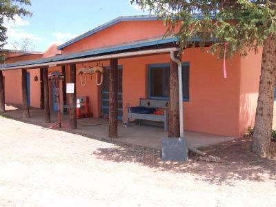
Kosloski's Historic Stagecoach Stop and Trading Post
The most heavily traveled road in Colonial America passed through here, linking areas from the Great Lakes to Augusta, Ga. Laid on ancient animal and Native American Trading/Warrior Paths. Indian treaties among the Governors of NY, PA, & VA and the . . . — — Map (db m44473) HM
The First Oblong Friends Meeting House was erected on this site in 1742. It was used as a place of worship until 1764. West of the site was the Friends burial ground. During the fall and winter of 1778 the present meeting house was a hospital . . . — — Map (db m25028) HM
On the Battlefield of
La Belle Famille
Father Claude Joseph Virot S. J.
Chaplain of the French forces
was killed by the Iroquois
July 24, 1759. — — Map (db m67345) HM WM
Built on lands belonging to the Blauvelt Family from 1741 to 1970 when it was acquired by the Historical Society of Rockland County
Presented by Daniel De Clerque Chapter Daughters of the American Colonists — — Map (db m21380) HM
This site and "meeting house" was the area birthplace of a new country in pre-revolutionary meetings, a new county (Alamance), a new county seat (Graham), an early public library, a courthouse, a school to college presidents and a governor, and a . . . — — Map (db m64237) HM
America’s first female political activist. Leader of 51 women who signed a Proclamation of Protest in 1774 known as The Edenton Tea Party; The first organized political activity by women in our country, encouraged women to boycott English goods. An . . . — — Map (db m224300) HM
This 1756 church contains unique and artistic
North Carolina soft soapstone & pierced
tombstones, carved. by Anglo-German cabinet
and furniture makers, many attributed to the
Swicegood School, using the same tools as
used in furniture. They . . . — — Map (db m239122) HM
The most heavily traveled in Colonial America passed near here, linking areas from The Great Lakes to Augusta, GA. Laid out on animal and Native American Trading & Warrior Paths. Indian treaties aming NY, PA, VA and the Iroquois League of Five . . . — — Map (db m52540) HM
Colonial home of Mary and Philip Hoggatt A Quaker Potter Typical example of a Pre-Revolution home Built in Guilford County ca. 1754 In continuous use until the 1960's. — — Map (db m213709) HM
On its summit in July, 1767
a Treaty was made between English Officers and Cherokee Chiefs.
Establishing there the extreme western frontier for White settlers.
The Mountain was named for
William Tryon
then Royal Governor of the . . . — — Map (db m231272) HM
This cemetery, eight miles west of Salisbury was
established by December 10, 1750. It is the oldest
ecclesiastical cemetery in the western half of North
Carolina. The oldest surviving grave marker is that
of John Nesbit, 1755. Veterans of the . . . — — Map (db m237118) HM
Captain Robert Cleveland was born in Virginia around 1744 and moved with his family to western North Carolina around 1766. Cleveland acquired 150 acres near the Lewis Fork in what is today known as the Purlear Community by 1778. He built his log . . . — — Map (db m192195) HM
The Treaty of Paris, 1763, did not prevent Indians, led by Pontiac, from destroying forts along Lake Erie, such as Sandusky and Presque Isle.
The English sent Colonel John Bradstreet to Detroit to "Awe" Pontiac. He led the largest force ever . . . — — Map (db m78467) HM
The last mission of the Moravians in the Valley of the Huron in the Ohio Country was at the Indian Village of Pettquottink, now Milan. — — Map (db m90658) HM
Old Indian Trail blazed by Chief Tecumseh
later used by Pony Express and became Post Road
This ground was cleared in 1809 by well known pioneer Richard Taylor — — Map (db m77600) HM
Nathaniel Massie, born Goochland County, Virginia, December 28, 1763, 1800 married Sarah Everard Mead, died November 13, 1813.
Revolutionary soldier; surveyor of wilderness then known as Northwest Territory and locator of Revolutionary War . . . — — Map (db m58110) HM
Established at Vinita
Cherokee Nation, Indian Territory
by the Rev. J. W. Scroggs, D.D.
Dedicated Jan. 14, 1883
Named in honor of the
Rev. Samuel A. Worcester, D.D.
Missionary among the Cherokees — — Map (db m55648) HM
522 feet north of this point on March 25, 1879 was established Tulsa's first post office. Known at that time as "Tulsey Town" Creek Nation, Indian Territory, Josiah C. Perryman Post-Master. — — Map (db m101675) HM
This Creek Indian school was founded by Rev. R.M. Loughridge, Presbyterian Bd. [Board] Foreign Miss. [Missions], 1848. Rev. W.S. Robertson was employed as the supt. Rebuilt by Creeks when destroyed by fire in 1880. Operated until 1907 for . . . — — Map (db m73128) HM
Used by Indians; by Hudson's Bay trappers; by covered wagons; by Fremont 1846; by railroad survey party 1855; by soldiers at Fort Klamath. Site of the Modoc Indian conference in hope of averting war with that tribe; of the first water wheel; of the . . . — — Map (db m100223) HM
Pioneer village founded in 1870. A rival town of Linkville and the first platted in Klamath County. Named after the merganser ducks on Klamath River. A bridge-crossing made it an important trade route. The town served as a settler defense rendezvous . . . — — Map (db m116786) HM
Martin R. Frain born December 17, 1832 in New York, came west in 1850, arrived in Oregon Territory April 30, 1857 crossed Link river and camped under a ledge nearby. Established the first Trading Post at the present area of Payne Alley and Main . . . — — Map (db m100207) HM
In 1846, first crossed the Applegate Trail. The Southern Wagon Road and Topsy Road made original junction. An Indian Trail, at first; then the
Soldiers traversed these roads and in 1863, the Pony Express Trail was used to carry messages from Fort . . . — — Map (db m100225) HM
Honorable Lindsay Applegate, son of a Revolutionary soldier with Colonial ancestry, born in Kentucky, September 18, 1808. Explorer, soldier, Trailblazer. Came to the Oregon country 1843. An Oregon Patriot, served in provisional, territorial and . . . — — Map (db m112625) HM
600 yards southwest on the east bank of the Multnomah Channel was the site of Fort William. Nathaniel J. Wyeh, Massachusetts trader and founder of Ft. Hall, established Ft. William near Warrior Point in 1834. In the spring of 1835 he moved the . . . — — Map (db m245463) HM
This pioneer settler of Rostraver Township, Westmoreland County, arrived in Philadelphia from Rotterdam aboard the ship Mortonhouse in 1729. He and his wife Mary lived for a time near Hagerstown, Maryland and after the Braddock and Forbes . . . — — Map (db m63078) HM
From whom McKeesport derives its name, first permanent white settler at the forks of the Monongahela and Youghiogheny Rivers in 1755. The Colonial Government granted to him exclusive right of ferrage over these rivers April 3, 1769, called . . . — — Map (db m29962) HM
Has served as a home, shoe repair shop, school, bakery and tavern. John Henry Simler built a 20’ X 24’ log cabin with in-door stairways to the fruit cellar, second floor and attic. Luxury items included the attic window and panes of glass in all . . . — — Map (db m162025) HM
British Major General Edward Braddock camped here at Stewart's Crossing on the banks of the Youghiogheny River, June 28-30, 1755. His goal was to reach Fort Duquesne (Pittsburgh) and drive the French from the area. He was accompanied by colonial . . . — — Map (db m76134) HM
Clarion call of the American Revolution in South Carolina. His eloquence awakened the sons of his native state to their danger and brought them to arms, from the mountains to the sea. President of Provincial Congress in 1775, Chief Justice of S.C. . . . — — Map (db m106453) HM
Jacob Rabe came from Maryland in 1770 to Western Pennsylvania while this area was claimed by Virginia. In 1774 he received a Virginia Certificate for 412 acres. Boundary dispute between Virginia and Pennsylvania was settled in 1781, with the . . . — — Map (db m69762) HM
Here in the churchyard of
St. Philip's are buried
Charles Pinckney
(1757-1824)
Signer of the United
States Constitution
and author of the famous
"Pinckney Draught"
Governor of South Carolina
U.S. Senator & Congressman . . . — — Map (db m27541) HM
The most heavily traveled road in Colonial America passed through here, linking areas from the Great Lakes to Augusta, GA. Laid on ancient animal and Native American Trading/ Warrior Paths. Indian treaties among the Governors of NY, PA, & VA and the . . . — — Map (db m13719) HM
Wilson Crossroads At this point the Camden-Mars Bluff road intersected the road to Darlington on property granted to the Reverend John Wilson (1790-1869) by the state of South Carolina in 1837. Wilson, a North Carolinian, settled here, and . . . — — Map (db m224017) HM
Born in Darlington County in 1859, William Dowling was a descendant of Robert Dowling, who had settled in S.C. in the Parish of St. David by 1773. William served as a member of the South Carolina House of Representatives, 1899-1900, and was . . . — — Map (db m38168) HM
(Front text)
Middleton Place
These famous gardens were laid out about
1741 by Henry Middleton (1717-84), President
of Continental Congress. His son Arthur,
Signer of the Declaration Of Independence,
lived here as did his son Henry . . . — — Map (db m16281) HM
Birthplace of Jeremiah John Snow. China Grove was the birthplace of the Reverend Jeremiah John Snow (1836–1892), a son of the third James Snow who lived here. He entered the Methodist Conference in 1863, and was a chaplain in the Third . . . — — Map (db m16513) HM
[Front]:
The Reverend James Jenkins served in the Methodist ministry for 55 years. He was born in Bitton's Neck, the son of Samuel and Elizabeth Britton Jenkins. His mother was a Revolutionary War heroine. In 1805 he married Elizabeth . . . — — Map (db m27704) HM
In 1718, at a site 2.7 miles east, near the place where the Cherokee Path crossed Congaree Creek, the first frontier outpost in central South Carolina was established under the command of Captain Charles Russell. The fort was abandoned in 1722, but . . . — — Map (db m21711) HM
Britton's Neck. One of the oldest settlements in Marion County, Britton's Neck lay between Great and Little Pee Dee Rivers extending northward from the mouth of Little Pee Dee. It was named for Francis, Timothy, Daniel, Moses, Joseph, and . . . — — Map (db m45857) HM
[Front Side]:
The main trading path to the Cherokee Nation paralleled the route of Highway 11 for several miles at this point. This section of the path was used by travelers going from Keowee, the main Lower Town of the Cherokees, across . . . — — Map (db m14383) HM
(side 1)
Fort Prince George, covered by Lake Keowee since 1968, was built nearby in 1753, near the unofficial boundary between Cherokee lands and white settlements. Across the Keowee River from the Cherokee Lower Town of Keowee, it was . . . — — Map (db m78989) HM
In 1732 Roger Gordon led 40 Scotch Irish to found Williamsburg Township, (Kingstree), one of 11 inland sites granted by the Provincial Governor in King George’s plan to develop a successful English colony in South Carolina. In 1738 the town acquired . . . — — Map (db m54667) HM
With a military expedition
camped in the vicinity
July 10, & 11th, 1859.
He conducted on Sunday
the first Christian services
on Meade County soil. — — Map (db m172481) HM
Here on west bank of the creek that he discovered in 1772, Kasper Mansker and other first settlers built a log fort in 1779. John Donelson’s family fled here in 1780 for safety from Indians. Mansker abandoned the fort in 1781 and moved to Fort . . . — — Map (db m2586) HM
Built in 1896 — West Tennessee's oldest working courthouse
Court-first held in Peter Wall's home in 1821. A log courthouse built in Clifty 1823. Two story brick courthouse erected on this land in 1825 and replaced in 1852.
The . . . — — Map (db m155871) HM
Reelfoot Lake is a by-product of the "New Madrid Earthquakes", a series of 1,874 recorded tremors centered generally about 70 miles southwest of the Lake, taking place from December 16, 1811 until March 8, 1812. The "hard shock” came at 3 . . . — — Map (db m155949) HM
Three principal Indian and pioneer trails
cut across Rutherford County connecting
the Great Lakes to the Gulf of Mexico and
the Atlantic Coast substantially following
animal trails to salt and water. Great South
Trail continued to Alabama and . . . — — Map (db m158268) HM
The most heavily traveled road in Colonial America passed through here, linking areas from the Great Lakes to Augusta, GA. Laid on ancient animal and Native American Trading/Warrior Paths. Indian treaties among the Governors of NY, PA, & VA and . . . — — Map (db m158112) HM
Daughters of
the American Colonists
“1673 — James Needham & Gabriel
Arthur, first English-speaking
visitors, passed here en route
to the Cherokee towns on the
Little Tennessee River.”
“1700 — Daniel . . . — — Map (db m157847) HM
Colonial and Revolutionary Service
A native of South Carolina; Founder of Brown’s Settlement on Nolachucky River, 1771; Merchant, Gunsmith and Blacksmith to the Cherokee Indians; purchased from those Indians two boundaries of land-a . . . — — Map (db m83139) HM WM
The center of the sugar industry from Texas colonial days and the site of the first sugar refinery in Texas located by S. M. Williams on land granted to him by the Mexican government. — — Map (db m27764) HM
1836 - 1845
In commemoration of
The Texas Navy
that played heroic part
in the struggle of
the Texas Republic
and made headquarters at
the port of Galveston
Erected by
the Texas Society
Daughters of the American . . . — — Map (db m90704) WM
At contact, Europeans found that Native American communities and regions were connected by trails. The major trail in Texas was known to its' colonizers as the Camino de los Tejas. This road, also known as Camino de Arriba and El Camino Real and . . . — — Map (db m156886) HM
At confluence of Concho and
Rio Grande Rivers.
A settlement for over 10,000 years
Site of
first recorded wagon train
crossing into Texas
December 10, 1582
Headed by Antonio de Espejo — — Map (db m215858) HM
Site of
Historic Crossing on the Sabine River
Erected by
Sabine River Chapter
Texas Society of the
National Society Daughters
of the American Colonists
Mrs. Roy E. Massengill,
Chapter Regent
Mrs. Walter M. . . . — — Map (db m30763) HM
Vermont is crossed by a complete system of ancient major routes from the Lake Champlain Valley to the Connecticut River Valley leading eventually to the sea. Paths were first made by migrating herds of animals searching for salt, and later by Native . . . — — Map (db m144471) HM
In this graveyard is buried
Col. Benjamin Harrison, V
December 13, 1730
April 24, 1791
Singer of the
Declaration of Independence
Member of
Virginia House of Burgesses
Continental Congress
Federal Constitutional Convention . . . — — Map (db m87114) HM
Richard Bland Lee (1761-1827)
First Congressional Representative for Northern Virginia to the first three Federal Congresses
A Commissioner to supervise reconstruction of the War of 1812 damaged buildings in the United States . . . — — Map (db m198261) HM
Here at Cape Henry first landed in America, upon 26 April 1607, those English colonists who, upon 13 May 1607, established at Jamestown, Virginia, the first permanent English colony in America.
Erected by the National Society, Daughters of the . . . — — Map (db m23198) HM
On May 30, 1792 Captain Vancouver and his party anchored off this point and came ashore the following morning. Commissioned by the British to survey the N.W. Coast of America, they named this area Rose Point for the many wild roses that grew here. — — Map (db m83866) HM
AS YOU ENTER BUDD INLET...
The Dofflemyer Point Lighthouse greets you. It sits seven miles
north of the Port of Olympia, near the Boston Harbor Marina.
This structure provides the southernmost light in Puget Sound.
‘A JOYFUL NOISE’ - The . . . — — Map (db m234058) HM
On June 6th 1870, in a time when women were barred from politics, 15 local women tested their citizenship rights by voting in a general election. After endearing themselves to the election judges in Grand Mound with a picnic dinner, seven Grand . . . — — Map (db m233377) HM
Here, in February 1909, both Houses of the Washington Legislature authorized a vote by the State’s qualified voters to amend the Washington State Constitution to enable women to vote in all elections. Male voters of Washington approved the amendment . . . — — Map (db m83709) HM
During the period of its existence Fort Walla Walla protected a vast area of the Northwest. Indian Wars which were fought by troops from this fort are Steptoe Expedition, Wright Expedition, Modoc War and Bannock War.
Regiments stationed here . . . — — Map (db m158915) HM
This park, built to portray and preserve Wisconsin's beginnings, is located on a site that is itself a part of history. On this 40-acre site stood Camp Smith--a temporary location of Fort Howard--part of the pioneer settlement known as Shantytown, . . . — — Map (db m240687) HM
On this site Morgan L. Martin (1805-87) built this home in 1837, after his marriage to Elizabeth Smith of Plattsburgh, N.Y. It was a center of social, literary and political accomplishment for nearly a century. Coming here in 1827 as a young . . . — — Map (db m37202) HM
In our ancient past, Wisconsin was crossed by a system of trails first forged by deer and elk as they migrated in search of good weather, food and salt. Native Americans used the Paths as they hunted, traded, and made war in troubled times. Some . . . — — Map (db m66620) HM
183 entries matched your criteria. Entries 101 through 183 are listed above. ⊲ Previous 100