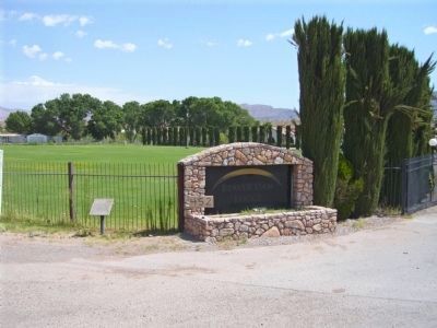
On County Highway 91 at Old Pioneer Road on County Highway 91.
The Old Spanish Trail, the main trade route between Santa Fe and Los Angeles, passed this way beginning in 1829. At the end of the Mexican-American War this portion of the route evolved into what was variously known as the Salt Lake Road, the . . . — — Map (db m78535) HM
Near Santa Anita Avenue south of Valley Boulevard, on the right when traveling south.
El Monte, on the bank of the San Gabriel River, played a significant part in California's early pioneer history. It was first an encampment on the Old Spanish Trail, an extension of the trail from Missouri to Santa Fe. By the 1850's some began . . . — — Map (db m162663) HM
Near Olvera Street just south of North Main Street.
This plaque marks the end of the Old Spanish Trail, an historic pack trail from Santa Fe to the Pueblo of Los Angeles. This trail was used by Mexican traders who brought woolen goods from New Mexico to trade for highly prized California . . . — — Map (db m113806) HM
On Bonita Avenue at Walnut Avenue, on the left when traveling east on Bonita Avenue.
This plaque commemorates the 1200-mile
Old Spanish Trail, an historic pack trail
from Santa Fe to Los Angeles. This trail
was used by Native Americans, explorers,
trappers, immigrants, and Mexican traders
who brought woolen goods from . . . — — Map (db m168937) HM
On Mission Road, on the right when traveling west. Reported permanently removed.
The Old Spanish Trail was an historic pack trail connecting Santa Fe to the pueblo of Los Angeles. Travelers from Santa Fe aimed for the San Gabriel Mission as a welcome destination and gathering place. Traders brought woolen goods from New . . . — — Map (db m66587) HM
On Death Valley Road (California Route 127 at milepost 29.8) at Saratoga Springs Road, on the left when traveling north on Death Valley Road.
Some 100 wagons found themselves in Salt Lake City too late to cross the Sierra Nevada. They banded together under the name of Sand Walking Co. and started for the gold fields in California over the old Spanish Trail. After being in Death Valley . . . — — Map (db m159400) HM
Near East Main Street (Business Interstate 15), on the right when traveling west.
[Text from the bottom panels, left to right]
The first explorers kept detailed journals of their expeditions detailing the route taken and the friendly and hostile encounters with Indians along the way. Journals assisted those who followed . . . — — Map (db m50615) HM
On National Trails Highway west of Minneola Road, on the right when traveling west.
Three miles north lies the Mojave River and the site of Forks of the Road. This was the junction of two major travel routes: The Old Spanish or Salt Lake Trail and The Ancient Mojave River Trail. In the 1830s and 1840s the Old Spanish Trail saw . . . — — Map (db m159526) HM
On Cajon Boulevard, on the right when traveling east.
Cajon Pass, separating the San Bernardino and San Gabriel ranges, has long been an important natural gateway. It is traversed by Indian trails, emigrant routes, railroads, and a superhighway. Early in the nineteenth century it became the southern . . . — — Map (db m119252) HM
On Manada Road, on the right when traveling north.
For centuries the Cajon Pass has been an important thoroughfare for travelers and traders between the Mojave Desert and Southern California. Following the route of the Old Spanish Trail, most travelers transited the pass on its east side. This . . . — — Map (db m80751) HM
On Foothill Boulevard east of Baker Avenue, on the left when traveling east.
Directly to your right are examples of the types of pavements used in California highway building during the early 1900s.
This road was originally part of the Old Spanish Trail, used by early California explorers and settlers as a stagecoach . . . — — Map (db m120642) HM
On State Highway 150 0.2 miles north of U.S. 160, on the right when traveling north.
¡Bienvenidos! Caminantes!
Come! Take a walk with us. We know an old song, El Caminante, which tells of taking a long walk along the ancient roads. Like the first prehistoric inhabitants, you too are a ‘caminante’, or one who walks upon . . . — — Map (db m71877) HM
On U.S. 160 at milepost 136.9, just west of Hersch Avenue, on the right when traveling west.
The Old Spanish Trail was neither entirely Spanish nor Particularly old. But the name seemed to fit this rugged road, which passed about thirty miles south of here as it stretched from Santa Fe to California. Franciscan pathfinders Dominguez and . . . — — Map (db m293895) HM
Near Gunnison River Drive (North Palmer Street) 0.3 miles west of U.S. 50.
Antoine Robidoux and Fort Uncompahgre The Story of a Western Colorado Fur Trader / By Ken Reyher, 1998 Fort Uncompahgre was constructed in 1828 by Antoine Robidoux, a trader based out of Mexican Santa Fe. The post was situated about two miles . . . — — Map (db m290981) HM
Near Gunnison River Drive (North Palmer Street) 0.3 miles west of U.S. 50.
Follow the Trail It is 1829, eight years after Mexico gained independence from Spain. New Mexican traders travel overland to establish new commercial relations with frontier settlements in California. They carried locally produced merchandise . . . — — Map (db m290975) HM
On State Highway 149 at milepost 93, just west of County Road 25, on the right when traveling south.
“In the Colorado Rockies where the snow is deep and cold… a man afoot can starve to death unless he’s brave and bold.” ~Ballad of Alferd Packer What is now recognized as one of the most notorious events in Colorado's . . . — — Map (db m291792) HM
On State Highway 149 at milepost 93, just west of County Road 25, on the right when traveling south.
Between 1829 and 1848 woolen goods were transported by mule caravans from the Mexican outpost of Santa Fe to the Missions of Southern California on the Old Spanish Trail. Annual mule pack caravans traveled the historic Old Spanish Trail . . . — — Map (db m291698) HM
On U.S. 160 0.8 miles west of Cherry Creek Road, on the left when traveling west. Reported damaged.
Between 1800 and 1850, the Old Spanish Trail became a regional trade route between Santa Fe and California.
Dominguez and Escalante traveled through this valley in 1776. Within twenty-five years of their expedition this trail became a . . . — — Map (db m301745) HM
On 8th Street (State Highway 285) at Christy Avenue, on the right when traveling north on 8th Street.
This sign marks an important junction of the Old Spanish Trail. Both forks, east and west, of the North Branch of this Trail converged at Saguache before continuing west of Cochetopa Pass and on to Los Angeles.
The Old Spanish Trail was the . . . — — Map (db m120165) HM
On 8th Street (State Highway 285) at Christy Avenue, on the right when traveling north on 8th Street.
The land around Saguache (pronounced “sah-WATCH”) has been inhabited for thousands of years – first by unnamed nomads, later by the Utes (who camped here seasonally), and later still by Mexican traders bound for California on the . . . — — Map (db m120166) HM
On County Road 241 S near NW 294 Avenue, on the left when traveling south.
A Spanish Mission was established near here within sight of the Santa Fe River about A.D. 1606 by Franciscan missionaries. The river took its name from the mission, as did the modern town of Santa Fe. At one time, Santa Fe de Toloca was said to be . . . — — Map (db m64880) HM
On South River Landing Road 0.5 miles south of West Washington Street (U.S. 90), on the right when traveling south.
This prehistoric mound is the largest of seven that once stood here at River Landing Park. Believed to date from the Fort Walton time period (A.D. 900-A.D. 1500), its original appearance was that of a flat-topped pyramid. Archaeologists believe that . . . — — Map (db m110893) HM
On Spanish Lake Road south of West Old Spanish Trail (State Highway 182), on the right when traveling east.
Spanish Lake is an example of a bluff lake, which forms in areas between the bayou bank and the higher bank that runs along the edge of a river's drainage area.Spanish Lake, formerly called Lake Flamand and later Lake Tasse (meaning . . . — — Map (db m115825) HM
During the early 19th Century, the Biloxi peninsula was sparsely populated
with a few French speaking families. The 1827 establishment of steamboat
service between New Orleans and Mobile, via Lake Pontchartrain, served
as a catalyst for the . . . — — Map (db m102223) HM
On Pahrump Valley Highway (Nevada Route 160 at milepost 17), on the left when traveling west.
This portion of the Old Spanish Trail was discovered in January, 1830, by Antonio Armijo during his first trip from Santa Fe to Los Angeles. The spring just north of this marker provided excellent water and fed meadows of luxuriant grass for draft . . . — — Map (db m270155) HM
On Village Boulevard at Diamond Street, on the left when traveling east on Village Boulevard.
Stretching for 130 miles across Clark County, this historic horse trail became Nevada's first route of commerce in 1829 when trade was initiated between Santa Fe and Los Angles. The trail was later used by the wagons of the "49ers" and Mormon . . . — — Map (db m29218) HM
On San Pedro Street, on the right when traveling east.
This small spring, first used by Anasazi and Paiute people, also sustained the caravan that pioneered a pack route now known as the Old Spanish Trail. En route to Los Angeles from Santa Fe, trader Antonio Armijo, 60 men and 100 mules camped here on . . . — — Map (db m39470) HM
On East Lake Mead Drive (Nevada Route 564) 0.1 miles south of Pyrenees Court, on the left when traveling north.
On January 8, 1830, the first pack train to pass from Santa Fe, New Mexico to Los Angles crossed Las Vegas Valley. Antonio Armijo, a merchant in Santa Fe, commanded the train and roughly sixty men. The successful completion of the journey opened a . . . — — Map (db m29247) HM
On Arrowhead Trail Road 0.5 miles south of Mission Drive, on the right when traveling south.
The name, "Arrowhead Trail" likely originated from the former San Pedro, Los Angeles, and Salt Lake Railroad's logo, an arrowhead. Prior to 1850, New Mexican trading caravans from Santa Fe en route to Los Angeles used this segment of the Old Spanish . . . — — Map (db m308212) HM
Few children traveled with the regular Spanish Trail caravans. The journey was long and dangerous. Young children were a burden and older ones were needed at home. Before 1841, families with children rarely moved to California. Those who mode the . . . — — Map (db m241715) HM
In 1843-1844 Capt. John C. Fremont explored the West. He named the Old Spanish Trail and the Great Basin - a vast region whose rivers drained inland, not to the sea. He first trekked to Oregon, then south through California, then back eastward . . . — — Map (db m241714) HM
Spanish Trail caravans wound between watering holes across the Mojave Desert. Mormon wagon trains followed much of the Spanish Trail, but since wagons could haul water and feed, this opened up short-cuts. The railroad broke new ground by building . . . — — Map (db m241717) HM
For centuries before the Spanish arrived in the Southwest, native peoples traded goods across the network of routes that became the Old Spanish Trail. The Spanish called all the first people "Indians", later identifying them as Pueblos, Apaches, . . . — — Map (db m241719) HM
For more than 150 years this ten-acre parcel preserved the ruts of the Old Spanish Trail between Las Vegas Springs and Mountain Pass.
When Spain owned the Southwest, Santa Fe and Los Angeles were the only two centers of government and . . . — — Map (db m241707) HM
On South Cimarron Road, on the right when traveling north.
Spanish Trail routes crossed deserts and mountain ranges far from Mexican settlements and government authorities. Horses and mules were in short supply to conduct the Santa Fe-Missouri trade opened in 1821 by Americans from Missouri. Outlaws and . . . — — Map (db m241725) HM
The most dangerous section of the Old Spanish Trail crossed the Mojave Desert; it is extremely hot in the summer and without major rivers running through it. Springs and the Amargosa River (which drains into Death Valley) made it possible to . . . — — Map (db m241722) HM
During the Mexican War, Mormon men served as a special battalion in the U.S. Army. They left lowa in July 1846 and marched through the Southwest to San Diego, building roads and American outposts along the way. They fought the Battle of San . . . — — Map (db m241721) HM
Spanish Trail travelers through Clark County followed changing routes as they learned shortcuts and new sources of water, but the trail always connected watering holes. Spanish Trail pioneer Antonio Armijo and early fur trappers depended on the . . . — — Map (db m241712) HM
Stretching for 130 miles across Clark County, this historic horse trail became Nevada’s first route of commerce in 1829 when trade was initiated between Santa Fe and Los Angeles. The trail was later used by the wagons of the “49ers” and . . . — — Map (db m1414) HM
On West Mesquite Boulevard (Nevada Route 144) at Yucca Street, on the right when traveling west on West Mesquite Boulevard.
Virgin Valley was traveled by Jedediah Smith in 1826 and by Fremont in 1844.
The valley served as the right-of-way for the Old Spanish Trail (1829-1848) and for the Mormon road or southern route of travel to southern California.
The areas . . . — — Map (db m1279) HM
On Nevada Route 169 at milepost 21, on the right when traveling south.
Rich in prehistoric, pueblo-type culture, and noted by the explorer Jedediah Smith in 1826, Moapa Valley is crossed by the Old Spanish Trail.
In 1865 Brigham Young sent 75 families to settle the area, to grow cotton for the people of Utah, and . . . — — Map (db m46780) HM
On Highway 160 west of Benedict Drive, on the right when traveling west.
Stretching for 130 miles across Clark County, this historic horse trail became Nevada's first route of commerce in 1829 when trade was initiated between Santa Fe and Los Angeles. The trail was later used by the wagons of the "49'ers" and Mormon . . . — — Map (db m89437) HM
On Mountain Vista Street 0.1 miles south of East Russell Road, on the left when traveling south.
This historical marker commemorates the valor and service of pioneer scout Rafael Rivera, the first Caucasian of record to view and traverse Las Vegas valley. Scouting for Antonia Armijo's sixty man trading party from Abiquiu, N.M. in January 1830. . . . — — Map (db m29167) HM
Originally known as Mesquite Valley, this area was first crossed in the 1850s by the Kingston Cutoff by the Old Spanish Trail. The first settlers did not arrive until 1876, when Miguel Navares began mining salt for the nearby Ivanpah mines. The . . . — — Map (db m107136) HM
Lordsburg was founded in 1880 on the route of the Southern Pacific Railroad, near that used by the Butterfield Overland Mail Co., 1858-1861. The town was named for Delbert Lord, an engineer with the railroad. In 1927, Charles Lindbergh landed his . . . — — Map (db m38244) HM
On West Motel Drive 0.4 miles east of Interstate 10, on the right when traveling east.
Lordsburg was founded in 1880 on the route of the Southern Pacific Railroad, near that used by the Butterfield Overland Mail Co., 1858-1861. The town was named for Delbert Lord, an engineer with the railroad. In 1927, Charles Lindbergh landed his . . . — — Map (db m73727) HM
On West Marcy Street near Lincoln Avenue, on the right when traveling east.
The Old Spanish Trail from Santa Fe to Los Angeles. In the years 1829 to 1848 pack mule trains regularly left the Santa Fe Plaza and northern New Mexico carrying woolen goods produced in New Mexico bound for California. Horses and mules were . . . — — Map (db m64852) HM
On Travis Street, on the right when traveling south.
Built to capitalize on oil boom prosperity, the Ott Hotel became a Liberty landmark. The regional economy in the early 20th century focused on trade, timber and agriculture. The discovery of large oil fields, including Batson (15 mi. NE) and South . . . — — Map (db m116824) HM
The first wagon over the Old Spanish Trail came into Iron County, Utah, May 15, 1848, with
25 Mormon Battalion men returning from California under Captain Henry G. Boyle. Piloted by
Porter Rockwell & James Shaw, they converted the western half of . . . — — Map (db m256021) HM
Exploring the Old Spanish Trail in Iron County, UT
Spanish Explorers traveled nearly 100 miles through Iron County on routes that are known today as major highways. Travel on our modern day roads to get a glimpse into the past.
Enoch . . . — — Map (db m266934) HM
On Main Street at Center Street, on the right when traveling south on Main Street.
This area, a part of the Great Basin, has evolved from the time of Lake Bonneville. It has known Anasazi Indian civilizations as evidenced by nearby ruins. It has seen the Dominguez-Escalante expedition of 1776 which passed west of this valley. It . . . — — Map (db m59620) HM
On Upper Bear Valley Road, on the left when traveling north.
The Old Spanish Trail originated as a series of ancient native american trade routes which were later connected by Mexican and American traders to provide a means for transporting commercial goods and slaves.
During the mid-1800's, Santa Fe . . . — — Map (db m240504) HM
On West Old US Highway 91, on the right when traveling south.
...the longest, crookedost, most arduous pack mule route in the history of America...
Profit could be made transporting New Mexico serapes and other woolen goods to Los Angeles, and wrangling California-bred horses and mules back to . . . — — Map (db m274178) HM
...the longest, crookedost, most arduous pack mule route in the history of America...
Profit could be made transporting New Mexico serapes and other woolen goods to Los Angeles, and wrangling California-bred horses and mules back to . . . — — Map (db m274179) HM
Between 1829 and 1848, traders from Santa Fe used the Spanish Trail which passed through Parowan to transfer dry goods and captured Indian slaves to Los Angles, where they were exchanged for horses.
The trail was pioneered between 1776 and 1831 . . . — — Map (db m59580) HM
On Old US Highway 91, on the left when traveling south.
...the longest, crookedost, most arduous pack mule route in the history of America...
Profit could be made transporting New Mexico serapes and other woolen goods to Los Angeles, and wrangling California-bred horses and mules back to . . . — — Map (db m274175) HM
The Ancient Ones
Evidence of the Anasazi's footsteps across the high plateaus of the area date back 2000 years. They were cliff dwellers who hunted deer and mountain sheep, and farmed the land. The Anasazi reached the peak of their culture . . . — — Map (db m41366) HM
On U.S. 89 at milepost 30.7, on the right when traveling west.
Old Spanish Trail
Where you are standing, Antonio Armijo and 60 men once ventured from New Mexico to California hoping to find a new trade route in 1829. Following established Native American trails, the explorers traveled through dry, . . . — — Map (db m95009) HM
In 1853, Captain John W. Gunnison was selected to lead an expedition to find a trans-continental railroad route. He followed the Old Spanish Trail through Salina Canyon, over the mountains to Pahvant Valley, and upon reaching Fillmore, visited . . . — — Map (db m69536) HM
On Utah Route 62, on the left when traveling west.
An Historic Trade Route Passed This Way
In the early 1800s, untold number of men, mules, and horses plodded along a well-travelled trail that skirted the western shores of Fish Lake. Can you imagine the dust, noise and smells of a trading . . . — — Map (db m260605) HM
This location has been a travelers’ resting place for two centuries. Beginning in 1829, horse teams on the Old Spanish Trail between Santa Fe and California stopped here for the abundant spring water and shade. After the settlement of Mormon . . . — — Map (db m92547) HM
Near South Main Street south of West 100 South, on the right when traveling south.
Hispanics have a very long history in the Southwest, dating back to the early 1600s. The Old Spanish Trail trade from Santa Fe, New Mexico, to California, passed through San Juan County near Monticello. There were no supply stations nor permanent . . . — — Map (db m95127) HM
On North Main Street, on the right when traveling south.
The Old Spanish Trail included four pack mule trading routes used mainly from 1829-1848, spanning approximately 2,700 miles across what was then northern Mexico. Trade items were
predominately woven goods brought from Santa Fe, New Mexico and . . . — — Map (db m279586) HM
An Historic Trade Route Passed This Way
In the early 1800s, thousands of men, mules, and horses plodded along a well-travelled trail that paralleled the creek below the dirt road. Can you imagine the dust, noise, and smells of a trading . . . — — Map (db m240584) HM
On U.S. 89 at Old Highway 89 / Sevier Highway, on the right when traveling north on U.S. 89.
Finding Passage
Traders could make a lot of money transporting woven goods from Sante Fe to Los Angeles and returning with mules and horses to sell. Caravans had to choose whether to travel through Long Valley, situated just east of where . . . — — Map (db m260611) HM
On U.S. 89 at Old Highway 89 / Sevier Highway, on the right when traveling north on U.S. 89.
The trail network collectively known as the Old Spanish Trail originates from a combination of indigenous footpaths and early trade and exploration routes. Traveling through this rugged environment was risky but worth the rich rewards one could . . . — — Map (db m260612) HM
An arduous 1,200-mile route between Santa Fe and Los Angeles, the "Old Spanish Trail" passed through Mountain Meadows during its heyday, between 1830 and 1848. The trail served traders who loaded their pack mules with woolen goods from Santa Fe each . . . — — Map (db m114259) HM
On West Old Highway 91, on the right when traveling north.
The Old Spanish Trail was a heavily used trade route that connected the Spanish-speaking communities of northern New Mexico with those in southern California. Pack trains of 100 or more mules - packsaddles bulging with woolen goods woven in New . . . — — Map (db m241356) HM
On Interstate 15 at milepost 33, on the right when traveling north.
October 13, 1776:"We set out southward from the small river and campsite of Nuestra Senora del Pilar ("Our Lady of the Pillar" – Kolob Canyon of Zion Canyon National Park)…" and…"We traveled a league and a half to the south, descended to . . . — — Map (db m59468) HM
Antonio Armijo was a Spanish Mexican explorer and merchant who in 1829 and 1830 led an expedition to find a trade route between New Mexico and Los Angeles. This was the first trading expedition between New Mexico and Los Angeles. It was so . . . — — Map (db m241344) HM