611 entries match your criteria. The first 100 are listed. ⊳
Quakerism Historical Markers
This series is on the history of Quakers (The Religious Society of Friends), including notable Meeting Houses, burial grounds, individuals, settlements and schools. This series is not about things named after Quakers but are not related to Quakerism, such as Quaker State Oil or Quaker Oats.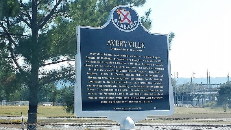
By Karen Emerson-McPeak, September 26, 2017
Averyville Marker
| 1 ► Alabama, Jackson County, Stevenson — Averyville — |
| On Old Mount Carmel Road (County Route 85) at Ohio Avenue, on the left when traveling west on Old Mount Carmel Road. | |||
| 2 ► Alabama, Limestone County, Capshaw — Nicholas Davis — |
| On Nick Davis Road (County Road 44) 0.5 miles west of Sanderson Road (County Road 127), on the left when traveling west. | |||
| 3 ► Arkansas, Phillips County, Helena — Answering a Call for Help — |
| On Walnut Street at Perry Street, on the right when traveling north on Walnut Street. | |||
| 4 ► Delaware, Kent County, Camden — KC-41 — Camden — |
| On U.S. 13 at E. Camden-Wyoming Ave. (Delaware Route 10) on U.S. 13. | |||
| 5 ► Delaware, Kent County, Camden — K-50 — Star Hill A.M.E. Church — |
| On Voshells Mill Star Hill Road at Lingo Drive on Voshells Mill Star Hill Road. | |||
| 6 ► Delaware, Kent County, Camden, Camden Wyoming — KC-73 — Camden Friends Meeting — Burial Place of John Hunn — |
| On East Camden-Wyoming Ave.. | |||
| 7 ► Delaware, Kent County, Camden, Camden Wyoming — John Hunn — 1814 - 1894 — Quaker Abolitionist — |
| On East Camden-Wyoming Ave.. | |||
| 8 ► Delaware, Kent County, Magnolia — KC-90 — Murderkill / Motherkiln Friends Meeting — |
| On South State Street close to Quaker Hill Road. | |||
| 9 ► Delaware, Kent County, Magnolia — KC-91 — Warner Mifflin — 1745 - 1798 — |
| On South State Street close to Quaker Hill Road. | |||
| 10 ► Delaware, Kent County, Smyrna — Site of the Duck Creek Society of Friends — |
| On Duck Creek Parkway. | |||
| 11 ► Delaware, New Castle County, Hockessin — NC-198 — Hockessin Friends Meetinghouse — |
| On Old Wilmington Road. | |||
| 12 ► Delaware, New Castle County, Newark, Iron Hill Park — Ninety Years Recording the Black Population of Pencader Hundred: The U.S. Census — Iron Hill Museum & Science Center — Delaware Academy of Science — |
| Near South Old Baltimore Pike east of Whittaker Road, on the right when traveling west. | |||
| 13 ► Delaware, New Castle County, Newport — NC-96 — Ashley Mansion — |
| On Maryland Avenue (Delaware Route 4) at Ashley Place, on the right when traveling east on Maryland Avenue. | |||
| 14 ► Delaware, New Castle County, Odessa — NC-90 — Appoquinimink Friends Meeting House — |
| On Main Street, 0.1 miles west of US 13 South, on the right when traveling east. | |||
| 15 ► Delaware, New Castle County, Wilmington — NC-150 — Old Town Hall — |
| On N. Market Street, on the right when traveling north. | |||
| 16 ► Delaware, New Castle County, Wilmington, Alapocas — NC-102 — Wilmington Friends School — |
| 17 ► Delaware, New Castle County, Wilmington, Alapocas Run State Park — A Family Company — |
| On Northern Delaware Greenway Trail, on the right when traveling south. | |||
| 18 ► Delaware, New Castle County, Wilmington, Alapocas Run State Park — Joseph Bancroft and His Legacy — |
| Near Northern Delaware Greenway Trail, on the left when traveling north. | |||
| 19 ► Delaware, New Castle County, Wilmington, Compton Village — Wilmington Historic Trail — |
| On North Walnut Street (Business U.S. 13) at East 7th Street on North Walnut Street. | |||
| 20 ► Delaware, New Castle County, Wilmington, Quaker Hill — NC-76 — Meeting House 1816 — Religious Society of Friends — |
| On 4th Street at West Street, on the right when traveling west on 4th Street. | |||
| 21 ► Delaware, New Castle County, Wilmington, Quaker Hill — NC-88 — Thomas Garrett — Stationmaster on the Underground Railroad — |
| On West 4th Street (Route 9) at Shipley Street, on the right when traveling east on West 4th Street. | |||
| 22 ► Delaware, New Castle County, Wilmington, Quaker Hill — NC-125 — Wilmington Friends Meeting — Burial Place of Thomas Garrett — |
| On 5th Street at Washington Street, on the left when traveling west on 5th Street. | |||
| 23 ► Delaware, New Castle County, Wilmington, Quaker Hill — Woodward Houses — 701-703 North West Street — |
| On North West Street just north of West 7th Street, on the left when traveling north. | |||
| 24 ► Delaware, New Castle County, Wilmington, Riverfront — NC-128 — Freedom Lost |
| On South Market Street (Business U.S. 13) at South Shipley Street, on the right when traveling south on South Market Street. Reported permanently removed. | |||
| 25 ► Delaware, New Castle County, Wilmington, Riverfront — The Underground Railroad — Riverfront Wilmington — |
| On South Market Street (Business U.S. 13) south of South Shipley Street, on the right. | |||
| 26 ► Delaware, New Castle County, Wilmington, Riverfront — Thomas Garrett — (b. August 21, 1789 - d. January 24, 1871) — |
| On Rosa Parks Drive at South King Street, on the right when traveling east on Rosa Parks Drive. | |||
| 27 ► District of Columbia, Washington, Northwest Washington, Adams Morgan — Archaeology in Adams Morgan — Surveying the Cemeteries in Walter Pierce Park, 2005-2013 |
| On Calvert Street Northwest at Biltmore Street Northwest, on the left when traveling east on Calvert Street Northwest. Reported permanently removed. | |||
| 28 ► District of Columbia, Washington, Northwest Washington, Adams Morgan — Archaeology in Adams Morgan: Surveying the Walter Pierce Park Cemeteries, 2005-2013 — |
| On Calvert Street Northwest at 20th Street Northwest, on the right when traveling west on Calvert Street Northwest. | |||
| 29 ► District of Columbia, Washington, Northwest Washington, Adams Morgan — Rediscovery and Remembrance — Hallowed Ground — Rock Creek Park, National Park Service, U.S. Department of the Interior — |
| On Calvert Street Northwest at 20th Street Northwest, on the right when traveling west on Calvert Street Northwest. | |||
| 30 ► District of Columbia, Washington, Northwest Washington, Adams Morgan — Resilience and Resistance — Hallowed Ground — Rock Creek Park, National Park Service, U.S. Department of the Interior — |
| On Calvert Street Northwest at 20th Street Northwest, on the right when traveling west on Calvert Street Northwest. | |||
| 31 ► District of Columbia, Washington, Northwest Washington, Cleveland Park — Peirce Still House — National Register of Historic Places — 2400 Tilden Street Northwest — |
| On Shoemaker Street Northwest south of Tilden Street Northwest, on the left when traveling south. | |||
| 32 ► District of Columbia, Washington, Northwest Washington, Cleveland Park — The Highlands — 3825 Wisconsin Avenue Northwest — |
| Near Wisconsin Avenue Northwest north of Quebec Street Northwest, on the right when traveling north. | |||
| 33 ► District of Columbia, Washington, Northwest Washington, U Street Corridor — "Sometimes I Feel Like A Motherless Child" — |
| On U Street Northwest east of 14th Street Northwest, on the right when traveling west. | |||
| 34 ► Florida, Alachua County, Micanopy — F-75 — William Bartram — (1739-1823) — |
| On NE Cholokka Blvd (County Road 234), on the left. | |||
| 35 ► Florida, Martin County, Hobe Sound — F-57 — Jonathan Dickinson Shipwreck — |
| 36 ► Georgia, Burke County, Sardis — 017-1 — Old Quaker Road — |
| On Waynesboro Highway (Georgia Route 24), on the left when traveling north. | |||
| 37 ► Georgia, Burke County, Waynesboro — 017-2 — Old Quaker Road — |
| On South Liberty Street (State Highway 24) at U.S. 25, on the left when traveling west on South Liberty Street. | |||
| 38 ► Georgia, Columbia County, Appling — 036-4 — Columbia County — |
| On Appling Harlem Road (US 221,State Road 47) near Shucraft Road, on the left when traveling north. | |||
| 39 ► Georgia, Jefferson County, Wrens — 081-5 — Old Quaker Road — |
| On North Main Street (U.S. 1) at Old Quaker Road, on the right when traveling south on North Main Street. | |||
| 40 ► Georgia, McDuffie County, Thomson — 094-5 — Wrightsboro — |
| On Wrightsboro Road, 0.5 miles west of Stagecoach Road, on the left when traveling west. | |||
| 41 ► Georgia, McDuffie County, Thomson — Wrightsboro Friends Meeting House — |
| On Wrightsboro Road, 0.6 miles east of Ridge Road, on the right when traveling east. | |||
| 42 ► Illinois, Saline County, Harrisburg — Cain Church — |
| Near South Feazel Street just north of Bauman Lane, on the right when traveling north. | |||
| 43 ► Indiana, Allen County, Fort Wayne, Spy Run — Meshekinnoquah — (Chief Little Turtle) — |
| On Lawton Place, 0.1 miles east of Spy Run Avenue, on the right when traveling east. | |||
| 44 ► Indiana, Fountain County, Stone Bluff — Progressive Friends Church Memorial — Dedicated October 8, 1864 — |
| On County Road 140 W at County Road 350 N, on the left when traveling north on County Road 140 W. | |||
| 45 ► Indiana, Hamilton County, Atlanta — 29.2016.1 — Roberts Settlement — |
| On E. 276th Street, 0.8 miles east of U.S. 31, on the left when traveling east. | |||
| 46 ► Indiana, Hendricks County, Plainfield — Sugar Grove Meeting House — |
| On East County Road 600 South at Praay Place, on the right when traveling west on East County Road 600 South. | |||
| 47 ► Indiana, Hendricks County, Plainfield — 32.1972.1 — Western Yearly Meeting House — |
| On E. Main Street (U.S. 40) at Avon Avenue (State Road 267), on the right when traveling east on E. Main Street. | |||
| 48 ► Indiana, Jay County, Balbec — 38.1972.1 — West Grove — |
| On W County Road 650N, 0.4 miles east of N Country Road 750W, on the left when traveling east. | |||
| 49 ► Indiana, LaPorte County, La Porte — Quaker Cemetery — |
| On Park Street at County Road N 100W, on the left when traveling north on Park Street. | |||
| 50 ► Indiana, Marion County, Indianapolis, Downtown — Randolph County — Organized in 1818 — Named for Thomas Randolph — |
| Near North Blackford Street north of Indianapolis Cultural Trail, on the right when traveling north. | |||
| 51 ► Indiana, Marion County, Indianapolis, Downtown — Susan B. Anthony — (February 15, 1820 - March 13, 1906) — |
| On West Walnut Street east of North Pierson Street, in the median. | |||
| 52 ► Indiana, Morgan County, Monrovia — West Union Friends Meeting — |
| On State Road 42 just west of Northwest Union Road, on the right when traveling west. | |||
| 53 ► Indiana, Parke County, Bloomingdale — 61.1970.1 — Dennis Hall — Western Manual Labor School — Friends Bloomingdale Academy — |
| On Bank Street, on the right when traveling east. | |||
| 54 ► Indiana, Randolph County, Winchester — 68 2013.1 — Amanda Way — |
| On Indiana Route 32, on the right when traveling west. | |||
| 55 ► Indiana, Randolph County, Winchester — 68.2010.1 — Randolph County Quakers — |
| On E. Washington Street (State Road 32) at S. East Street, on the right when traveling east on E. Washington Street. | |||
| 56 ► Indiana, Randolph County, Winchester, White River Township — Organized Religion — |
| On West Franklin Street at South Main Street, on the right when traveling west on West Franklin Street. | |||
| 57 ► Indiana, Tippecanoe County, Lafayette — The Buddell Sleeper House — Underground Railroad Station — |
| On West 700 South at South 550 West, on the right when traveling east on West 700 South. | |||
| 58 ► Indiana, Tippecanoe County, Westpoint — Farmers Institute Academy — |
| On County Road W 660 S west of County Road S 375 W, on the right when traveling west. | |||
| 59 ► Indiana, Tippecanoe County, Westpoint — Underground Railroad |
| On County Road W 700 S east of Road S 550 W, on the right when traveling east. Reported permanently removed. | |||
| 60 ► Indiana, Wayne County, Dublin — 89.2003.1 — Indiana’s First Woman’s Rights Convention — |
| On Cumberland Street (U.S. 40) west of Davis Street, on the right when traveling west. | |||
| 61 ► Indiana, Wayne County, Fountain City — 89.2002.1 — Levi Coffin — |
| On Cross Street (U.S. 27) at South Water Street, on the right when traveling north on Cross Street. | |||
| 62 ► Indiana, Wayne County, Richmond — Mendenhall-Clay Debate / Confrontation — |
| On N A Street (U.S. 40) at 7th Street, on the right when traveling west on N A Street. | |||
| 63 ► Iowa, Cedar County, West Branch — Friends Meetinghouse — |
| Near North Downey Street. | |||
| 64 ► Iowa, Cedar County, West Branch — Raised With Quaker Values — Herbert Hoover National Historic Site — |
| On South Downey Street, on the left when traveling south. | |||
| 65 ► Iowa, Cedar County, West Branch — Schoolhouse |
| Near Poplar Street. Reported permanently removed. | |||
| 66 ► Kansas, Johnson County, Merriam — 07 — Education in Merriam — Merriam Historic Plaza Walking Path — |
| 67 ► Kansas, Johnson County, Merriam — 02 — Shawnee Friends Mission — Merriam Historic Plaza Walking Path — |
| 68 ► Kansas, Johnson County, Merriam — 1 — Shawnee Friends Mission — |
| On 63rd Terrace, 0.1 miles west of Carter Avenue, on the right when traveling west. | |||
| 69 ► Maine, Cumberland County, Portland, Old Port — 9 — Friends (Quaker) Meeting House — Portland Maine Freedom Trail — |
| On Pearl Street at Federal Street, on the right when traveling north on Pearl Street. | |||
| 70 ► Maryland, Anne Arundel County, Friendship — Holly Hill — |
| On Friendship Road (Maryland Route 261) 0.1 miles south of Fairhaven Road (Route 423), on the left when traveling south. | |||
| 71 ► Maryland, Anne Arundel County, Galesville — Overlooking West River — Cedar Park, Tulip Hill — |
| On Muddy Creek Road, 0.1 miles east of Galesville Road, on the right when traveling east. | |||
| 72 ► Maryland, Anne Arundel County, Galesville — Welcome to Galesville — |
| On Main Street. | |||
| 73 ► Maryland, Anne Arundel County, Galesville, Churchton — Site of First Quaker Regional Gathering — |
| Near Galesville Road. | |||
| 74 ► Maryland, Anne Arundel County, West River — Old Quaker Burying Ground — 1672 — |
| On Owensville Road (Maryland Route 255) at Muddy Creek Road (Maryland Route 468), on the left when traveling east on Owensville Road. | |||
| 75 ► Maryland, Anne Arundel County, West River — William Penn — |
| On Owensville Road (Maryland Route 255) 1.4 miles east of Solomon's Island Road (Maryland Route 2). | |||
| 76 ► Maryland, Anne Arundel County, West River — William Penn — |
| On Galesville Road, 0.8 miles east of Muddy Creek Road (Maryland Route 468). | |||
| 77 ► Maryland, Baltimore, Clifton Park — The Samuel and Anne Hopkins Grand Staircase and Tower Restoration, Clifton Mansion — |
| On Indian Head Drive just east of St. Lo Drive, on the left when traveling east. | |||
| 78 ► Maryland, Baltimore, Cold Spring — Ruscombe — |
| On Spring Garden Drive. | |||
| 79 ► Maryland, Baltimore, Coldstream - Homestead - Montebello — Patapsco Friends Meeting House — |
| Near Harford Road. | |||
| 80 ► Maryland, Baltimore, Jonestown — 1781 Friends Meeting House — |
| On North Asiquith Street at East Fayette Street, on the right when traveling north on North Asiquith Street. | |||
| 81 ► Maryland, Baltimore, Jonestown — McKim Free School — |
| On East Baltimore Street at North Aisquith Street on East Baltimore Street. | |||
| 82 ► Maryland, Baltimore, Jonestown — On to Yorktown — Washington-Rochambeau Revolutionary Route Historic Tail — Road to Victory — |
| On East Baltimore Street, on the right when traveling west. | |||
| 83 ► Maryland, Baltimore, Mid-Town Belvedere — Tyson House — |
| On Cathedral Street, on the left when traveling south. | |||
| 84 ► Maryland, Baltimore, Mount Pleasant Park — Taylor’s Chapel — |
| Near Hillen Road. | |||
| 85 ► Maryland, Baltimore, Pigtown — The Underground Railroad — The Historic National Road, America's First Federally Funded Highway — |
| On South Poppleton Street just south of West Pratt Street, on the left when traveling east. | |||
| 86 ► Maryland, Baltimore County, Ellicott City — The George Ellicott House — |
| On Frederick Road (Maryland Route 144) at Westchester Avenue on Frederick Road. | |||
| 87 ► Maryland, Caroline County, Denton — 33 — Caroline County Visitor Center — Abolitionists Abound — Harriet Tubman Underground Railroad Byway — |
| On Crouse Park Lane west of Gay Street (Maryland Route 404), on the right when traveling west. | |||
| 88 ► Maryland, Caroline County, Denton — 34 — Tuckahoe Neck Meeting House — Living Their Beliefs — Harriet Tubman Underground Railroad Byway — |
| On Meeting House Road. | |||
| 89 ► Maryland, Caroline County, Preston — 23 — Leverton House — Finding Safe Haven — Harriet Tubman Underground Railroad Byway — |
| On Seaman Road. | |||
| 90 ► Maryland, Caroline County, Preston — 24 — Linchester Mill — Living Dangerously — Harriet Tubman Underground Railroad Byway — |
| On Linchester Road (Route 817) at Main Street (Maryland Route 331), on the left when traveling west on Linchester Road. | |||
| 91 ► Maryland, Caroline County, Preston — Mt. Pleasant Cemetery — Dangerous Rendezvous — Harriet Tubman Underground Railroad Byway — |
| On Marsh Creek Road. | |||
| 92 ► Maryland, Caroline County, Preston — The Underground Railroad — Seed of War — |
| On Linchester Road, 0.1 miles north of Maryland Route 331, on the right when traveling south. | |||
| 93 ► Maryland, Carroll County, Union Bridge — “Pipe Creek Meeting” — |
| On Quaker Hill Road, 0.2 miles south of Ladiesburg Road, on the left when traveling south. | |||
| 94 ► Maryland, Cecil County, Calvert — Calvert Village — |
| On Telegraph Road (Maryland Route 273) at Rosebank Road, on the right when traveling east on Telegraph Road. | |||
| 95 ► Maryland, Dorchester County, Cambridge — Agents on the Underground Railroad — |
| On Washington Street (Maryland Route 343) at Ocean Gateway (U.S. 50), on the right when traveling west on Washington Street. | |||
| 96 ► Maryland, Harford County, Kingsville — Jerusalem Mills — |
| On Jerusalem Road, 0.2 miles west of Jericho Road, on the left when traveling west. | |||
| 97 ► Maryland, Howard County, Ellicott City — Friends Meeting House and Graveyard — |
| On Old Columbia Pike, 0.2 miles south of Main Street, on the left when traveling south. | |||
| 98 ► Maryland, Howard County, Lisbon — New Lisbon — Servicing Travelers on the National Pike — The Historic National Road - The Road That Built The Nation — |
| On Historic National Road (Maryland Route 144), on the left when traveling west. | |||
| 99 ► Maryland, Montgomery County, Brookeville — Briggs House — War of 1812 Bicentennial — United States Capital for a Day — |
| On Market Street east of South Street, on the right when traveling east. | |||
| 100 ► Maryland, Montgomery County, Brookeville — The Rachel Carson Greenway — |
| Near Zion Road south of Sundown Road, on the right when traveling north. | |||
611 entries matched your criteria. The first 100 are listed above. Next 100 ⊳