1281 entries match your criteria. The first 100 are listed. ⊳
National Historic Landmarks Historical Markers
Nationally significant historic places designated by the Secretary of the Interior because they possess exceptional value or quality in illustrating or interpreting the heritage of the United States. Today, fewer than 2,500 historic places bear this national distinction.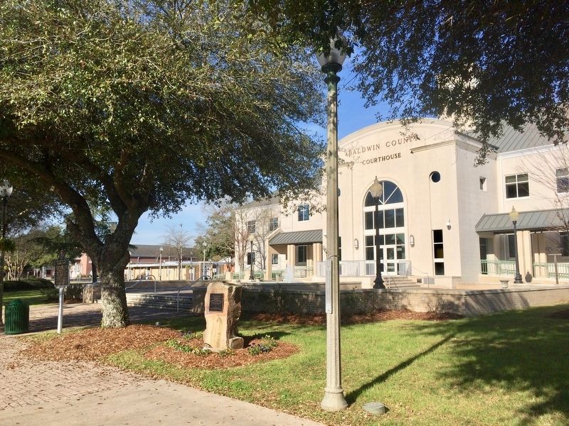
By Mark Hilton, January 14, 2017
Bottle Creek Site Marker in front of Baldwin County Courthouse.
| 1 ► Alabama, Baldwin County, Bay Minette — Bottle Creek Site — |
| On Courthouse Square (U.S. 31) at Hand Avenue, on the left when traveling east on Courthouse Square. | |||
| 2 ► Alabama, Colbert County, Cherokee — Barton Hall — |
| Near Cedar Lane (County Road 15) 0.7 miles south of U.S. 72, on the right when traveling east. | |||
| 3 ► Alabama, Colbert County, Tuscumbia — Ivy Green — Birthplace of Helen Keller — |
| 4 ► Alabama, Dallas County, Selma — Brown Chapel A.M.E. Church — Selma to Montgomery National Historic Trail — |
| On Martin Luther King Street, 0.1 miles south of Clark Avenue, on the right when traveling south. | |||
| 5 ► Alabama, Dallas County, Selma — Edmund Pettus Bridge — National Historic Landmark — |
| On Broad Street (Business U.S. 80) at Water Avenue, on the right when traveling south on Broad Street. | |||
| 6 ► Alabama, Dallas County, Selma — I Had A Dream — Dr. Martin L. King Jr. — |
| On Martin Luther King Street north of Selma Avenue, on the right when traveling north. | |||
| 7 ► Alabama, Elmore County, Wetumpka — Here Stood Fort Toulouse — |
| Near West Fort Toulouse Road, 0.3 miles west of Jackson Park Road, on the right when traveling west. | |||
| 8 ► Alabama, Hale County, Moundville — Moundville — |
| On Mound Parkway at State Highway 69, on the right when traveling west on Mound Parkway. | |||
| 9 ► Alabama, Hale County, Moundville — Moundville Archaeological Park — Alabama Indigenous Mound Trail — |
| On Mound Parkway, 0.6 miles west of Alabama Route 69, on the right when traveling west. | |||
| 10 ► Alabama, Hale County, Prairieville — St. Andrew’s Church — (Episcopal) — Prairieville — |
| On County Road 12 west of State Highway 69, on the right when traveling west. | |||
| 11 ► Alabama, Jefferson County, Birmingham — Rev. Fred Shuttlesworth Bethel Baptist Church — |
| On 29th Avenue North at 33rd Street North, on the right when traveling east on 29th Avenue North. | |||
| 12 ► Alabama, Jefferson County, Birmingham — Sixteenth Street Baptist Church — |
| Near 6th Avenue North at 16th Street North. | |||
| 13 ► Alabama, Jefferson County, Birmingham — Sloss Furnaces — |
| Near 1st Avenue North (U.S. 11) near 32nd Street North. | |||
| 14 ► Alabama, Jefferson County, Birmingham — The Blowing Engine Room — Sloss Furnaces National Historic Landmark — |
| Near 32nd Street North. | |||
| 15 ► Alabama, Jefferson County, Birmingham — The Gas System — Sloss Furnaces National Historic Landmark — |
| Near 32nd Street North. | |||
| 16 ► Alabama, Lauderdale County, Florence — Wilson Dam — |
| Near South Cox Creek Parkway, 0.5 miles east of Veterans Drive (Alabama Route 133), on the right when traveling south. | |||
| 17 ► Alabama, Madison County, Huntsville — Saturn V — |
| Near Tranquility Base, 0.5 miles west of Old Madison Pike NW, on the left when traveling west. | |||
| 18 ► Alabama, Madison County, Huntsville — The Church Of The Nativity, Episcopal — |
| On Eustis Avenue Southeast, on the right when traveling east. | |||
| 19 ► Alabama, Marengo County, Demopolis — Gaineswood — |
| On South Cedar Avenue at East Whitfield Street, on the right when traveling north on South Cedar Avenue. | |||
| 20 ► Alabama, Mobile County, Mobile — Government Street Presbyterian Church — |
| On Government Street (U.S. 98) at South Jackson Street, on the right when traveling west on Government Street. | |||
| 21 ► Alabama, Mobile County, Mobile — United States Ship Alabama (BB-60) — Battleship Memorial Park — |
| Near Battleship Parkway (U.S. 90) east of Dunlap Drive. | |||
| 22 ► Alabama, Montgomery County, Montgomery — Alabama State Capitol — |
| Near North Bainbridge Street at Dexter Avenue, on the right when traveling north. | |||
| 23 ► Alabama, Montgomery County, Montgomery — Alabama's First Capitals / The Alabama State Capitol — |
| On South Bainbridge Street at Dexter Avenue, on the right when traveling north on South Bainbridge Street. | |||
| 24 ► Alabama, Montgomery County, Montgomery — Dexter Avenue King Memorial Baptist Church — Organized 1877 — |
| On Dexter Avenue at S Decatur Street, on the left when traveling west on Dexter Avenue. | |||
| 25 ► Alabama, Montgomery County, Montgomery — The Frank M. Johnson, Jr. Federal Building and US Courthouse — |
| On Church Street at Lee Street, on the right when traveling north on Church Street. | |||
| 26 ► Alabama, Montgomery County, Montgomery — Train Shed 1897 — National Historic Landmark — |
| Near Water Street. | |||
| 27 ► Alabama, Russell County, Fort Mitchell — Fort Mitchell — <----- 5 miles ----- — |
| Near U.S. 165. | |||
| 28 ► Alabama, Russell County, Fort Mitchell — Fort Mitchell — National Historic Landmark — |
| On Alabama Route 165, on the right when traveling north. | |||
| 29 ► Alabama, Tuscaloosa County, Tuscaloosa — Site Of The Stand In The Schoolhouse Door / Foster Auditorium, 1939 — |
| Near 6th Avenue at 8th Street. | |||
| 30 ► Alaska, Sitka Borough, Sitka — Alaska Native Brotherhood Hall — Has Been Designated a National Historic Landmark — |
| On Katlian Street, on the left when traveling north. | |||
| 31 ► Alaska, Sitka Borough, Sitka — American Flag Raising Site — |
| 32 ► Alaska, Sitka Borough, Sitka — Russian Mission Orphanage — |
| On Lincoln Street at Monastery Street, on the right when traveling west on Lincoln Street. | |||
| 33 ► Alaska, Sitka Borough, Sitka — St. Michael's Cathedral — |
| On Lincoln Street when traveling east. | |||
| 34 ► Alaska, Sitka Borough, Sitka — St. Michael's Russian Orthodox Cathedral — |
| On Lincoln Street, on the left when traveling east. | |||
| 35 ► Alaska, Sitka Borough, Sitka — Tilson Building — |
| On Lincoln Street, on the right when traveling east. | |||
| 36 ► Alaska, Skagway — Skagway and White Pass — |
| Near 2nd Street. | |||
| 37 ► American Samoa, Maʻopūtasi County, Utulei — Blunts Point Naval Gun Site — |
| Near American Samoa Route 001. | |||
| 38 ► Arizona, Cochise County, Bisbee — Phelps Dodge General Office Building — |
| On Main Street, on the right when traveling east. | |||
| 39 ► Arizona, Cochise County, Douglas — San Bernardino Ranch — |
| Near East San Bernardino Road at Slaughter Ranch Road, on the right. | |||
| 40 ► Arizona, Cochise County, Hereford — Lehner Mammoth Kill Site — |
| On Lehner Road, 2 miles north of Palominas Road & State Highway 92, on the left when traveling east. | |||
| 41 ► Arizona, Cochise County, Huachuca City — Fort Huachuca — (1877) — |
| On Arizona Route 90 at milepost 314, on the right when traveling south. | |||
| 42 ► Arizona, Cochise County, Sierra Vista — Fort Huachuca — |
| On Grierson Avenue at Boyd Avenue, on the right when traveling south on Grierson Avenue. | |||
| 43 ► Arizona, Cochise County, Tombstone — Tombstone City Hall — Opened in 1882 — |
| On East Fremont Street (State Highway 80), on the right when traveling east. | |||
| 44 ► Arizona, Coconino County, Flagstaff — Lowell Observatory — National Historic Landmark — |
| Near West Mars Hill Road, 0.6 miles west of West Santa Fe Avenue. | |||
| 45 ► Arizona, Coconino County, Grand Canyon National Park — 1956 Grand Canyon TWA-United Airlines Aviation Accident Site — |
| Near Desert View Road, 0.5 miles north of Desert View Drive. | |||
| 46 ► Arizona, Coconino County, Grand Canyon National Park — Hopi House — Mary Elizabeth Jane Colter |
| Reported missing. | |||
| 47 ► Arizona, Coconino County, Grand Canyon National Park — Lookout Studio — |
| 48 ► Arizona, Coconino County, Grand Canyon National Park — Santa Fe Depot — |
| 49 ► Arizona, Coconino County, Grand Canyon National Park — The Watchtower — Mary Elizabeth Jane Colter — |
| 50 ► Arizona, Coconino County, Grand Canyon Village — Bright Angel Cabin 88 & 89 — Constructed in the 1890's — |
| Near Village Loop Drive, 0.4 miles west of El Tovar Road, on the right when traveling west. | |||
| 51 ► Arizona, Coconino County, Grand Canyon Village — El Tovar — |
| On El Tovar Road north of Village Loop Drive, in the median. | |||
| 52 ► Arizona, Coconino County, Grand Canyon Village — Hermit's Rest — |
| Near Hermit Road, on the right when traveling west. | |||
| 53 ► Arizona, Coconino County, Grand Canyon Village — Hopi House — |
| On El Tovar Road, 0.1 miles north of Village Loop Drive, on the right when traveling west. | |||
| 54 ► Arizona, Coconino County, Grand Canyon Village — Rest House — |
| On Hermits Road, on the right when traveling south. | |||
| 55 ► Arizona, Maricopa County, Scottsdale, North Scottsdale — Taliesin West — UNESCO World Heritage Site — |
| On Taliesin Drive, 1 mile north of Frank Lloyd Wright Boulevard. | |||
| 56 ► Arizona, Navajo County, Fort Apache — Theodore Roosevelt School (118) — |
| On Barracks Row, on the left when traveling west. | |||
| 57 ► Arizona, Navajo County, Holbrook — Painted Desert Inn — |
| On Petrified Forest Road, on the left when traveling east. | |||
| 58 ► Arizona, Navajo County, Whiteriver — Kinishba Ruins — |
| 59 ► Arizona, Navajo County, Winslow — Barringer Meteor Crater — |
| Near Meteor Crater Road south of Interstate 40, on the right when traveling east. | |||
| 60 ► Arizona, Pima County, Green Valley — Titan II Intercontinental Ballistic Missile Museum — |
| Near West Duval Mine Road. | |||
| 61 ► Arizona, Pima County, Tucson, Downtown — Pima County Courthouse — Historic Site — |
| Near Church Avenue, on the right when traveling south. | |||
| 62 ► Arizona, Pima County, Tucson, Menlo Park — Desert Laboratory — |
| On Tumamoc Hill Road, 0.7 miles south of West Anklam Road, on the right when traveling south. | |||
| 63 ► Arizona, Pima County, Tucson, Mission Valley — Mission San Xavier del Bac — |
| Near San Xavier Road. | |||
| 64 ► Arizona, Santa Cruz County, Tumacacori — Mission San José de Tumacácori — |
| On East Frontage Road, on the right when traveling north. | |||
| 65 ► Arizona, Santa Cruz County, Tumacacori — 87001437 — Tumacacori Museum — National Historic Landmark — |
| Near Interstate 19 Frontage Road, on the right when traveling north. | |||
| 66 ► Arizona, Yavapai County, Jerome — Jerome, Arizona — Too Strong to Die — |
| On Main Street (Arizona Route 89A), on the right when traveling east. | |||
| 67 ► Arizona, Yuma County, Yuma — Yuma Crossing — |
| On North 4th Avenue at West 1st Street, on the right when traveling south on North 4th Avenue. | |||
| 68 ► Arizona, Yuma County, Yuma — Yuma Crossing Park — |
| Near North 4th Avenue. | |||
| 69 ► Arkansas, Desha County, Rohwer — Rohwer Relocation Center Memorial Cemetery — |
| Near State Highway 1, 0.5 miles north of Rohwer Road, on the left when traveling north. | |||
| 70 ► Arkansas, Monroe County, Holly Grove — Initial Point of the Louisiana Purchase Survey — |
| On Baseline Road (State Highway 362) 1.8 miles east of U.S. 49. | |||
| 71 ► Arkansas, Monroe County, Holly Grove — Louisiana Purchase State Park — Louisiana Purchase Historic State Park — |
| Near State Highway 362, 1.8 miles east of U.S. 49. | |||
| 72 ► Arkansas, Monroe County, Holly Grove — The Opening of the American West — Louisiana Purchase Historic State Park — |
| Near State Highway 362, 1.8 miles east of U.S. 49. | |||
| 73 ► Arkansas, Monroe County, Holly Grove — Two Lines Mark the Future of the United States — Louisiana Purchase Historic State Park — |
| Near State Highway 362, 1.8 miles east of U.S. 49. | |||
| 74 ► Arkansas, Ouachita County, Chidester — Confederate and Federal Forces Engage — Panel 3 — |
| On Arkansas Route 76, 0.2 miles east of County Road 175, on the left when traveling east. | |||
| 75 ► Arkansas, Ouachita County, Chidester — Federal Forage Party Departs Camden April 17, 1864 — Panel 2 — |
| Near Arkansas Route 76, 1.2 miles west of County Road 100, on the right when traveling west. | |||
| 76 ► Arkansas, Ouachita County, Chidester — Forage Party Routed! — Panel 4 — |
| On Arkansas Route 76, 1.2 miles west of County Road 100, on the right when traveling west. | |||
| 77 ► Arkansas, Ouachita County, Chidester — The Civil War Battle of Poison Spring - April 18, 1864 — Turning Point of the Red River Campaign in Arkansas — Panel 1 — |
| Near Arkansas Route 76, 1.2 miles west of County Road 100, on the right when traveling west. | |||
| 78 ► Arkansas, Pulaski County, Little Rock, M.L.K. — Daisy Bates House — |
| On West 28th Street west of South Cross Street, on the left when traveling west. | |||
| 79 ► California, Alameda County, Alameda — 1029 — The Jimmy Doolittle Pier – Alameda Naval Air Station — Pier No. 3 — USS Hornet — |
| Near Hornet Avenue at Ferry Point. | |||
| 80 ► California, Alameda County, Berkeley, Southside — First Church of Christ, Scientist — Bernard Maybeck, Architect, 1910 — |
| On Dwight Way at Bowditch Street, on the left when traveling east on Dwight Way. | |||
| 81 ► California, El Dorado County, Coloma — Coloma — An Artists View — |
| On State Highway 49, on the left when traveling south. | |||
| 82 ► California, Humboldt County, Eureka — Indian/Gunther Island Site 67 (Tolowot) — |
| Near Startare Drive. | |||
| 83 ► California, Inyo County, Independence — 850 — Manzanar — |
| On Highway 395, on the right when traveling south. | |||
| 84 ► California, Inyo County, Ridgecrest — Coso Rock Art District — Big and Little Petroglyph Canyon — National Historic Landmark — |
| Near China Lake Boulevard. | |||
| 85 ► California, Kern County, Delano — The Forty Acres — |
| On Cesar Chavez Lane, 2.6 miles west of U.S. 99, on the right. | |||
| 86 ► California, Kern County, Onyx — 99 — Walker's Pass — |
| On Isabella Walker Pass Road (State Highway 178 at milepost 79.8), on the right when traveling east. | |||
| 87 ► California, Los Angeles County, Los Angeles, Downtown Los Angeles — 6 — Bradbury Building — |
| On Broadway at 3rd Street, on the left when traveling south on Broadway. | |||
| 88 ► California, Los Angeles County, Los Angeles, Downtown Los Angeles — 313 — Hompa Hongwanji Buddhist Temple — |
| Near 1st Street at Central Avenue, on the right when traveling west. | |||
| 89 ► California, Los Angeles County, Los Angeles, Downtown Los Angeles — 312 — Union Church — Union Center for the Arts — |
| On Judge John Aiso Street (San Pedro Street) north of 1st Street, on the right when traveling north. | |||
| 90 ► California, Los Angeles County, Los Angeles, Downtown Los Angeles — United States Court House — And Post Office — |
| On North Spring Street just north of Temple Street, on the right when traveling north. | |||
| 91 ► California, Los Angeles County, Los Angeles, East Hollywood — 12 — Hollyhock House — UNESCO World Heritage Site — |
| Near Hollywood Boulevard east of Edgemont Street, on the right when traveling east. | |||
| 92 ► California, Los Angeles County, Los Angeles, Echo Park — Angelus Temple — |
| On Glendale Boulevard at Park Avenue, on the right when traveling north on Glendale Boulevard. | |||
| 93 ► California, Los Angeles County, Los Angeles, Pacific Palisades — 381 — Eames House — National Historic Landmark — |
| Near Chautauqua Boulevard, 0.2 miles north of Pacific Coast Highway (California Route 1), on the left when traveling north. | |||
| 94 ► California, Los Angeles County, Los Angeles, San Pedro — S.S. Lane Victory — Port of Los Angeles — |
| On Pier 94 east of the Catalina Air-Sea Terminal Heliport. | |||
| 95 ► California, Los Angeles County, Los Angeles, Silver Lake — Neutra Studio and Residences — |
| On Silver Lake Boulevard, 0.2 miles south of Glendale Boulevard, on the left when traveling south. | |||
| 96 ► California, Los Angeles County, Los Angeles, South Los Angeles — 960 — Los Angeles Memorial Coliseum — |
| Near Figueroa Street south of Exposition Boulevard, on the right when traveling south. | |||
| 97 ► California, Los Angeles County, Los Angeles, South Los Angeles — 174 — Village Green — Baldwin Hills Village — |
| On Obama Boulevard at Cloverdale Avenue, on the right when traveling east on Obama Boulevard. | |||
| 98 ► California, Los Angeles County, Los Angeles, South Los Angeles — 993 — Watts Towers — National Historic Landmark — Watts Towers of Simon Rodia State Historic Park — |
| On 107th Street east of Graham Avenue, on the left when traveling east. | |||
| 99 ► California, Los Angeles County, Monrovia — 14 — Upton Sinclair House — |
| On Myrtle Avenue at Scenic Drive, on the right when traveling north on Myrtle Avenue. | |||
| 100 ► California, Los Angeles County, Pasadena — Hale Solar Laboratory — |
| Near Holladay Road south of Lombardy Road, on the left when traveling south. | |||
1281 entries matched your criteria. The first 100 are listed above. Next 100 ⊳