1283 entries match your criteria. Entries 101 through 200 are listed.⊲ Previous 100 — Next 100 ⊳
National Historic Landmarks Historical Markers
Nationally significant historic places designated by the Secretary of the Interior because they possess exceptional value or quality in illustrating or interpreting the heritage of the United States. Today, fewer than 2,500 historic places bear this national distinction.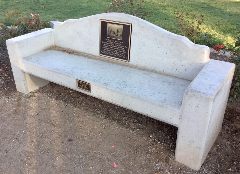
By Craig Baker, October 4, 2018
Rose Bowl Marker
| 101 ► California, Los Angeles County, Pasadena, North Arroyo — 1942 Rose Bowl — |
| On North Arroyo Boulevard, 0.2 miles north of Seco Street. | |||
| 102 ► California, Los Angeles County, Pasadena, North Arroyo — Space Flight Operations Facility — Jet Propulsion Laboratory — |
| Near Oak Grove Drive, 0.3 miles north of Foothill Boulevard. | |||
| 103 ► California, Los Angeles County, Pasadena, North Arroyo — 871 — The Gamble House — |
| Near Westmoreland Place north of Arroyo Terrace, on the right when traveling south. | |||
| 104 ► California, Los Angeles County, Santa Clarita, Stevenson Ranch — 516 — First Commercial Oil Well In California — Pico #4 — |
| Near Pico Canyon Road, 4.5 miles west of Interstate 5. | |||
| 105 ► California, Los Angeles County, Santa Monica — The Santa Monica Pier Carousel — |
| On Colorado Avenue west of Ocean Avenue, on the left when traveling west. | |||
| 106 ► California, Marin County, Point Reyes — Drakes Bay — |
| Near Limantour Road, 8 miles west of Bear Valley Road. | |||
| 107 ► California, Marin County, San Rafael — 999 — Marin County Civic Center — |
| Near Peter Behr Drive. | |||
| 108 ► California, Mariposa County, Wawona — Wawona Hotel — |
| On Wawona Road. | |||
| 109 ► California, Mariposa County, Yosemite National Park — A Home for Rangers — |
| On Village Drive, on the left when traveling west. | |||
| 110 ► California, Mariposa County, Yosemite National Park — LeConte Memorial Lodge — Sierra Club — Founded 1892 — |
| On Southside Drive, on the right when traveling east. | |||
| 111 ► California, Mariposa County, Yosemite National Park — The Grand Lodge — |
| Near Ahwahnee Drive, on the right when traveling east. | |||
| 112 ► California, Modoc County, Newell — 850-2 — Tule Lake — May 1942 - March 1946 — |
| On Emigrant Trails Scenic Byway (Route 139) at County Road 176, on the right when traveling north on Emigrant Trails Scenic Byway. | |||
| 113 ► California, Mono County, Bodie — 341 — Bodie — |
| On Bypass Road, 0.2 miles California Route 270, on the right when traveling west. | |||
| 114 ► California, Monterey County, Monterey — 1 — Custom House — |
| On Olivier Street. | |||
| 115 ► California, Monterey County, Monterey — 106 — Larkin House — |
| On Calle Principal near Jefferson Street, on the left when traveling north. | |||
| 116 ► California, Monterey County, Monterey — 105 — Royal Presidio Chapel — |
| On Church Streeet at Figueroa Street, on the left when traveling west on Church Streeet. | |||
| 117 ► California, Monterey County, Pacific Grove — Balance Lost and Found Again — Asilomar Conference Center — |
| 118 ► California, Nevada County, Truckee — 134 — Donner Party — |
| Near 12593 Donner Pass Road. | |||
| 119 ► California, Orange County, Modjeska Canyon — 205 — Modjeska's Home — |
| On Modjeska Canyon Road at Olive Hill Road, on the right when traveling east on Modjeska Canyon Road. | |||
| 120 ► California, Riverside County, Riverside — 1060 — Harada House — 1884 — |
| On Lemon Street north of 4th Street, on the right when traveling north. | |||
| 121 ► California, Riverside County, Riverside — 761 — Mission Inn — |
| Near Mission Inn Avenue, on the right when traveling west. | |||
| 122 ► California, Sacramento County, Folsom — 633 — Original Folsom Hydroelectric Plant — |
| Near Riley Street. | |||
| 123 ► California, Sacramento County, Locke — Locke / 樂居镇 — |
| Near Main Street south of Locke Road, on the right when traveling south. | |||
| 124 ► California, Sacramento County, Locke — Locke Memorial Park — |
| On Main Street, on the right when traveling south. | |||
| 125 ► California, Sacramento County, Sacramento, Central Business District — 614 — Leland Stanford House — |
| 126 ► California, Sacramento County, Sacramento, Midtown — 525 — Sutter's Fort — This Tree Came From Kandern, Baden, Germany — The Birthplace of General John A. Sutter — |
| 127 ► California, Sacramento County, Sacramento, Old Sacramento — 606 — B.F. Hastings Bank Building — Western Terminus of the Pony Express — |
| On 2nd Street south of I Street, on the left when traveling south. | |||
| 128 ► California, Sacramento County, Sacramento, Old Sacramento — 812 — Old Sacramento — |
| On 2nd Street, on the left when traveling south. | |||
| 129 ► California, Sacramento County, Sacramento, Old Sacramento — The River Lines Fleet — |
| Near Capital Mall. | |||
| 130 ► California, Sacramento County, Walnut Grove — Walnut Grove, Est. 1850/Locke, Est. 1915 — |
| On River Road (County Road E13) at Levee Road, on the right when traveling north on River Road. | |||
| 131 ► California, San Benito County, San Juan Bautista — Anza House — |
| On Third Street at Franklin Street, on the left when traveling west on Third Street. | |||
| 132 ► California, San Benito County, San Juan Bautista — San Juan Bautista Plaza Historic District — |
| On Second Street south of Mariposa Street, on the right when traveling south. | |||
| 133 ► California, San Diego County, Agra — Las Flores Adobe — Built in 1868 — |
| 134 ► California, San Diego County, Coronado — 844 — Hotel del Coronado — |
| 135 ► California, San Diego County, Oceanside — 239 — Mission San Luís Rey de Francia — |
| Near North El Camino Real north of Mission Avenue, on the right when traveling north. | |||
| 136 ► California, San Diego County, San Diego — 53 — Estudillo House — |
| Near San Diego Avenue at Mason Street. | |||
| 137 ► California, San Diego County, San Diego — 1031 — Ferryboat "Berkeley" — Maritime Museum of San Diego — |
| On North Harbor Drive at Ash Street, on the left when traveling north on North Harbor Drive. | |||
| 138 ► California, San Diego County, San Diego — 53 — La Casa de Estudillo — |
| Near Mason Street. | |||
| 139 ► California, San Diego County, San Diego — 52 — Mission Dam and Flume — |
| Near Father Junipero Serra Trail, on the right when traveling west. | |||
| 140 ► California, San Diego County, San Diego — 242 — Mission San Diego de Alcala — |
| 141 ► California, San Diego County, San Diego — 59 — San Diego Presidio Site — |
| Near Presidio Drive. | |||
| 142 ► California, San Diego County, Spring Valley — 626 — Bancroft Ranch House — |
| Near Memory Lane east of Bancroft Drive. | |||
| 143 ► California, San Diego County, Vista — 940 — Rancho Guajome — |
| Near Santa Fe Avenue, 2 miles south of California Route 76, on the right when traveling south. | |||
| 144 ► California, San Diego County, Warner Springs — 311 — Warner Ranch House — |
| On San Felipe Road (County Highway 52) 0.7 miles east of Highway 79, on the left when traveling east. | |||
| 145 ► California, San Francisco City and County, San Francisco, Financial District — Bank of Italy — (Later Bank of America) — |
| On Montgomery Street near Clay Street, on the left when traveling south. | |||
| 146 ► California, San Francisco City and County, San Francisco, Fisherman's Wharf — Liberty Ships – Born in World War II — 1941 to 1943 — Liberty Ship SS Jeremiah O’Brien - Alive and Steaming — |
| On Fisherman's Wharf - Pier 45 north of The Embarcadero. | |||
| 147 ► California, San Francisco City and County, San Francisco, Fort Mason — Fort Mason Historic District — U.S. Army Post (1864-1966) — |
| On San Francisco Bicycle Route 2 at Van Ness Avenue, on the right when traveling west on San Francisco Bicycle Route 2. | |||
| 148 ► California, San Francisco City and County, San Francisco, Marina District — Fort Mason Historic District — U.S. Army post (1864-1966) — |
| On Laguna Street at Marina Boulevard, on the right when traveling north on Laguna Street. | |||
| 149 ► California, San Francisco City and County, San Francisco, Presidio of San Francisco — Crissy Field — A Place of Renewal — |
| Near San Francisco Bay Trail near Marine Drive. | |||
| 150 ► California, San Francisco City and County, San Francisco, Presidio of San Francisco — 79 — Presidio of San Francisco — |
| On Funston Avenue at Lincoln Boulevard, on the right when traveling south on Funston Avenue. | |||
| 151 ► California, San Luis Obispo County, San Miguel — 326 — Mission San Miguel Arcangel — |
| Near Mission Street near El Camino Real (California Highway 101). | |||
| 152 ► California, San Luis Obispo County, San Simeon — 640 — Hearst San Simeon State Historical Monument — Hearst Castle — |
| Near Hearst Castle Road at Cabrillo Highway (California Highway 1). | |||
| 153 ► California, Santa Barbara County, Lompoc — La Purisima Mission State Historic Park — |
| Near Purisima at Mission Gate Road. | |||
| 154 ► California, Santa Barbara County, Santa Barbara — Santa Barbara County Courthouse — |
| Near Anacapa Street at E. Anapamu Street. | |||
| 155 ► California, Santa Barbara County, Santa Barbara, Upper East — Santa Barbara Mission — |
| Near Los Olivos Street at Laguna Street, on the left when traveling north. | |||
| 156 ► California, Santa Barbara County, Solvang — 305 — Mission Santa Inéz — |
| Near Mission Drive. | |||
| 157 ► California, Santa Barbara County, Vandenberg Space Force Base — Space Launch Complex 10 — Vandenberg Air Force Base — |
| Near Aero Road. | |||
| 158 ► California, Santa Clara County, San Jose, Almaden — 339 — New Almaden — (The New Mine) — After Almaden Mine in Spain — |
| On Bertram Way, on the left when traveling east. | |||
| 159 ► California, Santa Cruz County, Santa Cruz — ACE Roller Coaster Landmark — Giant Dipper — |
| Near Beach Street. | |||
| 160 ► California, Santa Cruz County, Santa Cruz — Giant Dipper — Thrilling riders since 1924 — |
| Near Beach Street. | |||
| 161 ► California, Santa Cruz County, Santa Cruz — Magical Merry-go-round — |
| On Beach Street at Riverside Avenue, on the right when traveling east on Beach Street. | |||
| 162 ► California, Siskiyou County, Tulelake — Lower Klamath National Wildlife Refuge — |
| On Lower Klamath Auto Tour Route. | |||
| 163 ► California, Sonoma County, Glen Ellen — 743 — Jack London Historical State Park — |
| Near London Ranch Road, 1 mile west of Arnold Drive. | |||
| 164 ► California, Sonoma County, Petaluma — 18 — Vallejo's Petaluma Adobe — |
| Near Adobe Road at Casa Grande Road, on the right when traveling south. | |||
| 165 ► California, Sonoma County, Santa Rosa — 234 — Luther Burbank Home — |
| Near Sonoma Avenue at Santa Rosa Avenue. | |||
| 166 ► California, Sonoma County, Sonoma — 316 — Sonoma Barracks — |
| Near East Spain Street near First Street East. | |||
| 167 ► California, Sonoma County, Sonoma, Sonoma Plaza — Sonoma Plaza — |
| Near East Napa Street (State Highway 12) west of First Street East, on the right when traveling west. | |||
| 168 ► California, Stanislaus County, Knights Ferry — Knight's Ferry Bridge — National Historic Landmark — |
| Near Covered Bridge Road east of Sonora Road (Main Street), on the right when traveling east. | |||
| 169 ► California, Tuolumne County, Columbia — 123 — Columbia — |
| On Broadway St. at Church Street, on the left when traveling north on Broadway St.. | |||
| 170 ► California, Tuolumne County, Columbia — 123 — Columbia — ← 2 Miles — |
| On Golden Chain Highway (State Highway 49), on the right when traveling south. | |||
| 171 ► California, Tuolumne County, Yosemite National Park — Parsons Memorial Lodge — |
| Near Tioga Pass Road, on the left when traveling east. | |||
| 172 ► California, Ventura County, Piru — 553 — Rancho Camulos — National Historic Landmark — |
| On State Highway 126, 2 miles east of Piru, on the right when traveling east. | |||
| 173 ► Colorado, Clear Creek County, Georgetown — Cushman Block I, 1872 — Georgetown-Silver Plume National Historic Landmark District — |
| On Sixth Street at Taos Street, on the right when traveling west on Sixth Street. | |||
| 174 ► Colorado, Clear Creek County, Georgetown — Cushman Block II, 1872/1875 — Georgetown-Silver Plume National Historic Landmark District — |
| On Sixth Street at Taos Street, on the right when traveling west on Sixth Street. | |||
| 175 ► Colorado, Clear Creek County, Georgetown — Fish Block, 1889 — Georgetown-Silver Plume National Historic Landmark District — |
| On Sixth Street at Rose Street, on the right when traveling west on Sixth Street. | |||
| 176 ► Colorado, Clear Creek County, Georgetown — Hotel de Paris, 1875-90 — Georgetown-Silver Plume National Historic Landmark District — |
| On Sixth Street at Taos Street, on the right when traveling east on Sixth Street. | |||
| 177 ► Colorado, Clear Creek County, Georgetown — John Tomay Memorial Library 1924 — Georgetown-Silver Plume National Historic Landmark District — |
| On Sixth Street at Rose Street, on the right when traveling east on Sixth Street. | |||
| 178 ► Colorado, Clear Creek County, Georgetown — Star Hook and Ladder Building 1886 — Georgetown-Silver Plume National Historic Landmark District — |
| On Sixth Street at Griffith Street, on the left when traveling east on Sixth Street. | |||
| 179 ► Colorado, Clear Creek County, Georgetown — Tucker Brothers Store, ca. 1870 — Georgetown-Silver Plume National Historic Landmark District — |
| On Sixth Street just west of Taos Street, on the right when traveling east. | |||
| 180 ► Colorado, Conejos County, Sanford — 43 — Pike's Stockade — |
| On County Road 24, 0.8 miles south of County Road Y, on the right when traveling east. | |||
| 181 ► Colorado, El Paso County, Colorado Springs, Cascade — Pike's Peak — |
| 182 ► Colorado, El Paso County, Colorado Springs, West Colorado Springs — Garden of the Gods Park — |
| On Gateway Road, on the right when traveling east. | |||
| 183 ► Colorado, Gilpin County, Central City — Central City — |
| On Main Street (State Highway 279) at Spring Street on Main Street. | |||
| 184 ► Colorado, La Plata County, Durango — Durango - Silverton Narrow Gauge Railroad — |
| On Main Avenue at 5th Street, on the right when traveling south on Main Avenue. | |||
| 185 ► Colorado, Larimer County, Estes Park — Beaver Meadows Visitor Center — A Legacy of Frank Lloyd Wright — National Historic Landmark — |
| Near Moraine Avenue (U.S. 36) 0.8 miles west of State Highway 66, on the left when traveling west. | |||
| 186 ► Colorado, Las Animas County, Ludlow — Ludlow Tent Colony Site Memorial — The Ludlow Massacre — |
| Near Road 44 at 61.5. | |||
| 187 ► Colorado, Montezuma County, Cortez — Mesa Verde Administrative District — |
| Near State Highway 10. | |||
| 188 ► Colorado, Prowers County, Granada — Amache - Granada Relocation Center — |
| Near County Road 235/10 south of West Amache Road. | |||
| 189 ► Colorado, Prowers County, Granada — Granada Relocation Center (Amache) — |
| On 23 5/10, 0.5 miles south of Highway 50/385, on the right when traveling south. | |||
| 190 ► Connecticut, Fairfield County, Darien — The Mather Homestead — Darien Heritage Trail — |
| On Brookside Road north of Stephen Mather Road, on the left when traveling north. | |||
| 191 ► Connecticut, Hartford County, West Hartford — Noah Webster Birthplace — |
| 192 ► Connecticut, Litchfield County, Cornwall, Cornwall Bridge — First Foreign Mission School — |
| On Bolton Hill Road at Pine Street, on the left when traveling west on Bolton Hill Road. | |||
| 193 ► Connecticut, Litchfield County, Litchfield — Earliest American Law School |
| On South Street (Connecticut Route 63) 0.2 miles south of East Street (U.S. 202), on the right when traveling south. Reported permanently removed. | |||
| 194 ► Connecticut, Litchfield County, Litchfield — Litchfield Historic District — |
| On East Street (U.S. 202) at North Street (Connecticut Route 63), on the left when traveling west on East Street. | |||
| 195 ► Connecticut, New Haven County, New Haven, Downtown — New Haven Green — |
| On Church Street at Court Street, on the left when traveling north on Church Street. | |||
| 196 ► Connecticut, New Haven County, New Haven, Downtown — Welcome to the New Haven Green — |
| On Temple Street north of Elm Street, on the left when traveling south. | |||
| 197 ► Connecticut, New Haven County, New Haven, Downtown — Welcome to the New Haven Green — |
| On College Street at Elm Street, on the right when traveling north on College Street. | |||
| 198 ► Connecticut, New Haven County, New Haven, Downtown — Welcome to the New Haven Green — |
| On Chapel Street at College Street, on the left when traveling east on Chapel Street. | |||
| 199 ► Connecticut, New Haven County, New Haven, Downtown — Welcome to the New Haven Green — |
| On Church Street at Chapel Street, on the left when traveling north on Church Street. | |||
| 200 ► Connecticut, New Haven County, New Haven, Downtown — Welcome to the New Haven Green — |
| On Chapel Street at Temple Street, on the left when traveling east on Chapel Street. | |||
1283 entries matched your criteria. Entries 101 through 200 are listed above. ⊲ Previous 100 — Next 100 ⊳