113 entries match your criteria. The first 100 are listed. The final 13 ⊳
Maryland Historical Trust Historical Markers
Launched in 1933, the roadside historical marker program has proven an effective way to draw attention to the many events, people and places that have contributed to the richness of our state and nation. The marker program is administered in cooperation with the Maryland State Highway Administration.
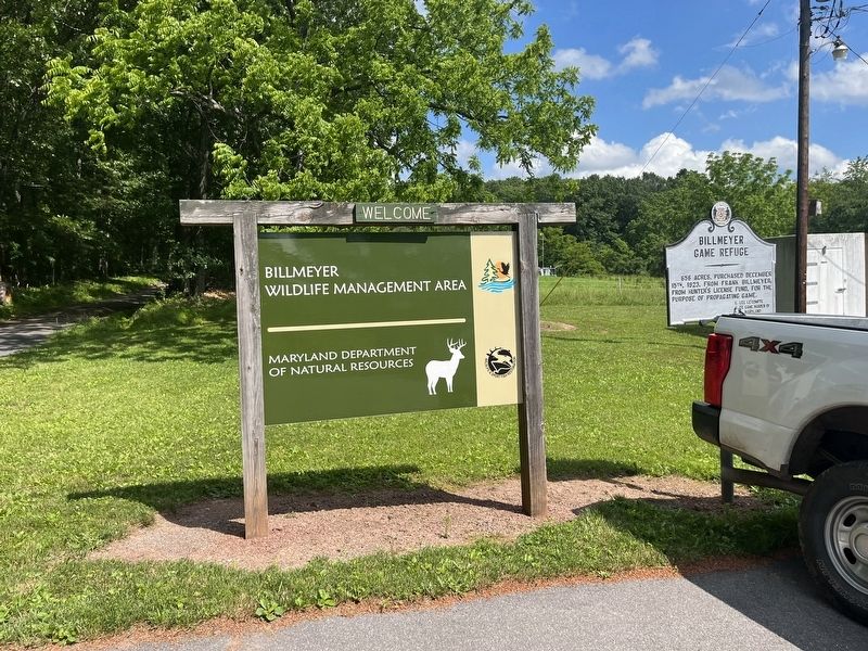
656 acres, purchased December 15th, 1923, from Frank Billmeyer; from Hunter's License Fund, for the purpose of propagating game. — — Map (db m199927) HM
Near this point, on June 10, 1755, after nearly a month's delay at Fort Cumberland, Braddock's troops started towards Fort Duquesne to wrest it from the French. On July 9, 1755, he met his terrible defeat at the Monongahela. — — Map (db m155433) HM
One of the most picturesque spots around Cumberland. Discovered by Spendelow after the road over Wills Mountain had been constructed by General Braddock. Adopted as the route of the Cumberland Road (The National Road) 1833. The old stone bridge . . . — — Map (db m187070) HM
A log chapel dedicated to St. Mary was built on this site in 1791. The first parishioners were mostly English Catholics from Southern Maryland. A brick church replaced the log building in 1939. Cumberland became a major center of transportation and . . . — — Map (db m134394) HM
Here in Evitts Creek Valley
on August 1, 1864,
General McCausland's Confederate
cavalry, returning after burning
Chambersburg, was surprised by
General Kelley's Union troops from
Cumberland. The Confederates
were repulsed and retreated . . . — — Map (db m19320) HM
Jane Frazier
wife of
Lieut. John Frazier
was captured by Indians near this spot in October 1755 and taken to the Miami River. She escaped after eighteen months and made her way back to her home. — — Map (db m402) HM
On this site originally stood the Headquarters of George Washington, since removed to Riverside Park. He was entertained at David Lynn's house (which later occupied this site) when he came here in 1794 to review the troops during the Whisky . . . — — Map (db m155434) HM
By order of Colonel Bouquet, George Washington’s troops opened this road from Fort Cumberland to Reas-town (Bedford, Pa.) during July 1758. Bouquet and Washington conferred half-way between these places July 30, 1758. — — Map (db m166865) HM
War path of the five nations from central New York to the Carolinas. One of the longest Indian trails in America, crossed this highway about this point. — — Map (db m3489) HM
50 acres, purchased December 13, 1930, from Perry Barnes and wife; from Hunter's License Fund for the purpose of propagating game. — — Map (db m199926) HM
During colonial exploration and settlement the valley provided a route to the western frontier. In 1753, preceding the French and Indian War, George Washington traveled this route to deliver Gov. Dinwiddie's order that the French abandon their . . . — — Map (db m84736) HM
First toll gate house on the old National (Cumberland) Road. Erected about 1833 after this portion of the road was turned over to the State of Maryland by the United States government. There was one other toll gate in Maryland on this Road. — — Map (db m442) HM
Was the first of the internal improvements undertaken by the U.S. Government. Surveys were authorized in 1806 over the route of “Braddock’s Road,” which followed “Nemacolin’s Path,” an Indian trail, over which George . . . — — Map (db m167131) HM
On March 25, 1655, colonial Governor William Stone landed Maryland militia at the Puritan settlement of Providence, located at the mouth of the Severn River. He planned to subdue the settlers who had asserted their independence from the government . . . — — Map (db m53178) HM
During the Revolutionary War, 1200 Continental Light Infantrymen under the command of Marquis de Lafayette encamped on the rise behind this sign en route to the decisive battle in Yorktown, Va. They arrived in Annapolis from Head of Elk by a . . . — — Map (db m2907) HM
Chartered in 1865 by the Maryland General Assembly after a fire at the State House in 1863. Waterworks began operation in 1866, designed by noted civil engineer William Rich Hutton, who had recently completed Washington Aqueduct. Innovative concrete . . . — — Map (db m51852) HM
Located in this vicinity, one of three camps established during the Civil War to accept paroled Union prisoners of war for Confederate prisoners similarly confined in the south. Over the course of the war, thousands of soldiers were held here until . . . — — Map (db m66303) HM
At this site, anonymously buried slaves were found during road construction in 1960. These unclaimed individuals were associated with the Locust Grove plantation founded by 1848. The remains were reburied at Mt. Tabor Church in nearby Chesterfield. . . . — — Map (db m114877) HM
An African American community and church were established nearby in the mid 19th century. In 1918 the Benevolent Sons and Daughters of Abraham, a mutual aid society, purchased and donated land on this site for a two-room school which was built . . . — — Map (db m49729) HM
Came here to the home of Col. Thomas Tailler on “the ridge” December 13, 1682 for his first conference with Charles Lord Baltimore as to the location of the boundary line between Maryland and Pennsylvania. — — Map (db m3042) HM
Growth of railways advanced the development of suburban communities in the early 20th century. Linthicum Heights was platted in 1908 along two interurban railroads by the Linthicum family to take advantage of direct transportation to Washington, . . . — — Map (db m8142) HM
Portland Landing
and
Saint Jerome's
Surveyed 1700
Owned by Col. Henry Darnall
brother-in-law of Charles,
3rd Lord Baltimore and
Secretary of State. — — Map (db m3142) HM
Only known World War I chapel in the United States. Consecrated in 1918 to minister to the soldiers at Camp Meade and serve as permanent mission in the village of Odenton. Designed in the Arts and Crafts style by Riggin Buckler. Used by all . . . — — Map (db m3162) HM
Established in the mid 19th century on land owned by Capt. James Spencer, who served in the Union Army during the Civil War, Freetown illustrates the principles of self-sufficiency and cooperation typical of African American communities. The first . . . — — Map (db m13567) HM
WB&A Road was constructed on the right-of-way of the main line of the Washington, Baltimore & Annapolis Electric Railroad. Using the most advanced technology of the time, the high-speed line provided passenger and freight service between Baltimore . . . — — Map (db m35050) HM
Born in England about 1603, he emigrated to Virginia about 1628, and he came to Maryland about 1648. He brought with him nine settlers, and many others followed. He obtained about 5,000 acres located in St. Mary’s, Charles and Calvert counties.
. . . — — Map (db m2889) HM
All Hallows Parish, South River, one of the original thirty parishes created by law in 1692 when the Anglican Church was established in Maryland. The present Georgian church was built c. 1730. Several prominent London Town merchants are buried in . . . — — Map (db m2941) HM
Named for Quartermaster General Samuel B. Holabird (1826-1907) and established in 1917 as the Army's first motor transport training center and depot. Supplied World War I American Expeditionary Forces in France with Detroit-made vehicles. Trained . . . — — Map (db m115239) HM
Property purchased in 1800 by Charles Carroll, signer of the Declaration of Independence, as a wedding present for his only son, Charles and bride Harriett Chew of Philadelphia. The younger Charles designed and oversaw the building of the . . . — — Map (db m18315) HM
Although the United States banned the Transatlantic Slave Trade in 1808, a domestic trade from the Upper South to the emerging cotton-growing regions of the Deep South thrived until the 1860's. Baltimore-based dealers supplied the trade, operating . . . — — Map (db m71935) HM
Established as a port of entry in 1706, this peninsula was originally known as Whetstone Point. Along this road in 1814, soldiers marched to the defense of Fort McHenry, nearby. Port facilities served as a Federal supply camp in the Civil War. Later . . . — — Map (db m2561) HM
Originally the estate of Major General Samuel Smith (1752-1839). In 1881 Lake Montebello began service as a drinking water supply for Baltimore when connected by tunnel with Loch Raven reservoir. Montebello water filtration plant was completed in . . . — — Map (db m96029) HM
On hill to the north stood the Georgian mansion built c. 1775 by Daniel Bowley II (1745–1807), Baltimore merchant and patriot of the revolution. He was a town commissioner, 1771–1778, and three times a State Senator. In 1814, British soldiers . . . — — Map (db m242400) HM
During the War of 1812, a circular 180° earthen artillery redoubt was erected as a defense for Fort McHenry. On September 13, 1814, Lt. George Budd commanded naval forces that assisted in repulsing a nighttime British attack on the Ferry Branch . . . — — Map (db m36849) HM
Babe Ruth was born in 1895, a few blocks northwest of here on Emory Street. In 1902 the seven-year-old was sent to Saint Mary's Industrial School, a home for unwanted children in southwest Baltimore. On the school's playfields he became an . . . — — Map (db m136346) HM
The first national strike began July 16, 1877, with Baltimore and Ohio Railroad workers in Martinsburg, West Virginia, and Baltimore Maryland. It spread across the nation halting rail traffic and closing factories in reaction to widespread worker . . . — — Map (db m63862) HM
Wrestling was a popular sport in Maryland in the early 20th century. Baltimore was the base for nationally known professionals Gus “Americus” Schoenlein, Frank “Shad” Link, Frank Lynch, Harry Scroggs, “Kid” Taylor . . . — — Map (db m60957) HM
Oldest cemetery for African Americans in Baltimore, founded in 1872 by Rev. James Peck, pastor, and trustees of Sharp Street Methodist Episcopal Church. Dating to 1787, the congregation served the community and was influential in the freedom . . . — — Map (db m13540) HM
In this valley 7031 acres laid out, 1683, for Charles, Third Lord Baltimore. Opened to settlers, 1721 by Charles, Fifth Lord Baltimore. Frederick, Sixth Lord Baltimore, ordered manor sold, 1766. Land remaining 1782 seized and sold as confiscated . . . — — Map (db m129902) HM
Marble from this quarry, located about a mile to the south, was used to build the Washington Monument in Baltimore. Designed by architect Robert Mills and erected between 1815 and 1829. This was the first public monument erected to George . . . — — Map (db m137696) HM
On September 10, 1935, Black students Lucille Scott and Margaret Williams were denied admittance to Catonsville High School. NAACP attorney Thurgood Marshall filed suit. Although they lost the case, Maryland's Court of Appeals . . . — — Map (db m128246) HM
On May 17, 1968, nine Catholic activists raided the Selective Service office in Catonsville and burned several hundred draft files to protest the Vietnam War. In a highly-publicized trial, the “Nine”, who included priests Daniel and Philip Berrigan, . . . — — Map (db m136419) HM
First commercial aviation facility in Maryland. Veteran World War I pilots formed club and opened Dundalk Flying Field in 1919. Renamed to honor stunt p1lot Lt. Patrick Logan, who was killed in crash during club's first major air meet. Became . . . — — Map (db m4338) HM
Developed by the Pennsylvania Steel Company in 1887-91, the Sparrows Point Steel plant and shipyard were purchased by Bethlehem Steel in 1916, and grew to become the largest in the world. Vital supplier of steel and ships during both the World Wars. . . . — — Map (db m95977) HM
Oldest Methodist Congregation in Maryland worshipping in its original location. Organized as Fork Meeting by Robert Strawbridge. Land near “The Forks of the Gunpowder” given in 1771 by James Baker, who converted to Methodism under the . . . — — Map (db m1928) HM
Called for a branch of that name on which Native Americans practiced a spiritual purification ceremony. Still done today, by generating steam from heated rocks in a sacred lodge while prayers are made. — — Map (db m1923) HM
Civil Engineer, graduated West Point 1822. Among engineer officers sent to assist railroad companies, surveyed first route of B&O, 1827. Resigned commission to pursue distinguished railroad career. Enlisted in Confederate Army after Baltimore riots, . . . — — Map (db m40864) HM
Patented to Richard Smith, Jr. 10th August 1684 for 2500 acres. Daniel Dulaney acquired 1250 acres of this tract 19th November 1724, after which it was called “Dulaney’s Valley.” — — Map (db m2080) HM
East of this point is mile stone 46 on the line marked by English surveyors and astronomers Charles Mason and Jeremiah Dixon. From 1763-1768 Mason and Dixon used innovative methods to settle a boundary dispute between the colonial proprietors. Each . . . — — Map (db m96072) HM
Before the 19th Amendment was passed in 1920, American women were not guaranteed the right to vote. The National American Woman Suffrage Association organized a large parade in Washington, DC. for March 3, 1913. On February 12, a group of women . . . — — Map (db m74356) HM
Highly effective undercover agent during WWII. Declared by Gestapo the most dangerous Allied spy. Grew up at Box Horn Farm nearby. Hunting accident forced partial amputation of leg, barring her from a career in the U.S. Foreign Service. She played . . . — — Map (db m199023) HM
Early romantic suburb designed in 1889 by Frederick Law Olmsted, Sr., father of landscape architecture in America. On 204 acres of James Howard McHenry’s “Sudbrook” estate. Olmsted designed a naturalistic landscape with curvilinear roads . . . — — Map (db m2266) HM
Franklin Academy founded January 10, 1820 by an Act of the General Assembly of Maryland. On January 25, 1849 became a public school. Was Reisterstown High School from 1874–1896. Became Franklin High School in 1897. — — Map (db m2062) HM
Created in 1830 as a change point, or "relay," for horses hauling the first scheduled railroad cars in the U.S. The first rail link to nation's capital began here. Thomas Viaduct carries the track across Patapsco gorge; completed in 1835, it is the . . . — — Map (db m8764) HM
At “19 mile stone” on York Road built in 1810 by Captain Joshua Gorsuch, a shipbuilder. The tavern was the meeting place of the Baltimore Countians who went to Pennsylvania to reclaim their slaves, thus bringing on the Christiana Riot of 1851. — — Map (db m2057) HM
Marble from this quarry, located nearby, was used to build the Washington Monument in Baltimore. Designed by architect Robert Mills and erected between 1815 and 1829, this was the first public monument erected to George Washington. The construction . . . — — Map (db m36850) HM
Built for the African American Community in 1874 as a school for children in the Loreley area and as home to this “benevolent” society, founded in 1872. Beginning in the late 18th century, such mutual aid societies, often formed by . . . — — Map (db m152189) HM
Built in 1828, the oldest operating lighthouse in Maryland. The prism lens used today was manufactured in Paris and installed in 1897. The original 38-foot tower was built of locally manufactured brick and was raised about 1912 to 51 feet. In 1953 . . . — — Map (db m3440) HM
Oldest standing one-room schoolhouse for
African American students in Calvert County.
Offered education for grades 1-7 in the
Wallville community. Illustrates the
segregated educational facilities of the late
19th and early 20th centuries. . . . — — Map (db m54367) HM
The first public high school for African Americans in Calvert County was opened in 1938 and served until desegregation in 1966. Named for William Sampson Brooks (1865–1934). Born in Calvert County, Rev. Brooks was an advocate of education, . . . — — Map (db m29522) HM
Emphasizing functional requirements as well as traditional Chesapeake Tidewater architecture, Gertrude Sawyer designed 26 Colonial Revival buildings for Patterson’s Point Farm from 1932 to 1955. A graduate of the first class (1919) of the . . . — — Map (db m80972) HM
JPPM archaeologists had long known that a stone house foundation, overgrown with weeds, sat in the woods in front of you. But who had lived there was a mystery. Then in 1996, two former local residents---Daniel and Minnie Octavia Gross . . . — — Map (db m81090) HM
You are now standing on the house site of Richard Smith, Sr., who in 1657 was appointed to fill the newly created office of Attorney General for Maryland.
The following year, this plantation---“St. Leonard’s---was used by the colonial General . . . — — Map (db m80970) HM
The Maryland Archaeological Conservation (MAC) Laboratory is a state-of-the-art archaeological research, conservation and collections facility. Opened in 1998, the Lab holds the State’s archaeological artifact collections. In the labs, the often . . . — — Map (db m81091) HM
During the period of racially segregated education, elementary school teacher Brown enlisted the N.A.A.C.P. and attorney Thurgood Marshall to challenge the inequity of separate salary scales for public school teachers based on race. Her case was . . . — — Map (db m5573) HM
Until it was named Federalsburg in 1812,
the community took its name from the bridge
at this crossing. This 215-foot concrete
structure was built in 1910 by the Luten
Bridge Company of York, Pennsylvania, a firm noted for
its filled Spanderel . . . — — Map (db m60467) HM
Originally built by John Miller in 1862 as a log cabin, the farmhouse was a brick-cased between 1866-1876 by Jonas Warner.
Inventory of Historic Properties Carr-1314 — — Map (db m135155) HM
Opened 1923 as Maryland's first tuberculosis sanatorium for African Americans. Treatment at the time sought to provide fresh air, good food, and sanitary living conditions; Henryton featured open porches, broad windows, and southern hillside . . . — — Map (db m80625) HM
In 1925, two years after the Maryland Tuberculosis Sanatorium opened in Henryton, a training school for nurses was established for black students in order to help manage the increasing patient population. The program was revised in 1945 to meet . . . — — Map (db m96080) HM
Established in 1909, became largest organization in Maryland advocating for women’s suffrage. Local chapters were founded throughout the state including in Westminster in 1913. By 1915 statewide membership numbered 17,000. The League’s campaign . . . — — Map (db m139586) HM
Land originally granted to Phillip Calvert, Chancellor of Maryland, and wife, Anne, in 1658. Richard Low, gentleman of Virginia, purchased tract known as "Hazelmore" and adjacent land "The Grove" in 1665. Bought by Abraham Wild, trader and mariner . . . — — Map (db m144250) HM
In the early 20th century, Maryland had no waiting period for issuing marriage licenses, and couples from throughout the Northeast flocked to Elkton—the first county seat south of the State line—where they could be married without delay. Independent . . . — — Map (db m237540) HM
Boyhood home of William Whann Mackall. Appointed to the U. S. Military Academy in 1834. Resigned from the U. S. Army, joined the Confederacy and served on the staffs of Generals Albert Sydney Johnston, Braxton Bragg and Joseph E. Johnston. General . . . — — Map (db m145439) HM
Crossed the Susquehanna River in five divisions and made their 23rd camp here at the end of August 1782 on the return from Yorktown victory to the north. — — Map (db m145428) HM
A leading iron producer during the Colonial period, Principio held Maryland’s first blast furnace, operating 1725, and first refinery forge, constructed 1728. After the American Revolution, Principio made cannons and other ordnance until the . . . — — Map (db m1481) HM
Born at this house at Creswell’s Ferry, now Port Deposit, in 1828, John Creswell graduated from Dickinson College and became a lawyer. He was elected to the General Assembly in 1861, became Adjutant General in 1862, was elected to Congress that same . . . — — Map (db m145442) HM
Named for Commodore William Bainbridge, who served in the Barbary Wars and the War of 1812. The U.S. Naval Training Center Bainbridge operated for 34 years. Beginning in 1942 as a recruit training command for World War II, and closing in 1976. The . . . — — Map (db m145443) HM
Built circa 1768 by merchant and tobacco farmer George Maxwell, Maxwell Hall features massive twin chimneys and foundation stones of English chert. Local tradition holds that in the War of 1812, the British invasion force took possession of Maxwell . . . — — Map (db m28317) HM
Charles County was created by the Maryland General Assembly in 1658. In 1674 the first Charles County Courthouse was built near here. In the area known as Moore's Lodge, a prison, ordinary (tavern), and race track also were located there. In 1727 . . . — — Map (db m81196) HM
February, 1766, Washington's schooner ran aground off this point. From his diary of August 25th, 1768, "Hauling seine upon the bar off Cedar Point for sheepshead but catched none." — — Map (db m116346) HM
Part of large tract reserved as public land by Cecilius Calvert, Lord Baltimore. Warrant issued 1667 to John Harrison for 600 acres of which 250 assigned to Thomas and Andrew Baker, called Harrison's gift. Colonel William Dent purchased in 1692. . . . — — Map (db m81195) HM
Born 1723 on "Coates Retirement" Plantation. Held the office of Charles County Justice, 1749-1764. Appointed 1760 to commission on Pennsylvania and Delaware boundary dispute, resulting in the Mason-Dixon boundary settlement. Moved to Annapolis by . . . — — Map (db m128614) HM
Last battle of the War of 1812 in the Chesapeake Bay. A tender to the British ship of war "Dauntless" was captured by Joseph Stewart and local militia near James Island on February 7, 1815. Ice along the shore allowed the militia to approach within . . . — — Map (db m4002) HM
The longrifle was a distinctly American weapon developed on the frontier for accuracy and distance. Produced mainly in Pennsylvania, Maryland and Virginia, it became known as the “Kentucky” rifle after a popular song commemorated its use by a . . . — — Map (db m1532) HM
Originally erected 1932 by the Federation of Rural Women's Clubs of Frederick County, MD., as part of a national movement to commemorate the bicentennial of Washington's birth through recognizing places noted in his diary.
Replaced 2016 . . . — — Map (db m102966) HM
Veteran of French and Indian War, early settler, head of family of Revolutionary patriots buried in the cemetery of homestead near here. At outset of the Revolution he and his sons Abraham, Basil, Daniel, John and his nephew Samuel were listed with . . . — — Map (db m203247) HM
"a large blast furnace— the stack wheel and bellows and all the buildings… are built in the best manner"
— From a notice in the Frederick Town Herald advertising the sale of the furnace property in 1871 workers employed or . . . — — Map (db m184182) HM
“The bones of Catoctin men and women show —almost literally— the effects of back-breaking labor. One elderly man's spine was so damaged by a lifetime of hard work that he was unable to stand up straight. Furnace labor and exposure to . . . — — Map (db m184333) HM
"This is, indeed, gross ingratitude…It would be a serious loss to me, if they would leave for Pennsylvania."
—John McPherson Brien, 1848, owner of Antietam Ironworks, Catoctin Furnace, and more than 60 enslaved men, women, and . . . — — Map (db m184331) HM
Some workers boarded1 others in their homes. In 1864, the rate for board was 12.5¢ for each meal. Single workers could also find housing in several nearby Boarding Houses.
Using scrip2 in . . . — — Map (db m184593) HM
General Braddock's 6th camp on the march to Fort Duquesne Saturday and Sunday June 20th and 21st, 1755. Washington was forced to remain behind with a guard on account of "violent fevers" until cured by "Dr. James's Powders (one of the most excellent . . . — — Map (db m135626) HM
The Casselman Inn. You are standing in front of the Casselman Inn, which was opened in 1842 by Solomon Sterner. This establishment has also been known as Sterner House, Drovers' Inn, Farmers' Hotel and Dorsey Hotel. There was a large outdoor . . . — — Map (db m360) HM
Granstville's Main Street, designated today as Alt. Route 40, was once part of the National Road, the country's first federally funded highway. Visit our Town Park to learn more about the history of the National Road.
Traffic on the National . . . — — Map (db m177981) HM
A nationwide program established by President Franklin D. Roosevelt to perform emergency natural resource conservation work on public lands. The C C C employed millions during the depression and set the standards for the development of our State and . . . — — Map (db m206732) HM
On April 7, 1970, 139 employees of the Garrett County Roads Department went on strike asking the Garrett County Commissioners to recognize their affiliation with the American Federation of State, County and Municipal Employees (AFSCME). After months . . . — — Map (db m235204) HM
"Suffrage hikes" were an effective tactic in gaining publicity and support for women's right to vote. From June 16-27, 1914, seven women from Baltimore crisscrossed Garrett County on foot. Marching nearly 100 miles and visiting 14 towns to spread . . . — — Map (db m152754) HM
113 entries matched your criteria. The first 100 are listed above. The final 13 ⊳