1604 entries match your criteria. The first 100 are listed. ⊳
Historical Markers and War Memorials in Colorado
By Mark Hilton, July 30, 2016
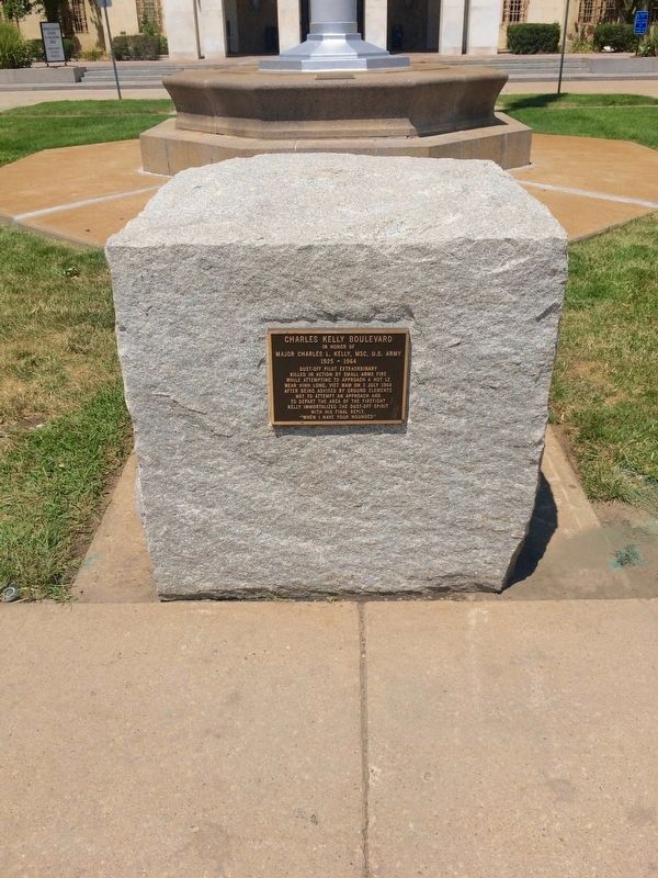
Charles Kelly Boulevard Marker
| 1 ► Colorado, Adams County, Aurora — Charles Kelly Boulevard — |
| On East 17th Place at Sharon A. Lane Drive, on the right on East 17th Place. | |||
| 2 ► Colorado, Adams County, Aurora — Colorado Freedom Memorial — |
| On North Telluride Street, 0.1 miles East 6th Avenue (Colorado Highway 30), on the right when traveling north. | |||
| 3 ► Colorado, Adams County, Aurora — Sharon A. Lane Drive — |
| On East 17th Place west of Victor Street, on the right when traveling west. | |||
| 4 ► Colorado, Adams County, Aurora — WWI Medical Staff Memorial — |
| Near East Montview Boulevard when traveling south. | |||
| 5 ► Colorado, Adams County, Bennett — 218 — Front Range Flight — |
| Near 15th Avenue at East Colfax Avenue. | |||
| 6 ► Colorado, Adams County, Brighton — Dedicated to the Pioneer Spirit of our Early Settlers — |
| On South Main Street at Bush Street, on the right when traveling south on South Main Street. | |||
| 7 ► Colorado, Adams County, Brighton — Historic City Hall — |
| Near East 160th Avenue (East Bridge Street) (State Highway 7) just east of South 4th Avenue (State Highway 2), on the right when traveling east. | |||
| 8 ► Colorado, Adams County, Buckley Air Force Base — Buckley — |
| Near Beaver Creek Street at A Basin Avenue. | |||
| 9 ► Colorado, Adams County, Commerce City — Early Years of Statehood — |
| Near Gateway Road, 0.7 miles north of Prairie Parkway (East 64th Avenue), on the left when traveling east. | |||
| 10 ► Colorado, Adams County, Commerce City — Habitat for Wildlife - A Rich History — |
| Near Gateway Road, 0.7 miles north of Prairie Parkway (East 64th Avenue), on the left when traveling east. | |||
| 11 ► Colorado, Adams County, Commerce City — Headquarters Area — |
| On East 72nd Avenue near Kenton Street, on the left when traveling east. | |||
| 12 ► Colorado, Adams County, Commerce City — Headquarters for a New Mission — |
| On East 72nd Avenue, on the left when traveling east. | |||
| 13 ► Colorado, Adams County, Commerce City — On This Site Stood the "White House" — |
| On East 72nd Avenue, on the left when traveling east. | |||
| 14 ► Colorado, Adams County, Commerce City — Rocky Mountain Arsenal National Wildlife Refuge — |
| Near Havana Street (Wildlife Drive), 0.6 miles north of East 64th Avenue (Wildlife Drive), on the right when traveling north. | |||
| 15 ► Colorado, Adams County, Commerce City — South Plants — Fabrica Sur — |
| Near Havana Street. | |||
| 16 ► Colorado, Adams County, Commerce City — The Fourteeners — |
| Near Gateway Road, 0.7 miles north of Prairie Parkway (East 64th Avenue), on the left when traveling east. | |||
| 17 ► Colorado, Adams County, Commerce City — Where's the Water? — |
| Near Gateway Road, 0.7 miles north of Prairie Parkway (East 64th Avenue), on the left when traveling east. | |||
| 18 ► Colorado, Adams County, Northglenn — Northglenn Veterans Memorial — |
| On Community Center Drive, 0.7 miles south of East 120th Avenue, on the right when traveling south. | |||
| 19 ► Colorado, Adams County, Thornton — Veterans Memorial Flag Pole — |
| On Grant Street. | |||
| 20 ► Colorado, Adams County, Westminster — 12 — Ma Barker's Gang — Westminster — [Lloyd William Barker] — |
| On West 73rd Avenue, 0.3 miles west of Lowell Boulevard, on the right when traveling west. | |||
| 21 ► Colorado, Adams County, Westminster — WFD Volunteers 1934 - 2000 — |
| On W 73rd Ave near Osceola Street. | |||
| 22 ► Colorado, Alamosa County, Alamosa — "Old Mose" — The King of the Grizzlies — |
| On 1st Street at Edgemont Boulevard, on the left when traveling east on 1st Street. | |||
| 23 ► Colorado, Alamosa County, Alamosa — 1988 NAIA Division 1 National Championship Runner-Up — |
| On 1st Street at Edgemont Boulevard, on the left when traveling east on 1st Street. | |||
| 24 ► Colorado, Alamosa County, Alamosa — Adams State College — |
| 25 ► Colorado, Alamosa County, Alamosa — Alamosa — |
| 26 ► Colorado, Alamosa County, Alamosa — Alamosa County — |
| 27 ► Colorado, Alamosa County, Alamosa — Alamosa Depot — |
| On State Avenue at the railroad tracks, on the right when traveling north on State Avenue. | |||
| 28 ► Colorado, Alamosa County, Alamosa — All Aboard for Alamosa! — |
| On Denver Avenue/Broadway Avenue (U.S. 160) at 4th Street, on the left when traveling north on Denver Avenue/Broadway Avenue. | |||
| 29 ► Colorado, Alamosa County, Alamosa — American Legion Building — |
| On Main Street (U.S. 160), on the left when traveling west. | |||
| 30 ► Colorado, Alamosa County, Alamosa — American National Bank Building — |
| On State Avenue at Main Street, on the right when traveling north on State Avenue. | |||
| 31 ► Colorado, Alamosa County, Alamosa — Denver & Rio Grande Western Locomotive No. 169 — |
| On Denver Avenue/Broadway Avenue (U.S. 160) at 4th Street, on the left when traveling north on Denver Avenue/Broadway Avenue. | |||
| 32 ► Colorado, Alamosa County, Alamosa — Emperius Building — |
| On State Avenue at Main Street (U.S. 160), on the right when traveling north on State Avenue. | |||
| 33 ► Colorado, Alamosa County, Alamosa — First Baptist Church — |
| On State Avenue north of Main Street (U.S. 160), on the right when traveling north. | |||
| 34 ► Colorado, Alamosa County, Alamosa — Millstone, c. 1845 — |
| On Edgemont Boulevard north of Main Street (U.S. 160/285), on the right when traveling north. | |||
| 35 ► Colorado, Alamosa County, Blanca — "The Magic Dog" — Los Caminos Antiguos Scenic & Historic Byway — |
| On State Highway 150, 0.2 miles north of U.S. 160, on the right when traveling north. | |||
| 36 ► Colorado, Alamosa County, Blanca — Los Caminos Antiguos — Los Caminos Antiguos Scenic & Historic Byway — |
| On State Highway 150, 0.2 miles north of U.S. 160, on the right when traveling north. | |||
| 37 ► Colorado, Alamosa County, Blanca — Lt. Zebulon Pike's Southwestern Expedition — 1806 - 7 — |
| On State Highway 150, 0.2 miles north of U.S. 160, on the right when traveling north. | |||
| 38 ► Colorado, Alamosa County, Blanca — On Sacred Ground — Los Caminos Antiguos Scenic & Historic Byway — |
| On State Highway 150, 0.2 miles north of U.S. 160, on the right when traveling north. | |||
| 39 ► Colorado, Alamosa County, Blanca — Welcome "Caminante" to ... — Los Caminos Antiguos Scenic & Historic Byway — |
| On State Highway 150, 0.2 miles north of U.S. 160, on the right when traveling north. | |||
| 40 ► Colorado, Alamosa County, Great Sand Dunes National Park and Preserve — A Landmark for People — Great Sand Dunes National Park and Preserve — National Park Service, U.S. Department of the Interior — |
| Near Highway 150. | |||
| 41 ► Colorado, Alamosa County, Mosca — "Totally Unique and Unexpected" — Great Sand Dunes National Park and Preserve — National Park Service, U.S. Department of the Interior — |
| Near Highway 150 near Pinyon Circle. | |||
| 42 ► Colorado, Alamosa County, Mosca — Dimensions — Great Sand Dunes National Monument — |
| On State Highway 150. | |||
| 43 ► Colorado, Alamosa County, Mosca — Evidence of a Changing World — |
| On Lane 6N, 1.2 miles west of State Highway 150, on the left when traveling west. | |||
| 44 ► Colorado, Alamosa County, Mosca — Great Risk for Great Reward — Los Caminos Antiguos Scenic & Historic Byway — |
| On Lane 6N east of State Highway 17, on the left when traveling east. | |||
| 45 ► Colorado, Alamosa County, Mosca — L.B. "Bill" Casselman — Dedicated to — |
| On Lane 6N, 1.2 miles west of State Highway 150, on the left when traveling west. | |||
| 46 ► Colorado, Alamosa County, Mosca — Los Caminos Antiguos — Los Caminos Antiguos Scenic & Historic Byway — |
| On Lane 6N east of State Highway 17, on the left when traveling east. | |||
| 47 ► Colorado, Alamosa County, Mosca — Lt. Zebulon Pike's Southwestern Expedition — 1806-7 — |
| On Lane 6N east of State Highway 17, on the left when traveling east. | |||
| 48 ► Colorado, Alamosa County, Mosca — Pike and Southwest Commerce — An Inauspicious Beginning — |
| On State Highway 150, 11.4 miles north of U.S. 160, on the left when traveling north. | |||
| 49 ► Colorado, Alamosa County, Mosca — Sangre de Cristo Ecosystem — Great Sand Dunes National Park and Preserve — |
| Near Highway 150. | |||
| 50 ► Colorado, Alamosa County, Mosca — Sounds of Silence — Pike and his men enter New Spain through Medano Pass — |
| On Lane 6N, 1.2 miles west of State Highway 150, on the left when traveling west. | |||
| 51 ► Colorado, Alamosa County, Mosca — Stepping into Wilderness — Great Sand Dunes National Park and Preserve — National Park Service, U.S. Department of the Interior — |
| Near Highway 150. | |||
| 52 ► Colorado, Alamosa County, Mosca — The Mountain Barrier — |
| Near Highway 150. | |||
| 53 ► Colorado, Alamosa County, Mosca — Understanding the Great Sand Dunes System: the Sabkha — |
| On Lane 6N, 1.2 miles west of State Highway 150, on the left when traveling west. | |||
| 54 ► Colorado, Alamosa County, Mosca — Understanding the Great Sand Dunes System: the Sand Sheet — |
| On Lane 6N, 1.2 miles west of State Highway 150, on the left when traveling west. | |||
| 55 ► Colorado, Alamosa County, Mosca — Welcome "Caminante" to... — Los Caminos Antiguos Scenic & Historic Byway — |
| On Lane 6N east of State Highway 17, on the left when traveling east. | |||
| 56 ► Colorado, Alamosa County, Mosca — Who Owns This Land? — Los Caminos Antiguos Scenic & Historic Byway — |
| On Lane 6N east of State Highway 17, on the left when traveling east. | |||
| 57 ► Colorado, Alamosa County, Mosca — Zebulon Pike's "sand-hills" — Great Sand Dunes National Park and Preserve — National Park Service, U.S. Department of the Interior — |
| On State Highway 150, 0.2 miles south of Visitor Center Entrance Driveway, on the left when traveling north. | |||
| 58 ► Colorado, Arapahoe County, Bennett — 218 — High-Five Plains Towns / Ten Miles a Day — |
| Near 15th Avenue at East Colfax Avenue. | |||
| 59 ► Colorado, Arapahoe County, Littleton — A Memorial to the Pioneers — |
| Near West Main Street at West Littleton Boulevard. | |||
| 60 ► Colorado, Arapahoe County, Littleton — Alfred G. Packer — |
| Near South Prince Street. | |||
| 61 ► Colorado, Arapahoe County, Littleton — Arapahoe County Courthouse — |
| On West Littleton Boulevard at South Court Place, on the right when traveling west on West Littleton Boulevard. | |||
| 62 ► Colorado, Arapahoe County, Littleton — Denver & Rio Grande Depot — |
| Near South Prince Street south of West Alamo Avenue, on the left when traveling south. | |||
| 63 ► Colorado, Arapahoe County, Littleton — J. D. Hill General Store — |
| On South Rapp Street at West Littleton Boulevard, on the right when traveling south on South Rapp Street. | |||
| 64 ► Colorado, Arapahoe County, Littleton — Littleton War Memorial — |
| Near West Lake Ave.. | |||
| 65 ► Colorado, Arapahoe County, Littleton — Littleton, Colorado Post Office — National Register of Historic Places — |
| Near South Prince Street just north of West Alamo Avenue, on the left when traveling north. | |||
| 66 ► Colorado, Arapahoe County, Littleton — Public Transportation — |
| Near South Prince Street south of West Alamo Avenue, on the left when traveling south. | |||
| 67 ► Colorado, Arapahoe County, Littleton — Rough and Ready — |
| Near South Prince Street south of West Alamo Avenue, on the left when traveling south. | |||
| 68 ► Colorado, Arapahoe County, Littleton — The Good, The Bad, and the Hungry — |
| Near South Prince Street south of West Alamo Avenue, on the left when traveling south. | |||
| 69 ► Colorado, Arapahoe County, Littleton — Weston Masonic Lodge — |
| On South Rapp Street at West Littleton Boulevard, on the right when traveling south on South Rapp Street. | |||
| 70 ► Colorado, Arapahoe County, Strasburg — Comanche Crossing Centennial — |
| Near Railroad Street at Arapahoe Street. | |||
| 71 ► Colorado, Arapahoe County, Strasburg — First Transcontinental Railroad — |
| Near East Colfax Avenue west of Wagner Street. | |||
| 72 ► Colorado, Arapahoe County, Strasburg — The Rail Chains Final Link — Pacific Atlantic |
| Near Railroad Street at Arapahoe Street, on the right when traveling west. Reported permanently removed. | |||
| 73 ► Colorado, Archuleta County, Chimney Rock National Monument — Chimney Rock Artifacts — |
| 74 ► Colorado, Archuleta County, Chimney Rock National Monument — Pit House Site — |
| 75 ► Colorado, Archuleta County, Chimney Rock National Monument — The Great Kiva — |
| 76 ► Colorado, Archuleta County, Pagosa Springs — Pagosa Springs — |
| Near Hot Springs Blvd. | |||
| 77 ► Colorado, Archuleta County, Pagosa Springs — People and Place — The Wondrous Culture and Landscape of Chimney Rock National Monument — |
| On Chimney Rock Road (Forest Road 617) near State Highway 151, on the right when traveling west. | |||
| 78 ► Colorado, Archuleta County, Pagosa Springs — Welcome to Chimney Rock National Monument — An Ancestral Puebloan Cultural Landmark — |
| On Chimney Rock Road (Forest Road 617) east of State Highway 151, on the right when traveling west. | |||
| 79 ► Colorado, Baca County, Campo — Changing Hands --- Changing Lands — |
| Near S. Main Street (U.S. 287) at 6th Street, on the right when traveling north. | |||
| 80 ► Colorado, Baca County, Springfield — Baca County Trails — |
| On Main Street (U.S. 287) north of East 8th Avenue, on the right when traveling north. | |||
| 81 ► Colorado, Bent County, Hasty — Santa Fe Trail — Travelers through Time — |
| Near County Highway HH near County Highway 24. | |||
| 82 ► Colorado, Bent County, Hasty — Santa Fe Trail — |
| On County Highway HH near County Highway 24. | |||
| 83 ► Colorado, Bent County, Las Animas — Boggsville — |
| On Colorado Route 101, 0.6 miles south of County Road 10.75, on the right when traveling north. | |||
| 84 ► Colorado, Bent County, Las Animas — From Trail to Town — Santa Fe National Historic Trail — Boggsville Historic Site — |
| Near Colorado Route 101, 1 mile south of County Road 10.75. | |||
| 85 ► Colorado, Bent County, Las Animas — Santa Fe Trail — 1822 — 1872 — |
| On U.S. 50 at County Road 13, on the right when traveling west on U.S. 50. | |||
| 86 ► Colorado, Bent County, Las Animas — Welcome to Bent County — |
| Near Carson Avenue (Colorado Route 101) north of 8th Street, on the right when traveling north. | |||
| 87 ► Colorado, Bent County, Las Animas — Welcome to Boggsville — |
| Near Colorado Route 101, 1 mile south of County Road 10.75, on the left when traveling south. | |||
| 88 ► Colorado, Boulder County, Boulder — At the Foot of The Slabs — |
| On Bluebell Road, 0.1 miles south of Kinnikinic, on the right when traveling south. | |||
| 89 ► Colorado, Boulder County, Boulder — Boulder County Courthouse Fountain — Renovated in 1998 — |
| On Pearl Street near 13th Street. | |||
| 90 ► Colorado, Boulder County, Boulder — The Gettysburg Address — |
| Near Pearl Street near 13th Street. | |||
| 91 ► Colorado, Boulder County, Boulder — L-02-1 — The Holiday Drive-In Marquee 1953 — |
| On 28th Street (U.S. 36) at Lee Hill Rd., on the right when traveling south on 28th Street. | |||
| 92 ► Colorado, Boulder County, Boulder — L-90-1 — White-Davis Mercantile Building — 1874 — |
| On Pearl Street west of 13th Street, on the left when traveling east. | |||
| 93 ► Colorado, Boulder County, Eldorado Springs — Welcome to the Crags Hotel — 1908 - 1912 — |
| 94 ► Colorado, Boulder County, Lafayette — City Hall — 201 East Simpson Street — Historic Lafayette Walking Tour — |
| On East Simpson Street at North Harrison Avenue, on the left when traveling east on East Simpson Street. | |||
| 95 ► Colorado, Boulder County, Lafayette — Colorado's Northern Coal Field — Lest We Forget — |
| On South Harrison Avenue south of East Simpson Street, on the right when traveling south. | |||
| 96 ► Colorado, Boulder County, Lafayette — 31 — George Bermont House — 203 East Cleveland Street — |
| On East Cleveland Street east of South Harrison Avenue, on the left when traveling east. | |||
| 97 ► Colorado, Boulder County, Lafayette — 2 — Joe Rodwick House — 103 East Simpson Street — Historic Lafayette Walking Tour — |
| On East Simpson Street east of South Public Road, on the left when traveling east. | |||
| 98 ► Colorado, Boulder County, Lafayette — 6 — Kettle Dry Goods Store — 208 East Simpson Street — Historic Lafayette Walking Tour — |
| On East Simpson Street east of South Harrison Avenue, on the right when traveling east. | |||
| 99 ► Colorado, Boulder County, Lafayette — Mary Miller Historical Mural — |
| On West Baseline Road at Crossing Drive, on the right when traveling west on West Baseline Road. | |||
| 100 ► Colorado, Boulder County, Lafayette — Miner's Museum — |
| On East Simpson Street at South Harrison Avenue, on the right when traveling east on East Simpson Street. | |||
1604 entries matched your criteria. The first 100 are listed above. Next 100 ⊳