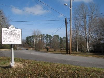
Born in NC, 1783; veteran of the War of 1812; early Bedford County manufacturer; Whig political leader. In 1810 Cannon provided 100 acres of land for the site of the "Town of Shelbyville" and in 1817 donated 5 acres to Dickson Academy and a lot to a . . . — — Map (db m26807) HM
In the cemetery north of the road are buried Confederate soldiers of the Army of Tennessee, who fell while opposing the advance of Rosecrans' Army of the Cumberland through Liberty Gap and Guy's Gap, in late June, 1863. Also buried here are soldiers . . . — — Map (db m25864) HM
(preface)
After the Battle of Stones River ended on January 2, 1863, Union Gen. William S. Rosecrans occupied Murfreesboro. Confederate Gen. Braxton Bragg withdrew south to the Highland Rim to protect the rail junction at Tullahoma, Bragg's . . . — — Map (db m85714) HM
Born in a house which stood here. Enlisted in the 1st Tenn. Volunteers for the Mexican War; on graduation from US Military Academy in 1853, commissioned in Dragoons. Resigning for the Confederacy and rapidly promoted to colonel, he was captured at . . . — — Map (db m207913) HM
In memory of the
"Shelbyville Rebels" Co. F.
41st Tenn. Reg't. C.S.A. and
all soldiers from Bedford
County who fought for the
Confederacy in the War
Between the States 1861-1865
Erected and affectionately dedicated
by the Agnes L. . . . — — Map (db m85555) WM
Son of Michael, an immigrant from Frankfurt on Main, Germany in 1760. Migrated by covered wagon, horseback and afoot from North Carolina in 1808 with his family and settled this tract of land on Thompson's creek. The land was granted to him by the . . . — — Map (db m80313) HM
Dedicated to the Memory of the Thirteen Free and Accepted Masons Who Were Among the First Signers of the Constitution of the United States.
A.D. 1787 - A.D. 1987
Donated by Normandy Lodge No. 617 Shelbyville Lodge No. 122 of Free and . . . — — Map (db m207988) HM
Governor of Tennessee for three successive terms 1939-1945. A native of Bedford County and graduate of Webb School, Princeton and Harvard Law School, he was Attorney General of the 8th Judicial Circuit, a member of the 63rd and 70th General . . . — — Map (db m25868) HM
Shelbyville was established in 1810 on 100 acres of land donated by Clement Cannon (1783-1860), local manufacturer and veteran of the War of 1812. The city was named in honor of General Isaac Shelby (1750-1826), statesman and noted Revolutionary War . . . — — Map (db m85443) HM
This 90-acre tract is home of the Tennessee Walking Horse National Celebration - "The World's Largest Walking Horse Show". On July 17, 1939, a non-profit association was chartered to conduct a national celebration to honor and exhibit the Tennessee . . . — — Map (db m25869) HM
[Side A]
Shelbyville — “Little Boston”
Shelbyville, Tennessee, better known as “Little Boston,” was a hotbed of Unionist sentiment throughout the war. When William Rosecrans' Union army captured the town, they were welcomed as . . . — — Map (db m191662) HM
Moore County Established 1871; named in honor of
Major Gen. William Moore
He settled in Tennessee in 1808, coming from Kentucky. Commanded a company in the Creek War; finished the War of 1812 as a Major General. Member of the State House . . . — — Map (db m61915) HM
By
Sergeant Major Larry E. & Mrs. Sheila M. Williams, US Army / Retired
Commander Camp #72 (Manchester), Starnes DBE., TN Div., SCV
10 December 2011 — — Map (db m152097) WM
Wartrace is located on a 5000-acre North Carolina grant acquired by General Andrew
Jackson at an 1802 marshal's sale in Nashville. In 1805, Jackson came to the area to establish his boundaries for the opening of the lands for settlement by the . . . — — Map (db m152096) HM
Hardee's Corps retired to the Wartrace-Fairfield defensive line, January, 1863. Here they remained until late June, when Rosecrans, moving the bulk of the Federal Army of the Cumberland around the right flank to Manchester, made Bragg withdraw from . . . — — Map (db m152093) HM
The Beechwood Plantation house, which formerly stood at this site, was an important Confederate headquarters during the Tullahoma Campaign. It was built for Col. Andrew Erwin, Jr. and family in 1826. The Erwins, who were southern sympathizers, . . . — — Map (db m25862) HM
In April 1862, Major James M. Shanklin with 197 men of the 42nd Indiana Infantry campedon the west bank of Wartrace Creek, near the end of Bridgeview Street, to secure the supply line of the Nashville & Chattanooga Railroad by guarding two bridges . . . — — Map (db m152103) HM
Strolling Jim, the first World's Champion Tennessee Walking Horse, is buried in a pasture directly behind the Walking Horse Hotel. Foaled in 1936, this former work horse was ridden to the championship by Floyd Carothers at the first Walking Horse . . . — — Map (db m24165) HM
(side 1)
Anatomy of a Campaign
In late June of 1863, Union Major General William S. Rosecrans launched a massive offensive from his base in Murfreesboro in an attempt to drive Confederate General Braxton Bragg’s 43,000-man Army of . . . — — Map (db m152889) HM
In 1850, Rice Coffey gave eight acres to the Nashville and Chattanooga Railroad on which the main line would run with a depot and freight house at the junction of the branch line to Shelbyville. In 1851, town lots were laid off. The following year, . . . — — Map (db m88407) HM
An early post office of this name was opened Sept. 28, 1835, in the home of William H.H. Burton, which stood at this site. It remained here until Aug. 27, 1837, when it was moved to the public square of Camden and the name changed to "Camden." . . . — — Map (db m109047) HM
Born 1779, South Carolina, died 1860, Benton County Tenn. Citizen soldier, War of 1812, member of Benton County's first quarterly court February 1836. Patriot for whom Benton County was named. Presented to the Citizens of Benton.
(Base monument) . . . — — Map (db m74482) HM
During the Civil War, several engagements occurred along the strategically important Tennessee River within about five miles of here. In each one, cavalrymen engaged naval forces.
On April 26, 1863 near the mouth of the Duck River east of here, . . . — — Map (db m74512) HM
8½ miles east, at Johnsonville Landing, Forrest's Cavalry Corps, after blocking river approaches from both directions with captured Federal vessels and gunfire, destroyed the Federal base at Johnsonville. Losses were 4 gunboats, 14 steamboats, 17 . . . — — Map (db m237476) HM
U.D.C. Marker to eight Irish CSA soldiers
probably worked on railroad
1860-1861
Erected by
Captain Nathaniel A. Wesson
United Daughters of the Confederacy
1992 — — Map (db m109049) WM
Mary Cordelia Beasley-Hudson, a life-long resident of Benton County, was an advocate for women's suffrage. The Tennessee General Assembly approved an amendment to the state constitution to allow women's suffrage on April 15, 1919. Seven days later . . . — — Map (db m81359) HM
On March 5, 1963, at 30 years of age, country singer Virginia Patterson Hensley, better known as Patsy Cline, along with her manager, Randy Hughes, and fellow Grand Ole Opry stars, Hawkshaw Hawkins and Cowboy Copas, were killed in a plane crash in . . . — — Map (db m184907) HM
Mildred Jolly Lashlee was the first woman elected to the Tennessee Senate for a full “regular” term. Elected in November 1944, she represented the 26th Senatorial District. Before her election she was appointed to complete the term of . . . — — Map (db m109048) HM
Born June 2, 1863, in a log cabin, about ½ mile N., he studied law at Charlotte, later began practice at Camden. Attorney General of the 13th Judicial District, 1908-12, he was the last Tennessee governor to be elected by a convention. . . . — — Map (db m74481) HM
Some of the lesser known battles and incidents of wars have afforded drama and have portrayed characteristics of the participants far beyond those of usual recorded history. Such was the Battle of Johnsonville, fought between Maj. Gen. N. B. . . . — — Map (db m146444) HM
In 1862 and 1863, Confederate cavalry raids along the Louisville & Nashville Railroad often shut down operations and slowed the flow of supplies into Nashville. The Union army built a supply depot at Johnsonville to help alleviate the disruptions. . . . — — Map (db m171324) HM
The logs for this cabin were taken from a barn owned by Mr. James Sykes of Eva. The barn was used by scouts for General Nathan Bedford Forrest during a reconnaissance of the Pilot Knob area on November 4, 1864. The lower story of the Syke's home . . . — — Map (db m171323) HM
"The river, a small rivercraft landing, its proximity to the N. B. Forrest State Park, and the Methodist assembly ground…make it attractive to visitors."
- Tennessee County History Series
The town of Eva began its . . . — — Map (db m183537) HM
Below the hill to your front and concealed by thick brush, Confederate troops under the command of Maj. Gen. Nathan Bedford Forrest constructed five artillery positions to deploy guns against the Union supply depot at Johnsonville. On November 3, . . . — — Map (db m146438) HM
By the fall of 1864, the Civil War was not going well for the Confederacy. The Union invasion of the Deep South continued to ravage both the military and civilian population of the war-torn region. In an attempt to halt the advance, Confederate Lt. . . . — — Map (db m146440) HM
(side 1)
Commemorating the capture
of Federal gunboats
by Forrest's cavalry in the
Johnsonville Expedition
November 4, 1864.
(side 2)
"Faith is the duty of the hour."
N.B. Forrest, Major-General
to . . . — — Map (db m146443) WM
"In those days, that was how you got over there; there was no highway”
-Ken Ingram
The track leading to the Tennessee River
Railroad Bridge once started here. The
nearby depot served as the debarkation
point for . . . — — Map (db m183534) HM
Take Exit 133, State Route 191, and drive north to visit two state parks associated with the struggle to control the Tennessee River during the Civil War.
In 1861, the Confederates built Fort Donelson on the Cumberland River and Fort Henry . . . — — Map (db m96639) HM
Late in 1862, the Union army Gen. Ulysses S. Grant threatened Vicksburg, Mississippi. Confederate Gen. Braxton Bragg ordered Gen. Nathan Bedford Forrest to sever Grant's West Tennessee supply line, which extended from Columbus, Kentucky, via the . . . — — Map (db m118580) HM
Established 1807. Named for Anthony Bledsoe. Born 1733. Died July 20, 1788. Captain in the Colonial Army from Virginia. Major in the Revolutionary Army, Colonel in the Tennessee Militia. This marker is erected by the Volunteer Chapter, U.S.D.of . . . — — Map (db m109176) HM
Honoring all who served and dedicated to the memory of those who made the supreme sacrifice.
World War I
Angel, Victor L. • Arnett, John • Ault, Thomas W. • Austin, Amos L. • Curtis, James H. • Dyer, Samuel C. • Elliott, Anderson • Hamilton, . . . — — Map (db m184528) WM
On Aug. 29, 1862, the Army of Mississippi was enroute to Kentucky: Army Headquarters was near Dunlap; Col. Joseph Wheeler's Cavalry Brigade was moving against Maj. Gen. A McD. McCook's Federal Division at Altamont. Advance elements of Maj. Gen . . . — — Map (db m81360) HM
Born in a house 160 ft. west, Oct. 18 1856. Elected Governor of Tennessee in 1902, he was reelected in 1904. He resigned in 1905, having been elected to the Senate, vice William B. Bate, deceased, and served there until 1911. Defeated for . . . — — Map (db m109180) HM
Born in a house 160 ft. west, Oct. 18 1856. Elected Governor of Tennessee in 1902, he was reelected in 1904. He resigned in 1905, having been elected to the Senate, vice William B. Bate, deceased, and served there until 1911. Defeated for . . . — — Map (db m109179) HM
The Pikeville AME Zion Church is the oldest African-American church still operating in Bledsoe County. The core of the church building dates from about 1870 when it served as the Freedmen's Bureau school. The AME Zion congregation's use of the . . . — — Map (db m184534) HM
The Bledsoe County Courthouse in front of you stands on the site of the first courthouse, which was completed by 1821. During the Civil War, in August 1862, Confederate Gen. Braxton Bragg led his Army of Tennessee north from Chattanooga to invade . . . — — Map (db m177522) HM
Gospel music publisher and hymnodist Robert Emmett (R.E.) Winsett composed many sacred songs, “Jesus Is Coming Soon” being the most well known, but his reputation rests more upon his publishing endeavor. The R. E. Winsett Publishing Company produced . . . — — Map (db m153659) HM
(obverse)
Rhea County
Established 1807; named in honor of
John Rhea
Revolutionary veteran, who fought at King's Mountain. Delegate to the North Carolina Convention which ratified the U.S. Constitution; member of the Tennessee . . . — — Map (db m63645) HM
About 500 yds. NW. This school was the outgrowth of a community meeting at Bryant Camp Ground in 1858. War conditions delayed opening until 1865, with Prof. Gerry Rodgers first president. The first student body included both Confederate and Federal . . . — — Map (db m57953) HM
In the 1940s, the City of Alcoa established a fire hall independent from the Aluminum Company of America (ALCOA). The City acquired its first fire truck in 1942, an open-cab 1940 Ford. The first fire hall, near the intersection of Springbrook Road . . . — — Map (db m195379) HM
In 1916, the Babcock Lumber & Land Company acquired 350 acres along Pistol Creek where saw and planing mills were constructed to process lumber the Company was timbering in Monroe County. At the time, Babcock was the nation's leading producer of . . . — — Map (db m195377) HM
Bassel School was constructed in 1923 to provide a new school for children in the Bassel community. The new school was dedicated February 1, 1924. The school contained eight grades.
Captions (clockwise from top left)
• Bassel School . . . — — Map (db m195403) HM
Alcoa schools for black citizens played a vital role in the growth and development of Alcoa. From 1916 to 1926, classes were held in one-room buildings and on the top floor of the Commercial Building. The first building on this site was completed . . . — — Map (db m195398) HM
Alcoa High School began participating in athletics, as the Red Tornadoes, in the fall of 1924. The gymnasium was added in 1927. Alcoa High School played its home basketball games there until 1954.
Captions (clockwise from top . . . — — Map (db m195370) HM
The V. J. Hultquist family home was constructed in 1925. The same year, the Aluminum Company of America (ALCOA) constructed a home for the family of E. M. Chandler, who supervised the Sheet Mill from 1924 to 1946. He also managed the North Plant . . . — — Map (db m195372) HM
Hunt Field was the home of the Maryville-Alcoa
Twins baseball team that won the 1953 Class-D
Mountain States League Pennant. This 1,750-seat
ballpark, built in the 1940s, averaged an
attendance of about 1,550 for 62 home games.
Major league . . . — — Map (db m195413) HM
By Tennessee Private Act Chapter No. 510, the City of Alcoa was incorporated effective July 1, 1919. Initially, there were three city commissioners, C. L. Babcock, mayor; S. A. Copp, and W. V. Arnold. V. J. Hultquist was appointed city manager, . . . — — Map (db m195396) HM
Initial Plant & Town Site Construction In 1913, the Aluminum Company of America (ALCOA) began construction of a reduction plant for the production of aluminum. A townsite, including the Bassel community, was also constructed for Company workers . . . — — Map (db m195405) HM
Millennium
Manor
This property
is listed in the
National Register
of Historic Places
by the United States
Department of the Interior
1937 — — Map (db m195410) HM
The Nicely's Grocery Store building, built in 1939, stands as a proud reminder of the neighborhood grocery store where customers could purchase groceries on a credit account, and the store made home deliveries. When the building was new, the Masonic . . . — — Map (db m195376) HM
When the Aluminum Company of America (ALCOA) established the City of Alcoa, a commitment was made to establish one acre of park for each 100 residents. Springbrook Park was established in 1925. More than 3,000 shade trees and 6,000 flowering shrubs . . . — — Map (db m195363) HM
Springbrook Pool, originally known as Alcoa Swimming Pool, opened June 13, 1931. Unemployed residents were allowed to work on construction of the pool in lieu of paying street tax, and the Aluminum Company of America (ALCOA) provided pipe and . . . — — Map (db m195375) HM
Springbrook School was built in 1921 for grades 1-12, including, until 1939, Alcoa High
School. The school was the City's first major school construction project. Today's park
grounds lying between the concrete pad and the creek were the school's . . . — — Map (db m195367) HM
The Commercial Building was constructed by the Aluminum Company of America (ALCOA) in 1919. Commercial businesses for the Hall community were located there, and until Charles M. Hall School was opened in 1926, the school for African American youth . . . — — Map (db m195399) HM
In March 1931, City Manager V. J. Hultquist, informed city .commissioners that work had begun on a proposed lake in Springbrook Park to be located adjacent to the swimming pool. Initially known as Mirror Lake, it was later named the Lily Pond. . . . — — Map (db m195373) HM
The Hall community, earlier known as Peniel, then Walnut Hill, was established in 1916 when the Aluminum Company of America (ALCOA) built 137 two- and three-room homes for African American workers who had been recruited and hired to build the local . . . — — Map (db m195401) HM
This village, 8 mi. W., was founded by a colony of Quakers from New Garden,
N. C., in the 1790's. The Newberry Meeting officially recognized it in 1808. The first Friends' organization in the county, it is the only one surviving. Friendsville . . . — — Map (db m150763) HM
The city of Friendsville hereby recognizes the Friendsville community for contributing their talents to the stone profession.
Tennessee pink marble is a historic reminder of days past when the railroad ran through
Friendsville. This block of . . . — — Map (db m150767) HM
Members of the Religious Society of Friends (Quakers) came to Blount County in the 1790s looking for a place to worship in peace. Hardworking and industrious, opposing war and slavery, they developed the land and founded the prosperous settlements . . . — — Map (db m81361) HM
In 1807, Sam Houston arrived at this 419-acre site with his widowed mother and eight brothers and sisters. The homesite was located just above the spring on the hill. Sam Houston served as general, President of Texas, Governor of Tennessee and . . . — — Map (db m150793) HM
About 2 miles northeast. Attacked Oct. 13, 1788, by 300 Indians under John Watts, the half breed. Defenders held out until ammunition was exhausted. 28 were taken prisoner; 17 slaughtered and bodies burned. Thereafter the locality was called the . . . — — Map (db m90458) HM
Lane, John E (KIA) • Hearon, Marlow M • Henry, Walter S • Hester, Thurman O • Hipsher, Henry N • Hollingshead, Denver KIA • Huffstetler, John H • Huskey, Eugene E • Hutson, Luther C • Ingram, John J Jr • Ivey, Charles K • Jackson, Taylor G • . . . — — Map (db m150832) WM
Yellow Sulphur Springs was developed on a modest scale by Jesse Kerr in 1859. In 1885, Nathan McCoy, of Indiana, built an elaborate hotel here. John Hanlon took it over in 1900, and operated it until the outbreak of World War I. It burned in 1933. — — Map (db m107919) HM
This Presbyterian church was
established in 1786. Its first pastor
was the Rev. Gideon Blackburn
who served an extensive circuit
in the area. Elizabeth Paxton
Houston, mother of Sam Houston,
is buried here. — — Map (db m150789) HM
In memory of soldiers and patriots
of the American Revolution
who settled in Blount County George Berry • Thomas Berry • John Biggs • Benjamin Bingham • Joseph Black Sr. • Andrew Bogle • Joseph Bogle Sr. • Joseph Bogle Jr. • John Boyd Sr. • . . . — — Map (db m150826) WM
In honored glory
Lest we forget: This monument dedicated to all those gallant heroes of Blount County , living and dead, who have fought in all wars to preserve the American way of life.
The people who have no interest in the past have no hope . . . — — Map (db m150798) WM
On Abram’s Creek, near the site of the early Cherokee village, Chilhowee, William and Robert James established a water-powered cotton and woolen spinning and weaving factory. A charter for the business was issued in 1846 and the mill was evidently . . . — — Map (db m58501) HM
Stockade enclosing about two acres extending southwest to large spring at base of bluff. Scene of many privations, perils and heroic encounters. — — Map (db m107578) HM
A three-story brick building was erected 1872-74 on this site to train blacks as teachers. Institute was begun in 1867, in a log house ½ mile north, and later moved into a new building, financed mainly by friends. By 1879, it had trained 80 . . . — — Map (db m81362) HM
March 2, 1793 – July 26, 1863
Born In Rockbridge County VA
Moved To TN in 1807
Taught At This Schoolhouse In 1812
Attended Porter Academy In 1813
Joined Army In 1813 In Maryville, TN
Studied Law In Nashville, TN In 1818
U.S. . . . — — Map (db m1733) HM
7446 entries matched your criteria. Entries 101 through 200 are listed above. ⊲ Previous 100 — Next 100 ⊳