The Bottle Creek site is the second largest mound center in Alabama and it represents the remnants of a large Mississippian Stage civic and ceremonial complex that dominated the Mobile-Tensaw Delta from AD 1250 to 1500. Located in the heart of the . . . — — Map (db m131832) HM
This stretch of road between Eufaula and the Bullock County line was reconstructed thro the initiative and assistance of Edward Trippe Comer, of Savannah, GA. Its perpetual upkeep is insured by a fund of $100,000.00 set up in trust by him in 1919. . . . — — Map (db m163247) HM
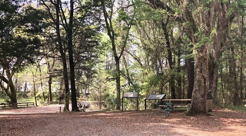
Dr. John Coleman, born June 6, 1788 in North Carolina, was one of Butler County's earliest pioneer settlers. He built the Coleman-Crenshaw House some time between 1817 and 1821. In June 1820 the first election for Sheriff and Constable, held in . . . — — Map (db m130052) HM
The Choctaw County Board of Education built Silas Elementary School in 1936 with support from the Alabama State Department of Education. Students attended the school from 1936-2005. After nearly 70 years as a school, the building took on a new . . . — — Map (db m110975) HM
Center of Industry for new town of Sheffield. Five blast furnaces with 75 ft stacks build 1886~1895 1/2 mile west. Promoted by E. W. Cole and E. Ensley. Iron ore and limestone from Franklin Co., coke from Walker Co. and Virginia used. Hattie Ensley . . . — — Map (db m28428) HM
This stone marks the site of Cahaba, selected November 21, 1818 as the first permanent capital of Alabama. The seat of goverment remaining here until removed to Tuscaloosa by the Legislature, January 1825.
On December 13, 1819, it was fixed as . . . — — Map (db m22609) HM
Edmund Pettus Bridge
has been designated a
National Historic Landmark
This site possesses national significance for its
association with "Bloody Sunday," a seminal event in the
Civil Rights Movement. Here, on March 7, 1965, . . . — — Map (db m82037) HM
Here stood
Fort Toulouse
A defense against
the Indians
Built by
Bienville
1714
The Alabama Society
of Colonial Dames
preserves the memory
of faithful service
1912 — — Map (db m69567) HM
In 1920, a wooden building was constructed as the Atmore Colored School and operated until 1925. In 1926, a new wood and a brick building was erected with assistance from Rosenwald School fund and it was renamed the Escambia County Training School. . . . — — Map (db m100835) HM
The Leigh Place
The First Escambia County Courthouse
in Brewton
Used as the County Seat from 1885 to 1890. After
various other uses, remodeled as an office in 1969. — — Map (db m84392) HM
Dwight Manufacturing Company of Chicopee, Massachusetts selected this site in Alabama City for a cotton mill in 1894. The Mill and the village covering 240 acres was constructed under the direction of Howard Gardner Nichols.
There were 160 . . . — — Map (db m18575) HM
Dismals has been designated a
Registered Natural Landmark
This site possesses exceptional value as an illustration of the nations’s natural heritage and contributes to a better understanding of man’s environment
1975 . . . — — Map (db m201740) HM
Municipal
Light & Water Plant
has been placed on the
National Register
of Historic Places
by the United States
Department of the Interior
1991 — — Map (db m115030) HM
Side 1
William Lafayette Shelley (1868-1953), son of Mark Shelley and Mary Jane Ronie Shelley, was a progressive farmer and entrepreneur in the Tumbleton community of Henry County, Alabama. “Papa Billy”, as he was known by . . . — — Map (db m73377) HM
The county seat of Jefferson County was moved from Elyton to Birmingham in 1873. On this site stood the first Courthouse in the City of Birmingham. The Italianate style structure was designed by architect W. K. Ball. Completed in 1875, the . . . — — Map (db m27095) HM
Sloss Blast Furnaces has been designated a National Historic Landmark.
This site possesses national significance in commemorating the history of the United States of America.
1981.
ASM International has designated Sloss Furnaces an . . . — — Map (db m173375) HM
The crossing of railroads in 1872 adjacent to this site gave rise to the industrial city of Birmingham. In 1881 Alabama railroad magnate and entrepreneur James Withers Sloss, capitalizing on the unusual coincidence of coal, iron ore and limestone in . . . — — Map (db m23498) HM
In 1924, George Ward, a former mayor of Birmingham, 1905-1909, 1913-1914, visited the City of Rome, Italy. He was so intrigued by the unique beauty of the Temple of the Vestal Virgins on a Roman hilltop that he vowed to build a replica of it on a . . . — — Map (db m25352) HM
Side A Sibyl Temple was moved to this site from its original location in 1975. George Ward built it on the brow of his 20-acre mountaintop “Vestavia” estate in 1929. It marked the entrance to the lower 10 acres where he planned a . . . — — Map (db m37708) HM
Listed on the National Register of Historic Places, this tower of native stone was completed in 1890 as the foundation for a wrought- iron tank with a capacity of 280,000 gallons of water. It is 70 feet high and is located on the highest elevation . . . — — Map (db m35234) HM
The Lane House, built in 1853 at the corner of Thach and College Street, was home to several Auburn University notables, E. T. Glenn, Treasurer, leased it in 1873. Gen. James H. Lane, Aide to Gen. Stonewall Jackson and Head of Engineering, purchased . . . — — Map (db m85165) HM
Side 1
Here in 1897 the first iron bridge in Lee County was built. In 1903 George W. Bean bought the mill, operating it until his death in 1952. About 1910 Bean installed an iron overshot wheel to replace the old turbine. Later, the dam . . . — — Map (db m73533) HM
The Tuskegee Veterans Administration Hospital (VA), established in 1923, is significant as the first VA hospital in the nation to be administered by an all African American medical staff.
After WWI, African American veterans found it difficult . . . — — Map (db m101900) HM
In 1807, Major Thomas Freeman,
Deputy U.S. Surveyor, established a
marker here on the state line and
began surveying south toward the
middle of the state. This line, known
as the Huntsville Meridian, is the
reference for all property . . . — — Map (db m154301) HM
Bessie, or Elsie, as she was sometimes called, started her life in Huntsville in 1963. Meadow Gold Diaries (sic) mounted her to their advertising billboard that stood at the corner of Memorial Parkway and Governor's Drive. Painted as a . . . — — Map (db m114570) HM
Site of Hotel Monte Sano, built in 1887 by the North Alabama Improvement Company with the assistance of Michael and James O’Shaughnessy. The 233-room hotel opened on June 1, 1887 and served as a health resort and haven for famous visitors including . . . — — Map (db m27796) HM
Has been desiginated a
Registered National
Historic Landmark
Under the provisions of the
Historic Sites Act of August 21, 1935
this site possesses exceptional value
in commemorating and illustrating
the history of the United . . . — — Map (db m74156) HM
Bertha Pleasant Williams Library Rosa L. Parks Avenue Branch has been placed on the Alabama Register of Landmarks & Heritage by the Alabama Historical Commission October 25, 2018 — — Map (db m136278) HM
Lucille and Charlie (d. 2/7/78) Times were married on February 3, 1939. Shortly after, the Times' joined the National Association for the Advancement of Colored People (NAACP). Mr. Times received several medals and a Commendation for his service in . . . — — Map (db m81804) HM
East of here, on the Chattahoochee River, was the "fort among the Apalachicolas," most northern of the Spanish settlements in eastern North America. A palisaded "strong house" built by Captain Enrique Primo de Rivera to check activities of English . . . — — Map (db m101252) HM
After the seat of government was moved to Montgomery in 1847, the Tuscaloosa Capitol and its furnishings were deeded to the University of Alabama to be used for educational purposes.
In 1857, the University Board of Trustees leased the building . . . — — Map (db m29064) HM
This bell tower, an enduring symbol of Alabama's first university, was erected in honor of President George H. Denny, under whose leadership (1911 to 1936) The University of Alabama gained national prominence. Conceived by Jerome M. Britchey and . . . — — Map (db m29610) HM
has been designated a
Registered National
Historic Landmark
under the provisions of the
Historic Sites Act of August 21, 1935
This site possesses exceptional value
in commemorating and illustrating
the history of the United . . . — — Map (db m181330) HM
has been designated a
National
Natural Landmark
This site possesses exceptional value
as an illustration of the nation's natural
heritage and contributes to a better
understanding of the environment
1972
National Park Service . . . — — Map (db m185282) HM
One of the West’s Longest and Bloodiest feuds took
place here and around Pleasant Valley. The Grahams and
the Tewksburys had been in the cattle business and it
seems probable that they first fell out over the division of cattle they jointly . . . — — Map (db m78742) HM
Presented to the city of Kingman as an historical monument in 1967 by the Santa Fe Railway Company.
This "Mountain Type" coal-burning steam locomotive was built in 1927 by the Baldwin Locomotive Works. It was rebuilt and converted to oil fuel . . . — — Map (db m29360) HM
Opened By
The Right Honorable The Lord Mayor Of London
Alderman Sir Peter Studd G.B.E.M.A.D.Sc.
In The Presence Of
The Honorable Jack Williams
Governor Of Arizona
October 10, 1971
Robert P. McCulloch Sr C.V. Wood Jr. . . . — — Map (db m4328) HM
Tucson Air Museum Foundation
of Pima County
Titan II Intercontinental Ballistic Missile Museum
Established May 8, 1986
571st SMS, 390th SMW
Davis-Monthan AFB
Strategic Alert July 1963 – November 1982
National . . . — — Map (db m26926) HM
Constructed in 1928, the tower is listed on the National Register of Historic Places and has been designated as a Tucson Landmark.
The tower's Spanish colonial revival sheathing was designed by Tucson architect Roy Place and added in 1932. . . . — — Map (db m26288) HM
The first mining claims were filed in 1876, within 20 years Jerome was a billion dollar copper mecca and one of the wildest, wickedest mining towns in the west. Drinking, gambling, brawls and frolicking with ladies of the night occurred . . . — — Map (db m33149) HM
As early as 1865, Lucian Bonaparte Jewell organized a Brass Band in Prescott, but by the 1870s the regimental bands from Ft. Whipple began to dominate the local music scene. The original Plaza Bandstand, built in the late 1800s, had survived the . . . — — Map (db m59299) HM
Prescott’s first railroad arrived on December 31, 1886. The current depot was built by the Santa Fe, Prescott and Phoenix Railway, also known as the “Peavine”, in 1907. Designed in the Mission Revival style of poured concrete with a . . . — — Map (db m18767) HM
Arriving from New York on July 13, 1910, "Lady Ermintrude" graced the Courthouse Plaza for more than 60 years. Over time, the fountain began showing signs of wear and, in 1976, was removed and placed in storage at the Sharlot Hall Museum.
In . . . — — Map (db m136155) HM
In March of 1864, the Union Army began the Red River Campaign, a plan to subdue Arkansas and Louisiana and capture Texas cotton for northern mills. By mid-April, the Arkansas arm of the campaign was stalled in Camden. A Union foraging party and . . . — — Map (db m121311) HM
The companies of soldiers that came out
of Van Buren were formed at this historic
landmark. It is also the site where some
infantry and Calvary units camped and
drilled. There were nine different
companies that were formed in . . . — — Map (db m96864) HM
Confederate forces used Cadron as a base in the war’s early years, and Union troops were here after taking Little Rock in September 1863. The site was valuable for the saw and grist mills nearby, the telegraph line that ran to Little Rock, and the . . . — — Map (db m96452) HM
This stone marks the base established Nov. 10, 1815
from which the lands of the Louisiana Purchase were surveyed by the United States Engineers. The first survey from this point was made to satisfy the claims of the soldiers of the War of 1812 . . . — — Map (db m6037) HM
This Bois D'Arc tree is also known as an Osage Orange, Hedge Apple, or Bow Wood tree. Historically, the wood was used by Native Americans to make strong and resilient bows and arrows. The early settlers also used it to make hubs, spokes, fence . . . — — Map (db m225453) HM
The
Geographical
Center of Arkansas
is a few steps
north of this highway
Erected by
The Arkansas Society
Daughters of American Colonists
Arkansas Centennial
1936 — — Map (db m96637)
[Center and Main Marker:]
This plaque marks the terminus of the First Transcontinental Passenger train that started in New York City and terminated at Alameda Point Pier on September 6, 1869. Erected by the U.S. Naval Air . . . — — Map (db m150959) HM
1939-1940
City of Berkeley Landmark
designated in 1982
These buildings are fine examples of the Art Deco style in the Bay Area. They were designed as an ensemble with the adjacent Berkeley High School Community Theater. Bas-reliefs and . . . — — Map (db m54218) HM
Here, in 1883, James Concannon founded the Concannon Vineyard. The quality it achieved in sacramental and commercial wines helped establish Livermore Valley as one of America’s select wine growing districts. Grape cuttings from this vineyard were . . . — — Map (db m100553) HM
Here, Charles A. Wetmore planted his vineyard in 1882. The Cresta Blanca wine he made from its fruit won for California the first international award, the highest honor at the 1889 Paris Exposition, first bringing assurance to California wine . . . — — Map (db m100552) HM
Made from one log, originally 126 feet in length. 18 inch diameter at base, 5,300 pounds
Shortened 14 feet in 1959
City of Livermore
Historic Preservation Landmark Site
Dedicated July 1998 — — Map (db m17785) HM
Here the first Wente Vineyards of 47 acres was established by C.H. Wente in 1883. In 1935 his sons, Ernest and Herman, introduced California’s first varietal wine label, Sauvignon Blanc. The efforts of the Wente family have helped to establish the . . . — — Map (db m100563) HM
“May God continue the unity of our country as this railroad unites the two great oceans of the world.” The gold spike ceremony at Promontory, Utah in May of 1869 united the tracks of the Central Pacific and Union Pacific Railroads. . . . — — Map (db m143737) HM
Oysters were the mainstay of the California fishing industry at the turn of the century. Along this site (the original Mulford Canal) the San Leandro oyster beds flourished. In 1892 William Roberts field title to the beds south along San Lorenzo . . . — — Map (db m100559) HM
In 1849 Dr. James Caples passed through here on his way to California’s gold country.
After a brief stay in Old Hangtown (Placerville) Caples remembered the lake and returned here with his family to establish a way station that served weary . . . — — Map (db m11048) HM
In 1856 a road was completed following the present sign route 4 from Murphys to this point, and thence northward via Faith and Charity Valleys to Hope Valley where it joined the Carson Pass Road. This connection was used by emigrants in 1856 and . . . — — Map (db m10316) HM
Founded 1848. Oldest town and first in which gold was discovered in Amador County. Its venerable town hall and other picturesque structures remain. Was not "dry" as name implies, containing 26 saloons at one time. — — Map (db m100575) HM
Buena Vista's store and house situated in Jackson Valley, was built by John Fitzsimmons, then sold to Sam Cook, then to James Norris and afterwards to Jacob and Verona Strohm. Once situated in Lancha Plana it was moved by the Chinese who discovered . . . — — Map (db m10189) HM
In the late 1850’s, Andrew Kennedy discovered gold in an outcropping of quartz. The mine produced over $34.2 million in gold, making it one of the richest gold mines in the world. With a depth of 5,912 feet, it was the deepest mine in North America . . . — — Map (db m19797) HM
The Order or Native Daughters
of the Golden West
was organized on these premises
The site of the
Pioneer Hall
on September 1, 1886.
This tablet is placed
In memory of
the founding of the order
by
Ursula Parlor No. 1, . . . — — Map (db m28039) HM
Knight Foundry was established in 1873 to supply heavy equipment and repair facilities to the gold mines and timber industry of the Mother Lode. Samuel N. Knight developed a high speed, cast iron water wheel which was a forerunner of the Pelton . . . — — Map (db m100590) HM
Sutter Creek's first fire bell was ordered by William M. Tucker (1843-1910) for the Sutter Creek Fire Company.
The bell hung in a wooden bell tower in the late 1800s at the fire station near the corner of Spanish St. and Keyes St.
The bell was . . . — — Map (db m94751) HM
The Thomas Starr King Bell was donated to the town of Volcano by Unitarian preacher Thomas Starr King in 1862, who was greatful to the town for its support for the Union and the election of Abraham Lincoln. The bell was originally located at the . . . — — Map (db m101341) HM
Discovered in 1848 by Colonel Stevenson’s men who mined Soldiers’ Gulch in ’49. First covered wagon party sluiced rich gravel beds. By ’53, men swarmed flats and gulches naming them picturesquely. Hydraulic operations, begun in ’55, brought . . . — — Map (db m11365) HM
[Larger Marker]:
Started 1848 by soldiers of Colonel Stevenson’s Regiment. Named by miners because of apparent volcanic appearance. Here the first California rental library, 1850, was established. And one of the first “Little . . . — — Map (db m100574) HM
In 1888, the State Board of Forestry established an experimental forestry station and nursery, a companion to the Santa Monica Station established in 1887. The two were the first such stations in the nation. Exotic and native trees were tested and . . . — — Map (db m100602) HM
A vast expanse covering 26,000 acres, Rancho Chico was purchased in 1849-50 by John Bidwell. In 1865 he began construction of the mansion nearby, which in time became the social and cultural center of the upper Sacramento Valley. It was through his . . . — — Map (db m230785) HM
This brick building, erected in 1858 with funds raised by a dance in the Billiard Saloon of the N.R. Prince Building (which still stands), is one of the oldest schools of California. Used as a school until 1950, it was then replaced by the present . . . — — Map (db m10143) HM
This structure was erected in 1852 by B. R. Prince and G. Garibardi for a general merchandise business. Improved in 1857 with living quarters on the second floor, it is still used for living and warehouse purposes. — — Map (db m11047) HM
Settled in 1849 by Mexicans who worked placers in Oregon Gulch. Rich copper deposits discovered in 1859. The largest living cork oak tree in California was planted here in 1858. Ruins of Adams Express Building still standing. — — Map (db m10629) HM
Copper here discovered by W. K. Reed and Thomas McCarty in 1860. Mines utilized during the Civil War and the First and Second World Wars. During Civil War period was the principal copper producing section of the United States. — — Map (db m13002) HM
Richest placer mining section, extending five miles, in Calaveras County. Received name from Chileans who worked gulch in 1848 and 1849, and scene of the so-called Chilean War. Largest known quartz crystals recovered from mine on south side of gulch. — — Map (db m11515) HM
Douglas Flat was a roaring mining camp of the early 1850s. In 1857 the Harper and Lone Star Claims produced $130,000 worth of gold. The so-called Central Hill Channel, an ancient river deposit from which vast quantities of gold have been taken, is . . . — — Map (db m81717) HM
Constructed by Peter L. Traver in 1856, this is the oldest stone building in Murphys. Its iron shutters and sand on the roof protected it from the fires of 1859, 1874, and 1893. It served as a general store, a Wells Fargo office, and later a garage. — — Map (db m2611) HM
A thriving mining camp on rich Pennsylvania Gulch in the 1850’s and 1860’s. Named for Alfred Brown, former owner of Table Mountain Ranch. Laws of Brownsville Mining District provided that each miner could own one wet and one dry claim, not to exceed . . . — — Map (db m11501) HM
Located on the Stockton-Murphy Road at the fourth crossing of the Calaveras River, this early mining settlement, once called Foremans, was famous in the 1850's for its rich placer ores. Later, it became an important stage and freighting depot and . . . — — Map (db m11969) HM
Gwin Mine, Paloma, and Lower Rich Gulch were mined for placer in 1849. Quartz was discovered by J. Alexander in 1851. Property acquired by Wm. M. Gwin, California's first U.S. Senator, in 1851. The Gwin Mine closed, in 1908, yielded millions. — — Map (db m14449) HM
The original three foot narrow gauge line was built by the San Joaquin & Sierra Nevada Railroad, extending from Brack’s Landing on the Mokelumne River, east to Valley Springs. The depot and turntable were built around the time of completion of the . . . — — Map (db m10635) HM
Named by famous scout Kit Carson while searching for pass over Sierras. One emigrant road forked at Big Meadows, and north branch came directly to West Point. A thriving trading post prior to gold discovery. Bret Harte, famous author, lived here for . . . — — Map (db m44371) HM
Erected in 1861, this Federal/Classic Revival style building is the oldest remaining courthouse in the Sacramento Valley. The “Southern” style reflects the county’s heritage from the Ante-Bellum South and states-rights sympathies during . . . — — Map (db m57626) HM
Welcome
Heading to the top?
Rising to 3,849 feet in elevation, Mount Diablo dominates the foothills and offers unobstructed views. Stand on its summit on a clear day and see over 200 miles in all directions; the Sierra Nevada to the east and past . . . — — Map (db m103091) HM
Like many other isolated peaks, Mt. Diablo is steeped in lore - much of it involving the mountain's name.
On a 1824 map, "M. del Diablo" signifies a Christian Indian village, not a peak. The reference to "diablo" or devil can be traced back to . . . — — Map (db m93632) HM
Coloma
Has been designated a
Registered National Historic Landmark
Under the provisions of the Historic Sites Act of August 21, 1935
This site possesses exceptional value in commemorating and illustrating the history of the United States . . . — — Map (db m215644) HM
Erected by the State of California in memory of James W. Marshall, 1810 - 1885, whose discovery of gold January 24, 1848 in the tailrace of Sutter’s Mill at Coloma started the great rush of Argonauts. — — Map (db m146477) HM
Here in the Valley of the Cul-lum-mah Indians, James W. Marshall discovered gold on January 24, 1848, in the tailrace of Sutter’s sawmill. The Old Coloma Road, opened in 1847 from Sutter’s Fort to Coloma, was used by Marshall to carry the news of . . . — — Map (db m12272) HM
El Dorado, meaning “The Gilded One”, was first known as Mud Springs from the boggy quagmire the cattle and horses made of a nearby watering place.
Originally a important camp along the old Carson Emigrant Trail. By 1849 – 50 it . . . — — Map (db m13148) HM
At this site on the old Clarksville-White Rock Emigrant Road was Mormon Tavern. Constructed in 1849, this popular stage stop was enlarged and operated by Franklin Winchell in 1851. It became a remount station of the Central Overland Pony Express and . . . — — Map (db m12056) HM
John Greenwood, a trapper and guide who came to California in 1844, established a here a trading post in 1849. The mining town of Greenwood, which developed during the Gold Rush, boasted a theater, 4 hotels, 14 stores, a brewery, and 4 saloons. . . . — — Map (db m10447) HM
1640 entries matched your criteria. The first 100 are listed above. Next 100 ⊳