By Duane and Tracy Marsteller, March 10, 2024
In Memory of Samuel Swayze Marker
| On Hutchins Landing Road, 0.2 miles east of Hillside Plantation Road, on the right when traveling east. |
| On Trails End Road west of North Palestine Road, on the right when traveling south. |
| On St. Catherine Street, 0.2 miles west of McCabe Street, on the left when traveling west. |
| On Martin Luther King Street at St. Catherine Street & Jefferson Street, on the left when traveling north on Martin Luther King Street. |
| On South Canal Street south of D.A. Biglane Street, on the right when traveling south. |
| Near S. Broadway Street south of Main Street, on the right when traveling south. |
| Near S. Broadway Street south of Main Street, on the right when traveling south. |
| On North Broadway at Franklin Street, on the right when traveling south on North Broadway. |
| Near N. Broadway Street north of Main Street, on the right when traveling south. |
| On Lissie Street/Old Cotton Street, 0.2 miles north of Liberty Road, on the right when traveling north. |
| On St. Catherine Street near 6th Street, on the left when traveling west. |
| Near Orleans Street near South Canal Street (Business U.S. 84). |
| On South Canal Street near D A Biglane Street, on the right when traveling south. |
| On D A Biglane Street at South Canal Street, on the right when traveling east on D A Biglane Street. |
| On St. Catherine Street near Old D'Evereux Street, on the left when traveling west. |
| On Jeff Davis Boulevard east of South Temple Road, on the right when traveling east. |
| On St. Catherine Street west of Liberty Road, on the left when traveling west. |
| On St. Catherine Street near Abbott Street, on the right when traveling west. |
| On North Wall Street at High Street, on the left when traveling south on North Wall Street. |
| On Main Street at Canal Street, on the left when traveling north on Main Street. |
| On Main Street at North Pearl Street, on the left when traveling west on Main Street. |
| On South Commerce Street at Main Street, on the left when traveling south on South Commerce Street. |
| On South Union Street at Main Street, on the left when traveling north on South Union Street. |
| On North Canal Street near Jefferson Street, on the left when traveling north. |
| On Franklin Street at North Pearl Street, on the left when traveling east on Franklin Street. |
| On Franklin Street near North Union Street, on the left when traveling east. |
| On South BroadwayStreet near Washington Street, on the right when traveling south. |
| On State Street west of South Canal Street, on the left when traveling west. |
| On South Pearl Street at State Street, on the right when traveling north on South Pearl Street. |
| On State Street near South Wall Street, on the left when traveling west. |
| On South Commerce Street at Washington Street, on the right when traveling south on South Commerce Street. |
| On South Martin Luther King Street at Washington Street, on the right when traveling west on South Martin Luther King Street. |
| On Washington Street at South Pearl Street, on the right when traveling east on Washington Street. |
| On Washington Street at South Rankin Street, on the right when traveling west on Washington Street. |
| On South Union Street near Washington Street, on the right when traveling south. |
| On Washington Street at South Wall Street, on the right when traveling west on Washington Street. |
| On Hutchins Landing Road east of Brick Quarters River Road, on the right when traveling east. |
| On Hutchins Landing Road, 0.3 miles east of Hillside Plantation Road, on the left when traveling east. |
| On St. Catherine Street at 6th Street, on the left when traveling west on St. Catherine Street. |
| On Hutchins Landing Road, 0.3 miles east of Hillside Plantation Road, on the right when traveling east. |
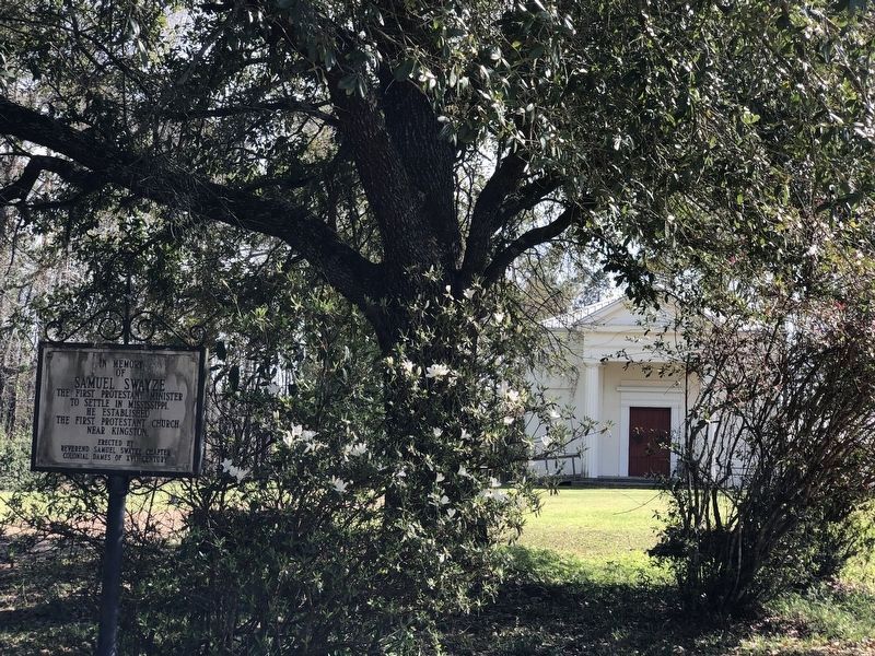
| On U.S. 61 at Kingston Road, on the right when traveling north on U.S. 61. |
| On U.S. 61 at Kingston Road, on the right when traveling north on U.S. 61. |
| On State Street east of South Union Street, on the left when traveling east. |
| On S. Broadway St at Bontura Street, on the right when traveling south on S. Broadway St. |
| Near S. Canal Street, 0.2 miles north of John R. Judkin Drive (U.S. 84), on the left when traveling north. |
| Near North Broadway Street near Jefferson Street, on the left when traveling north. |
| On Silver Street, 0.5 miles south of South Broadway Street, on the right when traveling south. |
| On Silver Street, 0.5 miles south of South Broadway Street, on the right when traveling south. |
| On John R. Junkin Drive (U.S. 84) at Lower Woodville Road, on the right when traveling east on John R. Junkin Drive. |
| On Silver Street east of South Broadway Street, on the right when traveling east. |
| On St. Catherine Street near McCabe Street, on the right when traveling west. |
| On S. Broadway St, on the right when traveling south. |
| On Morgantown Road at T Waring Bennett Jr. Road, on the left when traveling north on Morgantown Road. |
| On St. Catherine Street west of Auburn Street, on the left when traveling west. |
| On St. Catherine Street near Fourth Street, on the left when traveling west. |
| On South Commerce Street at Washington Street, on the left when traveling south on South Commerce Street. |
| On St. Catherine Street west of 6th Street, on the left when traveling west. |
| On South Canal Street, 0.2 miles north of John R. Junkin Drive (U.S. 84/425), on the right when traveling south. |
| On U.S. 61 south of Forest Plantation Road, on the right when traveling north. |
| On South Canal Street near Green Street, on the right when traveling south. |
| On St. Catherine Street near Old D'Evereux Street, on the left when traveling east. |
| On St. Catherine Street, on the left. |
| On Saint Catherine Street near O'Brien Street, on the right when traveling west. |
| On Jefferson College Street north of U.S. 61, on the right when traveling north. |
| Near Natchez Trace Parkway (at milepost 5.1), 3.3 miles south of U.S. 61. |
| On Foster Mounds Road, 0.5 miles south of Steam Plant Road, on the right when traveling north. |
| On Jefferson College Street north of U.S. 61, on the right when traveling north. |
| On U.S. 61 at Assembly Street, on the right when traveling south on U.S. 61. |
| On Jefferson College Street north of U.S. 61, on the right when traveling north. |
| On Main Street (State Highway 145) at Fillmore Street (State Highway 145), in the median on Main Street. |
| On N. Polk Street (State Highway 145) at Woodlawn Drive, on the right when traveling north on N. Polk Street. |
| On Fillmore Street (State Highway 145) north of Bunch Street, on the right when traveling north. |
| On N. Fillmore Street (State Highway 145) south of Gloster Street, on the right when traveling north. |
| On County Route 364 at County Route 356, on the right when traveling north on County Route 364. |
| On Main Street (State Highway 2) at College Street (County Highway 512), on the right when traveling east on Main Street. |
| On State Highway 24/33 at East Howard Street (State Highway 48), on the left when traveling north on State Highway 24/33. |
| On State Highway 33 north of Church Street, on the left when traveling north. |
| On Captain Gloster Drive (State Highway 24) at State Highway 33, on the left when traveling east on Captain Gloster Drive. |
| On Meadville Road, 0.2 miles north of Tynes Lane, on the left when traveling north. |
| On Main Street (State Highway 24) at Broad Street, on the right when traveling east on Main Street. |
| On State Highway 24/48, 0.5 miles east of Peoria Road, on the right when traveling west. |
| On Natchez Trace Parkway (at milepost 176.3), 0.1 miles south of County Road 3122, on the right when traveling north. |
| On West Washington Street (Business Mississippi Route 12) west of North Jackson Street, on the left when traveling west. |
| On East Washington Street at North Huntington Street, on the right when traveling west on East Washington Street. |
| On Cotton Row at North Sharpe Avenue, in the median on Cotton Row. |
| On East Main Street (State Highway 444) at East Park North (Old State Highway 61), on the right when traveling west on East Main Street. |
| On North Edwards Avenue at West Martin Luther King Jr. Drive, on the right when traveling north on North Edwards Avenue. Reported permanently removed. |
| On North Edwards Avenue (State Highway 161) at West Martin Luther King, Jr. Drive, on the right when traveling north on North Edwards Avenue. |
| On Public Square at Main Street on Public Square. |
| Near Natchez Trace Parkway (at milepost 232.4), 2.6 miles north of Mississippi Highway 8, on the right when traveling north. |
| On N. Jackson Street at E. Madison Street, on the right when traveling north on N. Jackson Street. |
| On N. Jefferson Street at E. Washington Street, on the left when traveling north on N. Jefferson Street. |
| On Park Lane Drive south of Adams Avenue, on the left when traveling north. |
| On East Monroe Avenue (Mississippi Route 41) east of South Carter Street, on the right when traveling west. |
| On Main Street at Mississippi Highway 15, on the right when traveling west on Main Street. |
| On State Highway 12 at Fentress-Panhandle Road, on the right when traveling east on State Highway 12. |
| On Mississippi Route 12, 1.4 miles west of Scott Road, on the right when traveling west. |
| On Natchez Trace Parkway (at milepost 180.7), 0.1 miles south of Mississippi Highway 413, on the right when traveling north. |
| On Natchez Trace Parkway (at milepost 180.7), 0.1 miles south of Mississippi Highway 413, on the right when traveling north. |
396 entries matched your criteria. The first 100 are listed above.
Next 100 ⊳