On East Bay Bike Path east of County Road (Rhode Island Route 114), on the right when traveling east.
Early Plymouth colonists called Barrington "The Garden of the Colony" for its beautiful location on Narragansett Bay and the Providence River, its numerous streams and meadows, and its fertile soil.
- from Bicknell, A History . . . — — Map (db m223012) HM
On East Bay Bike Path at New Meadow Road, on the right when traveling west on East Bay Bike Path.
"When workers were building the Barrington Bridge in 1914, my grandmother, Maria Balia, who lived nearby would serve them drinks that she kept cold in her well. The workers used to go to her house every day and sit under the grape . . . — — Map (db m222998) HM
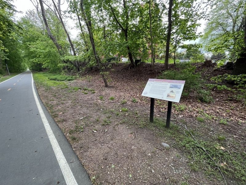
On Wampanoag Trail (Rhode Island Route 114) at Kyle Circle, on the right when traveling north on Wampanoag Trail.
Osamequin Nature Preserve and Bird Sanctuary is named in honor of the Massasoit (Great Leader) Osamequin (or Ousamequin) of the Pokanoket Tribe. Osamequin, which means Yellow Feather, led his people in helping the settlers of the Plymouth Colony . . . — — Map (db m223753) HM
On Wood Street south of State Street, on the right when traveling north.
Erected in memory of the stalwart founders and builders of Bristol those courageous men and women whose dauntless spirit and renowned achievements have become the everlasting heritage of this town — — Map (db m222923) HM
Near Thames Street north of John Street, on the left when traveling north.
In 1675, after King Philip's War, the lands known as Mount Hope were ceded to Plymouth Colony. Plymouth sold the area that became the Town of Bristol and its deep water harbor to four proprietors, who laid out streets relative to the waterfront. . . . — — Map (db m222772) HM
Near Tower Street (at milepost 0.7), 0.2 miles south of Tower Street.
In the 'Miery Swamp,' 100 feet W.S.W. from this spring, according to tradition, King Philip fell, August 12, 1676, O.S. This stone placed by the R.I. Historical Society. December, 1877. — — Map (db m86296) HM
Near Metacom Avenue (Rhode Island Route 136) 0.1 miles south of Mount Hope Avenue, on the right when traveling north.
Mount Hope (originally Montaup in the Pokanoket language) is a wooded promontory on the eastern shore of Bristol, Rhode Island overlooking the part of Narragansett Bay known as Mount Hope Bay. Before the European settlers arrived in New England, . . . — — Map (db m186121) HM
On Mount Hope Bridge (Rhode Island Route 114) 0.1 miles south of Old Ferry Road, on the left when traveling south.
Connecting Providence plantations settled by Roger Williams 1636 with the island of Rhode Island settled by John Clarke 1638 (purchased from the Indians and originally called Aquidneck)
On the nearby shores of Mount Hope lived the Wampanoag . . . — — Map (db m198190) HM
On Child Street (Rhode Island Route 103) at Hugh Cole Road, on the right when traveling east on Child Street.
The town of Warren was first settled by people from the Pokanoket Tribe, later known as the Wampanoag. The Pokanoket controlled the land from Plymouth to the eastern shores of Narragansett Bay. In 1620, “Osamequin”, which translates as “Yellow . . . — — Map (db m223848) HM
Near Asylum Road, 0.3 miles west of Cole School Road, on the left when traveling north.
In memory of Hugh Cole. Born London, England, 1627. Died Swansea, Mass, 1699. An honorable and useful citizen of Plymouth Colony. Many years a representative of Swansea, Mass. A sergeant in King Philip's War, 1675. An esteemed friend of King . . . — — Map (db m223850) HM
On Baker Street at Water Street, on the right when traveling west on Baker Street.
In October of 2000 the Massasoit Park Revitalization Committee rehabilitated and re-dedicated this park for the community of Warren as a recreational space for the Historic Waterfront District.
In the “Sacred Circle,” East, West, North and . . . — — Map (db m188388) HM
On Main Street (Rhode Island Route 114) at Jefferson Street, on the right when traveling north on Main Street.
Indigenous people known today as the Pokanoket Tribe had made their home in the Town of Warren for thousands of years prior to the arrival of the first European settlers.
The town and the surrounding area was called Sowams, and the land . . . — — Map (db m222960) HM
On Taft Street, on the right when traveling north.
Homestead OverviewIn 1770, this house was built by 27 year-old Quaker and iron-master, Nathanael Greene. The building is a well-preserved 18th Century structure of simple, yet refined design. The iron forge, which was located on the Pawtuxet . . . — — Map (db m83326) HM
On Railroad Street at Log Bridge Road, on the left when traveling west on Railroad Street.
The village of Summit was called Perry’s Hollow in the 18th century.
Located on a ridge between the Flat River and the Moosup River Watersheds, the name “Summit” signified a high point along the adjacent railroad line.
Summit developed when the . . . — — Map (db m107453) HM
On Marlborough Street at Long Street, on the left when traveling south on Marlborough Street.
Built in 1872 by William Northup on the former site of Scalloptown. This chapel was the first fully integrated congregation in East Greenwich. — — Map (db m58389) HM
This Tablet erected by the Rhode Island Society of Colonial Wars in recognition of the exceptional services rendered by Col. Benjamin Church
His fearless leadership and effective command during King Philip's war 1675-1676 — — Map (db m52392) HM
On Mount Vernon Street north of Barney Street, on the right when traveling south.
This was the home of Mr. Smith until his death in 1886. As a Real Estate Broker he helped to develop the land along Bellevue Avenue.
This property has been
placed on the
National Register
of Historic Places
by the United States . . . — — Map (db m223109) HM
On Marlborough Street at Farewell Street, on the left when traveling east on Marlborough Street.
In 1639, Helen and Nicholas Easton, John Clarke, William Coddington and others left Portsmouth, the settlement founded in 1638 by Anne Hutchinson and others on the northern end of Aquidneck Island. They came south and founded Newport. Newport’s . . . — — Map (db m48498) HM
Near Anthony Road Extention/Old Boyd's Lane, 0.1 miles west of Boyds Lane.
Erected to honor the memory and
perpetuate the spirit and ideals of
the founders of the first government
in the world to allow and to insure to
its citizens civil and religious liberty.
Established on this Site in the Year 1638
Portsmouth . . . — — Map (db m29736) HM
Near Roosevelt Avenue, 0.1 miles north of Main Street (Rhode Island Route 15), on the right when traveling north. Reported permanently removed.
Sylvanus Brown lived in this cottage from 1784 to 1824. Brown's proven pattern-making and carpentry skills earned him a place at Samuel Slater's side. Brown had also built water-powered mills and visited European mill sites. Between 1789 and . . . — — Map (db m118327) HM
On Main Street (Rhode Island Route 15) at Roosevelt Avenue, on the left when traveling east on Main Street.
When Samuel Slater first came here, the village had everything he needed to succeed. Pawtucket Falls provided ample waterpower. That energy was already powering local machine shops. Those shops were run by skilled mechanics who could assist with . . . — — Map (db m151670) HM
David Wilkinson (1771-1852), a blacksmith from Smithfield, Rhode Island, moved to Pawtucket in the early 1780s. Wilkinson invented new machines, including a steamboat, which he demonstrated in Pawtucket in 1792 (15 years before Robert Fulton's . . . — — Map (db m118248) HM
On Rochambeau Avenue just east of Lorimer Avenue, on the right when traveling east.
Morris Brown House
has been placed on the
National Register
of Historic Places
by the United States
Department of the Interior
Built 1793 — — Map (db m151679) HM
On North Main Street, on the left when traveling north. Reported permanently removed.
By the end of the Revolutionary War, the center of town had moved to several blocks south of this point. From 1820 to 1850 the Blackstone Canal and Providence and Worcester Railroad were built along the western edge of this plot, and Canal Street . . . — — Map (db m106872) HM
On North Main Street, on the left when traveling north. Reported permanently removed.
This intersection was the earliest center of colonial Providence. A grist mill stood just north, at the falls of Moshassuck River, and a tannery and taverns were nearby across the street. In 1676 the natives of many tribes united against the New . . . — — Map (db m56152) HM
Providence’s Downtown was not always located in its present location across the river.
The first town center was located along the Moshassock River and North Main Street near St. John’s Episcopal Church.
The second Downtown was located around . . . — — Map (db m107762) HM
On Benefit Street, on the right when traveling south.
Has been designated a Registered National Historic Landmark
Under the provisions of the Historic Sites Act of August 21, 1935
This site possesses exceptional value in commemorating and illustrating the history of the United States
US . . . — — Map (db m56155) HM
On South Water Street (U.S. 44) at Packet Street, on the right when traveling south on South Water Street.
Providence has changed dramatically since its founding in 1636, from the early settlement enriched by farmland, to the town competing with Newport for trade, to the thriving capital it is today. This evolution can be evaluated through a case . . . — — Map (db m151732) HM
Near this spot lived Gabriel Bernon a Huguenot Refugee
Born Larochelle France April 6, 1644
Died Providence February 1, 1736
Merchant Colonizer Churchman — — Map (db m56148) HM
On Congdon Street north of Cushing Street, on the left when traveling north.
This hilltop has been an important and strategic location throughout the history of Providence. In early days there was a beacon to use for communication between settlements along Narragansett Bay. Later, at the beginning of the Revolutionary . . . — — Map (db m223296) HM
Near North Main Street (U.S. 1) at Bowen Street, on the left when traveling north.
Roger Williams said there was no amount of money that could have purchased Providence.
In 1636, Williams and the Narragansett tribal leaders, or Sachems, Cononicus and Miantonomo, negotiated for the land that became Providence. Together, they . . . — — Map (db m115211) HM
Near North Main Street (U.S. 1) at North Court Street, on the left when traveling north.
Welcome to the birthplace of religious freedom in the United States. Roger Williams, fleeing religious persecution in England and Massachusetts Bay Colony, founded Providence here in 1636. The original inhabitants, the Narragansett and Wampanoag, . . . — — Map (db m115217) HM
On Main Street (U.S. 44) at Court Street, on the left when traveling north on Main Street.
Forced worship stinks in God's nostrils.
Roger Williams, in a letter to Connecticut
Governor Thomas Prence (1670)
The steeple in front of you is the First Baptist Church in America, gathered by Roger Williams in 1638. Williams was . . . — — Map (db m122503) HM
On North Main Street (U.S. 44) at North Main Street, on the right when traveling east on North Main Street.
If this building could speak, it would tell the remarkable tale of a city’s transformation.
The Antram-Gray House, the oldest surviving commercial building in Providence, was built around 1730 as a residence and distillery.
It soon found . . . — — Map (db m107736) HM
The rivers in Providence, 14 years after Roger Williams founded the city, were crossed by fording at low tide.
As time passed, some of the long narrow house lots became streets named after the owners of the lots. The stream ending in Mile . . . — — Map (db m222677) HM
On Washington Street east of Dorrance Street, on the left when traveling east.
The Great Salt Cove, a tidal pond, once filled the area that has become, over the past 160 years, the city's center for transportation, civic life, and commercial activity. Formed between 3800 and 2700 years ago, it was a major Native American . . . — — Map (db m222721) HM
On North Main Street (U.S. 1), on the left when traveling north. Reported permanently removed.
Though uninhabited on the eve of its settlement by Europeans, this area already had a 7000 year history of activity by native Americans. In 1636, this land was the low, marshy shoreline of a large saltwater cove to the west, along the eastern side . . . — — Map (db m56175) HM
Near North Main Street (U.S. 1) at Howland Street, on the left when traveling north.
…at last to proclaim a true and absolute Soul-Freedom to all the people of the land impartially, so that no person be forced to pray nor pay, otherwise than as his Soul believeth and consenteth.
Roger Williams, from Butler's . . . — — Map (db m115209) HM
In 1636, Roger Williams bought land from the Narragansett chiefs and established a colony here near the site of a fresh water spring. Naming the town for God's providence to him, Williams declared the settlement a shelter for the persecuted of all . . . — — Map (db m56176) HM
On Westminster Street at Memorial Boulevard (U.S. 44), on the right when traveling west on Westminster Street. Reported damaged.
In the 18th century the west side of the Providence River, now Downtown Providence and the Financial District, was known as the Weybosset Side after the name of its first street. With the dawn of the 19th century, development surged on the . . . — — Map (db m151701) HM
On Canal Street (U.S. 44) at Park Row West, on the right when traveling south on Canal Street. Reported damaged.
The junction of five Native American trails once occupied this stretch of North Main Street, between College Street and the Y-intersection at Mill Street. The Narragansett Trail or Pequot Path, as well as the Louquassuck, Pawtucket, Wampanoag, . . . — — Map (db m223303) HM
On Empire Street at Westminster Street, on the right when traveling south on Empire Street.
Look around you. Along the west side of Empire Street, where you can see a small park and office building today, you would have found the center of Providence's Chinese community, who settled in tenements here in the 1890s.
Although Chinese . . . — — Map (db m223032) HM
On Eddy Street at Ship Street, on the right when traveling north on Eddy Street.
The area that would become Providence's West Side, including Central Wharf, was former tidal marshlands on the west side of the Providence River. Native Americans used the area as hunting and fishing grounds before Roger Williams' arrival in . . . — — Map (db m222612) HM
On Canal Street (U.S. 44), on the left when traveling south. Reported permanently removed.
Roger Williams died in Providence early in 1683, and was buried with a simple ceremony behind his home, near today's intersection of Benefit St. and Bowen St. Remains at the site were exhumed in 1860 and removed to the Old North Burying Ground. In . . . — — Map (db m56154) HM
On South Water Street, on the right when traveling south.
The site of an 18th century seaport village where seafaring merchants participated in the African slave trade. In the 20th century this port was used by Cape Verdeans who came to live in America. — — Map (db m233864) HM
On Memorial Boulevard at Exchange Street, on the right when traveling west on Memorial Boulevard.
These rivers were named by the Narragansett & Wampanoag peoples before Roger Williams came to Rhode Island. Woonasquatucket means "The River Where the Tide Ends". Moshassuck means "The River Where the Moose Water". — — Map (db m223078) HM
On Main Street (U.S. 44) at Howland Street, on the left when traveling north on Main Street.
The Spring of clear cold water located thirty feet west of this point led Roger Williams to found Providence here in the year 1636 from which center has developed in four directions — — Map (db m122490) HM
On North Main Street (U.S. 44) at Church Street, on the left when traveling north on North Main Street.
Welcome to the birthplace of religious freedom in the United States. Roger Williams, fleeing religious persecution in England and Massachusetts Bay Colony, founded Providence here in 1636. The original inhabitants, the Narragansett and Wampanoag, . . . — — Map (db m222490) HM
On Washington Street at Eddy Street, on the right when traveling west on Washington Street.
Stephanie tells me that she was born in Senegal and spoke only French as a child, but Ashley was born in Providence. They say that their family is originally from Cape Verde, an island chain off the coast of West Africa that was uninhabited until . . . — — Map (db m151648) HM
On U.S. 44 at Canal Street, on the right when traveling west on U.S. 44.
A Short River Through Time
“Mooshausick,” was the name given by the native Narragansett tribe to the body of water that flows into the Providence River at Confluence Park. It means “river where the moose . . . — — Map (db m107704) HM
On North Main Street (U.S. 1), on the left when traveling north.
Left Plaque The Spring on this lot was the original water supply around which Roger Williams gathered the first settlers was in 1721 by reservation in the deed from the Proprietors of Providence made accessible to the townspeople forever . . . — — Map (db m56174) HM
A freshwater spring attracted Roger Williams to this site and anchored the community.
Williams built his house across the street, and religious and civil meetings took place around its “gushing” waters.
The spring remained in . . . — — Map (db m107747) HM
On U.S. 44 (U.S. 44) 0.1 miles west of Canal Street, on the right when traveling west.
The Early Years
“Wanasquatucket” was the name given by the native Narragansett tribe to the larger river that flows into the Providence River and Confluence Park. It means “the river where the tide ends.” This panel, along with the panel . . . — — Map (db m107723) HM
Near Memorial Boulevard east of Francis Street (U.S. 1), on the right when traveling east.
These rivers were named by the Narragansett & Wampanoag peoples peoples before Roger Williams came to Rhode Island. Woonasquatucket means "The River Where the Tide Ends". Moshassuck means "The River Where the Moose Water" — — Map (db m222695) HM
Near Dyer Street at Friendship Street, on the left when traveling south.
In remembrance of the strength, courage and determination of William Gilane—who created opportunity and a lasting legacy of integrity through living his core values—may his spirit never be forgotten.
Born in 1842 in County . . . — — Map (db m151750) HM
Cape Verdean Immigration to Rhode Island
The Cape Verdean community in Fox Point originated from the Cape Verde Islands, a tiny archipelago lying 240 nautical miles off the coast of West Africa. Uninhabited prior to discovery by the Portuguese . . . — — Map (db m75995) HM
On Old Bridge Path at Power Street, on the right when traveling south on Old Bridge Path.
"What Cheer, Netop?"
Roger Williams Landing, 1636
If you were standing on this spot at any time prior to the late 1870's, you would have been standing (or more likely, swimming) in the Seekonk River. The original shoreline was several . . . — — Map (db m151691) HM
Near India Street, on the right when traveling east.
Roger Williams, the founder of Rhode Island, was born in London in 1603. After graduating from Cambridge University in 1627, Williams took holy orders in the church of England. In 1630 he emigrated to the New World and settled in the Massachusetts . . . — — Map (db m57585) HM
On Gano Street just north of Williams Street, on the left when traveling north.
To the memory of
Roger Williams
The Apostle of Soul Liberty
Founder of the
State of Rhode Island
and
Providence Plantations
Below this spot
then at the waters edge
stood the rock
on which
according to tradition . . . — — Map (db m151690) HM
Welcome to India Point Park
In 1962, Mary Elizabeth Sharpe wrote of her vision for a park at the head of Narragansett Bay. Her passion for landscape allowed her to see beyond the abused and neglected waterfront. She shared her thoughts in a . . . — — Map (db m75991) HM
On East Bay Bike Path east of Water Street, on the right when traveling east.
West Bank / East BankFox Point / India Point and Watchemoket Square
The Washington Bridge connects the historic neighborhoods of Fox Point/India Point in Providence and Watchemoket Square in East Providence. Since 1793, . . . — — Map (db m222549) HM
On Rose Avenue near Green Memorial Boulevard, on the right when traveling north.
Built in 1773, the one-and-a-half-story, five-room, gambrel-roofed cottage sits on part of the land originally deeded to Rhode Island's founder, Roger Williams, by the Narrangansett sachems Miantonomi and Canonicus.
It was built for James . . . — — Map (db m222437) HM
Near FC Greene Memorial Boulevard south of Hawthorne Avenue, on the right when traveling south.
At least seven ice ages have chilled the earth over the last 1.6 million years. With each cooling, popular ice caps grow, ocean levels fall, and new habitats are created. When the planet warms, the oceans rise again, relocating and isolating . . . — — Map (db m222377) HM
On Newman Avenue (Rhode Island Route 152) at Pawtucket Avenue (Rhode Island Route 1A), on the right when traveling east on Newman Avenue.
The area of today’s City of East Providence was inhabited by the Pokanoket Tribe, later known as the Wampanoag, for over 10,000 years. In 1621, the Massasoit Ousamequin entered into a mutual protection agreement with the English settlers in . . . — — Map (db m207459) HM
On Main Street at River Street, on the right when traveling south on Main Street.
How the City Grew
Why is the City of Woonsocket here? And how did Market Square become its first center? The answers to those questions lie in the forces that shaped Woonsocket's earliest days — water, land and money. From here you can hear . . . — — Map (db m196978) HM
On Main Street at River Street, on the right when traveling south on Main Street.
The City's Cultural Tapestry
When the first textile mills were built at Woonsocket Falls in the early 1800s, mill workers were recruited from nearby Yankee farm families. But as the city expanded into six distinct villages, each with several . . . — — Map (db m196979) HM
On Nooseneck Hill Road (U.S. 3) at Chase Hill Road, on the right when traveling south on Nooseneck Hill Road.
Here for more than a century was the religious, business and civil center of Westerly. Near by in private homes, the people met in town meetings. Here crossed paths from what is now Hopkinton, Richmond and Westerly. Here were the first mill dam and . . . — — Map (db m29616) HM
On Lakeside Drive at Old Center Road on Lakeside Drive.
Here original settlers lived in caves and shelters. Site of first church 1772 Pastors Oliver Dodge, Trustrum Dodge Nearby site of first school house, windmill, pound, precious spring. Indian burying hill — — Map (db m17231) HM
On Post Road (U.S. 1) at Old Post Road on Post Road.
In 1637 near this spot, Roger Williams set up a trading post where he dwelt for many years, trading and treating with the Narragansett Indians. His dealings so completely won and held the friendliness of the powerful Narragansett sachems that for . . . — — Map (db m78927) HM
On Ten Rod Road (Rhode Island Route 102) east of Rodman Lane, on the right when traveling west.
This property
has been placed on the
National Register
of Historic Places
by the United States
Department of the Interior
Hortense Rodman Allen House
1865 — — Map (db m222644) HM
On Ten Rod Road (Rhode Island Route 108) east of Advent Street, on the right when traveling east.
For a place to be truly considered a village requires several vital components; buildings that serve the residents and contribute to the sense of community that the word "village" embodies. In Lafayette, virtually all those community-creating . . . — — Map (db m222662) HM
On Ten Rod Road (Rhode Island Route 102) at Advent Street, on the right when traveling east on Ten Rod Road.
Industry began here on the Shewatuck River, named after a village site of the Narragansett People, Showatucquese, "place between the small streams", in the colonial period with creation of the mill pond and the construction of a sawmill . . . — — Map (db m222647) HM
On Middlebridge Road at John Street, on the right when traveling south on Middlebridge Road.
At this “round rock,” noted Indian landmark, the original purchase of this land was made from Quassaquanch, Kachanaquant, and Quequaquenuet, chief Sachems of the Narragansetts, by Samuel Wilbor, John Hull, John Porter, Samuel Wilson, . . . — — Map (db m48053) HM
On Main Street (Rhode Island Route 1A) south of Robinson Street, on the left when traveling south.
On January 13th, 1886, Daniel Billington Griffin purchased a certain tract of land situated in Wakefield Village from Rowland & John N. Hazard for the sum of 2,000 dollars.
This particular parcel of land was located on the corner of Post Road . . . — — Map (db m115166) HM
On South County Trail (Rhode Island Route 2) at Great Swamp Monument Road, on the left when traveling west on South County Trail. Reported missing.
Three Quarters of a mile to the Southward on an island in the Great Swamp the Narragansett Indians were decisively defeated by the United Forces of the Massachusetts Bay, Connecticut, and Plymouth Colonies, Sunday, December 19, 1675. — — Map (db m56046) HM