After filtering for Rhode Island, 82 entries match your criteria.
Settlements & Settlers Topic
By Devry Becker Jones (CC0), May 5, 2023
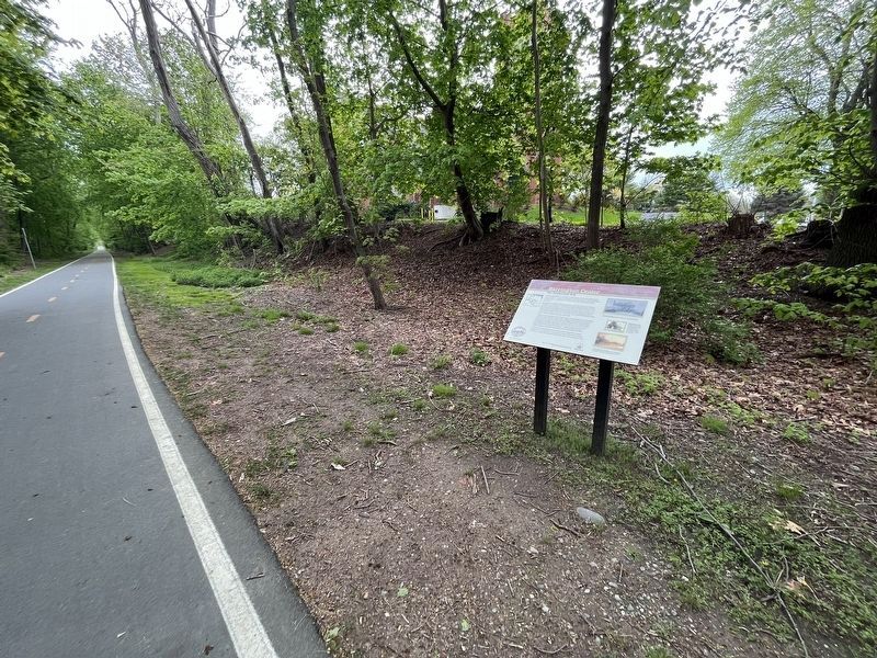
Barrington Center Marker
| 1 ► Rhode Island, Bristol County, Barrington — Barrington Center — The Commercial Hub — |
| On East Bay Bike Path east of County Road (Rhode Island Route 114), on the right when traveling east. | |||
| 2 ► Rhode Island, Bristol County, Barrington — New Meadow Neck — Rivers, Bridges, and an Early Town Center — |
| On East Bay Bike Path at New Meadow Road, on the right when traveling west on East Bay Bike Path. | |||
| 3 ► Rhode Island, Bristol County, Barrington — Osamequin — Great Leader of the Pokanokets — |
| On Wampanoag Trail (Rhode Island Route 114) at Kyle Circle, on the right when traveling north on Wampanoag Trail. | |||
| 4 ► Rhode Island, Bristol County, Bristol — Founders and Builders of Bristol — 1680 - 1930 — |
| On Wood Street south of State Street, on the right when traveling north. | |||
| 5 ► Rhode Island, Bristol County, Bristol — Historical Bristol — From Colonial Days to the Federal Era — ❔ — |
| Near Thames Street north of John Street, on the left when traveling north. | |||
| 6 ► Rhode Island, Bristol County, Bristol — In the Miery Swamp — King Philip Fell — |
| Near Tower Street (at milepost 0.7), 0.2 miles south of Tower Street. | |||
| 7 ► Rhode Island, Bristol County, Bristol — Mount Hope — Sacred Land of the Pokanokets — A Sowams Heritage Area Site — |
| Near Metacom Avenue (Rhode Island Route 136) 0.1 miles south of Mount Hope Avenue, on the right when traveling north. | |||
| 8 ► Rhode Island, Bristol County, Bristol — Mount Hope Bridge — |
| On Mount Hope Bridge (Rhode Island Route 114) 0.1 miles south of Old Ferry Road, on the left when traveling south. | |||
| 9 ► Rhode Island, Bristol County, Warren — Early Warren and the start of King Philip's War — |
| On Child Street (Rhode Island Route 103) at Hugh Cole Road, on the right when traveling east on Child Street. | |||
| 10 ► Rhode Island, Bristol County, Warren — In Memory of Hugh Cole — |
| Near Asylum Road, 0.3 miles west of Cole School Road, on the left when traveling north. | |||
| 11 ► Rhode Island, Bristol County, Warren — Massasoit Park Sacred Circle Monument — |
| On Baker Street at Water Street, on the right when traveling west on Baker Street. | |||
| 12 ► Rhode Island, Bristol County, Warren — Warren, RI — Home of the Massasoit Ousamequin who met the Pilgrims in 1621 — |
| On Main Street (Rhode Island Route 114) at Jefferson Street, on the right when traveling north on Main Street. | |||
| 13 ► Rhode Island, Kent County, Coventry — The General Nathanael Greene Homestead — |
| On Taft Street, on the right when traveling north. | |||
| 14 ► Rhode Island, Kent County, Coventry, Greene — Summit — |
| On Railroad Street at Log Bridge Road, on the left when traveling west on Railroad Street. | |||
| 15 ► Rhode Island, Kent County, East Greenwich — The Marlborough Street Chapel — Rhode Island Afro-American Heritage Trail — |
| On Marlborough Street at Long Street, on the left when traveling south on Marlborough Street. | |||
| 16 ► Rhode Island, Newport County, Little Compton — Col. Benjamin Church — |
| On Commons Street. | |||
| 17 ► Rhode Island, Newport County, Newport — Alfred Smith House — Circa 1845 — 12 Mount Vernon Street — |
| On Mount Vernon Street north of Barney Street, on the right when traveling south. | |||
| 18 ► Rhode Island, Newport County, Newport — Great Friends Meeting House — |
| On Marlborough Street at Farewell Street, on the left when traveling east on Marlborough Street. | |||
| 19 ► Rhode Island, Newport County, Portsmouth — Portsmouth Compact — 1638-1936 — |
| Near Anthony Road Extention/Old Boyd's Lane, 0.1 miles west of Boyds Lane. | |||
| 20 ► Rhode Island, Providence County, Pawtucket — River and Fields at Pawtucket — |
| On Exchange Street near Roosevelt Avenue, on the right when traveling east. | |||
| 21 ► Rhode Island, Providence County, Pawtucket — Sylvanus Brown House |
| Near Roosevelt Avenue, 0.1 miles north of Main Street (Rhode Island Route 15), on the right when traveling north. Reported permanently removed. | |||
| 22 ► Rhode Island, Providence County, Pawtucket — The Perfect Place — Blackstone River Valley National Historical Park, Slater Mill Historic Site — National Park Service, U.S. Department of the Interior — |
| On Main Street (Rhode Island Route 15) at Roosevelt Avenue, on the left when traveling east on Main Street. | |||
| 23 ► Rhode Island, Providence County, Pawtucket — The Wilkinson Mill — |
| 24 ► Rhode Island, Providence County, Providence, Blackstone Boulevard Realty Plat Historic District — Morris Brown House — 317 Rochambeau Avenue — |
| On Rochambeau Avenue just east of Lorimer Avenue, on the right when traveling east. | |||
| 25 ► Rhode Island, Providence County, Providence, College Hill — A Changing Nation |
| On North Main Street, on the left when traveling north. Reported permanently removed. | |||
| 26 ► Rhode Island, Providence County, Providence, College Hill — A Thoroughfare Town |
| On North Main Street, on the left when traveling north. Reported permanently removed. | |||
| 27 ► Rhode Island, Providence County, Providence, College Hill — Around the Corner from Market Square — taken from “The Civic and Architectural Development of Providence” by John Hutchins Cady — |
| On Canal Walk. | |||
| 28 ► Rhode Island, Providence County, Providence, College Hill — College Hill Historic District — |
| On Benefit Street, on the right when traveling south. | |||
| 29 ► Rhode Island, Providence County, Providence, College Hill — Crawford Street Bridge Without Crawford Street — |
| On South Water Street (U.S. 44) at Packet Street, on the right when traveling south on South Water Street. | |||
| 30 ► Rhode Island, Providence County, Providence, College Hill — First Town House of Providence — |
| On South Main Street (U.S. 44), on the right when traveling north. | |||
| 31 ► Rhode Island, Providence County, Providence, College Hill — Gabriel Bernon — |
| On Canal Street, in the median. | |||
| 32 ► Rhode Island, Providence County, Providence, College Hill — Prospect Terrace — |
| On Congdon Street north of Cushing Street, on the left when traveling north. | |||
| 33 ► Rhode Island, Providence County, Providence, College Hill — Realizing Providence — |
| Near North Main Street (U.S. 1) at Bowen Street, on the left when traveling north. | |||
| 34 ► Rhode Island, Providence County, Providence, College Hill — Roger Williams National Memorial — National Park Service, U.S. Department of the Interior — |
| Near North Main Street (U.S. 1) at North Court Street, on the left when traveling north. | |||
| 35 ► Rhode Island, Providence County, Providence, College Hill — Site of Roger Williams House — |
| On Main Street (U.S. 44) at Howland Street, on the right when traveling north on Main Street. | |||
| 36 ► Rhode Island, Providence County, Providence, College Hill — The Prophet of Religious Freedom — |
| On Main Street (U.S. 44) at Court Street, on the left when traveling north on Main Street. | |||
| 37 ► Rhode Island, Providence County, Providence, College Hill — Witness to History — Roger Williams National Memorial — National Park Service, U.S. Department of the Interior — |
| On North Main Street (U.S. 44) at North Main Street, on the right when traveling east on North Main Street. | |||
| 38 ► Rhode Island, Providence County, Providence, Downtown Providence — 1650 — |
| Near Memorial Boulevard west of Exchange Street. | |||
| 39 ► Rhode Island, Providence County, Providence, Downtown Providence — A History of Kennedy Plaza — Kennedy Plaza — Providence — |
| On Washington Street east of Dorrance Street, on the left when traveling east. | |||
| 40 ► Rhode Island, Providence County, Providence, Downtown Providence — A Howling Wilderness |
| On North Main Street (U.S. 1), on the left when traveling north. Reported permanently removed. | |||
| 41 ► Rhode Island, Providence County, Providence, Downtown Providence — A Livelie Experiment — |
| Near North Main Street (U.S. 1) at Howland Street, on the left when traveling north. | |||
| 42 ► Rhode Island, Providence County, Providence, Downtown Providence — A Shelter for Persons Distressed — |
| On North Main Street, in the median. | |||
| 43 ► Rhode Island, Providence County, Providence, Downtown Providence — Across the River from Market Square — taken from "The Civic and Architectural Development of Providence" by John Hutchins Cady |
| On Westminster Street at Memorial Boulevard (U.S. 44), on the right when traveling west on Westminster Street. Reported damaged. | |||
| 44 ► Rhode Island, Providence County, Providence, Downtown Providence — Aquene. Eniskeetompowaug. — Peace be with you. All Tribes are Welcome. — Roger Williams National Memorial |
| On Canal Street (U.S. 44) at Park Row West, on the right when traveling south on Canal Street. Reported damaged. | |||
| 45 ► Rhode Island, Providence County, Providence, Downtown Providence — Chinatown on Empire — Westminster Street — |
| On Empire Street at Westminster Street, on the right when traveling south on Empire Street. | |||
| 46 ► Rhode Island, Providence County, Providence, Downtown Providence — Early History and Archaeology of Central Wharf — |
| On Eddy Street at Ship Street, on the right when traveling north on Eddy Street. | |||
| 47 ► Rhode Island, Providence County, Providence, Downtown Providence — Gone From Hence |
| On Canal Street (U.S. 44), on the left when traveling south. Reported permanently removed. | |||
| 48 ► Rhode Island, Providence County, Providence, Downtown Providence — Providence — (Water Street) — |
| On South Water Street, on the right when traveling south. | |||
| 49 ► Rhode Island, Providence County, Providence, Downtown Providence — Providence River Park — ⚓ — |
| On Dyer Street at Providence River Greenway, on the left when traveling south on Dyer Street. | |||
| 50 ► Rhode Island, Providence County, Providence, Downtown Providence — Providence River Park — ⚓ — |
| On Memorial Boulevard at Exchange Street, on the right when traveling west on Memorial Boulevard. | |||
| 51 ► Rhode Island, Providence County, Providence, Downtown Providence — Roger Williams Founded Providence Here in 1636 — |
| On Main Street (U.S. 44) at Howland Street, on the left when traveling north on Main Street. | |||
| 52 ► Rhode Island, Providence County, Providence, Downtown Providence — Roger Williams National Memorial — National Park Service, U.S. Department of the Interior — |
| On North Main Street (U.S. 44) at Church Street, on the left when traveling north on North Main Street. | |||
| 53 ► Rhode Island, Providence County, Providence, Downtown Providence — Stephanie and Ashley — |
| On Washington Street at Eddy Street, on the right when traveling west on Washington Street. | |||
| 54 ► Rhode Island, Providence County, Providence, Downtown Providence — The Moshassuck River — Its Industry and settlements as shown on an 1885 map — |
| On U.S. 44 at Canal Street, on the right when traveling west on U.S. 44. | |||
| 55 ► Rhode Island, Providence County, Providence, Downtown Providence — The Original Water Supply — |
| On North Main Street (U.S. 1), on the left when traveling north. | |||
| 56 ► Rhode Island, Providence County, Providence, Downtown Providence — The Site of Hardscrabble Riot 1824 — |
| On Francis Street (U.S. 1) south of Gaspee Street (U.S. 1), on the right when traveling north. | |||
| 57 ► Rhode Island, Providence County, Providence, Downtown Providence — The Wellspring of Providence — Roger Williams National Memorial — National Park Service, U.S. Department of the Interior — |
| Near North Main Street. | |||
| 58 ► Rhode Island, Providence County, Providence, Downtown Providence — The Woonasquatucket River — Its industry and settlements as shown on an 1895 map — |
| On U.S. 44 (U.S. 44) 0.1 miles west of Canal Street, on the right when traveling west. | |||
| 59 ► Rhode Island, Providence County, Providence, Downtown Providence — Water Place — ⚓ — |
| Near Memorial Boulevard east of Francis Street (U.S. 1), on the right when traveling east. | |||
| 60 ► Rhode Island, Providence County, Providence, Downtown Providence — William Gilbane — |
| Near Dyer Street at Friendship Street, on the left when traveling south. | |||
| 61 ► Rhode Island, Providence County, Providence, Fox Point — Fox Point Cape Verdean Community — Providence Harbor Walk at Fox Point & India Point — |
| On India Street. | |||
| 62 ► Rhode Island, Providence County, Providence, Fox Point — 1 — Gano Park - Centuries of History — Fox Point's Seekonk Shoreline & India Point — |
| On Old Bridge Path at Power Street, on the right when traveling south on Old Bridge Path. | |||
| 63 ► Rhode Island, Providence County, Providence, Fox Point — Providence River Park — ⚓ — |
| On Bridge Street at Tockwotton Street, on the left when traveling north on Bridge Street. | |||
| 64 ► Rhode Island, Providence County, Providence, Fox Point — 12 — Roger Williams Landing 1636 — Providence Harbor Walk at Fox Point & India Point — |
| Near India Street, on the right when traveling east. | |||
| 65 ► Rhode Island, Providence County, Providence, Fox Point — The Landing Place of Roger Williams — |
| On Gano Street just north of Williams Street, on the left when traveling north. | |||
| 66 ► Rhode Island, Providence County, Providence, Fox Point — 7/8 — Welcome to India Point Park / Welcome to Fox Point — Providence Harbor Walk at Fox Point & India Point — |
| On George M Cohan Blvd. | |||
| 67 ► Rhode Island, Providence County, Providence, Fox Point — West Bank / East Bank / Washington Bridges — |
| On East Bay Bike Path east of Water Street, on the right when traveling east. | |||
| 68 ► Rhode Island, Providence County, Providence, South Elmwood — Betsey Williams Cottage — Roger Williams Park — |
| On Rose Avenue near Green Memorial Boulevard, on the right when traveling north. | |||
| 69 ► Rhode Island, Providence County, Providence, South Elmwood — Land Bridges — Australasia 18,000 years ago — |
| Near FC Greene Memorial Boulevard south of Hawthorne Avenue, on the right when traveling south. | |||
| 70 ► Rhode Island, Providence County, Providence, South Elmwood — Roger Williams — |
| On Rose Avenue north of Linden Avenue, on the right when traveling north. | |||
| 71 ► Rhode Island, Providence County, Rumford — Ring of the Green and settlement in the 17th Century — |
| On Newman Avenue (Rhode Island Route 152) at Pawtucket Avenue (Rhode Island Route 1A), on the right when traveling east on Newman Avenue. | |||
| 72 ► Rhode Island, Providence County, Woonsocket — Community Development — |
| On Main Street at River Street, on the right when traveling south on Main Street. | |||
| 73 ► Rhode Island, Providence County, Woonsocket — Ethnicity — |
| On Main Street at River Street, on the right when traveling south on Main Street. | |||
| 74 ► Rhode Island, Washington County, Hopkinton, Ashaway — 7th Day Baptist Churches of Hopkinton and Westerly — |
| On Nooseneck Hill Road (U.S. 3) at Chase Hill Road, on the right when traveling south on Nooseneck Hill Road. | |||
| 75 ► Rhode Island, Washington County, New Shoreham, Block Island — Fresh Pond — Elevation 78 Ft. — 1661 — |
| On Lakeside Drive at Old Center Road on Lakeside Drive. | |||
| 76 ► Rhode Island, Washington County, North Kingstown — Roger Williams — |
| On Post Road (U.S. 1) at Old Post Road on Post Road. | |||
| 77 ► Rhode Island, Washington County, North Kingstown, Lafayette — Hortense Rodman Allen House — 781 Ten Rod Road — Lafayette Village Historic District — |
| On Ten Rod Road (Rhode Island Route 102) east of Rodman Lane, on the right when traveling west. | |||
| 78 ► Rhode Island, Washington County, North Kingstown, Lafayette — Robert Rodman's Village — Lafayette — A Southern Rhode Island Mill Village — |
| On Ten Rod Road (Rhode Island Route 108) east of Advent Street, on the right when traveling east. | |||
| 79 ► Rhode Island, Washington County, North Kingstown, Lafayette — The Shewatuck & The Beginnings of Industry — Lafayette — A Southern Rhode Island Mill Village — |
| On Ten Rod Road (Rhode Island Route 102) at Advent Street, on the right when traveling east on Ten Rod Road. | |||
| 80 ► Rhode Island, Washington County, South Kingstown — Pettaquamscutt Rock — |
| On Middlebridge Road at John Street, on the right when traveling south on Middlebridge Road. | |||
| 81 ► Rhode Island, Washington County, South Kingstown, Wakefield — Griffin's Hollow — |
| On Main Street (Rhode Island Route 1A) south of Robinson Street, on the left when traveling south. | |||
| 82 ► Rhode Island, Washington County, South Kingstown, West Kingston — The Great Swamp Fight |
| On South County Trail (Rhode Island Route 2) at Great Swamp Monument Road, on the left when traveling west on South County Trail. Reported missing. | |||