By Craig Swain, July 24, 2010
Meadowville Marker
GEOGRAPHIC SORT Title Sort Marker Number Sort Marker Number Sort N Marker Number Sort T Publication Order Sort Publication Order Sort A Erected Year Sort Most Viewed Sort Most Recent-Interest Sort Most Recently Changed Sort SEE FAQ #33 FOR DESCRIPTIONS
On Morgantown Pike (State Highway 92) at Slate Road, on the right when traveling east on Morgantown Pike.
On Winchester Pike (U.S. 11) north of Old Mill Road, on the right when traveling north. Reported missing.
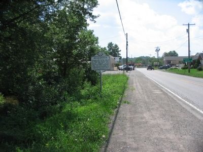
On Runneymead Road, 0.5 miles west of Goldmiller Road, on the right when traveling east.
On Runnymeade Road (County Route 26) at Soldier Drive, on the right when traveling west on Runnymeade Road.
On Winchester Pike (U.S. 11) north of Old Mill Road, on the right when traveling north. Reported missing.
On Winchester Pike (U.S. 11) south of Hatchery Road (County Route 11/8).
On Williamsport Pike (U.S. 11) east of Temple Drive, on the right when traveling west.
On Dominion Road, 0.1 miles south of Gerrardstown Road, on the left when traveling south.
On Gerrardstown Road (West Virginia Route 51) 0.1 miles east of Reunion Corner Road, on the left when traveling west.
On Gerrardstown Road (West Virginia Route 51) just north of Dominion Road (County Road 51/2), on the left when traveling north.
On Runnymeade Road (County Road 26) 0.4 miles west of Goldmiller Road (County Road 24), on the right when traveling west.
On West Main Street (West Virginia Route 9) just north of North Mary Street (West Virginia Route 901), on the right when traveling north.
On East Main Street (West Virginia Route 9) just east of South Mary Street (West Virginia Route 901), on the right when traveling east.
On West Main Street (West Virginia Route 9) just north of North Mary Street (West Virginia Route 901), on the right when traveling north.
On East Main Street (West Virginia Route 9) just east of South Mary Street (West Virginia Route 901), on the right when traveling east.
Paid Advertisement
On East Main Street (West Virginia Route 9) at Zion Street, on the right when traveling east on East Main Street.
On West Main Street (West Virginia Route 9) south of Bodine Street, on the right when traveling north.
On East Main Street (West Virginia Route 9) just north of South Mary Street (West Virginia Route 901), on the right when traveling south.
On East Main Street (West Virginia Route 9) just east of Zion Street, on the left when traveling east.
On North Mary Street (West Virginia Route 901) just north of Town Spring Street, on the left when traveling north.
On Town Spring Street just north of Skinner Lane, on the right when traveling north.
On North Mary Street (West Virginia Route 901) just north of Town Spring Street, on the right when traveling north.
On North Mary Street (West Virginia Route 901) just north of West Ash Street, on the right when traveling north.
On North Mary Street (West Virginia Route 901) just south of West Elm Street, on the right when traveling south.
On Hedgesville Road (West Virginia Route 9) near Mt. Zion Street, on the right.
On Bodine Street north of Hedgesville Road (West Virginia Route 9), on the left when traveling east.
On East John Street east of South Water Street, on the right when traveling west.
On Queen Street (U.S. 11) at King Street (U.S. 11), on the right when traveling north on Queen Street.
On South Queen Street (West Virginia Route 9) at East King Street on South Queen Street.
On South Queen Street (West Virginia Route 45) north of Buxton Street, on the left when traveling north.
On Williamsport Pike (U.S. 11) 0.4 miles north of Warm Springs Ave., on the right when traveling north.
Paid Advertisement
On East John Street, on the right.
On East John Street, on the right when traveling west.
On South Queen Street (West Virginia Route 9) north of Bulldog Boulevard, on the left when traveling north.
On Edwin Miller Boulevard (West Virginia Route 9) east of Interstate 81, on the left when traveling west.
On King Street (U.S. 11) near North Maple Avenue, on the left when traveling east.
On South Water Street at East John Street, on the right when traveling north on South Water Street.
On East King Street at South Queen Street (U.S. 11), in the median on East King Street.
On Winchester Avenue (U.S. 11) 0.2 miles south of Specks Run Road, on the right when traveling north.
On Daniel Boone Parkway (West Virginia Route 3) at Roundbottom Road (Local Route 119/21) when traveling west on Daniel Boone Parkway.
On Bridge Street (West Virginia Route 5) at S. Wabash Avenue, on the left when traveling west on Bridge Street.
On Main Street (West Virginia Route 67) 0.2 miles east of West Virginia Route 88, on the right when traveling east.
On Main Street (Route 67) at Fairway Street, on the right when traveling east on Main Street.
On Charles Street at 6th Street, on the left when traveling north on Charles Street.
On Bethany Pike (West Virginia Route 67) 0.1 miles north of McCord Hill Road (County Route 67/2), on the right when traveling north.
On Commerce Street (West Virginia Route 2) at 3rd Street, on the right when traveling north on Commerce Street.
Paid Advertisement
On 6th Street at Main Street, on the right when traveling west on 6th Street.
On Main Street at 6th Street, on the right when traveling south on Main Street.
On Commerce Street (West Virginia Route 2) north of 22nd Street, on the right when traveling south.
On Main Street at 6th Street, on the right when traveling south on Main Street.
On Charles Street at 11th Street, on the left when traveling north on Charles Street.
On Commerce Street (West Virginia Route 2) south of 3rd Street, on the right when traveling north.
On Main Street at 6th Street, on the right when traveling south on Main Street.
On Main Street at 6th Street, on the right when traveling south on Main Street.
On Main Street at Water Street on Main Street.
On 8th Street north of 5th Avenue (U.S. 60), on the left when traveling north.
On 4th Avenue west of 10th Street, on the right when traveling east.
On Bridge Street (West Virginia Route 2) at Richmond Street, on the left when traveling west on Bridge Street.
On 5th Avenue (U.S. 60) at 6th Street, on the left when traveling east on 5th Avenue.
On 5th Avenue at 8th Street on 5th Avenue.
Paid Advertisement
Near Roach Road (County Route 45) 0.6 miles north of West Virginia Route 10, on the left when traveling north.
On Little Kanawha Parkway (West Virginia Route 5) 1.3 miles west of the Big Bend Post Office, on the right when traveling east.
On Calhoun Highway (West Virginia Route 16) at Milo Road (Local Route 13), on the right when traveling south on Calhoun Highway.
On West Virginia Route 16 just south of Jess Reedy Road, on the left when traveling south.
On Main Street (West Virginia Route 16) east of Locust Street, on the left when traveling east.
On West Virginia Route 18 at Carter Camp Run Road, on the right when traveling north on State Route 18.
On Davis Street / Old U.S. 50 (West Virginia Route 18) just north of Main Street (West Virginia Route 18), on the left when traveling north. Reported missing.
On Dixie Highway (West Virginia Route 16) just north of Twenty Mile Creek Road (Route 16/3), on the left when traveling south.
On North Court Street (West Virginia Route 16).
On Main Street (County Road 25/9) just south of McKell Avenue, on the right when traveling south.
On Kaymoor Miners Trail, on the right when traveling south.
On County Route 82, on the right when traveling east.
On 4th Avenue east of Washington Street, on the right when traveling east.
Near Deepwater Mountain Road (West Virginia Route 61) at the Montgomery Bridge (West Virginia Route 6), on the right when traveling east.
On Bishop Ranch (West Virginia Route 612) at Milburn Road (County Route 1/5) when traveling east on Bishop Ranch.
On Main Street (West Virginia Route 211) 0.1 miles south of Evans Hill Road (County Road 21/12), on the right when traveling north.
Paid Advertisement
On Robert C. Byrd Drive (West Virginia Route 16) at Price Hill Road, on the right when traveling north on Robert C. Byrd Drive.
On Main Street (Route 211) 0.2 miles west of West Virginia Route 16, on the right when traveling east.
On Main Street (West Virginia Route 211) 0.1 miles east of North Michigan Avenue, on the right when traveling north.
On Main Street (West Virginia Route 211) 0.2 miles north of Virginia Street, on the right when traveling north.
Near West Virginia Route 211 at West Virginia Route 16, on the right when traveling west.
Near West Virginia Route 211 at West Virginia Route 16, on the right when traveling west.
On Keeneys Creek Road, on the right when traveling west.
On Keeneys Creek Road, on the left when traveling west.
On Keeneys Creek Road, on the right when traveling west.
On Keeneys Creek Road, on the right when traveling west.
On Tipple Trail, on the right when traveling west.
On Tipple Trail, on the right when traveling west.
On Thurmond Road (County Road 25/2) south of Beury Mountain Road (County Road 25/2), on the left when traveling north.
On Thurmond Road (County Road 25/2) south of Beury Mountain Road (County Road 25/2), on the left when traveling north.
On Thurmond Road (County Route 25/2) 0.2 miles north of Beury Mountain Road (County Road 25/2), on the right when traveling north.
On Thurmond Road (County Road 25/2) south of Beury Mountain Road (County Road 25/2), on the right when traveling north.
Paid Advertisement
On Thurmond Road (County Road 25/2) 0.1 miles south of Beury Mountain Road (County Road 25/2), on the right when traveling north.
On North Lewis Street (U.S. 33) at Factory Road (West Virginia Route 5), on the right when traveling east on North Lewis Street.
On Little Kanawha Parkway (West Virginia Route 5) just west of Millseat Run Road (Local Road 24/2), on the right when traveling east.
On Patterson Creek Road (County Route 5) 0.4 miles north of Williamsport-Twin Mountain Road (Local Road 5/2), on the left when traveling north.
On George Washington Highway (U.S. 50) west of Cherry Ridge Road, on the left when traveling west.
576 entries matched your criteria. The first 100 are listed above.
Next 100 ⊳