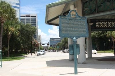
On Southern Teminus of S Hogan Street, in the median.
Approximately 15 miles up river from this point, the Union transport Maple Leaf was destroyed by a Confederate mine during the early morning hours of April 1, 1864. The Maple Leaf sank to the bottom of the St. Johns River after . . . — — Map (db m58347) HM
Near Water Street at Park Street when traveling west.
1862-1865
Just east of here began
The Line of Intrenchments
Eighth Maine
and
Sixth Connecticut
Infantry
Federal Army of Occupation
Jacksonville Historical Society.
1931 — — Map (db m152203) HM
On Phelps Street near Hubbard Street, on the right when traveling east.
(Top) 1861 In Memory of the Women of Our Southland 1865
(Center)
Let this mute but eloquent
structure speak to generations
to come, of a generation of
the past. Let it repeat
perpetually the imperishable
story . . . — — Map (db m58820) HM
On E. Forsyth Street at N.Liberty Street, on the left when traveling east on E. Forsyth Street.
The
Plaza Building
First Built Circa 1863
By the Chief Surgeon of the Confederate Army.
Rebuilt circa 1902 after the Great Fire of 1901.
Restored 1985
This property has been placed on the
National Register of . . . — — Map (db m138802) HM
Early U.S. Military Presence
In 1825, President John Quincy Adams ordered the creation of a naval station at Pensacola, Florida
Territory. The Pensacola Navy Yard opened the following year.
The first U.S. Naval Hospital was built here . . . — — Map (db m160818) HM
On North Palafox Street at West Chase Street, on the left when traveling south on North Palafox Street.
Col. William H. Chase, Construction Engineer, Pensacola Harbor defenses (Forts McRee, Barrancas, Redoubt, Pickens 1828-54). Captured Navy Yard for Florida Forces, January 12, 1861. Ordered to West Point 1856, resigned Commission to become President . . . — — Map (db m72254) HM
On South Adams Street at Church Street, on the left when traveling north on South Adams Street.
Erected in 1832, this is the oldest church building in Florida still standing on its original site. Tradition ascribes the design of this Episcopal Church to Sir Christopher Wren. Constructed of locally made brick, it was used by Federal forces . . . — — Map (db m147171) HM
On North 10th Avenue at East Salamanca Street, on the right when traveling south on North 10th Avenue.
Historic John the Baptist Church is the oldest Baptist congregation in Pensacola. In 1846, the First Baptist Colored Church of Pensacola, known as Historic John the Baptist Church since 1927, was organized in the Seville Square community. The . . . — — Map (db m72246) HM
On Scenic Highway (U.S. 90) at Langley Avenue, on the right when traveling north on Scenic Highway.
The Chimney is the only trace of what once was the first major industrial belt on the Gulf Coast, a string of antebellum wood mills and brick factories. The chimney represents the lumber industry of the Florida Panhandle. As the lumber industry . . . — — Map (db m72244) HM
On East Strong Street at North Hayne Street, on the left when traveling east on East Strong Street.
Born in 1838, John Sunday, a wealthy free man of color owned large
tracts of land and many houses in Pensacola including several properties
in the Eastside Neighborhood area. Mr. Sunday served as a Civil War
soldier who became a member of the . . . — — Map (db m177069) HM
On North Palafox Street at East Jackson Street, in the median on North Palafox Street. Reported permanently removed.
South Facing Side (Main Side)
A.D.1861. - A.D.1865.
The Uncrowned Heroes
of the
Southern Confederacy.
Whose joy was to suffer
and die for a cause they
believed to be just.
Their unchallenged devo-
tion and matchless . . . — — Map (db m72273) WM
Near East Palafox Street at East Government Street.
Obelisk west side
Born at Columbus, GA., June 6th, 1840,
Died in Washington, D.C. December 1st, 1897.
He fought for the Confederacy as Sergeant-
Major, Adjutant and Captain, at Shiloh, Corinth,
Chickamauga and other . . . — — Map (db m80076) HM
Near Fort Pickens Road, 9.9 miles west of Pensacola Beach Road (State Road 399). Reported missing.
In this vicinity Captain Richard G. Bradford of Madison was killed on October 9, 1861, during the Battle of Santa Rosa Island. The battle was fought in an attempt to capture Fort Pickens which protected Pensacola Harbor. Bradford was first . . . — — Map (db m149353) HM
Near Fort Pickens Road, 9.8 miles west of Pensacola Beach Boulevard (State Road 399).
If you had been here on November 22 and 23, 1861, you would have been in the midst of a fierce Civil War battle. Union troops at Fort Pickens bombarded Confederates who, in January, had occupied Fort McRee straight ahead across the bay and Fort . . . — — Map (db m80083) HM
Near Fort Pickens Road near Pensacola Beach Boulevard (State Road 399).
Fort Pickens played a critical role in an 1800s homeland-security program. Pickens was the largest of four forts the U.S. government built to protect Pensacola Bay and the Navy Yard. The fort succeeded, not against a foreign invasion, but against . . . — — Map (db m80098) HM
Near Taylor Road south of Tow Road, on the right when traveling south.
The Advanced Redoubt had a unique mission among four 1800s forts at Pensacola: resisting land-based attacks on the Navy Yard. The redoubt saw little action, but during the Civil War it quickly repulsed a raid from the west by Brig. Gen. James H. . . . — — Map (db m196855) HM
On Market Street at Avenue F, on the left when traveling north on Market Street.
During the 1830's, when the cotton port of Apalachicola was rapidly expanding, David G. Raney built a rather plain, Federal style house at this site. Around 1850, A two - story portico and other features of the then popular Greek Revival . . . — — Map (db m26663) HM
On Holly Drive, 0.2 miles north of West Washington Street (U.S. 90), on the right when traveling north.
The Apalachicola Arsenal, originally known as the Mt. Vernon Arsenal, was built by the United States Army and served as an arms depot during the Second Seminole Indian War. Construction began in 1832, and was completed in 1839. The original compound . . . — — Map (db m79625) HM
On North Main Street at Pecan Lane, on the left when traveling north on North Main Street.
The Apalachicola Arsenal, originally known as the Mt. Vernon Arsenal, was built by the United States Army and served as an arms depot during the Second Seminole Indian War. Construction began in 1832, and was completed in 1839. The original compound . . . — — Map (db m79626) HM
On River Landing Road, 0.4 miles south of U.S. 90, on the right when traveling south.
The wooden wrecks visible along the shoreline here are all that remain of once luxurious paddlewheel steamboats that plied the Apalachicola River from 1820s to the 1930s.
Marine archaeologists documented a large number of these vessels between . . . — — Map (db m230791) HM
On Maple Street at East Washington Street (U.S. 90), on the right when traveling north on Maple Street.
One-half mile to the north are the remains of the United States Arsenal erected by the United States Army Ordnance under an Act of Congress passed in 1832. The arsenal proper consisted of various buildings erected so that their exterior walls formed . . . — — Map (db m79447) HM
On Franklin Street just west of North Madison Street (County Road 65), on the right when traveling west.
This historic bell, manufactured by the William Buckley Co., New York, New York / circa 1830, was installed in the steeple of Centenary Methodist Church in 1839. In addition to ringing in weekly services, during the 19th and early 20th century the . . . — — Map (db m228475) HM
Near Washington Street at North Adams Street (State Road 267). Reported permanently removed.
South Side
Sacred to
the
memory of the
Confederate Soldiers
from Gadsden Co. Florida
who died in the defense
of their country.
—
"On fame's eternal camping ground their silent tents are spread and glory . . . — — Map (db m79722) WM
Near East Jefferson Street (U.S. 90) 0.1 miles east of North Love Street, on the left when traveling east.
Gadsden County and the town of Quincy served the war effort of the Confederate States of America in many ways. Quincy served as a crossroads and a military center of activity through the four years of conflict. As a military center and commissary, . . . — — Map (db m79489) HM
On East King Street at North Madison Street (State Road 12), on the right when traveling west on East King Street.
Side 1
The White House
This house was constructed during the early 1840's for Joseph Leonard Smallwood. At that time, it was a one and one-half story structure. In 1849, Pleasants Woodson White married Smallwood's niece, Emily, and . . . — — Map (db m79487) HM
On Cape San Blas Road, 1.1 miles west of State Road 30A, on the right when traveling west.
A major Confederate saltworks, with daily capacity of 150 bushels, before completion, was located 200 feet north. Brick foundations were salvaged from ruins of the old City of St. Joseph. Salt processed by evaporation of seawater was one of . . . — — Map (db m27029) HM
On Hatley Street (U.S. 41/129) at Central Avenue Northwest, on the left when traveling east on Hatley Street.
After the Civil War began in 1861, it became critical for the Confederacy to have north and south running railroads to connect existing Florida and Georgia lines to bypass Union blockades at Florida ports. The Confederate government ordered . . . — — Map (db m96933) HM
On U.S. 41/129 just south of Chan Bridge Drive (15th Avenue Northwest), on the left when traveling south.
Warren Alford — US Army • Jack A. Buckles — US Army • Booker T. Bryant Jr. — US Army • Willie F. Cato — US Army • Arlester Cole — US Army • James A. Eatmon — US Navy • Joseph W. Goodbread — US Army • Obie R. Harris — US Navy • Dwight M. Hewitt — US . . . — — Map (db m234507) HM WM
On Spring Street (U.S. 41) east of Wesson Street, on the right when traveling east.
Although residents living here have always been somewhat insulated, outside influences such as war and conflict have historically influenced the Town of White Springs. The Spanish, French, British, and Americans all fought wars to own the peninsula . . . — — Map (db m44512) HM
On U.S. 41 (Local Road 25) just east of Wesson Street, on the right when traveling east.
These sulphur springs were thought to have medicinal properties and were considered sacred by the Indians. Warriors wounded in battle reputedly were not attacked when they came here to recuperate. Settlers moved into the vicinity in 1826 and the . . . — — Map (db m13675) HM
On State Road 80 at Collingswood Parkway, on the right when traveling west on State Road 80.
LaBelle's history begins here, along the Caloosahatchee River, on this old Fort Thompson site. Fort Thompson began c.1838 as a military post during the 2nd Seminole War, named for Lt. Colonel Alexander Thompson, who died in the battle of Okeechobee . . . — — Map (db m127268) HM
Near Cortez Boulevard (County Road 550) 1.5 miles south of Pine Island Drive.
(side 1)
Bayport in the Civil War
Bayport was a shallow-water gulf port town in the 1850s. The town was designated the Hernando County Seat and a port of delivery by Congress in 1854. Before the Civil War, the port shipped lumber cut . . . — — Map (db m110440) HM
Near Cortez Boulevard (County Road 550) 6.5 miles west of Commercial Way (U.S. 19), on the right when traveling west.
Bayport's Early Historic Period
During the First Spanish Period (1565-1763) Florida served as a military defense port. In 1763, under British control, agricultural commerce became important. Control of Florida returned to Spain in 1783. In . . . — — Map (db m93297) HM
On Cortez Boulevard, on the right when traveling south.
The interior of Central Florida opened for settlement by whites in the mid-1840s following the end of the Second Seminole War. In the absence of roads and railroads, coastal and inland waterways provided the transportation routes essential to . . . — — Map (db m67109) HM
On North Pinewood Avenue at East Brandon Boulevard (State Road 60), on the left when traveling north on North Pinewood Avenue.
In 1910, the United Daughters of the Confederacy,
Tampa Chapter No. 113, began to raise funds for a
monument to honor the soldiers and sailors of the
Confederate States of America, The Hillsborough
County Commission granted the chapter, . . . — — Map (db m32979) HM
On East Brandon Boulevard (State Road 60) at North Pinewood Avenue, on the left when traveling east on East Brandon Boulevard.
(West face)
1861
To the Honor and Courage
of the patriots of the
Confederate States
of America,
This monument is dedicated by
Tampa Chapter,
No.113, U. D. C.,
and the citizens of Tampa.
January 1911.
Memoria . . . — — Map (db m26385) WM
On North Collins Street at East Gilchrist Street, on the left when traveling north on North Collins Street. Reported permanently removed.
(Front face)1863 - 1865 Erected by Plant City Chapter #1931 United Daughters of the Confederacy November 17, 2007
By 1863 the Confederate Army was suffering severe food shortages. Capt. John T. Lesley was commissioned to recruit from . . . — — Map (db m46292) HM
On Bayshore Boulevard north of West Gandy Boulevard, on the left when traveling north.
Site of Only Land Engagement at Tampa between Confederate & Union Forces, Oct. 17, 1863 A Federal detachment of 124 men from U. S. gunboat Tahoma & Steamer Adela after firing 2 blockade-runners moored upriver fell back under Confederate assault . . . — — Map (db m44740) HM
On Jackson Street (U.S. 41) near North Franklin Street, on the right.
On this site, after the devasting hurricane of 1848, McKay, a native of Scotland, built his first permanent home of finished lumber from Mobile, Ala. Here, with his wife Matilda,they raised their children. McKay was a dominant factor in the . . . — — Map (db m27265) HM
On South Ashley Drive at Channelside Drive, on the right when traveling north on South Ashley Drive. Reported missing.
Captain Joseph Fry was born in Tampa (Fort Brooke) June 14, 1826. As a graduate of the U.S. Naval Academy, he served with the Navy throughout the world. When the Civil War broke out, Fry fought with courage and capacity for the South in the . . . — — Map (db m129943) HM
Near U.S. 301, 0.2 miles south of East Martin Luther King Jr Boulevard, on the right when traveling south.
The Florida 1st Special Cavalry Battalion was formed in 1863. Local cattleman, John I. Lesley, was commissioned by the Confederate government to organize a local company for his unit. There were nine such companies in Florida, now commonly referred . . . — — Map (db m197413) HM WM
Replica Naval Mounts
Manufactured for
The Friends of Plant Park
The Citizens of Tampa, Hillsborough County
and The University of Tampa
Dedicated to
The original inhabitants, soldiers, sailors and
settlers who with blood sweat and . . . — — Map (db m20000) HM
On Bayshore Boulevard at Hyde Park Place, on the right when traveling north on Bayshore Boulevard. Reported permanently removed.
Fort Brooke (Tampa)
Established 1824 by Col. George M. Brooke 4th US Infantry, east bank Hillsborough river. Prominent as Army Headquarters Seminole Indian Wars of 1835-42 & 1855-58.
Confederate Battery
A parapet mounted by three . . . — — Map (db m130076) HM
On North Ashley Drive south of East Twiggs Street, on the left when traveling north. Reported missing.
In 1848 a Board of Engineers with Lt. Col. Robert E. Lee, USA as recording officer visited Fort Brooke (Tampa). Aboard the Schooner Phenix they made a survey of Tampa Bay; requested government reservation of the bay keys and erection of defense . . . — — Map (db m216190) HM
On East Street, on the right when traveling north.
At this site, 407 East Street, was the home of John Thomas Lesley, built in 1897. Pioneer settler, soldier, statesman and entrepreneur, Lesley (1835 - 1913) was one of Tampa's greatest early leaders/ A native of Madison County, Florida, he came in . . . — — Map (db m54132) HM
On East Kennedy Boulevard (U.S. 41) near East Street, on the right when traveling west.
Erected in 1859, as a residence, by Capt. William Brinton Hooker, on the northwest corner of Madison and East Streets. A Georgia native, he moved to Florida in 1830 and signed its first Constitution in 1839. In 1843 Hooker settled in Hillsborough . . . — — Map (db m28332) HM
Near U.S. 301, 0.3 miles south of East Dr Martin Luther King Jr Boulevard (Florida Route 574), on the right when traveling south.
The Tampa Tribune published a story in 1982 about Calvin “Poppa” Taylor, a treasure hunter of sorts, who claimed to have gotten inside information from a descendant of McKay who revealed where to look for sunken treasure. The story includes a photo . . . — — Map (db m193202) HM
Near West Cypress Street, 0.5 miles west of North Reo Street, on the left when traveling west. Reported missing.
Salt was an essential commodity during the Civil War because it was required for the preservation of meat and fish. When the Confederate states no longer had access to vital sources of salt in West Virginia and Louisiana, southerners compensated . . . — — Map (db m214934) HM
Near U.S. 301, 0.2 miles south of East Martin Luther King Jr Boulevard, on the right when traveling south.
The Battle of Fort Brooke was a minor engagement fought during the Civil War near Tampa, Florida.
Two Union Navy ships, the USS Tahoma and the USS Adella, bombarded the fort on October 16, 1863. As the conflict continued, the Battle of Ballast . . . — — Map (db m199144) WM
Near U.S. 301, 0.2 miles south of East Martin Luther King Jr Boulevard, on the right when traveling south.
The Battle of Tampa, also known as the "Yankee Outrage at Tampa", was a minor engagement of the American Civil War fought June 30 - July 1, 1862, between the United States Navy and a Confederate artillery company charged with protecting the port of . . . — — Map (db m197409) HM WM
Near University Drive north of West Kennedy Boulevard (State Road 60), on the right when traveling north.
In 1891 upon the completion of the Tampa Bay Hotel, Henry B. Plant recovered two Civil War cannon from across the Hillsborough River at the site of Old Fort Brooke. With his landscape architect Anton Fiehe, Mr. Plant placed the cannon over a . . . — — Map (db m34084) HM
Near North Boulevard south of West Clinton Street, on the left when traveling north.
On October 18, 1863, a union task force of 85 soldiers found the “Scottish Chief” and “Kate Dale”, celebrated blockade runners, hidden in a remote anchorage in the Hillsborough River, near this site and set the ships afire. Owner-Skipper James . . . — — Map (db m33675) HM
On Henderson Boulevard (State Road 685) at South Bradford Avenue, on the left when traveling south on Henderson Boulevard.
William Benton Henderson was a leading figure in the development of Tampa and Hillsborough County in the late 19th and early 20th centuries. A Georgia native, Henderson arrived in Tampa in 1847 and served as a lieutenant in the Confederate army. . . . — — Map (db m132918) HM
On Lafayette Street (U.S. 90) at Jefferson Street (State Road 73), on the right when traveling east on Lafayette Street.
On September 27, 1864, Gen. Asboth's force of 700 Federal cavalry from Pensacola arrived in the Marianna area to forage and secure Negro recruits. Confederate forces of a few hundred home guardsmen barricaded the streets of Marianna and withstood . . . — — Map (db m74193) HM
On Lafayette Street at Caledonia Street, on the left when traveling west on Lafayette Street.
Union and Confederate troops battled for control of the downtown area as fighting swept east through the streets during the Battle of Marianna. A Union flanking party entered town from the north via Caledonia Street and moved east up Lafayette to . . . — — Map (db m93108) HM
On Lafayette Street (U.S. 90) at Caledonia Street, on the right when traveling east on Lafayette Street.
(Front)
Battle of Marianna
Sept. 27, 1864
Where overwhelming Federal forces were stubbornly resisted by a Home Guard of old men and boys and a few sick and wounded Confederates at home on furlough
((Left Side)
Live forever, . . . — — Map (db m246625) WM
Near Lafayette Street (U.S. 90) at Madison Street, on the right when traveling east.
Front (East Side)
In memory of the
Confederate
Soldiers
of
Jackson County Florida
North Side
We care not whence they came,
Dear in their lifeless clay!
Whether unknown, or known to fame,
Their cause and country . . . — — Map (db m74209) WM
On Lafayette Street (U.S. 90) at Jackson Street, on the right when traveling east on Lafayette Street.
Retreating Confederate troops reached the Chipola River after fighting pursuing Union troops from Ely Corner (intersection of Lafayette and Russ Streets) to this point. Captain Robert Chisolm's Woodville Scouts, a cavalry unit from Alabama, drove . . . — — Map (db m101422) HM
On Lafayette Street (U.S. 90) at Russ Street, on the right when traveling west on Lafayette Street.
The main section of the Battle of Marianna began here at 11 a.m. on September 27, 1864. Confederate cavalry under Col. A.B. Montgomery formed a line of battle across the main street at this point. Union troops, led by Brig. Ben. Alexander Asboth, . . . — — Map (db m93103) HM
On Lafayette Street (U.S. 90) at Wynn Street, on the right when traveling west on Lafayette Street.
Here at high noon on September 27, 1864, a Federal raiding force of 900 men under Brigadier-General Alexander Asboth fought a Confederate home guard of 95 old men and boys under Captain Jesse J. Norwood. Entering Marianna from the west, the main . . . — — Map (db m68796) HM
On Blue Springs Road (County Road 164) at Marble Court, on the right when traveling east on Blue Springs Road.
Near this site stood “Sylvania”, the plantation home of John Milton, Florida's Civil War governor, who settled in Jackson County in 1845. Milton's holdings consisted of over 2600 acres, a manor house, a school and family chapel, barns, . . . — — Map (db m74197) HM
Near West Washington Street (Florida Route 10) at North Hickory Street.
In honor of the Confederate
Soldiers of Jefferson County
and the south land who
who served the South and the
Confederate States of
America from 1861-1865.
Donated by the Sons of the
Confederate Veterans, Major . . . — — Map (db m239653) WM
On Jefferson Street (Courthouse Circle) (U.S. 19) at Washington Street (U.S. 90), on the left when traveling north on Jefferson Street (Courthouse Circle).
(front/north side)
Erected 1899 by the Ladies’ Memorial
Association of Jefferson County Fla.
Our Fallen Heros
(west side)
Let this testimonial of Woman’s deathless fidelity to Man’s imperishable valor speak to the sons . . . — — Map (db m126495) WM
Near Orange Avenue at West Line Street, on the right when traveling north.
Captain Albert D. Wright
Eustis
Captain Wright entered the Union Army on August 15, 1862, where he was mustered in as a sergeant in Company A, 149th Pennsylvania Volunteer Infantry. On April 20, 1864 he was transferred to the 43rd United . . . — — Map (db m247085) HM WM
Near Edwards Drive east of Monroe Street, on the left when traveling east.
(left panel)
On July 20 1861, U.S. Army Officer Major French wrote to U.S. Naval Officer McKean "I have information that a schooner, fitted out as a slaver is in the Caloosahatchee River. Her appointments I am told are full."
On . . . — — Map (db m218724) HM WM
On First Street at Jackson Street, on the right when traveling west on First Street.
In this vicinity, Caloosa Indian villages were located in ancient times. Around this site, in the Seminole War of 1841-1842, a fort was established and named for Lieutenant John Harvie. The fort was re-established in 1850 and named Fort Myers, . . . — — Map (db m183545) HM
On Monroe Street south of Bay Street, on the left when traveling south. Reported permanently removed.
The erection of this monument was sponsored by the United Daughters of the Confederacy, Fort Myers Chapter, and completed in 1966 A.D. with the assistance of the citizens of Lee County in honor of the man for whom this county was named. — — Map (db m246210) WM
On First Street at Vivas Court, on the right when traveling east on First Street.
In December 1863, the Army post of Fort Myers, inactive since 1858, was reoccupied. The fort served as a supply depot for the Federal blockade squadron. Troops from the fort often raided Confederate supply depots in the state's interior, since . . . — — Map (db m208747) HM
On Natural Bridge Road, on the right when traveling west.
Site of decisive repulse of Federal forces by Confederate Militia in joint U.S. Army and Navy Operation to take St. Marks. The Army landing at lighthouse was prevented from getting to rear of St. Marks by Confederate opposition at Newport and . . . — — Map (db m13721) HM
Near Natural Bridge Road, 6 miles east of Woodville Highway (State Highway 363), on the left when traveling east.
“Colonel Scott proceeded to place the troops in line… In the early dawn the enemy advanced in force across the pass, firing rapidly, but after a short contest were driven back by a mingled fire of musketry and canister.” ”During . . . — — Map (db m157202) HM
On Natural Bridge Road, 6 miles east of Woodville Highway (State Highway 363), on the left when traveling east.
(south)In Loving Memory 1861-1865 Defenders of Natural Bridge Lest We Forget (east) This monument erected under authority of an act of the legislature of Florida of 1921 as a just tribute of the people of Florida to commemorate the . . . — — Map (db m157200) HM WM
Near Natural Bridge Road, 6 miles east of Woodville Highway (State Highway 363), on the left when traveling east.
Honoring the Confederate and Union Soldiers who were killed in action or later died from their wounds. Battle of Natural Bridge March 6, 1865 CSA Captain Henry K. Simmons • Cpl. Matthew B. Hawkins • J.B. Ellis • John Grubbs • Eli Triplett USA . . . — — Map (db m157203) WM
Near University Way just east of Convocation Way when traveling east.
A campus gathering place for more than a century and site for commencement for nearly five decades, this green was dedicated in 1990 to Mina Jo Powell (B.S., 1950, M.S., 1963). Powell, a member of the final class to graduate on the site, was a . . . — — Map (db m230850) HM
Near Natural Bridge Road, 6 miles east of Woodville Highway (State Highway 363), on the left when traveling east.
In this area, the St. Marks River disappears into sinkholes several times and reappears as springs. Here, it flows underground through a cavern and reappears 150 feet to your right. This has formed a land bridge which has been used by wild . . . — — Map (db m157204) HM
Near Capital Circle Southwest (State Road 263) 0.3 miles west of Terminal Loop Road. Reported missing.
DeSoto wintered here (1539-40). In 1633, the Spaniards established a chain of forts and missions to convert Apalache Indians. These were destroyed by the British in 1704 and the area reverted to wilderness. This site was selected as the capital of . . . — — Map (db m129288) HM
Near Natural Bridge Road, 6 miles east of Woodville Highway (State Highway 363), on the left when traveling east.
Capturing Tallahassee was not General Newton’s primary objective even though the capital lay just eighteen miles north of St. Marks. His plan was to take St. Marks and the fort there, destroying the railroad, bridges, and other property in the area. . . . — — Map (db m157201) HM
On South Meridian Street north of East Madison Street, on the right when traveling north.
In January 1861, Florida seceded from the Union, eventually joining 10 other southern states to form the Confederacy. The nation's bloodiest conflict began in April 1861 and ended in April 1865. When the Civil War began, cotton plantations . . . — — Map (db m211718) HM
On Monroe Street at Apalachee Freeway on Monroe Street.
To Rescue from oblivion and perpetuate in the memory of succeeding generations the heroic patriotism of the men of Leon County who perished in the Civil War of 1861 - 1865 This monument is raised by their country women Western Battles Shiloh, . . . — — Map (db m73047) HM
On North Martin Luther King Jr. Boulevard at West Park Avenue, on the left when traveling north on North Martin Luther King Jr. Boulevard.
The present boundaries of the Old City Cemetery were established by the Florida Territorial Council in 1829. Many pioneers and their slaves are buried here, although some early Tallahasseans were buried several hundred feet east of this site. The . . . — — Map (db m79582) HM
On South Meridian Street north of East Madison Street, on the right when traveling north.
The Civil War brought with it great strides for freedom and equality for American slaves in Tallahassee, the official news of freedom came on May 25, 1865 with the reading of the Emancipation Proclamation outside the Knott House.
After freedmen . . . — — Map (db m211846) HM
On E. Park Avenue at S. Calhoun Street on E. Park Avenue. Reported permanently removed.
Evidence points to George Proctor, a free black man, as the probable builder of this structure in 1843. The house was a wedding gift for Catherine Gamble, the bride of attorney Thomas Hagner. In 1865 the house was used as temporary Union . . . — — Map (db m133541) HM
On East Park Avenue at South Calhoun Street, on the right when traveling east on East Park Avenue.
This house was constructed in 1843, probably by George Proctor, a free black builder. Attorney Thomas Hagner and his bride Catherine Gamble became the home's first residents the following year.
Immediately after the Civil War ended, Union . . . — — Map (db m133539) HM
Near North Martin Luther King Jr. Boulevard, on the left when traveling north.
David Lang was born on May 9, 1838 in Camden County, Georgia. After graduating from the Georgia Military Academy in 1857, he moved to Florida and worked as a surveyor for Suwannee County. At the outbreak of the Civil War he enlisted as a private and . . . — — Map (db m79580) HM
On North Calhoun Street, 0.1 miles south of East Carolina Street, on the right when traveling south.
Side 1
Governor William Dunnington Bloxham House 1844
This Federal-style building was constructed in 1844 by Richard A. Shine, a prominent builder and mason who constructed the south wing of Florida's Capitol in 1845. In 1881, . . . — — Map (db m79566) HM
On Seminole Drive at Santa Rosa Drive, on the left when traveling north on Seminole Drive.
(Front)
This earth work located on ground once part of the plantation of E.A. Houston, father of Captain Patrick Houston (later state adjutant general) who commanded the Confederate artillery at the Battle of Natural Bridge, is a silent . . . — — Map (db m79544) HM
On Santa Rosa Drive at Old Fort Drive, on the right when traveling east on Santa Rosa Drive.
(Side 1)
This earth work located on ground once part of the plantation of E.A. Houston, father of Captain Patrick Houston (later state adjutant general) who commanded the Confederate artillery at the Battle of Natural Bridge, is a silent . . . — — Map (db m151379) HM
On East Base Street (U.S. 90) at Southwest Shelby Avenue, on the right when traveling east on East Base Street.
Captain Richard G. Bradford of Madison was killed October 9, 1861, during the Battle of Santa Rosa Island. This battle was fought in an attempt to capture Fort Pickens which protected Pensacola Harbor. Bradford was the first Confederate officer from . . . — — Map (db m149388) HM
On Northwest Meeting Avenue, 0.1 miles north of Northwest Livingston Street, on the right when traveling north.
An early community cemetery, Oak Ridge presents a profile of North Florida history. Located on approximately eleven acres, the cemetery was established on land donated by two pioneer citizens.
Buried here are: William Archer Hammerly, Master . . . — — Map (db m149419) HM
On West Base Street (U.S. 90), on the left when traveling east.
The Wardlaw-Smith House was erected in the early 1860's for Benjamin F. Wardlaw, a prominent local citizen. Following the Civil War Battle of Olustee in February, 1864, it served as a Confederate hospital. This fine example of Greek Revival . . . — — Map (db m17745) HM
On 4th Avenue East east of 12th Street East, on the right when traveling east.
The Curry Houses are two of the oldest homes in Bradenton still in the location where they were built. Their age and connection to the Curry family make them important markers of the community’s history. Reflections of Manatee is dedicated to . . . — — Map (db m218514) HM
On 4th Avenue East, 0.1 miles west of 14th Street East, on the right when traveling east.
Curry Houses National Register Historic District
On this site, Captain John and Mary (Kemp) Curry built 22 homes after purchasing 30 acres from Dr. Franklin Branch in 1859. Their extended family of 29 moved here from Key West on a . . . — — Map (db m168455) HM
Near Desoto Memorial Highway (75th Street NW), 0.2 miles north of 24th Avenue NW when traveling north.
Picture the past as you stand here. Indians once gathered oysters and clams along this shore and fished the river. On your left are remnants of a mound composed of shells they discarded after countless meals. Long after the Indians were gone road . . . — — Map (db m125368) HM
On 3rd Street West north of 9th Avenue West, on the right when traveling north.
This plot was donated by Major Alden Joseph Adams to the village of Manatee in 1892 "to be used as a burying ground forever." It was first called New Cemetery. Members of pioneer families, including Major Adams, are interred here. The property is . . . — — Map (db m72423) HM
On 4th Avenue East east of 12th Street East, on the right when traveling east.
Battles were not fought around the Manatee settlement, but the Civil War brought stress and stain none-the-less. Men went away to war. Union blockades meant that women and children only had flour occasionally – when it was smuggled in – and . . . — — Map (db m218513) HM
On Manatee Avenue East (Florida Route 64) at 14th Street East, on the right when traveling east on Manatee Avenue East.
This point is the western terminus of the Florida Cracker Trail designated by the Florida State Legislature in 1987. The Cracker Trail follows an east/west route across the State of Florida that has existed since approximately 1850. This trail was . . . — — Map (db m43076) HM