By Tom Bosse, January 23, 2021
David Hall Cabin Marker
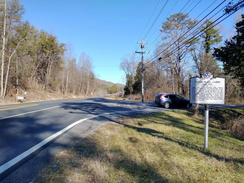
| On Edgemoor Road (Tennessee Route 170) at New Henderson Road, on the right when traveling east on Edgemoor Road. |
| On Norris Freeway (U.S. 441) 0.1 miles south of Clear Creek Road, on the left when traveling south. |
| On South Tulane Avenue, on the right when traveling south. |
| On Wartrace Park (Tennessee Route 64), on the right when traveling east. |
| On Shelbyville Highway (Tennessee Route 231), on the left when traveling south. |
| On Lane Pkwy. (County Route 387), on the right when traveling south. |
| On Ike Farrar Road, 0.1 miles north of Glendale Road, on the left when traveling north. |
| On Public Square East (Tennessee Route 130) at West Depot Street, on the left when traveling north on Public Square East. |
| On North Main Street, on the left when traveling south. Reported missing. |
| On West Depot Street at Public Square West, on the left when traveling east on West Depot Street. |
| On South Spring Street south of McGrew Street, on the right when traveling south. |
| On Spring Street (Tennessee Route 269) at Bridgeview Street, on the right when traveling north on Spring Street. |
| On Tennessee Route 64, 0.5 miles west of Fairfield Pike, on the right when traveling west. |
| On Cortner Road (County Route 269), on the right when traveling south. |
| On Spring Street (Tennessee Route 269) at Bridgeview Street, on the right when traveling north on Spring Street. |
| On Bridgeview Street, 0.2 miles west of Spring Street, on the left when traveling west. |
| On Spring Street (Tennessee Route 269) at Bridgeview Street, on the right when traveling north on Spring Street. |
| On Birdsong Marina Road, 0.5 miles east of Birdsong Road (Tennessee Route 191). Reported damaged. |
| On North Church Avenue at East Lake Stret, on the left when traveling north on North Church Avenue. |
| Near West Main Street (Business U.S. 70) west of Cole Avenue, on the left when traveling west. |
| Near Pilot Knob Road (Tennessee Route 191) 0.2 miles east of Cherry Ridge Road. |
| Near Eva Beach Drive, 0.2 miles east of Lucas Road, on the right when traveling east. |
| Near Pilot Knob Road (Tennessee Route 191) 0.5 miles north of Happy Hollow Road, on the left when traveling north. |
| Near Pilot Knob Road (Tennessee Route 191) 0.2 miles east of Cherry Ridge Road. |
| Near Pilot Knob Road (Tennessee Route 191) 0.2 miles east of Cherry Ridge Road. |
| Near Pilot Knob Road (Tennessee Route 191) 0.2 miles east of Cherry Ridge Road. |
| Near Interstate 40 at milepost 130, on the right when traveling east. |
| On Interstate 40W at milepost 131,, 1.9 miles west of Birdsong Road (Tennessee Route 191), on the right when traveling west. |
| On Main Street (Tennessee Route 28) at Spring Street, on the right when traveling north on Main Street. |
| On West Hill Avenue at Church Street, on the right when traveling east on West Hill Avenue. |
| Near McCammon Avenue at McGhee Street, on the left when traveling east. |
| On West Broadway Avenue (U.S. 411) at West Lamar Alexander Parkway (U.S. 321), on the right when traveling north on West Broadway Avenue. |
| On Broadway Avenue (State Highway 33), on the right when traveling east. |
| On Worth Street Northeast at Market Street Northeast, on the left when traveling east on Worth Street Northeast. |
| On Eureka Road NW (Tennessee Route 306) at Old Eureka Road NW, on the right when traveling north on Eureka Road NW. |
| On Market Street Northeast north of Cass Street Northeast, on the right when traveling north. |
| On Dalton Pike (Tennessee Route 60) 0.4 miles south of Old Weatherly Switch Road SE (Tennessee Route 317), on the left when traveling south. |
| On Inman Street East (U.S. 64) at Parker Street Northeast, on the right when traveling east on Inman Street East. |
| On North Ocoee Street (State Highway 74) at 8th Street Northwest, on the left when traveling north on North Ocoee Street. |
| On North Ocoee Street at 8th Street NE, on the right when traveling north on North Ocoee Street. |
| Near 12th Street SW west of Goode Street SW, on the right when traveling west. |
| On North Ocoee Street (State Highway 74) just north of 6th Street Northeast, on the left when traveling north. |
| On Old Blue Springs Road west of Blue Springs Road Southeast, on the left when traveling west. |
| On Worth Street Southwest at 6th Street Southwest, on the right when traveling south on Worth Street Southwest. |
| Near Interstate 75 north of 5th Street (U.S. 25W), on the right when traveling south. |
| On Indian Mountain State Park Circle, on the left when traveling north. |
| On U.S. 25 at 1st Street, on the right when traveling north on U.S. 25. |
| On North Tennessee Avenue at North Indiana Avenue (U.S. 25W), on the right when traveling south on North Tennessee Avenue. |
| On West Main Street (U.S. 70S) at Murfreesboro Road, on the right when traveling west on West Main Street. |
| On McMinnville Highway (U.S. 70S) at Gassaway Road (Tennessee Route 53), on the right when traveling west on McMinnville Highway. |
| On West Main Street (U.S. 70S) at North Cannon Street, on the right when traveling west on West Main Street. |
| On Lexington Clarksburg Road (Tennessee Route 22) at Tennessee Route 424 when traveling south on Lexington Clarksburg Road. |
| On Court Square at Lexington Street (Tennessee Route 22), on the left when traveling east on Court Square. |
| On East Main Street (U.S. 70) at Oakhill Drive, on the right when traveling east on East Main Street. |
| On East Main Street (Business U.S. 70) at Northwood Drive, on the right when traveling west on East Main Street. |
| On Highland Drive (U.S. 76) 0.2 miles south of Oak Manor Road & Hamilton Street, on the right when traveling north. |
| On North Carroll Street, 0.3 miles north of East Smith Avenue, on the left when traveling north. |
| On North Main Street at Cedar Street (Tennessee Route 124), on the right when traveling south on North Main Street. |
| On Main Street (State Highway 77) at College Street (State Highway 105), on the right when traveling south on Main Street. |
| On North Main Street at East Elk Avenue, in the median on North Main Street. |
| On U.S. 19E at Valley Forge Christian Church Road, on the right when traveling south on U.S. 19E. |
| On North Main Street at East Elk Avenue, on the right when traveling north on North Main Street. |
| On East Elk Avenue, 0.1 miles west of Veterans Memorial Parkway (U.S. 19E), on the right when traveling west. |
| Near Happy Valley Road just north of Milligan Highway (Tennessee Route 359), on the left when traveling north. |
| On Tennessee Route 12 at Neptune Road, on the left when traveling north on State Route 12. |
| On Tennessee Route 49, 0.1 miles south of Girl Scout Road, on the right when traveling north. |
| On North Main Street north of West Kingston Springs Road, on the right when traveling north. |
| On Kingston Springs, 0.1 miles west of Park Street (County Road 1931), on the right when traveling west. |
| On Cabin Lane, 0.2 miles south of Lake Levee Road, on the left when traveling east. |
| On East Main Street at White Avenue (Tennessee Route 365), on the right when traveling east on East Main Street. |
| On East Main Street (Tennessee Route 365) at North Cason Avenue, on the left when traveling east on East Main Street. |
| On Front Street south of West Main Street (Tennessee Route 365), on the right when traveling south. |
| On Front Street south of West Main Street (Tennessee Route 365), on the right when traveling south. |
| On State Highway 100 at State Route 22, on the right when traveling east on State Highway 100. |
| On University Boulevard (Mars-DeBusk Parkway), on the right when traveling west. |
| On Cumberland Gap Parkway (U.S. 25E), on the left when traveling north on Cumberland Gap Parkway. |
| On Irish Cemetery Road, 0.3 miles north of Tazewell Road, on the left when traveling west. |
| On Old Knoxville Road at Main Street, on the right when traveling east on Old Knoxville Road. |
| On Main Street at East Lake Avenue (Tennessee Route 52), on the right when traveling south on Main Street. |
| On Brown Street (Tennessee Route 52) 0.1 miles west of Tennessee Route 53. |
| On Tennessee Route 340 at Old Hwy 321, on the right when traveling north on State Route 340. |
| On Old Parottsville Highway (Tennessee Route 340) at Parrotts Circle, on the right when traveling east on Old Parottsville Highway. |
| On Confederate Cemetery Road, 0.1 miles west of Grossburg Road (Tennessee Highway 64), on the right when traveling west. |
| Near Confederate Cemetery Road, 0.1 miles south of Old U.S. Highway 41. |
| On Murfreesboro Highway (U.S. 41), on the left when traveling north. |
| Near Confederate Cemetery Road at Gossburg Rd (Highway 41), on the right when traveling west. |
| Near Confederate Cemetery Road, 0.1 miles south of Old U.S. 41. |
| Near Confederate Cemetery Road, 0.1 miles south of Old U.S. Highway 41, on the right when traveling south. |
| On Murfreesboro Highway (U.S. 41), on the right when traveling north. |
| On Manchester Pike (U.S. 41) 0.1 miles south of East Fox Hollow Road, on the right when traveling north. |
| Near Confederate Cemetery Road. |
| Near Confederate Cemetery Road. |
| Near Confederate Cemetery Road. |
| On Confederate Cemetery Road, 0.3 miles west of Old U.S. 41, on the right when traveling north. Reported unreadable. |
| On North Spring Street at West Fort Street, on the right when traveling south on North Spring Street. |
| On Stone Fort Drive, on the right when traveling south. |
| On West Main Street at North Irwin Street, on the right when traveling west on West Main Street. |
| On West Main Street at North Irwin Street, on the right when traveling west on West Main Street. |
| On North Spring Street at West Main Street, on the left when traveling north on North Spring Street. |
2644 entries matched your criteria. The first 100 are listed above.
Next 100 ⊳