On Bluff Street, 0 miles south of Commerce Street, on the right when traveling south.
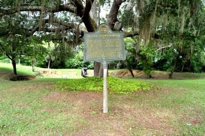
CONFEDERATE FORT - To protect Fort Gaines from Federal gunboats, Confederate Army engineers in 1863 laid out a fort here, commanding a full view of the river for two miles below. A large magazine of lumber and sand was built about 60 feet from the . . . — — Map (db m46934) HM
On Cotton Hill Road (County Route 43) 0.5 miles east of County Route 50, on the right when traveling east.
This church was constituted on July 21, 1822, under the leadership of the Rev. Jim Davis, when Fort Gaines was part of Early County. Land for the church was donated and deeded by J. Hugh Edge. The first building, which also served as a schoolhouse, . . . — — Map (db m47207) HM
On Carroll Street, 0.1 miles west of North Hancock Street, on the left when traveling west.
This was the first established cemetery of Fort Gaines. The earliest death date on a stone marker is 1830. The tombs of Georgia Militia General John Dill and his family are found in an enclosed lot. Reverend John E. Brown, second president of the . . . — — Map (db m47792) HM
On New Hope Church Road (County Route 129) 2.6 miles west of Georgia Route 39, on the right when traveling west.
New Lowell United Methodist Church
Methodist Episcopal Church worship services were conducted in this area during the early 1840’s in a brush arbor. The original church, known as Lowell, was destroyed by fire during the Civil War. From 1865 to . . . — — Map (db m23419) HM
On West Fayetteville Road (Georgia Route 314) at East Fayetteville Road, on the right when traveling south on West Fayetteville Road.
This pioneer sanctuary stood some 200 ft. W., atop the hill. Long since vanished, its site is indicated by the HUTCHESON CEMETERY. It was cited as a landmark on maps of military operations by Federal armies moving E. toward the Macon . . . — — Map (db m18889) HM
On Johnson Street at North McDonough Street, on the right when traveling west on Johnson Street.
Located near the center of fighting on the second day of the Battle Jonesborough (Jonesboro), the final major battle of the Atlanta Campaign, this cemetery contains the graves of up to 1,000 Confederate soldiers killed while fighting here on . . . — — Map (db m103182) HM
On Johnson Street at North McDonough Street, on the left when traveling east on Johnson Street.
In this vicinity were fought the engagements that ended the Atlanta Campaign of 1864. Confederate forces under Gen. Hardee, endeavoring to defend the remaining R.R. to Atlanta, against outnumbering Federal troops, Aug. 31 & Sept. 1 were forced to . . . — — Map (db m12330) HM
Near North McDonough Street at Johnson Street, on the right when traveling north.
To the honored memory of
the several hundred unknown
Confederate Soldiers reposing
within this enclosure who fell
at the Battle of Jonesboro
August 31-September 1, 1864
These soldiers were of Hardee’s Corps, commanded by Maj. Gen. . . . — — Map (db m74212) WM
On Guest Mill Pond Road (Private), 0.1 miles west of Pearson Highway (Route 441), on the left when traveling west.
Site of ante-bellum trading post. Dam constructed in 1840 by Duncan Giddens; acquired by Miles J. Guest.1858, and enlarged by him. Water power used for grist mill and gin. Election precinct.1850-1920; Justice of Peace Court held here for area now . . . — — Map (db m102638) HM
On Arabia Church Road, 0.1 miles north of Georgia Route 122, on the right when traveling north.
Bethany Primitive Baptist Church was initiated as an arm of Union Church in 1841, and was formally constituted in May, 1847.
In the cemetery adjoining the church, on the high bluff of Arabia Bay, are buried many of the pioneers of this section, . . . — — Map (db m14648) HM
Near Floyd Road Southwest, 0.1 miles north of Maran Lane Southwest, on the right when traveling north.
The Mable Family Cemetery is the final resting place for both the Mable Family and some of their slaves. The family section which contains twenty-three graves is paved and covered with pea gravel. Twenty-two of the graves are marked.
The first . . . — — Map (db m197615) HM
Near Floyd Road Southwest, 0.1 miles north of Maran Lane Southwest, on the right when traveling north.
In grateful
acknowledgement to God for
those African-Americans
here, known and unknown,
who, in slavery, lived,
served, and enrichened the
history of Mableton
From Robert Mable's family Bible
*Gelia Born December 31st 1824 • . . . — — Map (db m197614) HM
Near Washington Avenue NE at Cole Street NE, on the right when traveling east.
Civil War Dead An estimated 700,000 Union and Confederate soldiers died in the Civil War between April 1861 and April 1865. As the death toll rose, the U.S. government struggled with the urgent but unplanned need to bury fallen Union troops. . . . — — Map (db m120096) HM WM
Four score and seven years ago our fathers brought forth on this continent, a new nation, conceived in liberty, and dedicated to the proposition that all men are created equal.
Now we are engaged in a great civil war, testing whether that . . . — — Map (db m114679) HM WM
Near West Atlanta Street SE, 0.1 miles north of Cemetery Street SE.
3,000 Confederate dead from every southern state are buried in this cemetery. First established for [CS] soldiers killed in a railroad collision in 1863, it became the resting place for dead from nearby battlefields. In 1866, under the direction of . . . — — Map (db m17007) HM
On Powder Springs Road (Georgia Route 360) at South Marietta Parkway (Georgia Route 120), on the right when traveling north on Powder Springs Road.
Burial of Confederates killed in a railroad collision, September, 1863, on land given by Mrs. Jane Glover, established this cemetery. Later more land was given by Ann Moyer and others, and the [CS] dead here from Marietta hospitals and the Kennesaw . . . — — Map (db m29816) HM
Near West Atlanta Street SE, 0.2 miles north of Cemetery Street SE.
Oldest grave is on this plot for Wm. Harris' son, William Capers G. Harris (1823-1831). Mr. Harris, a wealthy planter, was a devout Methodist and champion of education. In War of 1812 he served in Capt. Jett Thomas' Co., 2nd, Regt., Ga. Militia. He . . . — — Map (db m15202) HM
On West Atlanta Street SE, 0.1 miles north of Cemetery Street SE.
This memorial to Mary Annie Gartrell (1853-1906) was erected by her grieving sister Lucy (1863-1954). Musicians both and natives of Cobb County, Lucy visited this grave from her Atlanta home at least twice-weekly for 48 years, many times on foot. . . . — — Map (db m15203) HM
Near West Atlanta Street SE north of Confederate Avenue, on the left when traveling north.
This cemetery was
established on property once
owned by the First Baptist
Church of Marietta.
Following the church's move,
John H. Glover, Marietta's
first mayor, bought this
parcel. His wife, Jane Porter
Glover, permitted this quiet
corner . . . — — Map (db m142953) HM
Atlanta Campaign During the Civil War, the fight for Atlanta began in early May 1864 in north Georgia. It ended when Union troops marched into the state capital on September 2. Over four months, Union and Confederate armies met in sixteen . . . — — Map (db m120022) HM WM
Here rest the remains of 10,132 Officers and Soldiers who died in defence of the Union, 1861-1865.
Dedication plaque on one of the marble columns:
In Memory of
Henry Greene Cole
Of Marietta Georgia
Who Gave These Grounds . . . — — Map (db m61180) WM
Near West Atlanta Street SE just north of Cemetery Street SE.
Celebrated in song as "Little Mary Phagan" after her murder at age 13 on April 26, 1913 in Atlanta. The trial and conviction of Leo Frank were controversial, as was the commutation of his death sentence four days before Confederate Veterans marked . . . — — Map (db m16571) HM
On Powder Springs Road SE (Georgia Route 360) at Cemetery Street SE, on the right when traveling north on Powder Springs Road SE.
Built in the style of coastal burial chambers in 1854 by Savannah planter Francis Harris McLeod (1784-1864), an investor in Roswell King's mills. He was the namesake of his grandfather Francis Harris, first Speaker of 1751 Ga. Colonial Assembly. Six . . . — — Map (db m15187) HM
Mattie Harris Lyon, 97, the “Mother of Marietta,” was known for her years of zealous and affectionate service in religious, civic, welfare and patriotic activities. Her life was dedicated to the service of people of all races. A true humanitarian, . . . — — Map (db m5198) HM
On West Atlanta Road SE, 0.2 miles north of Cemetery Street SE, on the left when traveling north.
Prominent minister who was born a slave 1833. He was a charter member of Zion Baptist at its founding in 1866 and its second pastor (1869-1885). In 1885 he organized Cole St. & later Pleasant Grove and Whitlock Avenue Baptist Churches. In 1890 . . . — — Map (db m15191) HM
Near West Atlanta Street SE at Cemetery Street SE.
The only slave burial ground in any major white Georgia cemetery. Here 19 Christian slaves and freed persons of Marietta Christians were buried in unmarked graves ca. 1848-1866. Only four have been positively named, servants of Mrs. Eliza G. . . . — — Map (db m15188) HM
Near West Atlanta Street SE, 0.3 miles north of Cemetery Street, on the left when traveling west.
Front:
To our
Confederate Dead.
Erected and
dedicated by
Kennesaw Chapter
United Daughters
of the
Confederacy,
Marietta, Georgia.
1908.
Right:
To the
3000 soldiers in this
cemetery, from every . . . — — Map (db m87441) WM
On West Atlanta Road, 0 miles Cemetery Street SE, on the right when traveling north.
Beloved merchant, druggist, and Episcopalian, he helped found St. James in 1842; in 1844 he built his home across from the church. His 1845 drug store on the square was a town social center. The Root home, one of the oldest wooden houses, and a good . . . — — Map (db m17193) HM
Wisconsin
Dedicated to the memory of
Wisconsin Soldiers
who gave their lives
in defense of the Union in
1861 - 1865
Four hundred and five
belonging to the following regiments
are buried here
1st Cavalry
5th . . . — — Map (db m87442) WM
On North Church Lane at Collins Springs Drive, on the right when traveling east on North Church Lane.
Founded circa 1850, the original church was destroyed in 1864 by the Federal Army and rebuilt after the Civil War. The church, cemetery, and nearby spring carry the name of James A. Collins, an Atlanta pioneer, merchant, and local landowner. His . . . — — Map (db m33421) HM
On Memorial Place, 0 miles south of Atlanta Road SE (Georgia Route 3), on the right when traveling south.
There may have been burials in this cemetery prior to 1848, however, this grave is the earliest one with an engraved headstone which shows a date. His daughter Mary, who died at approximately 17 years of age on March 14, 1858, is the second . . . — — Map (db m17088) HM
On Memorial Place, 0 miles south of Atlanta Road SE (Georgia Route 3), on the right when traveling south.
From her birth home just across the railroad track on Gilbert Street, Mazie Whitfield Nelson watched the growth of downtown Smyrna from a village of less than 400 when she was born on New Year’s Day in 1890, to a community of over 20,000 when . . . — — Map (db m17089) HM
On Memorial Place, 0 miles south of Atlanta Road SE (Georgia Route 3), on the right when traveling south.
Traditional history says this cemetery was established in 1838 by the Smyrna Methodist Church. However, Wylie Flannigan of Campbell County, Ga. took title to Land Lot 522 in which the cemetery is located, on July 1, 1843 after paying Georgia $5.00 . . . — — Map (db m17066) HM
On Memorial Place, 0 miles south of Atlanta Road SE (Georgia Route 3), on the right when traveling south.
Ulysses S. Grant was President of the U.S., and the South was still suffering from the effects of abusive Reconstruction when Smyrna was first incorporated August 23, 1872. One theory is that in the post-war era, citizens feared the town would . . . — — Map (db m17072) HM
On U.S. 319 at Mack Dekle Road, on the right when traveling north on U.S. 319.
The Murphy families were among early pioneer settlers who migrated from Duplin and Sampson Counties, North Carolina to this area between the 1790’s and early 1800’s. This area and surrounding land was inhabited by Lower Creek Indian tribes . . . — — Map (db m40867) HM
On Greenfield Church Road at Kilgore Road, on the left when traveling east on Greenfield Church Road.
This site, along with 19,600 acres, was purchased through a state land lottery, September, 1843-44, by Rev. Eli Graves, formerly of Vermont. In March, 1848, all was sold to his brother, Presbyterian pastor, Rev. Joel S. Graves. In 1850, using . . . — — Map (db m40691) HM
On Griffin Street west of Grantville Brown School Drive, on the right when traveling south.
Grantville native Thomas E. Zellars (1898-1924) graduated from the US Naval Academy in 1920 and reported for duty aboard the USS Mississippi. As turret commander he rose to the rank of lieutenant. In 1924, an explosion and fire engulfed his . . . — — Map (db m82410) HM
On Herring Street, 0.1 miles north of Jefferson Street (Georgia Route 34), on the left when traveling north.
Here are buried 268 Confederate soldiers, most of whom died of wounds or disease in the several Confederate hospitals located in Newnan. Some were killed in the battle fought south of here, July 30, 1864. Due to the efficiency of the local . . . — — Map (db m32133) HM
On Slygo Road (County Route 143) 0.3 miles south of Hales Gap Road (County Route 200), on the right when traveling south.
William Isham Cole was born May 7, 1805. He married Lovina Clark about the same time as the Treaty of New Echota between the U.S. Government and the Cherokee Nation that ended all Native land claims in the State of Georgia. Cole took advantage of . . . — — Map (db m134461) HM
On Williams Street at Clay Street, on the left when traveling west on Williams Street.
This property was given to the Attapulgus Cemetery Inc. on Easter Sunday, April 15, 2001, by Dr. and Mrs. Charles Ross Hatcher Jr., To the Glory of God, Our Father, And in memory of his parents, Charles Ross and Vivian Miller Hatcher Sr. . . . — — Map (db m57447) HM
On Main Street (Georgia Route 241) at Church Street, on the left when traveling south on Main Street.
Perpetual Care Foundation
Lot given by J. H. Gibson 1850
Pleasant Grove Presbyterian Church
Cemetery 1854 Resolution 1966
Record Decatur Co, GA.
In Memory Gibson, Chestnut, Cook,
Pound & others by descendants.
Initial gift W.P. Cook . . . — — Map (db m57360) HM
On Faceville Highway (Georgia Route 97) at Florida Street, on the right when traveling west on Faceville Highway.
Decatur County’s first industrialist was Ira Sanborn, a native of Concord, New Hampshire. Born in 1799, Sanborn came to Apalachicola, Florida about 1830 and later resettled in Quincy, Florida where he married Susan Woodson. In 1833 they moved to . . . — — Map (db m55924) HM
Near Booster Club Road at Recovery Road, on the right when traveling east.
Erected on the site of Camp Recovery near which are buried officers and soldiers of the United States Army who died during the Indian Wars in the Flint River and Chattahoochee River countries 1817 to 1821 — — Map (db m116792) HM WM
On Starvine Way, 0.3 miles west of Clairmont Road (U.S. 23), on the right when traveling west.
The Hardman Family Cemetery is one of the oldest landmarks in DeKalb County and among the last vestiges of its early settlement. Both white settlers and enslaved African Americans were buried here. Nearby ran the Shallowford Indian Trail, a trade . . . — — Map (db m142533) HM
On Commerce Drive (Georgia Route 155) 0.5 miles north of East Ponce De Leon Avenue, on the right when traveling north.
The oldest known publicly owned burial ground in metro Atlanta, the Decatur Cemetery is believed to predate the city’s 1823 incorporation. The first written record is an 1832 act of legislature providing “Commissioners for the Decatur Burial . . . — — Map (db m9685) HM
On Cemetery Circle north of East Ponce de Leon Avenue, on the right when traveling north.
On July 18 & 19, 1864, during the Atlanta Campaign, Union Brigadier General Kenner Garrard's cavalry division raided Stone Mountain. They skirmished with the Confederate cavalry brigade of Colonel George G. Dibrell, destroyed two miles of railroad . . . — — Map (db m113346) HM
Near Firetower Road at Orphans Cemetery Road at Firetower Road.
Albert G. Williamson, a Dodge County entrepreneur, donated land for a burial place in Orphans community following the death of a neighbor’s child, George
P.A. Barnes, in 1887. The community was named in honor of the six orphaned Williamson brothers . . . — — Map (db m8463) HM
Near Dawson Road west of Greenwood Drive, on the right when traveling west.
Edward Vason Jones, born in Albany on August 3, 1909, was a nationally recognized 20th-century classical architect and designer. Originally a student of dentistry at Northwestern University, Jones was a self-taught architect and began his career at . . . — — Map (db m117124) HM
Near Dawson Road, 0.5 miles north of West 3rd Avenue, on the right when traveling north.
During a time of dire peril that threatened the existence of Britain and the civilized world, these young Britishers died in aerial pilot training accidents in the skies and fields of Southwest Georgia while based at Darr Aero Tech and Turner . . . — — Map (db m186900) HM WM
On Indian Mounds Road, 0.2 miles east of Georgia Route 1940, on the left when traveling east.
You are at the edge of one of the largest and most important mound groups in the southeastern United States. Most of this complex of mounds was constructed about A. D. 200-600. Archaeologists call this period the Middle Woodland Period and the . . . — — Map (db m48243) HM
On Ebenezer Road (Georgia Route 275), on the left when traveling east.
[Marker's East face]:
To the Memory of the
Salzburgers
and
their faithful pastors.
Rev. John Martin Bolzius
and
Rev. Israel Christain Gronau
who for their faith in the doctrines
of Gods Word as taught
in . . . — — Map (db m14739) HM
On Central Boulevard (State Highway 17) at Springfield Avenue (State Highway 119), on the left when traveling north on Central Boulevard.
In May 1862 the Confederate Government established a General Hospital in Guyton, Georgia. This hospital was located on a nine acre tract of land between Central Railroad, a determining factor in locating hospitals, and current Georgia Highway 119, . . . — — Map (db m7979) HM
On Ebenezer Road (County Route 275) 0.1 miles east of Old Augusta Road (County Route 284), on the left when traveling east.
This cemetery has been the primary burial site for the town of New Ebenezer and the congregation of Jerusalem Lutheran Church since at least the mid-1740’s. An earlier burial ground dating from 1734 was located at the site of Old Ebenezer near . . . — — Map (db m156763) HM
In this cemetery are buried the Rev. John Martin Bolzius and the Rev. Israel Christian Gronau, ministers who came to Georgia with the first company of Salzburgers. In March 1734, the Rev. Mr. Bolzius was Superintendent of the Latin Orphan House at . . . — — Map (db m7631) HM
On Heardmont Road at Johnsontown Drive, on the right on Heardmont Road. Reported missing.
Stephen Heard, Governor of Georgia in 1781, lawyer, planter, surveyor and soldier of the Revolution, lies buried in this family cemetery. With a price on his head he was captured by the British at the Battle of Kettle Creek and condemned to die. . . . — — Map (db m38595) HM
On Deadwyler Street at North Oliver Street (Georgia Highway 77), on the left when traveling east on Deadwyler Street.
Elbert County was named in honor of General Samuel Elbert, an outstanding military leader in the Revolutionary War and distinguished Governor of the State of Georgia in 1785-86.
Born in 1740, Elbert was orphaned at an early age; achieved . . . — — Map (db m21908) HM
On Glynn Street (Georgia Route 85) at Fisher Avenue, on the left when traveling south on Glynn Street.
Hugh Manson Dorsey was born in Fayetteville, and was admitted to the Georgia bar at the Fayette County Courthouse in 1894. After practicing law at his father’s firm, Dorsey became solicitor general of the Atlanta Judicial Circuit in 1910. In this . . . — — Map (db m10074) HM
On Senoia Road (Old Georgia Route 74) 0 miles north of Carriage Oaks Drive, on the right when traveling north.
This family cemetery was established October 24, 1845, when Barbara Jane, the infant of John and Barbara Morris Palmer, was buried here. John Palmer acquired the property - lot 116 in the 7th District of Fayette County, Georgia, in October, 1844. . . . — — Map (db m14563) HM
On Georgia Route 20, on the right when traveling west.
The first residence of missionaries sent in 1821 to establish the Turnip Mountain Mission to the Cherokees was located on this site, just north of the Cemetery wall. The mission, later known as Haweis, was built two miles to the east. Sardis . . . — — Map (db m11522) HM
On Alabama Highway (State Highway 20) at Woods Road NW, on the left when traveling west on Alabama Highway.
Thomas E.G. Ransom enlisted as captain of Company E, 11th Illinois Volunteer Infantry in 1861. Wounded four times, he won honors at Ft. Donelson, Shiloh, Vicksburg, and Red River. Rising steadily through the ranks, Ransom led the 17th Corps, Army . . . — — Map (db m111658) HM
Near South Broad Street near Myrtle Street Southwest.
Myrtle Hill Cemetery
The City of Rome established Myrtle Hill Cemetery in 1857, successor to Rome's first burial place, Oak Hill Cemetery/West Seventh Avenue. Originally Myrtle Hill did not include this triangular area at the foot of the . . . — — Map (db m171109) HM
Near Broad Street at East 4th Avenue, on the right when traveling east.
Vonalbade Gammon (b. 1879), a Rome native, entered UGA in 1896. He quarterbacked UGA's undefeated team coached by Glenn “Pop” Warner, and played against Auburn coached by John
Heisman, on October 30, 1897. In a game with UVa, Von . . . — — Map (db m171075) HM
On Resthaven Street west of Atlanta Highway (Georgia Route 9), on the left when traveling east.
In 1834, Moses Whitsett was the first person buried on the property which in 1840 became the cemetery for the Baptist Church and the Presbyterian Church. In 1856, the Presbyterian Church disbanded. When the Baptist Church relocated, the cemetery . . . — — Map (db m14382) HM
On Marietta Boulevard NW, 0.2 miles south of Bolton Road NW, on the right when traveling south.
On the rise above this marker is the family cemetery of Major J. M. C Montgomery (1770-1842) probably the first white man to settle permanently in what is now Fulton County. A soldier in the War of 1812, Montgomery served under Lt. George R. Gilmer . . . — — Map (db m21516) HM
On Powers Ferry Road NW, 0.1 miles north of Roswell Road, on the right when traveling north.
Sardis Methodist Church is built on land taken from the Indians by Sy Donaldson and given to the church before this section of the State had been surveyed -- when land was platted by beeswax string, and there were no deeds. Believed to date from . . . — — Map (db m23340) HM
The City of Atlanta Office of Cemetery Commission purchased this fountain from J. L. Mott Iron Works as a cemetery improvement. T. G. Spearman ordered the statue and constructed a masonry pool, which was altered in 1984. The figural group was . . . — — Map (db m64800) HM
Born in Clinton, Jones County, Georgia
February 14, 1829
Died Atlanta, Georgia
March 31, 1911
He was the son of
Alfred Iverson, Sr.
United States Senator for Georgia
and
Caroline Goode Holt . . . — — Map (db m64825) HM WM
On Martin Luther King Jr. Ave SE, 0.1 miles east of Oakland Avenue, on the right when traveling east.
The section of the cemetery encompassing the area behind this marker, bounded by the lane to the east, the sidewalk to the west, and the wall to the south, was established in 1892 as the burial ground for Congregation Ahavath Achim, chartered in . . . — — Map (db m53310) HM
Clement A. Evans, Brig. Gen., C.S.A., began his military career in his native Stewart Co., Ga., where he was commissioned Major in Co. E, 31st Ga. Infantry. He rapidly rose in rank and in Nov. 1864, was put in command of a division, succeeding . . . — — Map (db m64826) HM
Near Oakland Avenue SE at Martin Luther King, Jr. Drive SE.
Here rest the remains of Colonel Joseph F. Burke. In 1861, at age 16, he was in the Confederate States Forces defending Charleston, SC, when it was invaded and attacked by Union Forces attempting to reach Fort Sumter. As Commander, Colonel Burke led . . . — — Map (db m186559) HM
Near Oakland Avenue SE at Martin Luther King, Jr. Drive SE.
The Confederate Memorial Grounds is the final resting place of approximately 6,900 Confederate soldiers who died during the Civil War (1861-1865). Atlanta was a Confederate military center and manufacturing site during the war. Several railroads . . . — — Map (db m186546) HM
Near Oakland Avenue SE at Martin Luther King, Jr. Drive SE.
The Atlanta Ladies Memorial Association (ALMA) formed in 1866 with a purpose to “preserve and foster the memory of our Confederate Dead.” The federal government did not fund Confederate burials after the war. Volunteer groups, often organized by . . . — — Map (db m186549) HM
"Resolved, that the petition of the Atlanta Ladies Memorial Association, asking a donation of land for the purpose of interring the Confederate Dead, be referred to the Committee on Cemetery, and that said committee have full power to act in the . . . — — Map (db m64823) WM
Dr. Charles d'Alvigny, son of Dr. Noel d'Alvigny, was captured with Cobb's Legion in NC in 1865. He was released when it was recognized that he was Dr. d'Alvigny's son. He was a dentist and later Sexton of Streets in Atlanta overseeing their . . . — — Map (db m64816) HM
Dr. Noel d'Alvigny was born in 1800, Paris. As a surgeon in both the French and Confederate Armies (Leyden Artillery), he said, "I was in two revolutions." He was the only doctor who bravely remained during the burning of Atlanta in 1864 and was . . . — — Map (db m64818) HM
The City of Atlanta deeded this plot of ground to the Hibernian Benevolent Society in 1873. The grant recognized contributions made by the "Hibernian Rifles" and Father Thomas O'Reilly in defending and preserving the city during the Civil War. — — Map (db m64836) HM
Near Oakland Avenue SE at Martin Luther King, Jr. Drive SE.
Historic Oakland Cemetery, founded in 1850, is the final resting place of over 70,000 residents, including many of Atlanta's settlers, builders, and noted citizens like Bobby Jones, Margaret Mitchell, and Maynard Jackson. This 48-acre garden . . . — — Map (db m186543) HM
A native of Upson County, Georgia, and a Major General, Confederate States Army, was one of General Lee's most trusted and outstanding officers. He brilliantly led his devoted men in every engagement in which the Army of Northern Virginia . . . — — Map (db m64831) HM
In this spot set apart by the city is buried
Martha Lumpkin Compton
August 25, 1827 - February 13, 1917
Wife of
Thomas M. Compton
Daughter of
Governor Wilson Lumpkin
and his wife
Annis Hopson Lumpkin
In honor of . . . — — Map (db m64785) HM
On Oakland Avenue at Martin Luther King Drive, on the right when traveling north on Oakland Avenue.
In 1850 the City of Atlanta established a public cemetery on this ridge overlooking downtown. Originally known as Atlanta or City Cemetery, the name Oakland was adopted in 1872 because of its many oaks. It was the principal burial ground for Atlanta . . . — — Map (db m10148) HM
In 1852 the Atlanta City Council ruled that African Americans were to be buried in a segregated section at the rear of Oakland Cemetery, at the eastern boundary of the original 6 acres. By the beginning of the Civil war, more than 800 persons . . . — — Map (db m64824) HM
Near Oakland Avenue SE at Martin Luther King, Jr. Drive SE.
In 1866, the city of Atlanta set aside this 3.2-acre section of land for African Americans to buy burial plots. Before 1866, African Americans were buried in an area called Slave Square in Oakland Cemetery's original six acres. The practice of . . . — — Map (db m186550) HM
Near Oakland Avenue SE at Martin Luther King, Jr. Drive SE.
In the “Golden Age of American Sport” no athlete captured the public imagination like Atlanta's own Robert Tyre “Bobby” Jones Jr. Born in nearby Grant Park in 1902, Jones popularized golf on an international stage. His sportsmanship called . . . — — Map (db m186544) HM
Near Oakland Avenue SE at Martin Luther King, Jr. Drive SE.
Oakland's African American Burial Grounds reflect the extent of racial segregation in America. From 1866 until 1963, African Americans could only buy burial plots in this section. As people were racially segregated in daily life — in education, . . . — — Map (db m186558) HM
On Memorial Drive S.E. at Park Avenue S.E. on Memorial Drive S.E..
280 feet south of this location on June 18, 1862, seven of the Union Army's brave Andrews (sic) Raiders were hanged and buried. On April 12, 1862, 22 Andrews (sic) Raiders seized the General, a tender and three boxcars at Big Shanty (now Kennesaw) . . . — — Map (db m64905) HM WM
Near Oakland Avenue SE at Martin Luther King, Jr. Drive SE.
On November 17, 1930, Bobby Jones stunned the world when he announced his retirement. He had joined his father's law firm (now Alston & Bird LLP) two years earlier. Specializing in corporate law, he also held interests in several Coca-Cola bottling . . . — — Map (db m186567) HM
On Oakland Avenue at Martin Luther King Jr. Drive, on the right when traveling east on Oakland Avenue.
In 1856 James E. Williams (Mayor of Atlanta 1866-1868), built a residence atop this high ground which later became a part of Oakland Cemetery. From the second story of the house, Gen. John B. Hood, in command of Confederate forces, & members of his . . . — — Map (db m10448) HM
On April 12, 1862, Captain Fuller pursued and after a race of 90 miles, from Big Shanty northward on the Western & Atlantic Railroad, re-captured the historic war-engine "General" which had been seized by 22 Federal soldiers in disguise, thereby . . . — — Map (db m64788) HM
Near Oakland Avenue SE at Martin Luther King, Jr. Drive SE.
Constructed in 1908, the Women's Comfort Station served as a bathroom and place of shelter during extreme weather. The Men's Comfort Station, located next to the African American Burial Grounds and Potter's Field, was completed the same year. . . . — — Map (db m186565) HM
On Metropolitan Parkway SW (U.S. 41) at Old Jonesboro Road, on the left when traveling south on Metropolitan Parkway SW.
On September 29, 1957, Mount Zion Methodist Church, one of the first churches in this area, celebrated its 141st anniversary. Services were held first in a log structure, built for a schoolhouse. Tombstones in the cemetery bear dates from 1796; . . . — — Map (db m17787) HM
On Helena Road SE west of Jonesboro Road SE (Georgia Route 54), on the left when traveling east.
South-View Cemetery was founded in 1886 by formerly enslaved African Americans who objected to the conditions and the treatment they received at Atlanta's segregated burial grounds. South-View's landscape reflects the influence of 19th century . . . — — Map (db m186568) HM
On Paces Ferry Road at Mount Paran Road, on the right when traveling east on Paces Ferry Road.
On 29 September 1877 William Brown donated one acre of land at the intersection of Paces Ferry and Mount Paran Roads for the purpose of establishing and building a church. Pleasant Hill Methodist Church was first served by circuit rider ministers, . . . — — Map (db m41951) HM
On Cleveland Avenue SW at Interstate 75, on the right when traveling west on Cleveland Avenue SW.
This monument marks the site of the Gilbert Cemetery, originally a one-acre plot set aside by Jerimiah S. Gilbert for burials. He acquired the land in 1861 from his father. Throughout the nineteenth and early twentieth centuries use of these grounds . . . — — Map (db m186569) HM
On Cahaba Drive at Bayberry Drive, on the left when traveling north on Cahaba Drive.
Utoy Primitive Baptist Church, the oldest Baptist Church in present Fulton County, was constituted August 15, 1824, in a log house just west of here. The church was moved to its present location in the summer of 1828. In 1864 the church was used as . . . — — Map (db m8876) HM
388 entries matched your criteria. Entries 101 through 200 are listed above. ⊲ Previous 100 — Next 100 ⊳