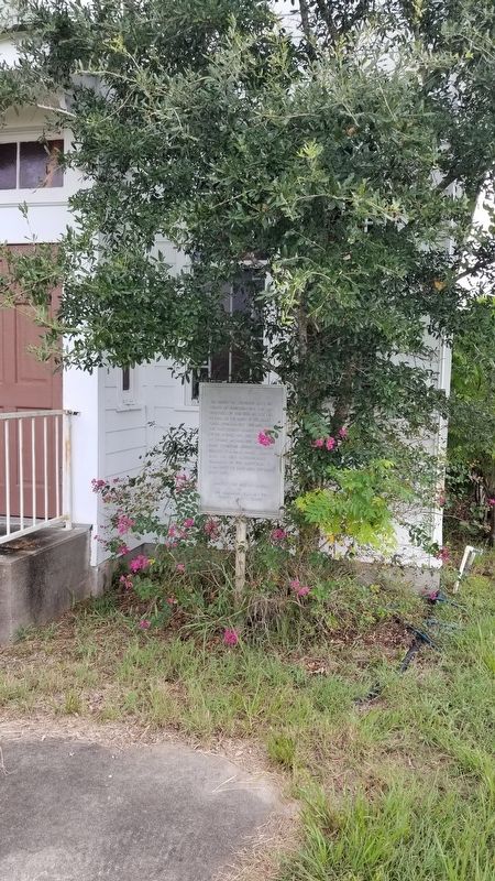
The present St. Catherine Catholic Church of Blanconia was built and dedicated, on this site, on October 17, 1926. On the banks of the Blanco Creek, approximately one mile east, the first church named Our Lady of the Rosary, was erected in 1875 by . . . — — Map (db m180949) HM
Built in 1905. First church to serve the needs of Protestants in Pettus. Called a Christian Church at request of land donor, Mrs. S.B. Hodges. Contributions came from all denominations. On August 29, 1906, the First Christian Church (Disciples of . . . — — Map (db m206927) HM
Originally known as Pecan Grove Baptist Church, this fellowship was organized in 1873 by the Rev. M.V. Smith, the Rev. H.I. Kimball, and the Rev. G.W. Baines, great-grandfather of United States President Lyndon Baines Johnson. In 1884 the church was . . . — — Map (db m29036) HM
The first Lutheran worship services in this area were held at the home of early German settler J.E. Pietzsch, who had moved from Austin County. In 1880 a small school and church building was erected on land donated by John Bartlett, for whom the . . . — — Map (db m29038) HM
Noted lawmaker, judge, lay preacher, served in the legislatures of his native Kentucky and of Alabama. Represented Alabama in U.S. Congress, 1829-1831.
Came to Texas 1839. Was Associate Justice Supreme Court, Republic of Texas, 1840-1846. Judge . . . — — Map (db m152063) HM
The First Baptist Church of Belton was organized in the summer of 1853 under the leadership of the Rev. Solomon G. O'Bryan and the Rev. David Fisher. There were eight charter members, and the congregation met in a small frame building on Pearl . . . — — Map (db m152233) HM
The only physical remnant of the Post Oak community, this cemetery began as the burial ground for the family of Isham McMillin, who acquired land in this part of Bell County in 1855. The oldest marked grave, that of McMillin’s daughter Elizabeth, . . . — — Map (db m89692) HM
Bethel Primitive Baptist Church originated in the Palo Alto Community, which was located about 3.5 miles northeast of present Killeen. Organized about 1864, the congregation met in a Union Church building shared with other denominations.
When . . . — — Map (db m234566) HM
The first burial in this graveyard, that of Wilhelm Wolf, took place in 1891, two years after the German Evangelical Lutheran Emmanuel Congregation was formally organized. The Rev. H.F. Daude (1850-1924), who served as first pastor, deeded land here . . . — — Map (db m121279) HM
In 1889 five families met under a brush arbor to form the Nolanville Church of Christ and within a month had purchased land at this site on which to build a permanent church. That first meeting led to 106 consecutive summer camp meetings dedicated . . . — — Map (db m175096) HM
Church Bell Purchased in 1879
1864 - Salado Baptist Church Organized.
1878 - Original Church Building Erected.
1879 - Bell Placed in Cupola of Original Building.
1962 - Original Building Torn Down.
1964 - Bell Tower . . . — — Map (db m203296) HM
A Baptist revival was held on the banks of Salado Creek as early as 1854. By about 1860, members of area Baptist, Methodist, Presbyterian and Church of Christ denominations were meeting in an ecumenical house of worship. Each group held an all-day . . . — — Map (db m29083) HM
Reverend George Washington Baines is buried at this site with his second wife, Cynthia Williams, and one of his sons, Taliaferro. Reverend Baines was born in North Carolina Dec 29, 1809. Educated in Alabama and ordained a minister in 1836. A . . . — — Map (db m203271) HM
Built in the 1860s, this house was the residence of the Rev. George Washington Baines (1809-83) from 1870 to 1883. A pioneer Baptist preacher, missionary, editor, and educator, the Rev. Baines was the great-grandfather of United States President . . . — — Map (db m29313) HM
The Taylors were among the earliest Baptist missionaries to Brazil. Zachary Clay Taylor (b. 1851) was a pastor preparing for missions when he met Kate Crawford (b. 1862), a Salado school teacher. They wed Christmas Day 1881 at the then named Salado . . . — — Map (db m203294) HM
When Addie Barton (1858-1921) was seven years old, her parents, Dr. Welborn and Louisa Barton, moved to Salado so their children could attend Salado College. Upon graduation, Addie became a teacher. She felt called to become a missionary in 1883 . . . — — Map (db m29249) HM
When Salado College opened its doors in 1860, the Church of Christ began meeting in the chapel alternating Sundays with the Baptists, Methodists, and Presbyterians. The congregation cooperated with these groups in having a union, or . . . — — Map (db m212177) HM
Rev. Denman was born in Gumlock Creek, Franklin Co., Georgia on May 8, 1803 and moved to Cherokee County, Texas with his first wife, Elizabeth Randle (1805-1861), in 1849. There he established a large plantation and ran a general store with the help . . . — — Map (db m203301) HM
Founded in March 1859, this congregation first met in a brush arbor on the north bank of Salado Creek. The first two elders were James Anderson and J.W. Vickrey, both of whom were instrumental in the organization of Salado College. A frame . . . — — Map (db m29258) HM
In 1854, the Rev. Thomas Gilmore, a Methodist circuit rider, led a revival at Pecan Grove on the north side of Salado Creek. He organized a Methodist church and a Union Sunday school in a small frame building. During the next decades, the . . . — — Map (db m29347) HM
Alabama native James Ferguson (1824-1876) became a Methodist preacher in Arkansas before moving to Texas in 1847. As a circuit rider for the next 20 years, he served Methodists in numerous parts of central and southeast Texas. Ferguson wed native . . . — — Map (db m29373) HM
Willingham Spring Baptist Church was organized in 1911 with the aid of Brother Cullam, pastor of Prairie Dell Methodist Church. Local farmer Wilson Willingham deeded property on this site. Oral history relates that Hanna Elizabeth "Grandma" Kidd . . . — — Map (db m178533) HM
Founded as a mission in 1889, this fellowship achieved parish status in 1902 and began raising money to erect this church building. After a public fund drive (1904), construction was started on the Gothic Revival edifice designed by A.O. Watson of . . . — — Map (db m207216) HM
Corinth Missionary Baptist Church has its roots in Temple Chapel Baptist Church, which organized around 1881 as one of the area's earliest African-American congregations. African Americans needed a place of worship as they migrated to the new town . . . — — Map (db m207293) HM
Soon after the establishment of Temple as a railroad town in 1882, the Rev. L.J. Mackey organized the Saint Love All Baptist Church. The early mission of the church was to serve African American railroad workers in the new town. It was located on . . . — — Map (db m207288) HM
The Rev. E.R. Barcus served as the first pastor of the congregation, organized in 1882, one year after the city of Temple was founded. The original structure on this site was destroyed by fire in 1911. The present Romanesque Revival building was . . . — — Map (db m207219) HM
Founded in 1882 to serve the area's German population, this congregation originally was known as the Friedens (Peace) Church of the Evangelical Association. This sanctuary was completed in 1883 on land donated by the Gulf, Colorado and Santa Fe . . . — — Map (db m207299) HM
Born to a wealthy Missouri plantation family, Raleigh R. White joined the Confederate Army, against his father's wishes, at age 21. During his service White fought under Gen. Nathan Bedford Forrest and made a lifelong friend of fellow soldier J.B. . . . — — Map (db m207088) HM
George Connor, a missionary elder of the African Methodist Episcopal (A.M.E) church assigned to the Temple area, organized this congregation in 1883. A frame sanctuary was built at this site two years later, with Dock Lacy and Green McGrew as church . . . — — Map (db m207296) HM
In Honour of the Aviation Cadets
Who Worshipped in Chapel No. 1
Their Heroic Deeds and
Noble Sacrifices
in Defense of Our Country
Serve to Inspire Future Generations — — Map (db m33893) WM
Site of
US Army Air Corps
Primary Flying School
Post Chapel
Construction completed 19 Jul 1934
Dedicated on 30 Sep 1993
———————
Chapel One
50 years dedicated service
to the . . . — — Map (db m31786) HM
In December 1854, Polish settlers began arriving in eastern Bexar County from their homeland in Upper Silesia. The early community of fewer than 20 families was called Martinez. In 1857, residents built a mission log church on the land of Ludwig . . . — — Map (db m205628) HM
As the granddaughter of Lorenzo de Zavala (1789-1836), first vice-president of the Republic of Texas, young Adina de Zavala was exposed to vivid accounts of Texas' revolutionary and republican past. She became a guiding force in the preservation . . . — — Map (db m61083) HM
Mission San Antonio de Valero, established nearby in 1718, was relocated here in 1724. By 1762, the mission plaza was enclosed by thick stone and adobe walls. The 11x14-foot main gateway was located at this site along the south wall. In 1803 . . . — — Map (db m30713) HM
At this location an exciting discovery was made. Approximately two feet below the current surface archaeologist recently uncovered a circular stone platform - but what is it?
Alamo archaeologist Kristi Nichols explains, "It appears to be . . . — — Map (db m188522) HM
Title to the Alamo Mission property,
acquired through her efforts and
her personal fortune, was conveyed by
Clara Driscoll
to the State of Texas, Sept. 5th 1905:
“That the sacred shrine be saved from the
encroachments of . . . — — Map (db m30734) HM
25 years ago, engineers tried to block rising damp by pushing a special plate made of corrosion-resistant alloy through the Alamo Church's foundations. Today's excavations here will tell preservation architects how well this metal plate, called a . . . — — Map (db m227628) HM
The San Antonio de Padua Mission was founded in San Antonio in 1716 by the Franciscan Father, Antonio Olivares, and after merging with the San Francisco Solano Mission in 1718, it was officially founded as the San Antonio de Valero Mission. The . . . — — Map (db m9228) HM
The Treaty of Velasco mandated that all Mexican forces withdraw south of the Rio Grande. Before leaving the Alamo, however, Mexican troops destroyed much of what remained. For many years, the structure stood deserted as the affairs of the new . . . — — Map (db m188747) HM
Erected in grateful recognition of
the supreme act of heroism of the
thirty two men from Gonzales
who gave their lives in the Alamo
in response to the appeal of Travis.
Erected March 1, 1936 — — Map (db m30777) HM
To the Memory of
The Heroes of the Alamo
[Poem in Chinese follows]
Japanese Monument
The story of the Alamo reaches far beyond the borders of Texas. More than 2.6 million visitors from around the world came to the Alamo in 1996. The . . . — — Map (db m30779) HM
Mills were used to grind grain such as corn or wheat into meal or flour for use as food. The grain was poured into the hopper which funneled it through the eye in the top millstone. Water drove the waterwheel which turned the top millstone. The top . . . — — Map (db m30749) HM
This is the ruins of the habitations of the friars and Indians; refrectory, kitchen and other regular offices. In the second patio there was a gallery with weaving rooms and rooms for storing materials and utensils.
The habitations of the . . . — — Map (db m30742) HM
On May 13, 1907, the San Antonio Section of the National Council of Jewish Women was organized in the Menger Hotel. Anna Hertzberg was elected president by the 15 charter members. The council immediately became active in the development of social . . . — — Map (db m30595) HM
When these buildings were built, Texas was part of the Spanish colony of New Spain. The buildings were part of the Mission San Antonio de Valero, established by Franciscan missionaries in order to convert the Native Americans living in the vicinity . . . — — Map (db m30774) HM
St. Joseph's Church was erected by the German speaking Catholics of San Antonio. The corner stone is dated May 8, 1866 and was laid on November 9, 1868. The church was dedicated by the Most Reverend C. M. Dubois in 1876. The first pastor of St. . . . — — Map (db m30604) HM
Conserving the Alamo Church means expert teamwork - and the excavation in front of you is a perfect example.
This unit is against the outside of the Alamo Church north wall. Guided by preservation experts, the archaeologists' goal is to expose . . . — — Map (db m188588) HM
In commemoration of the
150th Anniversary of Texas Independence
and in honor of the
Tennessee Volunteers
who gave their lives at the Alamo
on March 6, 1836
the Citizens of Tennessee
present this Tennessee Homecoming Tree and Plaque . . . — — Map (db m30775) HM
This is the Long Barrack, the oldest building in San Antonio. It was built in 1724 as a convento or residence for priests and was originally part of the Mission San Antonio de Valero, now known as the Alamo. Since then it has been used as a . . . — — Map (db m30743) HM
The Alamo
Mission San Antonio de Valero - famed as The Alamo - founded 1718 by Spanish Missionaries. Secularized 1793. Garrison for Spanish Cavalry and Flying Company of San Carlos de Parras y Alamo. Between February 23 and March 6, 1836, . . . — — Map (db m156704) HM
Corrals for cattle and horses occupied this space during the famous 1836 Siege and Battle of the Alamo. Small fortifications provided cover for the Texans during the siege. The structures shown in the illustration are (left to right) the church, the . . . — — Map (db m30714) HM
The church of former Mission San Antonio de Valero had been converted into a powder magazine and artillery platform by the Mexican Army in the autumn of 1835 during the Siege of Béxar. Following the capture of the town in early December 1835, Texan . . . — — Map (db m30736) HM
The fortress known to history as “The Alamo” was originally built by the Spanish in the 18th Century. Named Mission San Antonio de Valero by Franciscan officials, the mission occupied this site from 1724 until it was closed in 1793. The mission . . . — — Map (db m30824) HM
One of the weakest points of the fortified former mission was an open space between the old church and the Low Barrack. During the Siege of Béxar, Mexican troops constructed a palisade, or double log-wall, to close the exposed area. The Texans . . . — — Map (db m30857) HM
With secularization, the religious emphasis of the mission was removed. The buildings were neglected until 1801, when a Spanish military unit from the Mexican province of Coahuila was sent to strengthen forces in San Antonio. The old mission was . . . — — Map (db m188673) HM
The Alamo in 1836 consisted of this church, the convent and a large rectangular area or plaza, an enclosure of about six acres surrounded by walls with barracks on the west side of the plaza. On February 23, 1836 Colonel William Barret Travis . . . — — Map (db m232312) HM
This region was inhabited by native peoples from early times. Among them were the Payayas, who lived along a river they called Yanaguana. On June 13, 1691, Franciscan Father Damián Massanet arrived and christened the river San Antonio de Padua in . . . — — Map (db m31015) HM
Upon the death of his father in 1821, Stephen F. Austin brought American settlers to Texas. Mexico first encouraged immigration for colonists willing to become citizens under the Mexican Constitution of 1824. This democratic document gave power to . . . — — Map (db m188684) HM
In 1877 Bishop R.W. Elliott of the Missionary District of West Texas envisioned a church for the nearly four million recently freed black citizens of Texas. His campaign for Sunday schools and other religious services for African Americans was cut . . . — — Map (db m207911) HM
Anna Barbara (Heiman) (1828-1913) and Johann Engelbert (1821-1915) Heidgen (also Heitgen) came from Prussia to San Antonio in 1852. They bought property at this site, which at the time was on the eastern edge of the Irish Flats neighborhood.
. . . — — Map (db m235106) HM
This school originated at a time when San Antonio lacked a boys' school of any kind. Bishop Jean-Marie Odin obtained teachers in France from the Society of Mary: Nicholas Koenig, Jean-Baptiste Laignaux, and Xavier Mauclerc. Andrew Edel, another . . . — — Map (db m179618) HM
Evangelist David Pennington came to San Antonio in 1883 and organized this Christian (Disciples of Christ) congregation. He held worship services in a variety of borrowed facilities until a sanctuary was constructed at this site in 1884. Central . . . — — Map (db m179572) HM
Constructed by the Christopher Columbus Italian Society in 1927 to complement the San Francesco Di Paola Catholic Church next door, this building was dedicated in January 1928. Designed by Richard Vander Stratten and built by Luigi L. Guido and . . . — — Map (db m179409) HM
Italian immigrants began arriving in San Antonio in the 1870s. By 1890 a number of families had established an Italian neighborhood northwest of downtown. In April of that year a small group gathered together in a fruit store at the corner of . . . — — Map (db m179431) HM
Spain, which ruled Mexico for 300 years ending in 1821, paid little attention to its northeastern frontier until French settlers built outposts near the Red River in Louisiana. The Spanish responded by establishing missions in East Texas in the . . . — — Map (db m119601) HM
Spain, which ruled Mexico for 300 years ending in 1821, paid little attention to its northeastern frontier until French settlers built outposts near the Red River in Louisiana. The Spanish responded by establishing missions in East Texas in the . . . — — Map (db m119618) HM
This marker commemorates the 275th anniversary of the naming of the site that became the city of San Antonio.
On the feast of St. Anthony of Padua, June 13, 1691, Padre Damian Massanet, Franciscan missionary and Governor Don Domingo Teran, . . . — — Map (db m82890) HM
Established in 1852 in frontier San Antonio by 4 members of the Society of Mary: Brothers Andrew Edel, John Baptist Laignoux, Nicholas Koenig, and Xavier Mauclerc - all natives of France.
Construction of this building began in fall, 1852, and . . . — — Map (db m132557) HM
This sculpture symbolizes the first Mass celebrated in San Antonio on June 13, 1691. The day before, the first Spanish expedition to march across Texas to the Louisiana border reached a stream the Indians called Yanaguana -- “Place of Restful . . . — — Map (db m30861) HM
Established on what was a part of the Alamo lands, Saint Mark's Espicopal Church traces its history to Trinity Church, a mission established in 1850 and disbanded in 1858. Saint Mark's church was organized in 1858 with the Rev. Lucius H. Jones as . . . — — Map (db m132556) HM
St. Mary's Catholic Church founded in 1852 is the second-oldest parish in San Antonio; it opened in 1857 for two different congregations: the Germans and English. It was known as the Church for the English-speaking people of the city. The Spanish, . . . — — Map (db m238393) HM
In 1926, at the request of the city's Italian Catholics, Diocesan officials invited the Rev. Saverio Vecchio to preach a mission. As a result, the congregation of San Francesco Di Paola was organized. Designed by Richard Vander Stratten and built . . . — — Map (db m179440) HM
In 1709 Franciscan Fathers Antonio Olivares and Isidro Espinosa came upon an Indian campsite at the natural springs (1.4 miles north) which form the headwaters of this creek. They named the creek San Pedro and noted the area as a superior site for a . . . — — Map (db m213476) HM
After the Texas War for Independence, numerous immigrants, notably from Ireland, Germany, and the Eastern United States, arrived in San Antonio. The need to minister to these non-Hispanic Catholics prompted the Rt. Rev. John M. Odin, first Bishop of . . . — — Map (db m237177) HM
First Presbyterian Church in San Antonio.
Built by Rev. John McCollough (1805-1870). Used by all Protestant faiths. Plastered rock construction. — — Map (db m61238) HM
San Antonio is named for the Catholic saint, Anthony (San Antonio) of Padua. Born in Portugal in 1195, he joined the Franciscan order and became a celebrated teacher of scripture. Anthony was declared a saint in 1232, less than a year after his . . . — — Map (db m119600) HM
Many immigrants from both the United States and Europe were attracted to the Republic of Texas after it became independent from Mexico in 1836. Among the new Texans were missionaries of various faiths, including the French Catholic priest Jean . . . — — Map (db m118178) HM
San Antonio's original water system, started in 1718, consisted of eight acequias or canals taking water from the San Antonio River and San Pedro Crek. These acequias extended 15 miles from the headwaters of the San Antonio River to the five . . . — — Map (db m30711) HM
On Dec. 1, 1881, the Rev. William Buchanan came to San Antonio as a missionary of the Presbyterian Church of the United States. With support from the military community and other persons of northern background, he began to hold services, at first . . . — — Map (db m179584) HM
Founded by the Rev. John Wesley DeVilbiss (1818-83), missionary to Republic of Texas, who in 1844 preached first Protestant sermon ever heard in San Antonio and in June 1846 organized his congregation in the courthouse. Villagers called him "the . . . — — Map (db m132555) HM
San Antonians had few places to educate their children before 1851 when Catholic Bishop Jean Marie Odin recruited members of the Order of St. Ursula to start a school for girls on the river at the northern edge of town.
The school grew quickly, . . . — — Map (db m118168) HM
This congregation was organized in 1879 by the Rev. Charles Augustis and 11 other ex-slaves who, although "Freed", felt the linkage of slavery and were moved to establish a fellowship in which they could feel wanted as equal participants. Known as . . . — — Map (db m213468) HM
Organized in 1866, St. Paul United Methodist Church was the first established for African Americans in San Antonio. Its origins were in Paine Chapel Methodist Episcopal Church South, which many of the founding members attended prior to . . . — — Map (db m163381) HM
230 N. Center Street, commonly referred to as "The Spire" today, was built in 1884 and was the first home of St. Paul Colored Methodist Church, as it was called during the Reconstruction era after the Civil War. It is the oldest African American . . . — — Map (db m245209) HM
The heritage of this Catholic University reflects the early educational efforts of Jean Martin Moye, an 18th-century French educator, and American bishops at the 1866 Council of Baltimore. In order to carry out the council's mandates, Bishop Dubois . . . — — Map (db m202221) HM
Erected in 1906, the Zion Lutheran Church was designed and built by church members in the uniquely American Carpenter Gothic tradition. Skilled at the construction of houses and barns, the farmers of Helotes created a church building reminiscent . . . — — Map (db m166320) HM
The earliest burial in this cemetery occurred upon the death of Anton Gugger, a German immigrant who was interred on his farmland in 1881. In 1906, Gugger's descendants donated this portion of his property to the Zion Lutheran Church of Helotes . . . — — Map (db m166321) HM
Formed in 1883 to serve the Fort Sam Houston community, St. Paul's Parish at once made plans for this edifice. The RT. Rev. R.W.B. Elliott, First Bishop of the Missionary District of West Texas donated the site. Miss Mary Coles of Philadelphia, . . . — — Map (db m179649) HM
Founder of Mission San Jose Born August 18, 1657 Valencia, Spain Died August 06, 1726 Mexico City, Mexico
Fray Margil received his holy orders at age twenty-five in Spain. For the next forty-three years he traveled by foot as far south as . . . — — Map (db m163837) HM
In the early years, mission Indians lived in small detached houses called jacales. In 1755, eighty-four of these jacales lined "streets" in what is today the plaza. But after 1768, as conflicts with Apaches and Comanches increased, the . . . — — Map (db m32738) HM
"It is truthfully the best of the Americas, and not in the like of the others; nor in all the frontier does the King have an outpost better constructed and easier to defend..."
Fr. Juan Agustín de Morfi, 1777-78
Mission San José and its . . . — — Map (db m33997) HM
No one knows why this intricate carving is now called "the Rose Window." Possibly dedicated to Saint Rose, its baroque beauty is entangled in many San Antonio legends that whisper of its mystery.
The artistry lavished on the church wall . . . — — Map (db m34069) HM
The missions of San Antonio were far more than just churches, they were communities. Each was a fortified village, with its own church, farm, and ranch. Here, Franciscan friars gathered native peoples, converted them to Catholicism, taught them to . . . — — Map (db m33990) HM
"The church...is a large, beautiful gallery of three vaults with a very pretty cupola...for its size and good taste, it could be the parish church of a great town."
Fr. Juan Agustín de Morfi, 1777-78
The church was central to the . . . — — Map (db m34077) HM
"From this roof one can hunt without risk, in comfort and with good success. I saw so many ducks, geese, and cranes in a nearby field that, as I said, they covered the ground, and so close to the house that it would be impossible to miss the . . . — — Map (db m34065) HM
This road linked the mission of San Antonio with each other and with the rest of Texas and Mexico. The Mission Road carried information, supplies and trade goods, and warnings of attack or danger. Some of the travel routes used by residents of the . . . — — Map (db m33985) HM
In 1846, the Rev. J.W. De Vilbiss bought a Methodist Church site (across street) in this block. He set up a bell, to denote worship site, but did not build when lot title proved defective. In 1879, German Methodists erected this Gothic Revival . . . — — Map (db m61253) HM
The 64 charter members of St. John's Evangelical Lutheran Church included families who migrated to Texas from Germany in the 1840s. Organized on Dec. 26, 1857, by the Rev. Philipp F. Zizelmann (1824-1902), a native of Wurttemberg, Germany, this was . . . — — Map (db m213318) HM
2316 entries matched your criteria. Entries 101 through 200 are listed above. ⊲ Previous 100 — Next 100 ⊳