By the Early 1720s the mission, presidio, and villa, established by the Spanish on the upper reaches of San Pedro Creek, had been moved downstream and closer to the San Antonio River. The mission was located on the east side of the river, and . . . — — Map (db m214538) HM
Spanish urban planners in the New World knew how to create a vibrant community: its two interconnected building blocks were a cathedral and a plaza.
This spatial structure compelled the citizens of New Spain to revolve around a civic center, . . . — — Map (db m118154) HM
Long the spiritual heart, government center, and social hub of San Antonio, Plaza de las Islas (Main Plaza) began to lose its centrality in the late nineteenth century. Railroads and trolleys reorganized the city's commercial activity by enabling . . . — — Map (db m245183) HM
One of the largest demonstrations of its kind ever witnessed in Southwest Texas took place in the area surrounding San Fernando Cathedral Wednesday night. An estimated 35,000 to 40,000 Roman Catholics from 140 parishes in the 32-county San Antonio . . . — — Map (db m30345) HM
The remains of the Alamo Heroes
are entombed in the chapel at the
left-hand side of the entrance to
this cathedral
Visitors Welcome — — Map (db m30343) HM
Built by Spanish subjects during the middle of the eighteenth century, San Fernando was a visible sign of San Antonios origins. Its prominent location between the two central plazas of the city was a silent reminder of enduring Tejano presence and . . . — — Map (db m188835) HM
To commemorate
the two hundredth anniversary of
the laying of the corner stone
of
San Fernando Cathedral
First place of worship for Texans. Built
through the generosity and zeal of the
Canary Islanders, founders of San Antonio . . . — — Map (db m30333) HM
After The Emancipation Proclamation reached Texas in 1865, a congregation of approximately one hundred formerly enslaved people and free African-Americans came together in San Antonio in 1867 under the spiritual discipline of the African . . . — — Map (db m214337) HM
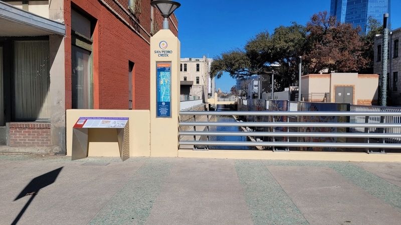
Over the centuries, many healers would find their way to the creek.
Until the Middle 1800s, health care in San Antonio was provided by private physicians, druggists, and curanderos (folk healers). After cholera epidemics killed hundreds . . . — — Map (db m214484) HM
Late Thursday evening we noticed an aged Mexicano standing in front of the new Cathedral of the Plaza, watching the workmen as they were busily engaged in tearing down the front wall of the old Cathedral. The old viejito was crying like a child, . . . — — Map (db m188834) HM
Samuel McCulloch, Jr. (1810-1893), wounded at the Battle of Goliad October 9, 1835, was one of the first casualties of the Texas Revolution. This site is part of land he received in 1850 as a bounty for his service. The oldest marked grave is that . . . — — Map (db m179924) HM
Episcopalians first worshiped in this Laurel Heights neighborhood in 1907, under the auspices of St. Mark's Church downtown. Christ Episcopal Church was formed in 1911, with the Rev. John D. Ridout as its first rector. In 1913, ground was broken . . . — — Map (db m176083) HM
In early 1907, residents of the Laurel Heights area petitioned the Sisters of the Divine Providence, a French religious order to open a neighborhood school. The order already operated four local schools and many more throughout Texas and adjoining . . . — — Map (db m213325) HM
Holy Ground
This is the site of a burial ground. Beginning about 1780, the remains of indigenous people and other local inhabitants were interred in this church that was never completed. They were removed during an archeological . . . — — Map (db m213536) HM
To assure a constant flow of water to Mission Espada's fields, Franciscans and Indians dug ditches curving along the contours of the river valley. Only here, where Sixmile Creek slashes the hillside, did the natural lay of the land impose a blockade . . . — — Map (db m213544) HM
Mission Espada has always had a spiritual heart, but it has not always beat in exactly the same location. Catastrophic epidemics struck Espada from time to time, and church construction efforts mirrored the population's rise and fall-as well as the . . . — — Map (db m215166) HM
Members Of Hunting And Gathering Tribes known collectively as Coahuiltecans found food and protection at Mission Espada in the 1700s. Daily life for those who chose to live here included instruction in language, religion, agriculture, building . . . — — Map (db m213718) HM
For more than sixty years, this mission plaza was a busy place of learning - of faith and works, language and traditions. Along with practicing hymns, prayers, and doctrines, mission Indians learned the skills needed to grow crops, to raise cattle, . . . — — Map (db m217679) HM
In this semi-arid land, nothing was more crucial to a mission's success than a reliable supply of food. The promise of security and regular meals attracted those Indians who lived near Espada - Arcahomos, Malahuitos, Pacaos, and Tacames - into the . . . — — Map (db m217672) HM
Workshops and storerooms clustered around this small courtyard bustled with activity - especially when a mule train arrived. Books, fabrics, hats, pots, griddles, and iron bars hauled from distant Mexico City were unpacked here and stored away. Then . . . — — Map (db m213300) HM
More than a church, Mission Concepción was also a village, fort, school, farm, and ranch.
At the missions the Franciscans gathered the native peoples together, converted them to Catholicism, taught them Spanish culture, and sought to . . . — — Map (db m164052) HM
Mission Espada, The Southernmost of San Antonio's five Spanish missions, was established here on the west bank of the San Antonio River in 1731. The small missionary-led community first built crude huts (jacales) that were later replaced by . . . — — Map (db m213719) HM
Only A Few Families Remained At Mission Espada after secularization. The mission continued to deteriorate, and by the late 1850s only part of the church remained standing. Father Francis Bouchu, who was appointed pastor of Espada in 1858, began . . . — — Map (db m213714) HM
On this spot early pioneers of San Antonio gathered in time of danger and also when they came to worship in the chapel of San Francisco de la Espada.
This lot was donated to the Archdiocese of San Antonio by the heirs of Josefa de la Garza . . . — — Map (db m132595) HM
Only a fraction of the buildings of the selfsustaining community that was Mission San Juan can still be seen above ground today. Archeology and old Spanish records provide clues to help us imagine this settlement of as many as 200 souls. . . . — — Map (db m217546) HM
Mission San Juan Capistrano was originally founded in East Texas in 1716 but failed to prosper in that remote location. It was reestablished in 1731 here on the east bank of the San Antonio River. The indigenous residents of the missionary-led . . . — — Map (db m213402) HM
Mission San Juan Capistrano, originally founded in East Texas in 1716, was reestablished here on the east bank of the San Antonio River in 1731. The mission community prospered in spite of its remote location, far from the Presidio of San . . . — — Map (db m213540) HM
Exploratory Expeditions Traveled North from New Spain (today's Mexico) beginning in the 1500s seeking to expand Spain's influence in America. In the following two centuries soldiers and priests accompanying these groups established presidios to . . . — — Map (db m213727) HM
Oak Island Cemetery has been a final resting place since the War Between the States with the earliest recorded graves being Julia Gayle in 1862 and Rev. J.K. Harper in 1863. According to Rev. John Welsey DeVilbiss field notes of August 11, 1875, . . . — — Map (db m230610) HM
Designated by Southwest Texas Conference, The Methodist Church, June 6-9, 1966
Oak Island Cemetery holds the grave of John Wesley DeVilbiss, circuit rider extraordinary. He was first in North America to add to his Methodist circuit. As the . . . — — Map (db m230609) HM
Circuit rider DeVilbiss came to Republic of Texas in 1842 to minister on Hispanic borders in the southwest. He pioneered among immigrants and native Texians to promote harmony in varied cultures in this far outpost. In county clerk's office in April . . . — — Map (db m230603) HM
All travelers coming into Mission San Juan were formally received here by a portero, who closely monitored this main gate. Pack trains hauled cargo on the Camino Real, some 15- days north from Coahuila in Mexico, or two weeks east from Louisiana. . . . — — Map (db m217651) HM
The missions of San Antonio were far more than just churches, they were communities. Each was a fortified village, with its own church, farm, and ranch. Here, Franciscan friars gathered native peoples, converted them to Catholicism, taught them to . . . — — Map (db m213285) HM
The missions of San Antonio were far more than just churches, they were communities. Each was a fortified village, with its own church, farm, and ranch. Here, Franciscan friars gathered native peoples, converted them to Catholicism, taught them to . . . — — Map (db m217683) HM
The doorway where you now stand was once for a few years - the entrance to a church. For those who lived in Mission Espada more than two centuries ago, it was the portal to a new way of life.
The sacraments and feast days of the Catholic faith . . . — — Map (db m215170) HM
This quarry was the source of stone for building Mission Concepción and portions of Mission San José. Indian and Mestizo laborers used picks and axes to cut grooves in the limestone rock, and bars and wedges to pry up the rough blocks. . . . — — Map (db m164050) HM
The World Heritage Site Program was established by the United Nations Educational, Scientific, and Cultural Organization (UNESCO) in 1972 to identify and honor cultural, natural, or mixed sites of worldwide importance. Participating countries . . . — — Map (db m213396) HM
Paisaje Ribereño
Estas tierras cerca del Rio San Antonio han sido un lugar de reunión desde que las primeras personas nativas acamparan aquí hace 11.500 años atrás. El río, alimentado por manantiales, provela agua y pescados y los . . . — — Map (db m216345) HM
The San Antonio River United And Sustained the five missions. Without its water, residents and their crops and livestock would not have survived. The oldest of the missions, San Antonio de Valero (the Alamo), was located north of here in what is . . . — — Map (db m216415) HM
Established in 1722 • Its Indian neophytes, few in number, passed into the care of the missionaries at San Antonio de Valero in 1726 • The land was later granted to the Mission Nuestra Señora de La Purísima Concepción de Acuña • Reestablished in . . . — — Map (db m163845) HM
Rural Land Surrounded Mission Concepción in the late 1800s providing a quiet retreat for city dwellers. The area began to change in 1888 when the San Antonio International Fair and Exposition opened at a nearby site along today's Roosevelt . . . — — Map (db m216287) HM
The World Heritage Site Program was established by the United Nations Educational, Scientific, and Cultural Organization (UNESCO) in 1972 to identify and honor cultural, natural, or mixed sites of worldwide importance. Participating countries . . . — — Map (db m216416) HM
In 1852, four brothers of Mary - three from France, one from Ohio - established the early beginnings of St. Mary's University and Central Catholic High School, at 112 College Street, San Antonio, Bexar County, Texas.
This sturdy stone rests . . . — — Map (db m238289) HM
St. Mary's University has served the educational needs of residents in San Antonio and throughout Texas since the mid-1800s. In 1851, the Rev. Jean-Marie Odin, Vicar Apostolic and later Bishop of Galveston, traveled to France to recruit clergy to . . . — — Map (db m238300) HM
In 1897, the Sisters purchased the 283 acre Fernridge estate from Colonel George W. Brackenridge as the site for a new Motherhouse for the growing Congregation.
The house was renamed the Brackenridge Villa by the Sisters. After 3 years as the . . . — — Map (db m214713) HM
Until the mid-1980's, the Sisters' land west of the San Antonio River was a natural, wooded area, with many headwaters springs. Sisters recall walking through a "wilderness" and seeing springs bubbling up from the ground.
A small dam downstream . . . — — Map (db m214709) HM
Established by the Sisters in 2008, the Headwaters Sanctuary preserves 53 acres of spring-filled land, including the San Antonio Spring or "Blue Hole." The Sisters dedicated this area to conservation as an expression of their commitment to care for . . . — — Map (db m214717) HM
Noted for quality educational programs, this institution grew from a teaching charter granted in 1881 to the Sisters of Charity of the Incarnate Word. In 1893 a boarding and day school known as Incarnate Word Academy was established. By 1909 a . . . — — Map (db m207839) HM
Built in 1904 by Fr. J.G. Bednarek of Chicago, the Grotto marked the 50th anniversary of the promulgation of the dogma of the Immaculate Conception of the Blessed Virgin Mary. It is a replica of the grotto of Our Lady of Lourdes in France. . . . — — Map (db m214711) HM
The 1900 Motherhouse of the Sisters of Charity of the Incarnate Word was designed by architect Alfred Giles to house the convent, novitiate, and College and Academy of the Incarnate Word. Here, the Sisters lived, prayed and worked. It was the home . . . — — Map (db m214704) HM
The Chapel of the Incarnate Word was dedicated on May 30, 1907. The Romanesque design by architect F.D. Gaenslen features outstanding stained glass windows created by the Emil Frei studios in St. Louis, Missouri. A place of prayer and celebration, . . . — — Map (db m214707) HM
The San Antonio Spring, or Blue Hole, is the mainspring in a field of many artesian springs which arise from the Edwards Aquifer and form the headwaters of the San Antonio River.
Known as Yanaguana, meaning Spirit Waters, this spring was once a . . . — — Map (db m214716) HM
The original complex of eight buildings was erected 1851-1882. Main building is largest known Texas structure in French "Pise de Terre" (Rammed Earth) method.
Upon their arrival here in 1851 the Ursuline Nuns found the abandoned, decaying . . . — — Map (db m213516) HM
Organized in 1886 as the San Antonio Home for Destitute Children, the Protestant Home for Destitute Children moved into this building in December 1890. The orphanage continued in operation at this site until 1926, when it relocated to larger . . . — — Map (db m176064) HM
Organized, 1854, by Rev. Daniel Rawls, Methodist circuit rider. Six charter members. Worship was held in log cabin and frame building until 1882.
Present structure erected, dedicated, 1883. Still serves as church sanctuary. Native limestone . . . — — Map (db m194114) HM
Led by Mr. and Mrs. Robert Silliman and the Rev. Joseph Bird (1821-1909), this congregation was organized on November 6, 1859, with five charter members. Worship services were held in a Union church shared with the local Methodist and Church of . . . — — Map (db m194103) HM
Born a slave in Virginia, Peyton Roberts became a freedman in Caldwell County, Texas, at the close of the Civil War. He soon moved west to this area and the settlement that developed around his farm became known as Peyton Colony. In 1874, under the . . . — — Map (db m194059) HM
In 1850's when first Catholic families came to Blanco County, worship was in homes and halls. Land was purchased in 1887. By efforts of Father Virgilius Draessel and people of Twin Sisters, this church was built and dedicated in 1889.
Stone for . . . — — Map (db m183635) HM
In 1879, on July 19-20 or August 16-17, seven members formed the Missionary Baptist Church of Christ, present First Baptist Church. The Rev. James E. Bell (b.1843) held services in the schoolhouse. Lumber for the original church building, erected . . . — — Map (db m31532) HM
>This congregation was organized in 1903 by the Rev. Tom Smith, an evangelist with the Texas Christian Missionary Society, and twenty-six charter members. Land for a church building was given by Judge N. T. Stubbs and a sanctuary was completed in . . . — — Map (db m31533) HM
Built by Johnson City founder James Polk Johnson (1845-1885), this structure has housed a variety of businesses and served as a community gathering place. In addition to serving as a community hall, opera house, and meeting place for churches and . . . — — Map (db m31126) HM
In 1869, Methodists in the Iredell area began worshiping at Hester Schoolhouse, a building used by both Baptists and Methodists for services. The Rev. Peter W. Gravis served as pastor. Two years later, the Methodist congregation moved to Wills . . . — — Map (db m161851) HM
John Clabaugh and W.A. Mason, missionaries for the Texas Baptist Convention, established first Baptist Church of Meridian on March 13, 1859 with ten area residents. Circuit-riding Preachers conducted the first worship services, and the . . . — — Map (db m161803) HM
Local Episcopalians founded the St. James congregation in 1913. Charter members Dr. James Julius Lumpkin and his wife, Ida Etoile (Fuller), donated this site, and church officials consecrated the new facilities that year. The church prospered in . . . — — Map (db m161841) HM
Organized in 1889, the Morgan Methodist Church first held worship services in the Baptist church building. At an 1891 revival, the fellowship initiated plans to construct this sanctuary. Originally a one-room structure, the building was enlarged in . . . — — Map (db m69595) HM
The Coon Creek community evolved from the Old Cyrus community, the oldest settlement in southeastern Bosque County. The first settler was Temple Spivey who purchased land on the Brazos River in 1853. In January 1856, John Jackson Smith purchased . . . — — Map (db m161798) HM
Methodists in this area trace their history to the 1840s. When circuit-riding preachers began holding camp meetings on a near-by farm. In 1889, after the railroad caused Valley Mills to relocate south of the Bosque River, the Methodists built their . . . — — Map (db m233633) HM
Pioneer area settler Joshua McCuistion donated land at this site for a Methodist chapel to serve the community of Hollis Prairie. Completed about 1880 adjacent to a schoolhouse, it was built by John R. Lane and his sons, for whom the settlement was . . . — — Map (db m84910) HM
Built of knotless pine lumber in 1888. First house of worship built by congregation who had been worshipping since 1839 in homes, groves and school. During this time the town of Dalby Springs emerged from farmland and grew into a summer health . . . — — Map (db m160935) HM
The Rev. William Stevenson led the pioneering efforts of Methodist Circuit Riders in Northeast Texas in 1815. He preached on both sides of the Red River, although Protestant Services were then illegal in the Spanish Territory of Texas. Methodist . . . — — Map (db m160916) HM
This rural congregation constructed its first church building on land donated by Mr. & Mrs. J. M. C. Yates in 1861. The log building, located at the present-day site of Red Bayou Cemetery, also served as a school.
In its early years the church . . . — — Map (db m234978) HM
Founded in 1883 with the Rev. J. C. Mason as first pastor, the Central Christian Church congregation built this structure in 1932. Construction was supervised by architect and church member E. C. Seibert (1878-1941), who used carefully placed . . . — — Map (db m96569) HM
Front
Hero of the Alamo
"They never fail who
die in a just cause"
Love of adventure
brought the young
South Carolinian to
Texas with James Long
in 1819. Romance made
of him a Mexican
citizen and won for
him in San . . . — — Map (db m96572) HM
The Texas and Pacific Railroad founded Texarkana on December 8, 1873. Anthony Ghio and Col. R.W. Rodgers purchased town lots on the first day of sale. They and several other residents formed Sacred Heart Catholic Church under the leadership of . . . — — Map (db m160910) HM
Local Episcopalians met on Oct. 30, 1876, at the Marquand Hotel to organize this congregation. The first parish meeting was held April 2, 1877. Citizens of all faiths contributed funds for the first church building, erected on property donated by . . . — — Map (db m160885) HM
According to oral tradition, the Red Lick Methodist Episcopal Church, South, was founded in 1885. Church services have taken place at this site, upon land donated by the Bob Bonner family, since the 1890s. During the early years the group met in a . . . — — Map (db m234915) HM
A Methodist circuit-riding minister, the Reverend Peter Nicholson, founded the First Methodist Episcopal Church in Alvin in 1881. Early worship services were held in the homes of its members and in the local railroad station. The first church . . . — — Map (db m173531) HM
The history of this congregation can be traced to 1890. Many families moved to Alvin at that time to take advantage of economic opportunities offered by the surrounding agricultural development. Among the new citizens were a number of . . . — — Map (db m173532) HM
The First Baptist Church of Angleton was established in 1896 with Joseph Matthew Kailin as pastor. A hurricane in 1900 destroyed the sanctuary. Members met in borrowed facilities until 1911 when a new church building was erected. The congregation . . . — — Map (db m173320) HM
Angleton's First Missionary Baptist Church organized in 1898, when it primarily served African American field hands and tenant farmers from the surrounding agricultural area. In 1905, under the direction of the Rev. Hamp Evans, congregants built . . . — — Map (db m173322) HM
On April 12, 1898, Rt. Rev. G. H. Kinsolving, Episcopal Bishop of the Diocese of Texas, visited Angleton to preach a sermon at the Methodist church at the invitation of an Episcopal Sunday School founded in 1897. While in Angleton, he also . . . — — Map (db m173308) HM
The Presbyterian denomination has been active in Brazoria since the 1830's. They worshipped together with the Episcopal and Methodist congregations in the Union Church, built around 1853 in Brazoria. Following the destruction of the church in the . . . — — Map (db m167906) HM
Bethel Presbyterian Church, one of the oldest in Texas, was organized June 13, 1840. Land and original church given by Mrs. J. H. Bell. New church acquired, 1932. Recorded Texas Historic Landmark - 1966 — — Map (db m182812) HM
Methodist circuit riding ministers were conducting worship services in the Velasco area as early as the 1830's. After the original townsite was destroyed in the hurricane of 1875 a new one developed further inland. Led by the Rev. John L. . . . — — Map (db m169456) HM
Though local Methodist worship can be traced to 1894, this congregation was officially organized in 1898 as the Methodist Episcopal Church of Pearland. The original frame building, shared with other denominations, was damaged in the storm of 1900 . . . — — Map (db m137335) HM
This congregation traces its history to early Methodist missionary activity during Texas' years as a republic in 1839. The Rev. Isaac L. G. Strickland was assigned to the Brazoria Circuit and organized a Methodist Church in Columbia (now West . . . — — Map (db m46456) HM
Born in North Carolina to Andrew and Elizabeth (Stevenson) McKenzie, Mary Eveline McKenzie met her future husband, Josiah Hughes Bell, while visiting her aunt and uncle in Christian County, Kentucky, where her family helped found Little River . . . — — Map (db m172994) HM
During the early colonization of Texas, the Catholic religion was the
established religion of Texas. As the colonists arrived in Texas to receive
their land grant they were required to accept the Catholic faith even
though many of them were of . . . — — Map (db m164590) HM
Organized Nov. 21, 1867, in the Presbytery of Brazos by the Rev. J.H. Hutchinson, this apparently was the second denominational group in Bryan. In 1871, members themselves built their first sanctuary at Washington and 29th Streets. This effort was . . . — — Map (db m170268) HM
This parish traces its origin to Episcopal services held in nearby Millican in 1864. A yellow fever epidemic in the Millican area prompted the relocation of the Saint Andrew's Mission to Bryan in 1867. A parish was formed that year and led by The . . . — — Map (db m129293) HM
The Ursuline Sisters, founded by St. Angela in Italy in 1535, opened their first girls' school in North America in Quebec in 1639. In 1727, they opened the Ursuline Academy in New Orleans, followed in 1847 with the Ursuline Academy in Galveston. . . . — — Map (db m179149) HM
Although Catholic worship services were celebrated in Bryan by 1869, this church traces its history to the early 1870s. The first church building was erected about 1871 for a small active parish. The Reverend John Moore is considered to be the . . . — — Map (db m170269) HM
The Rev. Joseph Pelnar of Bryan's St. Joseph Catholic Church erected a parish school building here in the early 1890s. The children of East European immigrant families dominated student enrollment at St. Joseph's until about the 1930s. Teachers . . . — — Map (db m170271) HM
Methodism among African American Texans predates the civil war with the first church being established in 1848. the earliest known African American minister in Brazos county was reverend Emmanuel Hammitt who served under Reverend W.S. South after . . . — — Map (db m239014) HM
German immigrant Adam Royder (d. 1894) donated one acre of land here for school purposes in 1891. A one-room schoolhouse was constructed where area students received instruction through the seventh grade. The Rock Prairie Missionary Baptist Church . . . — — Map (db m168058) HM
In 1918–19, Texas A&M President W.B. Bizzell asked ministers of Bryan churches to provide religious services for students of their respective denominations. In response, Rev. P.T. Ramsey of First Methodist Church provided $500 and encouraged . . . — — Map (db m238739) HM
When the railroad came through this area in 1882, the settlement of Osborne was established here near natural springs. The community's name changed to Murphysville in 1883, and at that time, as the population began to grow, missionaries arrived from . . . — — Map (db m61014) HM
2316 entries matched your criteria. Entries 201 through 300 are listed above. ⊲ Previous 100 — Next 100 ⊳