After filtering for Nebraska, 154 entries match your criteria. The first 100 are listed. ⊳
Roads & Vehicles Topic
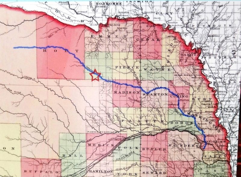
Marker detail: 1867 Nebraska Map
| 1 ► Nebraska, Antelope County, Neligh — Trails, Rails, and Roads: Lifelines of a Mill — |
| On N Street south of East 2nd Street, on the left when traveling south. | |||
| 2 ► Nebraska, Buffalo County, Kearney — 488 — Buffalo County’s Lincoln Highway Seedling Mile — |
| On U.S. 30, on the right when traveling west. | |||
| 3 ► Nebraska, Buffalo County, Kearney — Old Oregon Trail — |
| On Central Avenue at Railroad Street, on the right when traveling north on Central Avenue. | |||
| 4 ► Nebraska, Buffalo County, Shelton — 407 — Joseph E. Johnson and the Huntsman’s Echo — |
| On U.S. 30 at South D Street, on the right when traveling west on U.S. 30. | |||
| 5 ► Nebraska, Cedar County, Crofton — Meridian Highway — |
| Near U.S. 81, 1.5 miles south of 898th Rd.. | |||
| 6 ► Nebraska, Cheyenne County, Sidney — 78 — Sidney ~ Cheyenne County — |
| Near Interstate 80 (at milepost 61), 1.3 miles east of Upland Parkway (Alternate Interstate 80), on the right when traveling west. | |||
| 7 ► Nebraska, Cheyenne County, Sidney — Sidney-Black Hills Trail — |
| On Lincoln Highway (U.S. 30) 1 mile west of 13th Avenue, on the left when traveling west. | |||
| 8 ► Nebraska, Cuming County, Bancroft — M60A3 Tank — Built in 1775 — Weight 53.45 Ton — |
| On Park Road just south of Public Road, on the right when traveling south. | |||
| 9 ► Nebraska, Custer County, Gothenburg — 530 — Etna — |
| On Etna Road just east of State Highway 47, on the left when traveling east. | |||
| 10 ► Nebraska, Dawes County, Chadron — 465 — Fort Robinson - Camp Sheridan - Pine Ridge Indian Agency Road — |
| On U.S. 385 at West 16th Street, on the left when traveling north on U.S. 385. | |||
| 11 ► Nebraska, Dawes County, Chadron — 304 — The Fort Pierre-Fort Laramie Trail — |
| On U.S. 385 near U.S. 20. | |||
| 12 ► Nebraska, Dawes County, Crawford — Crossing of the Trails — |
| On 2nd Street just south of Ash Street, on the left when traveling north. | |||
| 13 ► Nebraska, Dawes County, Marsland — The Sidney Black Hills Trail — |
| On Nebraska Route 2, 15 miles south of U.S. 20, on the left when traveling south. | |||
| 14 ► Nebraska, Dawson County, Cozad — 73 — Central Platte Valley — |
| Near Interstate 80 at milepost 226, on the right when traveling east. | |||
| 15 ► Nebraska, Dawson County, Gothenburg — The Pony Express — |
| On 15th Street, on the left when traveling east. | |||
| 16 ► Nebraska, Dawson County, Gothenburg — The Road to Zion — |
| On 15th Street, on the left when traveling east. | |||
| 17 ► Nebraska, Deuel County, Big Springs — Deuel County Nebraska — |
| On County Highway 36 at County Highway 63.2, on the left when traveling south on County Highway 36. | |||
| 18 ► Nebraska, Deuel County, Big Springs — The Big Spring — |
| Near West Second Street. | |||
| 19 ► Nebraska, Deuel County, Big Springs — 113 — The Great Platte River Road — |
| Near Interstate 80 at milepost 100, on the right when traveling east. | |||
| 20 ► Nebraska, Deuel County, Chappell — 316 — Historic Lodgepole Creek Valley — |
| On State Highway 25A at County Route 165, on the right when traveling north on State Highway 25A. | |||
| 21 ► Nebraska, Deuel County, Chappell — 9 — Hughes’ Ranch Pony Express Station — In Search of the Pony Express Stations — |
| On Gold Rush Byway (U.S. 385), on the left when traveling north. | |||
| 22 ► Nebraska, Dodge County, Fremont — Fremont's First City-Owned Parking Lot — Nov. 14, 1964 — |
| On Park Avenue at 5th Street, on the left when traveling south on Park Avenue. | |||
| 23 ► Nebraska, Dodge County, Fremont — 117 — Mormon Pioneer Trail — |
| On Military Avenue, on the right when traveling east. | |||
| 24 ► Nebraska, Dodge County, Fremont — Overland Emigrant Trails |
| On Military Avenue at D Street, on the left when traveling east on Military Avenue. Reported permanently removed. | |||
| 25 ► Nebraska, Douglas County, Florence, North Omaha — The Mormon Pioneer Trail / A Meeting House For The Saints — |
| On North 30th Street, on the right when traveling south. | |||
| 26 ► Nebraska, Douglas County, Omaha, Central Omaha — Dundee Memorial Park Streetcar Wall — |
| On Underwood Avenue at Happy Hollow Boulevard, on the left when traveling west on Underwood Avenue. | |||
| 27 ► Nebraska, Dundy County, Benkelman — 470 — Nature's Gift: The Highway 34 Springs — |
| On Old U.S. 34 at Avenue 339, on the right when traveling east on U.S. 34. | |||
| 28 ► Nebraska, Dundy County, Haigler — 126 — Texas Trail Canyon — |
| On U.S. 34, on the right when traveling east. | |||
| 29 ► Nebraska, Gage County, Beatrice — Homesteading's Legacy is Written on the Land — |
| 30 ► Nebraska, Gage County, Beatrice — Railroads: Union Pacific & Burlington Northern — |
| On Court Street (U.S. 136) at 2nd Street, on the right when traveling west on Court Street. | |||
| 31 ► Nebraska, Gage County, Beatrice — River Town Development — |
| On Court Street (U.S. 136) at 2nd Street, on the right when traveling west on Court Street. | |||
| 32 ► Nebraska, Gage County, Beatrice — Roads to Success — |
| 33 ► Nebraska, Gage County, Beatrice — The De Roin & Oregon Trails — |
| On Court Street (U.S. 136) at 2nd Street, on the right when traveling west on Court Street. | |||
| 34 ► Nebraska, Gage County, Beatrice — Veterans Memorial Drive — Dedicated to All Veterans — |
| On 6th Street (U.S. 77) near Veterans Memorial Drive, on the right when traveling south. | |||
| 35 ► Nebraska, Gage County, Odell — The Oketo Cutoff — |
| On State Highway 8, 0.6 miles west of Perry Street, on the right when traveling west. | |||
| 36 ► Nebraska, Garden County, Lewellen — Descent of Windlass Hill — |
| Near U.S. 26, on the right when traveling south. | |||
| 37 ► Nebraska, Garden County, Lewellen — Oregon Trail — |
| Near U.S. 26, on the right when traveling south. | |||
| 38 ► Nebraska, Garden County, Lewellen — Oregon Trail — |
| On U.S. 26, on the right when traveling north. | |||
| 39 ► Nebraska, Garden County, Lewellen — Rough Going — |
| Near U.S. 26, on the right when traveling south. | |||
| 40 ► Nebraska, Garden County, Lewellen — The Oregon Trail — |
| Near U.S. 26, on the right when traveling south. | |||
| 41 ► Nebraska, Garden County, Lewellen — Wagon Ruts — |
| Near U.S. 26, on the right when traveling south. | |||
| 42 ► Nebraska, Garden County, Lewellen — Wagons in the West — |
| Near U.S. 26, on the right when traveling south. | |||
| 43 ► Nebraska, Garden County, Lisco — The Mormon Pioneer Trail / The Rapture of Spring — |
| On U.S. 26. | |||
| 44 ► Nebraska, Garden County, Oshkosh — 235 — John Hollman Grave — |
| On State Highway 27 at Road 54, on the right when traveling south on State Highway 27. | |||
| 45 ► Nebraska, Garden County, Oshkosh — Oregon Trail — |
| On State Highway 27 at Road 54, on the right when traveling south on State Highway 27. | |||
| 46 ► Nebraska, Garden County, Oshkosh — Oregon Trail Memorial — |
| On State Highway 27 at Road 54, on the right when traveling south on State Highway 27. | |||
| 47 ► Nebraska, Hall County, Grand Island — Old California Overland Trail — |
| On Tech Drive at U.S. 34 on Tech Drive. | |||
| 48 ► Nebraska, Hall County, Grand Island — Sinclair Tank Wagon, 1917 — |
| On Bosselman Avenue at Wood River Road, on the right when traveling south on Bosselman Avenue. | |||
| 49 ► Nebraska, Hall County, Grand Island — 255 — The Lincoln Memorial Highway — |
| 50 ► Nebraska, Hall County, Grand Island — The Mormon Trail — |
| On Interstate 80 at milepost 316.5, on the right when traveling west. | |||
| 51 ► Nebraska, Hall County, Grand Island — 482 — The Seedling Mile — |
| On Seedling Road, in the median. | |||
| 52 ► Nebraska, Hitchcock County, Stratton — 352 — The Leavenworth and Pike’s Peak Express — |
| On Howard Street (U.S. 34) near Texas Avenue, on the left when traveling east. | |||
| 53 ► Nebraska, Hitchcock County, Trenton — Old Texas Ogallala Trail — 1869 - 1885 — |
| On State Highway 34 near County Route 363, on the left when traveling east. | |||
| 54 ► Nebraska, Holt County, O'Neill — 228 — U.S. Highway 281 — |
| On American Legion Memorial Highway (U.S. 281) 8.6 miles south of U.S. 20, on the right when traveling south. | |||
| 55 ► Nebraska, Jefferson County, Fairbury — Jefferson County Pony Express Stations — The Pony Express — 1860:1861 • 1960:1961 — |
| Near 5th Street just west of E Street (568th Avenue), on the left when traveling west. | |||
| 56 ► Nebraska, Jefferson County, Fairbury — Virginia Station — (Whiskey Run) — The Pony Express — 1860:1861 • 1960:1961 — |
| On 568th Avenue (Nebraska Route 15) 4 miles north of U.S. 136, on the left when traveling north. | |||
| 57 ► Nebraska, Johnson County, Tecumseh — Rural Free Delivery — |
| On Broadway near 5th Street, on the left when traveling east. | |||
| 58 ► Nebraska, Johnson County, Tecumseh — 203 — Tecumseh — Nebraska Historical Marker — |
| On Broadway at 4th Street, on the right when traveling east on Broadway. | |||
| 59 ► Nebraska, Kearney County, Kearney — 364 — The Great Platte River Road — |
| On 25th Road (Nebraska Route 44) 0.1 miles south of W Road, on the left when traveling south. | |||
| 60 ► Nebraska, Keith County, Brule — 313 — California Hill — |
| On U.S. 30 at M, on the right when traveling west on U.S. 30. | |||
| 61 ► Nebraska, Keith County, Brule — Oregon Trail - California River Crossing — |
| On Lincoln Highway (U.S. 30) at County Road M, on the right when traveling west on Lincoln Highway. | |||
| 62 ► Nebraska, Keith County, Ogallala — 7 — California Hill — |
| On West Second Street. | |||
| 63 ► Nebraska, Keith County, Ogallala — Chain – O – Lakes — |
| Near Interstate 80. | |||
| 64 ► Nebraska, Keith County, Ogallala — 5 — Cowboy Capital — Nebraska Historical Marker — |
| On North Spruce Street (Scenic U.S. 26) at West 10th Street on North Spruce Street. | |||
| 65 ► Nebraska, Keith County, Ogallala — 3 — End of the Texas Trail — 1875-1885 — |
| On North Spruce Street near East Third Street. | |||
| 66 ► Nebraska, Keith County, Ogallala — 10 — Highways 26 and 92 — The Western Trails Scenic and Historic Byway — |
| On North Spruce Street near West Second Street. | |||
| 67 ► Nebraska, Keith County, Ogallala — 9 — Interstate 80 — |
| On West First Street (U.S. 30). | |||
| 68 ► Nebraska, Keith County, Ogallala — 97 — Ogallala and the Platte Valley — |
| Near Interstate 80, on the right when traveling west. | |||
| 69 ► Nebraska, Keith County, Ogallala — Oregon Trail — |
| On Lawrence Road at West Road 80, on the left when traveling north on Lawrence Road. | |||
| 70 ► Nebraska, Keith County, Ogallala — Samuel David “Lep” Sanders — |
| On West 1st Street (U.S. 30) at West O Street on West 1st Street. | |||
| 71 ► Nebraska, Keith County, Ogallala — Standard Oil Gas Station — “Hugh” — |
| On North Spruce Street near West 3rd Street, on the right when traveling south. | |||
| 72 ► Nebraska, Keith County, Ogallala — 1 — The Great Platte River Road — 1813 - 1840 — |
| On East A Street at West Second Street on East A Street. | |||
| 73 ► Nebraska, Keith County, Ogallala — 2 — The Great Platte River Road — 1841- 1866 — |
| On East A Street at West Second Street on East A Street. | |||
| 74 ► Nebraska, Keith County, Ogallala — 8 — The Lincoln Highway — |
| On West First Street (U.S. 30). | |||
| 75 ► Nebraska, Keith County, Ogallala — 5 — The Mormon Trail — |
| On West A Street near West Second Street. | |||
| 76 ► Nebraska, Keith County, Ogallala — 4 — The Pony Express — |
| On North Spruce Street near West Second Street. | |||
| 77 ► Nebraska, Lancaster County, Denton — 143 — Nebraska City-Fort Kearny Cutoff — |
| On 100 Street, 0.3 miles south of West Saltillo Road, on the right when traveling north. | |||
| 78 ► Nebraska, Lincoln County, Brady — 194 — Road Ranches Along the Platte — |
| Near Interstate 80 at milepost 194,, 13.7 miles east of State Highway 56A, on the right when traveling east. | |||
| 79 ► Nebraska, Lincoln County, North Platte — 1887 Horse Barn — Buffalo Bill Ranch State Historical Park — |
| Near Scouts Rest Ranch Road (State Highway 56E) 0.2 miles west of North Buffalo Bill Avenue, on the right when traveling west. | |||
| 80 ► Nebraska, Lincoln County, North Platte — 80 — Mormon Pioneer Camp — |
| Near North Buffalo Bill Avenue, 0.8 miles north of Lincoln Highway (U.S. 30), on the right when traveling north. | |||
| 81 ► Nebraska, Lincoln County, North Platte — Oregon Trail Memorial — |
| Near North Buffalo Bill Avenue, 0.8 miles north of Lincoln Highway (U.S. 30), on the right when traveling north. | |||
| 82 ► Nebraska, Lincoln County, North Platte — Ox Yokes — |
| Near North Buffalo Bill Avenue, 0.8 miles north of Lincoln Highway (U.S. 30), on the right when traveling north. | |||
| 83 ► Nebraska, Lincoln County, North Platte — Pony Express — |
| Near North Buffalo Bill Avenue, 0.8 miles north of Lincoln Highway (U.S. 30), on the right when traveling north. | |||
| 84 ► Nebraska, Lincoln County, North Platte — Pony Express Cold Springs Station — |
| On West Walker Road, 0.9 miles west of South Buffalo Bill Avenue, on the left when traveling west. | |||
| 85 ► Nebraska, Lincoln County, North Platte — Pony Express Station — |
| Near North Buffalo Bill Avenue, 0.8 miles north of Lincoln Highway (U.S. 30), on the right when traveling north. | |||
| 86 ► Nebraska, Lincoln County, North Platte — 89 — Sioux Lookout — |
| On East Third Street at North Dewey Street, on the right when traveling east on East Third Street. | |||
| 87 ► Nebraska, Lincoln County, Sutherland — 109 — Crossing the Overland Trail — |
| On Interstate 80 at milepost 159, on the right when traveling east. | |||
| 88 ► Nebraska, Lincoln County, Sutherland — 110 — The Great Platte River Road — |
| Near Interstate 80 at milepost 159, on the right when traveling east. | |||
| 89 ► Nebraska, Lincoln County, Sutherland — 111 — The Great Platte River Road — |
| Near Interstate 80 at milepost 159. | |||
| 90 ► Nebraska, Merrick County, Central City — 92 — Lone Tree — |
| On U.S. 30 at 15th Road, on the left when traveling west on U.S. 30. | |||
| 91 ► Nebraska, Merrick County, Central City — 6 — The Mormon Trail — |
| On U.S. 30 at 15th Road, on the left when traveling west on U.S. 30. | |||
| 92 ► Nebraska, Morrill County, Bayard — Chimney Rock Station — |
| On State Highway 92 near County Route 73, on the right when traveling west. | |||
| 93 ► Nebraska, Morrill County, Bayard — The Mormon Pioneer Trail / Halfway To Zion — |
| On U.S. 26 at Road 104, on the left when traveling north on U.S. 26. | |||
| 94 ► Nebraska, Morrill County, Bayard — The Oregon Trail — |
| On State Highway 92, on the left when traveling east. | |||
| 95 ► Nebraska, Morrill County, Bridgeport — 349 — Amanda Lamme — |
| On Gold Rush Byway (U.S. 385) at Local Road 86, on the right when traveling north on Gold Rush Byway. | |||
| 96 ► Nebraska, Morrill County, Bridgeport — 418 — Bridgeport, Nebraska — “Trail City, USA” — |
| On Main Street (Route 26/385) near 4th Street, on the right when traveling south. | |||
| 97 ► Nebraska, Morrill County, Bridgeport — 391 — Camp Clarke Bridge and Sidney-Black Hills Trail — |
| On U.S. 26, on the right when traveling west. | |||
| 98 ► Nebraska, Morrill County, Bridgeport — Guiding Landmarks — Courthouse and Jail Rocks — |
| On Route 26 near Road 103, on the right when traveling west. | |||
| 99 ► Nebraska, Morrill County, Bridgeport — 79 — Mormon Pioneer Camp — |
| On Main Street (Route 26/385) near Brown's Creek Road (underpass), on the left when traveling north. | |||
| 100 ► Nebraska, Morrill County, Bridgeport — Oregon Trail — |
| On State Highway 88 near Road 92, on the right when traveling south. | |||
154 entries matched your criteria. The first 100 are listed above. The final 54 ⊳