By Howard C. Ohlhous, December 13, 2007
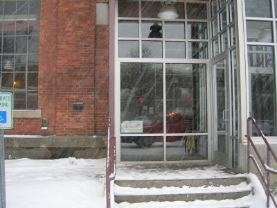
Entrance to Albany Pump Station brew pub
GEOGRAPHIC SORT Title Sort Marker Number Sort Marker Number Sort N Marker Number Sort T Publication Order Sort Publication Order Sort A Erected Year Sort Most Viewed Sort Most Recent-Interest Sort Most Recently Changed Sort SEE FAQ #33 FOR DESCRIPTIONS
On Montgomery Street (parking lot), on the right when traveling south.
Near Quay Street north of Broadway, on the right when traveling north.
On Broadway (New York State Route 5) north of Hudson Avenue, on the right when traveling north.
Near Broadway at Quay Street.
Near Broadway at Quay Street.
Near Broadway at Quay Street.
On Saratoga Street (New York State Route 32), on the right when traveling north.
On Delaware Avenue, on the left when traveling north.
On Cohoes-Crescent Road, on the right when traveling north.
Near North Mohawk Street, on the right when traveling south.
On Delaware Ave., on the right when traveling north.
On Delaware Avenue, on the left when traveling north.
On Delaware Avenue, on the right when traveling north.
Paid Advertisement
On 2nd Avenue (New York State Route 32) north of 26th Street, on the right when traveling north.
On Broadway (New York State Route 32) near Federal Express Plaza, on the right when traveling north.
On 2nd Avenue (New York State Route 32) north of 26th Street, on the right when traveling north.
On Van Wies Point Road south of Wheeler Road, on the left when traveling south.
On New York State Route 146, on the left when traveling west.
Near Broadway south of 4th Street, on the right when traveling north.
On 2nd Avenue (New York State Route 32) at 23rd Street, on the right when traveling north on 2nd Avenue.
On New York State Route 305 at South Shore Rd (County Road 25), on the right when traveling south on State Route 305.
On New York State Route 19 at Leonard Ave, on the right when traveling south on State Route 19.
On Main Street (New York State Route 19) 0.1 miles north of Vandermark Road (County Road 10), on the right when traveling north.
On Andover Roa (New York State Route 417) at Duffy Hollow Road, on the right when traveling east on Andover Roa.
Near Bronx Park Road, 1 mile south of East Fordham Road (U.S. 1), on the right when traveling south.
Near Bronx Park Road south of East Fordham Road (U.S. 1) when traveling south.
On Jungle World Road, 0.1 miles east of Bronx River Parkway, on the right when traveling west.
On Erben Avenue, on the right when traveling east.
On Wadhams Street just south of Erben Avenue, on the right when traveling south.
Paid Advertisement
On Erben Avenue, 0.6 miles east of Crowninshield Street, on the left when traveling east.
Near Wadhams Street, 0.1 miles north of Hanus Street, on the right when traveling north.
Near Wadhams Street, 0.1 miles south of Hanus Street, on the left when traveling south.
On West 230th Street at Marble Hill Avenue, on the left when traveling west on West 230th Street.
Near East 140th Street just west of Brook Avenue, on the left when traveling east.
On Saint Ann's Avenue just north of La Lupe Way, on the right when traveling south.
On Saint Ann's Avenue at East 139th Street, on the right when traveling south on Saint Ann's Avenue.
On East 140th Street just west of Brook Avenue, on the right when traveling east.
Near Exterior Street north of East 150th Street, on the right when traveling south.
Near Exterior Street north of East 150th Street, on the left when traveling north.
Near North Shore Drive at Water Street.
On I-88, on the right when traveling east.
Paid Advertisement
On Front Street at Main Street, on the right when traveling west on Front Street.
On Vestal Parkway E. just west of Clubhouse Road, on the right when traveling west.
On Route 11 at East Main Street, on the left when traveling south on Route 11.
On Main Street (New York State Route 79).
Near East Lake Road at White Bridge Road.
Near New York State Route 31 at West Brutus Street.
Near New York State Route 31 at West Brutus Street.
Near New York State Route 31 at West Brutus Street.
On New York State Route 31 at West Brutus Street, on the right when traveling east on State Route 31.
On Bell Avenue, 0.1 miles north of Main Street (New York State Route 104A).
On High Street, 0.1 miles north of Erie Street, on the left when traveling north.
On Chapman Road, 0.3 miles west of High Street, on the right when traveling south.
Near High Street, 0.1 miles north of Erie Street.
On New York State Route 90 at Erie Street, on the right when traveling north on State Route 90.
On High Street at Erie Street, on the left when traveling north on High Street.
On New York State Route 31 west of High Street, on the right when traveling east.
Paid Advertisement
Near Utica Street (New York State Route 31) 0.3 miles east of Main Street (New York State Route 38).
Near New York Thruway (Interstate 90), on the right when traveling east.
Near Utica Street (New York State Route 31) 0.3 miles east of Main Street (New York State Route 38).
Near Utica Street (New York State Route 31), on the right when traveling east.
Near New York Thruway (Interstate 90) 25.4 miles east of Ridge Road (New York State Route 414), on the right when traveling east.
Near Interstate 90 near Erie Canal Heritage Site.
Near Utica Street (New York State Route 31) 0.2 miles east of Main Street (New York State Route 38). Reported permanently removed.
On Turnpike Road (County Route 10B) 0.1 miles west of Lewis Road, on the right when traveling east.
On New York State Route 90 at Dills Beach Road, on the right when traveling south on State Route 90.
On North Seneca Street (New York State Route 34) at Franklin Street, on the left when traveling north on North Seneca Street.
On South Seneca Street (New York State Route 34) at Furnace Street, on the right when traveling north on South Seneca Street.
Paid Advertisement
On Lakeside Drive west of Lenhart Avenue, on the right when traveling west.
Near East Trail north of Traffic Circle, on the right when traveling west.
On Central Avenue, 0.1 miles north of Lake Shore Drive West (New York State Route 5), on the left when traveling north.
Near Point Drive North, 0.6 miles north of Lake Shore Drive West (New York State Route 5).
On Chautauqua Lake Rest Area at Interstate 86, on the right when traveling east on Chautauqua Lake Rest Area.
Near South Main Street at Shearman Place, on the right when traveling north.
On South Main Street, 0.1 miles south of East 1st Street, on the right when traveling north.
Near Lakeview Avenue at Buffalo Street.
Near Jones and Gifford Avenue, 0.1 miles north of Fairmount Avenue.
On Frewsburg Road (U.S. 62) 0.2 miles south of Jamestown Road (New York State Route 394).
On East Chautauqua Street (New York State Route 430) at South Erie Street (New York State Route 394), on the right when traveling east on East Chautauqua Street.
On Water Street (New York State Route 394) 0.2 miles south of Lakeview Avenue, on the left when traveling south.
On East Lake Road (New York State Route 5) 0.2 miles east of North Portage Road (New York State Route 394), on the right when traveling west.
On East Lake Road (New York State Route 5) near North Portage Road (New York State Route 394).
On Wyncoop Creek Road (County Road 3) just south of Main Street (County Road 60), on the right when traveling south.
On East Water Street (State Highway 352) at Clemens Center Parkway (State Highway 14), on the right when traveling east on East Water Street.
Paid Advertisement
On Main Street at 3rd Street, on the left when traveling north on Main Street.
On Madison Avenue, 0.1 miles north of Maple Street, on the right when traveling north.
On North Main Street (New York State Route 14) 0.1 miles north of Old Ithaca Street, on the right when traveling north.
On New York State Route 12, 0.1 miles east of Williams Road.
On New York State Route 12.
1222 entries matched your criteria. The first 100 are listed above.
Next 100 ⊳