On Forrest Street (Delaware Route 8) west of Gibbs Drive, on the right when traveling west.
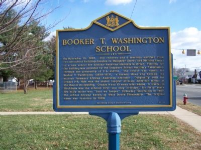
On November 13, 1922, 210 children and 6 teachers marched from two old school buildings located on Slaughter Street and Division Street to a new school for African-American students in Dover. Funding for the building was provided by the Delaware . . . — — Map (db m39064) HM
Established May 15, 1891, by an act of the Delaware General Assembly as the State College for Colored Students, by virtue of the 1890 Morrill Land-Grant Act under the provisions of the 1862 Morrill Act of Congress. Incorporated July 1, 1891. . . . — — Map (db m39054) HM
On College Road, 0.7 miles west of North Dupont Highway (U.S. 13), on the right when traveling west.
On June 17, 1921, the Board of Trustees of the State College for Colored Students, later known as Delaware State College, approved a resolution recommending the establishment of a high school for Negro students on its campus. This was the second . . . — — Map (db m142491) HM
On College Avenue, 0.7 miles west of North Dupont Highway (U.S. 13), on the right when traveling west.
From 1921 until 1952 this simple brick structure, named for its benefactor, Pierre S. Dupont, served as a laboratory-classroom for students enrolled in the teaching course at the State College for Colored Students (now DSU).
The educational . . . — — Map (db m142492) HM
In 1947 the International Latex Corporation established a specialty products division and chose this site for its location. The company’s rise to prominence as a supplier of aeronautic and aerospace equipment began in 1952 when it was contracted to . . . — — Map (db m39062) HM
In 1723 Nicholas Loockerman purchased 600 acres of land known as “The Range.” Following his death in 1771, the property passed to his grandson Vincent Loockerman Jr. Evidence suggests that he built the Georgian-style mansion known today . . . — — Map (db m39053) HM
Near Bayside Drive (Delaware Route 9) 0.4 miles east of Savana Road (County Road 86), on the right when traveling east.
The Free School Act of 1829 was passed through the efforts of Judge Willard Hall, Charles Marim, and others. Each school district received a generous subsidy for organizing & school free for children of the district.
This school was erected . . . — — Map (db m142505) HM
Rooted in the Free School Act of 1829, the Octagonal Schoolhouse, built in 1836, served as the District No. 12 school in Kent County until its closure in 1930, when it became a community center. The building's construction consisted of undressed . . . — — Map (db m244781) HM
On North State Street at Fulton Street, on the right when traveling south on North State Street.
Wesley College is a private, liberal arts college affiliated with the United Methodist Church. It was founded in 1873 as Wilmington Conference Academy, a preparatory school for boys under the patronage of the Methodist Episcopal Church. Female . . . — — Map (db m243725) HM
On Carver Road, 0.1 miles north of Forest Street (Delaware Route 8), on the right when traveling north.
In 1947 the General Assembly appropriated funding to build a comprehensive high school for Blacks and other persons of color residing in central Delaware. The site for the new school was selected in 1949. The state and the Delaware School Auxiliary . . . — — Map (db m243657) HM
In the vicinity of this marker, a Flat Outline Map of the State
would be exactly balanced.
In 1989, a curious seventh grader from the Caesar Rodney School District asked where the center of Delaware was located. . . . — — Map (db m39607) HM
Little Creek United Methodist was established in 1820 as Gum Swamp Methodist Episcopal. By 1832 the church operated and maintained a non-segregated school. In February 1875 the congregation relocated Gum Swamp ME to its current site and on May 30, . . . — — Map (db m141374) HM
In 1829 the Delaware General Assembly enacted legislation resulting in the establishment of a public school system. The state was subdivided into local districts. One of these was School District #5, which was created to serve the needs of students . . . — — Map (db m142499) HM
In 1919, a new era for education in Delaware was initiated when a statewide effort to replace old and outdated facilities was undertaken. In 1922, the new Smyrna Colored School opened its doors for African-Americans and other persons of color . . . — — Map (db m141287) HM
State Consolidated District No. 1 was authorized and created on July 1, 1915. Seven months later on February 28, 1916, voters of the district approved the request of the State Board of Education by a vote of 52 to 1 to bond together schools in the . . . — — Map (db m94381) HM
On East Scotland Drive just west of St. Andrews Road, on the right when traveling west.
John Barbour was born about 1316 and died in 1396. He was a native of Aberdeen, Scotland, a well educated man and for 40 years served as Archdeacon of St. Machar Cathedral.
In the mid 14th century there were no Scottish universities. John . . . — — Map (db m146790) HM
Near Carr Rd, 0.5 miles west of Philadelphia Pike.
On February 12, 1829, the Delaware Legislature passed the “Act for the establishment of free schools.” To meet the educational needs of the area’s youth, local residents formed a committee that purchased a parcel of land from Joseph Orr in 1830 for . . . — — Map (db m80519) HM
On N. Old Baltimore Pike (Delaware Route 7), on the right when traveling north.
Formal education for African American children in Christiana began in the 1880s with the construction of a one-room schoolhouse. Many African American schools in existence at this time were marked by dilapidated facilities, a lack of running water, . . . — — Map (db m145173) HM
On Philadelphia Pike, on the right when traveling north.
This was once the home of John Jakob Raskob (1879-1950), financier, DuPont and General Motors executive, Chairman of the Democratic National Committee, and developer of the Empire State Building. Known as "The Patio," his palatial home was . . . — — Map (db m14697) HM
On Philadelphia Pike (U.S. 13) at Darley Road, on the right when traveling south on Philadelphia Pike.
Also known as Naaman's Creek School No. 1, THE CLAYMONT STONE SCHOOL was built on land donated by John Dickinson, the "Penman of the American Revolution," in 1805. The building was expanded and renovated in 1905. Evidence suggests that it may have . . . — — Map (db m146379) HM
On Green Street at Lawson Street, on the right when traveling south on Green Street.
Constructed 1924-25. Also known as the Green Street School. Prominent in United States history as the first public high school in the 17 segregated states to be legally integrated.
In January 1951, eight black students applied for admission. Due . . . — — Map (db m14705) HM
On Madison Street, 0.2 miles south of 5th Street (Delaware Route 9), on the right when traveling south.
This building, formerly known as Delaware City School #118C, served as a school for the African American students of Delaware City between the years of 1922 and 1961. During these years 13 teachers taught over 300 students. — — Map (db m174522) HM
Near Madison Street, 0.3 miles south of 5th Street.
In 1919 Delaware radically altered its state school system, opening a new era in the education of African-American youth. Progress was stimulated by the efforts of the Delaware School Auxiliary Association and its primary supporter, P.S. duPont, who . . . — — Map (db m10445) HM
On Clinton Street, on the right when traveling north.
Delaware City was founded in 1826, in anticipation of the opening of the Chesapeake and Delaware Canal. The town was incorporated in 1851. The benefits of proximity to the canal resulted in a sustained period by prosperity and expansion of the . . . — — Map (db m94190) HM
Local tradition states that a school was present at this location as early as 1829. However, in 1878 the first documented school for African-Americans in Hockessin was established in this vicinity. The school was funded and built primarily by the . . . — — Map (db m94251) HM
Also known as the Hockessin Colored School, this building was constructed in 1920 to serve the needs of the communities African-American students. Funding for construction was provided by the Delaware School Auxiliary Association and its primary . . . — — Map (db m92145) HM
The Louis L. Redding Comprehensive High School opened in 1953 and served African American students in grades 1-12 in the Middletown area. It replaced the smaller Middletown School 120-C, a three-room wood structure on East Lake Street. The school . . . — — Map (db m141497) HM
On N. Broad Street (Delaware Route 71) at Crawford Street, on the right when traveling south on N. Broad Street.
In 1824 area residents petitioned the General Assembly for a lottery to erect a building for education and public worship. Construction of the Academy began in 1826 and was completed the next year. For many years the building served as the center of . . . — — Map (db m155748) HM
On West Green Street just west of South Broad Street (Delaware Route 71), on the right when traveling west.
From Old Academy Building, Broad Street, Middletown.
Cast by John Wilbank, Philadelphia, 1827
Moved to this location: March 3, 2008 — — Map (db m174526) HM
Built in 1923 with funding provided by Pierre S. duPont for schools in Delaware, this school replaced New Castle’s first school for “colored” students that was built in 1867 on Williams Street. The Delaware School Auxiliary Association provided . . . — — Map (db m92290) HM
On Buttonwood Avenue, on the left when traveling east.
In 1919 a school was established in the Buttonwood Methodist Church to serve the needs of “colored” students in the growing neighborhood. The first teacher was James Matthew Coulbourne. In 1926 a new one room school housing grades 1-8 was built here . . . — — Map (db m92291) HM
On East Main Street west of Academy Street, on the left when traveling west.
With deep gratitude for their commitment to education and service, the University of Delaware recognizes Albert Gallatin Lewis, his family and heirs, on whose land this building was built as a schoolhouse in 1884. — — Map (db m131156) HM
On East Main Street (Delaware Route 273) at The Green, on the right when traveling west on East Main Street.
[Left plaque]
Alumni Hall
has been placed on the
National Register
of
Historic Places
[Right plaque]
Alumni
Hall
Erected before 1810 — — Map (db m152669) HM
On The Green north of East Park Place, on the left when traveling south.
Some say the stars shine just a bit brighter over Cannon Hall, a residence hall built in 1952 and named for noted astronomer Annie Jump Cannon.
As curator of the Harvard College Observatory, Dr. Cannon classified 350,000 stars and discovered . . . — — Map (db m154026) HM
Near East Park Place west of Academy Street, on the right when traveling west.
Beatrice Hartshorn joined the Women's College at the University of Delaware in 1925 as head of the physical education program, which at the time consisted of rudimentary exercises and games.
Miss Hartshorn, who served on the University . . . — — Map (db m154035) HM
Near The Green south of East Delaware Avenue (Delaware Route 273), on the left when traveling north.
Under President Hullihen's leadership, the two colleges known as Delaware College and the Women's College were officially joined and became known as the University of Delaware in 1921. Two years later, Hullihen inaugurated the internationally . . . — — Map (db m154399) HM
On South College Avenue at West Delaware Avenue (Delaware Route 273), on the left when traveling north on South College Avenue.
This building is named in honor of E. Arthur Trabant, who served two terms as President of the University of Delaware: 1968-87 and 1988-90. During his presidency, enrollment at the University doubled, the Laird Campus was developed, the University . . . — — Map (db m131143) HM
On The Green north of East Park Place, on the right when traveling south.
Emalea Pusey Warner was one of the most influential women in the history of the University of Delaware. She was the first woman appointed to its Board of Trustees, serving from 1928-42.
The project closest to Mrs. Warner's heart was the . . . — — Map (db m131148) HM
On Dayett Mills Road near Old Baltimore Pike, on the right when traveling south.
If you are just "passing through" or are a new resident or even a life-long Delawarean, we hope to spark your interest in the varied activities available in the Pencader Hundred Area. Whether your are experiencing these for the first time or . . . — — Map (db m156918) HM
Near South College Avenue at Kent Way, on the right when traveling north.
Son of a weaver in Northern Ireland, Dr. Francis Alison (1705-1779) was educated at Scotland's leading universities. He migrated to America, where he became the father of higher education in the middle colonies. In 1743 Alison founded the Academy . . . — — Map (db m154832) HM
On The Green north of East Delaware Avenue (Delaware Route 273), on the right when traveling north.
George Abram Harter served as President of Delaware College, now the University of Delaware, from 1896 to 1914. A quiet scholar who enjoyed teaching, he was an administrator respected for his unwavering dedication to the college.
Under his . . . — — Map (db m152709) HM
On The Green south of East Delaware Avenue (U.S. 273).
Delaware College, now University of Delaware, might have been a financial casualty of the Civil War period except for the assistance of George Gillespie Evans, a Newark merchant. Indeed, Delaware College did close for 11 years before, during and . . . — — Map (db m131107) HM
On The Green south of East Delaware Avenue (Delaware Route 273), on the right when traveling north.
A New Englander born into modest means, Harry Fletcher Brown was a chemist who developed smokeless powder. In 1904, he joined the Du Pont Company and later became a benefactor of education and social services.
Mr. Brown was an intense, . . . — — Map (db m154178) HM
On The Green north of East Delaware Avenue (Delaware Route 273), on the left when traveling north.
During the height of the Great Depression, Harry Fletcher Brown first came to the aid of the University of Delaware and, over the next decade, became one of the University's most generous benefactors, financing construction of Brown Laboratory, . . . — — Map (db m154179) HM
On The Green south of East Delaware Avenue (Delaware Route 273).
An 1898 graduate of Delaware College, now the University of Delaware, Hugh Martin Morris was one of Delaware's most distinguished jurists, serving as a Wilmington attorney and, from 1919-30, as a U.S. District Judge for Delaware.
A member of . . . — — Map (db m154480) HM
On The Green north of East Delaware Avenue (Delaware Route 273), on the right when traveling north.
Born in Sussex County, Del., Hugh Rodney Sharp spent four happy years at Delaware College, now the University of Delaware, graduating in 1900 at the age of 20. He went on to become a successful business executive, a University Trustee and one of . . . — — Map (db m152661) HM
On The Green south of East Delaware Avenue (Delaware Route 273), on the left.
H. Rodney Sharp was only 16 when he entered Delaware College in 1896, and he graduated four years later in what was termed the "Class of aughty-aught." In 1915, he was appointed a Trustee.
Mr. Sharp was deeply loyal to his alma mater. He . . . — — Map (db m152662) HM
On The Green south of East Delaware Avenue (Delaware Route 273), on the left when traveling north.
To the men of the
University of Delaware
who died in the service of their country
during World War II
John H. Banks, III '46 •
Casimir L. Blaska '43 •
Robert J. Bostwick '31 •
Henry S. Brady, Jr. '34 •
Horace C. Brown '45 • . . . — — Map (db m154317) WM
On Dayett Mill Road south of Old Baltimore Pike, on the right when traveling south. Reported permanently removed.
The Iron Hill Museum is dedicated to the study of human and natural history of the Iron Hill Area. The Museum is currently engaged in a project to restore the Iron Hill School #112C and document the experiences of African-American students who . . . — — Map (db m158406) HM
Near East Main Street (Delaware Route 273) east of North College Avenue, on the right when traveling west.
Jastak-Burgess Hall, home of the Department of Foreign Languages and Literatures, is named in honor of psychologist Dr. Sarah Jastak-Burgess and Leslie M. Burgess ('43 B.S. UC Berkeley, '61 MBA Harvard). Their generous gifts in support of this . . . — — Map (db m154608) HM
On West Delaware Avenue (Delaware Route 273) west of Orchard Road, on the left when traveling east.
This building is named for renowned scholar John A. Munroe an authority on Delaware history and the author of many books, including a history of the University. After receiving his bachelor's and master's degrees from Delaware, he joined the . . . — — Map (db m154813) HM
On Academy Street north of Courtney Street, on the right when traveling north.
This building was named for John A. Perkins (1914-82), who served as President of the University of Delaware from 1950-67. His tenure marked one of the greatest periods of growth in the history of the University, with the undergraduate enrollment . . . — — Map (db m152056) HM
On The Green north of East Park Place, on the left when traveling south.
Kent Residence Hall, constructed in 1956, is named after Kent County, located in the central part of Delaware and home of the First State's capital city of Dover.
The adjoining Kent Dining Hall predates the residence hall by 31 years. The . . . — — Map (db m154027) HM
Near The Green south of East Delaware Avenue (Delaware Route 273), on the left when traveling south.
This laboratory is named for Lammot du Pont (1831-1884), a gifted scientist and grandson of the founder of the DuPont Company. His many talents resulted in new products and enhancements to the company's operation.
Recognized as a skilled . . . — — Map (db m130514) HM
On The Green north of East Park Place, on the right when traveling south.
This building is named for the small southern Delaware town of Laurel, the birthplace of Mary Wooten Carpenter. Her Husband, Walter S. Carpenter Jr., who served as President of the University of Delaware Board of Trustees from 1959-62, supported . . . — — Map (db m153415) HM
Located at the heart of The Green, Memorial Hall is a welcoming landmark and a signature building of the University of Delaware. The University community marks the passage of time by carillon music from atop the building, including hourly chimes, . . . — — Map (db m154917) HM WM
On South College Avenue at Kent Way, on the right when traveling north on South College Avenue.
The University of Delaware has a proud legacy of being a teaching University and accordingly, acknowledges faculty who are distinguished by their contributions of teaching excellence and mentorship of students. The first member of the University's . . . — — Map (db m154180) HM
On The Green north of East Park Place, on the left when traveling north.
This residence hall is named for the northernmost of Delaware's three counties, New Castle County. The City of Newark lies within its boundaries.
The dormitory was constructed with state funding in 1925, in response to the expansion of the . . . — — Map (db m131154) HM
On Delaware Avenue (Delaware Route 273) at Haines Street, on the right when traveling east on Delaware Avenue. Reported missing.
In 1893 a group of Newark women established a literary and social organization known as the Tuesday Club. Later renamed the New Century Club, the organization became part of the General Federation of Women's Clubs. Committed to matters of civic . . . — — Map (db m154776) HM
The first documented public school for African-American youth in the Newark community was established in 1867 by the Bureau of Refugees, Freedmen and Abandoned Lands. This was one of several schools established in Delaware during the post-Civil War . . . — — Map (db m154662) HM
On Academy Street at E. Main Street, on the right when traveling north on Academy Street.
Founded at New London, Pennsylvania, in 1741 by Rev. Dr. Francis Alison, removed in 1752 to Cecil County, Md., and in 1767 to Newark. Chartered by Thomas and Richard Penn 1769. Closed from 1777 to 1780 on account of Revolutionary War. Merged with . . . — — Map (db m9781) HM
On E. Main Steet (Delaware Route 273), on the right when traveling west.
This building contained a chapel (called the Oratory) class, dormitory, dining, administrative, and student society rooms. Newark College chartered February 5, 1833, opened its doors for instruction May 8, 1834. Name changed to Delaware College . . . — — Map (db m154610) HM
On The Green south of East Delaware Avenue (Delaware Route 273), on the right when traveling north.
Pierre S. du Pont can fairly be described as the founder of the modern University of Delaware. In 1915, he donated the money to purchase the land that is now The Green, which physically unified Delaware College and Women's College.
President of . . . — — Map (db m131108) HM
On The Green south of East Delaware Avenue (Delaware Route 273), on the right when traveling north.
In 1871, Theodore Wolf joined Delaware College as a 21-year-old Professor of Chemistry, fresh from receiving his doctorate at the University of Heidelberg, Germany.
Professor Wolf was a demanding but innovative and popular teacher. He worked to . . . — — Map (db m131112) HM
Near Academy Street south of Lovett Avenue, on the left when traveling north.
Francis Alison came to America from Ireland in 1735 and served as a Presbyterian minister in New London, Pennsylvania, from 1736-52. In 1743, he started a free school there to which the University of Delaware traces its origin. His first class, . . . — — Map (db m153982) HM
On The Green south of East Delaware Avenue (Delaware Route 273), on the left when traveling north.
Robert ("Bob") Gore was a University of Delaware undergraduate studying chemical engineering when he invented GoreTexⓇ. This polymer material became key to the success of W.L. Gore and Associates, a company that Bob's father, Wilbert L. . . . — — Map (db m154281) HM
On The Green south of East Delaware Avenue (Delaware Route 273), on the left when traveling north.
In 1914, Samuel Chiles Mitchell was elected the 16th President of what was then known as Delaware College, now the University of Delaware.
During his six-year tenure as President, the Women's College was opened; the central campus was . . . — — Map (db m131105) HM
On The Green north of East Park Place, on the left when traveling south.
Squire Hall is named for Francis Hagar Squire, a popular Professor of History at the University from 1927-56, who also served as Dean of the College of Arts and Sciences from 1945-56.
Professor Squire helped establish the master's degree . . . — — Map (db m162072) HM
On The Green north of East Park Place when traveling south.
This residence hall is named after Delaware's southernmost county and is one of the oldest buildings on the south Green. Sussex Hall was completed in 1917 and was built with an appropriation from the Delaware General Assembly. It was the second . . . — — Map (db m131152) HM
The Diamonds Walkway recognizes donors who make leadership level gifts to the University of Delaware for five consecutive years as members of the
Delaware Diamonds Society. Each brick in the walkway is inscribed to recognize the generosity of . . . — — Map (db m154614) HM
On West Main Street at South College Avenue, on the right when traveling west on West Main Street.
The Diamonds Walkway recognizes Delaware Diamonds Society donors who have generously contributed to UD for five consecutive years. As a special thank you, these loyal donors are offered the opportunity to have a personalized brick on the Walkway. . . . — — Map (db m238439) HM
Near Polly Drummond Hill Road, 0.2 miles north of Kirkwood Highway. Reported permanently removed.
Built in the 1790s, this 2½ story gray fieldstone house is the former home of Judge Hugh M. Morris. Morris was a Delaware native, respected attorney and distinguished federal judge. He purchased the house and a large parcel of land here in 1933. . . . — — Map (db m161924) HM
The Original Structure
The original structure was a 22-story gray fieldstone house built in the 1790s by John Barclay. The home was purchased by Andrew Gray in the 1820s. Gray made additions to the structure and named it "Chestnut Hill." . . . — — Map (db m161929) HM
Near South College Avenue north of Sunset Road, on the right when traveling north.
The beauty of the surrounding landscape on the University's South Green is the result of careful planning in the 1920s by one of the first female landscape architects in the United States, Marian Cruger Coffin. Miss Coffin designed and directed . . . — — Map (db m154197) HM
On The Green south of East Delaware Avenue (Delaware Route 273), on the right when traveling north.
In 1995, to celebrate the fifth anniversary of President David Roselle and his wife, Louise, at the University of Delaware, the Board of Trustees chose to name this section of campus, long known as The Grove, in recognition of the Roselles' service. . . . — — Map (db m154674) HM
The University of Delaware traces its origins to a school founded by the Rev. Francis Alison in 1743, which later became the Academy of Newark. In 1833, the state of Delaware chartered its first institute of higher education, called Newark . . . — — Map (db m154335) HM
On The Green south of East Delaware Avenue (Delaware Route 273), on the right when traveling south.
The University of Delaware traces its origins to a school founded by the Rev. Francis Alison in 1743, which later became the Academy of Newark. In 1833, the state of Delaware chartered its first institute of higher education, called Newark . . . — — Map (db m154472) HM
Near East Main Street east of South College Avenue, on the right when traveling west.
The UD Alumni Association (UDAA) has strengthened the commitment of graduates to the University of Delaware since 1846 and is governed by a volunteer Board of Directors. The names that follow are those who served as president along with the . . . — — Map (db m238444) HM
On East Main Street east of North College Avenue, on the right when traveling west.
The Emalea Pusey Warner and Alexander J. Taylor Sr. Awards honor an outstanding woman and man, respectively, of the senior class. Recipients demonstrate leadership, academic success and community service as exemplified by Mrs. Warner and Mr. . . . — — Map (db m238442) HM
On The Green north of East Delaware Avenue (Delaware Route 273), on the left when traveling north.
Wilbur Owen Sypherd served as President of the University from 1944-46, and his administration accomplished much, including a major reorganization of the University's administrative structure, reinstituting coeducation and strengthening the . . . — — Map (db m131116) HM
Near South College Avenue at Kent Way, on the right when traveling north.
Resembling a bird in flight, Wings of Thought by Richard Deutsch celebrates the University of Delaware's long history and its abiding commitment to academic excellence.
Honoring its founder, the Reverend Francis Alison, as well as the . . . — — Map (db m154834) HM
On The Green north of East Park Place, on the right when traveling south.
When Winifred J. Robinson became the first Dean of the Women's College in 1914, the school consisted of a muddy field and two buildings under construction on what is now the south lawn of The Green.
Dr. Robinson visited every Delaware high . . . — — Map (db m131147) HM
On South Old Baltimore Pike near Robert L. Melson Lane.
Education for ALL, Past and Present: Iron Hill School, No. 112C
The Past:
The Iron Hill School #112C, was one of the schools built for black school children in Delaware by philanthropist Pierre S. duPont as part of a $100 million dollar . . . — — Map (db m189506) HM
The Iron Hill area was a community of African American farming and mining families. Constructed in 1923, Iron Hill School #112-C was one of over 80 schools built with funding from Pierre S. duPont, who sought to replace rundown public schools with . . . — — Map (db m94286) HM
Near South Old Baltimore Pike east of Whittaker Road, on the right when traveling west. Reported damaged.
On the ground before you are the archaeological remains of the original Iron Hill School #112C. The one-room school was constructed for the education of African-American students in the Iron Hill area. Archival records suggest that the school . . . — — Map (db m238419) HM
On Market Street at Liberty Street, on the right when traveling west on Market Street. Reported permanently removed.
Built in 1856, this schoolhouse served to educate Port Penn's children until 1961. Now a State Parks interpretive center, it continues to teach people about the Port Penn community.
Eight grades of students attended classes in the two rooms of . . . — — Map (db m10430) HM
On West Market Street at Delaware City Port Penn Road (Delaware Route 9), on the right when traveling west on West Market Street.
Eight grades of students attended classes in the two rooms of this school. The schoolhouse had a coal stove, outdoor privy and a well. Because of segregation, Port Penn's African-American children were educated in a separate school on Port Penn . . . — — Map (db m189353) HM
Port Penn is a community connected to its wetland landscape. Seasonal changes bring about changes in the lifestyles of Port Penners themselves. Autumn waterfowl hunting and winter muskrat trapping lead into spring shad runs and summer sturgeon . . . — — Map (db m10438) HM
On Blackbird Forest Road, on the left when traveling west.
The passage of the Public School Law of 1829 brought free public education to Delaware and divided the state into many small districts overseen by county superintendents. Blackbird District No. 60 was first noted in the record of an Annual Meeting . . . — — Map (db m94186) HM
On Fleming Landing Rd., 0.1 miles south of Taylor Bridge Road, on the left when traveling south.
On April 5, 1923 a frame schoolhouse located nearby was destroyed by a storm. Within two weeks the General Assembley appropriated $5,000 to construct a new school. Although the amount proved to be inadequate, P.S. duPont, through the Delaware School . . . — — Map (db m10596) HM
153 entries matched your criteria. The first 100 are listed above. The final 53 ⊳