After filtering for West Virginia, 264 entries match your criteria. The first 100 are listed. ⊳
Education Topic
By Bradley Owen, November 29, 2022
"Apollo" Marker
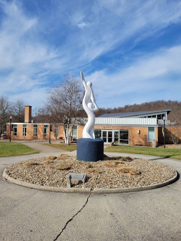
| 1 ► West Virginia, Barbour County, Philippi — "Apollo" — Created by Mark Warner '68 — |
| Near College Hill Road south of Circle Drive West, on the left when traveling south. | |||
| 2 ► West Virginia, Barbour County, Philippi — Historic Campbell School — |
| On Graystone Drive, on the right when traveling south. | |||
| 3 ► West Virginia, Barbour County, Philippi — Philippi School Cornerstone — |
| On South Main Street (U.S. 250) at School Street, on the right when traveling south on South Main Street. | |||
| 4 ► West Virginia, Barbour County, Philippi — Shearer Quadrangle — |
| On College Hill Road south of Circle Drive West, on the left when traveling south. | |||
| 5 ► West Virginia, Berkeley County, Martinsburg — J. R. Clifford — |
| On West Martin Street west of Raleigh Street, on the left when traveling west. | |||
| 6 ► West Virginia, Berkeley County, Martinsburg — Old High School — 401 South Queen Street — Built 1883 — |
| On South Queen Street (West Virginia Route 9) south of West Stephen Street, on the left when traveling north. | |||
| 7 ► West Virginia, Berkeley County, Martinsburg — Sumner-Ramer Memorial School — 515 West Martin Street — |
| On West Martin Street west of Raleigh Street, on the left when traveling west. | |||
| 8 ► West Virginia, Boone County, Madison — Robert Hager — |
| On West Virginia Route 85, 0.1 miles north of Country Estates Road, on the left when traveling south. | |||
| 9 ► West Virginia, Boone County, Whitesville — The Whitesville School — |
| On Coal River Road (West Virginia Route 3), on the right when traveling west. | |||
| 10 ► West Virginia, Brooke County, Bethany — Archibald McLean — |
| 11 ► West Virginia, Brooke County, Bethany — Bethany / Bethany College — |
| On Main Street (West Virginia Route 67) 0.2 miles east of West Virginia Route 88, on the right when traveling east. | |||
| 12 ► West Virginia, Brooke County, Bethany — Bethany / Rice's Fort — |
| On Main Street (Route 67) at Fairway Street, on the right when traveling east on Main Street. | |||
| 13 ► West Virginia, Brooke County, Bethany — Bethany Church of Christ — |
| On Main Street at Church Street, on the right when traveling east on Main Street. | |||
| 14 ► West Virginia, Brooke County, Bethany — Campbell Cemetery |
| On Main Street (West Virginia Route 67), on the right when traveling east. Reported missing. | |||
| 15 ► West Virginia, Brooke County, Bethany — Delta Tau Delta Birthplace — |
| On Main Street (West Virginia Route 67), on the right when traveling east. | |||
| 16 ► West Virginia, Brooke County, Bethany — Renner Union - Bethany House — Dedicated to R. Richard Renner, M.D. '17 and Jennie Steindorf Renner '22 — |
| Near College Street at Main Street (West Virginia Route 67). | |||
| 17 ► West Virginia, Cabell County, Huntington — Carter Godwin Woodson — |
| On Hal Greer Blvd at 9th Avenue on Hal Greer Blvd. | |||
| 18 ► West Virginia, Cabell County, Huntington — Dr. Carter Godwin Wilson — 1875 - 1950 — |
| On Hal Greer Boulevard (West Virginia Route 10) just north of 9th Avenue when traveling north. | |||
| 19 ► West Virginia, Cabell County, Huntington — Lavinia Norman, Founder — Alpha Kappa Alpha Sorority — |
| On 10th Avenue at Douglass Street / A D Lewis Avenue, on the right when traveling west on 10th Avenue. | |||
| 20 ► West Virginia, Cabell County, Huntington — Marshall Memorial — |
| Near Norway Ave (entrance to the cemetery). | |||
| 21 ► West Virginia, Cabell County, Huntington — Marshall Memorial Boulevard — |
| On Marshall Memorial Boulevard / Charleston Avenue east of 20th Street. | |||
| 22 ► West Virginia, Cabell County, Huntington — Marshall Memorial Boulevard — |
| On 3rd Avenue (U.S. 60) at 20th Street, on the right when traveling west on 3rd Avenue. | |||
| 23 ► West Virginia, Cabell County, Huntington — Marshall University — |
| On 3rd Avenue (U.S. 60) at 18th Street, on the left when traveling west on 3rd Avenue. | |||
| 24 ► West Virginia, Cabell County, Huntington — Marshall University — |
| On Hal Greer Boulevard (West Virginia Route 10) near 4th Avenue, on the right when traveling south. | |||
| 25 ► West Virginia, Cabell County, Huntington — November 14, 1970 — |
| On 20th Street north of 5th Avenue (U.S. 60), on the left when traveling north. | |||
| 26 ► West Virginia, Cabell County, Huntington — One Room School Museum — |
| On 5th Avenue at 17th Street, on the left when traveling east on 5th Avenue. | |||
| 27 ► West Virginia, Cabell County, Huntington — We Are . . . Marshall — |
| On 20th Street at 3rd Avenue (U.S. 60), on the right when traveling north on 20th Street. | |||
| 28 ► West Virginia, Cabell County, Huntington — West Virginia Colored Children's Home — |
| On Midland Trail (US 60). | |||
| 29 ► West Virginia, Clay County, Clay — Benjamin L. Stephenson — |
| On Main Street (West Virginia Route 16) east of Locust Street, on the right when traveling east. | |||
| 30 ► West Virginia, Fayette County, Clifftop — Camp Washington Carver — African American Heritage Tour — |
| 31 ► West Virginia, Fayette County, Montgomery — West Virginia Institute of Technology — |
| On Fayette Pike West (West Virginia Route 61) 0.3 miles east of Jackson Street, on the right when traveling east. | |||
| 32 ► West Virginia, Fayette County, Mount Hope — DuBois High School — |
| On West Virginia Route 16 north of Virginia Street, on the right when traveling south. | |||
| 33 ► West Virginia, Fayette County, Mount Hope — Dubois High School — African American Heritage Tour — New River Gorge National River, National Park Service, U.S. Department of the Interior — |
| On High School Drive east of State Route 16/61, on the right when traveling east. | |||
| 34 ► West Virginia, Fayette County, Mount Hope — Dubois School History — So let us not forget the roots that brought us this far — |
| On Main Street (West Virginia Route 211) 0.2 miles west of Route 16, on the right when traveling east. | |||
| 35 ► West Virginia, Fayette County, Mount Hope — Mount Hope School History — |
| On Main Street (West Virginia Route 211) 0.2 miles west of West Virginia Route 16, on the right when traveling east. | |||
| 36 ► West Virginia, Gilmer County, Glenville — Arbuckle House — |
| On North Court Street just north of Linn Street (County Road 5/3), on the left when traveling north. | |||
| 37 ► West Virginia, Gilmer County, Glenville — Clemons Tower — |
| On Lynn Street (County Road 5/3) 0.1 miles north of North Court Street, on the right when traveling south. | |||
| 38 ► West Virginia, Gilmer County, Glenville — Glenville State College — |
| On N. Court Street. | |||
| 39 ► West Virginia, Gilmer County, Glenville — Glenville State College Presidents — |
| On Linn Street (County Road 5/3) 0.2 miles north of North Court Street, on the right when traveling south. | |||
| 40 ► West Virginia, Gilmer County, Glenville — Glenville State College World War II Veterans Memorial — |
| On Lynn Street, on the right when traveling north. | |||
| 41 ► West Virginia, Gilmer County, Glenville — Glenville State Teachers College — |
| On N. Court Street. | |||
| 42 ► West Virginia, Greenbrier County, Alderson — Alderson Baptist Academy and Junior College — |
| On North Monroe Street north of Walnut Avenue, on the right when traveling north. | |||
| 43 ► West Virginia, Greenbrier County, Lewisburg — Carnegie Hall — |
| On Church St., on the right when traveling south. | |||
| 44 ► West Virginia, Greenbrier County, Lewisburg — Greenbrier College / Greenbrier Hall — |
| On Church Street at West Foster Street, on the right when traveling south on Church Street. | |||
| 45 ► West Virginia, Greenbrier County, Lewisburg — Greenbrier Military School — |
| On U.S. 60, on the right when traveling west. | |||
| 46 ► West Virginia, Greenbrier County, Lewisburg — Greenbrier Military School — |
| On U.S. 219 at Greenbrier Ave., on the right when traveling north on U.S. 219. | |||
| 47 ► West Virginia, Greenbrier County, Lewisburg — Lewisburg — |
| On Courtney Drive at Washington Street (U.S. 60) on Courtney Drive. | |||
| 48 ► West Virginia, Greenbrier County, Lewisburg — Lewisburg Graded School Bell — |
| On Jefferson Street (U.S. 219) at Randolph Street, on the left when traveling north on Jefferson Street. | |||
| 49 ► West Virginia, Greenbrier County, Lewisburg — Robert C. Byrd Clinic — |
| Near 1464 Jefferson Street N (U.S. 219). | |||
| 50 ► West Virginia, Hampshire County, Capon Bridge — The Ken Edmonds Memorial Heritage Trail — Preserving Our Colonial Heritage — The Fort Edwards Foundation — |
| Near Cold Stream Road (County Road 15) just north of Henderson Lane, on the right when traveling north. | |||
| 51 ► West Virginia, Hampshire County, Mechanicsburg — Mechanicsburg Gap / Col. Claudius Crozet — |
| On U.S. 50. | |||
| 52 ► West Virginia, Hampshire County, Romney — Literary Hall — |
| On West Main Street at N. High Street, on the left when traveling east on West Main Street. | |||
| 53 ► West Virginia, Hampshire County, Romney — Old Literary Hall |
| On South High Street (West Virginia Route 28) at Main Street (U.S. 50) on South High Street. Reported missing. | |||
| 54 ► West Virginia, Hampshire County, Romney — W. Va School for the Deaf and Blind — |
| On East Main Street (U.S. 50) at Administration Circle, on the left when traveling east on East Main Street. | |||
| 55 ► West Virginia, Hancock County, New Cumberland — Gravel Hill Academy — |
| On North River Avenue at Jefferson Street, on the right when traveling south on North River Avenue. | |||
| 56 ► West Virginia, Hardy County, Peru — Mt. Olive Lutheran Church — Founded in 1888 by Dr. Conrad B. Gohdes — |
| On South Fork Road (County Route 7) 16.7 miles north of U.S. 33, on the right when traveling north. | |||
| 57 ► West Virginia, Harrison County, Clarksburg — Towers School — |
| On South 2nd Street at West Pike Street (West Virginia Route 20), on the right when traveling north on South 2nd Street. | |||
| 58 ► West Virginia, Harrison County, Salem — Salem — |
| On West Main Street, 0.1 miles east of West Virginia Avenue, on the right when traveling east. | |||
| 59 ► West Virginia, Harrison County, Shinnston — Haywood Junction State Police Camp — |
| On Haywood Road (West Virginia Route 20) just west of Shinnston Pike (U.S. 19), on the right when traveling west. | |||
| 60 ► West Virginia, Jefferson County, Charles Town — African-American Schools in Charles Town, West Virginia |
| On South West Street at West Congress Street, on the right when traveling south on South West Street. Reported permanently removed. | |||
| 61 ► West Virginia, Jefferson County, Charles Town — Charles Town Schools — |
| On Congress Street at Charles Street, on the left when traveling west on Congress Street. | |||
| 62 ► West Virginia, Jefferson County, Charles Town — Etter Hall — |
| On Congress Street west of George Street (West Virginia Route 115), on the left when traveling west. | |||
| 63 ► West Virginia, Jefferson County, Charles Town — Etter Hall — |
| On Congress Street west of George Street (West Virginia Route 115), on the left when traveling west. | |||
| 64 ► West Virginia, Jefferson County, Charles Town — John Yates — |
| On E Washington Street (U.S. 340 Bus) at N George Street, on the right when traveling west on E Washington Street. | |||
| 65 ► West Virginia, Jefferson County, Charles Town — Martin Robison Delany — |
| On West Liberty Street at North Lawrence Street, on the right when traveling east on West Liberty Street. | |||
| 66 ► West Virginia, Jefferson County, Charles Town — The First School for "Colored" in Jefferson County — |
| On East Liberty Street west of North Samuel Street, on the right when traveling east. | |||
| 67 ► West Virginia, Jefferson County, Harpers Ferry — "The War That Ended Slavery" — Harpers Ferry National Historical Park — National Park Service, U.S. Department of the Interior — |
| On Shenandoah Street at Potomac Street, on the right when traveling east on Shenandoah Street. | |||
| 68 ► West Virginia, Jefferson County, Harpers Ferry — That was the happiest time of my life. — Storer alumna Ruby Reeler — Harpers Ferry National Historical Park, National Park Service, U.S. Department of the Interior |
| Reported permanently removed. | |||
| 69 ► West Virginia, Jefferson County, Harpers Ferry — Brackett House — |
| On Fillmore Street at Lancaster Street, on the right when traveling east on Fillmore Street. | |||
| 70 ► West Virginia, Jefferson County, Harpers Ferry — Camp Hill — Discover Harpers Ferry — |
| On Fillmore Street at Storer College Place, on the left when traveling east on Fillmore Street. | |||
| 71 ► West Virginia, Jefferson County, Harpers Ferry — Church and School |
| On Fillmore Street at Storer College Place, on the right when traveling east on Fillmore Street. Reported missing. | |||
| 72 ► West Virginia, Jefferson County, Harpers Ferry — Foundations of Freedom — Harpers Ferry National Historical Park — National Park Service, U.S. Department of the Interior |
| Reported permanently removed. | |||
| 73 ► West Virginia, Jefferson County, Harpers Ferry — Foundations of Freedom — |
| On Fillmore Street, on the right when traveling east. | |||
| 74 ► West Virginia, Jefferson County, Harpers Ferry — Foundations of Freedom — Civil War Camp to College Campus — Harpers Ferry National Historical Park, National Park Service, U.S. Department of the Interior — |
| On Mather Place, 0.1 miles south of Hartzog Drive when traveling south. | |||
| 75 ► West Virginia, Jefferson County, Harpers Ferry — Heads versus Hands — Harpers Ferry National Historical Park — National Park Service, U.S. Department of the Interior |
| Reported damaged. | |||
| 76 ► West Virginia, Jefferson County, Harpers Ferry — Heads versus Hands — Harpers Ferry National Historical Park — National Park Service, U.S. Department of the Interior — |
| Near Fillmore Street at Hartzog Drive, on the right when traveling east. | |||
| 77 ► West Virginia, Jefferson County, Harpers Ferry — Lockwood House — |
| Near Fillmore Street, 0.1 miles east of Columbia Street. | |||
| 78 ► West Virginia, Jefferson County, Harpers Ferry — Morrell House — |
| On Fillmore Street east of Columbia Street, on the right when traveling east. | |||
| 79 ► West Virginia, Jefferson County, Harpers Ferry — Nathan Cook Brackett — July 28, 1836 - July 20, 1910 — |
| 80 ► West Virginia, Jefferson County, Harpers Ferry — Storer College 1867-1955 — Harpers Ferry National Historic Park |
| Near Fillmore Street at Storer College Place, on the right when traveling east. Reported permanently removed. | |||
| 81 ► West Virginia, Jefferson County, Harpers Ferry — That was the happiest time of my life. — Storer student — Harpers Ferry National Historical Park, National Park Service, U.S. Department of the Interior — |
| On McDowell Street just south of Fillmore Street, on the left when traveling north. | |||
| 82 ► West Virginia, Jefferson County, Harpers Ferry — The Second Meeting of the Niagara Movement — Harpers Ferry National Historical Park — National Park Service, U.S. Department of the Interior — |
| Near Fillmore Street at Storer College Place, on the right when traveling east. | |||
| 83 ► West Virginia, Jefferson County, Kearneysville — Kearneysville Area Historic Properties — West Virginia 9 — Charles Town to Martinsburg — |
| On Route 9 Bike Path, 0.7 miles north of Leetown Road (County Road 1), on the right when traveling south. | |||
| 84 ► West Virginia, Jefferson County, Shepherdstown — Free School — Shepherd District — 1848 - 1881 — |
| On Princess Street, on the right when traveling south. | |||
| 85 ► West Virginia, Jefferson County, Shepherdstown — McMurran Hall — |
| On East German Street (West Virginia Route 230) just east of North King Street (County Road 480/2), on the right when traveling west. | |||
| 86 ► West Virginia, Jefferson County, Shepherdstown — Reformed Church Parsonage — |
| On W. German Street near Church Street, on the right when traveling east. | |||
| 87 ► West Virginia, Jefferson County, Shepherdstown — Shepherd College / Shepherdstown — |
| On South Duke Street (West Virginia Route 480) at Shepherd Grade Road, on the right when traveling west on South Duke Street. | |||
| 88 ► West Virginia, Jefferson County, Shepherdstown — Shepherd State Teachers College — |
| On German Street (West Virginia Route 230) at King Street (West Virginia Route 480), on the right when traveling west on German Street. | |||
| 89 ► West Virginia, Jefferson County, Shepherdstown — Shepherdstown — Blending the past and the present.... — |
| On North King Street (Route 480) 0.3 miles east of Shepherd Grade Road, on the right when traveling east. | |||
| 90 ► West Virginia, Jefferson County, Shepherdstown — World War I Memorial — |
| On North King Street (County Road 480/2) just south of East High Street, on the right when traveling north. | |||
| 91 ► West Virginia, Kanawha County, Cedar Grove — In Honor and Memory of William Morris — 1722 - 1792 — |
| On East Dupont Avenue (U.S. 60) at Woodmont Cemetery Drive, on the right when traveling south on East Dupont Avenue. | |||
| 92 ► West Virginia, Kanawha County, Charleston — Booker Taliaferro Washington — |
| Near Kanawha Boulevard East (U.S. 60) 0.1 miles east of Greenbrier Street. | |||
| 93 ► West Virginia, Kanawha County, Charleston — Garnet High School — |
| On Shrewsbury Street just south of John Norman Street, on the left when traveling north. | |||
| 94 ► West Virginia, Kanawha County, Charleston — Site Of Charleston High School — |
| On Morris Street at Quarrier Street, on the right when traveling north on Morris Street. | |||
| 95 ► West Virginia, Kanawha County, Charleston — State Capitol Annex — |
| On Quarrier Street at Hale Street, on the left when traveling north on Quarrier Street. | |||
| 96 ► West Virginia, Kanawha County, Charleston — William H. Davis — |
| On Kanawha Boulevard West just east of Florida Street, on the right when traveling east. | |||
| 97 ► West Virginia, Kanawha County, East Bank — East Bank High School — |
| On Third Avenue (Route 61) at Walnut Street, on the right when traveling west on Third Avenue. | |||
| 98 ► West Virginia, Kanawha County, Institute — ΑΦΑ Alpha Phi Alpha Fraternity, Incorporated — December 4, 1906 — ΑΖ Alpha Zeta Chapter, December 23, 1921 — |
| Near Washington Avenue just north of Chestnut Avenue, on the right when traveling south. | |||
| 99 ► West Virginia, Kanawha County, Institute — Brian O. Hemphill — |
| Near Fairlawn Avenue (West Virginia Route 25) 0.1 miles east of Barron Drive, on the right when traveling east. | |||
| 100 ► West Virginia, Kanawha County, Institute — Byrd Prillerman — |
| Near Fairlawn Avenue (West Virginia Route 25) 0.1 miles east of Barron Drive, on the right when traveling east. | |||
264 entries matched your criteria. The first 100 are listed above. Next 100 ⊳