After filtering for Colorado, 323 entries match your criteria. The first 100 are listed. ⊳
Industry & Commerce Topic
By Cosmos Mariner, June 27, 2018
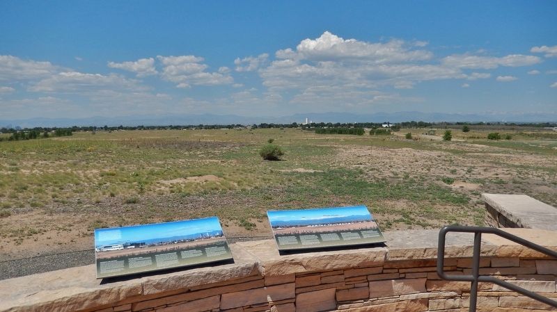
Early Years of Statehood Marker (wide view; this marker on right; related marker on left)
| 1 ► Colorado, Adams County, Commerce City — Early Years of Statehood — |
| Near Gateway Road, 0.7 miles north of Prairie Parkway (East 64th Avenue), on the left when traveling east. | |||
| 2 ► Colorado, Adams County, Commerce City — Headquarters Area — |
| On East 72nd Avenue near Kenton Street, on the left when traveling east. | |||
| 3 ► Colorado, Adams County, Commerce City — Headquarters for a New Mission — |
| On East 72nd Avenue, on the left when traveling east. | |||
| 4 ► Colorado, Adams County, Commerce City — On This Site Stood the "White House" — |
| On East 72nd Avenue, on the left when traveling east. | |||
| 5 ► Colorado, Adams County, Commerce City — South Plants — Fabrica Sur — |
| Near Havana Street. | |||
| 6 ► Colorado, Adams County, Westminster — 12 — Ma Barker's Gang — Westminster — [Lloyd William Barker] — |
| On West 73rd Avenue, 0.3 miles west of Lowell Boulevard, on the right when traveling west. | |||
| 7 ► Colorado, Alamosa County, Alamosa — Alamosa Depot — |
| On State Avenue at the railroad tracks, on the right when traveling north on State Avenue. | |||
| 8 ► Colorado, Alamosa County, Alamosa — All Aboard for Alamosa! — |
| On Denver Avenue/Broadway Avenue (U.S. 160) at 4th Street, on the left when traveling north on Denver Avenue/Broadway Avenue. | |||
| 9 ► Colorado, Alamosa County, Alamosa — Denver & Rio Grande Western Locomotive No. 169 — |
| On Denver Avenue/Broadway Avenue (U.S. 160) at 4th Street, on the left when traveling north on Denver Avenue/Broadway Avenue. | |||
| 10 ► Colorado, Alamosa County, Alamosa — Millstone, c. 1845 — |
| On Edgemont Boulevard north of Main Street (U.S. 160/285), on the right when traveling north. | |||
| 11 ► Colorado, Alamosa County, Mosca — Pike and Southwest Commerce — An Inauspicious Beginning — |
| On State Highway 150, 11.4 miles north of U.S. 160, on the left when traveling north. | |||
| 12 ► Colorado, Alamosa County, Mosca — Understanding the Great Sand Dunes System: the Sabkha — |
| On Lane 6N, 1.2 miles west of State Highway 150, on the left when traveling west. | |||
| 13 ► Colorado, Arapahoe County, Littleton — Denver & Rio Grande Depot — |
| Near South Prince Street south of West Alamo Avenue, on the left when traveling south. | |||
| 14 ► Colorado, Arapahoe County, Littleton — J. D. Hill General Store — |
| On South Rapp Street at West Littleton Boulevard, on the right when traveling south on South Rapp Street. | |||
| 15 ► Colorado, Arapahoe County, Littleton — Rough and Ready — |
| Near South Prince Street south of West Alamo Avenue, on the left when traveling south. | |||
| 16 ► Colorado, Archuleta County, Pagosa Springs — Pagosa Springs — |
| Near Hot Springs Blvd. | |||
| 17 ► Colorado, Boulder County, Boulder — L-02-1 — The Holiday Drive-In Marquee 1953 — |
| On 28th Street (U.S. 36) at Lee Hill Rd., on the right when traveling south on 28th Street. | |||
| 18 ► Colorado, Boulder County, Boulder — L-90-1 — White-Davis Mercantile Building — 1874 — |
| On Pearl Street west of 13th Street, on the left when traveling east. | |||
| 19 ► Colorado, Boulder County, Eldorado Springs — Welcome to the Crags Hotel — 1908 - 1912 — |
| 20 ► Colorado, Boulder County, Lafayette — 31 — George Bermont House — 203 East Cleveland Street — |
| On East Cleveland Street east of South Harrison Avenue, on the left when traveling east. | |||
| 21 ► Colorado, Boulder County, Lafayette — 6 — Kettle Dry Goods Store — 208 East Simpson Street — Historic Lafayette Walking Tour — |
| On East Simpson Street east of South Harrison Avenue, on the right when traveling east. | |||
| 22 ► Colorado, Boulder County, Lafayette — Mary Miller Historical Mural — |
| On West Baseline Road at Crossing Drive, on the right when traveling west on West Baseline Road. | |||
| 23 ► Colorado, Boulder County, Lafayette — 32 — Peltier House — 107 South Public Road — Historic Lafayette Walking Tour — |
| On South Public Road south of East Simpson Street, on the right when traveling south. | |||
| 24 ► Colorado, Broomfield County, Broomfield — Columbine Mine / Coal Field Country — |
| On East Baseline Road (Colorado Route 7) 0.3 miles east of Mountain View Boulevard, on the right when traveling east. | |||
| 25 ► Colorado, Chaffee County, Buena Vista — Getting from There to Here — |
| On U.S. 24, 1 mile east of County Highway 397, on the left when traveling east. | |||
| 26 ► Colorado, Chaffee County, Buena Vista — Stagecoach Road to Riches — |
| On U.S. 24, 1 mile east of County Highway 397, on the left when traveling east. | |||
| 27 ► Colorado, Chaffee County, Buena Vista — The Placers In Between — |
| On U.S. 24, 1 mile east of County Highway 397, on the left when traveling east. | |||
| 28 ► Colorado, Chaffee County, Salida — The Salida Steam Plant — |
| On West Sackett Avenue near G Street. | |||
| 29 ► Colorado, Cheyenne County, Kit Carson — Old Cattle Trail — |
| On State Highway 59 south of County Route CC, on the right when traveling south. | |||
| 30 ► Colorado, Clear Creek County, Georgetown — Commemorating the Historical Importance of the Georgetown Mining Region — |
| On Rose Street, 0.1 miles south of Sixth Street, on the left when traveling south. | |||
| 31 ► Colorado, Clear Creek County, Georgetown — Cornish House, 1892 — Georgetown-Silver Plume National Historic Landmark District — |
| On Argentine Street south of 4th Street, on the left when traveling south. | |||
| 32 ► Colorado, Clear Creek County, Georgetown — Cushman Block I, 1872 — Georgetown-Silver Plume National Historic Landmark District — |
| On Sixth Street at Taos Street, on the right when traveling west on Sixth Street. | |||
| 33 ► Colorado, Clear Creek County, Georgetown — Cushman Block II, 1872/1875 — Georgetown-Silver Plume National Historic Landmark District — |
| On Sixth Street at Taos Street, on the right when traveling west on Sixth Street. | |||
| 34 ► Colorado, Clear Creek County, Georgetown — Fish Block, 1889 — Georgetown-Silver Plume National Historic Landmark District — |
| On Sixth Street at Rose Street, on the right when traveling west on Sixth Street. | |||
| 35 ► Colorado, Clear Creek County, Georgetown — Forbes Building, ca. 1869 — Georgetown-Silver Plume National Historic Landmark District — |
| On Taos Street south of 6th Street, on the right when traveling south. | |||
| 36 ► Colorado, Clear Creek County, Georgetown — Hamill House Museum — |
| On Argentine Street, on the right when traveling south. | |||
| 37 ► Colorado, Clear Creek County, Georgetown — Kneisel and Anderson Store, 1892 — Georgetown-Silver Plume National Historic Landmark District — |
| On Sixth Street at Rose Street, on the right when traveling east on Sixth Street. | |||
| 38 ► Colorado, Clear Creek County, Georgetown — McMurdy-Snetzer Building, 1869 — Georgetown-Silver Plume National Historic Landmark District — |
| On Taos Street at 5th Street, on the right when traveling north on Taos Street. | |||
| 39 ► Colorado, Clear Creek County, Georgetown — Teal Building, 1875 — Georgetown-Silver Plume National Historic Landmark District — |
| On Rose Street at 4th Street, on the right when traveling south on Rose Street. | |||
| 40 ► Colorado, Clear Creek County, Georgetown — Tucker Brothers Store, ca. 1870 — Georgetown-Silver Plume National Historic Landmark District — |
| On Sixth Street just west of Taos Street, on the right when traveling east. | |||
| 41 ► Colorado, Clear Creek County, Idaho Springs — Arrastra — |
| On Miner Street just west of 14th Avenue, on the right when traveling west. | |||
| 42 ► Colorado, Clear Creek County, Idaho Springs — Idaho Springs Opera House — 1535 Miner Street — |
| On Miner Street, 0.1 miles east of 15th Avenue, on the right when traveling east. | |||
| 43 ► Colorado, Clear Creek County, Idaho Springs — Mining Exchange Building — 1517 - 1523 Miner Street — |
| On Miner Street, 0.1 miles east of 15th Avenue, on the right when traveling east. | |||
| 44 ► Colorado, Clear Creek County, Idaho Springs — The Charlie Tayler Waterwheel — |
| On Interstate 70, 0.2 miles east of Chicago Creek Road. | |||
| 45 ► Colorado, Clear Creek County, Idaho Springs — The Mead and Cooper Building — 1511-1515 Miner Street — |
| On Miner Street just east of 15th Avenue, on the right when traveling east. | |||
| 46 ► Colorado, Crowley County, Crowley — Crowley Communities / National Sugar Company / Last Days of the Buffalo / Crowley Country — |
| On Colorado Route 96 at Broadway, on the right when traveling west on State Route 96. | |||
| 47 ► Colorado, Custer County, Wetmore — Hardscrabble |
| On Colorado 67 (at milepost 2) at County Road 19C, on the right when traveling south on Colorado 67. Reported unreadable. | |||
| 48 ► Colorado, Delta County, Delta — Western Slope Agriculture / Delta County — |
| On North Palmer Street, 0.1 miles north of Confluence Drive, on the right when traveling north. | |||
| 49 ► Colorado, Delta County, Hotchkiss — West Elk Loop — Scenic and Historic Byway — |
| On County Highway 92 at Doc Maloney Way, on the right when traveling south on County Highway 92. | |||
| 50 ► Colorado, Denver County, Denver, Auraria — Elephant Corral — |
| On Blake Street at 14th Court, on the left when traveling west on Blake Street. | |||
| 51 ► Colorado, Denver County, Denver, Ballpark District — 18th St. Atrium / Littleton Creamery Beatrice Cold Storage Warehouse — Lower Downtown Walking Tour — |
| On 18th Street at Wynkoop Street, on the right when traveling north on 18th Street. | |||
| 52 ► Colorado, Denver County, Denver, Ballpark District — Blake Street Area — Lower Downtown Historic District — Established 1988 — |
| On Blake Street west of 20th Street, on the right when traveling west. | |||
| 53 ► Colorado, Denver County, Denver, Ballpark District — Local Transit Through the Ages — Look How Far We've Come — 1871-Present — |
| On Wynkoop Street north of 16th Street, on the right when traveling south. | |||
| 54 ► Colorado, Denver County, Denver, Ballpark District — The People of the Station — and the Stories they Tell — Voices from the Past — |
| On Wynkoop Street at 17th Street, on the right when traveling south on Wynkoop Street. | |||
| 55 ► Colorado, Denver County, Denver, Ballpark District — Union Station Area — Lower Downtown Historic District — Established 1988 — |
| On Wynkoop St near 17th Street. | |||
| 56 ► Colorado, Denver County, Denver, Ballpark District — Windsor Farm Dairy Building / The Crocker Cracker Factory — Lower Downtown Walking Tour — |
| On Blake Street at 19th Street, on the left when traveling west on Blake Street. | |||
| 57 ► Colorado, Denver County, Denver, Central — 15th / Wazee Street — 1865-1875 — Lower Downtown Walking Tour — |
| On 15th Street at Wazee Street, on the left when traveling north on 15th Street. | |||
| 58 ► Colorado, Denver County, Denver, Central — Barney Ford Building — 1863 — Lower Downtown Walking Tour — |
| On Blake Street. | |||
| 59 ► Colorado, Denver County, Denver, Central — Barteldes, Hartig Building — 1906 — Lower Downtown Walking Tour — |
| On 16th Street at Wynkoop Street, on the right when traveling north on 16th Street. | |||
| 60 ► Colorado, Denver County, Denver, Central — C. S. Morey Mercantile Building — 1896 — Lower Downtown Walking Tour — |
| On Wynkoop Street at 16th Street Mall, on the right when traveling east on Wynkoop Street. | |||
| 61 ► Colorado, Denver County, Denver, Central — Clark and Gruber Mint — 1860 — Lower Downtown Walking Tour |
| On 16th Street at Market Street on 16th Street. Reported missing. | |||
| 62 ► Colorado, Denver County, Denver, Central — Denver City — Lower Downtown Historic District — Established 1988 — |
| On Blake Street at 14th Street, on the right when traveling south on Blake Street. | |||
| 63 ► Colorado, Denver County, Denver, Central — Denver City Railway Building — 1883 — Lower Downtown Walking Tour — |
| On 17th Street at Wynkoop Street, on the right when traveling north on 17th Street. | |||
| 64 ► Colorado, Denver County, Denver, Central — Edward W. Wynkoop — |
| On Wynkoop Street south of 18th Street, on the left when traveling south. | |||
| 65 ► Colorado, Denver County, Denver, Central — Henry Lee Building — 1907 — Lower Downtown Walking Tour — |
| On 16th Street Mall at Wazee Street, on the left when traveling east on 16th Street Mall. | |||
| 66 ► Colorado, Denver County, Denver, Central — Larimer Street — Lower Downtown Historic District — Established 1988 — |
| On Larimer Street at 15th Street on Larimer Street. | |||
| 67 ► Colorado, Denver County, Denver, Central — 2w — Let the Buyer Beware — Wall Street of the Rockies — Seventeenth Street Denver, Colorado — |
| Near 17th Street at Larimer Street, on the right when traveling south. | |||
| 68 ► Colorado, Denver County, Denver, Central — 1w — Mint Robbery February 1864 — Wall Street of the Rockies — Seventeenth Street Denver, Colorado — |
| Near 17th Street just west of Larimer Street, on the right when traveling south. | |||
| 69 ► Colorado, Denver County, Denver, Central — Spratlen-Anderson Building — 1906 — Lower Downtown Walking Tour — |
| On 15th Street at Wynkoop Street, on the right when traveling south on 15th Street. | |||
| 70 ► Colorado, Denver County, Denver, Central — Sugar Building — 1906 — Lower Downtown Walking Tour — |
| On 16th Street at Wazee Street on 16th Street. | |||
| 71 ► Colorado, Denver County, Denver, Central — The City Beautiful — Lower Downtown Historic District — Established 1988 — |
| On 17th Street south of Market Street, on the right when traveling south. | |||
| 72 ► Colorado, Denver County, Denver, Central — The Edbrooke Lofts — |
| On Wynkoop Street at 15th Street, on the right when traveling north on Wynkoop Street. | |||
| 73 ► Colorado, Denver County, Denver, Central — The Elephant Corral — The Lower Downtown Walking Tour — 1902 — |
| On Wazee Street, 0.1 miles south of Fifteenth Street, on the left when traveling west. | |||
| 74 ► Colorado, Denver County, Denver, Central — Warehouses — Lower Downtown Historic District — Established 1988 — |
| On Wynkoop Street south of 18th Street, on the right when traveling north. | |||
| 75 ► Colorado, Denver County, Denver, Central Business District — 9w — "The Bank that Looks Like a Bank" — Wall Street of the Rockies — Seventeenth Street Denver, Colorado — |
| Near 17th Street, on the right when traveling south. | |||
| 76 ► Colorado, Denver County, Denver, Central Business District — 13e — Boom and Bust — Wall Street of the Rockies — Seventeenth Street Denver, Colorado — |
| Near 17th Street at California Street, on the left when traveling south. | |||
| 77 ► Colorado, Denver County, Denver, Central Business District — 16e — Dow Jones Average — Local Boy Makes Good — Wall Street of the Rockies • Seventeenth Street Denver, Colorado — |
| Near 17th Street at Welton Street, on the left when traveling south. | |||
| 78 ► Colorado, Denver County, Denver, Central Business District — 12w — E is for Equitable — Wall Street of the Rockies — Seventeenth Street Denver, Colorado — |
| Near 17th Street, on the right when traveling south. | |||
| 79 ► Colorado, Denver County, Denver, Central Business District — 10w — Four Corners — Wall Street of the Rockies — Seventeenth Street Denver, Colorado — |
| Near Champa Street at 17th Street, on the right when traveling south. | |||
| 80 ► Colorado, Denver County, Denver, Central Business District — 4e — Private Profits and the Public Good — Wall Street of the Rockies — Seventeenth Street Denver, Colorado — |
| Near 17th Street at Lawrence Street, on the left when traveling south. | |||
| 81 ► Colorado, Denver County, Denver, Central Business District — Rian Kerrane — The Oscar Wallpaper — PVC, cast aluminum, paint, fake flora, found plastic items — |
| On Court Place just north of 16th Street Mall, on the left when traveling north. | |||
| 82 ► Colorado, Denver County, Denver, Central Business District — 40 — Smoky Hill Trail — |
| On Broadway at Colfax on Broadway. | |||
| 83 ► Colorado, Denver County, Denver, Central Business District — 10e — Solid Investment — Wall Street of the Rockies — Seventeenth Street Denver, Colorado — |
| Near 17th Street, on the left when traveling south. | |||
| 84 ► Colorado, Denver County, Denver, Central Business District — 16w — The Black Baron — Wall Street of the Rockies — Seventeenth Street Denver, Colorado — |
| Near 17th Street at Welton Street, on the right when traveling south. | |||
| 85 ► Colorado, Denver County, Denver, Central Business District — 14w — The Stock Market Crash of 1929 — Wall Street of the Rockies — Seventeenth Street Denver, Colorado — |
| Near 17th Street south of California Street, on the right when traveling south. | |||
| 86 ► Colorado, Denver County, Denver, Central Business District — 20e — Those Illustrious Browns — Wall Street of the Rockies — Seventeenth Street Denver, Colorado — |
| Near 17th Street at Tremont Place, on the left when traveling south. | |||
| 87 ► Colorado, Denver County, Denver, Central Business District — 18w — Wall Street of the Rockies — Seventeenth Street Denver, Colorado — |
| Near 17th Street at Glenarm Place, on the right when traveling south. | |||
| 88 ► Colorado, Denver County, Denver, Central Business District — 17w — Western Philosophy — Wall Street of the Rockies — Seventeenth Street Denver, Colorado — |
| Near 17th Street at Glenarm Place, on the right when traveling south. | |||
| 89 ► Colorado, Denver County, Denver, Elyria-Swansea — Platte River Trail — |
| On Brighton Boulevard (State Highway 265) at York Street, on the right when traveling north on Brighton Boulevard. | |||
| 90 ► Colorado, Denver County, Denver, Lincoln Park — The Buckhorn Exchange — Established 1893 — Denver’s Oldest Restaurant — |
| On Osage Street at West 10th Avenue on Osage Street. | |||
| 91 ► Colorado, Douglas County, Castle Rock — The Rock / Gray Gold — |
| On Wilcox Street close to 3rd Street, on the right when traveling south. | |||
| 92 ► Colorado, Eagle County, Basalt — Colorado Midland Depot — Constructed in 1885 — |
| On Midland Avenue east of Midland Spur, on the right when traveling east. | |||
| 93 ► Colorado, El Paso County, Colorado Springs, West Colorado Springs — Goerke & Son Photography — |
| On Garden Drive. | |||
| 94 ► Colorado, El Paso County, Manitou Springs, West Colorado Springs — Wheeler Town Clock — |
| On Manitou Avenue near Otoe Place. | |||
| 95 ► Colorado, Elbert County, Elizabeth — Olde Hotel Square — |
| On Main Street just south of East Kiowa Avenue (State Highway 86), on the left when traveling south. | |||
| 96 ► Colorado, Fremont County, Cañon City — Hotel St. Cloud — |
| On Main Street west of 7th Street, on the right when traveling west. | |||
| 97 ► Colorado, Fremont County, Cañon City — Raynolds Bank — |
| On Main Street at South Fourth Street, on the right when traveling east on Main Street. | |||
| 98 ► Colorado, Fremont County, Cañon City — St. Cloud Hotel — |
| On Main Street at 7th Street, on the right when traveling west on Main Street. | |||
| 99 ► Colorado, Fremont County, Cañon City — The Banana Belt of Colorado — |
| On Main Street east of South 4th Street, on the right when traveling east. | |||
| 100 ► Colorado, Fremont County, Florence — Andrews Block — 126-128 West Main Street — Original Owner: Henry Sherman Andrews. Constructed in 1898 — |
| On West Main Street (Colorado Route 115) west of North Pikes Peak Avenue, on the right when traveling west. | |||
323 entries matched your criteria. The first 100 are listed above. Next 100 ⊳