By Mark Hilton, May 8, 2015
Marker across Kentucky Highway 80.
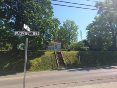
| On Jamestown Road (Kentucky Route 80) at Elm Street, on the right when traveling north on Jamestown Road. |
| On Coral Hill-Lecta Road at Coral Hill Road (Kentucky Route 740), on the right when traveling east on Coral Hill-Lecta Road. |
| On N. Jackson Highway (U.S. 31E) 0.1 miles north of Horton Rigdon Road, on the right when traveling north. |
| On E. Main Street (State Highway 90) east of Franklin Street, on the right when traveling west. |
| On U.S. 31 E at Lexington Drive, on the right when traveling south on U.S. 31 E. |
| On Finney Road (Kentucky Route 252) 0.1 miles Old Kentucky Road 252, on the left when traveling east. |
| On Old Dixie Highway (State Highway 255) west of J. Brown Road, on the right when traveling east. |
| Near Mammoth Cave Parkway (State Highway 255) 1.3 miles north of Interstate 65, on the right when traveling north. |
| Near Mammoth Cave Parkway (State Highway 255) 1.3 miles north of Interstate 65, on the right when traveling north. |
| On U.S. 60 at Old River Road, on the left when traveling west on U.S. 60. |
| Near West Main Street (U.S. 60). |
| On Kentucky Route 36, on the left when traveling north. |
| On West Main Street, on the left when traveling west. |
| On Main Street (Kentucky Route 211), on the right when traveling north. |
| On Pinnacle Road, on the right when traveling east. |
| On 12th Street (U.S. 25E) at 14th Street East, on the right when traveling south on 12th Street. |
| On Bob Madon Bypass (U.S. 25E) at Tennessee Avenue, on the right when traveling west on Bob Madon Bypass. |
| Near Washington Street (Kentucky Route 18) near Jefferson Street, on the right. |
| On North Jefferson Street (Kentucky Route 338) west of Temperate Street, on the right when traveling west. |
| On Union Square north of Washington Street (Kentucky Route 18), on the right when traveling west. |
| On Washington Street (Kentucky Route 18) at Garrard Street, on the right when traveling west on Washington Street. |
| On Main Street at Dixie Highway (U.S. 42), on the right when traveling east on Main Street. |
| On Kentucky Route 8, on the left when traveling east. |
| On Front Street west of Tanner Avenue, on the right when traveling south. |
| On Ryle Road at Boat Dock Road (Kentucky Route 1925), on the right when traveling south on Ryle Road. |
| On Main Street (Business U.S. 68) at 9th Street, on the right when traveling north on Main Street. |
| On U.S. 27 at Kentucky Highway 1876, on the right when traveling south on U.S. 27. |
| On High Street (U.S. 460), on the right when traveling south. |
| On High Street (U.S. 460), on the right when traveling south. |
| On Winchester Street (Kentucky Route 627) at Vine Street, on the right when traveling south on Winchester Street. |
| On Russell Cave Road (Kentucky Route 353) 0.3 miles south of Centerville Lane, on the right when traveling south. |
| On Ruddells Mill Road (Kentucky Route 1940) at Old Ruddles Mill Road (Kentucky Route 1893), on the right when traveling south on Ruddells Mill Road. |
| On 15th Street at Front Street, on the right when traveling north on 15th Street. |
| On Winchester Avenue at 15th Street, on the left when traveling west on Winchester Avenue. |
| On Bath Avenue east of 16th Street, on the right when traveling east. |
| On Winchester Avenue (Business U.S. 23) at 23rd Street, on the left when traveling east on Winchester Avenue. |
| On Bellefonte-Princess Road (Kentucky Route 5) at Princess Drive and Oxcart Road, on the left when traveling south on Bellefonte-Princess Road. |
| On Kentucky Route 5 at Straight Creek Road, on the left when traveling north on State Route 5. |
| On Kentucky Route 5 at Princess Drive, on the left on State Route 5. |
| On U.S. 60 south of Shopes Creek Road (Route 583). |
| On Kentucky Route 3 just south of Bolts Fork Road (Kentucky Route 773), on the left when traveling south. |
| On South Buell Street (U.S. 68) at West Second Street (U.S. 150), on the right when traveling south on South Buell Street. |
| On North Bragg Street, Harrodsburg Road (U.S. 68) north of Hardee Street, on the left when traveling south. |
| On Augusta chatham Road (Kentucky Route 19) north of Mary Ingles Highway (Kentucky Route 8), on the left when traveling south. |
| On Elizabeth Street north of East 4th Street, on the right when traveling north. |
| On Main Street at 3rd Street, on the right when traveling south on Main Street. |
| On West Main Street (State Road 2200) at Oak Street, on the right when traveling west on West Main Street. |
| On West Main Street (Kentucky Route 2200) east of Center Street, on the right when traveling west. |
| On Preston Highway (Kentucky Route 61) at Beech Grove Road (County Route 1494), on the left when traveling north on Preston Highway. |
| On Happy Hollow Road, on the right when traveling west. |
| On Jim Beam Way just north of Happy Hollow Road, on the right when traveling north. |
| On Pioneer Drive, 1 mile south of East Pioneer Drive, on the left when traveling south. |
| On Kentucky 44 West at Raymond Road, on the right when traveling west on Kentucky 44 West. |
| On Reedyville Road (State Road 185) 0.3 miles south of Lock 5 Road, on the left when traveling south. |
| On North Harrison Street at West Main Street, on the left when traveling south on North Harrison Street. |
| On Kentucky Route 672 north of Cobb Spur Road, on the right when traveling north. |
| On State Highway 121 at Cypress Trail, on the right when traveling north on State Highway 121. |
| On Clayridge Road south of Smith-Hiteman Road, on the right when traveling south. |
| On Alexandria Pike (U.S. 27) at Kenton Station Road (Kentucky Route 1936), on the right when traveling south on Alexandria Pike. |
| On East 6th Street west of Riviera Drive, on the left when traveling west. |
| On East Third Street near Monmouth Street. |
| On Monroe Street south of East 6th Street, on the right when traveling south. |
| Near Riverboat Row, on the right when traveling north. |
| Near Riverboat Row, on the right when traveling south. |
| On West 5th Street (Kentucky Route 8), in the median. |
| Near Riverboat Row, on the right when traveling north. |
| Near Riverboat Row, on the right when traveling south. |
| Near Riverboat Row, on the left when traveling south. |
| On Hitchens Road (Kentucky Route 1) south of East Main Street (U.S. 60), on the right when traveling south. |
| On Carol Malone Road (Kentucky Route 1) 1 mile north of Interstate 64, on the right when traveling south. |
| On U.S. 60 just west of Clay Hollow Road, on the left when traveling west. |
| On Local Road 8024A, 0.2 miles east of Cave Road, on the right when traveling north. |
| On State Road 70 at Bethel Ridge Road, on the right when traveling east on State Road 70. |
| On Lafayette Road (Kentucky Route 107) at Herndon Street, on the left when traveling north on Lafayette Road. |
| On Cox Mill Road (State Highway 695) 0.3 miles south of Pierce Lane, on the right when traveling north. |
| On South Virginia Street (U.S. 41) at East 7th Street, on the right when traveling north on South Virginia Street. |
| On Court Street at South Main Street (U.S. 41), on the right when traveling north on Court Street. |
| On North Main Street near Roaring Springs Road, on the left when traveling east. |
| On South Main Street west of East Cross Street, on the right when traveling north. |
| On Athens Boonesboro Road (Kentucky Route 418) east of Jones Nursery Road, on the left when traveling east. |
| On Lexington Road (U.S. 60) west of Clintonville Road, on the right when traveling west. |
| On Bucknerville Road south of Colby Road (County Route 1927), on the left when traveling south. |
| On Athens Boonesboro Road (Kentucky Route 418 at milepost 4.4), 0.1 miles east of Hidden Grove Lane, on the right when traveling west. |
| On North Main Street (U.S. 60) 0.1 miles north of East Broadway Street, on the right when traveling north. |
| On Lexington Rd (U.S. 60) 0.9 miles east of Venable Road, on the right when traveling west. |
| On College Street west of Wheeler Avenue, on the left when traveling west. |
| Near Railroad Avenue south of Poplar Street, on the right when traveling south. |
| On Kentucky Route 70 at Axel Creek Road, on the left when traveling north on State Route 70. |
| On North Walker Street north of East Bellville Street (Kentucky Route 120), on the left when traveling north. |
| On North Main Street (Kentucky Route 61) at Hill Street, on the left when traveling south on North Main Street. |
| On Hill Street at North Main Street (Kentucky Route 61), on the right when traveling east on Hill Street. |
| On River Road (State Road 331), on the right when traveling north. |
501 entries matched your criteria. The first 100 are listed above.
Next 100 ⊳