After filtering for United States of America, 185 entries match your criteria. The first 100 are listed. ⊳
Historical Markers and War Memorials in Harpers Ferry WV 25425
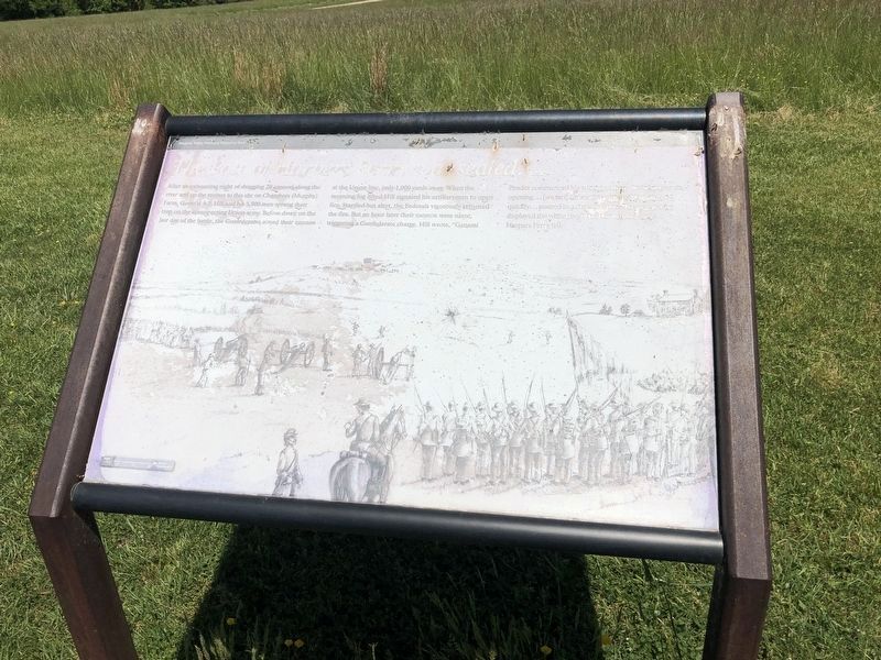
By Devry Becker Jones (CC0), May 21, 2021
The Fate of Harpers Ferry was sealed. Marker
| 1 ► West Virginia, Jefferson County, Bolivar — The Fate of Harpers Ferry was sealed. — A.P. Hill — Harpers Ferry National Historical Park |
| Near Shoreline Drive. Reported unreadable. | |||
| 2 ► West Virginia, Jefferson County, Bolivar — A Dangerous Position — Harpers Ferry National Historical Park — National Park Service, U.S. Department of the Interior — |
| On Bakerton Road (County Route 27), on the right when traveling north. | |||
| 3 ► West Virginia, Jefferson County, Bolivar — A Moving Symbol — Harpers Ferry National Historical Park — National Park Service, U.S. Department of the Interior — |
| Near Murphy Road, on the right when traveling south. | |||
| 4 ► West Virginia, Jefferson County, Bolivar — A Position Strong by Nature — Harpers Ferry National Historical Park — National Park Service, U.S. Department of the Interior — |
| Near Bakerton Road (County Route 27), on the right when traveling north. | |||
| 5 ► West Virginia, Jefferson County, Bolivar — A Union Predicament — |
| Near Shenandoah Street, on the right when traveling north. | |||
| 6 ► West Virginia, Jefferson County, Bolivar — A Union Predicament — |
| Near Whitman Avenue, 0.2 miles north of West Washington Street (Alternate U.S. 340), on the left when traveling north. | |||
| 7 ► West Virginia, Jefferson County, Bolivar — Allstadt House — John Brown's Hostages — Prelude to War — |
| On Allstadt Hill Road, 0.2 miles north of Millville Road (County Route 27), on the left when traveling north. | |||
| 8 ► West Virginia, Jefferson County, Bolivar — Area History — |
| Near Campground Road. | |||
| 9 ► West Virginia, Jefferson County, Bolivar — Assessing the Obstacle — Harpers Ferry National Historical Park — National Park Service, U.S. Department of the Interior — |
| On Bakerton Road (County Route 27), on the right when traveling south. | |||
| 10 ► West Virginia, Jefferson County, Bolivar — Battle of Harpers Ferry / Jackson Arrives — Harpers Ferry National Historical Park — National Park Service, U.S. Department of the Interior — |
| On Bakerton Road (County Route 27), on the right when traveling south. | |||
| 11 ► West Virginia, Jefferson County, Bolivar — Battle of Harpers Ferry / Union Stronghold — Harpers Ferry National Historical Park — National Park Service, U.S. Department of the Interior — |
| On Prospect Avenue (County Road 27/1) at Whitman Avenue, on the left when traveling north on Prospect Avenue. | |||
| 12 ► West Virginia, Jefferson County, Bolivar — Bolivar Heights Trail — |
| On Whitman Avenue at Prospect Avenue (County Road 27/1), on the left when traveling north on Whitman Avenue. | |||
| 13 ► West Virginia, Jefferson County, Bolivar — Bolivar Methodist Church — |
| On West Washington Street (Alternate U.S. 340) just east of Jefferson Street, on the right when traveling east. | |||
| 14 ► West Virginia, Jefferson County, Bolivar — Casualties of War — |
| Near Whitman Avenue at West Washington Street (Alternate U.S. 340), on the left when traveling north. | |||
| 15 ► West Virginia, Jefferson County, Bolivar — Closing the Doors — Harpers Ferry National Historical Park — National Park Service, U.S. Department of the Interior — |
| On Whitman Avenue at Prospect Avenue (County Road 27/1), on the left when traveling north on Whitman Avenue. | |||
| 16 ► West Virginia, Jefferson County, Bolivar — Confederate Victory — |
| On Shenandoah Street, on the right when traveling north. | |||
| 17 ► West Virginia, Jefferson County, Bolivar — Confederate Victory — |
| Near Prospect Avenue. | |||
| 18 ► West Virginia, Jefferson County, Bolivar — Confederates Converge — Harpers Ferry National Historical Park — National Park Service, U.S. Department of the Interior — |
| Near Bakerton Road (County Road 27), on the right when traveling south. | |||
| 19 ► West Virginia, Jefferson County, Bolivar — Destined for Antietam — Harpers Ferry National Historical Park — National Park Service, U.S. Department of the Interior — |
| Near Bakerton Road (County Route 27), on the right when traveling south. | |||
| 20 ► West Virginia, Jefferson County, Bolivar — Discover Harpers Ferry — Harpers Ferry National Historical Park — National Park Service, U.S. Department of the Interior — |
| Near Shoreline Drive, 0.2 miles south of Pointfield Drive, on the left when traveling south. | |||
| 21 ► West Virginia, Jefferson County, Bolivar — Facing the Enemy — Harpers Ferry National Historical Park — National Park Service, U.S. Department of the Interior — |
| On Whitman Avenue at Prospect Avenue (County Road 27/1), on the left when traveling north on Whitman Avenue. | |||
| 22 ► West Virginia, Jefferson County, Bolivar — Fake Attack - September 14th — Harpers Ferry National Historical Park — National Park Service, U.S. Department of the Interior — |
| Near Bakerton Road (County Route 27), on the right when traveling south. | |||
| 23 ► West Virginia, Jefferson County, Bolivar — First Major Action — |
| 24 ► West Virginia, Jefferson County, Bolivar — Five Rounds into the Darkness — Harpers Ferry National Historical Park — National Park Service, U.S. Department of the Interior — |
| On Bakerton Road (County Road 27), on the right when traveling north. | |||
| 25 ► West Virginia, Jefferson County, Bolivar — Fortifying Bolivar Heights — |
| Near Whitman Avenue, 0.2 miles north of West Washington Street (Alternate U.S. 340), on the left when traveling north. | |||
| 26 ► West Virginia, Jefferson County, Bolivar — From Civil War to Civil Rights / Battle of Harpers Ferry — Harpers Ferry National Historical Park — National Park Service, U.S. Department of the Interior — |
| On Murphy Road (Local Road 340/5) 0.3 miles south of Campground Road (Local Road 340/17), on the left when traveling south. | |||
| 27 ► West Virginia, Jefferson County, Bolivar — From Skirmish Line to Burial Ground — Harpers Ferry National Historical Park — National Park Service, U.S. Department of the Interior — |
| Near Bakerton Road (County Route 27), on the right when traveling north. | |||
| 28 ► West Virginia, Jefferson County, Bolivar — Gun Position #6 — |
| Near Campground Road. | |||
| 29 ► West Virginia, Jefferson County, Bolivar — Harpers Ferry — Prize of War — |
| On Whitman Avenue at Prospect Avenue, on the right when traveling south on Whitman Avenue. | |||
| 30 ► West Virginia, Jefferson County, Bolivar — Harpers Ferry Bolivar Veterans Memorial — |
| On Washington Street (Business U.S. 340) west of Polk Street, on the right when traveling west. | |||
| 31 ► West Virginia, Jefferson County, Bolivar — Harpers Ferry National Historical Park — |
| On Shenandoah Street, on the right when traveling north. | |||
| 32 ► West Virginia, Jefferson County, Bolivar — Historic Heights — |
| On Whitman Avenue at Prospect Avenue, on the right when traveling west on Whitman Avenue. | |||
| 33 ► West Virginia, Jefferson County, Bolivar — History in the Mountains — |
| Near Shenandoah St.. | |||
| 34 ► West Virginia, Jefferson County, Bolivar — Holy Ground — Harpers Ferry National Historical Park — National Park Service, U.S. Department of the Interior — |
| Near Murphy Road, on the right when traveling south. | |||
| 35 ► West Virginia, Jefferson County, Bolivar — Home Becomes Battlefield — Harpers Ferry National Historical Park — National Park Service, U.S. Department of the Interior — |
| Near Shoreline Drive. | |||
| 36 ► West Virginia, Jefferson County, Bolivar — Honoring All Who Served — |
| On W Washington Street, on the right when traveling west. | |||
| 37 ► West Virginia, Jefferson County, Bolivar — In Honor of Private Luke Quinn — |
| On U.S. 340, 0.1 miles west of Union Street, on the right when traveling west. | |||
| 38 ► West Virginia, Jefferson County, Bolivar — Infantry Positions — |
| Near Campground Road. | |||
| 39 ► West Virginia, Jefferson County, Bolivar — Jackson at Harpers Ferry — The Stonewall Brigade — |
| On Washington Street, on the right when traveling west. | |||
| 40 ► West Virginia, Jefferson County, Bolivar — Mountains, Men, and Maneuvers — Harpers Ferry National Historical Park — National Park Service, U.S. Department of the Interior — |
| Near Shoreline Drive. | |||
| 41 ► West Virginia, Jefferson County, Bolivar — No Man's Land — Harpers Ferry National Historical Park — National Park Service, U.S. Department of the Interior — |
| Near Bakerton Road (County Road 27) just south of Boer Way, on the right when traveling south. | |||
| 42 ► West Virginia, Jefferson County, Bolivar — Pilgrimage — Harpers Ferry National Historical Park — National Park Service, U.S. Department of the Interior — |
| Near Murphy Road, on the right when traveling south. | |||
| 43 ► West Virginia, Jefferson County, Bolivar — Pre Civil War Spring House — Restored in 2002 — Contractor - James Fillinger's Contracting — |
| On Washington Street (Business U.S. 340), on the right when traveling east. | |||
| 44 ► West Virginia, Jefferson County, Bolivar — Protecting the Supply Lines — |
| Near Prospect Avenue. | |||
| 45 ► West Virginia, Jefferson County, Bolivar — Rats in a Cage — Harpers Ferry National Historical Park — National Park Service, U.S. Department of the Interior — |
| Near Prospect Avenue. | |||
| 46 ► West Virginia, Jefferson County, Bolivar — School House Ridge, Harpers Ferry, W.V. — |
| On Bakerton Road (County Road 27) 0.4 miles north of Boxer Way, on the left when traveling north. | |||
| 47 ► West Virginia, Jefferson County, Bolivar — Sheridan Dug In — Harpers Ferry National Historical Park — National Park Service, U.S. Department of the Interior — |
| Near Shoreline Drive. | |||
| 48 ► West Virginia, Jefferson County, Bolivar — Sheridan Fortifications — |
| Near Campground Road. | |||
| 49 ► West Virginia, Jefferson County, Bolivar — Simon Bolivar — 1783 - 1830 — |
| On Washington Street (Alternate U.S. 340) at Panama Street, on the right when traveling west on Washington Street. | |||
| 50 ► West Virginia, Jefferson County, Bolivar — Stonewall Jackson's Headquarters — |
| On Washington Street (Business U.S. 340). | |||
| 51 ► West Virginia, Jefferson County, Bolivar — Struggle to the Heights — Harpers Ferry National Historical Park — National Park Service, U.S. Department of the Interior — |
| Near Shoreline Drive. | |||
| 52 ► West Virginia, Jefferson County, Bolivar — The Abatis — |
| Near Campground Road. | |||
| 53 ► West Virginia, Jefferson County, Bolivar — The Confederate Perspective — Harpers Ferry National Historical Park — National Park Service, U.S. Department of the Interior — |
| Near Bakerton Road (County Route 27), on the right when traveling north. | |||
| 54 ► West Virginia, Jefferson County, Bolivar — The First Line of Defense: The Union Skirmish Line — Harpers Ferry National Historical Park — National Park Service, U.S. Department of the Interior |
| Near Bakerton Road (County Route 27), on the right when traveling north. Reported permanently removed. | |||
| 55 ► West Virginia, Jefferson County, Bolivar — The First Year of War — |
| On Prospect Avenue at Whitman Avenue on Prospect Avenue. | |||
| 56 ► West Virginia, Jefferson County, Bolivar — The Murphy Farm — |
| Near Shoreline Drive. | |||
| 57 ► West Virginia, Jefferson County, Bolivar — The Trap Closes — |
| Near Shenandoah St.. | |||
| 58 ► West Virginia, Jefferson County, Bolivar — Union Skirmish Line — |
| On Bakerton Road, on the right when traveling north. | |||
| 59 ► West Virginia, Jefferson County, Bolivar — We Began Firing At Will: The 111th New York Regiment — Harpers Ferry National Historical Park — National Park Service, U.S. Department of the Interior — |
| On Bakerton Road (County Route 27), on the right when traveling north. | |||
| 60 ► West Virginia, Jefferson County, Harpers Ferry — "A journey of 1,000 miles begins with a single step." — Harpers Ferry National Historical Park — National Park Service, U.S. Department of the Interior — |
| On Appalachian Trail - High Street. | |||
| 61 ► West Virginia, Jefferson County, Harpers Ferry — "for the deposit of arms" — |
| On Shenandoah Street at High Street on Shenandoah Street. | |||
| 62 ► West Virginia, Jefferson County, Harpers Ferry — "I just had to speak out" — -Pearl Tatten Harpers Ferry National Historical Park — National Park Service, U.S. Department of the Interior — |
| On Potomac Street north of Shenandoah Street, on the right when traveling east. | |||
| 63 ► West Virginia, Jefferson County, Harpers Ferry — "The War That Ended Slavery" — Harpers Ferry National Historical Park — National Park Service, U.S. Department of the Interior — |
| On Shenandoah Street at Potomac Street, on the right when traveling east on Shenandoah Street. | |||
| 64 ► West Virginia, Jefferson County, Harpers Ferry — That was the happiest time of my life. — Storer alumna Ruby Reeler — Harpers Ferry National Historical Park, National Park Service, U.S. Department of the Interior |
| Reported permanently removed. | |||
| 65 ► West Virginia, Jefferson County, Harpers Ferry — A Government Factory Town — |
| Near Shenandoah Street (Business U.S. 340), on the right when traveling east. | |||
| 66 ► West Virginia, Jefferson County, Harpers Ferry — A Government Factory Town No Longer — |
| Near Shenandoah Street (Business U.S. 340), on the right when traveling east. | |||
| 67 ► West Virginia, Jefferson County, Harpers Ferry — A Land Divided — Harpers Ferry National Historical Park — National Park Service, U.S. Department of the Interior |
| On Fillmore Street, on the right when traveling east. Reported permanently removed. | |||
| 68 ► West Virginia, Jefferson County, Harpers Ferry — A Land Divided — Harpers Ferry National Historical Park — National Park Service, U.S. Department of the Interior — |
| On Fillmore Street just east of Storer College Place, on the right when traveling east. | |||
| 69 ► West Virginia, Jefferson County, Harpers Ferry — A Nation's Armory — Harpers Ferry National Historical Park — National Park Service, U.S. Department of the Interior — |
| On Hog Alley at Potomac Street, on the right when traveling north on Hog Alley. | |||
| 70 ► West Virginia, Jefferson County, Harpers Ferry — A Perfect Heap of Ruins — Harpers Ferry National Historical Park — National Park Service, U.S. Department of the Interior — |
| Near Potomac Street, on the right when traveling west. | |||
| 71 ► West Virginia, Jefferson County, Harpers Ferry — 5 — Armory Grounds — Meriwether Lewis at Harpers Ferry — |
| On Potomac Street, on the right when traveling west. | |||
| 72 ► West Virginia, Jefferson County, Harpers Ferry — Armory Paymaster's Residence — |
| On Hamilton Street, on the right when traveling east. | |||
| 73 ► West Virginia, Jefferson County, Harpers Ferry — Armory Workers — |
| Near Shenandoah Street (Business U.S. 340), on the right when traveling east. | |||
| 74 ► West Virginia, Jefferson County, Harpers Ferry — Arsenal Square — |
| On Shenandoah Street at Potomac Street, on the right when traveling north on Shenandoah Street. | |||
| 75 ► West Virginia, Jefferson County, Harpers Ferry — Brackett House — |
| On Fillmore Street at Lancaster Street, on the right when traveling east on Fillmore Street. | |||
| 76 ► West Virginia, Jefferson County, Harpers Ferry — Branding the B&O — Harpers Ferry National Historical Park — National Park Service, U.S. Department of the Interior — |
| On Potomac Street, on the right when traveling west. | |||
| 77 ► West Virginia, Jefferson County, Harpers Ferry — Burned, Flooded, and Leveled — Harpers Ferry National Historical Park — National Park Service, U.S. Department of the Interior — |
| On Shenandoah River Drive (Alternate U.S. 340) at High Street (Alternate U.S. 340), on the right when traveling east on Shenandoah River Drive. | |||
| 78 ► West Virginia, Jefferson County, Harpers Ferry — Butcher Shop and Boarding House — |
| Near Shenandoah Street (Business U.S. 340), on the right when traveling east. | |||
| 79 ► West Virginia, Jefferson County, Harpers Ferry — By the aid of these machines... — Harpers Ferry National Historical Park — National Park Service, U.S. Department of the Interior — |
| Near Potomac Street, on the right when traveling west. | |||
| 80 ► West Virginia, Jefferson County, Harpers Ferry — Camp Hill — Discover Harpers Ferry — |
| On Fillmore Street at Storer College Place, on the left when traveling east on Fillmore Street. | |||
| 81 ► West Virginia, Jefferson County, Harpers Ferry — Camp Hill during the Civil War — Harpers Ferry National Historical Park |
| Near Fillmore Street at Storer College Place, on the right when traveling east. Reported permanently removed. | |||
| 82 ► West Virginia, Jefferson County, Harpers Ferry — No. 1 — Capture of Harpers Ferry — No. 1 — |
| On South Potomac Street, on the right when traveling east. | |||
| 83 ► West Virginia, Jefferson County, Harpers Ferry — No. 2 — Capture of Harpers Ferry — No. 2 — |
| On South Potomac Street, on the right when traveling east. | |||
| 84 ► West Virginia, Jefferson County, Harpers Ferry — No. 3 — Capture of Harpers Ferry — No. 3 — |
| On South Potomac Street, on the right when traveling east. | |||
| 85 ► West Virginia, Jefferson County, Harpers Ferry — No. 4 — Capture of Harpers Ferry — No. 4 — |
| On South Potomac Street, on the right when traveling east. | |||
| 86 ► West Virginia, Jefferson County, Harpers Ferry — No. 5 — Capture of Harpers Ferry — No. 5 — |
| On South Potomac Street, on the right when traveling east. | |||
| 87 ► West Virginia, Jefferson County, Harpers Ferry — Casualties of Time — |
| Near Shenandoah Street (Business U.S. 340), on the right when traveling east. | |||
| 88 ► West Virginia, Jefferson County, Harpers Ferry — Casualty of War — |
| On High Street at Hog Alley, on the left when traveling east on High Street. | |||
| 89 ► West Virginia, Jefferson County, Harpers Ferry — Chimney — |
| Near Potomac Street, 0.1 miles north of Shenandoah Street, on the right when traveling north. | |||
| 90 ► West Virginia, Jefferson County, Harpers Ferry — Church and School |
| On Fillmore Street at Storer College Place, on the right when traveling east on Fillmore Street. Reported missing. | |||
| 91 ► West Virginia, Jefferson County, Harpers Ferry — Cotton Mill — |
| Near Shenandoah Street (Business U.S. 340), on the right when traveling east. | |||
| 92 ► West Virginia, Jefferson County, Harpers Ferry — Daring Escapes — Harpers Ferry National Historical Park — National Park Service, U.S. Department of the Interior — |
| Near Potomac Street just north of Shenandoah Street, on the right when traveling west. | |||
| 93 ► West Virginia, Jefferson County, Harpers Ferry — Early Travel — |
| Near South Potomac Street. | |||
| 94 ► West Virginia, Jefferson County, Harpers Ferry — Federal Armory — |
| On South Potomac Street, on the right when traveling east. | |||
| 95 ► West Virginia, Jefferson County, Harpers Ferry — Floods — |
| On Shenandoah Street (Business U.S. 340) at Market Street, on the right when traveling east on Shenandoah Street. | |||
| 96 ► West Virginia, Jefferson County, Harpers Ferry — Found Underground — |
| Near Potomac Street, on the right when traveling west. | |||
| 97 ► West Virginia, Jefferson County, Harpers Ferry — Foundations of Freedom — Harpers Ferry National Historical Park — National Park Service, U.S. Department of the Interior |
| Reported permanently removed. | |||
| 98 ► West Virginia, Jefferson County, Harpers Ferry — Foundations of Freedom — |
| On Fillmore Street, on the right when traveling east. | |||
| 99 ► West Virginia, Jefferson County, Harpers Ferry — Foundations of Freedom — Civil War Camp to College Campus — Harpers Ferry National Historical Park, National Park Service, U.S. Department of the Interior — |
| On Mather Place, 0.1 miles south of Hartzog Drive when traveling south. | |||
| 100 ► West Virginia, Jefferson County, Harpers Ferry — Harper Cemetery — |
| On Fillmore Street, 0.2 miles east of Columbia Street, on the right when traveling east. | |||
185 entries matched your criteria. The first 100 are listed above. The final 85 ⊳