569 entries match your criteria. The first 100 are listed. Next 100 ⊳
Entries Containing All of the Words «trail» AND «death»
This list will also include matches for inflectional* forms of the words. The following noise* word you entered was ignored: of. If this word is required for a successful search, go to the Other Ways to Search page and use the Google Search from there.
Oct. 6, Day 33 of the forced march from their Indiana homeland, 850 Potawatomi Indians camped nearby after traveling 18 miles that day. As the barren land only allowed one choice for encampment, it was named "Hobson's Choice". Water on route was . . . — — Map (db m181376) HM
From October 8-10, 1838, more than 800 Potawatomi Indians were encamped here in Quincy, Illinois and directly across the Mississippi River in Missouri. They were being forced to march from Southern Michigan and Northern Indiana to Eastern Kansas . . . — — Map (db m150021) HM
On October 7, 1838 nearly 850 Potawatomi Indians camped near here on Mill Creek on the forced removal from Indiana to Kansas. The diary records that they traveled 12 miles that day A child died. — — Map (db m181377) HM
Some 800 Potawatomi were forcibly removed by U.S. and Indiana officials from near Plymouth, Indiana and taken to eastern Kansas in 1838. Enroute 39 recorded deaths occurred. This tragic event became known as the “Trail of Death”. The . . . — — Map (db m32503) HM
Over 800 Potawatomi were forcibly removed from near Plymouth, Indiana by U. S. And Indiana Officials and taken to eastern Kansas in 1838. This historic event was named the “Trail of Death” after the tragic occurrence of 39 recorded . . . — — Map (db m33251) HM
Over 800 Potawatomi encamped at Sidney after their forced removal by U.S. and Indiana officials from near Plymouth, Indiana. They were being marched to eastern Kansas. Two people died at Sidney, including a child. A total of 39 Potawatomi tragically . . . — — Map (db m33248) HM
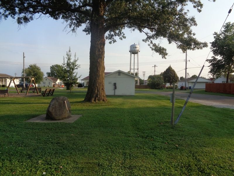
Forcibly removed from northen Indiana to eastern Kansas, over 800 Potawatomi encamped here, cared for sick, and were allowed to hunt; 2 children and 1 woman died; 39 deaths occurred along the entire route.
Sponsors: Hanson Engineers, . . . — — Map (db m33284) HM
We honor the pioneers and the three Native Americans who died here while on the Trail of Death march in 1838 and are buried in this cemetery — — Map (db m33255) HM
About 800 Potawatomi Indians camped at Pyatt’s Point during a forced march from Twin-Lakes, Ind. To the reservation on the Osage River, Kansas. One woman, three children were buried during this stop. — — Map (db m33262) HM
On Oct. 5, 1838, about 800 Potawatomi Indians camped at McKee’s Creek near here on the forced removal from Indiana to Kansas, known as the Trail of Death. They crossed the Illinois River by ferry. Leaving the river they had to seek water, because of . . . — — Map (db m135378) HM
Potawatomi
Trail of Death
Sept 4 - Nov 4, 1838
McCoys Mill
Encampment
During a drought, 850 Potawatomi Indians were force-marched more than 600 miles from Indiana to Kansas. 40 died, mostly children.
After a 17 mile march from the . . . — — Map (db m32537) HM
Potawatomi
Trail of Death
Sept 4 - Nov 4, 1838
Island Grove
Encampment
During a drought, 850 Potawatomi Indians were force-marched more than 600 miles from Indiana to Kansas. 40 died, mostly children.
After a 6 mile march from McCoy's . . . — — Map (db m32538) HM
On Sept. 29, 1838, 800 Potawatomi Indians marched through Springfield on the forced removal from Indiana to Kansas. Although many had died and they faced severe hardship, they were encouraged by Judge Polke and Chief I-o-weh to exhibit pride, so . . . — — Map (db m34320) HM
Approximately 800 fatigued Potawatomi camped in this area on September 28, 1838, on a forced removal from Indiana to Kansas. Two children died during the night. Chief I-O-Weh led his people through the town of Springfield the next day. — — Map (db m156778) HM
In 1838 the northern Potawatami tribes and many Indians from other tribes were forcibly relocated to Eastern Kansas.
The first point to encampment in Illinois on the march westward was near the North Fork River in Danville.
This monument is . . . — — Map (db m32501) HM
Here at Chief Winamac's old village, about 900 Potawatomi Indians camped on their forced removal from Indiana to Kansas. A child and a man died here during the encampment. They also left behind 24 too sick to continue. — — Map (db m35399) HM
On September 11, 1838, about 850 Potawatomi Indians camped at Pleasant Run, having traveled 17 miles that day on the forced removal from Indiana to Kansas. — — Map (db m35400) HM
Rev. Benjamin Marie Petit, of the City of Rennes, France, arrived as the Catholic missionary to the Potawatomi Indians in northern Indiana in November 1837. By June 1838, he had learned much of their difficult language and their culture, and had . . . — — Map (db m35500) HM
On September 5, 1838, nearly 850 Potawatomi Indians marched single file through Rochester on the forced removal from Indiana to Western Territory (Kansas). Three chiefs were transported in a jail wagon: Menominee, Black Wolf, and Pepinewa. There . . . — — Map (db m35501) HM
In memory of Chief Menominee and his band of 859 Pottawatomie Indians removed from this Reservation Sept. 4, 1838 by a company of soldiers under command of General John Tipton, authorized by Governor David . . . — — Map (db m36122) HM
Two miles east, on north bank of Twin Lakes, some 800 Potawatomi Indians were collected in August 1838 and forced to begin their long march to new homes in the West. Many perished on the way. — — Map (db m2307) HM
Indiana to Kansas, September 4 - November 4, 1838 The 1811 Battle of Tippecanoe on this site was decisive, leading to the loss of their homelands and the removal of Indians from Indiana. At Gunpoint, about 850 Potawatomi passed this location . . . — — Map (db m6433) HM
Over 850 Potawatomi Indians camped here on the Wabash River in Tippecanoe County, Indiana, Sept. 13, 1838, on the forced removal from Indiana to Kansas. There were 106 sick so two doctors were called in, Drs. Ritchie & son. Sanford Cox later wrote . . . — — Map (db m33811) HM
In 1838 some 800 Potawatomi Indians, being forcibly removed from Marshall County to Kansas, camped along this road, the LaGrange-Logansport State Road. On this “trail of death”, scores of Native Americans suffered and died. The mother of Chief . . . — — Map (db m33812) HM
On September 15, 1838, about 860 Potawatomi Indians camped near here on the forced removal from Indiana to Kansas. They had to camp by a dirty stream. Two small children who died on the trek from Williamsport were buried at this camp. — — Map (db m32495) HM
In 1838 a band of over 800 Potawatomi Indians were forcibly removed from their homeland in Northern Indiana and marched to Eastern Kansas. Many died along the trail during the two month trek. This mournful caravan traveled this road on September 14, . . . — — Map (db m9307) HM
About 850 Potawatomi Indians camped here near Williamsport September 14, 1838. Two deaths occurred in the evening. Three chiefs were transported in a jail wagon because they refused to leave their beloved homeland in Indiana. — — Map (db m32620) HM
The removal of the Potawatomi Indians from northern Indiana to Kansas took place Sept. - Nov. 1838. Nearly 900 Indians were rounded up by soldiers and marched at gun point for 61 days. So many died on the way and were buried by the roadside that . . . — — Map (db m70609) HM
Rev. Benjamin Marie Petit, of the City of Rennes, France, arrived as the Catholic missionary to the Potawatomi Indians in northern Indiana in November 1837. By June 1838, he had learned much of their difficult language and their culture, and had . . . — — Map (db m70652) HM
Father Benjamin Marie Petit, a missionary to the Potawatomi in northern Indiana, accompanied them on the forced removal in 1838. He ministered to their needs, both spiritual and physical. He baptized the dying children, "whose first step was . . . — — Map (db m70635) HM
[Map] Designates 1838 'Trail of Death' route from Indiana to present day Osawatomie, Kans.
In September 1838 over 850 Potawatomi Indian people were rounded up and marched at gunpoint from their Indiana homeland. Many walked the 600-mile . . . — — Map (db m70654) HM
On Oct. 24, 1838 about 800 Potawatomi Indians camped near Carrollton on forced emigration from Indiana to Kansas. Cold was intense on the prairie. — — Map (db m198474) HM
On Oct. 23, 1838, about 800 Potawatomi Indians camped near here on the forced removal from Indiana to Kansas. They camped at Thomas' encampment. Having marched 10 miles after ferrying the Grand River. Wet bottom lands and severe cold made the march . . . — — Map (db m198473) HM
On Oct. 22, 1838, about 800 Potawatomi Indians began ferrying the Grand River as they walked from Indiana to Kansas on the forced removal. By dark all the Indians and many of the wagons were over the river and ferried the rest the next day. — — Map (db m198471) HM
(front:)
In remembrance of the forced removal of the Potawatomi (Neshdabe) people from their homes in northern Indiana to Miami County, Kansas in 1838
(reverse:)
This historical landmark was made possible by the Eagle . . . — — Map (db m200147) HM
In 1838, 823 Potawatomi Indians camped near Blue River on the forced removal from Indiana to Kansas. Capt. Hull's group of 23 Indians, 5 horses and 3 wagons were attached to the body of emigration under Judge Polke. — — Map (db m200330) HM
On October 26, 1838 about 800 Potawatomi Indians being forcibly removed from Indiana camped on the river bank opposite Lexington. They ferried the Missouri River on October 27 and were marched on to Northeast Kansas.
This monument is in memory . . . — — Map (db m90921) HM
On Saturday October 27th the Potawatomi Indians camped in Wellington at the Little Schuy Creek (Big Sni).
On Sunday October 28, a Potawatomi child died. — — Map (db m200328) HM
About 800 Potawatomi Indians camped near here on See's Creek on Oct. 22, 1838 on a forced removal from northern Indiana to eastern Kansas. Two or 3 Indians were placed under guard. Health good so no medicine administered to them. Horses grazed in . . . — — Map (db m243900) HM
On Oct. 11, 1838 the emigration moved from the encampment of the last two days. The march was pleasant and without the occurrence of any difficulties. Potawatomi Indians numbering 850 camped here at Pleasant Spring near Palmyra, Mo. Capt. J. Holman . . . — — Map (db m243899) HM
On Oct. 8-10, 1838, about 800 Potawatomi Indians camped here on the west side of the Mississippi River, after crossing by steam-ferry from Quincy. They were enroute to Kansas, being forcibly removed from Indiana. Three children died Oct. 8. Wagons . . . — — Map (db m181374) HM
On October 13, 1838 about 800 Potawatomi Indians camped at Clinton, Mo (North Fork) on the forced removal from Indiana to Oklahoma. They had traveled 17 miles from See's Creek. Chief Ash-Kum asked that Gen. A. Morgan not leave the emigration . . . — — Map (db m221437) HM
On October 17 & 18, 1838 about 850 Pottawatomie Indians camped near Huntsville, on their way from northern Indiana to Kansas; a forced march accompanied by soldiers. Having traveled 13 miles in cold rain, a flooded camp caused them to stay a second . . . — — Map (db m96113) HM
Designates 1838 Potawatomi "Trail of Death" route starting in Indiana, crossing Illinois and Missouri, and ending at present day Osawatomie, Kansas.
In September 1838, over 850 Potawatomi Indian people were rounded up and marched at gunpoint . . . — — Map (db m198476) HM
Through a series of nine treaties, signed between 1786 and 1830, the Choctaw Tribe ceded the Mississippi/Alabama homeland to the United States in exchange for lands in what is now southeastern Oklahoma. Most Choctaw people opposed these agreements . . . — — Map (db m226561) HM
On this spot, where the eroded ruts of the Bismarck-Deadwood Trail are still plain to see took place on July 17, 1877 the massacre of the Wagnus family by Indians, who from Bear Butte watched with envy the passing of their lands to the whites. Two . . . — — Map (db m184171) HM
Death was a constant companion for emigrants headed west. It is estimated that 10,000 to 30,000 people died and were buried along the trails between 1843 and 1869.
Cholera and other diseases were the most common cause of death. People didn't . . . — — Map (db m67046) HM
Now a ghost town, Ballarat served nearby mining camps from 1897 to 1917. They produced nearly a million in gold. The jail & a few adobe ruins remain. Seldom Seen Slim, it's last resident, was buried in Boothill in 1968. It had a school but no . . . — — Map (db m159350) HM
The escape trail where Manley & Rodgers led the Bennett & Arcane families to safety from Death Valley in Feb 1850.
←Brier's Silent Sepulchre Fish's Gravesite, 1 mile. — — Map (db m174570) HM
Indiana to Kansas 1838
On Oct. 11, 1838, 850 Potawatomi Indians camped at Pleasant Spring near Palmyra on the forced removal from Northern Indiana to Eastern Kansas. They passed through Palmyra at 10 o'clock October 12. That night they camped . . . — — Map (db m36351) HM
Site of
Pottawatomie Indian Church
at
Chi Chi Pi Ou Ti pe Twin Lakes
First Church in Marshall County
erected 1827 by Father Badin.
First Catholic Priest ordained in U. S.
1838 the Indians were moved westward
and the Chapel was . . . — — Map (db m35326) HM
From 1818 through 1851 groups of American Indians were forcibly removed from states on the east side of the Mississippi River to territories on the west side. One of these removals was the Potawatomi Trail of Death, conducted by William Polke, . . . — — Map (db m181375) HM
Thousands of pioneers journeyed over 1,000 miles to reach this point. Illness and death were common. Everywhere along the trail people died and were buried.
It is estimated that one out of ten emigrants who started on the trail died before . . . — — Map (db m95503) HM
From the very early days of tourism in Death Valley, visitors wanted to explore the geologic treasures found in Golden Canyon. Once a road travelled up the canyon, but now only remnants of asphalt remain and the route is now Death
Valley's most . . . — — Map (db m195617) HM
Oregon Trail Memorial
Erected 1931
Restored 1978
Caribou County 4H Builders Club
In honor of William Henry Harrison of Massachusetts who lost his life on the Oregon Trail about 1850.
Erected by his niece Mrs. Alura F. . . . — — Map (db m106732) HM
[front side] The signing of the Treaty of Dancing Rabbit Creek on Sept. 27, 1830, was the final negotiation to remove the Choctaws from their ancestral homelands in Mississippi and Alabama to Indian Territory. The trip covered 600 miles. . . . — — Map (db m165637) HM
(Six panels dealing with the Pendleton area portion of the Oregon Trail are found at this kiosk)
The Long Walk to Oregon
Contrary to popular belief Oregon Trail emigrants rarely took the reins while seated in their . . . — — Map (db m111578) HM
Thousands of Cherokee Indians passed through Waterloo in the 1830s when they were forced by the U.S. government to move West on the "Trail of Tears". Most came by boat from Tuscumbia and camped here to await transfer to larger steamboats. During the . . . — — Map (db m84301) HM
"The Cherokees have been kept on a small spot, surrounded by a strong guard… obliged to live very much like brute animals… exposed to wind and rain, and herd[ed] together… like droves of hogs…” —Reverend Butrick, June 1838 . . . — — Map (db m156907) HM
In late 1849 instead of wintering in Salt Lake, many argonauts, in their haste to reach the gold fields, took the Spanish Trail on to California. One large group, following a faulty map of a supposed short cut, left the trail in southern Utah and . . . — — Map (db m220297) HM
This waterhole, only one in the sand dune area of Death Valley, was at the junction of two Indian trails. During the bonanza days of Rhyolite and Skidoo it was the only known water source on the cross-valley road. When sand obscured the spot, a . . . — — Map (db m94591) HM
The first resort on this site, originally named “Bungalette City," was opened on November 1, 1926. Owned and operated by Herman William (Bob) and Helene Eichbaum, this resort was the first attempt to provide full scale tourist services in Death . . . — — Map (db m103254) HM
This spring was on the old Indian Horsethief Trail and later (1834) Joe Walker Trail. The famished Manly-Jayhawk Death Valley parties (1849-50) were revived here after coming from Indian Wells through Last Chance Canyon. This was also a station on . . . — — Map (db m117039) HM
In 1834 explorer Joseph R. Walker passed this junction of Indian trails after discovering nearby Walker Pass. Death Valley 49er parties here diverged west and south after their escape from Death Valley enroute to the California gold fields. Later . . . — — Map (db m207791) HM
Visited by Padre Garces (1776) while following Old Horse Thief Trace later known as Joe Walker Trail. Fremont stopped here (1844). The famished Jayhawk Party (1850) found water here while struggling from Death Valley to Los Angeles. Still later was . . . — — Map (db m156684) HM
Judges Cave
Here May Fifteenth 1661 and for some weeks thereafter Edward Whalley and his son-in-law William Goffe, members of the Parliament General, officers in the army of the Commonwealth and signers of the death warrant of King Charles First, . . . — — Map (db m34719) HM
Here on the Indian Path that connected two Indian Trails, from Hartford to Fort Hawkins and from Barnard’s Crossing to the Old Creek Agency, James Abbington Everett established, in the 1820’s, the Indian Trading Post around which Fort Valley arose. . . . — — Map (db m53096) HM
Returning to Virginia from his historic visit at Fort Le Boeuf, Washington used the adjacent Venango Indian Trail. In this locality, on Dec. 27, 1753, he narrowly escaped death, being shot at by an Indian less than fifteen paces from him. — — Map (db m80462) HM
George W. and Harriet Cluck settled in this area with their family in the early 1870s, soon after they returned from a cattle drive on the Chisholm Trail. They built a log home and were instrumental in the community’s development. In 1901, upon . . . — — Map (db m101639) HM
In 1853, Lt. Colonel John C. Fremont mapped a new trail and made daily astronomical observations from Green River to Parowan, Utah. In his party of 22 were: S.N. Carvalho, artist and daguerreotypist, Mr. Von Egloffstein, topographer with assistants . . . — — Map (db m138061) HM
This is where seven men were hanged in December 1859 and March 1860 for their part in John Brown’s Raid on Harpers Ferry. The scaffold stood here in a large field. A month after the trial, on December 2, 1859, John Brown was the first to die. He . . . — — Map (db m41650) HM
Mary Price Ratrie Greenspace
Biography
Mary Price Ratrie was born in the Dickinson family, which through its manufacture of salt, coal mining, banking activities and philanthropic contributions, helped develop and shape Charleston and the . . . — — Map (db m178536) HM
Zora Neale Hurston House, 1734 Avenue L
From early 1958 through late 1959, Zora Neale Hurston lived in this house, part of a new subdivision developed by Dr. Clem C. Benton, a prominent Ft. Pierce physician and community leader. Dr. . . . — — Map (db m202513) HM
Title: Ga bgojwébnegéjuk
Potawatomi for: Those that were uprooted from their natural place
This mural is to honor the Native Americans who were forced from their lands in this area to reservations located in Kansas. This removal took . . . — — Map (db m240943) HM
Sagamore Hill was the family home of our 26th President Theodore Roosevelt, his wife Edith and their six children. He built the Queen Anne Shingle style home on 155 acres between 1884 and 1886 and it became known as the “Summer White House” during . . . — — Map (db m42840) HM
Winstead Hill Park is located approximately two miles south of downtown Franklin. The hill’s name comes from an early inhabitant of Williamson County, Samuel Winstead, who owned the land. Some 19 years before the Civil War, he executed a . . . — — Map (db m146925) HM
The isolated trails between Boulder and Escalante, Utah, were important in the history of the two towns. The foot trail, used by Indians for centuries, connected the two areas and was known as the Death Hollow Trail. Mules, horses, or people . . . — — Map (db m74759) HM
Cribbin's Home
• This park, historically known as the Cribbin's Home, Kuhlmann's Grove, and even Cedar Grove in 1875, features a well-known home built in the mid-1800s.
• The home was built by Lawrence Cribbin (sometimes spelled . . . — — Map (db m150854) HM
The perilous last leg of the Oregon Trail down the Columbia River rapids took lives, including the sons of Jesse and Lindsay Applegate in 1843. The Applegate brothers and others vowed to look for an all-land route into Oregon from Fort Hall (in . . . — — Map (db m167270) HM
Just west of this point was the Southern Pacific terminus for the Twenty-Mule-Team Borax wagons that operated between Death Valley and Mojave from 1884 to 1889. The route ran from the Harmony Borax Mining Company works, later acquired by the . . . — — Map (db m123891) HM
The Bradshaw Trail
Circa 1862
To the Cahuilla, the native people of this valley, this point of land was important because it marked access to water. They dug a well into the wash with steps leading down to water level less . . . — — Map (db m232942) HM
In 1764, Thomas Green sold a one-quarter acre lot at this location to his grandson, Charles Green. Some time thereafter, Charles established a facility for the manufacturing of redware pottery on this site. The business is known to have been in . . . — — Map (db m39678) HM
The New Echota Treaty of 1835 relinquished Cherokee Indian claims to lands east of the Mississippi River. The majority of the Cherokee people considered the treaty fraudulent and refused to leave their homelands in Georgia, Alabama, North . . . — — Map (db m10051) HM
Cimarron, settled in 1878, got its name as the starting point at one time of the shorter Cimarron or dry route to Santa Fe. Here the Santa Fe Trail divided, one branch heading directly southwest, the other (present US 50) following the Arkansas . . . — — Map (db m204576) HM
In the early nineteenth century the Thornapple band of Ottawa Indians established a village a short distance from Thornapple Lake. It was served in the 1840s by a Methodist mission and school conducted by the Reverend Mannaseh Hickey. Trails leading . . . — — Map (db m191511) HM
Logo text:
"Pokégnek Bodéwadmik" (Pokagon Band of Potawatomi)
New Buffalo was founded during an era of Indian removal from the region. Historically, the Potawatomi lands included millions of acres in Southern . . . — — Map (db m202624) HM
Here Henry and Clara Bryant Ford lived from 1915 until their deaths in 1947 and 1950. The eminent American auto magnate and inventor named Fair Lane after the road on which his father, William Ford, was born in County Cork, Ireland. The fifty-six . . . — — Map (db m31690) HM
Preserved here is a portion of the deeply eroded or “sunken” Old Trace. Hardships of journeying on the Old Trace included heat, mosquitoes, poor food, hard beds (if any), disease, swollen rivers, and sucking swamps.
Take 5 minutes to walk this . . . — — Map (db m87313) HM
Legendary frontiersman Christopher H. "Kit" Carson (1809-1868) was a mountain man, trapper, scout, Indian agent, explorer, and guide. Some of Carson's greatest adventures took place on the Santa Fe Trail, including his initiation into the Santa Fe . . . — — Map (db m199423) HM
Scene of the tragic death of the lovelorn Indian girl whose broken heart is said to have given the lake it's sorrowful name, "Creve Coeur." — — Map (db m150902) HM
569 entries matched your criteria. The first 100 are listed above. Next 100 ⊳
* Inflectional forms of words are their plurals, singulars, and possessives as well as gramatical tenses and similar variations.
* A noise word is a word that Microsoft has deemed too common to index. “The,” “to,” and ‘’then” are examples of noise words. You will find a full list on the Other Ways to Search page, in the Rules and Options link of the Keyword Search.