Oregon Travel Experience promotes over 100 official historical markers throughout Oregon and the majority are easily identifiable by their painted white beaver emblems on brown wooden panels.
Near Campbell Street near Sunridge Lane, on the right when traveling west.
In October 1861, a group of prospectors in search of the mythical Blue Bucket Mine, made camp on a creek six miles southwest of here. That evening, Henry Griffin discovered gold in the gulch which bears his name. That started a stampede which . . . — — Map (db m108152) HM
Early Oregon Trail emigrants crested the south flank of Flagstaff Hill and, with the Blue Mountains looming to the west, saw a solitary tree in the valley below. Called l’arbre seul (the lone tree) by French-Canadian fur trappers, this large . . . — — Map (db m108122) HM
On Oregon Route 86 near Oregon Trail, on the right when traveling west.
Beginning in 1843, thousands of Oregon Trail emigrants trekked through this region toward new lives in the West. This epic journey indelibly etched the landscape with wagon ruts, such as those near by. When Henry Griffin, a prospector from . . . — — Map (db m108128) HM
On Old U.S. 30 at Oxman Ranch Road, on the left when traveling west on Old U.S. 30.
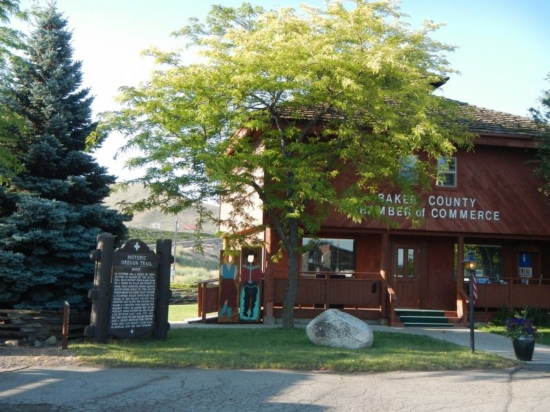
This spot was famous in early days as Express Ranch an important relay station on the Umatilla-Boise Basin stage and freight route. It was also a favorite camping place for emigrants and teamsters. — — Map (db m108121) HM
On Front Street (La Grande-Baker Highway) near 4, on the left when traveling south.
After the close of the Sioux and Piute Indian wars the ranchers of Wyoming and Montana, discouraged in their attempts to fatten the Texas longhorn, turned to Oregon for their cattle. During the spring cattlemen and their cowboys arrived daily from . . . — — Map (db m113516) HM
Near Camp Adair Road near Pacific Highway West (Oregon Route 99W), on the left when traveling east.
The US War Department ultimately selected 55,000 acres at this location for an infantry training site in 1941. Temporary quarters were constructed, and the site was dedicated as Camp Adair in 1942. Camp Adair was designed to train two divisions at . . . — — Map (db m114382) HM
On Corvallis-Newport Highway (aka Main Street) (U.S. 20) at South 11th Street, on the right when traveling west on Corvallis-Newport Highway (aka Main Street).
Philomath College was chartered November 1865, as the United Brethren School for Oregon, Washington, Idaho, Montana and California. The name combines two Greek words meaning love of learning. The building’s center structure was completed in . . . — — Map (db m122509) HM
On McLoughlin Boulevard (Oregon Route 99) near S. 2nd Street, on the right when traveling south.
Oregon City - once known as Willamette Falls - was early the site of an Indian salmon fishing village. The falls furnished the power for a lumber mill which began operation in 1842. A flour mill in 1844. A woolen mill in 1864 and the first paper . . . — — Map (db m113515) HM
On Mt. Hood Highway (U.S. 26), on the left when traveling west.
The pioneer road here detoured the Columbia River rapids and Mount Hood to the Willamette Valley. The road at first followed an old Indian trail. The later name was Barlow Road. Travel was difficult. Wagons were snubbed to trees by ropes on held . . . — — Map (db m112372) HM
On Northbound Rest Area (Interstate 205), on the right when traveling north.
Was early the site of an Indian salmon fishing village. The falls furnished the power for a lumber mill which began operation in 1842, a flour mill in 1844, a woolen mill in 1864 and the first paper mill in the Pacific Northwest in 1867. The first . . . — — Map (db m113514) HM
Many of Oregon’s early transportation routes resulted from the efforts of enterprising pioneers like the Boone family of Clackamas County. In 1846 Alphonso Boone, grandson of Daniel Boone, emigrated to Oregon via the Applegate Trail with his large . . . — — Map (db m127162) HM
On Oregon Coast Highway (U.S. 101) north of Carnahan Road N, on the right when traveling north.
Lt. Neil M. Howison, U.S.N., arrived in the Columbia River 1 July, 1846 on board the 300-ton United States Naval Survey Schooner "Shark" for the purpose of making an investigation of part of the Oregon Country. His report was instrumental in . . . — — Map (db m113513) HM
On Oregon Coast Highway (U.S. 101) north of Carnahan Road North, on the right when traveling north.
Cannon Beach was named after a carronade (a short, smoothbore, cast iron naval cannon) found buried in the sand nearby. The cannon broke free of the USS Shark's deck during a shipwreck at the mouth of the Columbia River on September 10, 1846. . . . — — Map (db m177304) HM
On Warrenton-Astoria Highway (Business U.S. 101) at Fort Clatsop Road, on the left when traveling west on Warrenton-Astoria Highway.
Fort Clatsop built by Lewis and Clark in December 1805 for use as winter quarters was situated eight-tenths of a mile south of this point. The site was chosen because of the game in the surrounding country and because it was convenient to the coast . . . — — Map (db m113578) HM
On Oregon Coast Highway (U.S. 101) near Radar Road, on the right when traveling east.
On January 8, 1806 William Clark and perhaps fourteen of the famous expedition reached a Tillamook village of five cabins on a creek which Captain Clark named Ecola or Whale Creek. Three days earlier, two men sent out from Fort Clatsop to locate a . . . — — Map (db m113597) HM
Near Sunset Highway (Route 26 at milepost 28) near Olson Road, on the right when traveling west.
This Rest Area is dedicated in honor of the 41st Infantry (Sunset) Division.
This division was organized for World War I in 1917 at Camp Greene, North Carolina and was demobilized at Camp Dix, New Jersey in 1919. It was reorganized and federally . . . — — Map (db m113888) HM WM
On Sunset Highway (Route 26 at milepost 28) near Olson Road.
Oregon's historic Tillamook forest fire of 1933 spread over 240,000 acres of forest land. Fires in 1939 and 1945 brought the total to 355,000 acres. Over 13 billion board feet of timber were killed.
Devastation by these disastrous fires aroused . . . — — Map (db m114418) HM
Seaside
Devastating waves called “tsunamis” can strike Oregon’s coast at any time. These giant waves are caused by great undersea earthquakes. Such earthquakes can occur along the Cascadia Subduction Zone, one of the largest . . . — — Map (db m113871) HM
Near Columbia River Highway (U.S. 30) near Clifton/Shingle Mill Road, on the right when traveling west.
"Captain" John West was a self-made man. A native of Scotland, he settled on the lower Columbia River near this spot in the early 1850s after trying his luck in the goldfields of California. West built and operated sawmills, ran a general store and . . . — — Map (db m113583) HM
On Columbia River Highway (U.S. 30) at SW Old Portland Road, on the left when traveling north on Columbia River Highway.
One of the Oregon Country’s most picturesque fur-traders, Thomas McKay is buried near Scappoose.
He was a daring leader, famous storyteller and could drive a nail with a rifle ball.
A Canadian, he arrived with the Astorians as a teen-age boy; . . . — — Map (db m114416) HM
On Oregon Coast Highway (U.S. 101) south of Central Avenue, on the right when traveling south.
(panel 1)
The Oregon Coast boasts forested headlands, towering dunes of sand, and sparkling lakes and rivers. From the Columbia River south to Bandon, the picturesque coastline is bordered to the east by the peaks of . . . — — Map (db m113658) HM
On Coquille-Bandon Hwy (Oregon Route 425) south of Coos Bay-Roseburg Highway (Oregon Route 42) when traveling south.
Aircraft proved their military worth during World War I—initially for observation purposes, and later for the support of ground troops and bombing. When the United States entered the war in 1917, air supremacy was hotly contested and airplane . . . — — Map (db m120619) HM
On North Bank Chetco River Road at Oregon Coast Hwy (U.S. 101), on the right when traveling south on North Bank Chetco River Road.
Prior to the attack on Pearl Harbor, a contingent of Japanese I-Class submarines sailed from Yokosuka via the Marshall Islands to take up positions off Hawaii and the coast of North America. Five of these vessels carried midget two-man submarines . . . — — Map (db m112537) HM
On Oregon Coast Hwy (U.S. 101), on the left when traveling north.
Spanish navigators were the first to explore the North American Pacific Coast, beginning fifty years after Columbus discovered the western continents. Sebastian Vizciano saw this cape in 1603 and named it after the patron saint of the day of his . . . — — Map (db m113292) HM
On Oregon Coast Hwy (U.S. 101), on the right when traveling south. Reported missing.
During the early 1850s hundreds of miners and settlers poured into southwest Oregon and onto Indian lands staking claims and establishing farms. The clash of cultural attitudes toward the ownership and use of natural resources led to the Rogue River . . . — — Map (db m113293) HM
This portion of the southwest Oregon is homeland to the Cow Creek Band of Umpqua Indians. They thrived here for thousands of years before contact with Euro-Americans. Living in plank-house villages, they followed a seasonal round of resource use. . . . — — Map (db m112859) HM
On Interstate 5, on the right when traveling south.
The story of the Cow Creek Band of Umpqua Tribe of Indians is a tale of perseverance and strong recovery in the face of great loss. Epidemics and hostilities with miners let to large population declines. The tribe entered into a treaty with the . . . — — Map (db m99222) HM
On Oregon Coast Highway (U.S. 101) 0.1 miles south of Lower Smith River Road, on the right when traveling south.
Jedediah Smith's explorations in the American West began when he was 21 and lasted until his death at age 32. He crisscrossed the region in search of beaver pelts and new travel routes. His travel journals became a foundation for the first accurate . . . — — Map (db m176970) HM
On Vineyard Lane at Elgarose Road, on the left when traveling south on Vineyard Lane.
Oregon’s successful and widely recognized wine industry can be traced to this place, where Richard Sommer first planted Pinot noir grapes in 1961. The Umpqua and Willamette valleys’ climates and topographies are much like those of European wine . . . — — Map (db m114452) HM
On Southeast Spruce Street at SE Washington Ave (U.S. 138) on Southeast Spruce Street.
Southern Oregon is a land of great geographic diversity. Here are the more than 250-million-year-old Klamath Mountains in the south, and to the north and uplifted 50-million-year-old ocean floor and overlying sediments, called “Siletzia” . . . — — Map (db m112535) HM
On Umpqua Highway (Oregon Route 38) at Main Street, on the left when traveling west on Umpqua Highway.
Few Oregon communities have had a more colorful history than Scottsburg. It was named for Levi Scott, a pioneer of 1844, who homesteaded here and founded the town in 1850. There was a lower town at the head of tidewater on the Umpqua River which . . . — — Map (db m113510) HM
On U.S. 20 at South Harney Road, on the right when traveling east on U.S. 20.
Weary Oregon Trail emigrants, eager to ease travel or gain mileage, often attempted cutoffs and shortcuts. While many of these alternate routes proved successful, others did not--they became roads to ruin for some and the end of the trail for . . . — — Map (db m63032) HM
On Dead Indian Memorial Rd at Green Springs Highway (U.S. 66) on Dead Indian Memorial Rd. Reported permanently removed.
Long before the first Euro-American emigrants trekked westward, this road was a trail used by the Takelma and Shasta Peoples as a trade route. With the arrival of settlers and gold-seekers, the trail quickly became a wagon road called ‘Indian . . . — — Map (db m244111) HM
Near U.S. 97, 0.4 miles south of SW Culver Highway, on the left when traveling north.
This park is named for Peter Skene Ogden, 1793-1854. In the fall of 1825, Ogden led a Hudston's Bay Company trapping party on the first recorded journey into central Oregon, crossing the country to the north and east into the Crooked River Valley . . . — — Map (db m67889) HM
Triple Nickles
Formed in 1943, the all-Black 555th Parachute Infantry Battalion was the first opportunity for African officers and enlisted men to become paratroopers in the segregated US Army during World War II.
Racial Segregation . . . — — Map (db m112484) HM
On I-5 Frontage Road at Ritchie Road, on the right when traveling north on I-5 Frontage Road.
The narrow gorge of Canyon Creek has long served as a travel corridor. Native Americans likely trekked this canyon for thousands of years. Alexander McLeod of the Hudson's Bay Company provided the first written account of the route in 1829, while . . . — — Map (db m112856) HM
Very near here, on a warm spring day in 1945, six people-a woman and five children-were killed by a Japanese "balloon bomb," or Fugo. The party had arrived for a picnic when they discovered the deflated balloon. While they gathered around the . . . — — Map (db m112533) HM
Near U.S. 97 at Glendale Street, on the left when traveling south.
A Pacific Railroad survey party searching for a practicable route for a railroad to connect the Sacramento Valley with the Columbia River passed near this point bound north on August 20, 1855. Lieutenant R.S. Williamson headed the party with 2nd . . . — — Map (db m112508) HM
On Green Springs Highway (Oregon Route 66 at milepost 44) at Toby Grade Road, on the right when traveling west on Green Springs Highway.
The first emigrant train over the "Southern Route," including more than fifty wagons under the leadership of Captain Levi Scott and David Goff, left the Oregon Trail at Fall Creek or Raft River, on the Snake River, August 10, 1846. The Klamath River . . . — — Map (db m88002) HM
On Lakeshore Drive, on the right when traveling west.
This is Oregon's largest body of water, about 90,000 acres. Indians inhabiting its shores ("People of the Lake") lived well on wild fowl, fish and wocus seeds. The first known white visitors (1825-26) were Hudson's Bay trappers under Tom McKay and . . . — — Map (db m112525) HM
On Oregon Route 31 south of Old Fort Rock Road, on the left when traveling south.
Fort Rock is the remnant of a maar volcano or tuff ring, formed when rising basaltic magma encountered water and exploded violently. The exploded debris – called tuff – fell back to earth around the volcanic vent to form this . . . — — Map (db m113585) HM
On Fremont Hwy (U.S. 395), on the right when traveling south.
Behind you to the east is a steep cliff called Abert Rim, made of many layers of hardened lava flows. This 30-mile-long, 2,500-foot-high, steep cliff is an example of a fault scarp, produced over millenia by great blocks of rock tilting and moving . . . — — Map (db m112536) HM
On Oregon Route 58 south of Edenvale Road, on the left when traveling north.
Elijah Bristow, a veteran of Andrew Jackson's army, erected his cabin here on Pleasant Hill in 1846, earliest year of settlement in Lane County. He and his wife Susannah then led in establishing the county's first church and first school. This . . . — — Map (db m99218) HM
On Oregon Coast Highway (U.S. 101) south of Southeast 54th Drive, on the right when traveling south.
During the 18th century, Native American villages occupied the mouths of nearly every stream along this coastline—including here at Siletz Bay.
References to great flooding and ground shaking events are recorded in the oral traditions of . . . — — Map (db m244254) HM
On Yaquina Bay State Park Road west of Oregon Coast Highway (U.S. 101), on the left when traveling north.
The old Yaquina Bay Lighthouse established in 1871 is the earliest aid to navigation, standing within the range of the first recorded landfall made from a ship to the shores of the Pacific Northwest. Captain James Cook made this landfall on March . . . — — Map (db m113917) HM
On Halsey-Sweet Home Highway (West Bishop Way) (Oregon Route 228 at milepost 6) near Loucks Way, on the right when traveling east.
A Town with Ancient Beginnings and Many Names
Long before the first pioneer settlers arrived here in the 1840’s, this area was occupied by the ancient Mound Builders and then the Kalapuya Indians. The relative ease of finding food in . . . — — Map (db m114451) HM
On Santiam Highway (U.S. 20) near Gorton Road (Santiam Wagon Road) (Forest Road 2032), on the right when traveling east.
The pass located east of here through the Cascade Range was once called Wiley Pass after Andrew Wiley. Wiley with other Willamette Valley Pioneers explored it in 1859 while searching for a route to move their livestock to the grasslands of central . . . — — Map (db m113671) HM
On Roswell Road (Oregon Route 452) at Succor Creek Highway (Oregon Route 201), on the left when traveling west on Roswell Road.
During the late 19th century thousands of Americans left farms, families and friends to trek the Oregon Trail toward new lives in the West. The trail was nearly 2,000 miles across prairies, mountains and parched deserts. Contrary to popular belief, . . . — — Map (db m106941) HM
On Danner Loop Road near Old Ion Highway, on the right when traveling north.
This site marks the final resting place of the youngest member of the Lewis and Clark Expedition, born to Sacajawea and Toussaint Charbonneau at Fort Mandan (North Dakota) on February 11, 1805. Baptiste and his mother symbolized the peaceful nature . . . — — Map (db m106876) HM
On Central Oregon Highway (U.S. 20), on the right when traveling north.
Peter Skene Ogden, leading a party of Hudson’s Bay Company trappers, camped near here on October 10, 1828. On this Ogden’s fifth and final expedition into the "Snake Country," he started on September 22, from Fort Nez Perce (Walla Walla). From here, . . . — — Map (db m63024) HM
On A Street East (U.S. 26) at Washington Street East (U.S. 26), on the left when traveling east on A Street East.
Eager to save time on the Oregon Trail, emigrants often attempted shortcuts. Between 1845 and 1854, three wagon trains left this campsite seeking a cutoff to the Willamette Valley.
The Meek Cutoff of 1845
Frontiersman Stephen . . . — — Map (db m107076) HM
On Main Street North East near Pacific Highway East (Oregon Route 99E), on the left when traveling south.
Dr. Wilhelm Keil founded here a Christian co-operative colony patterned after his colony at Bethel, Missouri. Musicians of the settlement made it widely famous. After Dr. Keil's death in 1877 the communal enterprise was dissolved. — — Map (db m114279) HM
Near Interstate 5 at milepost 281,, 1 mile south of Miley Road, on the right when traveling north.
During the period of Oregon's Provisional Government ( 1841-1849), residents traveled by Indian trails, water courses, or on privative rough-hewn wagon roads etched by emigrant settlers. During the days to the Territorial Government (1849-1859), and . . . — — Map (db m114295) HM
Near Champoeg Road NorthEast near French Prairie Road NorthEast.
This area, once named tchampuick, the 'place of yampah' was the traditional homeland of the Tualatin Kalapuya tribe. Fur trappers first arrived here by canoe in 1811, and they found lush open prairies bordering the Willamette River. In 1830, . . . — — Map (db m114307) HM
On Hillsboro-Silverton Highway NorthEast (Oregon Route 219) near Champoeg Road NorthEast, on the left when traveling south. Reported missing.
Willamette Post was established in December 1813 on a knoll just east of this location by employees of the North West Company, a Montreal based fur-trading company. During the ensuing years the two-room log cabin, also known as Fort Kalapuya, served . . . — — Map (db m114308) HM
Near Hatchery Road, 0.3 miles south of Tanner Creek Road.
The prominent monolith across the river was named Beacon Rock by Lewis and Clark, November 2, 1805. It marked the beginning of tidewater for early river explorers who used it for a landmark in their journeys. The Indians say that when the Chinook . . . — — Map (db m34643) HM
On Columbia River Highway (Interstate 84 at milepost 23), 8.6 miles west of Rooster Rock Park West-bound on ramp, on the right when traveling west.
Captain George Vancouver in a voyage of exploration to the Northwest coast of America ordered by the British Admiralty Office assigned Lieutenant William Robert Broughton, Commander of H.M.S. Chatham, to explore the navigable waters of the Columbia . . . — — Map (db m34495) HM
On NW Skyline Boulevard, 0.4 miles west of West Burnside Road, on the left when traveling west.
This short trail leads to the Willamette Stone, the surveyor's monument that is the point of origin for all public land surveys in Oregon and Washington. The landmark was established on June 4, 1851 by John B. Preston, Oregon's first Surveyor . . . — — Map (db m38400) HM
On North Broadacre Road, 0.1 miles west of North Expo Road.
Within a year of the US entering World War II, more than 160,000 people moved to Portland — a city of only 360,000 — to work in Home Front industries. Industrialist Henry Kaiser's three shipyards employed the most workers. To house his . . . — — Map (db m38410) HM
On Historic Columbia River Highway at Crown Point Highway on Historic Columbia River Highway.
On October 30, 1792 off the point in the Columbia River where the Sandy empties its waters, the boat crew from the H.M.S. Chatham (Vancouver's Voyages) were the first white men to sight the snowclad peak which Lt. Wm. R. Broughton named Mt. Hood in . . . — — Map (db m38388) HM
On Oregon Route 18 near Grand Ronde Road, on the right when traveling west.
Indians inhabited Oregon’s inland valleys for thousands of years before Euro-Americans began to arrive in the late 18th Century. In the early 1780s, and again in the 1830s, diseases spread by seafarers and fur trappers swept through Oregon’s valleys . . . — — Map (db m112996) HM
On Pacific Highway West (Oregon Route 99W) at Burch Grove Lane, on the right when traveling north on Pacific Highway West.
James W. Nesmith, born in New Brunswick, Canada on July 23, 1820, was among the first emigrants to trek the Oregon Trail in 1843.
He filed a land claim near present day Monmouth in 1844, and the following year took part in the formation of . . . — — Map (db m113611) HM
On Biggs-Rufus Highway (Oregon Route 206) 0.2 miles east of Moody Road (County Road 143), on the right when traveling west.
The Oregon Trail crossed the hazardous Deschutes River at this point by floating the prairie schooners and swimming the livestock. An island at the river mouth was often utilized when the water was high and the ford dangerous. Pioneer women and . . . — — Map (db m34575) HM
On U.S. 101 near Bayview Forest Road, on the left when traveling north.
commanding the sloop, "Lady Washington" left Boston in October 1787 on a trading voyage to the West Coast of North America, seeking otter furs. To his small crew of about a dozen men, Gray soon added Markus Lopeus, who boarded at the Cape Verde . . . — — Map (db m113549) HM
Near Old Oregon Trail near Interstate 84, on the left when traveling north.
In the first week of January, 1812, a party of trappers and traders, members of the Astor Overland Expedition, crossed the Blue Mountains in this area. Traveling afoot in bitter cold, often waist deep in snow, they were the first white men in this . . . — — Map (db m111534) HM
On Old Highway 30 near Main Street, on the right when traveling north.
First known as Lee's Encampment,
from establishment of a troop
camp by Major H.A.G. Lee in 1844,
A.B. and Harvey Meacham operated
famous "Mountain House" here, which
gave the town its present name.
In later years a famous railroad
eating . . . — — Map (db m111530) HM
On Pendleton Highway (Southeast Court Avenue) (U.S. 30) near Goad Road when traveling west.
This location marks a travel corridor for Plateau Tribes moving seasonally from the Columbia River to the Blue Mountains. In 1811, members of the Astor Party under the leadership of Wilson Price Hunt camped here on their way west. They traded with . . . — — Map (db m111565) HM
On Westgate (Northwest Pendleton Highway) (U.S. 30) near County Route 1302, on the left when traveling west.
Weary emigrants traveling westward on the Oregon Trail favored a campsite on the near bank of the Umatilla River at this point. On leaving they climbed the same hill the highway now traverses. Then recrossed the Umatilla River at Echo 20 hot dusty . . . — — Map (db m111912) HM
On Pendleton - John Day Highway (U.S. 395), on the left when traveling north.
The decisive engagement of the Bannock War was fought on the foothills of Battle Mountain, July 8, 1878. The war - a protest against white encroachment, and the last major uprising in the Pacific Northwest - was started by Bannock Indians, but Egan, . . . — — Map (db m108178) HM WM
On La Grande - Baker Highway (Adams Avenue) (U.S. 30) near Otten Drive, on the right when traveling north.
La Grande was the first town permanently settled in Northeastern Oregon. Daniel Chaplin laid out the original "Old Town" in spring of 1862 and Ben Brown built the first house, a log cabin, alongside the Oregon Trail at the corner of B Avenue and . . . — — Map (db m111438) HM
On La Grande - Baker Highway (Oregon Route 237) near Government Gulch Road, on the left when traveling north.
Madame Marie Dorion, a Native American of the Sioux Nation, gained recognition for her endurance and courage in the early American West. As the only woman on the long and difficult Wilson Price Hunt expedition from Montreal to the wild Oregon . . . — — Map (db m111338) HM
On Wallowa Lake Highway (Oregon Route 82) 0.1 miles east of Highland Avenue, on the right when traveling east.
Wallowa Valley, summer homeland of the Joseph Band Nez Perce, was part of the expansive Nez Perce Reservation established by the treaty of 1855. Upon discovery of gold in the region, the U.S. eliminated the reservation in the Wallowas in 1863. The . . . — — Map (db m71746) HM
On Wallowa Lake Highway (Powerhouse Road) (Oregon Route 351), on the right when traveling north.
Wallowa Lake fills a depression that was formerly occupied by a great river of ice that flowed out of the high Wallowa mountains to the south. This glacier reached its greatest size in the late Pleistocene age, about 12 to 40 thousand years ago. As . . . — — Map (db m111368) HM
On Interstate 84 at milepost 72, on the right when traveling west.
Until very recent times, the Indian people of the Columbia River did not bury their dead, Instead, bodies were wrapped in robes or tule mats and deposited in canoes that were placed in the woods, on rocky points, or in cedar vaults on islands like . . . — — Map (db m113517) HM
Near Celilo Park Road, 0.1 miles south of Celilo-Wasco Highway (Oregon Road 206), on the right when traveling west.
Before a network of dams controlled the Columbia River it was a raging torrent. Here at Wyam Falls, known today as Celilo Falls, a vertical drop of more than 20 feet and sheer basalt bluffs on either shore forced the river into seething, boiling . . . — — Map (db m34581) HM
On Sherar's Bridge Highway (Oregon Route 216) near U.S. 197, on the right when traveling east.
This area on the Deschutes River has been a river crossing and fishing location for thousands of years. Peter Skene Odgen made note of an Indian camp and bridge when he crossed here in 1826. Early pioneers using the Meek Cutoff passed here on their . . . — — Map (db m112505) HM
On NorthWest Victory Lane near NorthWest School Road, on the right when traveling north.
This marks the land claim of Joseph L. Meek, famed and unlettered "mountain man," who arrived in 1840 after driving from Fort Hall to Walla Walla in the first wagon on that part of the Oregon Trail. He was a founder of the Provisional Government; . . . — — Map (db m113887) HM
On SouthEast Dayton-Salem Highway (aka 3rd Street) (Oregon Route 221) near Main Street, on the right when traveling south.
Courthouse Square Park is a monument to the civic and commercial aspirations of Dayton’s founders, Joel Palmer, his son-in-law Andrew Smith and Christopher Taylor. Palmer and Taylor, who settled here to farm in 1848, laid out the town site on the . . . — — Map (db m114311) HM
On SouthEast Dayton-Salem Highway (aka 3rd Street) (Oregon Route 211) at Main Street, on the right when traveling south on SouthEast Dayton-Salem Highway (aka 3rd Street).
This marker is composed of two panels.
This building was a military blockhouse built at the Grand Ronde Agency by Willamette Valley settlers in 1856.
U.S. Troops were sent to the station the same year and its was named "Fort . . . — — Map (db m114313) HM
Near SW Oldsville Road, 0.2 miles east of SW Dusty Drive, on the right when traveling west.
The 90-ton glacial erratic rock at the top of this 1/4-mile-long trail is a stranger from a distant location—it was transported here thousands of years ago on an iceberg in the wake of a cataclysmic flood.
During the last Ice Age, . . . — — Map (db m68913)