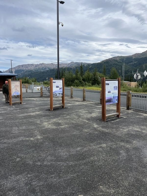
On Headquarters Road north of Doty Lane, on the right when traveling south.
From the outset, park vistors could opt for lodging that was a far cry from camping.
If you arrived at McKinley Station between 1925 and 1939, chance are the Mt. McKinley Tourist and Transportation Company was here to meet you. You . . . — — Map (db m283238) HM
"It's not fair to the rangers to ask them to patrol in the cold weather…and then have to spend the night out in the open under a spruce tree."
-Ranger Fritz Nyberg, 1927.
Even during the short summer months, . . . — — Map (db m257623) HM
On Railroad Depot Rd, on the right when traveling north.
During World War II, thousands of servicemen left the war behind and spent a week in the park.
When Japanese forces attacked the Aleutian Islands in June 1942, vacation travel to Alaska ground to a halt. In the absence of full . . . — — Map (db m283780) HM
On the Park Road (at milepost 13), on the right when traveling west.
"I shall never forget that, when he got through asking questions, he said, 'You're lacking in experience, but I think you can learn. I'll send you on a patrol trip alone. You will be gone a week. If you don't get back by then, I'll . . . — — Map (db m257613) HM
On Bus Concessionaire Road at Murie Road, on the right when traveling west on Bus Concessionaire Road.
How did you imagine the park before you had seen it for yourself? In years past, travelers' expectations were shaped by railroad brochures
that touted the marvels of Alaska and portrayed the park as
a wonderland. The words below are from a . . . — — Map (db m283937) HM
On Murie Road at Bus Concessionaire Road, on the left when traveling north on Murie Road.
1915 Construction begins on the Government Railroad, later renamed the Alaska Railroad.
1917 Mount McKinley National Park is established. Enterprising pioneers have already built homesteads outside park boundaries, near . . . — — Map (db m283782) HM
"It is not only the outward beauty of Alaska that we must think about when considering
its future; we must also think of its native wildness-its wilderness spirit."
—Park Biologist Adolph Murie
On Park Road 3.4 miles west of Parks Highway (Alaska Route 3), on the left when traveling west.
He laid the foundation of the National Park Service, defining and establishing the policies under which its areas shall be developed and conserved unimpaired for future generations. There will never come an end to the good that he has done. — — Map (db m195774) HM
Near Park Road (at milepost 1.5) south of Bus Concessionaire Road, on the right when traveling north.
Near this site, in July 1937, Alaska Railroad crews broke ground for the McKinley Park Hotel.
A Modern Wilderness Outpost
Despite financial setbacks and a contentious design (it was modern, not rustic), the hotel opened on June 1, . . . — — Map (db m294078) HM
On Murie Road at Bus Concessionaire Road, on the left when traveling north on Murie Road.
As the number of ways to get to the park grew, so did the number of visitors.
If you wanted to visit the park prior to 1957, rail travel was not only a good option, it was about your only option. A few visitors arrived by chartered . . . — — Map (db m283550) HM
On Railroad Depot Rd, on the right when traveling north.
The fortunes of the park and the railroad have long been linked.
It could be said that the coming of the railroad was a catalyst for the creation of the park. In January 1917 Stephen R. Capps of the U,S. Geological Survey reported that . . . — — Map (db m283594) HM
On Railroad Depot Rd, on the right when traveling north.
Many things have changed since the park was created and the railroad was completed, but the route to the park remains the same. Whether you traveled the historic rail line or modern highway, you took the route taken by the park's first visitors. . . . — — Map (db m283503) HM
"…if they don't sent in a warden pretty soon their won't be anything left to warden."
-Local Alaskan guide Harry Karstens in a letter to friend and conservationist Charles Sheldon, 1920. Karstens was hired as the Park's first . . . — — Map (db m257618) HM
On Yukon Drive east of Tanana Loop/Koyukuk Drive, on the right when traveling east.
Battalion Chief Phil Rounds would like to invite you to have a seat
and put your feet up. Enjoy the view of this beautiful place we live in
and take a moment to reflect at all the awesomeness we have
around us.
Phil was a chief with the . . . — — Map (db m256391) HM
On Central Avenue, on the left when traveling south.
The pavilion was designed to resemble a
World War II/Cold War era hanger similar
to the "Birchwood Hangers" found
throughout the state. Suspended from the
ceiling is a miniature replica of Ben
Eielson's Curtiss JN-4 "Jenny", reported to
be . . . — — Map (db m255942) HM
The Chamber of Commerce bought the SS Nenana in 1957 from the Alaska Railroad then sold it to the
Greater Fairbanks Opportunities Inc., an offshoot of businessmen from the Chamber of Commerce.
The Greater Fairbanks Opportunities Inc. brought . . . — — Map (db m256668) HM
The SS Nenana was originally in a different place
in the park? She was moved more then [sic] 200 ft.
to be placed where she is now. She was originally
placed in a man made pond, facing the Pioneers Museum. — — Map (db m256661) HM
It took three days to bring the SS Nenana to Fairbanks from Nenana. The vessel traveled cautiously with a sounding boat out in front to test the river depth and check for sandbars.
She was still hung up on a sand bar by the mouth of the Chena . . . — — Map (db m256667) HM
1955
The idea that sparked the creation of Pioneer Park came from a Fairbanks Golden Days Celebration Committee meeting. Robert Sheldon of Pioneers of Alaska Fairbanks Igloo No. 4 took the idea to the Fairbanks Pioneer Igloos to . . . — — Map (db m256603) HM
The church had its beginning in the winter of 1902-03 when the
Rev. M. E. Krouse Ph. D., Presbyterian missionary of Rampart,
Alaska came to the new camp on the Chena [River] called Fairbanks. He
built a mission cabin, preached the first . . . — — Map (db m256859) HM
You are standing in a parking lot built in 1930.
The access road to the powerhouse site
provided the first public road to the glacier.
People drove over a trestle to reach the lot.
By 1937 a Glacier Highway Recreation Guide touted the . . . — — Map (db m282870) HM
On Glacier Spur Road 3 miles Second St., on the right when traveling north.
The Civilian Conservation Corps left a legacy of labor and public service.
This shelter represents a piece of the nation's past and attests to the historic popularity of this site. It represents work for the public good and
one of the most . . . — — Map (db m282994) HM
On The Trail of Time at Glacier Spur Road, on the left when traveling east on The Trail of Time.
Natural and cultural forces reshaped the landscape through plant succession and human development.
Small changes had dramatic effects over time. On a daily basis the movement of the glacier was often unnoticeable As the glacier sets, . . . — — Map (db m282929) HM
On East Glacier Trail at Glacier Spur Road, on the left when traveling east on East Glacier Trail.
The spot on which you stand was underneath the Mendenhall Glacier in 1921. The photo above was taken approximately ¼ mile south of here, near the 1930 parking area. — — Map (db m283005) HM
On East Glacier Trail at Glacier Spur Road, on the left when traveling east on East Glacier Trail.
The pavement may end but your journey through time begins.
Today the cues to the past on the trail ahead are obscured by vegetation. Close examination of this 1939 photograph reveals features along the trail head of you.
Note the . . . — — Map (db m283002) HM
Near Bawden Street, on the right when traveling north.
This landscape design and construction is by local resident and Eagle Scout Joey Karlik. Tongass Historical Museum, Tongass Historical Society, and the City of Ketchikan extend their sincere gratitude. As Ketchikan was becoming established, so too . . . — — Map (db m310697) HM
On Front Street at Spruce Mill Way, on the right when traveling south on Front Street.
E pluribus funum
Independence Day was a bang-up community affair in early-day Ketchikan. In the midst of busy summertime, the Stars and Stripes provided a common denominator for diverse frontier folk. July Fourth inspired considerable . . . — — Map (db m181996) HM
On Alaska Street south of Dahlia Street, on the left when traveling south.
This park is dedicated to the agricultural pioneers of the
Matanuska Valley and particularly to those that participated
in the Matanuska Valley Colonization Project of 1935,
who by their labor and perseverance gave birth to
the City of . . . — — Map (db m254849) HM
On Elmwood Avenue east of Eklutna Avenue, on the left when traveling east.
The Bill Hermann Tennis Courts
were constructed in the 1970s
with a donation from Bill Hermann.
Bernard "Bernie" Nieman faithfully
cared for these courts for 30 years.
Courts were reconstructed in 2022 by Mat-Su Tennis Association . . . — — Map (db m254876) HM
On Glenn Highway (State Highway 1 at milepost 61.6) east of Chickaloon Way, on the left when traveling east.
This log home was originally built by Ray Roberts and his family with the help
from local friends and neighbors in 1949. The cottonwood logs were harvested at
Kings River and milled on the Roberts' property. The interior of the home was . . . — — Map (db m255259) HM
On Chickaloon Way north of Glenn Highway Milepost 61.6 (Alaska Highway 1), on the right when traveling north.
Rita was instrumental in forming the Alpine Historical Society
and was the first president serving in that capacity from 1983 to
1984. Rita and her husband Gene moved to Alaska in 1969. For
three years, they lived at Fort Richardson Army Base . . . — — Map (db m254924) HM
On Chickaloon Way north of Glenn Highway Milepost 61.6 (Alaska Highway 1), on the right when traveling north.
History, Nature, and Culture:
These are just a few of the things that make the
Alpine Historical Park a popular stop for travelers
along the Glenn Highway National Scenic Byway.
Athabascan Culture, Coal Mining, and Glenn Highway . . . — — Map (db m254897) HM
On Lincoln Street at Katlian Street, on the left when traveling east on Lincoln Street.
Sitka Totem Square is a park and recreation area acquired from the Federal government in 1972 for use by the general public. The park is owned by the State of Alaska and is maintained by the Department of Health and Social Services, Division of . . . — — Map (db m308365) HM
As Alaska evolved from department to district to territory, and finally, to state, this hill went through a series of changes, eventually becoming Baranof Castle State Historic Site.
Who's the Boss?
A short lull followed the excitement of . . . — — Map (db m181369) HM
On 5th Avenue east of Broadway, on the left when traveling east.
The authorization of Klondike Gold Rush National Historical Park in 1976 included the mandate to preserve and protect the Gold Rush heritage of Skagway. With the purchase of the Moore Homestead from the Kirmse family in 1977, a key element for . . . — — Map (db m257809) HM
On 2nd Avenue west of Broadway, on the left when traveling west.
Friends of Itjen's, George and Edna Rapuzzi took over the museum after his death and later moved the building to this location. Thankfully for us they kept everything!
George and Edna Rapuzzi
Born at the tail end of the gold rush in . . . — — Map (db m257875) HM
On the Alaska Highway (State Highway 2) west of the Gerstle River (9-span) Bridge, on the left when traveling west.
Delta Junction Bison Range
Bison were released along the Delta River in 1928, and the herd increased from 28 animals to 400 by 1947. Bison hunting began in 1951. The 90,000 acre Delta Junction Bison Range (DJBR) was established in 1979, . . . — — Map (db m255605) HM
Over the Moon
A bird's-eye view reveals this peaceful oxbow lake was once part of the mighty Tanana River. Fed by a healthy supply of glacial melt from the Alaska Range, the Tanana River's heavy silt load is ideal for the formation of a . . . — — Map (db m255592) HM
On Puerco Loop east of Petrified Forest Road, on the left when traveling south.
In this vast, nearly treeless landscape, it may sound strange to call the Civilian Conservation Corps (CCC) Roosevelt's Tree Army, but it has meaning here. President Franklin D. Roosevelt created the CCC in 1933 as part of his New Deal program for . . . — — Map (db m286291) HM
Nowhere else has so large and beautiful and in every way wonderful [a] section of the ancient…forests been discovered, and, after it is cared for by the Nation and made easily accessible, it will, I am sure, become one of the most . . . — — Map (db m269682) HM
Strong lines, flat roofs, smooth, unadorned wall surfaces, and asymmetrical facades are the main characteristics of the International Style of architectural design. In the United States, Richard Neutra was a top architect on this style. In a daring . . . — — Map (db m255934) HM
Like the geologic layers of the Painted Desert, the lives of its residents layer upon each other in the form of rock art, structures, and artifacts. Ongoing research uncovers such dramatic evidence, constructing a timeline of continuous occupation . . . — — Map (db m255984) HM
What does silence sound like? Where do you go if there are no footsteps to follow? How does it feel to be in a place where day and night are the only times that matter? How does it feel to be totally immersed in nature?
The answers to . . . — — Map (db m255959) HM
On Petrified Forest Road at Old U.S. Route 66, on the right when traveling south on Petrified Forest Road.
Petrified Forest is the only National Park in the country with a portion of Historic Route 66 within its boundaries. You are currently standing where the Mother Road used to be, with the line of telephone poles paralleling its alignment through the . . . — — Map (db m163277) HM
Enjoy the tranquility of the grassland as the trail leads you to scenic Tawa Point. The Tawa rail is a perfect place to stretch your legs after a long road trip
In Hopi ideology, Tawa refers to the Sun Spirit, the creator of the World. The . . . — — Map (db m255941) HM
Enjoy the tranquility of the grassland as the trail leads you to scenic Tawa Point. The Tawa rail is a perfect place to stretch your legs after a long road trip
In Hopi ideology, Tawa refers to the Sun Spirit, the creator of the World. The . . . — — Map (db m255948) HM
Iowa Congressman John Fletcher Lacey strongly advocated the protection of public lands and the resources within them. Lacey is most prominently known by his namesake of the Lacey Act of 1900, which protected both plants and wildlife. However, he . . . — — Map (db m255987) HM
From its perch on the Painted Desert rim, this building has seen many changes. First built by Herbert Lore in the early 1920s, it was made with the resource most abundant in the area: petrified wood! Look above the double doors and you will see a . . . — — Map (db m255958) HM
You have made a good decision to exit the interstate and visit Petrified Forest National Park. Beyond lies a 28 mile (45 km) road through the heart of the park, showcasing the Painted Desert, the world's largest and most colorful concentration of . . . — — Map (db m255927) HM
Think of a word to describe the semi-arid grassland in front of you. Is it lush, green, or forested? No, but those would be accurate descriptions for this land during the Triassic Period. At that time, this area resided on the supercontinent Pangea . . . — — Map (db m269588)
Step up to the railing ahead and you will see one of the park’s largest concentrations of petroglyphs. It is called Newspaper Rock for the more than 650 images pecked, carved, or incised in the boulders below. This unique site is part of a larger . . . — — Map (db m269681) HM
On East Mohave Street at South Zuni Street, on the left when traveling west on East Mohave Street.
This park contains buildings restored by the White Mtn. Historical Society. They preserve early settler, Hispanic, & Native American cultures, along with farming, forestry and ranching heritage. — — Map (db m36594) HM
On Pan American Avenue (U.S. 191) at 10th Street, on the right when traveling south on Pan American Avenue.
Built in 1905 by El Paso and Southwest Railroad and the Calumet and Arizona Copper Co., and citizens of Douglas.
Expanded in 1916 to include a gym, a swimming pool and other recreational facilities with additional support provided by the . . . — — Map (db m195862) HM
The population of the San Pedro Valley, once Native American, was flooded with new cultures in the nineteenth century.
New immigrants from Europe and Mexico were hired to work the mines and stamp mills. The Montezuma Hotel and saloon was once . . . — — Map (db m249897) HM
On State Road 82 at North Old Fairbank Road on State Road 82.
While the silver mines were near Tombstone, the mills that processed the silver ore were along the San Pedro River. Why go to all the trouble to haul heavy wagon loads of ore all that way?
Water! It took enormous amounts of water to run the . . . — — Map (db m249980) HM
Fairbank is the most intact historic townsite along the San Pedro River. It is managed by the Bureau of Land Management (BLM) as part of the San Pedro Riparian National Conservation Area (SPRNCA), established in 1988 to protect its natural and . . . — — Map (db m249872) HM
The idea of a non-motorized trail
traversing Arizona from Mexico to Utah
was conceived by Dale Shewalter, a Flagstaff
public school teacher, after numerous
long-distance hikes throughout the state. In
1985 Dale walked from Nogales to . . . — — Map (db m121444) HM
The City of Flagstaff purchased this land in 1959 from the United States Forest Service.
In 1964, James Potter, Sr., long-time resident, entrepreneur and Flagstaff Chamber of Commerce President, led the effort to form a non-profit organization, . . . — — Map (db m33347) HM
Floods and People Chose the Rio's Course
For thousands of years, rain and snowmelt on the south-west slopes of the San Francisco Peaks flowed down the Rio de Flag drainage carving a shallow canyon where Bonito Street is located today. The . . . — — Map (db m263269) HM
On East Route 66 at Mall Way, on the right when traveling west on East Route 66.
This trail follows the south side of historic Route 66 from downtown Flagstaff to the east side of town. In the mid 1990s the City removed a series of Billboards from the strip or land between Route 66 and the BNSF railroad tracks, and replaced it . . . — — Map (db m263060) HM
Heading west, Route 66 helped determine Flagstaff's urban form by creating the long commercial corridor that provided travelers with motels, auto repair, gas, entertainment and food. The buildings along Route 66 that remain today are a living museum . . . — — Map (db m263117) HM
On North Humphrey Dtreet at West Birch Avenue, on the right when traveling south on North Humphrey Dtreet.
This park is named in honor of Rollin W. Wheeler who served as mayor from 1960 to 1968, councilman from 1952 to 1960, and teacher, coach and counselor at Flagstaff High School from 1929 to 1968.
He molded citizens by action and . . . — — Map (db m263081) HM
This trail follows the south side of historic Route 66 from downtown Flagstaff to the east side of town. In the mid 1990s the City removed a series of Billboards from the strip or land between Route 66 and the BNSF railroad tracks, and replaced it . . . — — Map (db m263109) HM
Directly behind you, looking down into Hermit Canyon, you can see part of Hermit Trail and the remains of Hermit Camp. In 1911-12 the Santa Fe Railroad built both trail and camp to serve a blossoming tourist trade. Why did Santa Fe build here at . . . — — Map (db m156999) HM
Bright Angel Hotel (below) was built around 1895 to serve stagecoach passengers. In 1905 the hotel became Bright Angel Camp, which eventually included cabins and an adjoining tent village.
In 1935 the Fred Harvey Company replaced the camp . . . — — Map (db m39510) HM
Artist Thomas Moran was a storehouse of pictures. In 1873, geologist John Wesley Powell invited Moran to accompany his geologic survey of the Grand Canyon region. For Moran, the canyon was "by far the most awfully grand and impressive scene." As a . . . — — Map (db m250577) HM
One thousand years ago, wood smoke curled up from a farming village on the riverside delta below you, named Unkar Delta. Many such villages have dotted Grand Canyon's bottomlands since ancient times. Corn, beans, squash, and cotton grew between . . . — — Map (db m250578) HM
You are standing on a section of the original Hermit Road, constructed in 1911-1913. It was a road ahead of its time, offering sweeping vistas and gentle grades, at a cost of $250,000 — an unheard of sum for such a short road. It was built for . . . — — Map (db m157147) HM
Below you, the Colorado River makes a dramatic turn. Ever since the river entered Grand Canyon at Lees Ferry, it has been deepening its gorge east of the Kaibab Plateau. Here, the river turned west to cut straight through the plateau, opening a . . . — — Map (db m250582) HM
"No language can fully describe, no artist paint the beauty, grandeur, immensity and sublimity of this most wonderful production of Nature's great architect. [Grand Canyon] must be seen to be appreciated."
C.O. Hall, Grand . . . — — Map (db m39659) HM
It is hard to imagine the power of Hance Rapid from this distance, 3.8 miles (6.1 km) away. Closer to its roar, it is clearly one of Grand Canyon's most hazardous rapids, as the Colorado River falls the height of a three-story building. River . . . — — Map (db m250580) HM
On the inner plateau, Hermit Camp has been built.... A skilled Chef is in charge of the dining room, where excellent meals are provided. It is camping out ‘deluxe.’ —1916 Hermit Camp postcard Deep in the canyon are faint signs of . . . — — Map (db m156994) HM
Near Hermit Road at Village Loop Drive, on the right when traveling west.
Today, most visitors will travel the Hermit Road by shuttle, but in 1912 when the road first opened, you would have traveled by horse or buggy. The Santa Fe Railway and U.S. Forest Service built the buggy road so early visitors had a choice in . . . — — Map (db m157166) HM
Albright's contributions to the National Park Service can hardly be overstated. While working with the agency's first director, Stephen Mather, in the early years of the National Park Service, Horace Albright played a decisive role in guiding the . . . — — Map (db m39600) HM
If a horseshoe can bring luck, why not a horseshoe-shaped mesa? Some 2,500 feet (760 m) below you sits Horseshoe Mesa. There, in 1890, Pete Berry and fellow miners discovered copper and began digging the Last Chance Mine. The ore was rich (15 to 30 . . . — — Map (db m250566) HM
Welcome to Grand Canyon and Desert View, where sun and sky, canyon and river gorge, tiered plateaus, and historic architecture blend into sweeping panoramas.
Constructed in 1932, the 70-foot tall Desert View Watchtower provides visitors from . . . — — Map (db m250584) HM
The mule barn and the nearby livery stable were two of the most important buildings in the original Grand Canyon Village. In the early 1900's, when all travel within the village was by horse-drawn carriage, these huge barns were the center of all . . . — — Map (db m39585) HM
Now known as Phantom Ranch, this area along the Bright
Angel delta first gained attention as a tourist camp under the
name Rust's Camp. In 1902, David Rust began the planting
of fruit trees and cottonwoods and the
building of a camp for . . . — — Map (db m310656) HM
Build a structure that provides the widest possible view of Grand Canyon yet harmonizes with its setting: this was architect Mary Colter's goal when the Fred Harvey Company hired her in 1930 to design a gift shop and rest area here at Desert View. . . . — — Map (db m39616) HM
From Navajo Point, your view includes Grand Canyon and extends across the surrounding plateaus into modern-day Indian Country. Several tribes still live in and around the canyon, honoring their ancient connection to this place. Grand Canyon is . . . — — Map (db m250581) HM
Near Desert View Drive (Arizona Route 64) 21.5 miles east of South Entrance Road.
Mary Colter's Desert View Watchtower creates an illusion of age. Concealed within the tower is an entirely different reality. Workers built a concrete and steel reinforced superstructure and then applied a veneer of native stone. The weathered . . . — — Map (db m169439) HM
Completed in 1935, Bright Angel Lodge was designed and built under the direction of Mary Colter, Fred Harvey company's celebrated Southwest architect. Colter's penchant for rustic designs and her attention to detail led to the creation of this . . . — — Map (db m250419) HM
On El Tovar Road at Village Loop Drive, on the right when traveling west on El Tovar Road.
The Grand Canyon National Park Superintendent's Residence is a National Park Service Rustic style building. It was designed in 1921 by Daniel Ray Hull, Chief Landscape Engineer for the National Park Service Branch of Plans and Designs, as the park's . . . — — Map (db m250416) HM
California condors are the largest flying birds in North America. Their wingspans of nearly 10 feet (3.5 m) make condors easy to spot gliding above Grand Canyon today. Yet, in the 1920s, these birds disappeared from Grand Canyon skies. Condors were . . . — — Map (db m250417) HM
A rich architectural history awaits as you explore Grand Canyon Village. Eclectic in nature, the village is a mix of early pioneer, Santa Fe Railroad, and National Park Service structures. Entrepreneurial-pioneers started building here in the early . . . — — Map (db m250414) HM
On Coconino Rim Road 1.3 miles south of Desert View Drive ( Route 64), on the left when traveling south.
This steel lookout tower, erected in 1936, is 80 feet
tall. It replaced an earlier wooden lookout tower and platform. The two-room bungalow style cabin, also built in
1908, serves as the lookout's residence.
As guardians of our . . . — — Map (db m310681) HM
Near Fire Road 307, 1.5 miles east of Coconino Rim Road, on the left when traveling east.
Hull Cabin Historic District, built circa 1890, has been placed on the
National Register
of Historic Places
by the United States
Department of the Interior. — — Map (db m310705) HM
On Desert View Walkways north of Desert View Road, on the right when traveling north.
Mary Colter's attention to detail is reflected in every element of the Desert View Watchtower.
Each rock and painted wall is intended to convey meaning. Colter used ornamental details, seemingly haphazardly, to create an added charm of the . . . — — Map (db m285542) HM
Near Desert View Drive (Arizona Route 64) 14.6 miles east of South Entrance Road, on the left when traveling east.
Near here in late summer of 1540, soldiers from the Spanish expedition of Francisco Vasquez de Coronado became the first Europeans to see Grand Canyon.
After journeying for six months, Coronado's army arrived at the Hopi mesas, east of . . . — — Map (db m125895) HM
He laid the foundation of the National Park Service, defining and establishing the policies under which its areas shall be developed and conserved unimpaired for future generations. There will never come an end to the good that he has done. — — Map (db m169438) HM
Constructed of locally quarried Kaibab limestone, Lookout Studio appears as if it grew out of the canyon wall. In 1914, Fred Harvey company took a bold step to compete against Kolb Studio (just west of here). They asked Mary Colter to design a . . . — — Map (db m250420) HM
Near Desert View Drive (Arizona Route 64) 21.4 miles east of South Entrance Road, on the left when traveling east.
Catastrophe can happen even in spectacular beauty. When technological achievements and human actions fail, disasters may happen.
On June 30, 1956, a United Airlines DC-7 and a TWA Super Constellation maneuvered around towering cumulus clouds on . . . — — Map (db m124533) HM
Throughout their longstanding friendship, Congressman Morris K. Udall and Senator John S. McCain set an example of bipartisan comity, collegiality, and leadership.
Though members of different political parties, these two great leaders and . . . — — Map (db m292135) HM
Inspired by Grand Canyon's burgeoning tourism trade, in 1898, John Verkamp established a small tent shop on the South Rim, selling American Indian arts and crafts. Profits proved meager, so John sold his inventory to the Bright Angel Hotel and . . . — — Map (db m250413) HM
Isolated from society, settlers here had to provide for themselves. Growing their own food proved to be a constant struggle as unreliable irrigation plagued the
desert fields. Lonely Dell families endured and grew lush gardens, orchards, and fields . . . — — Map (db m289827) HM
The Paria Canyon-Vermilion Cliff Wilderness was added to the National Wilderness Preservation System on August 28, 1984. This 112,000-acre jewel of the desert Southwest truly reperesents the meaning of wilderness. The majority of the wildreness area . . . — — Map (db m289824) HM
13462 entries matched your criteria. Entries 101 through 200 are listed above. ⊲ Previous 100 — Next 100 ⊳