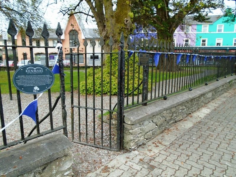
Although there had been a settlement of English colonists in Kenmare since 1670 it was not until a century later that the foundations of the present estate town were laid. This was done by William Petty-Fitzmaurice, the 1st Marquis of . . . — — Map (db m139672) HM
HENRY STREET - This street was named in honour of the 3rd Marquis of Lansdowne, Henry Petty-Fitzmaurice (1780-1863), who oversaw a number of major stages in the development of Kenmare. It dates from 1770s but assumed its present form . . . — — Map (db m139847) HM
This pub has been granted the
James Joyce Pub Award
for being an authentic Irish pub
'A good puzzle would be to cross Ireland
without passing a pub.' Ulysses
James Joyce identified and described the . . . — — Map (db m139755) HM
Early History
Stone circles, standing stones and rock art are common around Kenmare. These archaeological sites indicate humans have lived here from the Bronze Age (c.2200-500BC). But it was the upheavals of 17th century Ireland . . . — — Map (db m139761) HM
MAIN STREET - Main Street was formerly named William Street in honour of the 1st Marquis of Lansdowne, William Petty-Fitzmaurice who was raised in Lixnaw, County Kerry. He inherited the Lansdowne estates at Kenmare in 1761 and became . . . — — Map (db m139850) HM
The Market House - This three storey Classical style building was designed by renowned English architect Sir Charles Barry for the 3rd Marquis of Lansdowne. Barry (1795-1860) was a prominent architect of his time. Probably his most . . . — — Map (db m139774) HM
In onóir gaisigh Óglaigh na hÉireann agus laochra
Cumann na mBan a throid ar son Saoirse na hÉireann
a tógadh an leacht chuimhneacháin seo.
Erected in honour of the men of Óglaigh na hÉireann and
the women of Cumann na . . . — — Map (db m139673) HM WM
As part of their preparations for the 1916 Easter Rising, the Irish Republican Brotherhood (IRB) decided on a plan to seize a wireless transmitter from the Atlantic College in Cahersiveen to contact the Aud, the German vessel which carried arms . . . — — Map (db m142785) HM
In commemoration of
the first casualties
of the 1916 Rising
Erected at Easter 2016
—————————————
Mar chomóradh ar na
chéad taismigh . . . — — Map (db m142789) HM
Late Captain Kerry Militia
Drowned in Castlemaine Bay
20th June 1867
when gallantly attempting to
save the life of a fellow creature
Erected
by his brother officers
of the Kerry Militia
in testimony of the affectionate . . . — — Map (db m142765) HM
Kilmalkedar — from Cill Mhaoilchéadair (the Church of Mhaoilchéadair)
Kilmalkedar Church
Kilmalkedar, one of the most important early church sites on the Dingle peninsula, is traditionally associated with St. Brendan but it was . . . — — Map (db m24299) HM
This sculpture was designed by local councillor and craftsman Tony O'Callaghan
The “Standing Stone” illustrates the River Feale which flows around our town.
The “Ring” depicts an earthen fort situated in the . . . — — Map (db m23989) HM
Where very many
nameless victims of the
Irish Famine of 1845-47
lie buried
Also buried here are others
who died
in the nearby workhouse
built 1840
Saibhreas na bhflaitheas dóibh! — — Map (db m23042) HM
POBLACHT NA H EIREANN.
The Provisional Government
of the
Irish Republic
TO THE PEOPLE OF IRELAND.
IRISHMEN AND IRISHWOMEN: In the name of God and of the dead generations
from which she receives bor old tradition Inationhood, . . . — — Map (db m231457) HM WM
The village of Portmagee was named after Captain Theobald Magee who was an officer in King James's Army. After the famous Battle of the Boyne, Magee retired from the army and became the commander of a merchant ship operating between . . . — — Map (db m141308) HM
This boat was built by Dan 'Denny' O'Connell in the early 1900s. He built her at the back of the Post Office, where he built all his boats, on a site which later became the local dance hall. Her purpose was to ferry people from . . . — — Map (db m141205) HM
Poet, fiddler, teacher, and dancing master, born in Derrynane, Co. Kerry, Tomás Rua was a supporter and close friend of the Irish Politician Daniel O'Connell.
Amhrán ne Leabhar - Song of the books.
Tomás Rua was transferred from . . . — — Map (db m141208) HM
Reask - from An Riasc (the marsh). This important early monastery was probably founded in the 6th century.
Little is known of the history of the site. The enclosing wall is roughly circular and its interior is divided by a . . . — — Map (db m24147) HM
Chief Justice of Ireland 1961-1973
Judge of the European Court of Justice 1973-1974
President of Ireland 1974-1976
Unveiled June 5th, 1983
by
The President of Ireland
Dr. Patrick Hillery
Sculptor-Vivienne Roche
I don't . . . — — Map (db m139942) HM
En ce moment grave de ma longue vie,
j'ai trouvé ici ce que je cherchais :
être en face de moi-même.
L'Irlande me l'a offert
de la façon la plus delicate,
la plus amicale.
(18.VI.1969) . . . — — Map (db m139881) HM
One of the 'All-Time Great' Gaelic football stars
and a member of Kerry's 'Golden Era Team'
of the 1970s and 80s. John played for Sneem Gaa club
and following retirement from Kerry,
for Bishopstown in Cork where he worked.
He . . . — — Map (db m139889) HM
[Chinese script not transcribed]
Go maire an Cairdeas idir Pobal na Síne agus na hÉireann go deo. Tiomnaithe d'Iar-Uachtarán na hÉireann, A Oirirceas an tUas. Cearbhall Ó Dálaigh, nach maireann, ag Comhlachas Phobal na Síne um . . . — — Map (db m139934) HM
Gift to the people of Ireland
from the President of Israel,
Chaim Herzog,
in memory of Cearbhall Ó Dálaigh.
Wednesday 19th June, 1985
Sculptor Tamara Rikman
——————————
Ar na bhronnadh ar
mhuintir . . . — — Map (db m139887) HM
Tá sé seo ar cheann de na cathracha is mó agus is breátha in Éirinn agus is dóigh gur i gcéadta luatha d'aois Chríost, sular tháinig an Chríostaíocht go hÉirinn, a tógadh í. Ní foláir nó go raibh taoiseach nó feimeoir . . . — — Map (db m140605) HM
Fear na scannan cara an choireáin
a chaith blianta shona inár measc.
For the man who made the movies
speak in the hearts of millions
Charlie spent many years in our
midst as a welcome and humble
guest and friend of . . . — — Map (db m140959) HM
This is the main entrance to the Cable
Station property. This station operated
6 cables to America, 4 cables to the U.K.
and 2 to France. Together with its sister
companies it relayed cablegrams worldwide.
The company broke the monopoly . . . — — Map (db m141068) HM
Dr. Millerick served this community with great diligence for
11 years from 1887 until his death in 1898 at the age of 33.
He is buried at Abbey Island, Derrynane in the O'Connell family plot.
Derrynane Dispensary Committee . . . — — Map (db m140949) HM
Built in 1858, as a shooting lodge,
by J. Clemanti.
The Commercial Cable Company
purchased the lodge in 1884 for the
superintendent's residence and as
the company's first office.
The office was later enlarged by
an extension . . . — — Map (db m141081) HM
Superintendent's Residence
Take a moment to read the adjacent
commemorative plaque for information
on the heritage of this house.
In addition to the Superintendent's residence the
grounds also included the Bachelor's quarters . . . — — Map (db m141086) HM
Determined in 1892
by
Herbert Hall Turner
and
Henry Park Hollis
Royal Observatory, Greenwich
and
Prof. Clement H. McLeod
McGill . . . — — Map (db m141094) HM
Erected by the Commercial Cable Company in
the 1890's to mark Waterville Cable Station's
participation in the 1892 international project with
Greenwich Observatory and McGill University,
to determine the longitude of . . . — — Map (db m141096) HM
Born
9th June 1936
Birthplace
Waterville, Co. Kerry
Parents
John O'Dwyer and Mary Galvin
Married
Mary Carmel O'Sullivan on 20th Feb 1962
Family
Four sons: John, Michael, Robert and Karl
----------------
Inter-County . . . — — Map (db m140960) HM
This building, designed by renowned Irish architect
J.F. Fuller FSA, housed the offices of the
Commercial Cable Company from 1899 to 1964.
Worldwide telegraphs were received and transmitted
from here. Waterville was one of the . . . — — Map (db m141069) HM
His grateful fellow countrymen at home and beyond the seas have erected this monument to the memory of Rev. William Casey, for a quarter of a century prior to his death, the parish priest of this parish. He found his people struggling in the . . . — — Map (db m24739) HM
The Augustinian Friary, known as the Black Abbey, was founded in 1316 by the Earl of Kildare. It is now the Church of Ireland (Anglican) parish church and school.
The Augustinian friars first came to Dublin from England in about 1260. They were . . . — — Map (db m143072) HM
In grateful memory of the zeal shewn by the
people of this village in quenching a fire at the
offices of Adare Manor on the 18 April 1844
This supply of water was brought and fountain
erected by Caroline Countess of Dunraven
Lord prosper . . . — — Map (db m142967) HM
The old town of Adare, which stood on the northern bank of the river Maigue near the castle, was destroyed during 16th century wars. Almost all of the present town was built in the 19th century.
In 1683 Thady Quin, a local landowner, leased the . . . — — Map (db m142919) HM
1756-1778
John Wesley, Founder of the Methodist Church visited this area on ten occasions during these years. A strong local tradition affirms that he preached under an ash tree near the ruin of the Franciscan Abbey on at least one of these . . . — — Map (db m142812) HM
Founded in 1230, this is the only monastery of the Trinitarian order known in Ireland. It is now Holy Trinity Abbey, Adare's Roman Catholic church.
The Trinitarian order - or the Order of the Redemption of Captives - was founded in France at the . . . — — Map (db m142969) HM
This small pool, formed by a tributary of the river Maigue, was the traditional place for the women of Adare to wash their family clothes. It was also used as a watering place for animals.
[Illustration captions, counterclockwise from top left, . . . — — Map (db m142922) HM
CAPT. DONAL SHEEHAN, Monagae, drowned at Ballykissane Pier, when going to meet the German gunship the "Aud" 20/4/1916
CAPT. CON COLBERT, Castlemahon, fought in the GPO during Easter week, executed by firing squad 7/5/1916
LT. DANIEL . . . — — Map (db m143114) HM
An Scairdeán
Saoránaigh Chaisil a thóg an scairdeán seo mar aitheantas ar ról an Déin Tomás Ó Coinneáin, S.P. chun an bóther iarainn a thabhairt go Caiseal. Nochtaíodh é ar 19ú Nollaig 1904, an lá a thaistil an chéad traein ó . . . — — Map (db m137018) HM
Carraig Phádraig
Ba í Carraig Phádraig, ceann de na láithreacha is stairiúla in Éirinn, suí rithe na Mumhan ón 4ú haois go dtí 1101 an uair a bronnadh ar an Eaglais í. Is iad seo na séadchomharthaí is tábhachtaí anseo:
Séipéal . . . — — Map (db m78627) HM
Falla an Ghorta Mhóir/An tArdán
Thóg Coimisinéirí Chaisil Falla an Ghorta Mhóir mar chuid d'obair fheabhasacháin an bhaile tar éis dá n-oifigeach dlí, Micheál Ó Dubhchonna, cúiteamh airgid a fháil ó thiarna talún sna blianta i . . . — — Map (db m136977) HM
Tobar Mhuire
Ainmníodh Tobar Mhuire in onóir na Maighdine Muire agus b'ionad oilithreachta é ag muintir na háite go dtí deireadh an 19ú haois. Ba í Sráid Thobar Mhuire ionad Aonaigh Chaisil ar feadh breis is 1500 bliain. Bhíodh dhá . . . — — Map (db m137015) HM
The ruined castle before you was first built by the Norman followers of Theobald Butler as a 2 storey hall-keep in the 13th/14th c. One Thomas de Cantwell paid tax for the land of the manor of Dromineer in 1299. In the late 14th c. the land . . . — — Map (db m143104) HM
Dromineer in the 19th century-especially before the coming of the railway to Nenagh in 1863-was in a real sense the port of northwest Tipperary. Dromineer was the transit point for much of the commercial traffic for the area, including the canal . . . — — Map (db m143098) HM
This large stone-walled fort, located on a hilltop commanding views over Loughs Foyle and Swilly and counties Donegal, Derry and Tyrone, was the royal citadel of the northern Uí Néill from the 5th to the 12th century. It was probably built some . . . — — Map (db m71458) HM
In 1907 a young woman from Carrick, who had emigrated to America was at the centre of a national controversy. Mary Cunningham worked as a domestic servant for the famous sculptor Augustus Saint-Gaudins in New Hampshire. It was claimed that . . . — — Map (db m72266) HM
This Napoleonic anchor and chain from the French frigate Romaine has connections with Napoleon's failed invasion to assist the Irish in the 1798 rebellion, Irish patriot Wolfe Tone's arrest and subsequent death and in later years Admiral Horatio . . . — — Map (db m88327) HM
Donegal Castle was built by Red Hugh O'Donnell, the young 'Eagle of the North', in the late 15th Century beside the River Eske. During the Plantation of Ulster that followed 'The Flight of the Earls' in 1607, the Castle, historic home of the . . . — — Map (db m71570) HM
Donegal Friary was founded for the Franciscan Friars in 1474 by the first Red Hugh O'Donnell and his wife Nuala O'Brien. It survived until it was plundered by the English in 1588. Four years later, they in turn were driven out by the second Red . . . — — Map (db m71608) HM
Founded 1474 and richly endowed by the Lady Nuala O'Connor and the Lady Nuala O'Brien, wives of successive O'Donnell chieftains.
The Friary followed the usual Franciscan layout of church on the south side, with cloisters and conventual . . . — — Map (db m71600) HM
At this point once stood the home place of the late Jimmy Gallagher, his wife and family. Jimmy who was an employee of the County Donegal Railway, was a guard on the Letterkenny to Strabane train, when on 11th August 1941, he was fatally injured . . . — — Map (db m71478) HM
St. Eunan's Cathedral
Work began on Saint Eunan and Saint Colmcille's Catholic Cathedral in 1890. It was designed by William Hague. It is built of white stone from Mountcharles and cost £300,000. The ceilings are the work of Amici of Rome, . . . — — Map (db m71548) HM
The Chough is called cág cos-dearg in Irish - the red-footed jackdaw. It can be easily recognized by its glossy black coat, its red bill and legs, a sharp shrill call and its acrobatic flight. They normally nest in crevices and caves on rocky . . . — — Map (db m71696) HM
Local farmers use the cliffs of Sliabh Liag as a grazing area for sheep. Hardy varieties of sheep suited to harsh mountain environments are raised to produce wool which was traditionally woven locally to produce the world famous Donegal Tweeds. . . . — — Map (db m71630) HM
The sea has always been a central part of the lives of the people who live in this area. Fishing once provided an important source of income for many local families. However, today the industry is in steady decline. Donegal Bay, once busy with . . . — — Map (db m71644) HM
Signal Towers can be found all around the coast of Ireland and date from the period around 1800. They were built as an early warning system to guard against invasion by France during the reign of Napoleon Bonaparte. Located on headlands, which . . . — — Map (db m71669) HM
The principal fuel for heating homes in this area has always been turf, which is cut out of the bog. Cutting the turf begins around April or May when wet sods are spread on the surface to begin drying. These are then 'footed' into small piles to . . . — — Map (db m71668) HM
These features were part of a monastery founded by St Tighearnach at the beginning of the 6th century. The 10th or 11th century Round Tower, the monastery's bell-tower, is the oldest surviving building on the site. Close by, in the graveyard, is . . . — — Map (db m72654) HM
This is a 10th century Ulster Scripture Cross. Cap-stone, Head & Shaft are all from different periods. However, the main shaft is dated as above. Originally a termon or boundary cross marking monastic lands limit.
Also used as a teaching aid . . . — — Map (db m73258) HM
Here lie the remains of
St Tiernach.
Of the Royal House of Oriel.
First Abbot of Clones Monastry [sic]
Bishop of Clogher.
500 AD to 4th April 548. — — Map (db m73277) HM
One of the earliest examples of a round Tower. Probably built in the 10th century. The base shows evidence of attempts to destroy by burning.
The Tower lost its conical cap between 1591 and 1741. Four top windows face the cardinal points. Old . . . — — Map (db m73266) HM
Twelfth century representation of an early Christian Church. Carved from a single block of sandstone. Originally made to contain a relic possibly of Saint Tiernach. Carving on surface severely weathered.
Position of Sarcophagus probably in . . . — — Map (db m73272) HM
374 entries matched your criteria. Entries 301 through 374 are listed above. ⊲ Previous 100