On Farm to Market Road 1346 at Adkins Street, on the right when traveling east on Highway 1346.
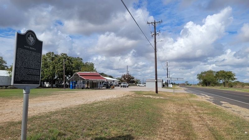
Located in far eastern Bexar County, Saint Hedwig was settled in 1855 by immigrants from Upper Silesia in Prussian Poland. Without land grants, funding or transportation provided by an empresario, establishing a community proved to be difficult for . . . — — Map (db m234990) HM
Once called "bobwire" by cowboys, barbed wire was a French invention first patented in the U.S., in 1867, but it did not gain favor with cattlemen until late 1870s. Joseph Glidden of Dekalb, Illinois, received a patent for his barbed wire in 1874, . . . — — Map (db m30607) HM
David Crockett was a frontiersman who became a well-known politician and humorist in early 19th Century America. In a period of history that celebrated the rise of the common man, no common man rose higher from such humble beginnings. "Davy" . . . — — Map (db m188527) HM
All great nations have creation myths, the Republic of Texas was no different. Born in New Haven, Connecticut, Emily D. West was a free woman of mixed race. In 1835, she signed a one-year contract in New York City agreeing to work as a housekeeper . . . — — Map (db m232623) HM WM
On Alamo Plaza at East Houston Street on Alamo Plaza.
Hendrick Arnold, a free man of mixed race, emigrated from Mississippi in 1826, settling with his parents in Austin's Colony on the Brazos River. He played a key role in the Texas Revolution as a guide and spy for the Texian Army.
By 1835, . . . — — Map (db m232678) HM WM
James Bowie represented the fluid nature of the frontier, born in Kentucky but living in Missouri and Louisiana before finally settling in Texas. Along the way, he gained a reputation as a deadly duelist with a knife.
Bowie traveled to Texas . . . — — Map (db m188534) HM
On Alamo Plaza at East Houston Street on Alamo Plaza.
Virginia-born John William Smith gained fame for the role he played in early Texas history. Smith, nicknamed "El Colorado" for his red hair, arrived in Texas in 1827 and settled in San Antonio de Béxar. He became fluent in Spanish, moving easily . . . — — Map (db m188529) HM
Mills were used to grind grain such as corn or wheat into meal or flour for use as food. The grain was poured into the hopper which funneled it through the eye in the top millstone. Water drove the waterwheel which turned the top millstone. The top . . . — — Map (db m30749) HM
This is the ruins of the habitations of the friars and Indians; refrectory, kitchen and other regular offices. In the second patio there was a gallery with weaving rooms and rooms for storing materials and utensils.
The habitations of the . . . — — Map (db m30742) HM
When these buildings were built, Texas was part of the Spanish colony of New Spain. The buildings were part of the Mission San Antonio de Valero, established by Franciscan missionaries in order to convert the Native Americans living in the vicinity . . . — — Map (db m30774) HM
A native of Tennessee, Susannah Dickinson and her husband, Almeron, settled in Gonzales, Texas in 1831. The couple had one daughter, Angelina, prior to the Texas Revolution. Living in San Antonio de Béxar in February 1836, the family took shelter in . . . — — Map (db m188533) HM
In commemoration of the
150th Anniversary of Texas Independence
and in honor of the
Tennessee Volunteers
who gave their lives at the Alamo
on March 6, 1836
the Citizens of Tennessee
present this Tennessee Homecoming Tree and Plaque . . . — — Map (db m30775) HM
Corrals for cattle and horses occupied this space during the famous 1836 Siege and Battle of the Alamo. Small fortifications provided cover for the Texans during the siege. The structures shown in the illustration are (left to right) the church, the . . . — — Map (db m30714) HM
The church of former Mission San Antonio de Valero had been converted into a powder magazine and artillery platform by the Mexican Army in the autumn of 1835 during the Siege of Béxar. Following the capture of the town in early December 1835, Texan . . . — — Map (db m30736) HM
On Alamo Plaza, on the right when traveling north. Reported missing.
The fortress known to history as “The Alamo” was originally built by the Spanish in the 18th Century. Named Mission San Antonio de Valero by Franciscan officials, the mission occupied this site from 1724 until it was closed in 1793. The mission . . . — — Map (db m30824) HM
On Crockett Street at Alamo Plaza, on the right when traveling west on Crockett Street.
One of the weakest points of the fortified former mission was an open space between the old church and the Low Barrack. During the Siege of Béxar, Mexican troops constructed a palisade, or double log-wall, to close the exposed area. The Texans . . . — — Map (db m30857) HM
Near East Johnson Street west of King William Street, on the right when traveling west.
The river followed an irregular course through the town center and irrigated the lower farmlands of Mission San Antonio de Valero (the Alamo) to the south. After the mission was secularized 1793, the surrounding fields were distributed to . . . — — Map (db m118908) HM
On King William Street at Washington Street, on the right when traveling south on King William Street.
The King William neighborhood is located on the former farmlands of Mission San Antonio de Valero (the Alamo). The 216-acre area, less than one mile from the former mission, includes two National Register districts. It is bounded generally by Cesar . . . — — Map (db m235053) HM
Near Navarro Street north of Hagner Arc, on the right when traveling north.
The San Antonio River begins four miles north of here, fed by springs that rise from the Edwards Aquifer deep below the Texas Hill Country. The river is also fed by tributaries along its winding, southeasterly course to join the Guadalupe River . . . — — Map (db m125627) HM
On Alamo Street at Commerce Street on Alamo Street.
Area was first explored and named by Spaniards in 1691. Colonial settlement began here May 1-5, 1718, with founding of Franciscan Mission San Antonio de Valero (later known as "The Alamo"). In vicinity of the mission was the Presidio San Antonio . . . — — Map (db m30588) HM
On Starr Street at Elm Street, on the left on Starr Street.
Anna Barbara (Heiman) (1828-1913) and Johann Engelbert (1821-1915) Heidgen (also Heitgen) came from Prussia to San Antonio in 1852. They bought property at this site, which at the time was on the eastern edge of the Irish Flats neighborhood.
. . . — — Map (db m235106) HM
Near South St. Mary's Street north of Villita Street, on the right when traveling north.
The narrow strip of land known to residents in the middle 1800s as Galveston Island was actually a peninsula surrounded on three sides by a bend in the San Antonio River. It was called an island because the fourth side was almost completely closed . . . — — Map (db m128527) HM
This tract of land is a natural peninsula in the San Antonio River. It once was bounded by the river on three sides and on the fourth by the Concepcion Acequia. In 1845 John Bowen, a native of Philadelphia, bought the property from Maria Josefa . . . — — Map (db m30864) HM
Near East Commerce Street, 0.1 miles east of South Alamo Street, on the left when traveling west.
Spain, which ruled Mexico for 300 years ending in 1821, paid little attention to its northeastern frontier until French settlers built outposts near the Red River in Louisiana. The Spanish responded by establishing missions in East Texas in the . . . — — Map (db m119601) HM
Near Villita Street at King Philip Alley, on the right when traveling west.
This marker commemorates the 275th anniversary of the naming of the site that became the city of San Antonio.
On the feast of St. Anthony of Padua, June 13, 1691, Padre Damian Massanet, Franciscan missionary and Governor Don Domingo Teran, . . . — — Map (db m82890) HM
Near South Presa Street south of West Market Street.
Spanish missionaries, soldiers, and families who settled San Antonio in the 1700s relied on the San Antonio River and irrigation ditches (acequias) to provide water for household and agricultural use. One of the earliest ditches, the Pajalache . . . — — Map (db m128817) HM
Near Lexington Avenue north of Avenue A, on the right when traveling north.
The isolated Spanish outpost established a short distance northwest of here in 1718 was soon relocated to a more protected area between the river and San Pedro Creek in today's center city. The mission and its religious community were placed east of . . . — — Map (db m119599) HM
Near Navarro Street west of North Presa Street when traveling east.
Ferdinand Ludwig Von Herff (1820-1912) was the son of Christian and Eleanora (Von Meusebach) Herff, prominent citizens of Darmstadt, Germany. The younger Von Herff studied in Giessen, Bonn and Berlin, graduating with a medical degree in 1843. He . . . — — Map (db m30554) HM
Near East Commerce Street, 0.1 miles east of South Alamo Street, on the left when traveling west.
San Antonio is named for the Catholic saint, Anthony (San Antonio) of Padua. Born in Portugal in 1195, he joined the Franciscan order and became a celebrated teacher of scripture. Anthony was declared a saint in 1232, less than a year after his . . . — — Map (db m119600) HM
Near San Antonio River Walk, 0.1 miles east of North St. Mary's Street when traveling east.
Many immigrants from both the United States and Europe were attracted to the Republic of Texas after it became independent from Mexico in 1836. Among the new Texans were missionaries of various faiths, including the French Catholic priest Jean . . . — — Map (db m118178) HM
San Antonio's original water system, started in 1718, consisted of eight acequias or canals taking water from the San Antonio River and San Pedro Crek. These acequias extended 15 miles from the headwaters of the San Antonio River to the five . . . — — Map (db m30711) HM
On Camaron Street, 0.1 miles north of West Houston Street, on the left when traveling north.
The Community Grew Slowly in the years after its founding in 1718. In the earliest years of this community of New Spain, military and civilian residents intermingled, and there was no organized civilian settlement. By royal decree, municipal . . . — — Map (db m225449) HM
Near Lexington Avenue north of Avenue A, on the right when traveling north.
San Antonio grew from a small Spanish colonial town to a bustling American city between 1800 and 1900. Years of fighting for independence - first from Spain and then from Mexico - left San Antonio in ruins.
Rebuilding began during the Republic . . . — — Map (db m119619) HM
Near Lexington Avenue north of Avenue A, on the right when traveling north.
The San Antonio River begins four miles north of here, fed by springs that rise from the Edwards Aquifer deep below the Texas Hill Country. The river is also fed by tributaries along its winding, southeasterly course to join the Guadalupe River . . . — — Map (db m119617) HM
Near East Travis Street west of North Saint Mary's Street, on the right when traveling east.
County leaders purchased land on the west bank of the San Antonio River in 1859, intending to build a new courthouse and jail. Their plans changed and the property was sold in 1866 to a miller, Jacob Laux, who dammed the river and built a . . . — — Map (db m119162) HM
Near North St. Mary's Street, 0.1 miles north of West Crocket Street, on the right when traveling south.
Irish immigrant John Twohig built his house here on the San Antonio River in the late 1840s. A suspended footbridge connected the house with his business on the opposite side of the river.
Twohig became known as the “breadline . . . — — Map (db m119550) HM
On East Houston Street at Navarro Street, on the right when traveling east on East Houston Street.
Originally the unpaved El Paseo or Paseo Hondo, Houston Street had developed into San Antonio's premier retail and theater district by the early 20th century. Many spectacular commercial buildings from this era have been preserved. Follow the . . . — — Map (db m227696) HM
Daughter of Erastus "Deaf" Smith and wife of James Nathaniel Fisk. Born in San Antonio October 28, 1829 - Died November 11, 1890 — — Map (db m208481) HM
The houses preserved as the Ellis Alley Enclave are what remain of one of the first settlements of African Americans in San Antonio after Emancipation.
Originally part of a Spanish land grant, much of the area was acquired by Dr. Anthony . . . — — Map (db m245205) HM
"It is truthfully the best of the Americas, and not in the like of the others; nor in all the frontier does the King have an outpost better constructed and easier to defend..."
Fr. Juan Agustín de Morfi, 1777-78
Mission San José and its . . . — — Map (db m33997) HM
The missions of San Antonio were far more than just churches, they were communities. Each was a fortified village, with its own church, farm, and ranch. Here, Franciscan friars gathered native peoples, converted them to Catholicism, taught them to . . . — — Map (db m33990) HM
"The church...is a large, beautiful gallery of three vaults with a very pretty cupola...for its size and good taste, it could be the parish church of a great town."
Fr. Juan Agustín de Morfi, 1777-78
The church was central to the . . . — — Map (db m34077) HM
"From this roof one can hunt without risk, in comfort and with good success. I saw so many ducks, geese, and cranes in a nearby field that, as I said, they covered the ground, and so close to the house that it would be impossible to miss the . . . — — Map (db m34065) HM
This road linked the mission of San Antonio with each other and with the rest of Texas and Mexico. The Mission Road carried information, supplies and trade goods, and warnings of attack or danger. Some of the travel routes used by residents of the . . . — — Map (db m33985) HM
Near South Alamo Street at East Nueva Street, on the right when traveling north.
Mayer Halff (1836-1905) immigrated to Texas from Lauterborg, Alsace Lorraine, France, in 1850. In partnership with his brother Solomon, he opened a mercantile business in Liberty and began a cattle ranching enterprise. They moved to San Antonio in . . . — — Map (db m82808) HM
There is something in the nature of man that will not tolerate the unexplored. Always he finds his perimeter of ground too small, and restless stirrings prod his feet until he has gazed from every peak.
Following this elusive music hundreds of . . . — — Map (db m30215) HM
Otto Bombach, a carpenter, built this combination house and store in 1856 before moving to Mexico. His wife lived here and managed the property until it was sold in 1869. Victor Bracht, author of Texas in 1848, lived here briefly, and in . . . — — Map (db m82888) HM
On Villita Street west of King Philip Alley, on the left when traveling west.
Margarita Pérez de Rodríguez, consort of Compañía de Béxar soldier Jose Antonio Rodríguez, was given this land "in satisfaction of her constitutional allowance." She sold the property in 1851 to San Antonio postmaster John Bowen, who conveyed it to . . . — — Map (db m82896) HM
On Villita Street west of South Alamo Street, on the right when traveling west.
José Amador was given this property by the Spanish Government in 1817. His heirs sold it to P.L. Buquor in 1847. Later that year, James Gray bought the land and built this house, which he sold to French consul Francois Guilbeau in 1853. Another . . . — — Map (db m82893) HM
Near King Philip Alley south of Villita Street, on the right when traveling south.
The Curbier Family, which was granted land in La Villita after the 1819 flood, sold this property in 1854 to Rafael Herrera, husband of their daughter Vicenta. Herrera built this house and owned it until 1897. The property, which extended back to . . . — — Map (db m82900) HM
Near South Presa Street south of Villita Street, on the right when traveling north.
Juana Francisca Montes de Flores inherited this property from her husband, Jose Leonardo de la Garza, and sold it to Ernest Hessler in 1869. Hessler built this house before 1873, when it appears on the city map. He never lived here, and in 1891 sold . . . — — Map (db m82912) HM
Near South Presa Street south of Villita Street, on the right when traveling north.
Like 208 South Presa, which it resembles, this house was probably built shortly after 1869 on land purchased by Ernest Hessler from Juana Francisca Montes de Flores. The structure, which appears on the 1873 city map, was rented when Louis Foutrel . . . — — Map (db m82913) HM
On King Philip Alley at East Nueva Street, on the right when traveling north on King Philip Alley.
Great early San Antonio leader, a native of North Carolina. Moved to Illinois, then to Missouri, where he was sheriff of Rawls County in 1824. Came to Texas with Green DeWitt in 1826 and settled at Gonzales.
Smith moved to San Antonio in 1828 . . . — — Map (db m82880) HM
Near King Philip Alley south of Villita Street, on the right when traveling south.
As early as 1877, this land was the site of an adobe residence where Mrs. Kate Womble operated a boarding house popular among travelers to San Antonio. The house appeared on the 1873 city map. The Sanborn Insurance maps show it as late as 1904. The . . . — — Map (db m82910) HM
On South Alamo Street at Villita Street, on the right when traveling south on South Alamo Street.
La Villita, “The Little Village”, settled about 1722 as “The Town of the Alamo". Here General Martin de Perfecto Cos signed the Articles of Capitulation to Texians December 11, 1835 and General Santa Anna's artillery battery . . . — — Map (db m82886) HM
Near King Philip V north of Villita Street when traveling north.
La Villita, located on the south bank of the San Antonio River a short distance south of Mission San Antonio de Valero (the Alamo), was settled in the 1700s. Situated on the river’s high bank near the mission, villa, and presidio, the area was . . . — — Map (db m128808) HM
On Villita Street at King Philip Alley, on the left when traveling west on Villita Street.
Mariano Romano Losana bought this land in 1859, and probably built this house soon afterward. It was purchased by Rafael Lopez in l866 and sold again in 1871, when the deed referred to “the house, out houses, fences and all other . . . — — Map (db m82894) HM
Near King Philip Alley south of Villita Street, on the right when traveling south.
This house appears on the 1873 city map and was probably built by José and Refugia Durán Tejada, who bought the land in 1855 from Concepción Ruiz. Ernest Hessler, who already owned the two houses to the west on Presa Street, bought the property in . . . — — Map (db m82911) HM
On Villita Street west of South Alamo Street, on the right when traveling west.
Colonel Jeremiah Y. Dashiell, a physician who served as paymaster in the U.S.-Mexico War, bought this land on the San Antonio River in 1849. Dashiell was stationed in South Carolina in 1856, when he sent his wife and daughter money and instructions . . . — — Map (db m82892) HM
On South Alamo Street south of East Nueva Street, on the right when traveling south.
Erected as a school for children of German settlers, these historic buildings have served numerous educational and cultural purposes:
1858 – German–English school founded by "The Lateiner”, a group of German intellectuals. . . . — — Map (db m82882) HM
Near South Presa Street south of Villita Street, on the right when traveling north.
This property was the site of a small caliche house that stood at 105 Nacional Street. Because of its poor condition, the house was demolished during the restoration of La Villita in 1939. The property had been owned by José Maria Monjaras and . . . — — Map (db m82914) HM
On Dolorosa at South Main Avenue, on the left when traveling west on Dolorosa.
56 Canary Islanders founded a village, "San Fernando de Béjar", after arriving March 9, 1731.
They walked nearly 1,200 miles from Veracruz, with children, livestock and all their worldly possessions, for more than six months after a . . . — — Map (db m179534) HM
On Dwyer Avenue at Dolorosa, on the left when traveling north on Dwyer Avenue.
In years gone by, the southern portion of Main Plaza was devoted to the restaurant purposes of the Mexicans, and there one could obtain at any time a plate of chili-con-carne, frijoles, tamales, or whatever his taste might crave in the way of . . . — — Map (db m30206) HM
On East Nueva Street at South Main Avenue, on the right when traveling west on East Nueva Street. Reported missing.
The administrative government of Bexar County, besides being the oldest in Texas, is distinguished by having served under nine governments. The community served under Spanish rule from May, 1718, until January, 1811, when it was taken over by . . . — — Map (db m53972) HM
During March 5 through 9, 1981, the City of San Antonio commemorated the 250th anniversary of the arrival of sixteen immigrant families from the Canary Islands to the Presidio of San Antonio de Bejar and the transfer of three Franciscan missions . . . — — Map (db m179544) HM
We strolled into a Justice’s Court the other day, and were reminded of the time when God smote the children of men with a confusion of tongues. A German was complained of by a Mexican, and a Frenchman was the witness. Each spoke his native tongue . . . — — Map (db m30208) HM
On East Commerce Street at Soledad Street, on the left when traveling west on East Commerce Street.
Spanish urban planners in the New World knew how to create a vibrant community: its two interconnected building blocks were a cathedral and a plaza.
This spatial structure compelled the citizens of New Spain to revolve around a civic center, . . . — — Map (db m118154) HM
On East Commerce Street at North Main Avenue, on the left when traveling west on East Commerce Street.
Long the spiritual heart, government center, and social hub of San Antonio, Plaza de las Islas (Main Plaza) began to lose its centrality in the late nineteenth century. Railroads and trolleys reorganized the city's commercial activity by enabling . . . — — Map (db m245183) HM
On Dwyer Avenue at Kallison Walk, on the right when traveling north on Dwyer Avenue.
During the Main Plaza renovation in 2007, archaeologists discovered remnants of a military fortification underneath this street. This entrenchment would have been part of San Antonio's defense against attacks during the turbulent revolutionary . . . — — Map (db m30214) HM
On Plaza de Armas south of West Commerce Street, on the left when traveling south.
(Panel 1)
Born in Connecticut, October fourth 1761; moved to Philadelphia in 1783, thence to Virginia in 1785 and to Missouri in 1798.
Arrived in San Antonio on December 23, 1820.
Died in Missouri June tenth, 1821.
(Panel . . . — — Map (db m119803) HM
On West Nueva Street east of South Main Avenue, on the right when traveling west.
Born in San Antonio; descendant of Frenchman who settled in Mexico before 1714. Always a civic leader, helped found first public school in San Antonio, 1812.
Went (1821) with Juan M. Veramendi to escort Austin Colony leaders to Bexar, and . . . — — Map (db m118112) HM
On Military Plaza north of Dolorosa, on the right when traveling south.
One of oldest permanently settled locales in Texas, this area was first explored by Spaniards in 1691. The Presidio (Fort) of Bexar was relocated here in 1772 and for many years, Plaza was enclosed on three sides by adobe fortifications.
During . . . — — Map (db m118117) HM
The remains of the Alamo Heroes
are entombed in the chapel at the
left-hand side of the entrance to
this cathedral
Visitors Welcome — — Map (db m30343) HM
On Dwyer Avenue at Kallison Walk, on the right when traveling north on Dwyer Avenue.
Organized Nov. 1862, by act of Texas Legislature, incorporated 1863. Had store at this site. Its $44,000 capital included $8,000 subscribed by the city for its needy and for families of Confederates away in the Civil War. Aim of group was to keep . . . — — Map (db m30210) HM
To commemorate
the two hundredth anniversary of
the laying of the corner stone
of
San Fernando Cathedral
First place of worship for Texans. Built
through the generosity and zeal of the
Canary Islanders, founders of San Antonio . . . — — Map (db m30333) HM
On Commerce Street at Main Plaza, on the left when traveling west on Commerce Street.
Thomas Claiborne Frost (1833-1903) came to Texas from Alabama in 1855 to teach at Austin College, Huntsville. Admitted to the Bar in 1856, he served as a Texas Ranger before setting up a law practice in Comanche County. He was a delegate to the . . . — — Map (db m30223) HM
On Dolorosa at South Main Street, on the left when traveling west on Dolorosa.
The San Pedro Acequia (circa 1730), seen in this exposed fragment, was the largest of the seven canals that supplied water to the early settlers of San Antonio. Dug by Indians under the supervision of the Spaniards, these acequias extended the . . . — — Map (db m179553) HM
On Dolorosa at Main Plaza, on the right when traveling east on Dolorosa.
Earliest civilian colonists of San Antonio, this nucleus of pioneers from the Canary Islands formed the first organized civil government in Texas and founded the village of San Fernando de Bexar in 1731.
Following a sea and land voyage of over . . . — — Map (db m30194) HM
On Commerce Street at Main Avenue, on the left when traveling west on Commerce Street.
Mexico’s last invasion of the Republic of Texas alarmed San Antonio on Sept. 11, 1842, when Gen. Adrian Woll and 1300 troops struck the city from the west.
Awakened by booming cannon, 56 Texians (including judge, jurors, and citizens in town to . . . — — Map (db m30325) HM
On Old Pearsall Road (Farm to Market Road 2536) 0.1 miles east of Edwards Road, on the right when traveling west.
Anton F. Krause and Johanna Roesler emigrated from Austria to Texas in 1854. Like many new arrivals, they walked most of the way from the Texas coast to San Antonio where they were married in the San Fernando Church in May 1855. In 1875 they sold . . . — — Map (db m179926) HM
On Allison Road at Anastacia Place, on the left when traveling south on Allison Road.
In the late 1700s, residents of the Villa de San Fernando petitioned the King of Spain for permission to furrow an acequia (irrigation ditch) to water the land for the growing population. After years of opposition from the San Antonio de Valero . . . — — Map (db m213326) HM
On North Saint Mary's Street north of Alpine, on the right when traveling south.
In 1920 City Parks Commissioner Ray Lambert approved the building of The Mexican Village where the Aguilar, Rangel and Poio families lived in the 20th century. The stone buildings with thatched roofs were constructed near the base of the Alamo . . . — — Map (db m211719) HM
Near East North Loop Road, 0.2 miles west of Wurzbach Parkway.
Came from South Carolina to Texas in 1834. Served in Battle of San Jacinto in Texas War for Independence, 1836. Was one of a party with Deaf Smith that destroyed Vince's bridge near Pasadena. This deed may have kept Santa Anna's army from retreat . . . — — Map (db m177129) HM
Near East North Loop Road, 0.2 miles west of Wurzbach Parkway.
Malinda Brown Coker, wife of Joseph Coker, was born in 1811. She died May 24, 1853 and is buried in City Cemetery, Jacksonville, Texas.
Malinda died enroute to this land as she, her husband Joseph, and family were traveling from Alabama to . . . — — Map (db m177127) HM
On Leal Road, 0.1 miles north of Martinez Losoya Road, on the left when traveling north.
Numerous 19th-century journals and other written historical accounts trace the origin of this cemetery to the burial of casualties of the Battle of Medina. Fought on August 18, 1813, the battle was the result of a failed attempt by a Republican Army . . . — — Map (db m208257) HM
On this spot early pioneers of San Antonio gathered in time of danger and also when they came to worship in the chapel of San Francisco de la Espada.
This lot was donated to the Archdiocese of San Antonio by the heirs of Josefa de la Garza . . . — — Map (db m132595) HM
The Texas A&M University-San Antonio Campus was built on land that once was conveyed by Spanish and Mexican land grants and traversed by several branches of El Camino Real de Tierra Afuera del Oriente (also known as El Camino Real de los Tejas . . . — — Map (db m98241) HM
On New Sulphur Springs Road, on the right when traveling south.
John B. Cover (1857-1914) and his wife, Virginia Steele Cover (1860-1925), donated land in the late 1800s that became the Cover Cemetery. The oldest marked grave is dated Nov. 1896. Many cover family members, close friends and veterans are buried . . . — — Map (db m206784) HM
On Valhalla at Winged Foot, on the left when traveling south on Valhalla.
The Historic Evans Road Trail (Harrison Segment) follows or borders the southern reach of the historic Evans Road within the Selma City limits. Modern day Evans Road runs from Stone Oak Parkway in San Antonio to the Selma Visitor's Center in Selma. . . . — — Map (db m195464) HM
On Pinseeker at Winged Foot, on the left when traveling south on Pinseeker.
The Historic Evans Road Trail (Harrison Segment) follows or borders the southern reach of the historic Evans Road within the Selma City limits. Modern day Evans Road runs from Stone Oak Parkway in San Antonio to the Selma Visitor's Center in Selma. . . . — — Map (db m195789) HM
On Winged Foot at Pinseeker, on the left when traveling south on Winged Foot.
The Harrison House was built by John S. and Martha Jane Harrison in 1852. In June 1851 John established Star Route 6285 from Austin to San Antonio with stages stopping at the nearby Harrison & McCulloch Stage Stop believed to be built in 1850. The . . . — — Map (db m195518) HM
As was common for rural families during the early occupation of the Harrison property, hunting deer and raising cattle and hogs for meat was practiced. Central to the process of preparing various meats for the family was the Smoke House. The Smoke . . . — — Map (db m195811) HM
On Peyton Colony Road, 0.2 miles north of Farm to Market Road 165, on the left when traveling north.
In 1865, a group of freed persons, led by Peyton Roberts, established a community they named Peyton Colony. Roberts was born into slavery in Virginia. In the 1820s, he came to Texas with his owner, Jeremiah Roberts, settling in the Bastrop and . . . — — Map (db m194063) HM
On Settlement Road, 0.2 miles west of South Lady Bird Lane.
Abundant timber, "stirrup-high" grass, and seemingly adequate water lured the hill country's first settlers to this land. But the land deceived. Only a thin layer of poor soil sustained this lush landscape.
The virgin grasses that attracted the . . . — — Map (db m236531) HM
On Main Street (U.S. 290) at Plum Short on Main Street.
Because of his love for this land, respect for his ancestors who settled here, and his devotion to both, Lyndon Johnson has been called the "last of the frontier presidents."
Confederate veteran Samuel Ealy Johnson, Sr., and his wife Eliza . . . — — Map (db m236532) HM
3548 entries matched your criteria. Entries 201 through 300 are listed above. ⊲ Previous 100 — Next 100 ⊳