During the war of 1812, Gananoque was a strategic point along the St. Lawrence River corridor. All supplies heading west to support British and Canadian forces had to pass through this channel.
On September 21, 1812, a company of U.S. army . . . — — Map (db m90003) HM
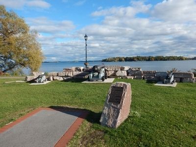
Eastern Ontario's first Court House and Gaol was constructed on the waterfront south of this site between 1795 and 1797. The complex included a chamber for the District Court on the upper floor as well as cells and a room for the jailer on the lower . . . — — Map (db m86949) HM
During the War of 1812 the St. Lawrence was the life-line of Upper Canada along which virtually all military and civilian supplies were transported from Montréal to Kingston. Fear that the Americans might attempt to block the passage of materiel . . . — — Map (db m87163) HM
On the morning of February 22, 1813, Lieutenant-Colonel "Red George" Macdonell of the Glengarry Light Infantry set out from Prescott with a force of some 480 regulars and militia to capture the strong United States military post at Ogdensburg. The . . . — — Map (db m86971) HM
English: The first Fort Wellington was erected on this site during the War of 1812 to shelter British regular troops and Canadian militia defending the vital St. Lawrence River transportation route. In February 1813 those soldiers crossed . . . — — Map (db m209406) HM
The front portion of this structure one of the earliest surviving military buildings in Ontario, was constructed as a residence about 1810 by Colonel Edward Jessup, the founder of Prescott. Following the outbreak of the War of 1812, the stone house . . . — — Map (db m86950) HM
Lieut. Colonel 'Red' George Macdonnell crossed the frozen river
with 500 men and some light guns mounted on sleighs in a raid on
Ogdensburgh, New York. The capture of the village was a British
victory that removed the American threat to . . . — — Map (db m242865) HM
The War of 1812 had shown that a successful defence of Canada against an American attack depended upon secure supply lines. The Rideau Canal was built as an alternate to the easily attacked St. Lawrence supply route. Blockhouses were . . . — — Map (db m207659) HM
Opposite here is the gap between Amherst Island and the eastern tip of Prince Edward County. On November 9, 1812, the British Corvette "Royal George" (22 guns), commanded by Commodore Hugh Earl(e), was intercepted off False Duck Islands by an . . . — — Map (db m83643) HM
English
Here was fought the Battle of Longwoods, 4th March, 1814. United States troops were entrenched on this hill. The British losses were Captain D. Johnson and Lieutenant P. Graeme and twelve men of the Royal Scots Light Company and . . . — — Map (db m78370) HM
The view from the British side (left side)
Commanded by Captain James Basden
Royal Scots Light • Western (Caldwell) Rangers • 89th Foot Light • Kent and Middlesex Militia • British Indian Department
On March 3, 1814, the . . . — — Map (db m78369) HM WM
Following the War of 1812 expeditions traversed the wilderness between Lakes Simcoe and Muskoka and the Ottawa River, seeking a route across Upper Canada less open to attack than by the St. Lawrence and Lake Ontario. In 1819 Lieut. J.P. Catty, R.E., . . . — — Map (db m144822) HM
[Text on the West Side]:
Battle of Chippawa
5 July 1814
In memory of all those who fought on this ground, many of whom are buried nearby,
and to commemorate the peace that has prevailed between Canada and the . . . — — Map (db m49393) HM
On these fields and the surrounding woods 4,000 American, British, Canadian and Native forces fought the first major battle of the Niagara campaign of 1814. When the last shots died away on Samuel Street's farm, more than 800 lay dead and wounded. . . . — — Map (db m49398) HM
At dawn 5 July 1814, parties of Canadian-Militia and British allied Native Warriors scouted the American camp. They began sniping from the bushes on the north side of Street's Creek and this continued throughout the morning. Around noon, General . . . — — Map (db m49399) HM
Major General Phineas Riall, the British commander, had repaired the bridge over the Chippawa and ordered his own Regular light infantry, the local Canadians of the 2nd Lincoln Militia and a force of Native Warriors, to clear out the now scattered . . . — — Map (db m49400) HM
British General Riall was convinced that the greater part of Brown's army was still surrounding Fort Erie. He did not know the Fort had surrendered and he was facing the entire U.S. division. Still, the number of men deployed on both sides was . . . — — Map (db m49402) HM
As the battle raged, more American artillery deployed to the middle of the plain between the 11th U.S. and the lone 25th U.S. company, less than 100 meters (109 yards) from the British line. General Brown then led Ripley's brigade across Street's . . . — — Map (db m49403) HM
The Aftermath. In the days following the battle, General Brown's victorious troops advanced another 25 kilometers (18 miles) north to Fort George before retiring back to Niagara Falls when more British troops arrived in the area. They met the . . . — — Map (db m49404) HM
The fortifications which stood on this site were built in 1791 to protect the southern terminus of the Niagara portage road, and serve as a forwarding depot for government supplies. Known also as Fort Welland, the main structure consisted of a log . . . — — Map (db m49164) HM
At daybreak on July 5, 1813, a British and Canadian force, consisting of some 35 militia and a small detachment of the 49th Regiment, embarked in this vicinity to attack Fort Schlosser. This American depot (now within Niagara Falls, New York) was . . . — — Map (db m49163) HM
Here, on 5 July 1814, an American army under Major-General Jacob Brown launched the last major invasion of Canada during the War of 1812. The Americans defeated a British and Canadian force commanded by Major-General Phineas Riall consisting of . . . — — Map (db m49050) HM
On this site was fought
The Battle of Chippawa
July 5, 1814.
Preservation of the Battleground
was made possible by
The Niagara Parks Commission
with the cooperation of
Frank and Mildred Branscombe,
River Realty . . . — — Map (db m49460) HM
In 1792-94 a village grew up near Fort Chippawa on Chippawa Creek at the end of the new portage road from Queenston. In 1793 the creek was renamed the Welland River, but the village, where a post-office was opened before 1801, remained "Chippawa". . . . — — Map (db m54124) HM
On the night of August 12, 1814 seventy seamen and marines, led by Captain Alexander T. Dobbs, R.N.,embarked in this vicinity to attempt the capture of three armed U.S. schooners lying off American-held Fort Erie. One of the six boats used had been . . . — — Map (db m53441) HM
On the night of 12 August 1814, as a prelude to a British attack on Fort Erie, an expedition was mounted against three armed American schooners anchored off the fort. Captain Alexander Dobbs, R.N., embarked with 70 seamen and marines in six batteaux . . . — — Map (db m48913) HM
Three fortifications occupied this site. The first (1764-1779) and second (c. 1783-1803), located at lower levels, were abandoned when ice and water inundated the works. The third Fort Erie, built between 1805 and 1808, was repaired in January 1814 . . . — — Map (db m48912) HM
[Text on the base of the Cairn];
Here are buried
150 British Officers and Men
Who fell in the attack on Fort Erie
On the 26th day of August, 1814, and three
of the defenders, men of the United States
Infantry, whose remains . . . — — Map (db m54139) HM
In an effort to regain the initiative lost at Queenston, the Americans planned a general invasion for 28 November 1812. Before dawn advance parties crossed the Niagara River to cut communications between Fort Erie and Chippawa and to silence the . . . — — Map (db m49049) HM
[English Text]: Engagement at the Forty
Here at the Forty Mile Creek, on 8th June, 1813, American forces, retreating after the Battle of Stoney Creek, were bombarded by a British flotilla under Sir James Lucas Yeo.
Indians and . . . — — Map (db m56704) HM
We dedicate this flagpole to the
Grimsby 1812 Bicentennial peace garden
in honour of the "Encounter at the Forty"
at this site on June 8, 1813, a turning point in
the War of 1812 by the United States and the British.
Also, to celebrate 200 . . . — — Map (db m56993) HM
We dedicate this gazebo to the Grimsby 1812 Bicentennial Peace Garden and to the residents of Grimsby, In commemoration of 200 years of peace between Canada and the United States.
The design of the gazebo was inspired by elements of Fort George . . . — — Map (db m57034) HM
Grimsby Remembers
The War of 1812
Engagement at the Forty: June 8, 1813
By the afternoon of June 6th the American army at least 3,300 strong were in full retreat, in total confusion, from the battle at Stoney Creek. Both General Winder . . . — — Map (db m233784) HM
During the War of 1812 the Mennonite congregation meeting on this site included members who followed their conscience and refused to serve in the military. Other Mennonite settlements in Niagara, Rainham, Markham and Waterloo faced the same issue at . . . — — Map (db m245739) HM
After this fierce and bloody battle, General Brown ordered the American withdrawal southward. The American forces were not expelled from the position they won, but retired voluntarily. The British regained possession of the battlefield, but were in . . . — — Map (db m139920) HM
Around midnight, with both sides completely exhausted, the Americans withdrew to their camp at Chippawa. They left the British guns behind, allowing Drummond to reclaim them the following morning. “At the Falls of the Niagara we met the enemy . . . — — Map (db m139936) HM
Adam Fralick, a descendent of a United Empire Loyalist family, watched as the tourist industry grew around the War of 1812 battlefield at Lundy’s Lane. In 1836, he purchased this property and built the Battle Ground Hotel. Later, in 1850, Fralick . . . — — Map (db m139940) HM
This was the site of the bloodiest battle of the War of 1812. On the afternoon of 25th July, 1814, Lieutenant-General Gordon Drummond with about 2800 men engaged the invading American army which had recently been victorious at Chippawa. The . . . — — Map (db m49053) HM
The Battle of Lundy’s Lane was a turning Point in the War of 1812-14. While British reinforcements began arriving in North America following the defeat of Napoleon in Europe, the Americans were pushing to gain control of the Niagara Peninsula with . . . — — Map (db m139921) HM
Following the close of the War of 1812, because both sides claimed victory here, the battlefield became a popular tourist destination. For many decades, veterans of the battle were available to conduct personal tours. In 1845, the first of five . . . — — Map (db m139943) HM
In the late 1790's the river flowed swiftly around these islands. The Bridgewater Mills, a water powered saw and grist mill and an iron foundry, where the first bar iron was made in Canada, were located here. The Mills were burned by the retreating . . . — — Map (db m53402) HM
Following the capture of his artillery by the Americans, Lt. General Drummond and his troops retreated from their defensive position on the height of land in the cemetery to this area on the north side of the hill. Starting before 10 p.m. and . . . — — Map (db m139914) HM
In 1786 John Burch, a United Empire loyalist, constructed a water-powered grist and sawmill on this site. He was the first to use the waters on the west bank of the Niagara River for industrial purposes. The mills were burned by the retreating . . . — — Map (db m79766) HM
In memory of Lt. Col. Cecil Bishopp who died of wounds received during the raid on Black Rock, New York, July 11, 1813 during the War of 1812. He was buried in this cemetery on July 17, 1813. In 1846 Bishopp’s two sisters erected this memorial in . . . — — Map (db m139969) HM
As early as 1795, a small log church, used by a number of denominations, was on top of this hill. Destroyed during the Battle of Lundy’s Lane on July 25, 1814, it was not replaced until 1819 when a combination church and schoolhouse was constructed . . . — — Map (db m139955) HM
Drummond Hill Presbyterian Church Present during the Battle of Lundy’s Lane, a former church once sat at the north east end of the cemetery. Built in 1887 by A.J. Lowell, the current church was then modernized in 1961. Captain Abraham Hull & . . . — — Map (db m139932) HM
“ In the centre the repeated and determined attacks of the enemy were met by the 89th Regiment, the detachments of the Royals and King’s and the Light Company of the 41st, with the most perfect steadiness and intrepid gallantry, and the . . . — — Map (db m139922) HM
Early on the morning of July 26th, 1814, Lieutenant-General Sir Gordon Drummond awaited another attack on the Lundy's Lane hill near Niagara Falls. Throughout the previous night, this hill had been taken and retaken in the bloodiest, most hard . . . — — Map (db m49693) HM
On the evening of July 25, 1814, Col. James Miller, commander of the 21st US Infantry Regiment, was asked if his regiment could silence the seven British guns that had been holding the attacking American Army at bay for several hours. Miller replied . . . — — Map (db m139956) HM
[Front Side of the Monument]:
To perpetuate
the name and fame of
Laura Secord
who walked alone nearly 20
miles by a circuitous difficult
and perilous route, through woods
and swamps and over miry . . . — — Map (db m49694) HM
Lundy’s Lane Battlefield Gateway Commemorated on July 25th, 2014 on the 200th anniversary of the Battle of Lundy’s Lane (1814 – 2014) The City of Niagara Falls acknowledges the generous contribution made by the following partners Government . . . — — Map (db m139945) HM
In celebration of the City of Niagara Falls Centennial, and the 190th Anniversary of the Battle of Lundy's Lane, fought on July 25, 1814. These limestone panels were created to pay tribute to those who lost their lives in the battle. Let us remember . . . — — Map (db m49739) HM
This Memorial
– is –
Erected to Commemorate
the celebration of the
One Hundredth
Anniversary of the
Battle of
Lundy's Lane
Held here July 25th 1914
Under the Auspices
– of –
The . . . — — Map (db m54045) HM
Ruth Redmond was a teacher at nearby Stamford Collegiate from 1926 to 1967.
In 1954, Miss Redmond began purchasing properties that were adjacent to her home here on the north side of Lundy's Lane. This valuable land was part of the Lundy's Lane . . . — — Map (db m57035) HM
[Front Side of Monument]:
Erected by the
Canadian Parliament
in honour of the victory
gained by the
British & Canadian Forces
on this field on the
25th day of July, 1814
and in grateful remembrance . . . — — Map (db m49790) WM
British and American forces suffered heavy losses at the Battle of Lundy’s Lane on July 25, 1814 and these were severe in proportion to the number of combatants. The casualty rates were nearly equal, as each side recorded around 800 casualties, . . . — — Map (db m139918) HM
Scott’s brigade approached from the south along the Portage Road. Shortly after 7pm on July 25, 1814, they emerged from the woods that covered the area south of this cemetery along present day Barker Street. Ahead, they saw the height of land at . . . — — Map (db m139926) HM
The Americans surged forward, attempting to take the British position. This and repeated attempts failed and they endured heavy losses. Later, under cover of darkness, the American 21st Infantry made its way up the southeast slope of the hill. In a . . . — — Map (db m139931) HM
The Battle of Lundy’s Lane was a turning point in the War of 1812-14. While British Reinforcements began arriving in North America following the defeat of Napoleon in Europe, the Americans were pushing to gain control of the Niagara Peninsula. In . . . — — Map (db m139907) HM
In the early evening of July 25th, 1814, the British commander, Lt. General Drummond stood on this hilltop. Having just received intelligence that an American force was marching northward in this direction along the Portage Road, he realized that . . . — — Map (db m139912) HM
On the river banks below here, the Americans were trapped. To the right the Americans scaled the river cliff and seized the Heights above. To the left the British held the Village of Queenston. A British 18-pounder cannon situated here within an . . . — — Map (db m75875) HM
This Monument erected July 25, 1991
by the American Legion, Niagara
County Committee & Dept. of New York
In memory of the U.S. Officers &
Soldiers who died at the Battle
of Lundy's Lane
Connecticut 25th; New York 23rd;
Massachusetts . . . — — Map (db m49695) HM
The Napoleonic Wars raged in Europe from 1803 to 1815 and had a global impact. Wishing to remain neutral and assert its independence, the United States continued to trade with both Britain and France. Nevertheless, diplomatic relations between the . . . — — Map (db m139911) HM
A native of Pennsylvania, William Lundy and his wife Nancy (Silverthorn) came to Canada in 1786. They were among the first settlers in the Niagara area. As a United Empire Loyalist, William received from the Crown a large land grant in this section . . . — — Map (db m199068) HM
The Tower
By 1813, the British were planning to build "a tower in small redoubt to command the entrance of the River...at Mississauga Point." Begun in the Spring of 1814, this tower rests on the remains of the first Capital of . . . — — Map (db m52200) HM
A Strategic Location
You are standing at Mississauga Point where the Niagara River flows into Lake Ontario. Long ago the lakes and rivers were military supply and transportation routes and forts were built to protect them. . . . — — Map (db m52610) HM
Fort Niagara was only 1200 metres from Fort George, well within artillery range. In May, 1813, combined artillery fire from Fort Niagara, its detached batteries, and American warships at the river's mouth completely destroyed Fort George and forced . . . — — Map (db m53604) HM
The Niagara River was extremely important from a strategic perspective. It was part of the St. Lawrence – Great Lakes system, one of the main transportation routes on either side of the border. Those who controlled the waterways would . . . — — Map (db m140087) HM
On the 8th of July, 1813, an outpost of the invading force, encamped near Fort George, was defeated by a band of Six Nations and Western Indians led by Chiefs John Norton and Blackbird and interpreters Michel Brisebois, Louis Langlade and Barnet . . . — — Map (db m48747) HM
Brown's Inn was located here. Both the Canadian York Militia and the American Army bivouacked near here on separate occasions during the War of 1812. Adam Brown later added a store to his inn, and built a wharf on the river shore below, where . . . — — Map (db m49166) HM
In the early morning of December 19th, 1813, a force under Colonel John Murray, consisting of detachments of the 100th and 41st Regiments. Royal Scots, Royal Artillery and Canadian Militia embarked in bateaux at the foot of this ravine. Crossing . . . — — Map (db m49158) HM
Constructed by order of Lieutenant-Governor Simcoe 1796-99, Fort George served as the headquarters for Major-General Brock in 1812. In May, 1813, it was bombarded and captured by the Americans who constructed fortifications of their own on the site. . . . — — Map (db m48743) HM
This tower and earthwork are all that survive of the barracks, guardroom, and cells of Fort Mississauga. Built between 1814 and 1816 to replace Fort George as the counterpoise to the American Fort Niagara immediately opposite, it was garrisoned . . . — — Map (db m48745) HM
• Mississauga Point was the location of a Neutral First Nation fishing settlement by the 15th century.
• The area was under the control of the Seneca Nation during the late 17th century, and it became home to the Mississauga Nation by the . . . — — Map (db m52236) HM
Explore a part of our heritage - visit a fort almost 200 years old and discover part of the Lake Ontario shoreline.
Explorez un volet de notre patrimoine - visitez un fort qui a presque 200 ans d'histoire et decouvrez une partie du rivage du . . . — — Map (db m48632) HM
Across the Niagara River is the imposing American stronghold, Fort Niagara. Originally built by the French, then occupied by the British, and finally by the Americans, this fort for nearly 150 years stood guard over the traditional supply route to . . . — — Map (db m53630) HM
Garrison guns were heavy and awkward to move. To be transported, the barrel had to be taken off the carriage with the help of a tripod hoist or gun gin. The gin was equipped with a pulley system that made it possible for two men to lift the barrel. . . . — — Map (db m54006) HM
This Georgian style house was built in 1800 by John McFarland (1757-1815) and his sons, on land granted by the Crown. It is one of the oldest surviving structures in the Niagara district. During the War of 1812 it was used as a hospital by both . . . — — Map (db m49480) HM
The facilities of this strategic location have served British and later Canadian troops stationed at Niagara from 1765 to the 1920's. — — Map (db m49477) HM
Brock's Monument and
Queenston Heights:
This striking commemoration and final resting place of Major General Brock marks the site of the Battle of Queenston Heights. Visitors can climb the 235 stairs to take in spectacular views, or . . . — — Map (db m54037) HM
The first lighthouse on the Great Lakes was built of stone at Point Mississauga in 1804 by John Symington, under orders from Lieutenant-Governor Peter Hunter. Demolished in 1814 to make room for this fort, its materials with debris from the ruined . . . — — Map (db m48746) HM
Field artillery was designed for mobility. Cannons mounted on carriages with large wheels could be moved quickly, even over rough terrain. This six pounder has a limber to carry ammunition and supplies and would be harnessed to a team of horses. . . . — — Map (db m54000) HM
One of the earliest Anglican churches in the province, St. Mark’s was begun in 1804 to serve a congregation organized twelve years earlier. Its first rector, the Reverend Robert Addison, chaplain of Upper Canada’s first Legislative Assembly, . . . — — Map (db m139894) HM
On the 25th May, 1813, the American Fleet and the Batteries at Fort Niagara across the river began a devastating two-day bombardment of Fort George. On the 27th a large American force was landed and after a brief engagement in which his outnumbered . . . — — Map (db m48628) HM
In May of 1813, combined artillery fire from Fort Niagara and detached batteries destroyed Fort George paving the way for invasion. On May 27th, a large American force defeated a much smaller number of British regulars, militia and First Nations . . . — — Map (db m140092) HM
On July 18th, 1814, during the final American campaign on the Niagara frontier, Major-General Peter B. Porter sent a detachment of militia from the United States encampment at Queenston to attack St. Davids. This force, commanded by . . . — — Map (db m58172) HM
[Text on Marker]:
Navy Hall originally consisted of a small shipyard, storehouses, residences and docks which served as a depot for local supplies; it also served as a trans-shipment point for the posts on the upper Great Lakes. From . . . — — Map (db m49476) HM
One of the oldest brick houses in Ontario, this handsome Georgian structure was built about 1800. Originally a farm house, it was the home of Gilbert Field (1765-1815), a United Empire Loyalist who was in possesion of the land by 1790. During the . . . — — Map (db m56718) HM
The St.Lawrence and Great Lakes system was the most efficient route to the interior of the continent of North America. Large waterways allowed for substantial sailing vessels to trade and maintain contact with Native allies from Montreal to the . . . — — Map (db m53624) HM
Everywhere
Artillery was vitally important to the defense of Upper Canada. Due to a shortage of heavy cannons available in the province, there were only five garrison guns mounted inside Fort George in May of 1813. . . . — — Map (db m53989) HM
Manned by Captain Samuel Hatt's 5th Lincoln (Militia) Regiment and a small party of the Lincoln Militia Artillery under Lieutenant John Ball, and consisting of one 24-pounder cannon mounted within a crescent-shaped earthwork, this Battery was . . . — — Map (db m48750) HM
Built in 1796, Fort George was the scene of fierce engagements during the War of 1812. It was captured and destroyed then refortified by the Americans in 1813. It was re-taken by the British later that same year. The fort was abandoned in the . . . — — Map (db m54038) HM
Early in the morning of October 13, 1812, after galloping seven miles from Fort George, General Brock tethered his gray horse ‘Alfred’ here in the Village of Queenston in order to lead a charge on foot to repel the invading enemy. Brock was killed . . . — — Map (db m49167) HM
If you go to the lookout behind the Laura Secord monument you will see across the river and slightly to your right the area where a huge American force assembled for the invasion of Canada. In the early hours of October 13, 1812, six hundred . . . — — Map (db m55029) HM