After filtering for Ontario, 254 entries match your criteria. Entries 101 through 200 are listed.⊲ Previous 100 — The final 54 ⊳
War of 1812 Topic
By Kevin Craft, October 14, 2015
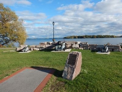
Wideview of War of 1812-1814 Marker
| 101 ► Ontario, Leeds and Grenville United Counties, Gananoque — War of 1812-1814 — |
| On Water Street west of Market Street, on the left when traveling west. | |||
| 102 ► Ontario, Leeds and Grenville United Counties, Johnstown — Eastern Ontario's First Court House and Gaol — |
| On Provincial Highway 2 at Provincial Highway 16, on the right when traveling west on Provincial Highway 2. | |||
| 103 ► Ontario, Leeds and Grenville United Counties, Mallorytown — Chimney Island (Bridge Island) — |
| On Thousand Islands Parkway, 2 kilometers east of Mallorytown Road, on the right when traveling east. | |||
| 104 ► Ontario, Leeds and Grenville United Counties, Prescott — Capture of Ogdensburg — 1813 — |
| Near Sophia Street, 0.1 kilometers south of Corrine Street. | |||
| 105 ► Ontario, Leeds and Grenville United Counties, Prescott — Fort Wellington — |
| Near Vankoughnet Street close to King Street East, on the left when traveling south. | |||
| 106 ► Ontario, Leeds and Grenville United Counties, Prescott — Prescott Barracks and Hospital — |
| On East Street, 0.1 kilometers north of King Street East (Ontario Highway 2). | |||
| 107 ► Ontario, Leeds and Grenville United Counties, Prescott — Prescott Raid on Ogdensburgh — |
| On Centre Street at Water Street West, on the left when traveling south on Centre Street. | |||
| 108 ► Ontario, Leeds and Grenville United Counties, Township of Rideau Lakes — The Enemy to the South / l'Ennemi du Sud — |
| On Narrows Lock Road (County Highway 14) close to the Rideau Canal, on the right when traveling north. | |||
| 109 ► Ontario, Lennox and Addington County, Greater Napanee — Escape of the Royal George 1812 — |
| On Loyalist Parkway (Provincial Highway 33) close to County Route 21. | |||
| 110 ► Ontario, Middlesex County, Glencoe — Battle Hill — |
| On Longwoods Road (Provincial Highway 2) close to Pratt Siding Road, on the right when traveling east. | |||
| 111 ► Ontario, Middlesex County, Glencoe — Battle of Longwoods — March 4, 1814 — |
| On Longwoods Road (Provincial Highway 2) close to Pratt Siding Road, on the right when traveling east. | |||
| 112 ► Ontario, Muskoka District, Baysville — Explorers of Muskoka & Haliburton — |
| On Baysville Terrace just east of Bay Street (Bridge Street), on the right when traveling east. | |||
| 113 ► Ontario, Niagara Region, Chippawa — Battle of Chippawa — |
| On Niagara River Parkway just west of Edgworth Road, on the right when traveling south. | |||
| 114 ► Ontario, Niagara Region, Chippawa — Chippawa Battlefield Panel 1 — Background to a Battle — |
| Near Niagara River Parkway just west of Edgworth Road, on the right when traveling south. | |||
| 115 ► Ontario, Niagara Region, Chippawa — Chippawa Battlefield Panel 2 — Opening Strikes — July 5, 1814 3:00 p.m. — |
| Near Niagara River Parkway just west of Edgworth Road, on the right when traveling south. | |||
| 116 ► Ontario, Niagara Region, Chippawa — Chippawa Battlefield Panel 3 — Advance to Contact — July 5, 1814 3:30 p.m. — |
| Near Niagara River Parkway just west of Edgworth Road, on the right when traveling south. | |||
| 117 ► Ontario, Niagara Region, Chippawa — Chippawa Battlefield Panel 4 — Battle on the Plain — July 5, 1814 4:30 p.m. — |
| Near Niagara River Parkway just west of Edgworth Road, on the right when traveling south. | |||
| 118 ► Ontario, Niagara Region, Chippawa — Chippawa Battlefield Panel 5 — Final Stages — July 5, 1814 5:30 p.m. — |
| Near Niagara River Parkway just west of Edgworth Road, on the right when traveling south. | |||
| 119 ► Ontario, Niagara Region, Chippawa — Chippawa Battlefield Panel 6 — The Aftermath — |
| Near Niagara River Parkway just west of Edgworth Road, on the right when traveling south. | |||
| 120 ► Ontario, Niagara Region, Chippawa — Fort Chippawa 1791 — |
| On Niagara Parkway at Macklem Street, on the right when traveling north on Niagara Parkway. | |||
| 121 ► Ontario, Niagara Region, Chippawa — Raid on Fort Schlosser 1813 — |
| On Niagara Parkway at Macklem Street, on the right when traveling north on Niagara Parkway. | |||
| 122 ► Ontario, Niagara Region, Chippawa — The Battle of Chippawa — La Bataille de Chippawa — |
| On Niagara River Parkway north of Edgworth Road, on the right when traveling south. | |||
| 123 ► Ontario, Niagara Region, Chippawa — The Battle of Chippawa — |
| On Edgworth Road just west of Niagara River Parkway, on the right when traveling west. | |||
| 124 ► Ontario, Niagara Region, Chippawa — The Founding of Chippawa — |
| On Willoughby Drive at Bridgewater Street, on the left when traveling south on Willoughby Drive. | |||
| 125 ► Ontario, Niagara Region, Crystal Beach — Capture of the "Somers" and "Ohio" — |
| On Queen's Circle at Shannon Road South, on the left when traveling south on Queen's Circle. | |||
| 126 ► Ontario, Niagara Region, Fort Erie — Capture of the "Ohio" and "Somers" — Prise des Goelettes "Ohio" et "Somers" — |
| On Lakeshore Road south of Dominion Road, on the right when traveling south. | |||
| 127 ► Ontario, Niagara Region, Fort Erie — Fort Erie — |
| Near Lakeshore Road south of Dominion Road, on the right when traveling south. | |||
| 128 ► Ontario, Niagara Region, Fort Erie — Fort Erie, Pro Patria Mori Cairn — |
| On Lakeshore Road just south of Dominion Road, on the right when traveling south. | |||
| 129 ► Ontario, Niagara Region, Fort Erie — Frenchman's Creek — |
| On Niagara Parkway north of Anger Avenue, on the left when traveling south. | |||
| 130 ► Ontario, Niagara Region, Grimsby — Engagement at the Forty Mile Creek — |
| On Elizabeth Street just north of Lakeside Drive, on the left when traveling north. | |||
| 131 ► Ontario, Niagara Region, Grimsby — Forty Mile Creek — |
| Near Elizabeth Street. | |||
| 132 ► Ontario, Niagara Region, Grimsby — Grimsby 1812 Bicentennial Flagpole — |
| On Elizabeth Street north of Lakeside Drive when traveling north. | |||
| 133 ► Ontario, Niagara Region, Grimsby — Grimsby 1812 Bicentennial Gazebo — |
| On Elizabeth Street north of Lakeside Drive when traveling north. | |||
| 134 ► Ontario, Niagara Region, Grimsby — The War of 1812 — Engagement at the Forty: June 8, 1813 — |
| Near Elizabeth Street. | |||
| 135 ► Ontario, Niagara Region, Lincoln, Vineland — Mennonite Conscientious Objectors, 1812 - 1814 — |
| On King Street (Niagara road 81) at Rittenhouse Road, on the right when traveling west on King Street (Niagara road 81). | |||
| 136 ► Ontario, Niagara Region, Niagara Falls — American Withdrawal — |
| On Lundy's Lane, on the left when traveling west. | |||
| 137 ► Ontario, Niagara Region, Niagara Falls — Americans Withdraw — |
| Near Lundy's Lane, on the right when traveling west. | |||
| 138 ► Ontario, Niagara Region, Niagara Falls — Battle Ground Hotel — |
| Near Lundy's Lane, on the right when traveling west. | |||
| 139 ► Ontario, Niagara Region, Niagara Falls — Battle of Lundy's Lane — Bataille de Lundy's Lane — |
| Near Lundy's Lane at Hanan Avenue, on the right when traveling east. | |||
| 140 ► Ontario, Niagara Region, Niagara Falls — Battle Stages — |
| Near Lundy's Lane, on the left when traveling west. | |||
| 141 ► Ontario, Niagara Region, Niagara Falls — Battlefield Tourism — |
| Near Lundy's Lane, on the right when traveling west. | |||
| 142 ► Ontario, Niagara Region, Niagara Falls — Bicentennial of the Battle of Lundy’s Lane — |
| Near Lundy's Lane, on the right when traveling west. | |||
| 143 ► Ontario, Niagara Region, Niagara Falls — Bridgewater Mills — |
| On Burning Spring Hill Road just south of Niagara Parkway, on the right when traveling south. | |||
| 144 ► Ontario, Niagara Region, Niagara Falls — British Retreat — |
| Near Lundy's Lane, on the right when traveling west. | |||
| 145 ► Ontario, Niagara Region, Niagara Falls — Burch’s Mill — |
| On Niagara Parkway just north of Dufferin Isle Road, on the right when traveling north. | |||
| 146 ► Ontario, Niagara Region, Niagara Falls — Cecil Bishopp — |
| Near Lundy's Lane, on the right when traveling west. | |||
| 147 ► Ontario, Niagara Region, Niagara Falls — Churches Atop of Drummond Hill — |
| On Lundy's Lane, on the left when traveling west. | |||
| 148 ► Ontario, Niagara Region, Niagara Falls — Drummond Hill Cemetery — |
| Near Lundy's Lane, on the left when traveling west. | |||
| 149 ► Ontario, Niagara Region, Niagara Falls — Facing the American Attack — |
| Near Lundy's Lane, on the left when traveling west. | |||
| 150 ► Ontario, Niagara Region, Niagara Falls — Holding the High Ground — |
| Near Lundy's Lane at Hanan Avenue, on the right when traveling east. | |||
| 151 ► Ontario, Niagara Region, Niagara Falls — I’ll Try, Sir — |
| Near Lundy's Lane, on the right when traveling west. | |||
| 152 ► Ontario, Niagara Region, Niagara Falls — Laura Secord — |
| On Lundy's Lane at Hanan Avenue, on the right when traveling east on Lundy's Lane. | |||
| 153 ► Ontario, Niagara Region, Niagara Falls — Lundy’s Lane Battlefield Gateway — |
| On Lundy's Lane, on the left when traveling west. | |||
| 154 ► Ontario, Niagara Region, Niagara Falls — Lundy's Lane Battlefield Commemorative Wall — Celebrating 100 Years — July 25, 2004 — |
| On Lundy's Lane at Hanan Avenue, on the right when traveling east on Lundy's Lane. | |||
| 155 ► Ontario, Niagara Region, Niagara Falls — One Hundredth Anniversary of the Battle of Lundy's Lane — |
| Near Lundy's Lane close to Hanan Avenue. | |||
| 156 ► Ontario, Niagara Region, Niagara Falls — Ruth Redmond — 1903 - 1999 — |
| Near Hanan Avenue at Latshaw Street. | |||
| 157 ► Ontario, Niagara Region, Niagara Falls — Site of Redan Battery — |
| Near Niagara Parkway, 0.4 kilometers east of York Street (Local Route 81), on the right when traveling west. | |||
| 158 ► Ontario, Niagara Region, Niagara Falls — Soldier's Monument — Lundy's Lane — |
| On Lundy's Lane, 0.03 kilometers south of Hanan Avenue, on the right when traveling east. | |||
| 159 ► Ontario, Niagara Region, Niagara Falls — The Aftermath of Battle — |
| On Lundy's Lane, on the left when traveling west. | |||
| 160 ► Ontario, Niagara Region, Niagara Falls — The Americans Attack — |
| Near Lundy's Lane, on the left when traveling west. | |||
| 161 ► Ontario, Niagara Region, Niagara Falls — The Americans Capture the British Guns — |
| Near Lundy's Lane, on the left when traveling west. | |||
| 162 ► Ontario, Niagara Region, Niagara Falls — The Battle of Lundy’s Lane — War of 1812 — |
| On Lundy's Lane, on the right when traveling west. | |||
| 163 ► Ontario, Niagara Region, Niagara Falls — The British Defense — The Battle of Lundy’s Lane — |
| Near Lundy's Lane, on the right when traveling west. | |||
| 164 ► Ontario, Niagara Region, Niagara Falls — 3 — The Capture of the Redan and the Death of Brock — |
| Near Niagara Parkway, 0.4 kilometers east of York Street (Local Route 81), on the right when traveling west. | |||
| 165 ► Ontario, Niagara Region, Niagara Falls — U.S. Infantry Trench — July 23, 1814 — |
| Near Lundy's Lane at Hanan Avenue, on the right when traveling east. | |||
| 166 ► Ontario, Niagara Region, Niagara Falls — War of 1812 — |
| On Lundy's Lane, on the right when traveling west. | |||
| 167 ► Ontario, Niagara Region, Niagara Falls — William Lundy Homestead — |
| On Lundy's Lane (Regional Road 20) just west of Queen Elizabeth Way, on the right when traveling east. | |||
| 168 ► Ontario, Niagara Region, Niagara-on-the-Lake — A Fort Evolves — Fort Mississauga — |
| Near Simcoe Street just north of Front Street. | |||
| 169 ► Ontario, Niagara Region, Niagara-on-the-Lake — A Strategic Location — |
| Near Simcoe Street just north of Front Street. | |||
| 170 ► Ontario, Niagara Region, Niagara-on-the-Lake — A Strategic Site — |
| Near Queens Parade just south of Wellington Street.. | |||
| 171 ► Ontario, Niagara Region, Niagara-on-the-Lake — A Strategic Site — |
| Near Queens Parade, on the right when traveling north. | |||
| 172 ► Ontario, Niagara Region, Niagara-on-the-Lake — Action at Butler's Farm — Engagement a Butler's Farm — |
| On Butler Street west of John Street West when traveling west. | |||
| 173 ► Ontario, Niagara Region, Niagara-on-the-Lake — Brown's Point — |
| On Niagara Parkway north of Brown's Point Circle, on the left when traveling south. | |||
| 174 ► Ontario, Niagara Region, Niagara-on-the-Lake — Brown's Point — |
| On Niagara Parkway just south of Brown's Point Circle, on the left when traveling south. | |||
| 175 ► Ontario, Niagara Region, Niagara-on-the-Lake — Capture of Fort Niagara 1813 — |
| On Niagara Parkway east of East West Line (County Route 85), on the right when traveling north. | |||
| 176 ► Ontario, Niagara Region, Niagara-on-the-Lake — Fort George — Le Fort George — |
| Near Queens Parade south of Wellington Street. | |||
| 177 ► Ontario, Niagara Region, Niagara-on-the-Lake — Fort Mississauga — Le Fort Mississauga — |
| Near Simcoe Street north of Front Street, on the left when traveling east. | |||
| 178 ► Ontario, Niagara Region, Niagara-on-the-Lake — Fort Mississauga is a National Historic Site — an impotant part of Canada's story! — |
| Near Simcoe Street just north of Front Street when traveling north. | |||
| 179 ► Ontario, Niagara Region, Niagara-on-the-Lake — Fort Mississauga Trail — Sentier du fort Mississauga — |
| On Simcoe Street at Front Street, on the left when traveling east on Simcoe Street. | |||
| 180 ► Ontario, Niagara Region, Niagara-on-the-Lake — Fort Niagara — |
| Near Queens Parade just south of Wellington Street. | |||
| 181 ► Ontario, Niagara Region, Niagara-on-the-Lake — Guns Gins and Devil Carts — |
| Near Queen's Parade just south of Wellington Street. | |||
| 182 ► Ontario, Niagara Region, Niagara-on-the-Lake — McFarland House 1800 — |
| On Niagara Parkway just south of East West Line (County Route 85), on the left when traveling south. | |||
| 183 ► Ontario, Niagara Region, Niagara-on-the-Lake — Navy Hall — |
| On Ricardo Street just south of Melville Street, on the left when traveling south. | |||
| 184 ► Ontario, Niagara Region, Niagara-on-the-Lake — Niagara National Historic Sites — |
| Near Queens Parade close to Wellington Street. | |||
| 185 ► Ontario, Niagara Region, Niagara-on-the-Lake — Point Mississauga Lighthouse — Le Phare de Point Mississauga — |
| On Queen Street. | |||
| 186 ► Ontario, Niagara Region, Niagara-on-the-Lake — Sir Isaac Brock's First Burial Site — |
| Near Queens Parade just south of Wellington Street. | |||
| 187 ► Ontario, Niagara Region, Niagara-on-the-Lake — Six Pounder Field Gun — |
| Near Queen's Parade just south of Wellington Street. | |||
| 188 ► Ontario, Niagara Region, Niagara-on-the-Lake — St. Mark’s Church — |
| On Byron Street, on the right when traveling west. | |||
| 189 ► Ontario, Niagara Region, Niagara-on-the-Lake — The Battle of Fort George — La Bataille de Fort George — |
| On Queen Street north of Newark Street, on the right when traveling north. | |||
| 190 ► Ontario, Niagara Region, Niagara-on-the-Lake — The Battle of Fort George — |
| Near Queens Parade, on the right when traveling north. | |||
| 191 ► Ontario, Niagara Region, Niagara-on-the-Lake — The Burning of St. Davids 1814 — |
| On York Road (County Route 81) at Four Mile Creek, on the left when traveling east on York Road. | |||
| 192 ► Ontario, Niagara Region, Niagara-on-the-Lake — The Early Years — |
| On Ricardo Street just south of Melville Street, on the left when traveling south. | |||
| 193 ► Ontario, Niagara Region, Niagara-on-the-Lake — The Field House — |
| On Niagara Parkway south of 4 Line Unopened Road, on the right when traveling south. | |||
| 194 ► Ontario, Niagara Region, Niagara-on-the-Lake — The Fortified Mouth of the Niagara River — |
| Near Queens Parade just south of Wellington Street. | |||
| 195 ► Ontario, Niagara Region, Niagara-on-the-Lake — The Remains of Three Soldiers — |
| On Queen Street north of Newark Street, on the right when traveling north. | |||
| 196 ► Ontario, Niagara Region, Niagara-on-the-Lake — Ubique — |
| Near Queen's Parade just south of Wellington Street. | |||
| 197 ► Ontario, Niagara Region, Niagara-on-the-Lake — Vrooman's Battery — La Batterie Vrooman — |
| On Niagara Parkway north of Line 8 Road, on the right when traveling north. | |||
| 198 ► Ontario, Niagara Region, Niagara-on-the-Lake — Welcome to Fort George — |
| Near Queens Parade just south of Wellington Street. | |||
| 199 ► Ontario, Niagara Region, Queenston — 'Alfred' — |
| On Clarence Street west of Queenston Street, on the left when traveling west. | |||
| 200 ► Ontario, Niagara Region, Queenston — 1 — Attack — The Battle of Queenston Heights Walking Tour — Stop 1 of the 5-stop walking tour — |
| Near Niagara Parkway just north of Portage Road. | |||
254 entries matched your criteria. Entries 101 through 200 are listed above. ⊲ Previous 100 — The final 54 ⊳