On 4th Street (U.S. 51/62), on the right when traveling north.
For Capt. Bland Ballard, 1759-1853. Born in Va. Came to Ky. in 1779. Devoted life protecting frontier. Scout for George Rogers Clark's Ohio expedition, 1780. '82; Wabash campaign 1786. In the battles of Fallen Timbers, 1793; Tippecanoe, 1811; River . . . — — Map (db m18550) HM
On Westvaco Road (U.S. 51/62), on the right when traveling south.
Fort Jefferson (also known as Camp Crittenden) was the second of two Union Army posts established in Ballard County in September 1861, following the Confederate occupation of Columbus. Fort Jefferson was first established during the American . . . — — Map (db m18493) HM
On Westvaco Road (U.S. 51/62), on the right when traveling south.
Fort Jefferson Site Built in 1780 by George Rogers Clark as part of impressive plan of settlement, conceived by Gov. Patrick Henry of Virginia, later pursued by and named for Gov. Thomas Jefferson. The fort was to protect US claim to its . . . — — Map (db m18639) HM
This famous Revolutionary War hero, who rode 40 mi. to warn Jefferson, Patrick Henry and other legislators of British approach, June 3, 1781, is buried in Bath Co. Jack Jouett of Va. galloped all night from Cuckoo Tavern to Monticello to . . . — — Map (db m26285) HM
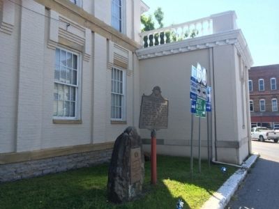
On North 24th Street at Gloucester Avenue, on the right when traveling north on North 24th Street.
Grave of Colonel Arthur Campbell (1743-1811). Statesman, revolutionary soldier, justice, legislator, county lieutenant. Sons, James and John killed in War of 1812. — — Map (db m57938) HM
Near Main Street at Ardery Place, on the left when traveling north.
Soldiers of the American Revolution Who Died Citizens of Bourbon County
Samuel Brice • Isaac Darnell • James Duncan • James Hughes • James Hutchinson • John Luckie • Alexander Mitchell • John Moore • Robert Purdy • William Turner • Benjamin . . . — — Map (db m231274) WM
On Georgetown Road (U.S. 460) east of Clay Kiser Road, on the right when traveling east.
Robert Johnston, a Revolutionary War captain, was born in Virginia in 1749. He and his wife operated a tavern in their house here from 1796-1812. Located on what was the main road between Maysville and Lexington, this inn served stage and horseback . . . — — Map (db m67703) HM
On West Main Street, on the right when traveling west.
To honor and commemorate the men who fought in the American Revolution and sleep in Boyle County Kentucky.
John Spears • Michael Harmon • Hugh Shiell •
John Pipes • John Gray • William Warren •
Samuel McDowell • Thomas Crawford . . . — — Map (db m121869) WM
On U.S. 150 at Airport Road (Kentucky Route 1273), on the right when traveling south on U.S. 150.
Homesite and grave 1 mile west. B., Orange Co., Va., 1740. D., 1825. 40 years service to his country. Lt. at Fort Pitt, Dunmore's War, 1774. Captain, Botetourt County militia, 1776. Northwest Campaign of George Rogers Clark, 1778. Came to Ky., 1781. . . . — — Map (db m120112) HM
On Lexington Street (Kentucky Route 34) at Cecilian Terrace, on the right when traveling west on Lexington Street.
Stephen Albert Fisher, Rev. War soldier from Va., assigned in 1775 to active duty and wounded while serving with Colonel John Bowman's militia. Returned to Ky. in 1779 with wife Mary Magdalene Garr. He established garrison of military significance . . . — — Map (db m70981) HM
On West Park Street south of West 2nd Street, on the left when traveling south.
Captain Philip Buckner, an Englishman, was a Revolutionary War veteran. He came to Va., served adopted colony as issuing commissary, received extensive land grants, then settled here. In 1797, he donated this lot for Augusta Public Square as part of . . . — — Map (db m86656) HM
On North Main Street at EGL Smith Street, on the right when traveling north on North Main Street.
For Gen. Richard Butler, b. 1743, Ireland. Came to America, 1760. Officer during Revolutionary War. Indian agent, 1784; Supt. Indian Affairs for Northern Dist., 1785. With Geo. Rogers Clark negotiated Indian treaty, 1786. As Maj. Gen., second in . . . — — Map (db m123929) HM
On North Main Street north of W G L Smith Street, on the left when traveling north.
Morgantown
The county seat of Butler Co., it was originally called Funkhouser Hill. It was renamed Morgan Town in Dec. 1810 to honor Revolutionary War officer Daniel Morgan and was incorporated in 1813. It began as a settlement of . . . — — Map (db m123448) HM
On East Washington Street west of Edwards Avenue, on the left when traveling east.
Shandy Hall, two-story stone home built on Bluff above Big Spring, built by William Prince on his 200-acre survey made in 1798. Prince, a Rev. War veteran from S.C., began town on waters of Eddy Creek. In 1817, Princetown became county seat of . . . — — Map (db m123817) HM
On East Main Street at North Franklin Street, on the right when traveling east on East Main Street.
Shandy Hall, two-story stone home built on Bluff above Big Spring, built by William Prince on his 200-acre survey made in 1798. Prince, a Rev. War veteran from S.C., began town on waters of Eddy Creek. In 1817, Princetown became county seat of . . . — — Map (db m123818) HM
On East Market Street at Hopkinsville Street, on the left when traveling east on East Market Street.
A Revolutionary War patriot - He served as a captain in Colonel Benjamin Roxbury Spartan Regiment - S.C. Organized a group from 96th S.C. District migrated through Cumberland Gap. Settled on Red River in NW Tennessee. In 1798 he explored land on . . . — — Map (db m244271) HM
On North Franklin Street at East Market Street, on the right when traveling north on North Franklin Street.
William Prince
1752-1810
Born in Virginia, his family moved to Spartanburg Co., S.C. in 1768. During the Revolutionary War, he served as captain in Col. Benjamin Roebuck’s S.C. Spartan regiment. After completing his military duty, he . . . — — Map (db m123867) HM
On Court Place at York Street (U.S. 27), on the right when traveling east on Court Place.
Northern Kentucky's first doctor. Born in Oxfordshire, England on July 10, 1737. Graduate of Royal College of Physicians. Served at Quebec with Gen. James Wolfe. In 1765 settled in Virginia; personal physician to Patrick Henry. Chief Surgeon, 1775, . . . — — Map (db m175075) HM
On U.S. 42 east of Ware Avenue, on the right when traveling west.
First settled 1792, incorporated as Port William 1794. Carroll County formed and name of town changed to Carrollton by the Kentucky Legislature, 1838, both honoring "Charles Carroll of Carrollton" of Maryland, bold signer of the Declaration of . . . — — Map (db m22149) HM
Near General Butler Park Road east of 11th Street (Road 320).
Marker Front:
Col. Percival Butler was appointed Ky.'s first adjutant gen. in Gov. Isaac Shelby's first term. Born in Penn., he was with Washington at Valley Forge and Lafayette at Yorktown. Immigrated to Jessamine Co., Ky., then moved to . . . — — Map (db m22097) HM
On Highland Avenue (U.S. 42) at 2nd Street, on the right when traveling west on Highland Avenue.
In 1754 James McBride canoed down the Ohio to the mouth of this river—now Kentucky. Here, as first explorer, he carved his initials and the date on a tree, a landmark for 30 years. Cited for part in defense of Bryan Station and Battle of Blue . . . — — Map (db m136145) HM
Entered land on Carpenter's Creek 8 miles north, 1780, on a Treasury Warrant for service in Revolution. Land Grant signed, 1783, by Gov. Benj. Harrison. Engaged in Battle of Point Pleasant, 1774. Served in Rockingham Militia, Va., during . . . — — Map (db m83446) HM
This bell was cast by the Whitechapel Bell Foundry in London, England, the same company that cast the original. This bell is an exact duplicate of the original Liberty Bell that arrived in America in 1753. Comprised of tin and copper the bell and . . . — — Map (db m215010) HM
On South Main Street (U.S. 41) at East 6th Street, on the right when traveling south on South Main Street.
For Col. William Christian, native Virginian, soldier, politician, and pioneer. Served as Colonel in Revolution, member Va. Legislature. Moved family to Jefferson County in 1785, where his Va. land grants totaled 9,000 acres. Killed 1786, defending . . . — — Map (db m88910) HM
The Cherokee people once occupied much of the mid-Atlantic territory of North America. During the American Revolution they sided with the British against encroaching settlers and were forced to live in the mountains of Georgia, Tennessee, and North . . . — — Map (db m105691) HM
On Paris Road (Kentucky Route 627) 1.5 miles south of Austerlitz Road/Thatchers Mill Road (Kentucky Route 57), on the left when traveling south.
Home of two Revolutionary War officers: built about 1793 by Col. Nathaniel Gist 1735-1796 and Gen. Charles Scott 1739-1813, Governor of Kentucky 1808-1812 who married the widow Gist, 1807. — — Map (db m170085) HM
On Athens Boonesboro Road (Kentucky Route 418 at milepost 4.4), 0.1 miles east of Hidden Grove Lane, on the right when traveling west.
Colonel John Holder
John Holder commanded at Fort Boonesborough in 1779 and est. Holder's Station near the mouth of Lower Howard's Creek in 1782. He led a garrison at Vincennes in George Roger Clark's 1786 Wabash Campaign & was appointed a . . . — — Map (db m206154) HM
On Cleveland Street west of South Main Street (U.S. 60), on the left when traveling west.
For General George Rogers Clark, who came to Kentucky territory from Virginia, 1775. He commanded expedition into Illinois territory in 1778-79, taking the British forts which held the northwest for future US settlement, and capturing . . . — — Map (db m164154) HM
Near Ford Road/4 Mile Road (Kentucky Route 1924) 1.2 miles south of Boonesboro Road (Kentucky Route 627), on the left when traveling south.
Land Fever
Why did so many people brave the dangers of frontier life to come to Clark County and the Bluegrass? The answer is land -- cheap land, fertile land. The quest for land drove the settlement of Kentucky.
John Findley was a hunter . . . — — Map (db m74753) HM
On State Highway 66, 0.6 miles north of U.S. 421, on the right when traveling south.
(Side One)
Named in honor of first white man to settle on Red Bird River, at the mouth of Gilbert’s Creek. A veteran of Revolutionary War, John Gilbert came here to hunt and trap. He surveyed and claimed much of Clay, Leslie and Harlan . . . — — Map (db m87568) HM
On Road 144 at Yellow Creek Park, on the right when traveling east on Road 144.
Col. Algernon S. Thruston
Lawyer, soldier and farmer. Born in Louisville 1801, died 1864 at Thruston. Went to Texas with company of volunteers in 1836. Commissary General of Purchases (1837) and Quartermaster General (1838) for the Republic . . . — — Map (db m160173) HM
On Main Cross Street at Washington Street, on the right when traveling north on Main Cross Street.
For Capt. John Edmonson, b. 1764, Va. In War of Revolution a private in company led by father. Battle of King's Mountain, 1782. Came to Ky., 1790. In War of 1812, raised rifle company in Fayette County. Killed at Battle of River Raisin, Jan. 22, . . . — — Map (db m170838) HM
On Athens Walnut Hill Road, 0.7 miles west of Interstate 75, on the left when traveling west.
Home of Capt. Robert Boggs, b.1746,
Mill Creek Hundred, Del. Moved to
Va. Soldier in Revolution. Came
to Ky., 1774, as chainman Col. John
Floyd's survey party. One of founders
of Boonesborough. Officer, Cherokee
Expedition, 1776. Under . . . — — Map (db m169730) HM
On Gentry Road, 0.3 miles east of North Baxter Boulevard, on the left when traveling east.
Israel
1759 — 1782
Son of Daniel and Rebecca Bryan
Killed in the Battle of Blue Licks
Aug. 19, 1782
Edward
1740 — 1780
Killed by Indians
Brother of Daniel
Samuel
1728 — 1808
Revolutionary soldier
Brother of . . . — — Map (db m202810) HM WM
On Gentry Road, 0.3 miles east of North Baxter Boulevard, on the left when traveling east.
Daniel Boone surveyed this site in 1774 for a 4,000-acre land grant to James Hickman. In Dec. 1779, Boone and other families lived here in crude shelters; in 1780, built cabins & stockade. By 1783, the station included 15-20 families. Among these, . . . — — Map (db m169706) HM
On Versailles Road (U.S. 60) 0.3 miles west of Man O War Boulevard, on the right when traveling west.
Here on May 14, 1825, General LaFayette was entertained by Major John Keene who had served as his aide-de-camp during the Revolutionary War. — — Map (db m30837) HM
On Gentry Road just east of North Baxter Boulevard, on the left when traveling east.
Grave of Samuel Boone, the eldest
brother of Daniel Boone, renowned
Kentucky pioneer. Samuel was born
in Penna., May 20, 1728. Came to
Kentucky from South Carolina in
1779 with his family and settled
Boone's Station. He joined in
defense of . . . — — Map (db m169709) HM
On West Maxwell Street east of South Mill Street, on the left when traveling east.
Mary Desha, one of four founders
of the Daughters of the American
Revolution in 1890, taught public
school here, 1875-85. Designer of
society's seal. Taught in Alaska
schools, returned to Washington,
successfully advocated . . . — — Map (db m169869) HM
On East 3rd Street west of Elm Tree Lane, on the left when traveling east.
Grave of George Nicholas
1754-1799
Revolutionary soldier
Virginia House of Delegates
Father of Kentucky Constitution
First Kentucky Attorney General
Professor of Law at Transylvania University — — Map (db m61134) HM
On Bowman Mill Road, on the right when traveling north.
This antebellum Greek Revival Home was part of Bowman estate. Col. Abraham Bowman commanded 8th Va. Regt. in Revolution. Behind house was Todd's Station, built 1779 by Levi Todd, grandfather of Mary Todd Lincoln and Emilie Todd Helm. Mrs. Helm, wife . . . — — Map (db m14009) HM
On Court Square at North Main Cross Street (Kentucky Route 57), on the left when traveling south on Court Square.
Kentucky's 26th, formed from Mason in 1798. Named for John Fleming, Rev. War officer who came in 1776 to mark and improve land. Built Fleming's Station, among the county's earliest. Fellow pioneers were John Finley, Michael Cassidy, and George . . . — — Map (db m83507) HM
On Elizaville Pike (Kentucky Route 32) at Cassidy Pike, on the left when traveling west on Elizaville Pike.
A fearless Indian fighter in over 30 battles, Michael Cassidy built Cassidy Station (site-one mile south) in later 1780s. A native of Ireland, he came to Va. as cabin boy at age 12. Enlisted early in Revolution and was with Washington at British . . . — — Map (db m83496) HM
On S. Central Avenue at E. Court Street, on the right when traveling south on S. Central Avenue.
For Col. John Floyd. Born Amherst County, Va., 1750. Led party to survey land now Kentucky, 1774. With George Rogers Clark’s Indian expeditions. Back in Va., joined Colonial navy. Captured, taken to England. Escaped. Built Floyd’s Station, 1779 or . . . — — Map (db m97255) HM
On N. Front Street at W. Court Street, on the left when traveling north on N. Front Street.
In Memory Of
John Graham
Revolutionary Soldier
Who Rests in Floyd County
This Tablet
Marks the Site of the First
Floyd County Court House
Given By Him — — Map (db m97202) HM
1750 - 1820
In memory of
Revolutionary War Soldier
Arrington Wickliffe
Died in Muhlenberg County, KY
Placed by
Elizabeth Campbell Russell
Chapter, NSDAR 2010 — — Map (db m205720) WM
On East Main Street (U.S. 60, 460) at Glenns Creek Road on East Main Street.
Daniel Boone - Pioneer
Born, Pa., 1734. Died, Mo., 1820. Married Rebecca Boone, 1756, N.C. First trip to Kentucky, 1767. Set up Ft. Boonesborough, 1775, blazed Wilderness Trail and settled. Frontiersman, surveyor, settler, legislator and . . . — — Map (db m9754) HM
On West Second Street (U.S. 60) at Ewing Street, on the left when traveling west on West Second Street.
Early Families Here Owners whose families lived in the original house here - J.W. Denny, State Attorney General; Thomas Loughborough and son Judge Preston Loughborough, Chief U.S. Postal Inspector; Sally S. Jouett, widow of Colonel William R. . . . — — Map (db m84217) HM
On Wilkinson Blvd south of Frazer Road, on the right when traveling south.
Willis A. Lee, Jr., built a double two-story log house here in 1793. Tract of land on which the house stood was given to Lee by his uncle, Hancock Lee, founder of Leestown, the first settlement in Franklin County. In 1815 Lee erected a story and a . . . — — Map (db m22126) HM
Near Clinton Street (Kentucky Route 420) at St Clair Street, on the right when traveling east. Reported permanently removed.
Veterans of American Revolution Elected
Governor of Kentucky
Isaac Shelby, 1792-96, 1812-16; Col., Va. Militia
James Garrard, 1796-1800, 1800-04; Col., Va. Militia
Christopher Greenup, 1804-08; Col., Va. Militia
Charles . . . — — Map (db m248135) HM WM
On East Main Street, on the right when traveling east.
During the War of Independence, Kentucky was only a western district of the
Common Wealth of Virginia. In 1780 Virginia called up 82 men from the three
counties that were to become the Commonwealth of Kentucky. These men served
in the Continental . . . — — Map (db m205855) HM WM
On East State Line Road (Kentucky Route 116) 0.8 miles west of Palestine Road, on the right when traveling west.
Enlisted, 1776, at age 14 in 2nd Virginia Reg., Cont. line. Wounded at Monmouth, discharged, 1779. Came to Ky., 1795. With family settled on Pond River grant, now Hopkins Co. When county formed, appointed on first County Court. Also sheriff. 1807 . . . — — Map (db m192708) HM
On Danville Road (Kentucky Route 52) west of Paulding Street, on the left when traveling west.
Built ca. 1820 on lot #46 of the original town plat. Thomas Buford son of town founder, Wm. Buford., appointed sheriff of Garrard Co. in 1803. He was a member of Ky. Legislature, 1806-09, and served in Senate, 1809. Veteran of War of 1812. In 1841, . . . — — Map (db m67846) HM
On Lexington Road (U.S. 27) at Danville Street (Kentucky Route 52), on the right when traveling south on Lexington Road.
This tablet is dedicated in grateful recognition of Captain William Early Buford
Who served his country with ability during the American Revolution, on June 5, 1797 he sold fifty city lots and gave the “Publick Square” for the . . . — — Map (db m171879) HM
On Lexington Road (U.S. 27) north of Dora Road (County Route 1363), on the right when traveling north.
Burial site of first Lincoln Co. surveyor, commissioned Jan., 1781. Surveyed this area, then part of Lincoln Co. Daniel Boone was made Deputy Surveyor under him, 1783. Thompson, nephew of Isaac Shelby, was State Rep., Garrard Co., 1803; State . . . — — Map (db m50811) HM
On Richmond Road (Kentucky Route 52) near Manse Road (County Route 1140), on the left when traveling west.
Founded 1784 by Rev. David Rice. Early elders of the church: Thomas Maxwell, Alexander Henderson, James Woods, Samuel Woods, Robert Brank, George Denny, Robert Henry. First located in Paint Lick Cemetery. Second building erected circa 1830 on . . . — — Map (db m50812) HM
On Falls of Rough Road (State Road 79) at Robinson Road, on the right when traveling south on Falls of Rough Road.
George Eskridge, born in Virginia in 1763, served in Revolutionary War, having enlisted in the Virginia Continental line at an early age. Eskridge came to Kentucky and settled in Grayson County, circa 1811. Built a log house at Falls of Rough River . . . — — Map (db m162247) HM
On Public Square at North Main Street (U.S. 62), on the left when traveling south on Public Square.
For Col. William Grayson, 1740-90,
aide de-camp to Gen. Washington.
Lawyer; in Revolutionary Army,
1776-79; Board of War, 1780-81;
Virginia Assembly and Continental
Congress, 1784-87; State Convention
ratifying Federal Constitution . . . — — Map (db m123269) HM
On Main Street at Washington Street, on the left when traveling east on Main Street.
County named, 1803, for Christopher Greenup, governor of Kentucky, 1804-08. Born in Virginia, 1750, officer in American Revolution. Began law practice in Kentucky, 1783. Clear of Virginia court for the district or Kentucky, 1785-92. Member, . . . — — Map (db m126369) HM
On Main Street (Kentucky Route 69) at Madison Street (Kentucky Route 69), on the right when traveling south on Main Street.
For John Hancock, 1737-93. Patriot, statesman and soldier. President of Continental Congress, 1775-77, and bold first signer of the Declaration of Independence. Mayor-general of Mass. militia in Revolutionary War, member of the Mass. Constitutional . . . — — Map (db m119794) HM
On Leitchfield Road west of Masters Street, on the right when traveling west.
Site of fort, erected 1780, by
Jacob Van Meter, Sr., who led a
party of 100 settlers from Va.
to "the Falls of the Ohio.” They
made their journey on 27 flatboats
and suffered many hardships during
their trip. One member of . . . — — Map (db m171227) HM
On Gilead Church Road, on the left when traveling west.
With Va. Militia, from 1776-1780,
Cash took part in the battles of
Brandywine and Monmouth, several
skirmishes, and was with Washington
at Valley Forge. Married Susannah
Baskett, who taught him to read.
They came to Ky., joined . . . — — Map (db m171525) HM
On East Central Street at South 2nd Street, on the left when traveling west on East Central Street.
For Major Silas Harlan, born Va., 1752, came to Ky. in 1774. Built Harlan's Station, 7 miles south of Harrodsburg on Salt River, 1778. Commanded spies, 1779, in Illinois campaign of Gen. George R. Clark, who said: "He was one of bravest soldiers . . . — — Map (db m181164) HM
On East Clover Street, on the right when traveling east.
Harlan was first called Mount Pleasant. The town is situated in the valley between Big and Little Black Mountain, at the confluence of the three forks of the Upper Cumberland River. It is located at the junctions of two important highways, U.S. 421 . . . — — Map (db m181174) HM
On South Main Street (Courthouse Access Parking) north of Pike Street.
For Colonel Benjamin Harrison, who came to area, 1776. Served as Col. in Revolution from Penn. He was a member, 1787 and 1788 Kentucky Conventions, 1792 Constitutional Convention at Danville. Elected to Kentucky Legislature in 1793. County formed . . . — — Map (db m67683) HM
On Paris Pike (U.S. 27) at New Lair Road (State Route 982), on the right when traveling north on Paris Pike.
Settled by John Hinkston 1775. Abandoned 1776. Rebuilt by Isaac Ruddle 1779. Destroyed by British and Indians under Captain Henry Bird 1780. Hinkston later settled opposite this site. — — Map (db m84385) HM
On Hammonsville Road (State Highway 357) at Hammonsville-Jonesville Road (State Highway 2785), on the right when traveling north on Hammonsville Road.
Sergeant Joseph Timberlake, born in Va., 1752: buried here, 1841. Revolutionary soldier. One of the members of General Washington's body guard. All were chosen as being "sober, young, active and well built, men of good character that possess pride . . . — — Map (db m182935) HM
On Zion Road (Kentucky Route 351) 0.1 miles west of Denise Drive, on the right when traveling west.
Born in Va., 1753. On Washington's staff & in many campaigns, American Revolution. Came to Ky. in 1797, as Transylvania Company agent. Helped lay out town of Henderson. Chief Justice of first court, 1799. Member of Ky. House, 1800-06, and Senate, . . . — — Map (db m88962) HM
On North Main Street at 1st Street, on the right when traveling north on North Main Street.
Erected to the Memory of
Revolutionary Soldiers
Buried in Henderson County
General Samuel Hopkins
Col. Wynn Dixon • Col. Nathaniel Powell
Col. John Cannon • Col. William Marshall
Col. Gabriel Green • Capt. John Furna Cannon . . . — — Map (db m89383) WM
On 1st Street at North Main Street, on the right when traveling east on 1st Street.
Erected to the Memory of
Revolutionary Soldiers
Buried in Henderson County
Lt. Turner Anderson
Joseph Cabell, Jr. • Abraham Hatchett
Nancy Morgan Hart • Capt. Blackman Moseley, Sr
John Hart • Lewis Rouse
Lt. John Harrison • Dr. . . . — — Map (db m89384) WM
On East Center Street (Kentucky Route 70) at South Main Street (Highway 41), on the right when traveling east on East Center Street.
For Samuel Hopkins, 1753-1819. On Washington's staff and in many campaigns, War of the Revolution. Came to Ky., 1797, as Transylvania Company agent. In 1799, organized and named judge of first court held in original Henderson County, which included . . . — — Map (db m88939) HM
On Nebo Road (Alternate U.S. 41) 0.3 miles south of Shepherd Lane, on the right when traveling south.
Here was located 11000 acres
allotted by Virginia, for military
services in the American Revolution,
1777 — 1782
to
Frederick Wilhelm Augustus Heinrich Ferdinand
Baron von Steuben
Lieutenant general in the armies of . . . — — Map (db m172094) HM
On Nebo Road (Alternate U.S. 41) 0.3 miles south of Shepherd Lane, on the right when traveling south.
Named for the Prussian soldier
Friedrich Wilhelm Ludolf Gerhard
Augustin, Baron von Steuben. Born
in 1730, he came to America in
1777 to aid the cause of the
Revolution. Steuben instructed
Washington's army at Valley Forge
and was first . . . — — Map (db m172085) HM
On Seaton Springs Parkway at Nottingham Parkway, on the right when traveling east on Seaton Springs Parkway.
Home of Colonel Richard C. Anderson 1750-1826, American Rev. patriot. Aide to Lafayette, wounded at siege of Trenton and Savannah, captured at Charleston, fought at Yorktown, where surrender of Lord Cornwallis to Washington in 1781 completed the . . . — — Map (db m161982) HM
On Brownsboro Road (U.S. 42) at Blankenbaker Lane, on the right when traveling west on Brownsboro Road.
Home of Gen. George Rogers Clark from 1809 until his death, 1818. Built by William and Lucy Clark Croghan about 1790. Visited by Presidents Monroe, Jackson, Taylor. Clark and his 175 frontiersmen defeated British-Indians during Revolution: won . . . — — Map (db m161987) HM
On Morgan Jaymes Drive west of Justine Court, on the right when traveling west.
This small family cemetery is all that remains of what was once Joseph Hite's 1000 acre estate. Joseph's son and intended heir, Stephen Hite (1700-1828), is buried here. Stephen's wife, Martha (1798-1830), and daughter, Sarah (1824-1827), are also . . . — — Map (db m223424) HM
Born in Dublin he arrived in America c. 1768. Present at 1776 Delaware crossing and battles of Trenton, Princeton, Brandywine, Germantown & Monmouth; wintered 1777-78 at Valley Forge: captured at Charleston 1780 with Lt. Col. Jon. Clark: witnessed . . . — — Map (db m127917) HM
George Rogers Clark At Locust Grove
George Rogers Clark moved to Locust Grove in 1809 following amputation of his right leg. He lived here with his sister Lucy and her husband William Croghan until Clark's death in 1818. Clark recognized by . . . — — Map (db m101463) HM
On Lucas Lane east of Cave Spring Place, on the right when traveling west.
Isaac Hite's Home
This log house, which appears as Hite's house on John Filson's map printed in 1784, was on the plantation, Cave Spring, owned by Isaac Hite, an early surveyor. Hite (1753-1794) was born in Virginia. He came to Kentucky in . . . — — Map (db m161776) HM
On Dundee Road at Trough Spring Lane, on the right when traveling south on Dundee Road.
Lewis and Clark in Kentucky Trough Spring
While on the Corps of Discovery's expedition to the Pacific Ocean, coleader William Clark wrote six letters to his brother Jonathan at Trough Spring. In 1805 he sent over 30 expedition artifacts here . . . — — Map (db m162011) HM
On W Main Street at Place Montpellier, on the right when traveling west on W Main Street.
General George Rogers Clark
by
Felix W. de Weldon
A Gift to the People of Louisville
by the Hillman-Hopkins Family
( inscribed in the stones on the terrace )
In the spring of 1778, Lt. Col. George Rogers Clark led a small flotilla . . . — — Map (db m104250) HM
On W River Road, on the right when traveling west.
From its earliest beginnings, Louisville's wharf area has played an important role in the development of the city and the nation.
In 1778, George Rogers Clark chose Corn Island as his base of operations for a successful campaign against British . . . — — Map (db m178388) HM
On West Jefferson Street at South 6th Street, on the right when traveling west on West Jefferson Street. Reported missing.
Louis XVI
1754 – 1793
King of France
1774 – 1793
This city was named Louisville in 1780 because of his support of the American Colonies in the Revolutionary War.
The statue, sculptured by Valois in 1827, was given to Louisville by her . . . — — Map (db m178318) HM
On W Jefferson Street near S 5th Street, on the right when traveling west.
( inscribed around the base )
This monument to Thomas Jefferson was presented to the people of Kentucky July 4 1900 by Isaac W and Bernard Bernheim to perpetuate the teachings and examples of the Founders of the Republic
( . . . — — Map (db m104579) HM
On Rowan Street east of North 12th Street, on the right when traveling east.
This site marks the location of Fort-on-Shore, which was the the first building erected on the mainland when General George Rogers Clark and the settlers of Corn Island came ashore. The stockade and fort, built 1778-79 on orders from General Clark, . . . — — Map (db m161710) HM
On Shelbyville Road (U.S. 60) at Whipps Mill Road, on the right when traveling west on Shelbyville Road.
Fort William
Established in 1785 by William Christian and his wife, Anne, a sister of Patrick Henry. On this site one of earliest stone houses in Kentucky was a famous tavern, The Eight Mile House, on Harrods Trace to Falls of the Ohio. From . . . — — Map (db m161983) HM
On North Main Street (Business U.S. 27) south of West Walnut Street, on the right when traveling south.
This tablet is dedicated
to the memory of
revolutionary soldiers
who died citizens of
Jessamine County
Benjamin Adams • John Biswell • Samuel Burk • Robt. Campbell • James Carothers • John Carroll • Abram Cassell • John Cox • Col. J. . . . — — Map (db m169934) WM
Near Buttermilk Pike (Kentucky Route 371) at Collins Road, on the right when traveling west.
This Marker commemorates the men and women who achieved American independence. These Patriots, believing in the noble cause of liberty, fought valiantly to found a new nation.
1775 - 1783.
Presented by Rebecca Bryan Boone Chapter . . . — — Map (db m234567) WM
On Cumberland Gap Parkway (U.S. 25E) at Daniel Boone Drive (State Highway 11), on the right when traveling south on Cumberland Gap Parkway.
For Henry Knox, U.S. Sec. of War, 1785-96. Born Boston, 1750. Joined Continental Army, 1775. Battles of Bunker Hill, Brandywine, Yorktown, and others. Command of artillery, 1775. Commissioned Major-General, 1781. Proposed a military academy in 1779, . . . — — Map (db m35774) HM
On South Main Cross Street at East Main Street, on the right when traveling north on South Main Cross Street.
Dedicated to the memory of these Revolutionary soldiers once found in old Floyd County
— now Lawrence County KY
James Blevins • Edward Burgess • Jeremiah Burns • Richard Cains • John M. Chadwick • Joseph Davis Jr. • William Holbrook • . . . — — Map (db m212015) WM
On U.S. 119 at Jenkins Road, on the right when traveling south on U.S. 119.
Archelous Craft of Wilkes Co., N.C., was with small band of pioneers who immigrated to upper Ky. River Valley in 1804. Born Dec. 25, 1749, in Roanoke River area, Craft was a veteran of Revolutionary War; he fought in battles of Hanging Rock and . . . — — Map (db m97149) HM
“The Sport of Kings”, or horse racing, has a long tradition within the culture of the British Crown dating back to 1174, when Henry II held the first recorded royal race at Smithfield. James I had a palace and track at Newmarket where he . . . — — Map (db m105503) HM
On Main Street (Business U.S. 150) at 3rd Street, on the right when traveling west on Main Street.
For Benjamin Lincoln, 1733-1810. Born Mass. In War of Revolution took Mass. Regts. to reinforce New York, 1776; at Saratoga, 1777, cut Burgoyne's communications with Canada; 1778, command of Southern Department. Commissioned by Washington to receive . . . — — Map (db m49734) HM
On Goshen Church Road/John Logan Trail (Kentucky Route 642) north of Wilderness Trail (Kentucky Route 78), on the left when traveling north.
Pioneer, soldier, statesman, John Logan established land claim for 1400 acres in Lincoln County and built stone house here. He was in Lincoln County Militia; member of first Kentucky Court, 1781; Lincoln Co. delegate to Virginia Assembly and to 1787 . . . — — Map (db m218315) HM
The General and Statesman
Isaac Shelby’s military decisions at the Battle of King’s Mountain in 1779 secured a critical victory for America during the Revolutionary War. Before war’s end, Shelby had also served in the North Carolina . . . — — Map (db m120217) HM
186 entries matched your criteria. The first 100 are listed above. The final 86 ⊳