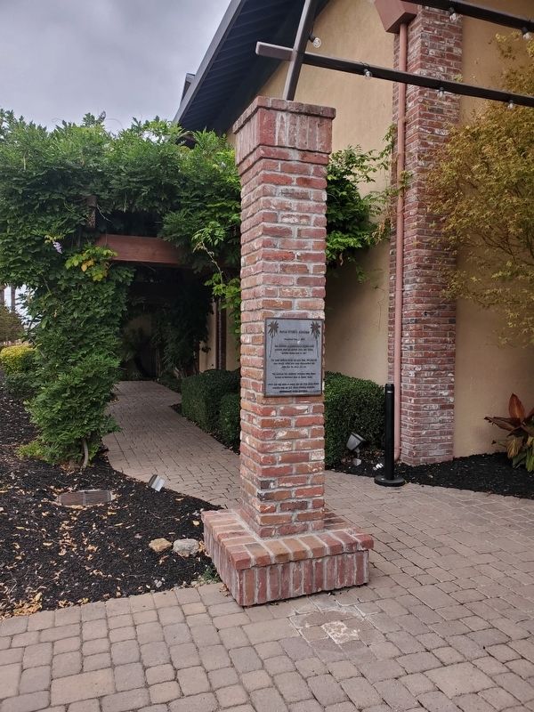
Near Vineyard Avenue east of Machado Place, on the right when traveling east.
This structure is constructed of original brick recycled from the historic Ruby Hill Winery building dating back to 1887.
The large redwood doors are built from 100-year-old wine barrels which have been disassembled and made into the doors you . . . — — Map (db m239752) HM
Between 1905 and 1913, the Nevada-California Power Company, a predecessor of the Southern California Edison Company, built a chain of five hydroelectric power plants along Bishop Creek. Water flowed from one power plant to the next through 60-inch . . . — — Map (db m245639) HM
On Woodford-Tehachapi Road, 3.2 mi E of Keene exit, on the left when traveling east.
In front of you is the world famous Tehachapi Loop which is about halfway upgrade to the Tehachapi Pass. This steep line averages 2.2% in gradient in its 28 miles of length. This feat of civil engineering genius was crowning achievement of civil . . . — — Map (db m134431) HM
Near Mt Wilson Red Box Road, 4.7 miles south of Angeles Crest Highway (California Route 2).
In 1904, astronomer George Ellery Hale obtained support from the Carnegie Institution of Washington to found the Mount Wilson Solar Observatory. Stellar telescopes were soon added: first the 60-inch, then the 100-inch, when "Solar" was removed . . . — — Map (db m143305) HM
Near Alameda Street just north of U.S. 101, on the right when traveling north.
On June 24, 1971, an explosion and fire took the lives of seventeen construction workers building a tunnel in Sylmar, California. The tunnel was being built for the Metropolitan Water District of Southern California by the Lockheed Shipbuilding . . . — — Map (db m126024) HM
On January 17, 1994, Los Angeles and the surrounding region experienced a 6.7 magnitude earthquake centered in Northridge. To commemorate the rebuilding of the region and CSUN, we created the sculpture garden incorporating remnants of the . . . — — Map (db m155780) HM
On Gaffey Street south of Leavenworth Drive, on the right when traveling south.
The friendship bell, overlooking the Pacific Ocean, was presented as a gift from the people of the Republic of Korea to the people of the United States of America on the occasion of the American Bicentennial Jubilee to further the . . . — — Map (db m51064) HM
On Sierra Highway, 0.7 miles north of Foothill Boulevard, on the right when traveling north. Reported missing.
[This site was designated California Historical Landmark No. 1006 on May 11, 1992.
There are three rock and concrete bases which had displayed four different markers. The markers are now missing. The following marker was never placed:] . . . — — Map (db m184724) HM
On Waterman Drive, 0.3 miles west of Woodley Ave, on the left when traveling west.
In honor of the pioneer aviators who have given their all that the science of aviation could be perfected, enabling it to take its place in the worlds commerce, this airport is dedicated.
December 17, 1928, on the 25th anniversary of the . . . — — Map (db m114309) HM
On El Rancho Drive, 0.3 miles east of De Soto Avenue.
Old Trapper's Lodge is one of California's remarkable twentieth century folk art environments. It represents the life work of John Ehn (1897-1981), a self-taught artist who wished to pass on a sense of the Old West. Derived from personal . . . — — Map (db m149170) HM
Near Mindanao Way, 1 mile west of Lincoln Boulevard.
For many years, this statue stood in front of, and was a trademark for, the world renowned Helms Bakery on Venice Boulevard in Los Angeles.
On October 6, 1971, it was generously donated to the Marina by the Helms family. In 1975, through the . . . — — Map (db m128458) HM
Near Pelton Street, 0.5 miles east of San Francisquito Canyon Road.
Some sections of the original Los Angeles Aqueduct, completed 1913, are still in use. During six years, 100,000 laborers built the 233-mile-long series of canals, pipelines and tunnels that make up the gravity-flow aqueduct from Owens Valley. — — Map (db m129858) HM
Near San Francisquito Canyon Road, 9 miles north of Copper Hill Road, on the right when traveling north.
The St. Francis Dam, part of the
Los Angeles Aqueduct system,
stood 1½ miles north of this site.
On March 12, 1928, the 185-foot high
concrete dam collapsed just
before midnight, sending 12⅓ billion
gallons of water roaring down . . . — — Map (db m146564) HM
Near San Francisquito Canyon Road, 0.3 miles south of San Francisquito Motorway. Reported missing.
On this site in August of 1924 construction started on the St. Francis Dam, a unit of the Los Angeles Aqueduct. When it was completed in May of 1926, this concrete dam stood 185 feet above the stream bed, impounding a 610 surface-acre lake.
. . . — — Map (db m143721) HM
On San Francisquito Canyon Road, 9 miles north of Copper Hill Road, on the right when traveling north.
The 185-foot concrete St. Francis Dam, part of the Los Angeles aqueduct system, stood 1½ miles north of this site. On March 12, 1928, the 185-foot high concrete dam collapsed just before midnight, sending 12½ billion gallons of water roaring down . . . — — Map (db m143722) HM
Near Pico Canyon Road, 4.5 miles west of Interstate 5.
On this site stands CSO-4 (Pico #4), California's first commerically productive well. It was spudded in early 1876, under the direction of Demetrius G. Scofield, later to become first president of Standard Oil Company of California, and was . . . — — Map (db m157684) HM
On Pines to Palms Highway (California Route 74), on the right when traveling south.
Construction on Lake Hemet Dam began in 1891 and was completed four years later on October of 1895. It stood at 122.5 feet and was the largest solid masonry dam in the world, a title it held for sixteen years.
Building of the dam itself was . . . — — Map (db m78534) HM
An Imperial Temple Bell from The
Manchu Temple in Nanjing, China.
This 3500 pound bell was cast of iron alloy
during the reign of Emperor Quang Hsu,
(1875AD - 1908AD) around the time of
The Boxer Revolution.
From 1898 to 1908 the . . . — — Map (db m233202) HM
On I street at Front Street, on the right when traveling west on I street.
Historic Civil Engineering Landmark
Sacramento Water Works
Completed in April 1854, the City of Sacramento’s water works was the first municipal, city-owned water system west of the Mississippi River. Before the municipal system was built, the . . . — — Map (db m224046) HM
On Front Street at K Street, on the left when traveling north on Front Street. Reported permanently removed.
At this location on January 8, 1863, Governor Stanford surrounded by politicians and locals, announced the start of the United States’ first transcontinental railroad. You are standing at Mile Marker 0, the origin of the Central Pacific Railroad . . . — — Map (db m149177) HM
Each year millions of tons of sediment wash out from the Central Valley through the Carquinez Strait and get deposited in the mudflats of the San Pablo and San Francisco bays. Because the docks on the opposite side of the island are a natural . . . — — Map (db m232402) HM
Four years after California became a state in 1850, the U.S. Navy commissioned Mare Island Shipyard, the first naval installation on the Pacific. Over 500 vessels, from wooden sailing ships to atomic submarines, were built at Mare Island . . . — — Map (db m232395) HM
The bridges, oil refineries, factories and ports along the East Bay shoreline reflect a commercial history that dates back to the Gold Rush. The Carquinez Strait provided easy passage for ships carrying cargo and people to and from the gold . . . — — Map (db m232404) HM
In addition to the naval shipyard, other military functions were established on the island. From 1857 to 1975 the Naval Ammunition Depot - located at the southern tip of the island - manufactured, tested and stored ammunition that supplied the . . . — — Map (db m232401) HM
Unionville has used Farmington River water power since the late 1700s. The first dam (item D1 on map 1 and Photograph P1), built circa 1780, was just 200 yards upstream from the Route 4 bridge. The canal from this dam was on the west side of . . . — — Map (db m95986) HM
Near Farmington Avenue (Connecticut Route 4) 0.3 miles north of Park Pond Place, on the left when traveling east.
Made of rock and iron, the fountain was the first in the nation powered by electricity at a time when streets and homes were still gaslit. The electricity was generated by the trolley line’s power station using the Farmington River. Colored lights . . . — — Map (db m142561) HM
On Kingman Island Trail Northeast south of Benning Road Northeast, on the left when traveling north. Reported damaged.
History
The Anacostia River was once nearly a mile wide, and the channel was deep enough for ocean-going ships to travel and trade. By 1850, the river had silted in from erosion caused by deforestation and farming, and was no longer . . . — — Map (db m237153) HM
On Heritage Island Trail Northeast east of Anacostia Riverwalk Trail, on the right when traveling east.
History
The Anacostia River was once nearly a mile wide, and the channel was deep enough for ocean-going ships to travel and trade. By 1850, the river had silted in from erosion caused by deforestation and farming, and was no longer . . . — — Map (db m237162) HM
On Georgia Avenue Northwest (U.S. 29) at Missouri Avenue Northwest, on the right when traveling south on Georgia Avenue Northwest.
The Grand, Neo-classical Revival style building that you see across Georgia Avenue north of Missouri opened in 1925 as the Bank of Brightwood, thanks to efforts of the Brightwood Citizens Association. Designed by Treasury Department architect . . . — — Map (db m72818) HM
On E Street Northwest west of 15th Street Northwest, on the left when traveling west. Reported permanently removed.
At 5:00 p.m. on Christmas Eve, 1923, President Calvin Coolidge walked from the White House to the Ellipse and “pushed the button” to light the first National Christmas Tree. A crowd of 3,000 witnessed the inaugural lighting of the 48-foot, cut . . . — — Map (db m130403) HM
Near South Bay Boulevard at Pine Avenue, on the left when traveling south.
The Anna Maria Development Company built this pier and wharf in 1911-1912 to provide dockage for ships from St. Petersburg and Tampa. It has since withstood hurricanes and lesser storms too numerous to mention. Although parts were damaged by . . . — — Map (db m242411) HM
Jupiter Inlet Lighthouse began protecting ships at sea on July 10, 1860. Now, we honor the U.S. Lighthouse Service crew who built it and the keepers who endured wilderness, wars and storms to keep the light beaming for 150 years. We are proud to be . . . — — Map (db m235588) HM
Near South Castillo Drive (Business State Highway A1A) east of Orange Street, on the right when traveling north.
(English)Invincible?
After marching through miles of wilderness, the Castillo is within sight, seemingly close. But can it be taken? A treacherous obstacle course of rising slopes (glacis), low walls (covered way), and a . . . — — Map (db m127742) HM
On Old Plantation Road north of Schoolhouse Lane, on the right when traveling north.
Chartered by the State of Georgia to be trustworthy stewards of the island, the Jekyll Island Authority has been very active in the preservation of the National Historic Landmark District. The rehabilitation of Crane Cottage and Cherokee in . . . — — Map (db m115119) HM
On Riverview Drive, 0.2 miles south of Stable Road, on the left when traveling south. Reported permanently removed.
With a family of eight Charles Stewart Maurice quickly decided accommodations of the Club House would not suffice. In 1890 he built Hollybourne, with plenty of large open, informal spaces, a home away from home during their winter stays here . . . — — Map (db m115056) HM
On Pier Road at Riverview Drive, on the right when traveling west on Pier Road.
The Executive Committee hired architect Charles Alexander to design the Clubhouse. He designed the building in a Queen Anne style that complemented the natural beauty of the island and emphasized the rustic simplicity that the Jekyll Island Club . . . — — Map (db m115117) HM
On Town Square at Candler Drive, on the left when traveling north on Town Square.
This is the original clock and bell mechanism that was installed in the tower of the historic Union County Courthouse soon after the brick and granite structure was built in 1899. According to records of the E. Howard Watch and Clock Company, makers . . . — — Map (db m230149) HM
On North 5th Street east of Main Street, on the right when traveling south.
Did service for the City of Warsaw from 1926 until 2004. Manufactured by the Ludlow Valve Co.. The fire plug was located at the foot of the North 4th Str. Hill. The original cost in 1926 was $52.50. The list on the replacement was $950.00. — — Map (db m243909) HM
Near Collins Lane, 0.1 miles north of Collinsville Road.
Cahokia was the largest prehistoric Indian community in America north of Mexico. It covered an area of six square-miles, including at least 120 mounds of different size and function. Initial occupation during Late Woodland times (AD 700-800) . . . — — Map (db m151122) HM
On Market Street north of West 5th Street, on the left when traveling west.
The Superman Statue is the Largest Superman Statue in the World and is 15 foot tall and weighs 6000 pounds. The Superman Statue was ordered on November 17, 1992, in the same month Superman "died" in the comics. Superman: The Man of Steel #17. . . . — — Map (db m233642) HM
On West High Street south of Main Street, on the left when traveling south.
This fountain and others identical to it were
commissioned by Sara Hall Easton to honor
her husband Edward S. Easton, a wealthy grain
dealer and distiller, upon his death in 1901.
The Eastons built and lived in the stately mansion
to your far . . . — — Map (db m220265) HM
The Little Turtle Waterway Plaza was conceived and built to: Provide public access to the Wabash River, Serve as the trailhead park for the future Lail system in Logansport and Cass County, Provide instruments to help interpret local history, and . . . — — Map (db m240889) HM
On 75 Main Street, on the right when traveling east.
It took a network of people to build one of the steepest canals Using detailed plans provided by engineers, construction crews built the 76-mile canal up the steep Whitewater Valley. To raise boats a total of 491 feet, the canal required: • . . . — — Map (db m227916) HM
This is one of 56 locks on the historic Whitewater Canal It is a "cut stone" lock-referring to stone cut from the nearby Laurel quarry. The hammered, dressed and coursed ashlar limestone made a watertight chamber. To raise boats, workers . . . — — Map (db m228917) HM
On South Capitol Avenue west of West Poplar Street, on the right when traveling south.
French Royal Flag 1370 - 1600
French Merchant Flag 1661 - 1790
Royal Flag & Ensign Of France Circa 1679
British Red Ensign 1663 - 1707
Union Flag Of Great Britian 1707 - 1801
Continental Colors Or Grand Union Flag 1776 - 1777
Fifteen . . . — — Map (db m242209) HM
On North Bluff Street at East Broadway Street, on the left when traveling north on North Bluff Street.
This cast iron drinking fountain was located on the east side of the Bedford Limestone Courthouse approximately thirty feet from the intersection of Main and Broadway streets. Historians estimate it was made in the 1800's, about the time the Bedford . . . — — Map (db m240954) HM
On North Bluff Street at East Broadway Street, on the left when traveling north on North Bluff Street.
The black light poles placed throughout the Tornado Memorial Park are the original City of Monticello downtown street lights. Historians estimate the lights were placed along the streets in the early 1900's. The glass top fixtures are reproductions. — — Map (db m240949) HM
Would you believe that the impressive stretch of water before you was once a creek?
As early as the 17th century, settlers to the New World realized that the nation’s growth would depend upon transportation of goods by land and water. . . . — — Map (db m144763) HM
On Susquehanna River Road (Maryland Route 222) 2 miles south of Conowingo Road (U.S. 1), on the right when traveling south.
The corporate title of the company authorized in 1783 to build one of the first inland waterways in America. The bed of this canal and some of its stone locks are still visible near this road. — — Map (db m146175) HM
On Capital Cresent Trail, on the right when traveling north.
Original Federal Boundary Stone
District of Columbia
Placed • 1791 • 1792
Protected by Columbia Chapter
Daughters of the American Revolution
July 12, 1915 — — Map (db m154767) HM
Near Glenallan Avenue east of Heurich Road, on the right when traveling east.
Hans Hanses, the M-NCPPC landscape designer responsible for designing the original gardens, was asked by several people what his design concept was for the gardens: "They were disappointed because there was no such [thing as a garden concept]. We . . . — — Map (db m114203) HM
Near Glenallan Avenue east of Heurich Road, on the right when traveling east.
The original concept for Brookside Gardens was to create an arboretum (a site that primarily focuses on trees and other woody plant materials); however after visiting several botanical gardens in New York plus a stop at Longwood Gardens in . . . — — Map (db m114208) HM
Near Glenallan Avenue east of Heurich Road, on the right when traveling east.
According to Carl Schoening, Chief of Horticulture for the Parks in 1969, "We're always kind of fashioned Brookside to be a miniature Longwood Gardens. To Some extent. Not a copycat, but along those lines."
If you've ever visited Longwood . . . — — Map (db m114206) HM
Near Glenallan Avenue east of Heurich Road, on the right when traveling east.
The first Trial Garden was a temporary display that tested new varieties of vegetables and annual plants for use in home landscapes. The permanent Trial Garden (pictured far right after completion) continues with this mission, but with more . . . — — Map (db m114204) HM
Placed in 1791-1792, this is one of forty Aquia Creek sandstone markers outlining the original boundaries of the Federal District as commissioned by President Washington. In 1916, The District of Columbia Daughters of the American Revolution . . . — — Map (db m154783) HM
On Father Jacobbe Road at Lisbon Street, on the right when traveling east on Father Jacobbe Road.
Situated on the Clippership Wharf Harborwalk, 'Islands' is inspired by the historic transition of five natural islands (Noddles, Hogg, Apple, Bird and Governors Island) into a manufactured peninsula which is now known to us as East Boston. As . . . — — Map (db m215779) HM
On Lewis Street at East Pier Drive, on the right when traveling south on Lewis Street.
Much has changed along Boston's waterfront and in the harbor since this image was drawn in 1848. Wharves were constructed and mud flats filled, creating more land. Buildings went up; others were torn down.
What else is different? Which . . . — — Map (db m215790) HM
On River Street at Pine Street, on the right when traveling west on River Street.
Edwin S. Noble (1838-1922) designed
and built this house for his family in
1865. Noble, an expert accountant,
was associated with the Dexter Noble
Company, first as secretary-treasurer
and later as a full partner. The company
was involved in . . . — — Map (db m234603) HM
On Ashmun Street (Business Interstate 75) at Dawson Street, on the right when traveling south on Ashmun Street.
The man-made power canal that bisects the city of Sault Ste. Marie was constructed from 1898 to 1902. The flow of water from the upper St. Mary's river through the canal still generates electricity at the Edison Sault hydroelectric plant, also . . . — — Map (db m214229) HM
On West Easterday Avenue at Ryan Avenue, on the right when traveling east on West Easterday Avenue.
This water tower was constructed in 1894 with a base of native sandstone that supports a brick top section covering a 364,000 gallon steel tank. As a vital component of the water system of the City of Sault St.e Marie, this community landmark was . . . — — Map (db m213456) HM
On West Portage Avenue at Osborn Boulevard, on the right when traveling west on West Portage Avenue.
This Shinto Torii, presented by
Chase S. Osborn in 1905, was one
of his many gifts meant to bring a
bit of the outside world to
Sault Ste. Marie.
In Japan, the Torii serves as a
formal gate marking the entrance
to special or sacred places. . . . — — Map (db m213654) HM
On East North Street near James Street, on the right when traveling east.
Marion Turner joined the Woman's Christian Temperance Union (WCTU) when it formed in Lansing in 1874. It was also called the White Ribbon Society. In 1902, the Lansing WCTU purchased a fountain in memory of Francis E. Willard who served as president . . . — — Map (db m214724) HM
With the metro Detrolit area growing, a new Lake Huron water intake and treatment plant was needed to serve both the Detroit and Flint areas. In 1968,
the Detroit Metro Water Department began a massive $125 million project of digging a water . . . — — Map (db m235474) HM
Near Fair Lane Drive, 0.3 miles west of Evergreen Road.
Guests of the Fords came from all walks of life, and the Great Meadow that greeted them remains. Its designer, Jens Jensen, used thousands of native plantings to create this vista he labeled, "The Path of the Setting Sun-Summer." Every summer . . . — — Map (db m96937) HM
Nevers Dam, 1898.
Nevers Dam once linked Minnesota and Wisconsin from the point of land directly across the river to the place where you are standing. The dam was named after Charles Nevers, a Wisconsin farmer whose land was bought . . . — — Map (db m234287) HM
On 1st Avenue N. (U.S. 8) west of N. Lakes Trail, on the left when traveling west.
The Water Tower's Evolution
1848: Kichi Saga (Chisago) area is surveyed.
1880: Village of Lindström is platted on October 14.
1900: Voters approve a public waterworks system at a cost not to exceed $5,500. F.N. Benson to dig . . . — — Map (db m248011) HM
On Grant Street at Marquette Avenue / 1st Avenue, on the right when traveling east on Grant Street.
This church stands as the first Minneapolis Methodist Church founded west of the Mississippi River. It has been the site of several Annual Conference sessions and twice Methodist bishops have been consecrated at its altar. Having brought scores . . . — — Map (db m122510) HM
On Scenic Mississippi Route 333, 0.1 miles north of Grenada Lake Visitor's Center, on the right when traveling north.
The Great Mississippi River Flood of 1927
affected an area of 27,000 square miles.
More than 130,000 homes were lost
and 700,000 people were displaced.
Congress took action, passing the Flood
Control Act of 1936. The U.S. Army
Corp of . . . — — Map (db m219775) HM
On Rosebud Road, 1.5 miles west of State Highway 314.
Be silent, close you eyes, and listen to the breeze as it rustles through the prairie grasses. To many, the whispering sounds make this a spiritual place. Hunans have defined this lans by its uses and the emotions it stimulates.
First . . . — — Map (db m189806) HM
Inside the Ryan Powerhouse, electricity is generated from Missouri River water as it drops 150 feet from the reservoir behind the dam. The water you see flowing from the bottom of the powerhouse has passed through the turbines and is returning to . . . — — Map (db m245998) HM
On Ryan Dam Road, on the left when traveling west.
Discovered by
Capt. Meriwether Lewis
June 13 1805
Power development
The Montana Power Co.
--- 1915 ---
Height of Falls 77.8 Ft.
Height of Dam 65 Ft.
Length of Spillway 1000 Ft.
Maximum Head 155 Ft.
Maximum Capacity . . . — — Map (db m246040) HM
Although Lewis and Clark saw the waterfalls as an obstruction, a century later others viewed it as a way to meet the region's energy needs. The natural rapid drop in river elevation provided a ready-made source of water power to spin turbines and . . . — — Map (db m246037) HM
On Valier Road (State Highway 358 at milepost 17) near TriGood Road, on the right when traveling south.
You may have noticed a ring of rocks on the land before you. This is a tipi ring - a remnant of American Indian architecture. Like many other tribes, the Blackfeet tribe who lived in this area used tipis as moving homes.
The tipi was . . . — — Map (db m220405) HM
On U.S. 89 near Robare Lane, on the right when traveling north.
Tensions between the United States and the Soviet Union ran high during the cold war. Both sides relied heavily on their nuclear weapons arsenals as deterrents to actual combat between the two superpowers. When the Soviets launched the first . . . — — Map (db m220226) HM
Near North Main Street (Business Interstate 90) near Warren Lane, on the left when traveling north.
The fields around you provide hay for the herd through the winter when grasses are dormant and covered with snow. With the transition from open range to modern ranching, growing hay became a necessity.
Loose hay stacks were the first method of . . . — — Map (db m210114) HM
Near North Main Street (Business Interstate 90) near Warren Street, on the left when traveling north.
The Homestead Act of 1862 and the Desert Land Act of 1877 allowed private land ownership. Homesteaders had to build fences to keep out the open range cattle. Their work became easier when the 1874 Glidden patent lead to the large-scale production of . . . — — Map (db m210112) HM
On Maiden Lane near Pond Street, on the right when traveling west.
Missoula senator Edward Donlan, Dr. Everett Peek, and Arthur Preston organized the Thompson Falls Light and Power Company in 1910 to develop electricity for the community and promote the concept of a hydroelectric power station. The monumental . . . — — Map (db m219647) HM
Near Continental Drive near Madison Street, on the left when traveling south.
Placer Mining
1864- 1875
Early pioneers used placer mining, or gold panning, which relied on water to separate waste rock from the gold (placer ore). Gold is heavier and sinks to the bottom. Placer mining tools generally include the . . . — — Map (db m205897) HM
On Continental Drive near Madison Street, on the left when traveling south.
The Anaconda Co. broke ground for the Berkeley Pit in 1955.
More than a dozen Butte mine yards were dismantled and relocated. Also, the residential communities of East Butte, Meaderville, McQueen, Dublin Gulch, and Finn Town were uprooted. Many . . . — — Map (db m205890) HM
Near Continental Drive near Madison Street, on the left when traveling south.
What is in the Water
METALS
The water has very high concentrations of copper, cadmium, cobalt, iron, magnesium, and zinc. All of these metals occur naturally in minerals found in the underground mines and Berkeley Pit. The water also . . . — — Map (db m205898) HM
Near Continental Drive near Madison Street, on the left when traveling south.
How Did the Water Get in the Pit?
During the years of underground mining, pumps were used to keep groundwater from filling the underground workings. The main pump station was located on the 3,900 foot level of the Kelley Mine. The pumps . . . — — Map (db m205896) HM
On U.S. 30 at North Meridian Avenue, on the right when traveling east on U.S. 30.
The 100th longitudinal line west of Greenwich was the major goal set by Congress in building the first transcontinental railroad.
Construction of the Union Pacific track reached the Meridian on October 5, 1866.
To celebrate this record-breaking . . . — — Map (db m123869) HM
On Ramsey Street east of Columbia Avenus, on the right when traveling east. Reported permanently removed.
This was the communications center of Goldfield from 1906 until 1963. From 1904 to 1920, Goldfield boomed as a gold producing center. It was the largest (20,000+) city in Nevada during that period, having four railroads and other modern . . . — — Map (db m114228) HM
On Rum Hill Road (U.S. 302), on the right when traveling south.
Settled in 1766 by Jaasiel Harriman whose cabin was near the Great Rock. His nine year old daughter Mercy carried dirt in her apron to the top of this unique rock formation. Here she planted corn, pumpkins and cucumbers, making the first garden . . . — — Map (db m74569) HM
Carved in ca.1894 by Carroll Farnsworth (1884-1986)
while a student at Ball-Farnsworth District 3 School,
at NW corner of Faxon Hill Rd. and King St.
Latter [sic] Carroll was an instructor. — — Map (db m230415) HM
On Light House Avenue, on the left when traveling south. Reported permanently removed.
Primary seacoast lights were located to warn mariners of their proximity to land, the presence of navigational dangers, and to help set their course. By 1852, however, lighthouses and lightships often looked so much alike that it was difficult to . . . — — Map (db m114571) HM
On Sunset Blvd. (County Route 606), on the left when traveling west.
As war clouds gathered in the late 1930s, the Army started building massive fortifications at the entrance to the Delaware River and Bay. Called Fort Miles, the main batteries and headquarters were at Cape Henlopen, Delaware, near the main . . . — — Map (db m39716) HM
Near Meeting House Rd east of Heritage Ln (Local Route 151).
The Dwelling House or "Bell House" contained a kitchen, large community dining rooms, and retiring rooms (bedrooms). At the height of this community, 100 Shakers lived in the main building and the 'T' shaped wing. On its roof in a cupola, hung a . . . — — Map (db m115659) HM
On Meeting House Road, on the left when traveling north.
The Brethren's Shop was used by the men and boys for various crafts including shoe making and tinsmithing. The porches and dormers were added in 1930 and the building is now used by Albany County as offices.
A date stone in the basement is . . . — — Map (db m115662) HM
The Shakers stored milk in the creamery to keep it cool. Milk was brought from the barn in large milk cans, which were then kept cool in troughs filled by water diverted from the creek. Later the building was used as a hen house; now it is used . . . — — Map (db m115688) HM
This brick building was used by the ministry elders. Each member of the ministry had to perform daily manual labor such as shoe making or tailoring. Elder Chauncey Copeley a cabinet maker, worked in a wing added to the building in 1850. . . . — — Map (db m115660) HM
By 1920, automobiles had become both necessary and fashionable. The Shakers never hesitated to adopt new technology that would make life easier and more efficient. They built this concrete garage for their Packard automobilies [sic]. — — Map (db m115671) HM
On Meeting House Road, on the right when traveling north.
This Meeting House, or Church, was built in 1848 to replace an earlier (1791) and much smaller Meeting House. It demonstrates many typical characteristics of Shaker architecture; double doors, one for men and one for women; a large meeting room . . . — — Map (db m115663) HM
On Meeting House Road, on the left when traveling east.
Shaker Creek provided water for both the canning and laundry operations. The first laundry, done on December 12, 1859, used a steam powered washing machine. Albany County used the building for laundry until the mid 1980s. Today it is a workshop. . . . — — Map (db m115674) HM
3456 entries matched your criteria. The first 100 are listed above. Next 100 ⊳