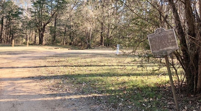
This artesian well was drilled to serve a factory which did not materialize. It was then used to water the grounds, a garden and pastures. In addition, by forcing water through pipes into his $50,000 home, E. M. Perine, a merchant prince, had the . . . — — Map (db m83518) HM
One of the most important jobs for humans and animals is
finding water. Early Indians knew of the many springs, streams,
and ponds on Monte Sano. Water also attracted deer and other
game; a year around source of food for Indians and
Early . . . — — Map (db m283193) HM
In the mid-1800s, masons sculpted local clay into these bricks and created this sidewalk. It sits approximately 18 inches below the present walk, level with the original street. What once served as a humble walkway for farmers, merchants and . . . — — Map (db m281043) HM
Original iron fence given in 1946 by the great-grandchildren of Archibald and Sarah Warren Tyson.
Sarah Morgan Wilcox • Isabelle Morgan Curry • William Morgan, Jr. • Lewis Render Morgan — — Map (db m268032) HM
"This section lying between Sixth Avenue and Eighth Avenue will provide the central beautification theme as it will evolve into a beautiful elevated rose garden with 2,000 selected roses planted at vantage points… the color ensemble, . . . — — Map (db m279728) HM
"Sun/Jan 8, 1939-Traveled down to the East Fork Ranger Cabin in the canyon. There was much overflow water from the mouth of the canyon down to the cabin. The rangers cabin was an awfull mess. The bear had been in the cabin. It took . . . — — Map (db m257625) HM
James Wickersham saw the cornerstone as key to keeping the idea of a college alive. "The interest of the people must not be permitted to lag," he wrote in June 1915, three months after he secured the land from Congress but two years before the . . . — — Map (db m257454) HM
On a June day in 1915, Alaska's territorial delegate to Congress, James Wickersham, and six companions cut a rough road to this hilltop site, set up a concrete pour and laid down a cornerstone.
The cornerstone's inscription, "A.A.C.S.M., July . . . — — Map (db m257459) HM
Bear Cache
A bear cache is a place designed to store food outdoors and prevents bears and other animals from accessing it. They are often used by campers when staying in bear habitat and can also be used by hunters for storing game. A . . . — — Map (db m257466) HM
The Nyac 2 1/2, as this model dredge is known, was given to James K. Crowdy in 1938. Crowdy, President of the New York-Alaska Gold Dredging Corp. of Nyac, Alaska, was presented this model by the Washington Iron Works of Seattle. The working model . . . — — Map (db m257488) HM
This drill was used in the Preacher Creek area during the early 20th Century, where it sat for decades until its restoration by Eagle Scout Seth Santoro of the Midnight Sun Council, Troop 92 in 2016. Drills were used to determine the presence . . . — — Map (db m257485) HM
This machine has a colorful past. It helped to build the Panama Canal, worked in Hawaii, and dug sections of Davidson Ditch; the Alaskan "Water Pipeline".
Davidson Ditch brought water from Chatanika to float and operate the huge hydraulic . . . — — Map (db m257486) HM
Wall tents have been a part of Alaskan camps and settlements
since the late 1800's. From the gold rush camps of the 1890's to
fishing and hunting camps of today, these substantial tents with
built-up walls remain typical of camp living in the . . . — — Map (db m255194) HM
The windmill powered the
pump for the well and later
generated electricity to charge
vehicle batteries. [? - possibly "Carl"] Tweiten
built the original windmill for
Rika in 1932. — — Map (db m255801) HM
This wood stove is an excellent example of Alaskan ingenuity. The collared opening and door are brake drums from an old automobile. Although it does not come from the same time period as the roadhouse, it does demonstrate the inventive re use . . . — — Map (db m255646) HM
Devices called "pigs" are routinely used in pipelines around the world. The first pigs, used to clean the inside walls of early small-diameter lines, were short and squat, suggesting the shape of the common barnyard animal. The name was applied . . . — — Map (db m255703) HM
The primary goal of habitat enhancement is to return an area to an earlier successional
stage, using methods such as tilling, mowing, rollerchopping, and prescribed fire.
① Maintaining bison habitat
Maintaining fields for . . . — — Map (db m255610) HM
Devices of this nature have been used for thousands of years to tell time, although only in a crude sense. Our division of the day into uniform hours occurred recently--in the 16th century-- while intervals of minutes and seconds were developed well . . . — — Map (db m263185) HM
This #3 bell was manufactured by C.S. Bell Company of Hillsboro, Ohio in 1886. Jonathan Heaton brought the bell to Moccasin on 23 July 1902. On 24 July 1902, he mounted it on the shed west of the Big House.
The crystal metal alloy gave a . . . — — Map (db m255616) HM
Every Lonely Dell family struggled to water their fields through various dams, tunnels, and hand-dug ditches. The Paria River's muddy flows and unpredictable floods caused problems, but ferryman Warren Johnson worked tirelessly to grow crops and . . . — — Map (db m289944) HM
There have been a lot of changes since Hoover Dam was complete in 1935.
Among those changes are a bridge that rivals the dam as an engineering achievement. But the old is as impressive as the new. Nearly a century after its builders met . . . — — Map (db m254651) HM
Visual icons of the Southwest, windmills were common in the plains and high desert from the 1800s. Metal windmills like this model became popular after 1890 because their curved blades allowed them to capture more wind, and they needed less . . . — — Map (db m274600) HM
Miss Willie K. Hocker, author, educator, member of
Pine Bluff Chapter, National Society, Daughters
of the American Revolution and designer of
the Arkansas Flag. The flag design was adopted
in 1913 by the General Assembly. The twenty-five stars . . . — — Map (db m305311) HM
Miss Willie K. Hocker, author, educator, member of
Pine Bluff Chapter, National Society, Daughters
of the American Revolution and designer of
the Arkansas Flag. The flag design was adopted
in 1913 by the General Assembly. The twenty-five stars . . . — — Map (db m305312) HM
The Tevis Arboretum & Gazebo
On any beautiful Tahoe summer afternoon, you might find members of the family and their guests enjoying tea here in the luxurious arboretum gardens. Gazebos and "summer homes" like this one were common . . . — — Map (db m275583) HM
During the first two decades of this century the Keane Wonder Mine was the scene of major investment and development. The products of this labor were the riches - gold and silver.
About 1903, Jack Keane, prospector, discovered gold in this . . . — — Map (db m159264) HM
A monument to determination and perserverance, William Henry "Burro" Schmidt took thirty-eight years to hand dig this half-mile long tunnel -- completed in 1936.
Born in Rhode Island, January 30, 1871.
Died in Ridgecrest, Calif., January 27, . . . — — Map (db m114470) HM
This restored adobe, second oldest in San Joaquin Valley, built by Daniel Rhoades, who came to California in 1846 by overland caravan. Rhoades and his brother, John, among organizers of the first expedition to rescue the Donner party at Donner Lake. . . . — — Map (db m66412) HM
You may not have realized it, but the ground you are standing on is part of one of the longest and most scenic continuous
trails in the world. To your left, this trail meanders 2,397 miles to the Canadian border; to your right, it continues for . . . — — Map (db m263075) HM
In front of you in the hills, high above freeway Interstate 5, is a portion of the historic 1915 two-lane “Ridge Route”. The power lines follow it.
The original Ridge Route was constructed in 1914-1915 by pick, shovel and mule drawn Fresno . . . — — Map (db m152085) HM
This single arch bridge was inspired by "The
Bridge to Nowhere", a concrete bridge built in
1936, located north of Azusa, in the San Gabriel
Mountains, spanning the East Fork of the San
Gabriel River. — — Map (db m260084) HM
On June 24, 1971, an explosion and fire took the lives of seventeen construction workers building a tunnel in Sylmar, California. The tunnel was being built for the Metropolitan Water District of Southern California by the Lockheed Shipbuilding . . . — — Map (db m126024) HM
On January 17, 1994, Los Angeles and the surrounding region experienced a 6.7 magnitude earthquake centered in Northridge. To commemorate the rebuilding of the region and CSUN, we created the sculpture garden incorporating remnants of the . . . — — Map (db m155780) HM
The friendship bell, overlooking the Pacific Ocean, was presented as a gift from the people of the Republic of Korea to the people of the United States of America on the occasion of the American Bicentennial Jubilee to further the . . . — — Map (db m51064) HM
[This site was designated California Historical Landmark No. 1006 on May 11, 1992.
There are three rock and concrete bases which had displayed four different markers. The markers are now missing. The following marker was never placed:] . . . — — Map (db m184724) HM
Settling Basin built by San Fernando Mission Indians about 1800. Mission water supply came from these wells.
panel 2:
Original water supply system, San Fernando Mission, circa 1800. Declared Historic Cultural Monument No. 50 . . . — — Map (db m111907) HM
In honor of the pioneer aviators who have given their all that the science of aviation could be perfected, enabling it to take its place in the worlds commerce, this airport is dedicated.
December 17, 1928, on the 25th anniversary of the . . . — — Map (db m114309) HM
One of the last remaining ornamental streetlights that graced Westwood Village in the late twenties. The blue and gold tiles are reflective of the colors of UCLA. — — Map (db m266663) HM
Old Trapper's Lodge is one of California's remarkable twentieth century folk art environments. It represents the life work of John Ehn (1897-1981), a self-taught artist who wished to pass on a sense of the Old West. Derived from personal . . . — — Map (db m149170) HM
For many years, this statue stood in front of, and was a trademark for, the world renowned Helms Bakery on Venice Boulevard in Los Angeles.
On October 6, 1971, it was generously donated to the Marina by the Helms family. In 1975, through the . . . — — Map (db m128458) HM
Tataviam Native Americans
The Tataviam - a name applied to the people occupying this
region by other tribal groups, and varying in meaning from
"people facing the sun" to "people of the south facing slope"
- lived in . . . — — Map (db m285463) HM
Problems With Design
Too Tall
Final design was 20 ft higher than the
original plan, without increasing the base
width to support the additional height.
Hydraulic Uplift
The design did not . . . — — Map (db m285494) HM
Geology That Contributed to the Failure
Landslides of the eastern abutment, oversaturated
sandstone and conglomerate of the western abutment,
and an active thrust fault under the footing contributed
to the failure. The Sespe . . . — — Map (db m285501) HM
Hello Girls
Telephone operators such as Louise Gipe in Santa
Paula and Reicel Jones in Saticoy - subsequently
nicknamed the "Hello Girls" - bravely stayed at
their posts after being notified of the flood headed
their way. They . . . — — Map (db m285495) HM
Some sections of the original Los Angeles Aqueduct, completed 1913, are still in use. During six years, 100,000 laborers built the 233-mile-long series of canals, pipelines and tunnels that make up the gravity-flow aqueduct from Owens Valley. — — Map (db m129858) HM
The St. Francis Dam, part of the
Los Angeles Aqueduct system,
stood 1½ miles north of this site.
On March 12, 1928, the 185-foot high
concrete dam collapsed just
before midnight, sending 12⅓ billion
gallons of water roaring down . . . — — Map (db m146564) HM
On this site in August of 1924 construction started on the St. Francis Dam, a unit of the Los Angeles Aqueduct. When it was completed in May of 1926, this concrete dam stood 185 feet above the stream bed, impounding a 610 surface-acre lake.
. . . — — Map (db m143721) HM
The 185-foot concrete St. Francis Dam, part of the Los Angeles aqueduct system, stood 1½ miles north of this site. On March 12, 1928, the 185-foot high concrete dam collapsed just before midnight, sending 12½ billion gallons of water roaring down . . . — — Map (db m143722) HM
Policy Changes
In response to the failure of the St. Francis Dam,
the California Department of Water Resources
Division of Safety of Dams was established on
August 14, 1929, by the State Legislature. The
division was . . . — — Map (db m285496) HM
Tony Harnischfeger
Tony was the dam keeper who frantically called
Mulholland earlier that day worried about the
muddy water coming from the dam. It is believed
that his girlfriend Leona, his 6-year old son Coder,
and
he, were . . . — — Map (db m285498) HM
What Were the Water Wars?
The California Water Wars were a series of political conflicts that took place in the
late 19th and early 20th centuries in Owens Valley. These conflicts centered around
Los Angeles' expanding population . . . — — Map (db m285492) HM
Early Life
William Mulholland joined the British
Merchant Navy at the age of 15 and
sailed as an apprentice for several years.
After landing in the United States, he
worked on the Great Lakes and in the
lumber camps of Michigan . . . — — Map (db m285493) HM
On this site stands CSO-4 (Pico #4), California's first commerically productive well. It was spudded in early 1876, under the direction of Demetrius G. Scofield, later to become first president of Standard Oil Company of California, and was . . . — — Map (db m157684) HM
On this spot, in 1887, the first fish ladder of its kind on the Pacific coast was designed and built by Stephen Schuyler Stedman, a Marin County pioneer. It was located on the end of the Samuel P. Taylor paper mill dam. Duplicates were later built . . . — — Map (db m291133) HM
On International Surfing Day 2015, on the south side of the Huntington Beach Pier, 66 former US Open of Surfing winners, Surfing Walk of Fame and Surfers' Hall of Fame inductees, celebrities, and local Huntington Beach heroes rode a custom-built, . . . — — Map (db m301497) HM
Bruce Phillips was a fixture of the Ranch Plan's development team for nearly two decades as a key contributor toward achieving Rancho Mission Viejo's vision of sustainable water management. Many of the sustainable water applications for stormwater . . . — — Map (db m273818) HM
Construction on Lake Hemet Dam began in 1891 and was completed four years later on October of 1895. It stood at 122.5 feet and was the largest solid masonry dam in the world, a title it held for sixteen years.
Building of the dam itself was . . . — — Map (db m78534) HM
An Imperial Temple Bell from The
Manchu Temple in Nanjing, China.
This 3500 pound bell was cast of iron alloy
during the reign of Emperor Quang Hsu,
(1875AD - 1908AD) around the time of
The Boxer Revolution.
From 1898 to 1908 the . . . — — Map (db m233202) HM
At this location on January 8, 1863, Governor Stanford surrounded by politicians and locals, announced the start of the United States’ first transcontinental railroad. You are standing at Mile Marker 0, the origin of the Central Pacific Railroad . . . — — Map (db m149177) HM
Historic Civil Engineering Landmark
Sacramento Water Works
Completed in April 1854, the City of Sacramento’s water works was the first municipal, city-owned water system west of the Mississippi River. Before the municipal system was built, the . . . — — Map (db m224046) HM
Built by cowboys to water their cattle,
Barker Dam today is a small, ephemeral
lake that attracts an array of animal life
in an otherwise parched environment.
A 1.3-mile loop trail with interpretive
markers leads to the rain-filled pool. . . . — — Map (db m263737) HM
In 1895 the Junior Order of American
Mechanics erected the first
Redlands “Liberty Pole” a term
derived from the American
Revolution. Made from a century
old douglas fir, the pole was moved
in 1963 from the intersection of
Orange, Cajon, . . . — — Map (db m269718) HM
In the early 1800s, the Spanish saw the need to control the flow
of water and to provide it year-round for their permanent
settlements. To solve this problem, engineers trained in Mexico
supervised Kumeyaay Indian laborers in building one of . . . — — Map (db m296528) HM
Lighthouse locations were usually far from fresh water.
To compensate, many lighthouses used rain "catchment systems" like the one before you.
These giant concrete funnels diverted rainwater into underground cisterns, where it was stored for . . . — — Map (db m296432) HM
Each year millions of tons of sediment wash out from the Central Valley through the Carquinez Strait and get deposited in the mudflats of the San Pablo and San Francisco bays. Because the docks on the opposite side of the island are a natural . . . — — Map (db m232402) HM
Four years after California became a state in 1850, the U.S. Navy commissioned Mare Island Shipyard, the first naval installation on the Pacific. Over 500 vessels, from wooden sailing ships to atomic submarines, were built at Mare Island . . . — — Map (db m232395) HM
The bridges, oil refineries, factories and ports along the East Bay shoreline reflect a commercial history that dates back to the Gold Rush. The Carquinez Strait provided easy passage for ships carrying cargo and people to and from the gold . . . — — Map (db m232404) HM
In addition to the naval shipyard, other military functions were established on the island. From 1857 to 1975 the Naval Ammunition Depot - located at the southern tip of the island - manufactured, tested and stored ammunition that supplied the . . . — — Map (db m232401) HM
Friar Pedro Benito Cambón—the mission’s co-founder was highly regarded for his knowledge of irrigation, agriculture and building construction—directed Chumash laborers to build this filtration building in 1792 as part of the mission’s timber, . . . — — Map (db m124925) HM
Rancho Cañada Larga o Verde, as it was originally known, came out of lands of the San Buenaventura Mission. Following Mexican independence from Spain, Joaquina Alvarado de Moraga, whose late husband, Gabriel Moraga, was a distinguished soldier of . . . — — Map (db m124924) HM
A visible section of the mission aqueduct still exists just east of Highway 33 on Cañada Larga Road. It is one of the few remaining parts of a seven-mile-long system that delivered water from San Antonio Creek to El Caballo filtration plant on the . . . — — Map (db m143278) HM
With a summit elevation of 14,110 ft above sea level, the Manitou & Pike's Peak
Railway is the highest railway in North America and the world's highest cog railway. This line was the third and last cog railroad to be built in the
United States . . . — — Map (db m250962) HM
Water Tower
Water For Everyone
Clean water was crucial to Arvada’s early growth. The ditch irrigation system that first provided Arvada’s drinking water was replaced in 1870 with the first well, hand-dug to 90 feet. This shallow . . . — — Map (db m289306) HM
Welcome to Golden Arch
The arch was constructed in early 1949 with a dedication ceremony in March 1949 along with the opening of the Golden Theater, earlier known as the Gem Theatre. The Governor of Colorado, along with 6000 people showed . . . — — Map (db m288326) HM
What’s that “M”?
To the west on Mount Zion is a large capital M formed by white rocks. The “M” stands for the Colorado School of Mines, and it has been on the mountain since 1908. The complex geometry that allows the M to appear in proper . . . — — Map (db m287620) HM
(1887 Cornerstone)
Justitia non est neganda non differenda
"Justice is not to be denied nor delayed"
This corner stone and inscription
Set August 11, 1887
Came from the original
Larimer County Courthouse
(1955 Cornerstone)
This . . . — — Map (db m281612) HM
Unionville has used Farmington River water power since the late 1700s. The first dam (item D1 on map 1 and Photograph P1), built circa 1780, was just 200 yards upstream from the Route 4 bridge. The canal from this dam was on the west side of . . . — — Map (db m95986) HM
Made of rock and iron, the fountain was the first in the nation powered by electricity at a time when streets and homes were still gaslit. The electricity was generated by the trolley line’s power station using the Farmington River. Colored lights . . . — — Map (db m142561) HM
Tales from the City
Walter Camp “Father of American Football”
Walter Camp, known as the “Father of American Football”, was born in New Britain on April 7, 1859. Camp played football at Yale University between 1876 and 1882, and then served . . . — — Map (db m259592) HM
The Bulkeley Mill Dam was originally built around 1680 by Rev. Gershom Bulkeley to provide
water power to his corne mill. It was rebuilt and enlarged in 1875 in order to strengthen, make
higher and flood additional land.
In 1975, the Town of . . . — — Map (db m301399) HM
Gift of Malvina Chapin Corliss in memory
of her parents, Regina & Norman F. Chapin
This statue once graced the grounds
of Laurelhurst, the estate of the Migeon family
that was located at the corner of Migeon Avenue
and Forest Street. Like . . . — — Map (db m297006) HM
Fire safety was uppermost in the
minds of early Guilford residents,
and for this purpose, deep fire
wells were dug on the Green for
a water supply. There remains
evidence of three of these wells,
capped by square slabs of
concrete and also . . . — — Map (db m272120) HM
History
The Anacostia River was once nearly a mile wide, and the channel was deep enough for ocean-going ships to travel and trade. By 1850, the river had silted in from erosion caused by deforestation and farming, and was no longer . . . — — Map (db m237153) HM
History
The Anacostia River was once nearly a mile wide, and the channel was deep enough for ocean-going ships to travel and trade. By 1850, the river had silted in from erosion caused by deforestation and farming, and was no longer . . . — — Map (db m237162) HM
English, Irish and German settlers, as well as enslaved and free African Americans, were the first non-natives to claim Brightwood. Farmers dominated until the Civil War. Then in the 1890s electric streetcars allowed government workers to live . . . — — Map (db m121018) HM
The City Park across the street was once Emery Place, the summer estate of Matthew Gault Emery.
A prominent builder, Emery was Washington City's last elected mayor during the period of home rule. He was succeeded in 1874 by a . . . — — Map (db m72816) HM
The Rock Creek Valley, once home to Native Americans, had attracted European settlers by 1703. Before he became president in 1825, John Quincy Adams purchased Adams Mills on Rock Creek from his cousin. The mills, just down the hill, . . . — — Map (db m130713) HM
For nearly 50 years, this corner was home to Nob Hill Restaurant, one of the nation's first openly gay bars for-and run by-African Americans.
Started in the 1950s as a private social club, Nob Hill went public in 1957. Patrons enjoyed . . . — — Map (db m86014) HM
A post-Civil War building boom brought grand new houses to this convenient area. By 1881 Blanche Kelso Bruce, the first African American to serve a full term in the U.S. Senate, and Major John Wesley Powell, pioneering director of the U.S. . . . — — Map (db m130887) HM
This Circle Honors Anna Julia Haywood Cooper the educator and civil and women's rights advocate who lived in the gracious house at 201 T Street from 1916 until her death in 1964 at age 105. Born into slavery, Cooper graduated from Oberlin . . . — — Map (db m170781) HM
The Roster of LeDroit Park's accomplished African Americans is long. Consider these prominent Washingtonians who lived on T Street.
Walter E. Washington and his wife, Bennetta Bullock Washington, lived with her family at 408 T Street. Mrs. . . . — — Map (db m152367) HM
To your right is "Point Reno," the highest point in Washington — 409 feet above sea level, to be exact.
This unsurpassed vantage brought the Civil War (1861-1865) to Tenleytown. After the Union defeat at Bull Run in July 1861, northern . . . — — Map (db m130923) HM
At 5:00 p.m. on Christmas Eve, 1923, President Calvin Coolidge walked from the White House to the Ellipse and “pushed the button” to light the first National Christmas Tree. A crowd of 3,000 witnessed the inaugural lighting of the 48-foot, cut . . . — — Map (db m130403) HM
Now a landmark feature of the museum's north entrance, this fountain faced shifting design plans and dwindling construction funds that almost kept it from being built. In 1966 architect Walker O. Cain proposed the fountain we see today. Completed . . . — — Map (db m281427) HM
Until 1890 Tenleytown was a rural crossroads. Then the electric streetcar arrived, followed by the Permanent Highway Plan. Real estate men promoted new houses at the top of the town: city conveniences, country charm, and great views, with a . . . — — Map (db m130921) HM
Presented to Curtis Bros. for their outstanding leadership and service to the public by the Basset Furniture Industries.
The chair made of solid Honduras mahogany is 19½ feet tall and weighs 4600 pounds.
Designer: Leo M. Jiranek . . . — — Map (db m5459) HM
You stand on a part of the Potomac River once marred by unattractive, putrid mudflats. Hains Point forms just a part of the over 700-acre Potomac Park created in the 1880s from 12 million cubic yards of dredged river sediments. It is named for . . . — — Map (db m265625) HM
3514 entries matched your criteria. The first 100 are listed above. Next 100 ⊳