3994 entries match your criteria. Entries 201 through 300 are listed.⊲ Previous 100 — Next 100 ⊳
Animals Topic
By Eric Polk, January 9, 2008
Santa Catalina Island Marker
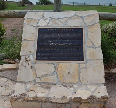
| 201 ► California, Los Angeles County, Rancho Palos Verdes — Santa Catalina Island — |
| On Palos Verdes Drive South, 0.2 miles east of Sea Cove Drive, on the right when traveling east. | |||
| 202 ► California, Los Angeles County, Santa Clarita, Newhall — American Bison — |
| Near Market Street, 0.2 miles south of Newhall Avenue. | |||
| 203 ► California, Los Angeles County, Santa Clarita, Newhall — Santa Clarita History Bear — 2017 - Frank Rock — |
| On Lyons Avenue at Main Street, on the right when traveling east on Lyons Avenue. | |||
| 204 ► California, Los Angeles County, South Pasadena — 18 — Cawston Ostrich Farm — 1896 - 1935 — |
| On Pasadena Avenue east of Sycamore Avenue, on the right when traveling east. | |||
| 205 ► California, Los Angeles County, Whittier — 646 — Greek George — Grave of George Caralambo — |
| On Citrus Avenue north of Broadway, on the left when traveling north. | |||
| 206 ► California, Madera County, Madera — Madera Zoo — |
| On West 6th Street, 0.1 miles west of South Gateway Drive, on the right when traveling west. | |||
| 207 ► California, Marin County, Inverness — Common Murres — Point Reyes National Seashore — |
| Near Sir Francis Drake Boulevard. | |||
| 208 ► California, Marin County, Point Reyes Station — Sea Life in These Waters — Gulf of the Farallones & Cordell Band — National Marine Sanctuaries — |
| Near Sir Francis Drake Boulevard north of Chimney Road Road. | |||
| 209 ► California, Marin County, Point Reyes Station — Whalewatching — |
| Near Chimney Rock Road. | |||
| 210 ► California, Marin County, Tiburon — Backcountry — |
| 211 ► California, Marin County, Tiburon — Crushing Rock for the Roads — |
| 212 ► California, Marin County, Tiburon — 2 — Feed Lot For Oysters — Compare Then and Now — The Tiburon Historical Trail — |
| 213 ► California, Marin County, Tiburon — Mule Barn — |
| 214 ► California, Marin County, Tiburon — Mule Power — |
| 215 ► California, Marin County, Tiburon — Saving and Protecting Our Bay — |
| 216 ► California, Marin County, Tiburon — 1 — The Trestle and Blackie's Pasture — The Tiburon Peninsula Historical Trail — |
| Near Tiburon Boulevard. | |||
| 217 ► California, Mariposa County, Fish Camp — A New Vision for an Ancient Grove — Mariposa Grove of Giant Sequoias — Yosemite National Park — |
| Near Mariposa Grove Road, 2.1 miles east of Wawona Road (California Route 41). | |||
| 218 ► California, Mariposa County, Yosemite National Park — A Seasonal Lake — |
| 219 ► California, Mendocino County, Laytonville — Stable / The Laytonville Baptist Church — |
| On U.S. 101, 0.1 miles north of Branscomb Road, on the right when traveling north. | |||
| 220 ► California, Merced County, Los Banos — Henry Miller — July 21, 1827 - October 14, 1916 — |
| On H Street at 6th Street, on the right when traveling west on H Street. | |||
| 221 ► California, Modoc County, Newell — Raptors - Birds of Prey — |
| On County Road 126 (County Route 126), on the left when traveling south. | |||
| 222 ► California, Mono County, Benton — Aurora and Owens River Wagon Road — |
| On State Highway 120 at Taylor Canyon Road (Federal Road 1S17), on the left when traveling west on State Highway 120. | |||
| 223 ► California, Monterey County, Big Sur — Condors: Returning to Our Skies — |
| Near Cabrillo Highway (U.S. 1 at milepost 37). | |||
| 224 ► California, Monterey County, Monterey — Cannery Divers Memorial — |
| On Cannery Row east of Reeside Avenue when traveling west. | |||
| 225 ► California, Monterey County, Monterey — Edward Ricketts — 1897-1948 — |
| Near Wave Street near Drake Avenue. | |||
| 226 ► California, Monterey County, Monterey — Monterey Bay Aquarium / Hovden Cannery — There was a cannery here before the aquarium — |
| On Wave Street / Ocean View Boulevard at David Avenue, on the right when traveling east on Wave Street / Ocean View Boulevard. | |||
| 227 ► California, Monterey County, Monterey — Monterey Breakwater — Historic Cannery Row — |
| Near Cannery Row. | |||
| 228 ► California, Monterey County, Monterey — The Calamari Story — Dedicated to the fishermen of Monterey Bay — |
| Near Fisherman's Wharf. | |||
| 229 ► California, Monterey County, Monterey — The Cannery Row Monument — Dedicated February 26, 2014 — |
| On Cannery Row, on the right when traveling west. | |||
| 230 ► California, Monterey County, Pacific Grove — Hopkins Marine Station — Hopkins scientists study the biology of the bay — |
| On Ocean View Boulevard at Eardley Avenue, on the right when traveling west on Ocean View Boulevard. | |||
| 231 ► California, Nevada County, Nevada City — Nevada Hose Co. No. 1 — |
| On Main Street, on the right when traveling west. | |||
| 232 ► California, Nevada County, Norden — McGlashan Point — |
| On Donner Pass Road, on the left when traveling east. | |||
| 233 ► California, Nevada County, Soda Springs — Summit Valley Sheep Pens — Hwy 40 Scenic Bypass — |
| On Old Donner Summit Road near Sugar Bowl Road, on the right when traveling east. | |||
| 234 ► California, Orange County, Aliso Viejo — Mixocetus Baleen Whale — Plaza de La Paz |
| Near Plaza De La Paz west of La Paz Road. Reported unreadable. | |||
| 235 ► California, Orange County, Anaheim, Anaheim Resort — Santa Ana River Area History — Welcome to the Santa Ana River Trail — |
| On Katella Ave., on the right when traveling east. | |||
| 236 ► California, Orange County, Dana Point — Don Hansen, Dana Wharf Sportfishing — 40th Anniversary 1971-2011 — |
| Near Golden Lantern Street south of Dana Point Drive, on the left when traveling south. | |||
| 237 ► California, Orange County, Irvine — Lion Country Safari — |
| On Dana at Pintado, on the left when traveling north on Dana. | |||
| 238 ► California, Orange County, Irvine, Northwood — The Evolution of the City — Irvine — |
| Near Jeffrey Road north of Roosevelt, on the right when traveling north. | |||
| 239 ► California, Orange County, Laguna Hills — Charlotte and Louise Moulton — Moulton Museum — |
| Near Cabot Road. | |||
| 240 ► California, Orange County, Laguna Hills — Nellie Gail and Charlotte Moulton — Moulton Museum — |
| Near Cabot Road south of La Paz Road, on the left when traveling south. | |||
| 241 ► California, Orange County, Lake Forest — Coast Live Oak - Historical Legend — |
| Near Serrano Road at Winding Way, on the right when traveling north. | |||
| 242 ► California, Orange County, Mission Viejo — Aguaje del Cuate Historic Highway 101 — Historical Site — |
| On Cabot Road, on the right when traveling north. | |||
| 243 ► California, Orange County, Mission Viejo — Fossil — Whale Exhibit — |
| On Christiana Road, on the right when traveling north. | |||
| 244 ► California, Orange County, Mission Viejo — Whale Fossil — |
| On Christiana Road, on the right when traveling north. | |||
| 245 ► California, Orange County, San Juan Capistrano — Welcome to Our Petting Zoo — History in the Making — |
| On Los Rios Street at Verdugo Street, on the left when traveling north on Los Rios Street. | |||
| 246 ► California, Orange County, Silverado — 144 — Death of the California Grizzly — 1908 — |
| On Silverado Canyon Road, on the right when traveling west. | |||
| 247 ► California, Placer County, Foresthill — Old Joe — |
| On Foresthill Divide Road near between Foresthill and Auburn, on the right when traveling east. | |||
| 248 ► California, Placer County, Tahoe City — The Plentiful Lake — |
| Near West Lake Blvd north of Tahoe Tavern Road. | |||
| 249 ► California, Riverside County, Coachella — Water Trough — |
| Near Orchard St at 6th St, on the left when traveling south. | |||
| 250 ► California, Riverside County, Riverside — Lt Col Shunzo Kido — |
| Near Mount Rubidoux Drive. | |||
| 251 ► California, Riverside County, Riverside — War Dog Memorial — |
| On Van Buren Boulevard. | |||
| 252 ► California, Riverside County, Riverside, Downtown Riverside — Napoleon and Joseph — |
| On Main Street. | |||
| 253 ► California, Sacramento County, Folsom — Who is Fisher? — |
| Near Stafford Street. | |||
| 254 ► California, Sacramento County, Gold River — The Treasured American River — |
| Near Gold Country Road. | |||
| 255 ► California, Sacramento County, Rancho Cordova, Mather — Welcome to Mather Lake — |
| Near Zinfandel Drive, 4 miles south of U.S. 50, on the right when traveling south. | |||
| 256 ► California, Sacramento County, Represa — Horse Head Hitching Post — |
| On Prison Road, on the left when traveling north. | |||
| 257 ► California, Sacramento County, Sacramento, Central Business District — The California State Insectary — Constructed in 1908 — |
| On 13th Street south of L Street, on the left when traveling south. | |||
| 258 ► California, Sacramento County, Sacramento, Old Sacramento — Early Explorers — |
| Near K Street at Interstate 5, on the right when traveling east. | |||
| 259 ► California, Sacramento County, Sacramento, Southwestern Sacramento — Spencer Hoofed Animal Complex — |
| Near West Land Park Drive. | |||
| 260 ► California, Sacramento County, Sloughhouse — Jared D. Sheldon — 1813 - 1851 — |
| Near Meiss Road near Jackson Highway (California Highway 16). | |||
| 261 ► California, San Benito County, Pinnacles National Monument — Return to Condor Crags — |
| 262 ► California, San Bernardino County, Barstow — General Beale Uses Camels — |
| On North Second Street north of East Cozy Avenue, on the left when traveling north. | |||
| 263 ► California, San Bernardino County, Big Bear Lake — Grizzly Come Home Campaign — Big Bear Alpine Zoo — |
| Near Club View Drive at Moonridge Road. | |||
| 264 ► California, San Bernardino County, Hesperia — 9 — Elliot Ranch — 1927 — |
| On California Route 138 at Summit Post Office Road, on the left when traveling east on State Route 138. | |||
| 265 ► California, San Bernardino County, Mountain Pass — Footprints in Time — |
| On Interstate 15, 25 miles north of Baker, on the right when traveling north. | |||
| 266 ► California, San Bernardino County, San Bernardino National Forest, Barton Flats — Whispering Pines Trail — A Journey of Exploration and Discovery — The History of Whispering Pines — |
| On State Highway 38 at Jenks Lake Road, on the right when traveling east on State Highway 38. | |||
| 267 ► California, San Diego County, Pacific Beach — The Ballad of P.B. — |
| On Ocean Boulevard. | |||
| 268 ► California, San Diego County, San Diego — Bum - San Diego’s Official Town Dog / Greyfriars Bobby — The “Tail” of Two Cities – The Brother Dogs Project — |
| Near 4th Avenue at Island Avenue. | |||
| 269 ► California, San Francisco City and County, San Francisco, Alcatraz Island — Western Gulls — Nursery on the Parade Ground — |
| 270 ► California, San Francisco City and County, San Francisco, Chinatown — A Legacy of Preserving Fish — |
| On Wentworth Place south of Jackson Street, on the right when traveling south. | |||
| 271 ► California, San Francisco City and County, San Francisco, Financial District — Bummer and Lazarus — |
| Near Washington Street, on the right when traveling east. | |||
| 272 ► California, San Francisco City and County, San Francisco, Financial District — 861 — Site of First California State Fair — |
| On Bush Street east of Montgomery Street, on the left when traveling west. | |||
| 273 ► California, San Francisco City and County, San Francisco, Financial District — The San Francisco Society for the Prevention of Cruelty to Animals — |
| On Clay Street at Leidesdorff Street on Clay Street. | |||
| 274 ► California, San Francisco City and County, San Francisco, Lincoln Park — Exploring Lands End — Golden Gate National Recreation Area — |
| Near Lands End Trail near Merrie Way. | |||
| 275 ► California, San Francisco City and County, San Francisco, North Waterfront — National Park Service — Alcatraz Landing — Keepers & the Kept — |
| Near The Embarcadero south of Bay Street, on the right when traveling north. | |||
| 276 ► California, San Francisco City and County, San Francisco, Northern Waterfront — Egg War of the Farallones — |
| Near The Embarcadero. | |||
| 277 ► California, San Francisco City and County, San Francisco, Presidio of San Francisco — Gulf of the Farallones National Marine Sanctuary — |
| Near Marine Drive. | |||
| 278 ► California, San Francisco City and County, San Francisco, San Francisco Zoo — Monarch's Tale — |
| Near Sloat Boulevard at The Great Highway when traveling west. | |||
| 279 ► California, San Francisco City and County, San Francisco, Twin Peaks — Twin Peaks Natural Habitat — |
| Near Christmas Tree Point Road near Twin Peaks Boulevard. | |||
| 280 ► California, San Joaquin County, Clements — History of Clements Buckaroos — |
| On California 88 (State Highway 88) just west of Hwy 88 hwy 12 split (State Highway 12), on the left when traveling east. | |||
| 281 ► California, San Joaquin County, Escalon — Campo Bravo Arena — |
| On Escalon-Bellota Road south of Skiff Road, on the right when traveling south. | |||
| 282 ► California, San Joaquin County, French Camp — 668 — French Camp — |
| On South Elm Street, on the right when traveling east. | |||
| 283 ► California, San Joaquin County, Lockeford — 365 — Pioneer Hill / Lockeford — |
| On Elliott Road, on the right when traveling north. | |||
| 284 ► California, San Luis Obispo County, San Simeon — Point Piedras Blancas, A Recent Colony — Thousands Strong and Growing… — |
| On Cabrillo Highway (California Route 1) 4.5 miles north of Hearst Castle Road, on the left when traveling north. | |||
| 285 ► California, San Luis Obispo County, Shandon — Home Sweet Homestead — |
| On Route 41, on the right when traveling north. | |||
| 286 ► California, San Mateo County, Moss Beach, Fitzgerald Marine Reserve — Bob Breen: Fitzgerald Marine Reserve's First Park Ranger — |
| On North Lake Street at Nevada Avenue, on the right when traveling west on North Lake Street. | |||
| 287 ► California, San Mateo County, Redwood City — Pleistocene Period — 2.6 Million - 11,700 Years Ago — Stanford | Redwood City — |
| On Broadway near Warrington Avenue, on the left when traveling west. | |||
| 288 ► California, San Mateo County, San Bruno — Seabiscuit — |
| On El Camino Real. | |||
| 289 ► California, San Mateo County, Woodside — Folger Stable c.1905 — Folger Estate Stable Historic District — |
| Near Woodside Road, on the right when traveling west. | |||
| 290 ► California, Santa Barbara County, Goleta — Arroyo Hondo Fish Passage & Upstream Habitat Restoration — Another Conservation Project of The Land Trust of Santa Barbara County — |
| Near U.S. 101, 3.5 miles east of Mariposa Reina. | |||
| 291 ► California, Santa Barbara County, Santa Barbara, Upper East — Assembly Required — The Making of Chad — A Blue Whale — |
| On Puesta Del Sol just west of Mission Canyon Road, on the left when traveling west. | |||
| 292 ► California, Santa Clara County, Gilroy — Henry Miller Summer Home — |
| On Pole Line Road. | |||
| 293 ► California, Santa Clara County, Gilroy — Uvas Creek — El arroyo de las Uvas — |
| Near Watsonville Road (County Road G8) at Burchell Road, on the right when traveling south. | |||
| 294 ► California, Santa Clara County, Morgan Hill — Anderson Lake County Park — |
| Near Cochrane Road at San Rafael Street, on the right when traveling west. | |||
| 295 ► California, Santa Clara County, Palo Alto — Motion Picture Research Commemoration — |
| Near Serra Mall at Palm Drive. | |||
| 296 ► California, Santa Clara County, San Jose, Rancho Santa Teresa — The Bernal Adobe Site and Bear Tree — |
| Near Curie Drive east of Korhummel Way, on the right when traveling east. | |||
| 297 ► California, Santa Clara County, San Jose, Santa Teresa — Farm Animals — Vital to ranch operations and family life — |
| On Manila Drive east of Camino Verde Drive, on the right when traveling east. | |||
| 298 ► California, Santa Clara County, San Jose, Santa Teresa — The Bernal Hacienda — Rancho Santa Teresa’s homeplace for family and business operations — |
| Near Manila Drive west of Manila Way, on the right when traveling east. | |||
| 299 ► California, Santa Clara County, Stanford — A Road Well Traveled — |
| On Santa Teresa Street at Govenor's Avenue, on the right when traveling east on Santa Teresa Street. | |||
| 300 ► California, Santa Cruz County, Santa Cruz — Arana Gulch's Changing Landscape — |
| On Agnes Street at Mentel Avenue, on the right when traveling east on Agnes Street. | |||
3994 entries matched your criteria. Entries 201 through 300 are listed above. ⊲ Previous 100 — Next 100 ⊳