4489 entries match your criteria. Entries 401 through 500 are listed.⊲ Previous 100 — Next 100 ⊳
Notable Places Topic
By Craig Baker, September 30, 2021
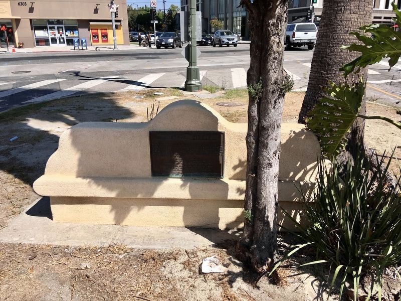
Carthay Circle Marker
401 ► California, Los Angeles County, Los Angeles, Carthay Circle — Carthay Circle —  |
| On McCarthy Vista at Wilshire Boulevard, on the left when traveling east on McCarthy Vista. | |||
| 402 ► California, Los Angeles County, Los Angeles, Downtown Los Angeles — 656 — Bella Union Hotel Site — |
| On North Main Street north of Temple Street, on the right when traveling north. | |||
| 403 ► California, Los Angeles County, Los Angeles, Downtown Los Angeles — 156 — Los Angeles Plaza — |
| On North Main Street south of West Cesar East Chavez Avenue, on the right when traveling north. | |||
| 404 ► California, Los Angeles County, Los Angeles, Downtown Los Angeles — Placita de Dolores Time Capsule — 1979–2079 — El Grito (The Cry) Mural — |
| Near North Alameda Street at Los Angeles Street, on the right when traveling south. | |||
| 405 ► California, Los Angeles County, Los Angeles, Downtown Los Angeles — 255 — The Original Pantry Cafe — |
| On Figueroa Street at James M Wood Boulevard (9th Street), on the left when traveling north on Figueroa Street. | |||
| 406 ► California, Los Angeles County, Los Angeles, Elysian Park — 655 — Portolá Trail — 1769 — |
| On Elysian Park Drive at North Broadway, on the left when traveling north on Elysian Park Drive. | |||
| 407 ► California, Los Angeles County, Los Angeles, Griffith Park — 942 — Griffith Park Pony Rides — |
| On Crystal Springs Drive 0.2 miles north of Los Feliz Boulevard, on the right when traveling north. | |||
| 408 ► California, Los Angeles County, Los Angeles, Highland Park — Galco’s Soda Pop Stop — |
| On York Boulevard at Ave 57, on the left when traveling west on York Boulevard. | |||
| 409 ► California, Los Angeles County, Los Angeles, Hollywood — Buster Keaton Studio — 1920 - 1928 — |
| On Lillian Way at Eleanor Avenue, on the right when traveling south on Lillian Way. | |||
| 410 ► California, Los Angeles County, Los Angeles, Hollywoodland — 535 — Hollywoodland Stairs — |
| On Woodshire Drive just west of Beachwood Drive, on the right when traveling west. | |||
| 411 ► California, Los Angeles County, Los Angeles, Pacific Palisades — 881 — Port Los Angeles — The Long Wharf — |
| Near Pacific Coast Highway (State Highway 1 at milepost 375), on the right when traveling south. | |||
| 412 ► California, Los Angeles County, Los Angeles, San Pedro — American Merchant Marine Veterans Memorial — |
| On Harbor Boulevard at 6th Street, on the right when traveling north on Harbor Boulevard. | |||
| 413 ► California, Los Angeles County, Los Angeles, San Pedro — 146 — Municipal Ferry Building — Los Angeles Maritime Museum — |
| On Sampson Way at East 6th Street, on the left when traveling south on Sampson Way. | |||
| 414 ► California, Los Angeles County, Los Angeles, San Pedro — Royal Palms County Beach — White Point — |
| On West Paseo Del Mar 0.2 miles east of Western Avenue, on the right when traveling east. | |||
| 415 ► California, Los Angeles County, Los Angeles, San Pedro — 384 — Timms' Point and Landing — |
| On Harbor Boulevard at Signal Place, on the left when traveling south on Harbor Boulevard. | |||
| 416 ► California, Los Angeles County, Los Angeles, Silver Lake — The Music Box Steps — Stan Laurel and Oliver Hardy — 1932 — |
| On Vendome Street 0.1 miles south of Sunset Boulevard, on the right when traveling south. | |||
| 417 ► California, Los Angeles County, Los Angeles, South Los Angeles — 35 — Adlai Stevenson — |
| On Monmouth Avenue north of 27th Street, on the left when traveling north. | |||
| 418 ► California, Los Angeles County, Los Angeles, South Los Angeles — 174 — Village Green — Baldwin Hills Village — |
| On Obama Boulevard at Cloverdale Avenue, on the right when traveling east on Obama Boulevard. | |||
| 419 ► California, Los Angeles County, Los Angeles, Venice — Muscle Beach Venice — 75th Anniversary Time Capsule — |
| Near Ocean Front Walk south of 18th Avenue, on the right when traveling south. | |||
| 420 ► California, Los Angeles County, Los Angeles, Wilmington — 169 — Drum Barracks — |
| Near Cary Avenue north of East Opp Street, on the left when traveling north. | |||
| 421 ► California, Los Angeles County, Monterey Park — Heritage Park Cascades — Built 1928 — |
| On De La Fuente Street at El Portal Place, on the right when traveling south on De La Fuente Street. | |||
| 422 ► California, Los Angeles County, Monterey Park — Jardin del Encanto — "El Encanto" — Built 1929 — |
| On El Mercado Avenue at El Portal Place, on the right when traveling north on El Mercado Avenue. | |||
| 423 ► California, Los Angeles County, Norwalk — Norwalk Square — |
| On Pioneer Boulevard at Rosecrans Avenue, on the right when traveling south on Pioneer Boulevard. | |||
| 424 ► California, Los Angeles County, Pasadena, Old Pasadena — Bonham Alley — |
| On Bonham Alley at North De Lacey Avenue, on the right when traveling east on Bonham Alley. | |||
| 425 ► California, Los Angeles County, Pasadena, Old Pasadena — Brainard Alley — |
| On North Arroyo Parkway at Brainard Alley, on the right when traveling west on North Arroyo Parkway. | |||
| 426 ► California, Los Angeles County, Pasadena, Old Pasadena — Christensen Alley — |
| On Christensen Alley at North De Lacey Avenue, on the right when traveling west on Christensen Alley. | |||
| 427 ► California, Los Angeles County, Pasadena, Old Pasadena — Electric Alley — |
| On E Holly St, on the left when traveling east. | |||
| 428 ► California, Los Angeles County, Pasadena, Old Pasadena — Hayes Alley — |
| On E Union Street. | |||
| 429 ► California, Los Angeles County, Pasadena, Old Pasadena — Hopkins Alley — |
| On N Raymond Ave, on the right when traveling north. | |||
| 430 ► California, Los Angeles County, Pasadena, Old Pasadena — Hugus Alley — |
| On Hugus Alley at Miller Alley, on the right when traveling west on Hugus Alley. | |||
| 431 ► California, Los Angeles County, Pasadena, Old Pasadena — Kendall Alley — |
| On E Union St, on the left when traveling east. | |||
| 432 ► California, Los Angeles County, Pasadena, Old Pasadena — Legge Alley — |
| On East Holly Street at Legge Alley, on the left when traveling west on East Holly Street. | |||
| 433 ► California, Los Angeles County, Pasadena, Old Pasadena — Pacific Alley — |
| On N Raymond Ave, on the right when traveling north. | |||
| 434 ► California, Los Angeles County, Pasadena, Old Pasadena — Places Change, People Endure — Exploring Pasadena's Past — |
| On North Pasadena Avenue at Holly Street, on the right when traveling north on North Pasadena Avenue. | |||
| 435 ► California, Los Angeles County, Pasadena, Old Pasadena — Plotkin Alley — |
| On S Raymond Ave. | |||
| 436 ► California, Los Angeles County, Pasadena, South Arroyo — Edwin Alley — |
| On Mills Alley at Mills Place, on the right when traveling east on Mills Alley. | |||
| 437 ► California, Los Angeles County, Pasadena, South Arroyo — Fraser Alley — |
| On Fraser Alley at South De Lacey Avenue, on the left when traveling west on Fraser Alley. | |||
| 438 ► California, Los Angeles County, Pasadena, South Arroyo — Martin Alley — |
| On Martin Alley at South De Lacey Avenue, on the left when traveling west on Martin Alley. | |||
| 439 ► California, Los Angeles County, Pasadena, South Arroyo — McCormick Alley — |
| On McCormick Alley at Mills Place, on the right when traveling west on McCormick Alley. | |||
| 440 ► California, Los Angeles County, Pasadena, South Arroyo — Mills Place |
| On Miller Alley at West Colorado Boulevard, on the left when traveling north on Miller Alley. Reported permanently removed. | |||
| 441 ► California, Los Angeles County, San Gabriel — San Gabriel Mission — Founded September 8, 1771 — |
| Near Mission Drive east of Junipero Serra Drive, on the right when traveling north. | |||
| 442 ► California, Los Angeles County, San Marino — Thornton Gardens — Katherine Emery Estate — |
| On Oak Grove Avenue just south of Oak Lane, on the right when traveling south. | |||
| 443 ► California, Los Angeles County, Santa Clarita, Newhall — 168 — Oak of the Golden Dream — ← 6 Miles — |
| On Lyons Avenue just east of Interstate 5, on the right when traveling east. | |||
| 444 ► California, Los Angeles County, Santa Clarita, Newhall — 168 — Oak of the Golden Dream — |
| Near Placerita Canyon Road 1.5 miles east of the Antelope Valley Freeway (California Route 14). | |||
| 445 ► California, Los Angeles County, Santa Clarita, Newhall — 172 — Pioneer Oil Refinery — ← 3 Miles — |
| On Lyons Avenue east of Interstate 5, on the right when traveling east. | |||
| 446 ► California, Los Angeles County, Santa Clarita, Saugus — Saugus Café — The Original — Est. 1888 — |
| Near Railroad Avenue 0.1 miles south of Magic Mountain Parkway, on the right when traveling south. | |||
| 447 ► California, Los Angeles County, Santa Clarita, Stevenson Ranch — 516-2 — Mentryville — |
| Near Pico Canyon Road 3 miles west of Interstate 5. | |||
| 448 ► California, Los Angeles County, Santa Clarita, Valencia — 168 — Oak of the Golden Dream — ← 9 Miles — |
| On The Old Road just north of Rye Canyon Road, on the right when traveling south. | |||
| 449 ► California, Los Angeles County, Santa Clarita, Valencia — 556 — Rancho San Francisco — |
| On The Old Road south of Henry Mayo Drive, on the right when traveling south. | |||
| 450 ► California, Los Angeles County, Santa Clarita, Valencia — Tesoro Adobe — |
| Near Avenida Rancho Tesoro 0.8 miles north of Copper Hill Drive. | |||
| 451 ► California, Los Angeles County, Santa Monica — Will Rogers Highway — Main Street of America — Route 66 — |
| On Ocean Avenue at Santa Monica Boulevard, on the right when traveling east on Ocean Avenue. | |||
| 452 ► California, Los Angeles County, Santa Monica, Ocean Park — 10 — Putting Down Roots — |
| On Pico Boulevard at 3rd Street, on the right when traveling west on Pico Boulevard. | |||
| 453 ► California, Los Angeles County, Santa Monica, Ocean Park — Third Street Neighborhood Historic District — |
| On 3rd Street at Hill Street, on the right when traveling north on 3rd Street. | |||
| 454 ► California, Los Angeles County, Santa Monica, Ocean Park — Third Street Neighborhood Historic District — |
| On 2nd Street at Ocean Park Boulevard, on the right when traveling north on 2nd Street. | |||
| 455 ► California, Los Angeles County, Santa Monica, Ocean Park — Third Street Neighborhood Historic District — |
| On 3rd Street at Ocean Park Boulevard, on the right when traveling north on 3rd Street. | |||
| 456 ► California, Los Angeles County, Whittier — President Nixon Law Office — |
| On Philadelphia Street just east of Greenleaf Avenue, on the right when traveling east. | |||
| 457 ► California, Madera County, Raymond — Grub Gulch — |
| On County Road 600 6 miles State Route 41, on the left when traveling south. | |||
| 458 ► California, Marin County, Inverness — Point Reyes Light — Point Reyes National Seashore — |
| Near Sir Francis Drake Boulevard. | |||
| 459 ► California, Marin County, Sausalito — H. Dana Bowers Memorial Vista Point — |
| Near Redwood Highway (U.S. 101) north of Golden Gate Bridge, on the right. | |||
| 460 ► California, Mariposa County, Wawona — 4 — Yosemite Valley's First Visit by White Men |
| Near Wawona Road (State Highway 41), on the left when traveling east. Reported missing. | |||
| 461 ► California, Mariposa County, Yosemite National Park — Early Tourism — |
| Near Northside Drive, on the right when traveling west. | |||
| 462 ► California, Mariposa County, Yosemite National Park — John Muir... The Woodcutter — |
| Near Northside Drive, on the right when traveling west. | |||
| 463 ► California, Mendocino County, Fort Bragg — 615 — Fort Bragg — |
| On Main Street (State Highway 1), on the right when traveling south. | |||
| 464 ► California, Mendocino County, Fort Bragg — Fort Building — |
| On North Franklin Street, on the right when traveling north. | |||
| 465 ► California, Mendocino County, Fort Bragg — Our Past Through Our Trash — |
| Near West Elm Street near Glass Beach Drive. | |||
| 466 ► California, Merced County, Gustine/Santa Nella — San Joaquin Valley National Cemetery — |
| On West McCabe Road. | |||
| 467 ► California, Merced County, Merced — John Haney Rogers — California's Unsung Hero — 1822 - 1906 — |
| On B Street north of Childs Avenue, on the right when traveling north. | |||
| 468 ► California, Modoc County, Fandango Pass — 546 — The Applegate-Lassen Trail — |
| On Fandango Pass Road (County Road 9) 4 miles west of Surprise Valley Road (County Road 1), on the right when traveling east. | |||
| 469 ► California, Mono County, Coleville — Coleville — |
| On U.S. 395. | |||
| 470 ► California, Mono County, Topaz — Topaz Post Office — |
| On Topaz Lane 1.4 miles east of Three Flags Highway (California Highway 395). | |||
| 471 ► California, Monterey County, Del Monte Forest — Lone Cypress — Perched over the Pacific for Hundreds of Years |
| On 17 Mile Drive west of California Highway 1, on the right when traveling south. Reported missing. | |||
| 472 ► California, Monterey County, Monterey — Building Cannery Row — Historic Cannery Row — |
| On Wave Street, on the left when traveling south. | |||
| 473 ► California, Monterey County, Monterey — Old Fisherman's Wharf — |
| On Fisherman's Wharf at Monterey Bay Coastal Trail on Fisherman's Wharf. | |||
| 474 ► California, Monterey County, Monterey — The California Riviera — Historic Cannery Row — |
| On Cannery Row. | |||
| 475 ► California, Monterey County, Monterey — The Del Mar Canning Company, 1927-1947 — Historic Cannery Row — |
| On Cannery Row. | |||
| 476 ► California, Monterey County, Spreckels — Spreckels Historic District — |
| On Harris Road, on the right when traveling west. | |||
| 477 ► California, Napa County, Calistoga — 359 — Bale Grist Mill — |
| Near Saint Helena Highway (State Highway 29/128). | |||
| 478 ► California, Napa County, Calistoga — Calistoga City Hall — |
| On Washington Street, on the right when traveling west. | |||
| 479 ► California, Napa County, Calistoga — 561 — Schramsberg — |
| On Schramsberg Road west of California Highway 29. | |||
| 480 ► California, Napa County, St. Helena — 814 — Beringer Brothers Winery — |
| On St. Helena Highway (State Highway 29/128). | |||
| 481 ► California, Napa County, St. Helena — Hudson House — |
| Near St. Helena Highway (State Highway 29/128). | |||
| 482 ► California, Napa County, St. Helena — Stonebridge — |
| Near Pope Street. | |||
| 483 ► California, Napa County, Yountville — 828 — Veterans Home of California — |
| On California Drive at Solano Avenue, on the left when traveling west on California Drive. | |||
| 484 ► California, Nevada County, Grass Valley — St. Patrick’s Cemetery — 1853 — |
| On Dalton Street at South Church Street, on the right when traveling west on Dalton Street. | |||
| 485 ► California, Nevada County, Nevada City — 400 Broad Street — |
| On Broad Street at York Street, on the right when traveling west on Broad Street. | |||
| 486 ► California, Nevada County, Nevada City — Nevada City, The “Queen City of the Northern Mines” — National Register of Historic Places — |
| On Union Alley near Broad Street, on the right when traveling east. | |||
| 487 ► California, Nevada County, Nevada City — Pioneer Cemetery — |
| On West Broad Street, on the left when traveling south. | |||
| 488 ► California, Nevada County, Nevada City — Powell Home — |
| On South Pine Street, on the right when traveling west. | |||
| 489 ► California, Nevada County, Nevada City — 832 — South Yuba Canal Office — |
| Near Main Street near Coyote Street. | |||
| 490 ► California, Nevada County, Nevada City — 899 — The National Hotel — |
| On Broad Street, on the right when traveling east. | |||
| 491 ► California, Nevada County, North Columbia — Site of Lake City — (AKA Painesville) — |
| On Lake City Road at North Bloomfield Road on Lake City Road. | |||
| 492 ► California, Nevada County, Rough and Ready — Fippin's Blacksmith Shop — |
| On Rough and Ready Highway, on the right when traveling west. | |||
| 493 ► California, Nevada County, Rough and Ready — 294 — Rough and Ready — |
| On Rough and Ready Highway at Mountain Rose Road, on the right when traveling west on Rough and Ready Highway. | |||
| 494 ► California, Nevada County, Truckee — Pollard's Station — |
| On South Shore Drive at Old Highway Drive, on the right when traveling south on South Shore Drive. | |||
| 495 ► California, Nevada County, Truckee — Rocking Stone — |
| On High Street near Keiser Avenue. | |||
| 496 ► California, Nevada County, Truckee — Truckee — Jewel of the Eastern Sierra — |
| On Donner Pass Road, on the right when traveling east. | |||
| 497 ► California, Nevada County, Truckee — Truckee’s Old Stone Garage and Site of Town’s First Dwelling — |
| On Bridge Street at Jibboom Street, on the right when traveling south on Bridge Street. | |||
| 498 ► California, Nevada County, Washington — Washington — |
| On Washington Road at Alpha Toll Road on Washington Road. | |||
| 499 ► California, Orange County, Anaheim — 49 — Anaheim Cemetery — |
| Near Sycamore Street near Hawthorn Street. | |||
| 500 ► California, Orange County, Anaheim — 11 — Site of San Pedro Gate — 1857 — |
| On Center Street west of Walnut Street. | |||
4489 entries matched your criteria. Entries 401 through 500 are listed above. ⊲ Previous 100 — Next 100 ⊳