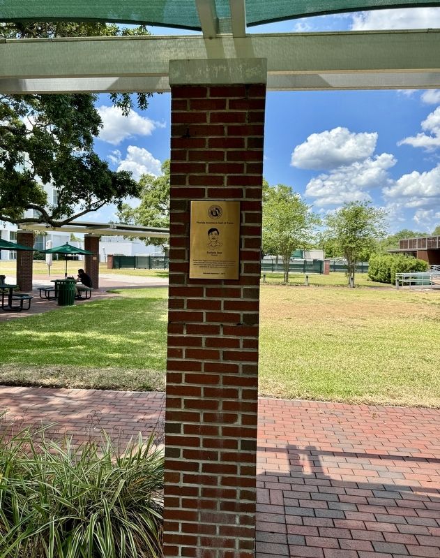
Near USF Alumni Drive, 0.1 miles west of Leroy Collins Boulevard, on the left when traveling west.
Sudipta Seal
Orlando
Trustee Chair, Pegasus and University Distinguished Professor at the University of Central Florida, whose work in transition metal and rare earth oxides led to groundbreaking therapeutic applications in . . . — — Map (db m246197) HM
This former grand old resort hotel, a seat of
culture and education, has been the proud
symbol of Tampa since 1891. Erected by The
University of Tampa Class of 1991, on the
occasion of the centennial of the building,
this marker is a . . . — — Map (db m20063) HM
On East 7th Aveune at North Tampa Street (Business U.S. 41), on the right when traveling west on East 7th Aveune.
Built with a $50,000 grant from industrialist and philanthropist Andrew Carnegie, the Tampa Free Public Library opened its doors in April 27, 1917, becoming the City of Tampa's first public library. This venture was the result of a sustained . . . — — Map (db m110892) HM
Near USF Alumni Drive, 0.1 miles west of Leroy Collins Boulevard, on the left when traveling west.
Thomas A. Lipo
Tallahassee
Research Professor at Florida State University for his pioneering innovations in the field of electrical machinery and power electronics that improved the technology that runs subway cars and paved the way . . . — — Map (db m246057) HM
Near USF Alumni Drive, 0.1 miles west of Leroy Collins Boulevard, on the left when traveling west.
Thomas H. Maren
1918 - 1999
Gainesville
Physician, University of Florida Graduate Research Professor, and charter member of the UF College of Medicine faculty who made the underlying discoveries behind Trusopt®, the first . . . — — Map (db m246453) HM
On Jackson Street (U.S. 41) near North Franklin Street, on the right when traveling east.
William F. Poe Plaza is named in honor of William F. Poe, Sr. in recognition of the many significant improvements he initiated in downtown Tampa during his five years of service as Mayor of Tampa from October 1974 to October 1979.
For many . . . — — Map (db m34188) HM
Near USF Alumni Drive, 0.1 miles west of Leroy Collins Boulevard, on the left when traveling west.
William Glenn
1926 - 2013
Boca Raton
Florida Atlantic University professor who developed high-definition digital imaging technology for NASA and many innovations in the "fields of high-resolution imaging technology, electronic and . . . — — Map (db m246417) HM
On West Swann Avenue just east of South Delaware Avenue, on the right when traveling west.
Teacher, dean, and principal-who dedicated himself to carrying on the traditions of excellence at Wilson Junior High School. He personified integrity, humility, and devotion to duty. He lived what he taught. He is deeply missed.
"No one is . . . — — Map (db m151020)
On West Swann Avenue just east of South Delaware Avenue, on the right when traveling west.
Woodrow Wilson Junior High School, Tampa's oldest surviving junior high, was started here in 1915 with 10 teachers and 259 students. Its longest serving principal, (1933-1960), Miss Pauline Bush, began the county's first school safety patrol during . . . — — Map (db m151011) HM
On North Pierce Street at East Madison Street, on the left when traveling south on North Pierce Street.
Born in West Tampa in 1938 to immigrants from Spain, Judge E.J. Salcines is widely admired for his professionalism and leadership in the administration of justice spanning almost fifty-five years. A graduate of Florida Southern College and South . . . — — Map (db m215682) HM
On East Estelle Street at Waters Court, on the right when traveling east on East Estelle Street.
Booker T. Washington School was named after the famous African-American educator who, in 1881, founded Tuskegee Institute in Alabama and who served as principal until his death in 1915. In 1912, at his speech in the Tamp Bay Hotel Casino, a sheet . . . — — Map (db m214925) HM
On Woodmont Avenue just west of North Lockmoor Avenue, on the left when traveling west.
Bertha Palmer, born in Louisville, Kentucky, was a world-renowned socialite, art patron, successful businesswoman, early feminist, and philanthropist. She played a pivotal role in the creation of the City of Temple Terrace. In 1902, after the death . . . — — Map (db m101008) HM
On North Riverhills Drive north of North Glen Arven Avenue, on the right when traveling north. Reported missing.
Billy Graham attended Florida Bible Institute, now Florida Coolege, from 1937 to graduation in 1940. A world-recognized evangelist, Dr. Graham is one of the 20th century's best-known Christian leaders and the spiritual advisor to ten United States . . . — — Map (db m130108) HM
On North Glen Arven Avenue at North Riverhills Drive, on the left when traveling south on North Glen Arven Avenue.
(side 1)
The Temple Terraces Country Club was built on the site of the 1910 hunting lodge of world renowned Chicago socialite and businesswoman Bertha Honore Plamer's 19,000 acre "Riverhills Ranch." It opened in 1922 as the centerpiece of . . . — — Map (db m93417) HM
On South Orange Street, 0.1 miles south of Pennslvania Avenue (County Road 512), on the right when traveling south.
(side 1)
The Fellsmere Public School, the first masonry school building in what is now Indian River County, was constructed during 1915 and 1916 at 22 South Orange Street. The 22,680 square foot, two-story school with a raised basement was . . . — — Map (db m93265) HM
On North Cypress Street, 0.1 miles south of West New York Avenue, on the right when traveling north.
The Merian Fell Library, the oldest library in Indian River County, opened its doors to the public on May 1, 1915 at 63 North Cypress Street, Fellsmere, Florida. Construction of the library was made possible by Marian Fell, daughter of Edward Nelson . . . — — Map (db m93264) HM
On 45th Street just east of 28th Court, on the right when traveling west. Reported missing.
In 1892, William Edward Geoffrey, an African American man from Darlington, South Carolina, came to work on the Florida East Coast Railroad in Gifford. The town's first school was built in 1898, but only served white children. In 1901, Geoffrey . . . — — Map (db m127810) HM
On 39th Street, 0.1 miles east of U.S. 1, on the right when traveling west.
In 1901, William E. Geoffrey, a black man, donated this land for a black school in Gifford. Funded with help from the Julius Rosenwald Foundation, which provided support for hundreds of black schools across Florida and the Southeast, the Gifford . . . — — Map (db m213229) HM
On Club Drive at Old Oak Lane, on the left when traveling north on Club Drive. Reported missing.
During the early 1920’s, three Cleveland, Ohio physicians established Riomar as a private winter resort for themselves and their families. The facilities included a clubhouse and guest cottage on what is now Riomar Drive, a nine-hole golf course and . . . — — Map (db m130537) HM
On Basswood Road (County Route 165) just south of Neals Landing Road, on the left when traveling north.
Bascom School was built in 1927 on the Woodman of the World Campground. The classic 1920s era design embodies many characteristics of Florida's founding and early development period (1890-1929). The one-story school used locally made bricks and hewn . . . — — Map (db m208152) HM
On State Road 2 at Fernwood Street, on the left when traveling east on State Road 2.
Principals: Sam Hand, John D. Milton, John Shipp, John Stapleton, Emmett S. Walden, W.F. McGlamery, Ben E. Upton, D.C. Sellers, Paul A. Coley, James F. Daniels, George Lawrence Campbellton Wildcats State Basketball . . . — — Map (db m228473) HM
On Orange Street at Clay Street, on the right when traveling south on Orange Street.
In 1922, Robert T. Gilmore (1879-1948), born in Monticello, founded Gilmore Academy, one of Jackson County's first African-American high schools. Trustees of Marianna's African-American community purchased this three-acre site in 1907 and raised . . . — — Map (db m74191) HM
On Groover Road (County Road 6) at Rains Road, on the right when traveling north on Groover Road. Reported missing.
The Elizabeth School, a three-room, vernacular shingle-clad building, was a school for Black students on Groover Road in 1938 and was funded by parents and the Works Progress Administration (WPA). Miles Edward Groover (1887-1966) and his wife, Daisy . . . — — Map (db m67601) HM
On 2nd Street at Park Avenue, on the right when traveling east on 2nd Street.
This historic marker recognizes Howard Academy Elementary/Junior High School, which eventually became Howard Academy High School. In 1957, the first phase of Howard Academy Elementary and Junior High School was constructed on Second Street. The . . . — — Map (db m67639) HM
On Mamie Scott Drive north of Cypress Street, on the left when traveling north.
Howard Academy High School's Building 1 opened on Chestnut Street in 1936 with one structure containing several classrooms. In 1940, a similar, second building was constructed and financed by the county, parents and The Julius Rosenwald Fund. . . . — — Map (db m67656) HM
On East Washington Street (U.S. 90) 0.1 miles east of North Marvin Street, on the right when traveling west.
Built in 1890, John Howard Girardeau and his wife, Agnes, constructed this Folk Victorian style house for their large family on 11 children. It faces north toward Dogwood Street. Girardeau planted 46 oaks along the street, which provided a grand . . . — — Map (db m200398) HM
Near West Avenue at West Osceola Street, on the right when traveling south.
The sign from Clermont High School (formerly located at 301 East Avenue) serves as a reminder of our rich heritage and perseverance in providing education for the children of Clermont. Clermont's schools date back to 1881 when school was held in a . . . — — Map (db m228410) HM
Near Ferran Park Drive at East McDonald Avenue, on the right when traveling south.
Born in Tallahassee, 1916. Graduated from Florida A&M University, 1937, BS Degree. Continued his career as Principal of J.R.E. Lee High School, Wildwood and then at Carver Heights High School, Eustis. Recognized for his efforts to improve . . . — — Map (db m166231) HM
(Side 1)
Constructed in 1937 during the Great Depression, Groveland High School, home of the Greenbacks, was built as part of the national Work Progress Administration (WPA) projects. The original building contained first through twelfth . . . — — Map (db m67026) HM
On 7th Street (County Road 455) south of Porter Avenue, on the right when traveling south.
Montverde Academy was founded by Hermon Palestine Carpenter in 1912 as the Montverde Industrial School for students of limited means. A native of Boyle County, Kentucky, Carpenter (1877-1958) came to Florida in 1912 and decided to found a school at . . . — — Map (db m93362) HM
On North Highland Street at East Jackson Avenue on North Highland Street.
Milner-Rosenwald Academy served African-American school children from 1926 to 1962. When fire destroyed the old school in 1922, parents and community leaders, led by Mamie Lee Gilbert (1886-1976) and Lula Butler, raised money for a new one. Seed . . . — — Map (db m72753) HM
On 27908 Virgil Hawkins Circle, 0.1 miles south of North Quarters Raod, on the right when traveling south.
Julius Rosenwald was the chairman of Sears Roebuck and Co. in 1908. As a Jewish American, he believed the most serious problem of the United Stats was the plight of Black Americans. Rosenwald was a close friend of Booker T. Washington. . . . — — Map (db m185785) HM
On East Pearl Street at Julia Street, on the right when traveling east on East Pearl Street.
Formed 1901, the Alva Book Club, was incorporated as the Alva Library Association November 15, 1906. It provided the first public library in Southwest Florida on this lot donated by Captain Peter Nelson, Alva's founder. This library was dedicated . . . — — Map (db m128652) HM
On Dean Street at Home Avenue, on the left when traveling east on Dean Street.
This school contains two historic building and is a rare example of a historical school that continues to serve its original function. The rural village of Bonita Springs, originally called Survey, grew during the Florida Land Boom of the 1920s and . . . — — Map (db m127699) HM
Near McGregor Boulevard south of Larchmont Avenue, on the left when traveling south.
This garden area has been created to reflect the Edison original plan for the Estate landscape. It commemorates the legacy of Thomas and Mina Edison and other groups and individuals involved in the cultural landscape of the Edison & Ford Winter . . . — — Map (db m89866) HM
On Euclid Avenue, 0.1 miles west of Cortez Boulevard, on the left when traveling east.
Historic Edison Park School, a public elementary school, is one of the oldest in Southwest Florida. It has played a prominent role in the cultural as well as the educational life of this community.
Started in 1926 and opened on March 30, 1927, it . . . — — Map (db m101017) HM
Near Dr. Martin Luther King Jr. Boulevard (Florida Route 82) 0.1 miles west of Henderson Avenue.
Williams Academy, originally located between Lemon Street and Anderson Avenue (later MLK Boulevard), was built in 1913. Named for J. S. Williams, the Lee County Supervisor of Colored Schools, it was Lee County's first government-funded school for . . . — — Map (db m160805) HM
On Blountstown Highway (State Road 20) 0.1 miles Five By Five Drive, on the right when traveling east.
Fort Braden was established in 1839 as a military outpost during the Second Seminole War (1835-1842). At the end of the war the fort was abandoned, but the small farming community that had developed nearby continued. A school in the Fort Braden area . . . — — Map (db m79475) HM
Near South Gadsden Street at East Gaines Street, on the left when traveling south.
Defeating segregation took years of sustained struggle. A federal court ordered the integration of Leon County's public schools in 1967 more than 10 years after the local civil rights movement began. The legacy of those who fought for justice . . . — — Map (db m230698) HM
Near Stadium Drive (Florida Route 366) south of West Pensacola Street, on the left when traveling south.
Bernard F. Sliger President 1977-1991 Bernard F. “Bernie” Sliger served as FSU president from 1977 to 1991. In 1993 he returned to the helm as interim president and served in that capacity until 1994. During Sliger’s tenure, student . . . — — Map (db m187599) HM
Near South Martin Luther King Jr Boulevard just south of Gamble Street.
Built in 1908 with funds donated by industrialist and philanthropist Andrew Carnegie, this was the first Carnegie Library built on a Black Land-Grant college campus. Nathan Young, President of the State Normal College for Colored Students, with . . . — — Map (db m207495) HM
On West Call Street just east of Murphree Street, on the left when traveling east.
Dale W. Lick served as president of Florida State University from 1991 to 1994. He led the implementation of the first Capital Campaign at FSU; construction of the University Center, National High Magnetic Field Laboratory and FSU London Study . . . — — Map (db m173933) HM
Near Learning Way, 0.2 miles east of Varsity Drive.
Dr. J. Stanley Marshall came to Florida State University in 1958 from the State University of New York at Cortland, where he held a professorship in physics. His first assignment was to establish a department of science education and to design . . . — — Map (db m173868) HM
On East Seventh Avenue at Martin Luther King,Jr. Boulevard, on the right when traveling west on East Seventh Avenue.
"The function of education is to teach one to think intensively and to think critically. Intelligence plus character - that is the goal of true education." - Dr. Martin Luther King, Jr.
Where We Are
The Levy Park neighborhood was built . . . — — Map (db m245734) HM
Near Learning Way, 0.2 miles east of Varsity Drive.
The Rhodes Scholarship is at the pinnacle of student achievement worldwide. Outpacing other Florida universities, Florida State University has produced two Rhodes Scholars since 2006. Garrett Johnson (2006 Rhodes Scholar) and Joseph O’Shea (2008 . . . — — Map (db m173931) HM
Near West Call Street east of Stadium Drive, on the right when traveling east.
James Buchanan taught at Florida State University from 1951-56. An economist renowned for his work on public choice theory, Buchanan won the 1986 Nobel Memorial Prize in Economic Science for his development of the contractual and constitutional . . . — — Map (db m173669) HM
Near West Call Street east of Stadium Drive, on the right when traveling east.
Robert Schrieffer won the 1972 Nobel Prize in Physics, with John Bardeen and Leon Neil Cooper, for developing the first successful microscopic theory of superconductivity. In 1992, Florida State University appointed Schrieffer as a university . . . — — Map (db m173668) HM
Near South Copeland Street at West College Avenue, on the right when traveling south.
John Thrasher became the 15th president of Florida State University following a successful career in business and law, including distinguished service in the U.S. Army and the Florida Legislature. Under President Thrasher’s leadership, Florida . . . — — Map (db m230181) HM
Near West Call Street east of Stadium Drive, on the right when traveling east.
Konrad Bloch was co-recipient with Feodor Lynen of the 1964 Nobel Prize in Medicine or Physiology for discoveries concerning the mechanism and regulation of the cholesterol and fatty acid metabolism — how cholesterol is made in the body. Bloch held . . . — — Map (db m173666) HM
On Gamble Street at South Martin Luther King Jr Boulevard, on the right when traveling west on Gamble Street.
Lucy Moten School was built in 1932 at Florida A&M University (FAMU) with support from the Julius Rosenwald Fund and General Education Board. For more than 70 years, the school served as a training facility for African-American educators. The . . . — — Map (db m137656) HM
Near University Way just east of Convocation Way when traveling east.
A campus gathering place for more than a century and site for commencement for nearly five decades, this green was dedicated in 1990 to Mina Jo Powell (B.S., 1950, M.S., 1963). Powell, a member of the final class to graduate on the site, was a . . . — — Map (db m230850) HM
On West Call Street at Murphree Street, on the left when traveling east on West Call Street.
The Mode L. Stone Building, home of the College of Education, was constructed in 1978 and named for the educator who arrived at Florida State in 1946 and served as dean of the College from 1956 to 1967. A 26,000-square-foot addition was completed . . . — — Map (db m173934) HM
Near West Call Street east of Stadium Drive, on the right when traveling east.
Paul Dirac was an outstanding theoretical physicist whose work was fundamental to the development of quantum mechanics and quantum electrodynamics. He was awarded the Nobel Prize in Physics jointly with Erwin Schrödinger in 1933 for contributions to . . . — — Map (db m173665) HM
Near West Call Street east of Stadium Drive, on the right when traveling east.
Robert Mulliken, a physicist and chemist, brought Florida State University its first Nobel Prize. While serving as Florida State University Distinguished Research Professor of Chemical Physics, Mulliken was awarded the 1966 Nobel Prize in Chemistry . . . — — Map (db m173667) HM
Near West Call Street east of Stadium Drive, on the right when traveling east.
Harold “Harry” W. Kroto, one of the co-recipients of the 1996 Nobel Prize in Chemistry, has been Francis Eppes Professor in Florida State University’s Department of Chemistry and Biochemistry since 2004. With Richard Smalley and Robert Curl, he was . . . — — Map (db m173670) HM
Near Capital Circle Southwest (State Road 263) 0.3 miles west of Terminal Loop Road. Reported missing.
DeSoto wintered here (1539-40). In 1633, the Spaniards established a chain of forts and missions to convert Apalache Indians. These were destroyed by the British in 1704 and the area reverted to wilderness. This site was selected as the capital of . . . — — Map (db m129288) HM
Near South Copeland Street near West College Avenue.
The Florida State University campus is the oldest continuously used site of higher education in the state of Florida. In 1851, the Florida Legislature authorized the establishment of two state seminaries, one east and one west of the Suwannee River. . . . — — Map (db m79549) HM
Near North Woodward Avenue, 0.2 miles south of West Tennessee Street (U.S. 90) when traveling south.
The Integration Statue stands as a celebration of hardships and successes of a group of young men and women with a vision to make FSU a center of learning for all people. It was designed to recognize the many brave young idealists who fought for . . . — — Map (db m173827) HM
Near South Copeland Street at West College Avenue, on the right when traveling south.
During the tenure of T.K. Wetherell The Florida State University enrolled the most academically talented students in the history of the university, increased the number of doctoral degrees awarded, set new records for research dollars and . . . — — Map (db m238620) HM
On South Meridian Street north of East Madison Street, on the right when traveling north.
Tallahassee's second industry is higher education. Florida State University (FSU) was established in 1851 as a military seminary, later transforming into Florida State College for Women in 1909. By 1947, the state officially converted the women’s . . . — — Map (db m212076) HM
Near South Meridian Street south of East Pensacola Street, on the left when traveling south.
Oftentimes, in the studies of urban life, the people who are best able to tell the story are those who experienced it personally. Such is the case with the history of Smokey Hollow in Cascades Park. Thanks to Blueprint 2000, the John G. Riley House . . . — — Map (db m211282) HM
On Young Street, 0.1 miles west of South Adams Street, on the right when traveling west.
This brick house was the home of legendary Florida A&M University (FAMU) football coach Alonzo “Jake” Gaither and his wife, Sadie, a FAMU English professor. The couple regularly hosted sports and public figures from the 1950s-1960s, . . . — — Map (db m128319) HM
On Beverly Court at North Franklin Boulevard, on the left when traveling east on Beverly Court.
(Side 1)
This brick home built in 1928 belonged to the renowned Hungarian composer, pianist, conductor, and professor, Erno Dohnányi. Born in 1877, Dohnányi grew up in Pozsony, now Bratislava. At age 11, he gave his first public . . . — — Map (db m151377) HM
On East Jefferson Street at South Meridian Street, on the right when traveling east on East Jefferson Street.
John Gilmore Riley was born in 1857, the son of Sarah and James Riley. He was not formally educated, but was instructed by his Aunt Henrietta. Riley became principal of Lincoln Academy, Tallahassee’s first local high school for African Americans in . . . — — Map (db m79583) HM
On N. Macomb Street at W. Brevard Street, on the right when traveling north on N. Macomb Street.
As Macomb Street continues its journey north of Carolina Street, it crosses Georgia Street. This area included additional businesses, such as the physicians' offices of Dr. Charles
Stevens and Dr. Millard Williams. Bill Chavis Filling Station was . . . — — Map (db m229168) HM
On West Georgia Street just west of North Copeland Street, on the left when traveling west.
As varied as the commercial enterprises were, the community and its activities were just as unique and exciting. Churches played a principal role in the community life of Frenchtown. St. James CME, Bethel African Methodist Episcopal, and Bethel . . . — — Map (db m229203) HM
On West Carolina Street just east of North Macomb Street, on the right when traveling east.
As the area grew and prospered, residents became more attuned with the responsibilities that came with freedom. Small homes were replaced by more impressive dwellings; businesses expanded and settled on Macomb Street; churches were rebuilt on . . . — — Map (db m229215) HM
On West Georgia Street at Aquilina Howell, on the left when traveling west on West Georgia Street.
Lincoln was established in 1869 under a Florida law that required schools for newly emancipated slaves. Caring, innovative and highly educated principals and teachers served for 100 years, until its closure in 1969 as a result of desegregation. . . . — — Map (db m229881) HM
On West Brevard Street at North Macomb Street, on the right when traveling west on West Brevard Street.
Not "Old Lincoln" or the "Original Lincoln" or "Historic Lincoln," just Lincoln! Lincoln High, Our Alma Mater, Dear to Us You'll Be. In Our Hearts We Will Always Cherish Memories of Thee. Lincoln was the jewel of the Frenchtown community. The school . . . — — Map (db m229689) HM
Near West Brevard Street at North Macomb Street, on the left when traveling east.
Lincoln School served as the primary public education institution for African Americans in Leon County from 1869 to 1969. Established in 1869 as one of only two Freedman's Bureau schools in Florida to educate newly freed slaves. It was named after . . . — — Map (db m110972) HM
On North Macomb Street just north of West Carolina Street, on the right when traveling south.
Another pioneer family led by George Madison and Annie Floyd Gardner maintained homes and property in the 400 block of Carolina Street. Among the properties was a building that housed several African American insurance companies and another that . . . — — Map (db m229300) HM
On North Martin Luther King Jr Boulevard south of West Georgia Street, on the right when traveling south.
Martin Luther King Jr. (MLK) Boulevard, formally Boulevard Street, was once a place of attractive, well kept houses where the Yellowhairs, Warrens, McPhersons, Sanfords, and Bessie Malachi, owners of private homes lived. The street was lined with . . . — — Map (db m229809) HM
On Eisenhower Street at Van Fleet Street, on the left when traveling north on Eisenhower Street.
After World War II, many veterans returning to Florida sought a college education through the GI Bill. The all-male University of Florida (UF) experienced record enrollment as thousands of veterans applied to the university. Unable to accommodate . . . — — Map (db m157515) HM
On East Tennessee Street (U.S. 90) 0.1 miles west of North Franklin Boulevard, on the right when traveling west.
The first Leon Academy opened in 1827, three years after Tallahassee's founding, and operated until the mid-1840s. In 1869, the Leon County Board of Public Instruction established separate schools for whites and blacks. In 1871, the county opened . . . — — Map (db m79541) HM
On South Martin Luther King Jr Boulevard at Palmer Avenue, on the right when traveling south on South Martin Luther King Jr Boulevard.
Founded in 1887 as the State Normal College for Colored Students, Florida Agricultural and Mechanical University (FAMU) is the only historically state supported educational facility for African Americans in Florida. It has always been . . . — — Map (db m79570) HM
On South Adams Street (State Road 363) at Palmer Avenue, on the right when traveling south on South Adams Street.
Founded in 1887 as the State Normal College for Colored Students, Florida Agricultural and Mechanical University (FAMU) is the only historically state supported educational facility for African Americans in Florida. It has always been . . . — — Map (db m79571) HM
On West Jennings Street near South Bronough Street.
Site of Pittman Boarding House
In 1947, Willie and Carrie Pittman purchased this lot at 1447 South Bronough Street from Fred and Clara Carrol for the price of $10. Soon after, the Pittmans built a two-story, 13-room, wood-frame house on the . . . — — Map (db m172640) HM
On West Palmer Avenue at South Adams Street (State Road 363), on the left when traveling west on West Palmer Avenue.
The first healthcare facility in Florida for African-Americans was the Florida A&M College (FAMC) Hospital, known as the Florida A&M University (FAMU) Hospital after 1953. The school's original two-story, 19-bed wooden sanitarium was built in 1911 . . . — — Map (db m79623) HM
On Southwest Rutledge Street at Southwest Horry Avenue, on the right when traveling east on Southwest Rutledge Street.
Madison was founded on land secured from Madison C. Livingston, May 2, 1838, and established as the county seat after its removal from San Pedro. An early political center, it was along the escape route of Confederate Secretary of War John C. . . . — — Map (db m149420) HM
On North Duval Street (Florida Route 145) at Northeast Marion Street, on the right when traveling north on North Duval Street.
Madison Lodge Number 11, F.& A.M. founded the St. Johns Seminary of Learning on the southwest corner of this block in 1850. This institution became the basis for Madison High School in 1886. W.B. Cates established the Florida Normal Institute here . . . — — Map (db m149389) HM
On West Base Street (U.S. 90), on the left when traveling east.
The Wardlaw-Smith House was acquired by Mr. and Mrs. William M. Goza in January, 1978 in a state of disrepair. It was meticulously restored and landscaped by them under the supervision of Dawson Rutherford, Master Contractor. Mr. and Mrs. Goza . . . — — Map (db m17750) HM
On 12th Street West at 3rd Avenue West, on the right when traveling south on 12th Street West.
(side 1)
In 1939, the Legislature created the Department of Public Safety and Florida Highway Patrol. Governor Fred P. Cone appointed W.F. Reid director in September. On October 1, Major H. Neil Kirkman was appointed Commandant of the . . . — — Map (db m100925) HM
On 1st Street (U.S. 41) 0.1 miles north of 10th Avenue Drive West, on the right when traveling south.
The Manatee County Board of Public Instruction purchased property from Mr. Alden J. Adams on July 25, 1914, and from Mr. and Mrs. J. K. Singletary on May 17, 1922, “for the purposes of a school for Negro children.” The old Manatee . . . — — Map (db m72415) HM
On Manatee Avenue East (State Road 64) at 17th Street East, on the right when traveling east on Manatee Avenue East.
side 1
The first advanced school erected in Manatee County was built about 200 feet east of this site on land deeded 15 August 1876 expressly for education and cultural purposes by Edmund Lee and his third wife, Elizabeth, to Trustees of . . . — — Map (db m72937) HM
Throughout America, the one-room schoolhouse was a fixture and the educational mainstay for many years.
This one-room schoolhouse was built in 1908 to serve the community of Bunker Hill, which is located in the northeast corner of Manatee . . . — — Map (db m43108) HM
Near Manatee Avenue East (State Road 64) at 14th Street East, on the right when traveling east.
A smokehouse was a necessary part of every rural pioneer home in early American history due to the lack of refrigeration for fresh meat storage. As part of the preservation process, cuts of meat, primarily pork and sausage, were hung on racks in the . . . — — Map (db m131207) HM
On 119th Street West at 45th Avenue West, on the left when traveling south on 119th Street West.
(side 1)
The 1890 Bratton Store
In the 1890s, William C. Bratton built the first commercial building at Hunter's Point, the original name of the area eventually to be called Cortez. The building served as post office, general store . . . — — Map (db m112519) HM
On Wauchula Rd at Keenetown Rd, on the left when traveling west on Wauchula Rd.
This five-room school was built in 1930 by volunteer labor when three smaller rural schools, Albritton, Bunker Hill, and Duette were consolidated. It is the only one-teacher school remaining in the state of Florida. For many years, it was a . . . — — Map (db m25060) HM
On 17th Street East at 3rd Avenue East, on the right when traveling east on 17th Street East.
(side 1)
Lincoln Memorial High School was established in 1949 and served as the only public high school in Manatee County to allow colored children to attend until it closed in 1969 in order to complete the desegregation of Manatee County's . . . — — Map (db m102467) HM
On 7th Street West west of 9th Avenue West, on the left when traveling west.
Side 1
From its 1868 home in a log building at 1102 Riverside Drive, S.S. Lamb's home school moved to the corner of 4th St. and 9th Ave. where a frame schoolhouse opened in 1889 with 60 pupils and Miss Frankie McKay (Mrs. James A. Howze) as . . . — — Map (db m146453) HM
On Center Road just north of Sunset Lane, on the right when traveling south.
(side 1)
Terra Ceia School
The first school on Terra Ceia was held in the parlor of the W.H. Abel home on Bayshore Drive. In 1894, residents built a wooden one-room schoolhouse here on Center Road. It was designed and built by . . . — — Map (db m112516) HM
On East Fort King Street, 0.1 miles south of East Silver Springs Boulevard.
PT 17
57th Army Air Forces
Flying Training Detachment
Greenville Aviation School
Ocala Fla
The unit provided primary
flight training for US Army
Air Corps Pilots
1941 - 1944
Sponsored by . . . — — Map (db m198459) WM
On SE Apollo Street at SE Ceres Street, on the right when traveling west on SE Apollo Street.
[First plaque]
1924
Martin County Historic Register
Martin County Historical Preservation Board
March 9, 2015
[Second plaque]
This property
is listed in the
National Register
of Historic Places . . . — — Map (db m193623) HM
On Southwest Warfield Boulevard (Florida Route 710) at Southwest Jefferson Avenue, on the right when traveling west on Southwest Warfield Boulevard.
Born in 1923, Betty Mae Tiger Jumper was the first Chairwoman of the Seminole Tribe of Florida, elected in 1967. She spent her early life with her parents, Ada Tiger and Abe Partan, at the Seminole camp in Indiantown. Tribal medicine men threatened . . . — — Map (db m148906) HM
On Main Highway north of Hibiscuss Street, on the right when traveling north.
Side 1
In the early 20th century, John Bindley (1846-1921), president of the Pittsburgh Steel Company, was among a wave of wealthy northern industrialists who built winter homes along the shore of Biscayne Bay. In 1917, he purchased this . . . — — Map (db m146091) HM
On Biltmore Way at Southwest 42nd Avenue (State Road 953), on the left when traveling west on Biltmore Way.
Dreamer, writer, poet, philosopher, lover of the beautiful - he made his dream become a reality in the creation of Coral Gables, City Beautiful.
Dade County commissioner from 1914 to 1916. He advocated and promoted good highways and . . . — — Map (db m99921) HM
On University Drive at Camilo Avenue, on the right when traveling south on University Drive.
On this site, in an unfinished building originally intended for a hotel, the University of Miami registered its first students on October 15, 1926. It was twenty years before the university was able to begin the move to the site originally . . . — — Map (db m74927) HM
Through the collective recognition of the community of nations
expressed within the principles of the
convention concerning protection of the world,
cultural and natural heritage
Everglades National Park
has been designated a . . . — — Map (db m213490) HM
United Nations Educational Scientific and Cultural Organization MAB Program on Man and the Biosphere By Decision of the Bureau of the International Coordinating Council of the Program on Man and the Biosphere, duly authorized to that . . . — — Map (db m213494) HM
490 entries matched your criteria. Entries 201 through 300 are listed above. ⊲ Previous 100 — Next 100 ⊳