After filtering for Maine, 200 entries match your criteria. The first 100 are listed. ⊳
Industry & Commerce Topic
By Devry Becker Jones (CC0), November 11, 2021
Androscoggin Log Drives / Les Draves Sur L'Androscoggin Marker
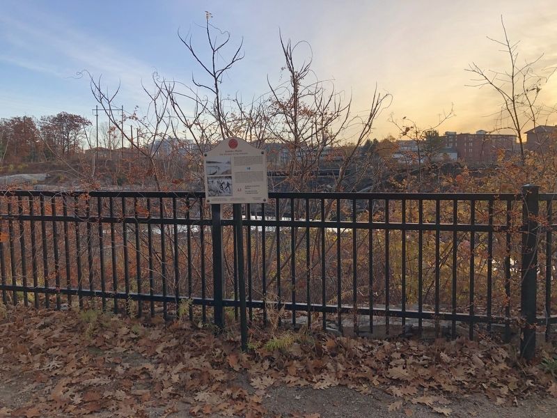
| 1 ► Maine, Androscoggin County, Auburn — A1 — Androscoggin Log Drives / Les Draves Sur L'Androscoggin — Auburn, Maine — The Museum in the Streets® — |
| On Auburn Riverwalk, 0.1 miles north of Great Falls Plaza, on the left when traveling east. | |||
| 2 ► Maine, Androscoggin County, Auburn — A5 — Auburn L.L. Bean Store / Le Magasin L.L. Bean À Auburn — Auburn, Maine — The Museum in the Streets® — |
| On Main Street (Maine Route 136) at Court Street (U.S. 202), on the right when traveling north on Main Street. | |||
| 3 ► Maine, Androscoggin County, Auburn — Map — Auburn, Maine — The Museum in the Streets — |
| On Main Street (Maine Route 136) 0.1 miles south of Court Street (U.S. 202), on the right when traveling north. | |||
| 4 ► Maine, Androscoggin County, Auburn — Map — Auburn, Maine — The Museum in the Streets — |
| On Auburn Riverwalk, 0.2 miles north of Court Street (U.S. 202), on the right when traveling north. | |||
| 5 ► Maine, Androscoggin County, Auburn — A12 — Development of New Auburn / Le Nouvel Auburn — Auburn, Maine — The Museum in the Streets® — |
| On Auburn Riverwalk, 0.1 miles north of Main Street (Maine Route 136), on the right when traveling north. | |||
| 6 ► Maine, Androscoggin County, Auburn — A7 — Edward Little House 1827 / La Maison d'Edward Little 1827 — Auburn, Maine — The Museum in the Streets® — |
| On Main Street (Maine Route 136) just south of Vine Street, on the left when traveling north. | |||
| 7 ► Maine, Androscoggin County, Auburn — Festival Plaza — |
| On Main Street (Maine Route 136) 0.1 miles south of Court Street (U.S. 202), on the right when traveling north. | |||
| 8 ► Maine, Androscoggin County, Auburn — A3 — Hydroelectric Power / L'Énergie Hydraulique — Auburn, Maine — The Museum in the Streets® — |
| On Auburn Riverwalk just north of Great Falls Plaza, on the right when traveling north. | |||
| 9 ► Maine, Androscoggin County, Auburn — A2 — Knight House / La Maison Knight — Auburn, Maine — The Museum in the Streets® — |
| On Auburn Riverwalk, 0.1 miles Great Falls Plaza, on the left when traveling north. | |||
| 10 ► Maine, Androscoggin County, Auburn — A11 — River Pollution and Restoration / Pollution et Restoration de la Rivière — Auburn, Maine — The Museum in the Streets® — |
| Near Auburn Riverwalk, 0.1 miles north of Main Street (Maine Route 136), on the right when traveling north. | |||
| 11 ► Maine, Androscoggin County, Auburn — A6 — Roak Block — Auburn, Maine — The Museum in the Streets® — |
| On Main Street (Maine Route 136) just north of Mechanics Row, on the left when traveling north. | |||
| 12 ► Maine, Androscoggin County, Lewiston — L14 — Canal System / Les Canaux — Lewiston, Maine — The Museum in the Streets® — |
| On Beech Street at Oxford Street, on the right when traveling east on Beech Street. | |||
| 13 ► Maine, Androscoggin County, Lewiston — Cities of the Androscoggin — Lewiston-Auburn — |
| On Auburn Riverwalk just west of Oxford Street, in the median. | |||
| 14 ► Maine, Androscoggin County, Lewiston — L1 — Early Industry / Les Débuts de L'Industrie — Lewiston, Maine — The Museum in the Streets® — |
| On Main Street (Route 202) at Lincoln Street, on the right when traveling west on Main Street. | |||
| 15 ► Maine, Androscoggin County, Lewiston — L4 — Haymarket Square / La Place du Marché des Fourrages — Lewiston, Maine — The Museum in the Streets — |
| On Main Street (U.S. 202) at Park Street, on the right when traveling east on Main Street. | |||
| 16 ► Maine, Androscoggin County, Lewiston — L5 — Music Hall — Lewiston, Maine — The Museum in the Streets® — |
| On Lisbon Street (Maine Route 196) 0.2 miles north of Ash Street, on the right when traveling north. | |||
| 17 ► Maine, Androscoggin County, Lewiston — L3 — Peck's Department Store / Le Grand Magasin Peck — Lewiston, Maine — The Museum in the Streets® — |
| On Lisbon Street (Maine Route 196) at Main Street (U.S. 202), on the right when traveling north on Lisbon Street. | |||
| 18 ► Maine, Androscoggin County, Lewiston — L2 — Veterans Memorial Park / Le Parc des Vétérans — Lewiston, Maine — The Museum in the Streets — |
| On Main Street (U.S. 202) at Lincoln Street, on the right when traveling west on Main Street. | |||
| 19 ► Maine, Aroostook County, Fort Kent — Rail Fuels Growth, Cultural Change — Le chemin de fer contribue à la croissance économique et aux changements culturels — |
| Near Market Street (Maine Route 161) just east of East Main Street (U.S. 1), on the right when traveling west. | |||
| 20 ► Maine, Aroostook County, Frenchville — "Smuggling is Not a Sin" / « La contrebande n'est pas-un péché! » — |
| On Main Street (U.S. 1) 0.1 miles east of Felix Avenue, on the left when traveling east. | |||
| 21 ► Maine, Aroostook County, Frenchville — Farming Then & Now / L'agriculture d'hier à aujourd'hui — |
| On Main Street (U.S. 1) 0.1 miles east of Felix Avenue, on the left when traveling east. | |||
| 22 ► Maine, Aroostook County, Frenchville — The "Potato Road" / La route «des patates » — |
| On Main Street (U.S. 1) 0.1 miles east of Felix Avenue, on the left when traveling east. | |||
| 23 ► Maine, Cumberland County, Brunswick — Androscoggin Swinging Bridge — National Register of Historic Places January 2004 — |
| 24 ► Maine, Cumberland County, Cape Elizabeth — CCC Headquarters — |
| 25 ► Maine, Cumberland County, Cape Elizabeth — Goddard Mansion — |
| Near Shore Road north of Littlejohn Road, on the right when traveling north. | |||
| 26 ► Maine, Cumberland County, Freeport — Derosier’s Market — |
| On Main Street (U.S. 1) south of School Street, on the right when traveling north. | |||
| 27 ► Maine, Cumberland County, Portland, Cliff Island — Welcome to Cliff Island — |
| On Wharf Road just west of Sunset Road, on the left when traveling west. | |||
| 28 ► Maine, Cumberland County, Portland, Downtown — Asa Clapp / Asa William Henry Clapp / Mary Jane Emerson Clapp — |
| On Congress Street just north of Elm Street, on the left when traveling north. | |||
| 29 ► Maine, Cumberland County, Portland, Downtown — In 1745 — |
| On Congress Street at Pearl Street, on the right when traveling north on Congress Street. | |||
| 30 ► Maine, Cumberland County, Portland, Downtown — Press Herald Building — Built 1923, Expanded 1948 — |
| On Exchange Street at Federal Street, on the right when traveling north on Exchange Street. | |||
| 31 ► Maine, Cumberland County, Portland, East Bayside — 1 — Franklin Street Wharf — Portland Freedom Trail — |
| On Commercial Street (U.S. 1) at Franklin Arterial (U.S. 1), on the right when traveling north on Commercial Street. | |||
| 32 ► Maine, Cumberland County, Portland, East Bayside — Hack Stand of Charles H.L. Pierre — Portland Freedom Trail — |
| On Middle Street at India Street, on the right when traveling west on Middle Street. | |||
| 33 ► Maine, Cumberland County, Portland, East Bayside — 5 — Home of Charles Frederick Eastman, Harriet Stephenson Eastman, and her father, Alexander Stephenson — Portland Freedom Trail — |
| On Newbury Street at Mountfort Street, on the right when traveling east on Newbury Street. | |||
| 34 ► Maine, Cumberland County, Portland, East Bayside — India Street Terminal — |
| On Commercial Street / Thames Street at India Street, on the left when traveling north on Commercial Street / Thames Street. | |||
| 35 ► Maine, Cumberland County, Portland, East Bayside — Joseph Coffin Boyd — 1760 - 1823 — |
| Near Congress Street. | |||
| 36 ► Maine, Cumberland County, Portland, East End — Portland Observatory — |
| On Congress Street near North Street, on the right when traveling north. | |||
| 37 ► Maine, Cumberland County, Portland, East End — Portland Observatory, Portland, Maine — Built 1807 — National Historic Civil Engineering Landmark — |
| On Congress Street just north of Kellogg Street, on the right when traveling north. | |||
| 38 ► Maine, Cumberland County, Portland, Old Port — Home of Deacon Brown Thurston, 32 Union Street — Portland Freedom Trail — |
| On Fore Street at Union Street, on the left when traveling east on Fore Street. | |||
| 39 ► Maine, Cumberland County, Portland, Waterfront District — A Dirty History of Casco Bay — |
| On Commercial Street (U.S. 1A) just south of Franklin Street (U.S. 1A), on the left when traveling south. | |||
| 40 ► Maine, Cumberland County, Portland, Waterfront District — Today, you see a healthier Casco Bay / Take a closer look — |
| On Commercial Street (U.S. 1A) just south of Franklin Street (U.S. 1A), on the left when traveling south. | |||
| 41 ► Maine, Cumberland County, Scarborough — Danish Village Archway — Danish Village — Scarborough, Maine — |
| On Sawyer Road, 0.1 miles south of Durant Drive, on the right when traveling south. | |||
| 42 ► Maine, Cumberland County, South Portland — East Yard — |
| On Slocum Drive west of Fort Road, on the right when traveling west. | |||
| 43 ► Maine, Cumberland County, South Portland — Liberty Ship Memorial — |
| 44 ► Maine, Cumberland County, South Portland — Shipbuilding — |
| 45 ► Maine, Cumberland County, South Portland — Shipbuilding — East and West Yards — |
| On Slocum Drive west of Fort Road, on the right when traveling west. | |||
| 46 ► Maine, Cumberland County, South Portland — South Portland and Its Liberty Ships — |
| 47 ► Maine, Cumberland County, South Portland — South Portland's Ships for Liberty — |
| 48 ► Maine, Cumberland County, South Portland — The Ugly Ducklings — |
| 49 ► Maine, Cumberland County, South Portland — The Ultimate Sacrifice — |
| On Madison Street, on the left when traveling west. | |||
| 50 ► Maine, Cumberland County, South Portland — The Work Force — |
| 51 ► Maine, Cumberland County, South Portland — The Yard — |
| 52 ► Maine, Cumberland County, South Portland — Voyages for Victory — |
| 53 ► Maine, Cumberland County, South Portland — West Yard — |
| On Slocum Drive west of Fort Drive, on the right when traveling west. | |||
| 54 ► Maine, Cumberland County, South Portland — WWII: On the Home Front — |
| 55 ► Maine, Franklin County, Rangeley — The Whip Willow Farm / La ferme de Whip Willow — |
| On Main Street (Maine Route 4) just south of Dallas Hill Road, on the right when traveling south. | |||
| 56 ► Maine, Hancock County, Bar Harbor — 27 — Agamont Park and Early Artists / Le parc Agamont et les artistes — Bar Harbor, Maine — The Museum in the Streets — |
| On West Street, on the right when traveling east. | |||
| 57 ► Maine, Hancock County, Bar Harbor — The Village Burying Ground — |
| On Mt. Desert Street (Maine Route 3) at School Street, on the right when traveling west on Mt. Desert Street. | |||
| 58 ► Maine, Hancock County, Bucksport — 75 Years of Quality Paper Making — Bucksport Paper Mill 75th Anniversary — November 2005 — |
| Near Main Street (Maine Route 15) at Steamboat Wharf Lane, on the right when traveling east. | |||
| 59 ► Maine, Hancock County, Bucksport — Of Ships and Men — |
| On Main Street (Maine Route 15) at 1st Street, on the left when traveling north on Main Street. | |||
| 60 ► Maine, Hancock County, Bucksport — Penobscot River — |
| 61 ► Maine, Hancock County, Bucksport — Site of the First Sawmill — |
| Near Main Street (Maine Route 15) at Mill Street, on the right when traveling east. | |||
| 62 ► Maine, Hancock County, Bucksport — The Town of Bucksport — |
| 63 ► Maine, Hancock County, Franklin — Curbstone Exhibit — |
| On West Franklin Road (Maine Route 182) at Grist Mill Road, on the right when traveling north on West Franklin Road. | |||
| 64 ► Maine, Hancock County, Franklin — Exhibit of the Granite Industry — In Eastern Hancock County — |
| On West Franklin Road (Maine Route 182) at Grist Mill Road, on the right when traveling north on West Franklin Road. | |||
| 65 ► Maine, Hancock County, Franklin — Galamander — |
| On West Franklin Road (Maine Route 182) at Grist Mill Road, on the right when traveling north on West Franklin Road. | |||
| 66 ► Maine, Hancock County, Prospect Harbor — Gouldsboro Town Park — |
| On Pond Road (Maine Route 195) at Main Street (Maine Route 186), on the right when traveling south on Pond Road. | |||
| 67 ► Maine, Hancock County, Prospect Harbor — Life on the Ocean’s Edge — Prospect Harbor — This small community has seen many changes — |
| On Main Street (Maine Route 186) at Pond Road (Maine Route 195), on the right when traveling east on Main Street. | |||
| 68 ► Maine, Hancock County, Somesville — Linking oceans, rivers and lakes — |
| On Main Street (Maine Route 102) at Oak Hill Road, on the right when traveling south on Main Street. | |||
| 69 ► Maine, Hancock County, Stonington — Stonecutter — |
| On Main Street (Maine Route 15) at Robbins St., on the right when traveling east on Main Street. | |||
| 70 ► Maine, Hancock County, Sullivan — Historic Architecture in Sullivan Harbor — |
| On U.S. 1 near Benvenuto Avenue, on the right when traveling east. | |||
| 71 ► Maine, Hancock County, Sullivan — Summer Rusticators, the Tourist Trade and the Waukeag House Hotel — |
| On U.S. 1 near Benvenuto Avenue, on the right when traveling east. | |||
| 72 ► Maine, Hancock County, Sullivan — The view of Frenchman Bay — |
| On U.S. 1 near Benvenuto Avenue, on the right when traveling east. | |||
| 73 ► Maine, Kennebec County, Augusta — 9 — Comfort Magazine / Le Magazine Comfort — Augusta, Maine — The Museum in the Streets® — |
| On Willow Street north of Cony Street, on the left when traveling north. | |||
| 74 ► Maine, Kennebec County, Augusta — Map — Augusta, Maine — The Museum in the Streets — |
| On Cony Street just west of Arsenal Street, on the left when traveling west. | |||
| 75 ► Maine, Kennebec County, Augusta — 23 — Augusta's Publishing Empire / L'empire de l'édition à Augusta — Augusta, Maine — The Museum in the Streets® — |
| On Water Street at Winthrop Street, on the left when traveling north on Water Street. | |||
| 76 ► Maine, Kennebec County, Augusta — Cushnoc Trading Post — 1628 - 1661 — |
| 77 ► Maine, Kennebec County, Augusta — 1 — Cushnoc Trading Post / Le Comptoir Commercial De Cushnoc — Augusta, Maine — The Museum in the Streets® — |
| Near Cony Street. | |||
| 78 ► Maine, Kennebec County, Augusta — 12 — D.W. Adams Department Store / Le grand magasin de D.W. Adams — Augusta, Maine — The Museum in the Streets® — |
| On Water Street north of Oak Street, on the right when traveling north. | |||
| 79 ► Maine, Kennebec County, Augusta — 22 — Flag Protest ~ War of 1812 / Drapeau en berne - Guerre de 1812 — Augusta, Maine — The Museum in the Streets® — |
| On Water Street south of Winthrop Street/Front Street, on the left when traveling north. | |||
| 80 ► Maine, Kennebec County, Augusta — 2 — Gunshots Reverberate on the Kennebec / Des coups de fusil résonnent sur le fleuve Kennebec — Augusta, Maine — The Museum in the Streets® — |
| 81 ► Maine, Kennebec County, Augusta — 15 — Market Square / La place du Marché — Augusta, Maine — The Museum in the Streets® — |
| On Water Street at Winthrop Street/Front Street, on the right when traveling north on Water Street. | |||
| 82 ► Maine, Kennebec County, Augusta — 3 — Old Fort Western / Le vieux Fort Western — Augusta, Maine — The Museum in the Streets® — |
| On Cony Street, on the left when traveling west. | |||
| 83 ► Maine, Kennebec County, Augusta — 17 — Shipbuilding Days / L'époque des chantiers navals — Augusta, Maine — The Museum in the Streets® — |
| On Front Street south of Winthrop Street, on the left when traveling south. | |||
| 84 ► Maine, Kennebec County, Augusta — 16 — Steamboat Landing / L'embarquement des bateaux à vapeur — Augusta, Maine — The Museum in the Streets® — |
| On Front Street at Winthrop Street, on the right when traveling north on Front Street. | |||
| 85 ► Maine, Kennebec County, Augusta — 8 — Strive to Excel! / Vive L'Excellence! |
| On Cony Street at Bangor Street (U.S. 201/202), on the right when traveling east on Cony Street. Reported missing. | |||
| 86 ► Maine, Kennebec County, Augusta — 24 — They Were Superior Buildings / Des bâtiments pittoresques — Augusta, Maine — The Museum in the Streets® — |
| On Water Street at Oak Street, on the left when traveling north on Water Street. | |||
| 87 ► Maine, Kennebec County, Fairfield — Early Electric Power Generation — |
| On Bridge Street (Maine Route 100) 0.1 miles east of Main Street (U.S. 201), on the right when traveling east. | |||
| 88 ► Maine, Kennebec County, Fairfield — Heritage of the Kennebec River — Le patrimoine de la Rivière Kennebec — |
| On Mill Street at Water Street, on the left when traveling south on Mill Street. | |||
| 89 ► Maine, Kennebec County, Fairfield — Heritage of the Kennebec River — Le patrimoine de la Rivière Kennebec — |
| On Bridge Street at Main Street, on the right when traveling east on Bridge Street. | |||
| 90 ► Maine, Kennebec County, Waterville — 1 — Immigration — The Museum in the Streets — |
| On Water Street south of Spring Street (Maine Route 137), on the right. | |||
| 91 ► Maine, Kennebec County, Waterville — Lombard Log Hauler — |
| On Bridge Streeet (U.S. 201) at Front Street (U.S. 201), on the right when traveling west on Bridge Streeet. | |||
| 92 ► Maine, Knox County, Camden — The Schooner Grace Bailey / The Schooner Mercantile — Built 1882 and 1916 — |
| 93 ► Maine, Knox County, Rockland — Rockland Harbor Trail — Snow Marine Park to Rockland Breakwater Light — |
| 94 ► Maine, Knox County, Rockland — Rockland Harbor Trail — Snow Marine Park to Rockland Breakwater Light — |
| On Main Street (U.S. 1), on the right when traveling north. | |||
| 95 ► Maine, Knox County, Rockport — The Rockport Lime Kilns — |
| Near Pascal Avenue. | |||
| 96 ► Maine, Knox County, Thomaston — 12 — Near the Old Prison / À Coté de l'Ancienne Prison — Thomaston, Maine — The Museum in the Streets — |
| On City Avenue / Main Street (Maine Route 131) at Georges Street, on the right when traveling east on City Avenue / Main Street. | |||
| 97 ► Maine, Knox County, Thomaston — The Builders, the Captains and the Seamen of Thomaston Ships — |
| On Knox Street at Main Street (U.S. 1), in the median on Knox Street. | |||
| 98 ► Maine, Knox County, Thomaston — Map — Thomaston, Maine — The Museum in the Streets — |
| On Main Street (U.S. 1) at Knox Street, on the right when traveling east on Main Street. | |||
| 99 ► Maine, Lincoln County, Damariscotta — Shipbuilding on the Damariscotta River — |
| Near Main Street (U.S. 1) east of Water Street, on the right when traveling west. | |||
| 100 ► Maine, Lincoln County, Wiscasset — 20 — Downtown Stores c. 1892 — Wiscasset, Maine — The Museum in the Streets — |
| On Main Street (U.S. 1) east of Middle Street, on the right when traveling east. | |||
200 entries matched your criteria. The first 100 are listed above. Next 100 ⊳